+10.3 F. October temperatures are running more than 10 degrees above average, to date.
.30" rain predicted between today and Sunday night for the Twin Cities (NAM model). Expect showers, not steady rain.
Thunder risk: slight chance of a few T-storms later today, again Saturday. A small percentage of storms over western and central MN may be severe.
Wind Advisory in effect for gusts over 30-35 mph later today.

If the mercury hits 80 again today (likely) it will be 6 days above 80 so far in October. That's the most number of 80-degree days since 1953, when MSP experienced 8 days above 80, according to Pete Boulay at the State Climate Office.
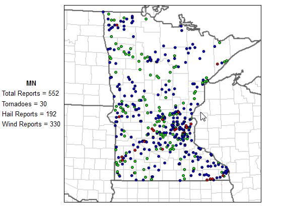
October Severe Threat. Rare, yes. Not exactly unprecedented. An eastward push of cooler, Canadian air may spark a few strong to severe storms from Minnesota southward to Omaha, Wichita to Altus, Oklahoma, according to SPC.
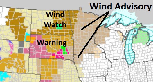
Wind Advisory in effect today for gusts over 35 mph. at times. Details from the National Weather Service:
...STRONG SOUTHERLY WINDS CONTINUING THROUGH FRIDAY EVENING.....
A WIND ADVISORY REMAINS IN EFFECT FOR WEST CENTRAL MINNESOTA THROUGH FRIDAY EVENING. A WIND ADVISORY HAD BEEN ISSUED FOR PORTIONS OF CENTRAL MINNESOTA AND WEST CENTRAL WISCONSIN STARTING FRIDAY MORNING AND CONTINUING INTO THE EVENING HOURS FRIDAY NIGHT.
STRONG SOUTHERLY WINDS OF 30 TO 35 MPH WILL BE COMMON OVER THE ADVISORY AREA. THE WINDS WILL DECREASE SOMEWHAT TO 20 TO 30 MPH SUSTAIN OVERNIGHT TONIGHT...BEFORE RAMPING BACK UP AGAIN DURING THE DAY ON FRIDAY. WIND GUSTS COULD EXCEED OVER 50 MPH OVER PORTIONS OF SOUTH CENTRAL MINNESOTA AND WESTERN WISCONSIN DURING THE DAY ON FRIDAY.
THE WINDS ARE FORECAST TO DIMINISH UNDER 20 MILES AN HOUR AFTER MIDNIGHT FRIDAY.
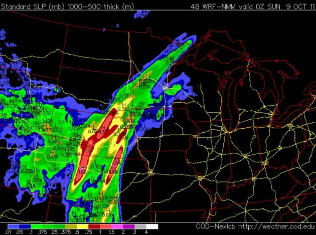
Showery Saturday. A cool front is forecast to slow down, possibly stall (temporarily) just west of MSP over the weekend. The metro area will probably be on the warm side of the front for much of Saturday, highs well up into the 70s - if the sun comes out for a couple hours 80 is not out of the question. The chance of showers/T-storms will increase the closer you get to St. Cloud, Willmar and Marshall - the heaviest rains staying over Nebraska and Kansas. NAM forecast map above valid 7 pm Saturday, showing accumulated rainfall for the previous 6 hours.
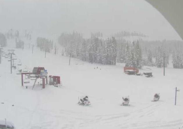

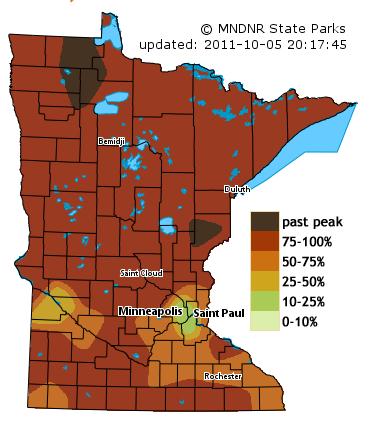
"...Studies in Europe and in Japan already indicate leaves are changing color and dropping later, so it stands to reason that it's happening here as well, said Richard Primack, professor of biology at Boston University." - from a Huffington Post article on climate change impacting fall color below.
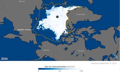
"...The rapid climate change could be good news for the world's shipping companies, as sea ice decreased enough to open up both the Northwest Passage and the Northern Sea route for brief periods in September. Several companies reported significant savings by completing voyages through the new routes this summer, with Danish shipping company Nordic Bulk Carriers claiming to have saved a third on its usual costs and nearly half the time shipping goods to China via the Arctic." - article below from the International Business Times.

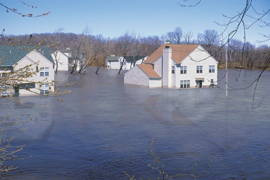
Whew! Flood Insurance Still Available. MSN has the details: "It was yet another punt by Congress: Elected officials in Washington, D.C., failed to pass a bill reforming the National Flood Insurance Program this week. However, they extended the program until Nov. 18, giving them time to close a deal that reportedly has support from both parties. What it means: If you're buying a home -- or trying to insure one against flooding -- in one of 20,000 communities participating in the program, you'll be able to buy flood insurance, a requirement for some purchases. The continuing resolution authorizing the short-term extension now goes to President Obama, who's expected to sign it, says HousingWire. You can't usually get flood insurance as part of a homeowners insurance policy. Private companies say it's too expensive to provide. The government program, run by FEMA through partnerships with private insurers, subsidizes premiums, making them affordable. "The program was originally intended to pay for itself, but since Hurricane Katrina, it's been heavily in debt," writes Ezra Klein at The Washington Post. Payouts after the disastrous 2005 and 2008 hurricanes and floods left it $19 billion in the hole, says this article in Science magazine (.pdf file)."

• Steven Paul Jobs, 1955-2011 (WSJ)
• Steve Jobs, Apple’s Visionary, Dies at 56 (NYT)
• Apple Fans From Cupertino to Singapore Mourn Passing of Jobs (Bloomberg)
• Steve Jobs’ 2005 Stanford Commencement Address (Video)
• Steve Jobs’s Best Quotes (Digits)
• His Life, His Companies, His Products (NYT interactive)
• boingboing goes old school Mac Classic (bb)
• Mossberg: The Steve Jobs I Knew (WSJ)
• Tech honchos remember Steve Jobs (Digits)
• A Look Back at Steve Jobs of Apple (Dealbook)
• Jobs’s Death Draws Outpouring of Grief and Tributes (NYT)
Paul's Conservation Minnesota Outlook for the Twin Cities and all of Minnesota:
TODAY: WIND ADVISORY. Windy and warm with intervals of sun . Passing shower or T-shower; a few strong/severe storms over western MN? Winds: South 20-35. High: 81
FRIDAY NIGHT: Chance of a shower or T-storm - unseasonably mild. Low: 64
SATURDAY: Unsettled - still unseasonably mild, few showers or T-showers. SW 10-15. High: 78
SUNDAY: Showers linger, still mild. Low: 61. High: 72
MONDAY: Cooler front arrives: rain likely. Low: 57. High: 69
TUESDAY: Intervals of sun, still milder than average. Low: 53. High: near 70
WEDNESDAY: Unsettled, more showers developing, cooler. Low: 57. High: 68
THURSDAY: Mostly cloudy, passing shower possible - feels like October again. Low: 51. High: 61
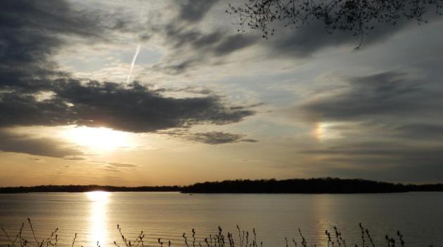
Dazed and Amazed
Between the Minnesota Lynx and a remarkable spell of 80s in October it's been a pretty good week. Blue sky, low humidity; think Palm Springs (with lakes). So far: 5 days in October above 80. 88 on Wednesday broke a record which has been on the books since 1879!
All this wondrous weather makes me nervous; my pet ulcer is acting up. I keep waiting for the other shoe to drop. Will we ease into winter this year, or will it come suddenly, with little warning?
Octobers have been trending milder in recent years. Last October was more than 5 degrees warmer than average. We went from 80 on the 11th to flurries on the 27th, but accumulating snow didn't arrive until November 13 (7.7" fell). I suspect something similar this year: flurries by late October, but no "plowable" snow until mid or late November. Deep breaths.
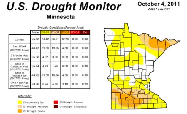
A cooler front sparks showers and T-storms into Sunday. 74% of Minnesota is too dry; 26% of our state is in a moderate drought - so I won't gripe about the rain, OK?
Hard to believe Steve Jobs is gone. He was our Thomas Edison and Michelangelo. He turned cynical adults into wide-eyed kids, made it cool to dream.
Jobs proved that magic still exists in the world.
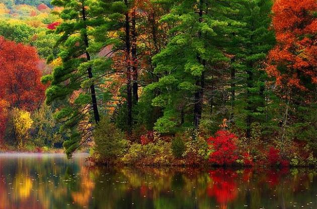
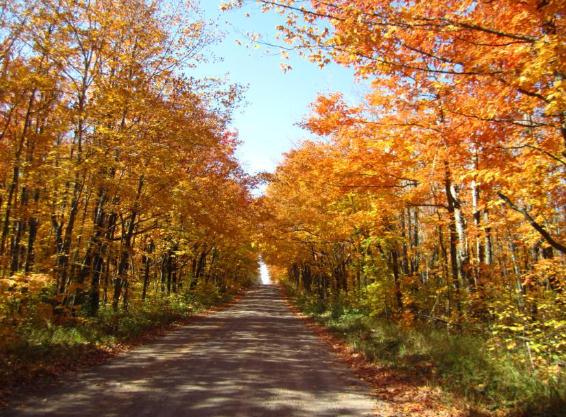
Fall Foliage: Leaves Could Change Color And Drop Later, Scientists Say. Huffington Post has a story on how a slowly warming environment may affect fall foliage over North America: "PORTLAND, Maine -- Clocks may not be the only thing falling back: That signature autumn change in leaf colors may be drifting further down the calendar. Scientists don't quite know if global warming is changing the signs of fall like it already has with an earlier-arriving spring. They're turning their attention to fall foliage in hopes of determining whether climate change is leading to a later arrival of autumn's golden, orange and red hues. Studies in Europe and in Japan already indicate leaves are changing color and dropping later, so it stands to reason that it's happening here as well, said Richard Primack, professor of biology at Boston University. "The fall foliage is going to get pushed back," Primack warned. Down the road, scientists say there could be implications not just for ecology but for the economy if duller or delayed colors discourage leaf-peeping tourists."
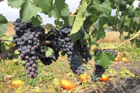
Study: Climate Change To Impact Where Wine Grapes Can Grow. Uh oh. First coffee - now wine? Two of the most precious fluids on Earth, more critical to daily life than even....oil? Now it's serious. USA Today has the story: "To the litany of changes being wrought by global warming, we may be able to add one more: where wine grapes can and can't be grown. Within 30 years, the areas where California can grow fine wine grapes could shrink because of climate change, while little-known growing regions such as Seattle's Puget Sound and Oregon's Willamette Valley see growth, according to one controversial study. A federal agency report in 2009 found that average U.S. temperatures could increase 2 to 4 degrees by 2020 compared with the 1970s' average. That's not huge, but the best grapes "grow in a narrow geographic range that exhibits a narrow climate envelope," says Noah Diffenbaugh, a climate scientist at Stanford University."
No comments:
Post a Comment