No significant rain in sight for the next 10 days.
Sunday Records:
Arkansas: N. Little Rock 87, Little Rock 88, Fort Smith 92
Louisiana: Monroe 92, Shreveport 92
Florida: Tallahassee 90

Next Saturday: Another Risk Of Indian Summer? A fast-moving pattern will continue into the weekend - a modified zonal flow bringing temperatures at, or even a few degrees above, average readings next Saturday, with highs close to 60 (and only a slight chance of a rain shower or sprinkle by Sunday). No major storms are in sight.
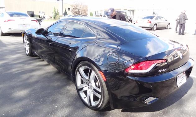
This Is A Hybrid? More on the newly released (American-made) Fisker Karma below. I'm a true believer

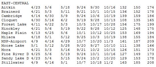
First 32 F. Reading. According to the Minnesota State Climate Office the average (mean) date of the first 32 F. reading at MSP International is October 7. That compares with September 20 at Moose Lake, September 24 at Cambridge and October 5 at Forest Lake. If skies clear and winds ease up a bit, MSP may pick up the first official 32 of the season Thursday morning.
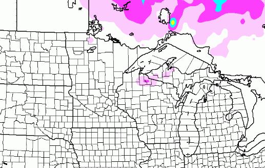
Retrograding Storm. A massive storm centered over Ontario, Canada will wobble southwestward, pushing clouds and a chance of flurries into parts of far northeastern Minnesota, the U.P. of Michigan and northern Wisconsin.
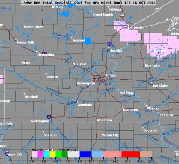
First Flakes? The 84 hour NAM model prints out a few snow showers an flurries from Duluth and the North Shore of Lake Superior into Wisconsin, possibly a few stray flakes as far south as the St. Croix River Valley late Tuesday into Wednesday night. No accumulation is expected.
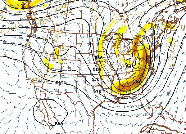
This Week: Major Storm For East Coast. The same surge of colder air that's whipping up strong winds across the Upper Midwest and Great Lakes will spin up a major storm along the eastern seaboard this week, heavy rain from Florida northward to New England, along with high winds, coastal beach erosion, even a few (rare) severe T-storms.
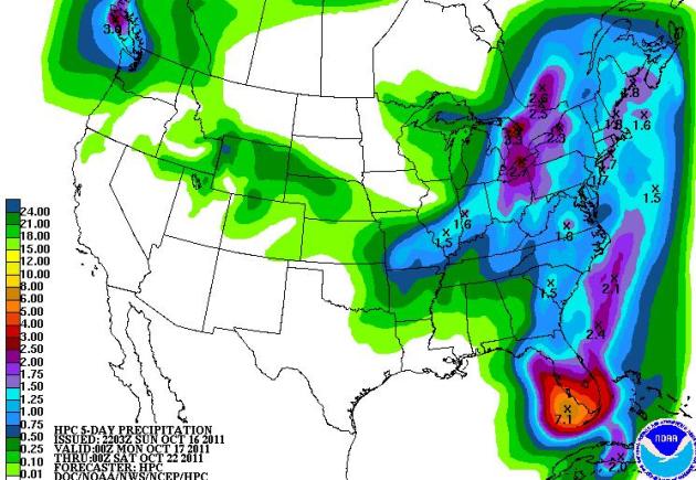
Florida Soaking. The eastern third of America will pick up more than an inch of rain over the next 5 days, with some 2-3" amounts from near Detroit to Buffalo - as much as 5-7" rain for southwestern Florida.
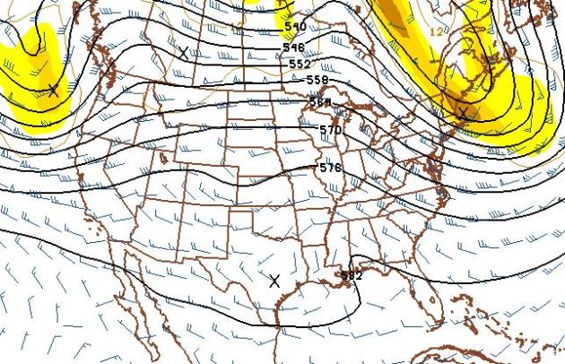
Halloween Preview: Another Touch Of Indian Summer? The 500 mb forecast map above is valid October 30 - a weather map that looks more like mid/late September than late October, with the core of the jet stream still unusually far north over Canada. The result: a mild, "zonal" Pacific flow from west to east, 60s sweeping across the Rockies into Minnesota, Iowa and Wisconsin, as much as 10 degrees above average? We'll see, but right now I don't see any major storms (rain or snow) between now and Halloween.

Peanut Butter Shortage? AccuWeather reports on how the drought of 2011 is about to result in a sharp spike in peanut butter prices: "The United States has a peanut shortage this fall and soon peanut butter prices will jump around 30 percent. Drought was the main obstacle for peanut growers this year. Tiffany Arthur, an agricultural economist at the U.S. Department of Agriculture’s Farm Service Agency, said that in Texas, the air was so dry that irrigation water would evaporate before the water could reach the plants. The Texas peanut yield is down 17 percent. Though not as bad as Texas, dry weather affected farmers in the state with the nation’s biggest peanut crop, Georgia. “I’ve never seen a year wherein we suffered from planting time, all the way through the growing season,” said Hawkinsville, Ga., farmer Rodney Dawson. “I’ve never experienced a season like this in 41 years.”
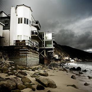
Why The Insurance Industry Won't Save Us From Climate Change. An interesting article from grist.org: "A myth floats around among those seeking free-market solutions to climate change that insurers will be a positive force. Insurers are worried about the impact of climate on their business model. They will increase rates. Expensive insurance will drive people off the coasts. People and property won't be as affected by coastal storms. Most recently, Fast Company asked whether trillion-dollar storms will drive us off the coasts: "Just how long until large chunks of America's coastline become virtually uninsurable, starting with Lower Manhattan? Some would say this is a good thing, a perfect example of markets appropriately pricing risk and (dis-)incentivizing people accordingly." There's only one problem: This market-driven solution won't work. Insurers are worried about climate change, with good reason. A recent Ceres report found, generally, that they're ill-prepared for climate. Their model for pricing risks depends on historical models, which are meaningless in the time of the new normal. For several years Munich Re, the giant reinsurer, has been advocating for governments to do something about climate change, based on rational self-interest: If governments can prevent it from happening, then insurers won't have to pay out. Guess that didn't work out so well -- thanks, United States Senate! As climate mitigation seems to be failing, adaptation strategies become necessary."

Why Facebook Is After Your Kids. An important story from the New York Times: "In May, Consumer Reports announced that 7.5 million kids age 12 and younger are on Facebook. The magazine called this “troubling news,” in no small part because their presence is at odds with federal law, which bars Web sites from collecting personal data about kids under 13 without permission from their parents. “Clearly, using Facebook presents children and their friends and families with safety, security and privacy risks,” Consumer Reports concluded. Within weeks of the Consumer Reports news, Mark Zuckerberg, the founder of Facebook, called for challenging the 1998 Children’s Online Privacy Protection Act (Coppa), which prevents Facebook from signing up young kids legally. “That will be a fight we take on at some point,” Zuckerberg said at the NewSchools Summit in California. And indeed, with the Federal Trade Commission poised to tighten Coppa’s regulations, Facebook has tripled its spending on lobbying, formed a political action committee and hired former Bush and Obama officials to push for its agenda."
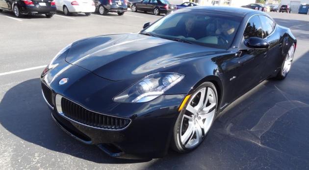

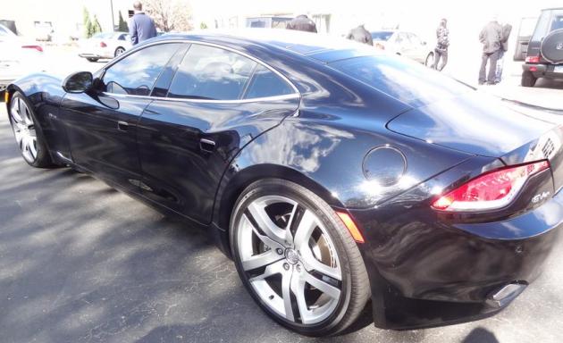
Fisker Karma. On Saturday I had a chance to test-drive the new "Karma" on Saturday at Borton Volvo (and Fisker) in Golden Valley. I wasn't disappointed. The car was fast, luxurious, and whisper-quiet. It's a hybrid, using lithium ion batteries and a small 4 cylinder (gas-powered) engine to prevent "range anxiety". You can travel about 100 miles on just electric power, another 300+ using the conventional 4 cylinder engine - truly the best of both worlds. Gas mileage? Anywhere from 60-100 mpg. The Karma is a 4-seater, with all natural (recycled) materials on the interior, and a sleek look that's a cross between Aston Martin and Corvette. More on the Fisker Karma here. They're coming out with a more affordable family sedan within the next 2 years. I suspect we'll all be driving some variation of the "Karma" within 5 to 10 years


Blustery Blue Sky. Whitecaps on the lakes, northwest winds howling at 20 mph, with frequent gusts over 35 mph at times - it certainly felt like autumn out there. But in the temperature department it was a perfectly average day, highs ranging from 51 at Alexandria to 55 in St. Cloud, 59 in the Twin Cities.
Paul's Conservation Minnesota Outlook for the Twin Cities and all of Minnesota:
TODAY: Plenty of sun, blustery! Winds: NW 15-30. High: 55
MONDAY NIGHT: Partly cloudy and colder. Low: 38
TUESDAY: More clouds than sun - heavy jackets return to Minnesota. High: 48 (feels like 30s).
WEDNESDAY: Hints of November. Mostly cloudy with a few sprinkles, even a stray flurry or two (best chance Wisconsin). Low: 34. High: 47
THURSDAY: First official frost? Sunny with less wind. Low: 32. High: 51
FRIDAY: Plenty of sun, leave work early. Low: 39. High: 59
SATURDAY: Touch of Indian Summer. Fading sunshine - milder than average. Low: 45. High: 61
SUNDAY: More clouds, passing shower north. Turning cooler. Low: 46. High: 57
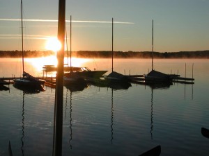
Super-Sized Autumn?
We have yet to see our first snow (or official frost) in the immediate Twin Cities. A fresh surge of Canadian air will spin up a major storm out east this week. This swirling pinwheel of moisture will wobble southwestward, pushing clouds, sprinkles, even stray flurries into Wisconsin by midweek. I wouldn't be shocked to hear of snow flurries from Hayward, WI into the eastern suburbs of MSP by Wednesday night - no worries about accumulation through the end of the month.
If anyone asks (doubtful) the mean date of the first 32 degree temperature at MSP International (where official readings are taken by the NWS) is October 7. If skies clear and winds ease MSP may see the first official 32 F. Thursday morning; coming 2 weeks later than usual.
But more Indian Summer is on tap. 60 may return Saturday; long-range models hinting at 60 on Halloween. No blizzards this year.
Intense storms forming in the Gulf of Alaska are pumping mild Pacific air as far away as Minnesota, Canadian cold fronts aimed at New England. Some years winter arrives suddenly. Other years we actually ease into winter. All bets are off for January - but right now I'm betting on a longer, super-sized fall.
No comments:
Post a Comment