Todd's Conservation MN Outlook for the Twin Cities and all of Minnesota
TUESDAY NIGHT: Partly cloudy and cold, but not as cold. Low: 11 Winds: turning W 5-10mph
WEDNESDAY: Another fast moving clipper rolls through. Light snow chance in the afternoon, then turning colder! High: 28. Winds: WNW 5-10mph
THURSDAY: Bundle up, another cold day with partial sunshine. Low: 15. High:21. Wind: WNW 5-15mph
FRIDAY: Another cold start, even colder than earlier in the week. Sub-zero wind chill potential to start the day and chilly into the afternoon with more clouds. Low: 4. High: 17. Winds: WSW 5-15mph
SATURDAY: Slightly warmer as a clipper nears from the northwest. More sun. Low: 10. High: 28. Winds: SW 10-15mph
SUNDAY: Clouds thicken with light snow potential through the afternoon. Low: 20. High. 32. Winds: Turning N 10-15mph.
MONDAY: Lingering low clouds with some light snow potential. Low: 20. High: 28. Winds: N 5-15mph
A little more than 2 weeks from now, we'll be talking about the official start to Winter. The sun's most direct rays will shine over the Tropic of Capricorn on December 21st, signifying the start to Winter in the Northern Hemisphere and the star to Summer in the Southern Hemisphere. With that said, it will sure feel like winter around here this week, today being one of those days. Single digit above and below temperatures this morning will make it some of the coldest air we've seen in nearly 6 months.
Chunks of cold air are being funneled south of the border by a larger low pressure system setting up near the Hudson Bay. This fairly large and stagnant low pressure center is known as a Polar Vortex. Up until now, we haven't seen much of this feature this season. What this means for us, is a steady stream of Arctic blobs hurling our way through the middle of December. I don't see any extended periods of cold air, but they will be frequent enough to get your attention.
Preceding each cold blast, flurries will be possible, just like yesterday. Our next best chance of flurries rolls in Wednesday night, meaning the end of the week will be cold!
Heavy Flooding Rainfall
Another slow moving front brought heavy rainfall to parts of the Lower Mississippi Valley, the Tennessee River Valley and the Ohio River Valley over the last couple of days. The extensive rainfall was good enough to create more flooding and was also good enough to send a few locations into the wettest year on record category. The image below shows the observed rainfall through a good chunk of Monday.

It’s official! Louisville KY has a new annual precipitation record. As of 10:26 am EST today – December 4, 2011, the total for 2011 is 64.68″ – surpassing the old record of 64.20″ in 2004. The graph below does not include Monday's precipitation, but gives you a good indication of what those folks are dealing with this year!

Here Are Some Other Numbers From Kentucky

Flooding Picture From Kentucky
Thanks to Brent Elkins from Dexter, KY for this picture
This is along highway 1346 at Dexter, Ky. west end of the state, after near 5" of rain in just over 24 hours.

Nome Man Gets Stuck In Snowdrift For 3 Days, Survives On Frozen Beer

This Picture Was Taken From Jacksboro, TX which is Northwest of the Dallas/Ft. Worth area

Snowfall Reports From Texas
The biggest snowfall report I saw was from Friona, TX with 4"

School Closings - Albuquerque, Santa Fe, Durango, Farmington and Roswell
Texas wasn't the only spot that got snow... New Mexico got some pretty good snow. In fact, it was enough snow to cancel school in many spots.
Read the Full Storm HERE:"140 schools have either closed or delayed due to the snowstorm. Altogether including government agencies, religious centers and all others, the total closure amount is 255 different entities."
California Recovering From Winds, New Gusts On Way
Picture below courtesy: David Zentz AP
"Theresa Reyes, left, Antjuan Roy and his mother, Diane Johnson, stand near Roy's destroyed car in Temple City, Calif., on Saturday. Weary Southern Californians struggling with the cleanup from last week's violent windstorm braced for yet another round of windy weather."

"Thousands of Southern Californians who have gone without power for five days are being told it’s almost over, though a new round of high wind warnings have been issued for some areas hard hit by last week’s ferocious windstorm."
Getting Into The Holiday Spirit
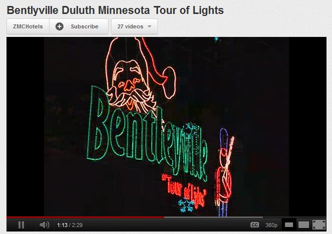
Have you heard of "Bentlyville"? It's an amazing display of holiday lights in Duluth, MN that is worth seeing if you have the chance to. Check out this short film... it'll make you want to see it in person.
Feeling Like Winter This Week
This will be our first real test of the wintry cold this season. Take a look at the blob of cold air that is sitting over the region on Tuesday. This will help drag temps down into the single digits above and below zero during the morning hours with sub-zero wind chill values and daytime highs struggling to get to 20F

Even Colder Thursday
The second wave of cold air will settle into place on Thursday and keep temperatures Thursday - Friday even colder

That's all for now, thanks for checking in and have a great rest of you week.
Don't forget to follow me on Twitter:

Meteorologist Todd Nelson
No comments:
Post a Comment