84 F. average high for July 6.
87 F. high temperature on July 6, 2011.
+13.1 F. first 5 days of July running more than 13 degrees F. above average, ever day above 90.
16 days above 90 F. so far this year (average for an entire summer is 13).

240 all-time record highs, nationwide, in the last 2 weeks. By all-time I mean the hottest ever observed for that city.
42,678 warm weather records since January 1, nationwide.
6,013 cold weather records since January 1. Source NOAA NCDC.
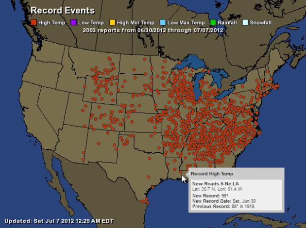
Record Highs. NOAA reports over 2,000 record highs in the last week. For an interactive map from Ham Weather click here.
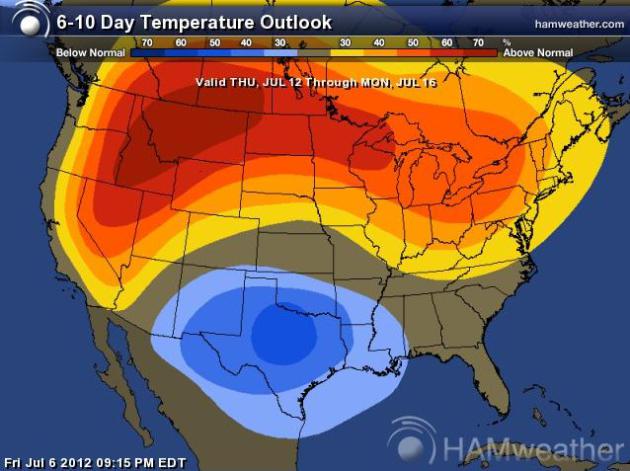
Extended Outlook: Hot Enough. No more 100-degree heat is in sight, but I suspect we'll see highs near 90 from Wednesday through Saturday of next week. Map: NOAA CPC and Ham Weather.

European Solution. We cool off slightly in the coming days, highs in the 80s. But the mercury may be flirting with 90 by Wednesday, a few low 90s possible toward the end of next week. Dry weather should be the rule for most of next week.

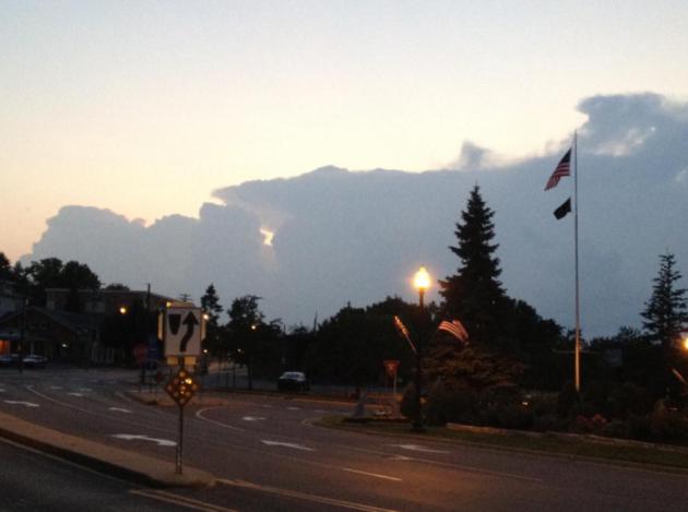
Cauliflower Cumulus. Bobbi Kelly snapped this photo of the developing squall line over the metro from Belle Plaine, Minnesota.

"Summer of 2012: A Legacy of Heat". Here is an excerpt from Dr. Mark Seeley's weekly WeatherTalk blog: "July is continuing a 9-month trend of above normal temperatures in Minnesota. In the Twin Cities Metro Area we have already seen 16 days with daytime highs of 90 degrees F or greater, and 8 nights when the temperature never fell below 70 degrees F. On average (1981-2010) the Twin Cities records 13 days each year with daytime highs of 90 degrees F or greater, and 11 nights when the nighttime temperature does not fall below 70 degrees F. Temperatures are expected to cool next week, but still average somewhat above normal. Lower dewpoints will help freshen the air."
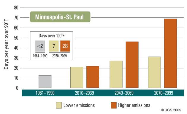
Extended Outlook: More 90+ Days. Graph above courtesy of the UCS, the Union of Concerned Scientists. Between 1961 and 1990 MSP saw an average of 13 days/year above 90 F. In a low carbon emission scenario we may see 21 days above 90 through 2039. If we fail to put a price on carbon, and greenhouse gas pollutants continue to increase worldwide the Twin Cities could see as many as 47 days/year above 90 by mid-century.
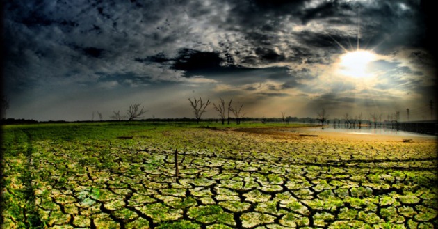
"Many people around the world are beginning to appreciate that climate change is under way, that it's having consequences that are playing out in real time and, in the United States at least, we are seeing more and more examples of extreme weather and extreme climate-related events." NOAA Chief Jane Lubchenco
"The climate models have predicted what we've now seen, which is a doubling in the rate at which we break all-time warmth records in the U.S. We're breaking those records, over the past decade, at a rate of almost twice what we would expect from chance alone." - from an article at Newsday below.
"No, our resurgent belief in global warming seems to be a function of the weather. A separate Yale survey this spring found that 82 percent of Americans had personally experienced extreme weather or natural disasters in the past year. And 52 percent said they believed the weather had been getting worse overall in recent years, compared to just 22 percent who thought it had gotten better." - from an article at slate.com.
"Department of Homeland Security Secretary Janet Napolitano, surveying wildfires in Colorado Springs earlier this week, remarked on the “pattern” evident in the weather. “You have to look at climate change over a period of years, not just one summer,” Napolitano said. “You could always have one abnormal summer. But when you see one after another after another then you can see, yeah, there’s a pattern here.” - excerpt from a story at The Hill.

Historic Derecho. Did global warming make last week's historic "super-derecho" even more intense and damaging? The Washington Post's meteorologist Jason Samenow takes a close look at the meteorological conditions leading up to this unprecedented wind storm below.
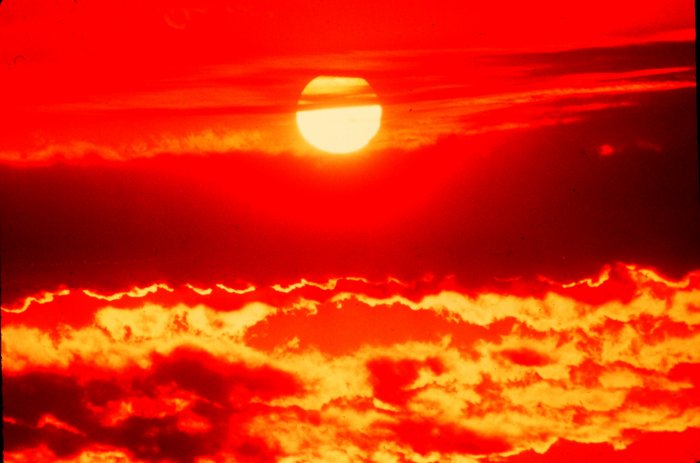
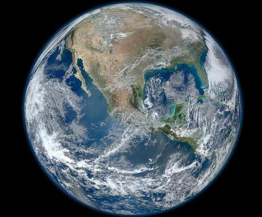
"NASA’s Goddard Institute for Space Studies, which monitors global surface temperatures, reports that nine of the warmest 10 years on record have occurred since 2000. The warmest year of all was 2010; last year was only the ninth warmest, but global temperatures were still almost a full degree warmer than they were during the middle of the 20th century." - from an Op Ed in The Miami Herald - details below. Image above: NASA.
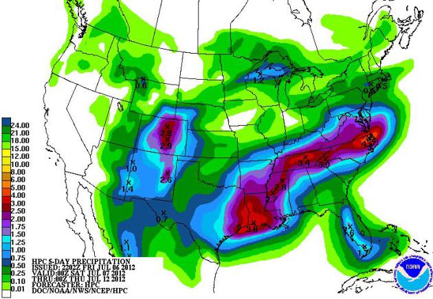
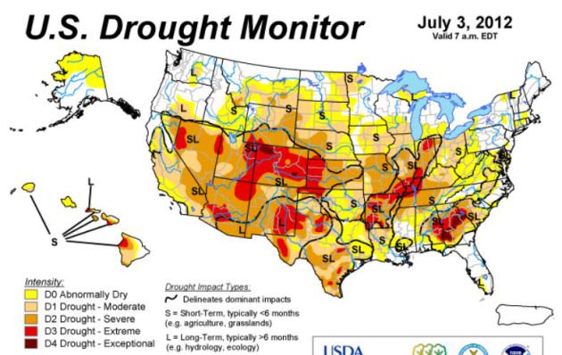
* Image above courtesy of NOAA's Drought Monitor.
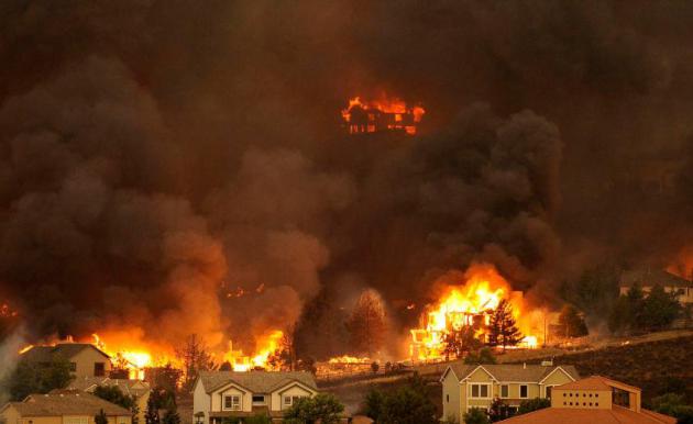
Photo credit above: "The Waldo Canyon fire burns an entire neighborhood in near the foothills of Colorado Springs, Colo. Tuesday, June 26, 2012. Colorado has endured nearly a week of 100-plus-degree days and low humidity, sapping moisture from timber and grass, creating a devastating formula for volatile wildfires across the state and punishing conditions for firefighters." (The Denver Post, Helen H. Richardson)
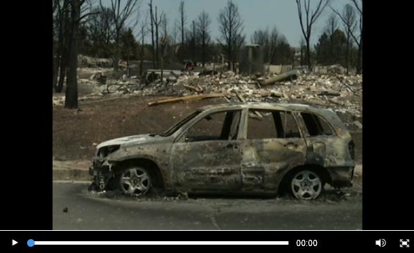
Colorado's Perfect Firestorm. Here's a snippet of an extraordinary article at The Los Angeles Times, trying to put the recent Colorado fires into some sort of long-term historical perspective: "Last week, my parents had to pack their belongings and flee as the Waldo Canyon fire barreled toward their house in Colorado Springs. They were among 32,000 people forced from their houses by the fire, which has destroyed nearly 350 homes. My parents were lucky. Despite the trauma and fear of having to evacuate, they didn't lose their home. But the fire emphasized something of a long-running debate between my father and me: the reality and politics of climate change. I am a political scientist who studies climate policy and adaptation, and the intersection between climate science and politics. My father is also a scientist — a nuclear engineer. But he's always been a bit skeptical about climate change. Though he's not a full-on doubter, he also hasn't fully embraced the idea that the planet is warming in ways that could be devastating, and that this change is the result of human activity. Events like the Waldo Canyon fire may make him and other climate skeptics easier to convince."
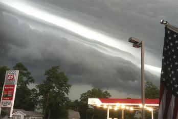
Derecho In D.C.: Science And Surprise. Here is a comprehensive look at the "super-derecho" that tracked nearly 800 miles, whipping up straight-line winds over 90 mph at times, knocking out power to millions of Americans. There was only a few hours advance-warning. What are these freak storms, how and why do they form? Why are computer models often ineffective predicting these swirling, boomerang-shaped swarms of severe storms? Some answers from NCAR/UCAR AtmosNews: "With a ferocity to match the record heat it displaced, a thunderstorm complex raced from Illinois to the Delaware coast in a mere 12 hours on Friday evening, June 29. It knocked down countless trees and power lines, with wind gusts topping 80 miles per hour in many spots. It threw millions of people into turmoil, with air conditioners, computers, and phones out for days. And it brought to light a weather word du jour with an obscure but intriguing history... By morning, though, the signals were starting to come together in data from radiosondes (weather balloons) and forecasts from weather models, which increasingly pointed toward a storm complex moving from the Midwest toward the Appalachians. Derechos seldom cross the Appalachians intact, which keeps D.C.-area forecasters cautious about forecasting such a leap. Indeed, a storm complex that produced 80 to 90 mph winds in Chicago on Sunday, 1 July, fizzled en route. But on June 29, the extreme warmth and depth of the air mass, plus energy from the jet stream, kept the derecho powerful all the way to the Atlantic Ocean."
Photo credit above: "A shelf cloud, forced upward by strong winds behind it, marks the front edge of the destructive derecho that moved from Illinois to the Atlantic Ocean on June 29, 2012. (Photo from NASA Earth Observatory, courtesy Kevin Gould and NOAA.)"
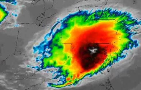
Did Global Warming Intensify The Derecho In Washington D.C.? Here's an excerpt of a fascinating article from meteorologist Jason Samenow at The Washington Post's Capital Weather Gang, attempting to connect the dots between supercharged heat/humidity and the subsequent super-derecho that struck with little warning: "The June 29 derecho, which caused widespread damage in Washington, D.C. blossomed to full fury in a record hot environment. Could the heat added to the atmosphere from manmade greenhouse gases have provided extra fuel to this explosive storm? The amount of energy available to this storm was extreme and, wundergound weather historian Chris Burt called the number of all-time heat records set around the time “especially extraordinary.” But as I wrote the day after the storm, connecting global warming to the derecho is a complicated and controversial question."
Photo credit above: "Infrared satellite image of derecho over Washington, D.C." (CIMMS Satellite blog)
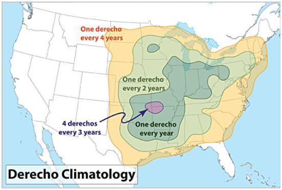
Derecho Climatology. Thanks to Cory Mottice and Everything WX and twitpic for passing this along.
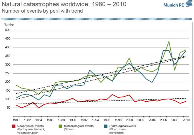
Natural Disasters On The Rise. The trend lines may be a combination of climate change turbocharging storms and land-use demographics: more people living in vulnerable areas (along the coasts and next to rivers). Graphic: Munich Re.
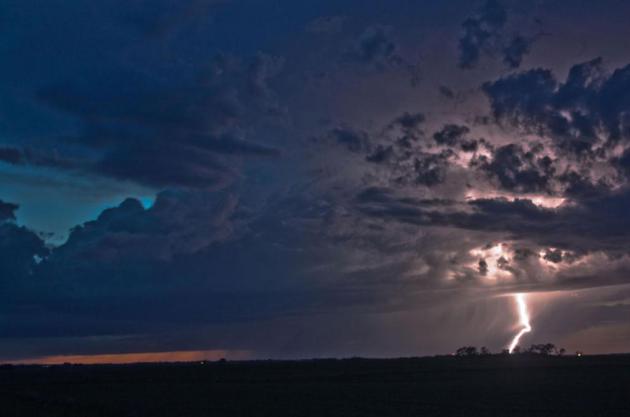
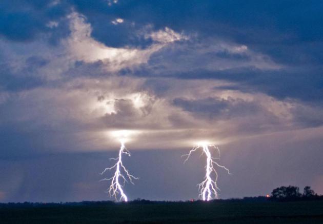
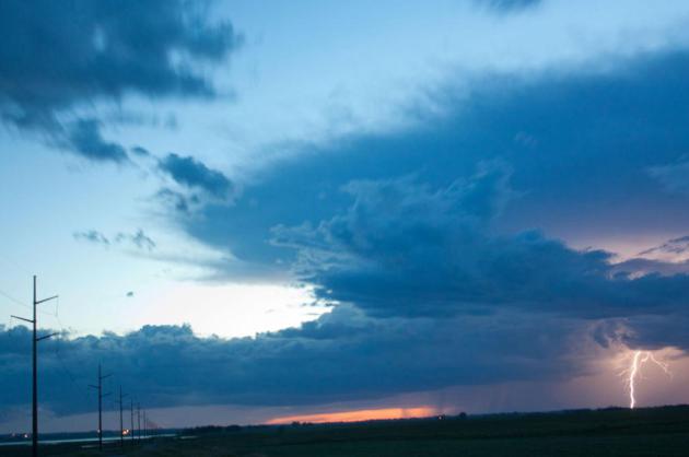
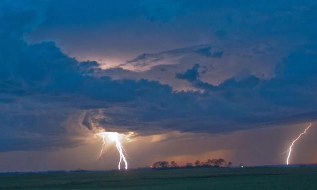
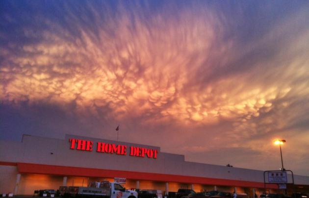
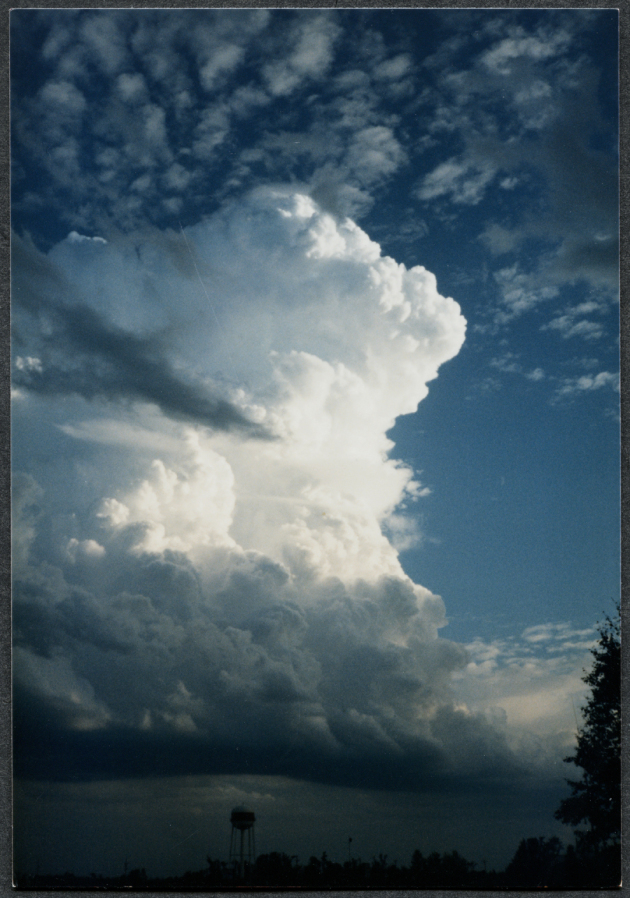
Photo Of The Day: "Mamma". A shout-out to Tyler Smelley down in Tuscaloosa, Alabama for a perfect example of cumulonimbus mammatus. Those ice scream scoop clouds on the underside of the thunderhead anvil are evidence of hail in the upper reaches of the storm.
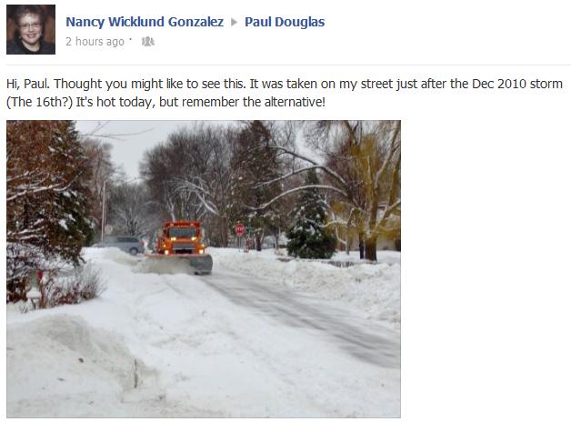
Good Point. But can we find a happy medium between 2 feet of snow and 102 F? Thanks Nancy.

Will Microsoft Redefine The Industry With Windows 8 And The Surface Pro? At first blush it looks pretty impressive - I'm keeping an open mind (in spite of my love for all-things-Apple). More from gizmag.com: "Windows 8 represents a big change for Microsoft’s industry leading OS. It breaks from tradition by doing away with the long serving Start button and replacing it with a tile-based and touch-friendly Metro UI. While this move has widely polarized opinion, especially in the enterprise sector, it does represent a major trend across the industry, with mobile-tablet operating systems becoming more and more closely related to their laptop and desktop counterparts. This trend is personified by Microsoft’s in-house tablet, the Surface Pro."

GoVacuum's $1 Million Gold-Plated Vacuum Cleaner. Just when you thought you'd seen everything - along comes this blurb from the amazing techno-geeks at gizmag.com. You just can't make this stuff up; here's an excerpt: "Every now and then, we here at Gizmag like to take a look at how the other half (or one percent) live. And why not? It's nice to occasionally fantasize about say, waking up in a private, underwater hotel room, to be chauffeured in a Mercedes-Benz to a weekend getaway on your own personal floating island. But does that fantasy involve personalized, gold-plated cleaning appliances? If it didn't before, it sure can now with GoVacuum's GV62711 vacuum cleaner and it's US$1 million price tag."
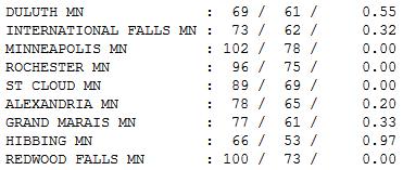
Paul's Conservation Minnesota Outlook for the Twin Cities and all of Minnesota:
TODAY: Partly sunny with a stiff breeze - much more comfortable. Dew point: 63. Winds: N 15. High: 82
SATURDAY NIGHT: Mostly clear and pleasant - open up the windows! Low: 64
SUNDAY: Sunnier, nicer day as winds ease - low humidity. Dew point: 60. Winds: NW 5-10. High: 84
MONDAY: Blue sky, light winds. Dew point: 61. Low: 66. High: 85
TUESDAY: Sunny and warmer. Still dry. Low: 64. High: 86
WEDNESDAY: Hazy sun, heating up. Low: 66. High: 89
THURSDAY: Sticky sun, hot again. Dew point: 68. Low: 67. High: near 90
FRIDAY: Murky sun. Dog Days return. Dew point: 70. Low: 70. High: 92

What Vacation?
We're all wired now, continuously plugged into
The Matrix; a never-ending treadmill of e-mails, texts and action items. But
meteorologists never (ever) get a break. "Honey, what time will the rain stop?" my wife demanded. 2:32 pm, I replied. Nothing
like a little sarcasm to brighten up a 28 year marriage. "Will the front
pass in time for fireworks? What time will the sun come out? Why is it still raining? You said it would be over by now!" So
here I sit, my face buried in the Doppler, praying (out loud) for a break. Yes,
I know it comes with the turf.
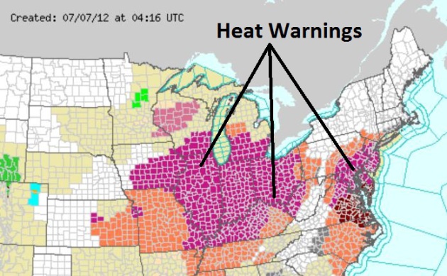
But we're all weather-weary now. If you're sick of Heat Warnings, Super-Derechos and
dew-point-babble raise your hand. I'm waving my little white flag. I
surrender.
Suffocating heat is over; a nagging frontal boundary sparks
more T-storms today. Not an all-day washout, but a few hours
of puddles, with a fresh north breeze and highs near 80. A C- Saturday.
Sunday
gets a B+ on my lop-sided grading scale; more sun - highs in the mid
80s. Each day gets sunnier and warmer next week; another run at 90+ the
latter half of next week.
Red blobs on Doppler? Uh oh. My wife won't be pleased.
I need a vacation from my vacation.

"Bad Weather Or Global Warming?" Here's an excerpt of an Op-Ed at Newsday on Long Island: "Swaths of the country have been enduring day upon day of triple- and near-triple-digit temperatures, so it might be hard to remember that just two years ago, when Washington, D.C., was blanketed in record snowfall, noted climate change skeptic Sen. James Inhofe (R-Okla.) and his family were building an igloo on the national mall to mock former vice president and leading environmentalist Al Gore. That winter, Matt Drudge and Rush Limbaugh gleefully noted that a Senate conference on climate change had to be canceled due to snow. Scientists and environmentalists pointed out at the time that a record snowfall is in no way inconsistent with a warming planet -- in fact, many models predict that heavy snow could become more common because a warmer atmosphere will hold more water vapor. But the larger point is that, as Jane Lubchenco, the head of the National Oceanic and Atmospheric Administration (NOAA), put it in 2010, "It is important that people recognize that weather is not the same thing as climate." Large variations in temperature and humidity will occur even as global temperatures rise."
Graphic credit above: Photo credit: Donna Grethen/Tribune Media Services. "More than 2,000 U.S. heat records were broken just in the past week. Some climatologists argue that while there's certainly nothing unexpected in periodic record-breaking temperatures, the rate at which these records are being broken year after year can't be explained away by coincidence."
Climate Change Belief Increased In U.S. After Extreme Weather, NOAA Chief Says. Here's an excerpt from Huffington Post: "....Many Americans had previously seen climate change as a "nebulous concept" removed from them in time and geography, said National Oceanic and Atmospheric Administration chief Jane Lubchenco. "Many people around the world are beginning to appreciate that climate change is under way, that it's having consequences that are playing out in real time and, in the United States at least, we are seeing more and more examples of extreme weather and extreme climate-related events," Lubchenco told a university forum in the Australian capital of Canberra."

Heat Wave, Fires Have Climate Change Activists Going On The Offensive. Here's an excerpt from The Hill: "...Still, Weiss said the extreme weather “will put the heat on legislators who want to block action to address climate change.” “Since so many members of the Senate and House Republican caucuses are climate science deniers, it is unclear whether that element will change, but at least for members who are sort of moderate conservatives, who in the past have tried to block carbon pollution reductions, this should be a giant wake-up call that time is growing short to act,” said Weiss, who directs his group’s climate strategy. Growing campaigns around extreme weather would mark at least a subtle shift in messaging for the environmental movement, which in recent years has focused heavily on emphasizing what they call the economic benefits of a shift to low-carbon energy sources."
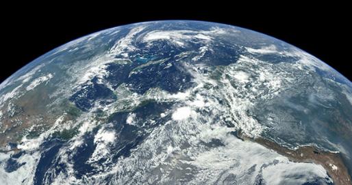
Global Warming Is Shrinking Plants: Study. Here's an excerpt of a story at The Bunsen Burner: "For the first time, scientists have begun study the effects of global warming on plant species morphology. University of Adelaide researchers have found that some Australian plants are narrowing their leaves in response to changes in climate. Lead author of the paper, Dr. Greg Guerin, says, “Climate change is often discussed in terms of future impacts, but changes in temperature over recent decades have already been ecologically significant.” Scientists gathered historical and contemporary specimens from the State herbarium, some dating back to the 1880’s. Focusing on narrow-leaf Hopbushes from Flinder’s Range, the largest mountain range in Southern Australia, research concluded that “leaf width…was negatively correlated with latitude regionally, and leaf area was negatively correlated with altitude locally.“ Researchers predicted, “…given within-species variation along a climate gradient, a morphological shift should have occurred over time due to climate change.” Image above: NASA.
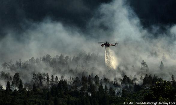
Photo credit above: U.S. Air Force; Master Sgt. Jeremy Lock.
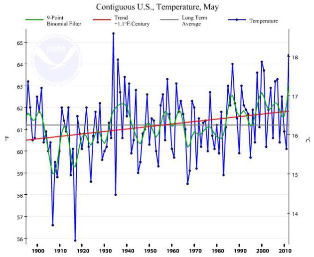
* graph above showing global temperature trends since 1900 courtesy of NOAA NCDC.
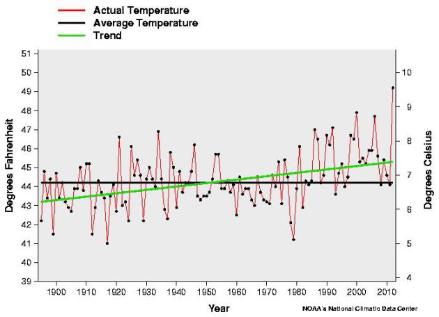
Temperature Trends: Contiguous USA. Data from NOAA NCDC - temperatures for 2012 are 4-5 F. warmer than the long-term average, on track to be the warmest year on record. 9 of the 10 warmest years on record have taken place since 2000.
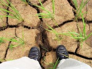
Photo credit above: IRRI Images, Flickr.
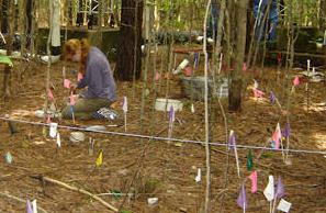
Photo credit above: "University of California-Irvine researcher Francesca Hopkins testing soil at an experimental forest in Wisconsin." Photo: University of California-Irvine.
No comments:
Post a Comment