78 F. average high for August 28.
78 F. high on August 28, 2011.
Mid-90s possible today, again Thursday.
Excessive Heat Watch (MSP metro) & Fire Weather Watch (southern Minnesota) posted for tomorrow
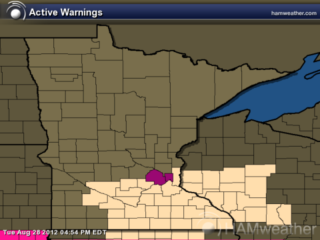
Excessive Heat Watch for Thursday. Hennepin and Ramsey counties are under an Excessive Heat Watch tomorrow; a Fire Weather Watch also posted for much of southern Minnesota; the combination of upper 90s, bright sun, strong winds and low humidity may cause brushfires to spread rapidly. Source: Ham Weather and NOAA.
"There is unequivocal evidence that Earth’s lower atmosphere, ocean, and land surface are warming; sea level is rising; and snow cover, mountain glaciers, and Arctic sea ice are shrinking. The dominant cause of the warming since the 1950s is human activities. This scientific finding is based on a large and persuasive body of research.” - from the latest AMS (American Meteorological Society) statement on climate change.
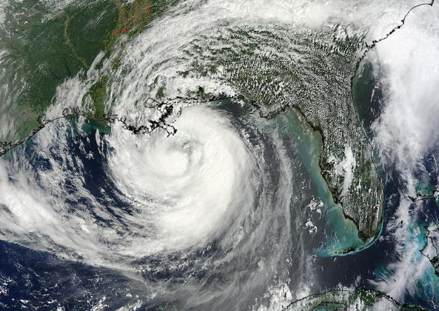
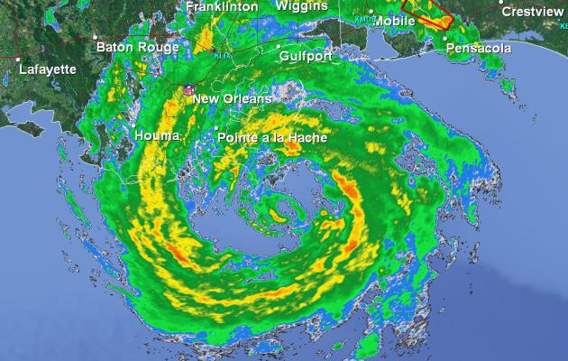
A Remarkable Sight. The view of Isaac from NASA's Modis satellite Tuesday was amazing. Dry air wrapping into the circulation kept Isaac sputtering along for much of Sunday and Monday, but the concentric shape Tuesday afternoon was a tangible sign that Isaac was (finally) getting its act together, and intensifying.
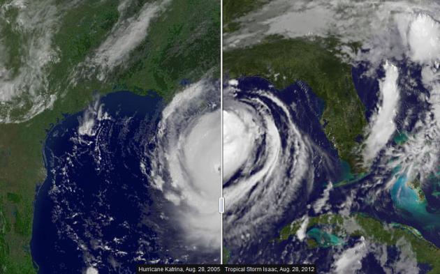
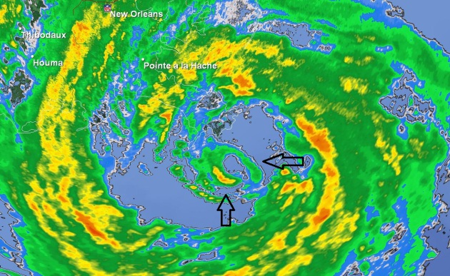
Eyewall Regeneration. One of the more fascinating elements of hurricane science is the ability for a hurricane to shed its eyewall, the donut-shaped ring where the strongest winds blow. Like a snake shedding its skin a hurricane's eyewall goes through cycles, a smaller eyewall forming within the main eye (upper right), followed by rapid disintegration of the original eyewall. We're still learning more about how hurricanes evolve over time - I grabbed these frame shots from the NWS Doppler in New Orleans Tuesday evening. I know, what a geek.
Study Tracks Relationship Between Storms, Cities. We know that large metro areas can "seed" clouds, pollutants increasing the potential for flooding and hail downwind. Here's an excerpt of an interesting story at phys.org: "We're trying to quantify something that has had anecdotal evidence through the years but has not been approached in a systematic way," said Geoff Henebry, a professor and senior scientist at the Geographic INformation Science Center of Excellence at South Dakota State University...."Our research will explore how city size and shape - both horizontal and vertical - can influence storm track, direction, and intensity," Henebry said."
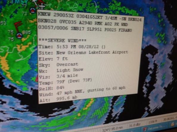
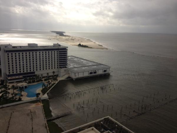
"Blurricane". I think this was a typo. Here was the hourly observation from New Orleans at 5:53 pm yesterday: overcast, 79 F, dew point 73 F, winds gusting to 60 with "light snow". Huh? That would be quite a trick. Thanks to Miranda Hilgers for passing this along.
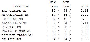
Gray Start, Fine Finish. A dying band of showers dropped about a tenth of an inch of rain on Alexandria, more at Eau Claire, but the sun came out by afternoon, boosting the mercury into the 80s statewide, 5-10 degrees above average.
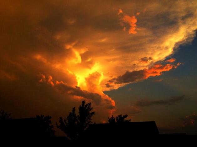
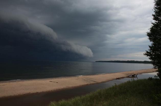
Tangerine Dusk. WeatherNation TV meteorologist Todd Nelson took this photo last week up in St. Michael. Yes, the sky really was that color.
Paul's Conservation Minnesota Outlook for the Twin Cities and all of Minnesota:
TODAY: Hot sun. Dew point: 61. Winds: SE 10-15. High: 94
WEDNESDAY NIGHT: Clear and sultry. Low: 72
THURSDAY: Excessive Heat Watch. Fire Weather Watch. Sizzling sun. Dew point: 55. Winds: SW 10. High: 95
FRIDAY: Still Steamy and unusually warm. Dew point: 56. Low: 71. High: 92
SATURDAY: Get to the lake! Hazy sun. Dew point: 60. Low: 72. High: near 90
SUNDAY: Sticky sun. Few T-storms north? Low: 70. High: 89
MONDAY: Slightly cooler, less humid. Dew point: 54. Low: 67. High: 87
TUESDAY: Muggy, few T-storms possible. Low: 69. High: 88
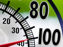
Another Heat Spike
We don't know as much as we think we know.
Hyper-local models and Doppler eye-candy give the illusion that we have
Mother Nature totally figured out. Note to self: we don't.
The atmosphere is a
fluid. We have math (nasty calculus) that describes how this airy fluid
SHOULD move over time, but our knowledge of how the atmosphere works is
incomplete. Think stock market picks or fantasy football, on a global scale.
Hurricanes
are especially humbling. With satellites it's doubtful we'll ever be
totally surprised, but predicting precise tracks and intensity is still
perilous.
If Isaac hugs the coast, the
core of the hurricane over warm water, further strengthening is possible
this morning - before pushing inland. Flash floods are possible as far
north as St. Louis, even Chicago.
While
we obsess over Isaac, desert heat is rushing toward Minnesota; 90+ today
& upper 90s possible tomorrow. An Excessive Heat Watch is posted
for Thursday along with a Fire Weather Watch, for a risk of fast-moving blazes. Heat lingers into early next week, hints of September by late next week. Whew.
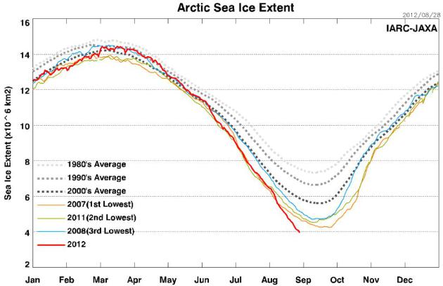
Today's blog includes a new record for least Arctic ice ever observed. A troubling trend up north.
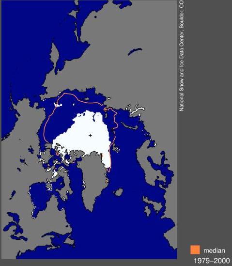
Graphic credit above: "The extent of Arctic sea ice reached a record low in the satellite record on Aug. 26 and is expected to continue dropping for the next several weeks, according to a University of Colorado Boulder research team." (Credit: NSIDC, University of Colorado Boulder)
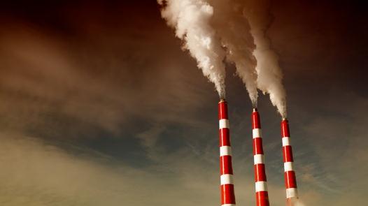
Photo credit above: "Cooling the emissions from coal-fired power plants would significantly reduce the levels of dangerous chemicals entering the atmosphere." (Photo: Shutterstock)
No comments:
Post a Comment