75 F. average high for September 9.
90 F. high on September 9, 2011.
Red Flag Warning posted for the southwestern third of Minnesota for a heightened risk of fast-moving brushfires into Tuesday.
90+ F. high likely Tuesday afternoon; 31st day at or above 90 this year in the metro area.
Wednesday PM into Thursday: next chance of rain in the metro area. Some .25 to .50" amounts are possible.

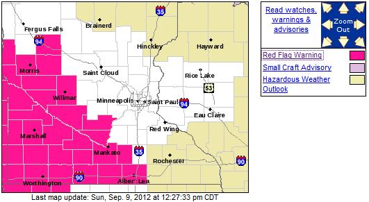
Red Flag Warning.
The greatest risk of fast-moving brushfires will be over southwestern
Minnesota today and tomorrow, the result of severe drought, low
humidity, and winds gusting over 30 mph. Details from the local NWS office:
...RED FLAG WARNING ACROSS WEST CENTRAL AND SOUTH CENTRAL
MINNESOTA ON MONDAY AND TUESDAY...

.ON MONDAY...STRONG SOUTHERLY WINDS GUSTING OVER 30 MPH WILL
DEVELOP ACROSS WESTERN AND SOUTHERN MINNESOTA BETWEEN RETREATING
HIGH PRESSURE TO THE EAST AND A COLD FRONT ADVANCING INTO THE
DAKOTAS. TEMPERATURES WARMING INTO THE 80S WILL ASSIST IN
PRODUCING MINIMUM RELATIVE HUMIDITY VALUES NEAR 20 PERCENT AS THE
WINDS INCREASE. THE COMBINATION OF DRY FUELS...STRONG WINDS AND
LOW HUMIDITY...WILL RESULT IN DANGEROUS WILDFIRE CONDITIONS. A
RED FLAG WARNING IS IN EFFECT ALONG AND SOUTHWEST OF A LINE FROM
ALEXANDRIA...THROUGH WILLMAR AND MANKATO...DOWN TO ALBERT LEA.

WHILE THERE WILL BE A BRIEF BREAK IN THE FIRE DANGER ON MONDAY
NIGHT INTO EARLY TUESDAY AS WINDS DECREASE AND RELATIVE
HUMIDITY INCREASES DURING THE OVERNIGHT HOURS... DANGEROUS FIRE
WEATHER CONDITIONS WILL REDEVELOP ON TUESDAY ACROSS SOUTHERN
MINNESOTA. TEMPERATURES WILL HEAT UP TO BETWEEN 90 AND 95 DEGREES
UNDER THE CONTINUED INFLUENCE OF STRONG SOUTHERLY WINDS. RELATIVE
HUMIDITY VALUES WILL FALL TO NEAR 20 PERCENT AGAIN AND RESULT IN
HIGH FIRE DANGER CONDITIONS.

A COLD FRONT IS EXPECTED TO ENTER WESTERN MINNESOTA ON TUESDAY
AFTERNOON. THE ARRIVAL OF THE FRONT AND DECREASING WINDS COULD
REDUCE THE FIRE DANGER ACROSS WEST CENTRAL MINNESOTA EARLIER ON
TUESDAY AFTERNOON.
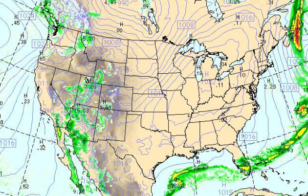
Today's Weather Map. The WRF model (valid 4 pm today) shows dry weather over the eastern 2/3rds of America, showers and T-storms confined to south Florida. Monsoon thunderstorms are likely over the southwestern U.S., more flash flooding possible from near San Diego to Phoenix, showery rains pushing into Seattle and Tacoma.
Summery Start - Autumny by Midweek. The ECMWF model also shows highs at or above 90 Tuesday, followed by a midweek cooling trend, light rain possibly by Wednesday. We cool off the latter half of the week (upper 60s to near 70), followed by yet another weekend of sunshine and 70s (80 possible next Sunday). More significant rian is predicted by Monday of next week. I hope the models are right.
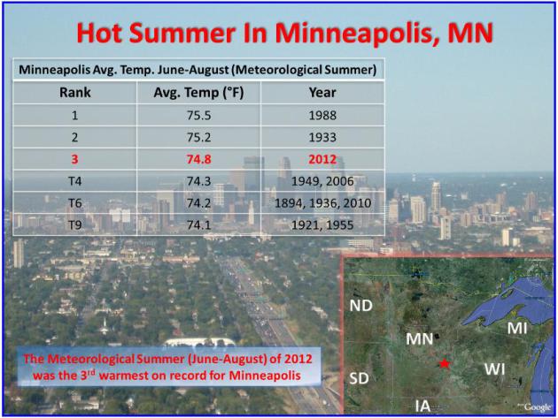
Third Hottest Meteorological Summer On Record. According to NOAA,
just a fraction of a degree F. cooler than 1988 and 1933, 2012 was a
sizzler. Nationwide July was the hottest month in recorded U.S. history.
So what kind of winters followed the steamy summers of 1933 and 1988?
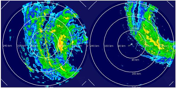
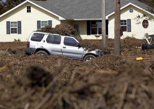
Photo credit above: "A car and lawn are covered in marsh grass after floodwaters from Hurricane Isaac receded in Braithwaite, La., Thursday, Sept. 6, 2012. Isaac hit southeast Louisiana and coastal Mississippi last week, causing severe flooding and seven deaths." (AP Photo/Gerald Herbert)
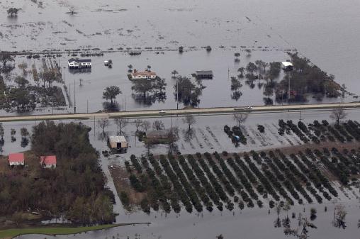
Photo credit above: "This aerial photo shows flooded homes and citrus orchards in the aftermath of Hurricane Isaac in Plaquemines Parish, La., Wednesday, Sept. 5, 2012." (AP Photo/Gerald Herbert)

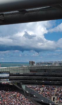
Photo credit above: NASA/Tony Landis
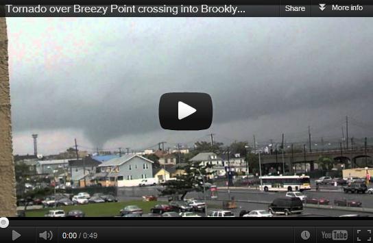
* YouTube video above courtesy of Joe FitzGerald.

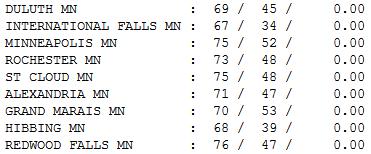
Flawless September Sunday. Yesterday was something out of a postcard from the Minnesota Chamber of Commerce. It was perfect, and yes, I'm editorializing. Under a blue sky the mercury rose to 67 at International Falls, 75 St. Cloud and the Twin Cities, 76 at Redwood Falls.

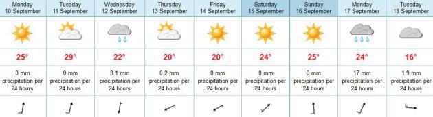
Paul's Conservation Minnesota Outlook for the Twin Cities and all of Minnesota:
TODAY: Warm sun, low humidity. Dew point: 43. Winds: S 15-30. High: 83
MONDAY NIGHT: Clear and mild. Low: 68
TUESDAY: Last 90? Windy and hot. Winds: S 25+. High: 93
WEDNESDAY: AM sun, then increasing clouds. Late-day shower? Cooler. Low: 65. High: 73
THURSDAY: Clouds, showers far south. Low: 57. High: 68
FRIDAY: Clouds linger, stray shower (east). Low: 52. High: 67
SATURDAY: Lukewarm sun, very nice. Low: 53. High: 75
SUNDAY: Sunny, heating up again. Low: 59. High: 81
* Long range guidance is hinting at a more significant cold front next week.
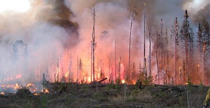
Fire Weather
Minnesota's pioneers braved the elements
without the luxuries of central air, Thinsulate and heated car seats.
They tolerated blizzards, tornadoes and floods, but anecdotal evidence
suggests that the source of greatest dread was fire.
As many as half of all brushfires a century ago
started from errant sparks along the railroads; an estimated 800 people
may have perished in one horrific blaze in Hinckley, in 1894.
The risk of deadly conflagrations has come
down, thanks to military-precision air drops of fire retardant and
bulldozer brigades, but some threat remains.
A combination of deepening drought, gusty winds
and tinder-dry humidity has forecasters concerned, especially tomorrow,
when highs top 90F, for the 31st day this year. A Red Flag Warning for
southwest Minnesota means fires may spread rapidly, with little
warning.
We cool off by midweek, enough rain to settle
the dust late Wednesday & Thursday. It won't be enough; the biggest
puddles staying south & east of MSP.
Lukewarm 70s return next weekend. Soak it up
because long range models shows a REAL cold front next week. The sun is
as high in the sky as it was March 31.
Yep, almost time to dig out the jackets.
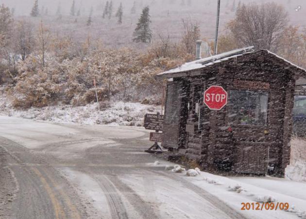
* photo above courtesy of the DNR.
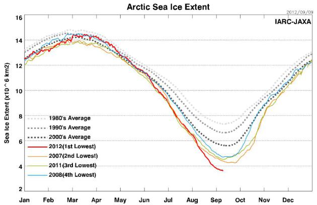
Arctic Sea Ice Falls To Record Low. Global Warming? No, I'm sure it's a coincidence that the 4 lowest Arctic ice measurements have all taken place since 2007. Here's a clip from The Christian Science Monitor: "Earth's icy skull cap, floating atop the Arctic Ocean,
has reached its lowest summer extent since satellites first began keep
in track in 1979, and by some estimates its lowest reach in nearly
1,500 years. As of Sept. 7, the Arctic Ocean's expanse of summer ice
this month spanned less than 1.54 million square miles, nearly six
times the size of Texas and some 45 percent less than for the average for the same month through the 1980s and '90s, according to the National Snow and Ice Data Center in Boulder, Colo. And the ice is still retreating; the summer melt season typically ends in mid to late September."
* graph above courtesy of the Arctic-Sea Ice Monitor. Japan Aerospace Exploration Agency, Earth Observation Research Center.
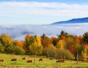
Autumn's Glow Put At Risk By Climate Change. NorthJersey.com has the story; here's an excerpt: "Climatologists
and phenologists — those who study the effects of seasonal changes on
plants and animals — are increasingly concerned about the effects of
rising temperatures and erratic weather patterns on fall foliage....
Studies in Europe and Japan have found that leaves are changing
color later that usual, and new research by U.S. scientists is coming
up with similar results:- In New Hampshire, data collected at the federal Hubbard Brook Experimental Forest in Woodstock suggest that sugar maples are going dormant two to five days later than they were two decades ago."
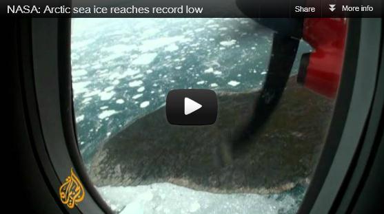
Image credit above: "NASA says that Arctic Sea ice has reached a record low that is going lower."
The Last Climate Change Skeptic. Here's a clip from thecanadian.org: "If
Dr. Richard Muller, a professor of physics from the University of
California, Berkeley, is not the last of the global climate change
skeptics, he should be. For years he has been one of the highest profile
critics of the procedures and conclusions of the UN's
Intergovernmental Panel on Climate Change (IPCC), arguing that its
current analysis of evidence is too flawed to definitively conclude a
relationship between anthropogenic emissions of carbon dioxide and
rising global temperatures. He has since changed his mind, offering an opinion piece in The New York Times (July
28/12) describing his “total turnaround” on the subject and defining
himself now as “a converted skeptic”. His transformation is worth
exploring."
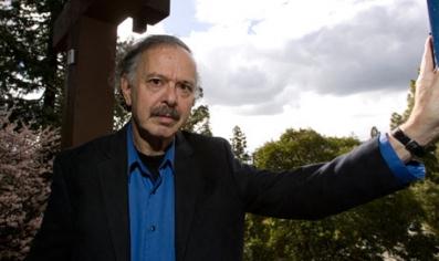
Photo credit above: Dr. Richard Muller (Guardian photo).
Is Global Warming Heating Texas? Here's an excerpt from the Texas State Climatologist at Austin's statesman.com: "Extreme
weather, such as droughts, floods, tornadoes, and hurricanes, has long
been a subject of intense scientific research. Recently, though, the
study of extreme weather has taken a different turn. People are
wondering whether extreme weather is becoming more frequent or intense,
and whether specific events might be linked to a long-term global rise
in temperatures. Science is responding to this demand for information,
and ever-increasing numbers of research studies are addressing this
issue. To confidently answer such questions, you need two things: a
clear trend in the data and a sound physical reason. Without the sound
explanation, a trend might be random chance. Without the trend, the
reason might be wrong because it left out some important factor."
No comments:
Post a Comment