By Todd Nelson
If you're keeping track, there are only 32 days left until Valentine's Day; 47 days left until Meteorological Spring (March 1st) and only 66 days left until the Vernal Equinox (March 20). To be honest, I can't believe it's already the 13th of January. Before we know it, we'll be able to start buying petunias and pansies! #Optimism
Not sure if that positive spin helped any, but the good news is that we're heading in the right direction. We've managed to pick up nearly 20 minutes of extra daylight since the Winter Solstice a little more than 3 weeks ago. By the end of January, we'll have gained nearly 40 to 50 minutes!
As we muddle through mid January, several clipper system will race through the Midwest with colder winds and precipitation chances. Our first clipper arrives later today with a good shot of snow overnight. By sunrise Tuesday, there could be a fresh coating of snow that could have an impact on commute times; plan ahead. Temperatures take a bit of a nosedive this week with each passing clipper. Sub-zero wind chill values return as harsh winds surround one system as it passes Wednesday night and Thursday. Hang in there! -Todd Nelson
_____________________________________________________________
SUNDAY NIGHT: Mostly cloudy, turning colder. Low: 21 Winds: SW 5-15
MONDAY: Back to work. Breezy and cooler. Another clipper arrives late/overnight, snow develops. High: 25. WNW 5-15
MONDAY NIGHT: Snow likely. 1" to 3" possible by sunrise Tuesday. Low: 15. Winds:
TUESDAY: Lingering snow early. Clearing later. High: 18.
WEDNESDAY: Clouds thicken, wintry mix develops later. Wake-up: 0. High: 19.
THURSDAY: WINDY! Dropping temps with a few wind blown flakes. Wake-up: 19. High: 24 (falling thru the day)
FRIDAY: Sub-zero AM wind chills. Cold sun. Wake-up: -1. High: 10.
SATURDAY: Cold start. Mostly sunny. Wake-up: 2. High: 19.
SUNDAY: Raw sunshine. Wake-up: 4. High: 22.
______________________________________________________________
This Day in Weather History
January 13th
1987: Warm air invades Minnesota with a balmy high of 48.
__________________________________________________
Gettin' Out of Dodge
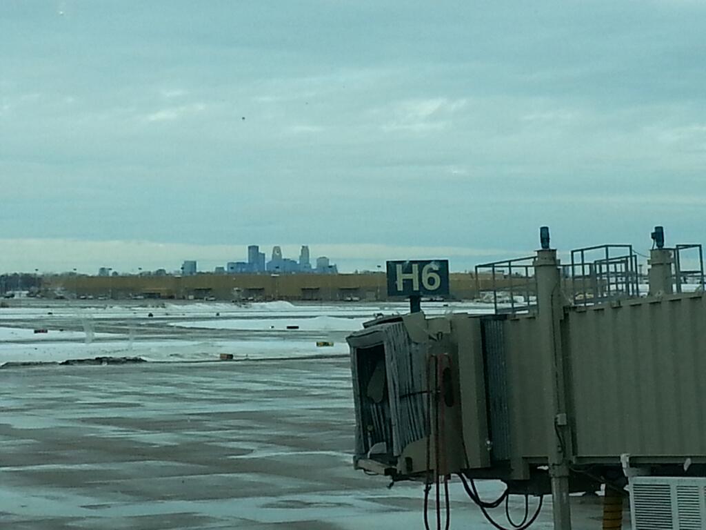
Thanks to my good friend and colleague Mace Michaels for the picture below who said he enjoyed the mild weather in Minneapolis on Sunday, but is heading south for a bit before the next Arctic plunge moves in this week.
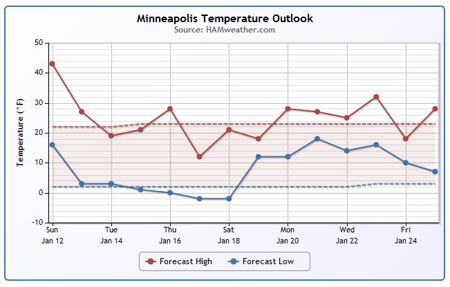
Minneapolis Temp Trend
After a very mild Sunday, temperatures this week will take a bit of a nosedive. Several clipper systems will move through the Upper Midwest this week and each one that passes will tug down some chilly air. There's a threat of some sub-zero lows temps and wind chill values.
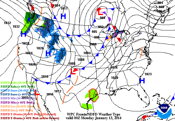
Incoming Clipper
Watch the loop below; note the incoming clipper system across the Upper Midwest by PM Monday into Tuesday. This will bring a quick shot of light snow accumulations from the Dakotas to the Great Lakes Region.
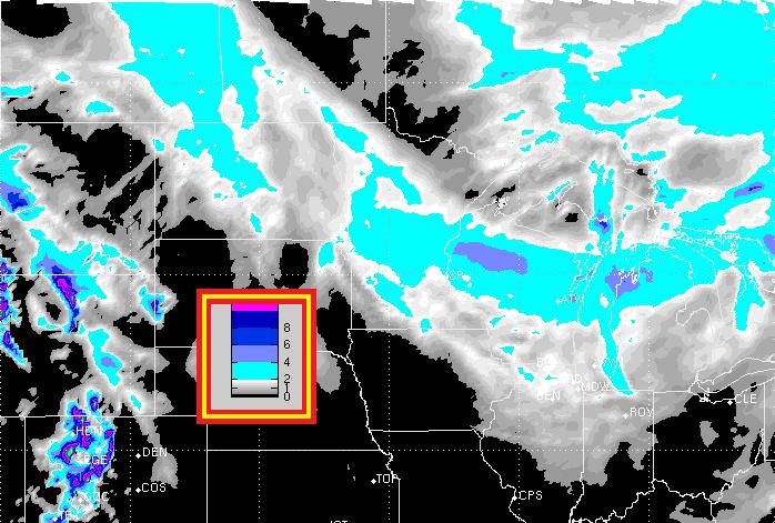
Midwest Snow Potential
Here's the snow potential through Tuesday. Note the fairly narrow swath of snow accumulations from North Dakota to Minnesota to Wisconsin to Michigan. The accumulations will pile up Monday through North Dakota; Monday night through Minnesota and Tuesday from Wisconsin to Michigan. The Tuesday morning commute could be quite slow for folks in Minnesota and Wisconsin; plan accordingly.
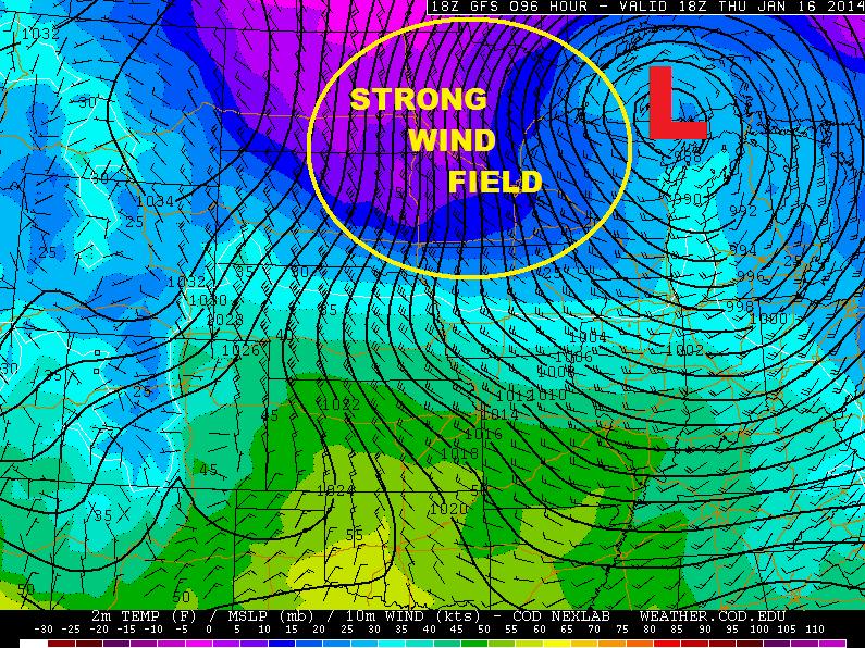
Windy Thursday Ahead!
There she blows! The wind field surrounding another clipper system across the Upper Midwest looks quite impressive later this week. According to this forecast model, surface winds could be 20mph to 40mph with higher gusts possible!
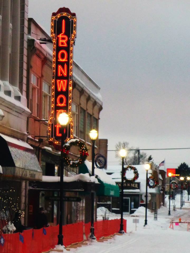
SISU Ski Fest Taste 'n Tour
Thanks to my good friend Melissa Ganje Kramolis for these pictures who attended the SISU Ski Fest Taste 'n Tour in Ironwood, MI this weekend. 9K of skiing with food and drink, sounds amazing! Hope you had a great time!

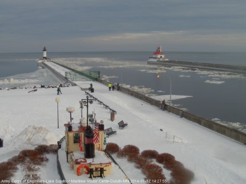
Icy Sunday in Northern MN
There were several reports of freezing drizzle and freezing rain on Sunday across the northern half of Minnesota. Roads were quite icy in spots as well. Here was the view from Downtown Canal Park in Duluth, MN from midday Sunday. You can see chunks of ice in the canal, which is actually part of the St. Louis River as it flows out into the open waters of Lake Superior.
See the Duluth Webcam HERE:
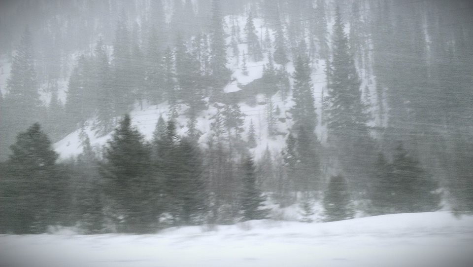
Colorado Snow
Thanks to Taylor M. Anderson for the picture below out of Frisco, CO where yesterday heavy snow was falling.
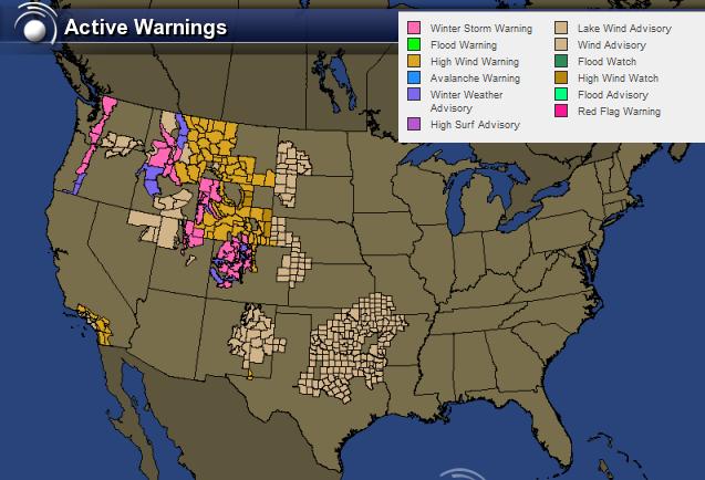
Western Mess Continues
The last in the series of systems to plow through the Pacific Northwest will exit the region on Monday. There will still be lingering snow and wind issues for all the colored counties below. The good news is that weather conditions will begin to settle down in the western part of the country by Tuesday and stay quiet for much of the week. The next Pacific storm will take shape later this week with another round of heavier precipitation and strong winds. Stay tuned...
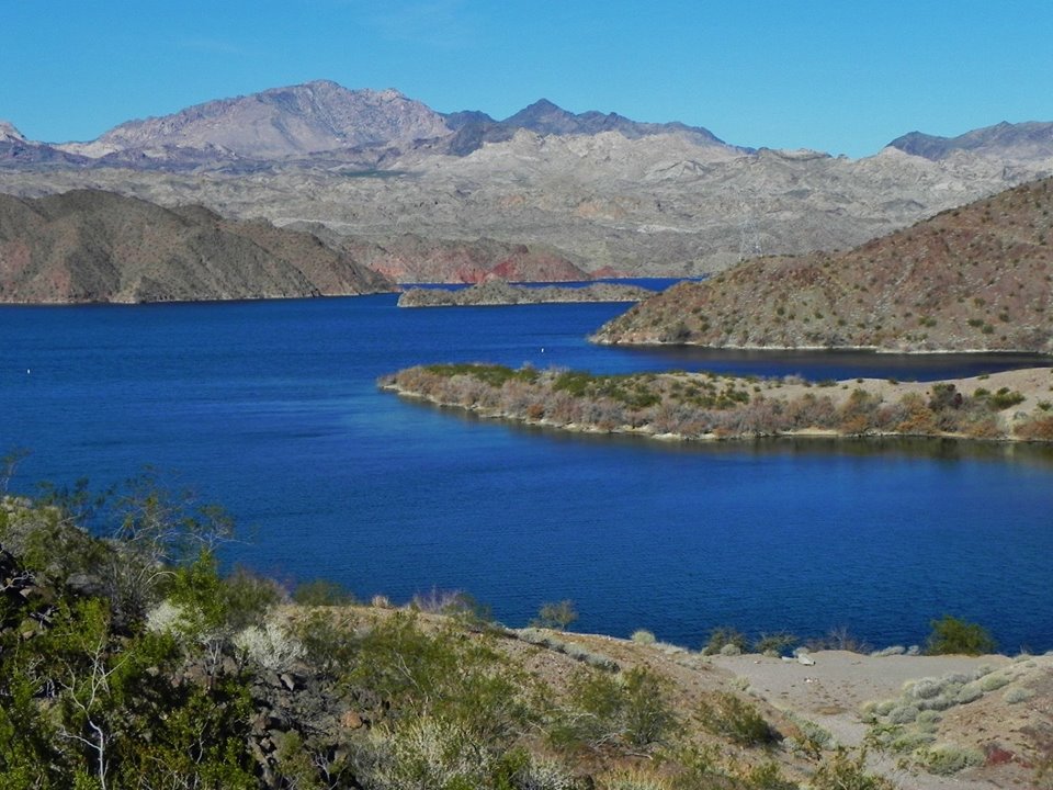
Warm in the Southwest
Thanks to my good friend Rich Koivisto for the picture below who took a quick trip to Lake Mohave this weekend. Looks nice Rich!
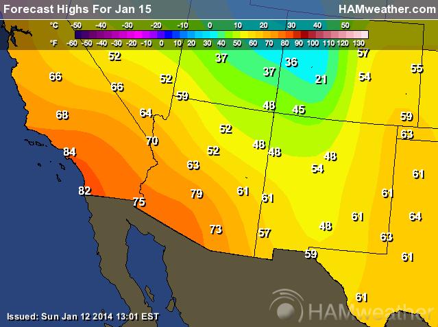
Warm Wednesday Ahead
Temperatures in the Southwestern part of the country look quite warm this week. Forecasts call for some of the warmest temps to move in by Wednesday as high pressure strengthens over the western part of the country.
Highs Wednesday
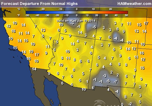
Highs From Norm Wed
By Wednesday, many spots in the Southwest will be nearly 5F to 15F above average.
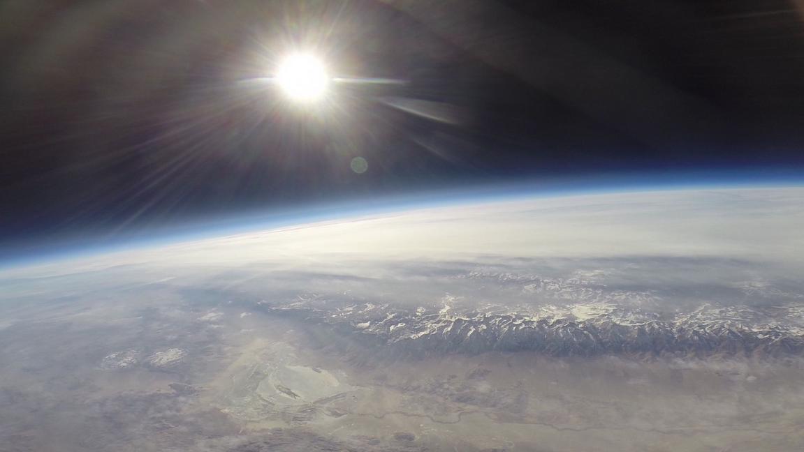
Pictures from the Stratosphere
WOW! these are cool pictures taken from a balloon launch over California. The balloon launch was conducted by Earth to Sky Calculus in an attempt to study solar radiation. The picture was taken as the balloon popped from the stratosphere.
See more from Earth to Sky Calculus HERE:
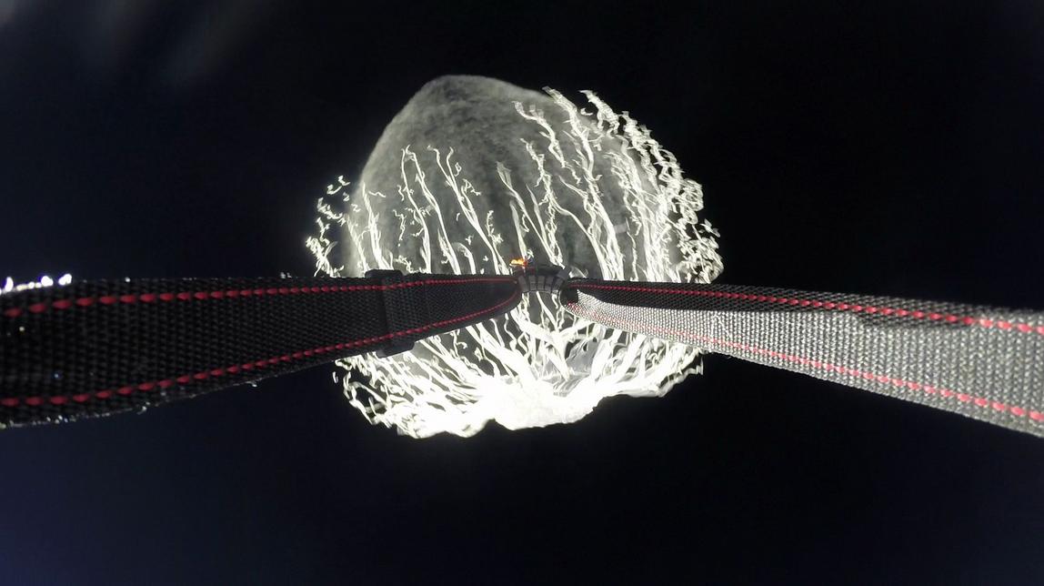
This picture was taken high above the Sierra Nevada Mountains, which look quite brown at this time of the year due to the ongoing drought in California.
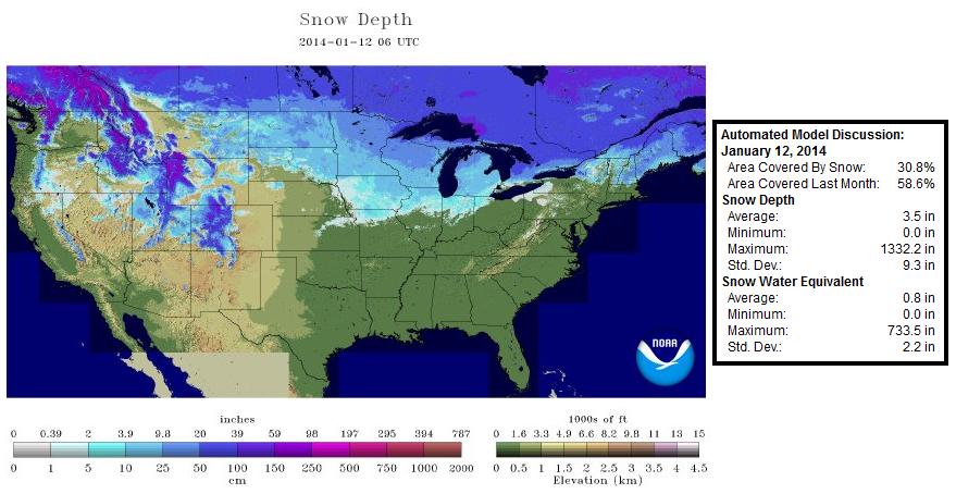
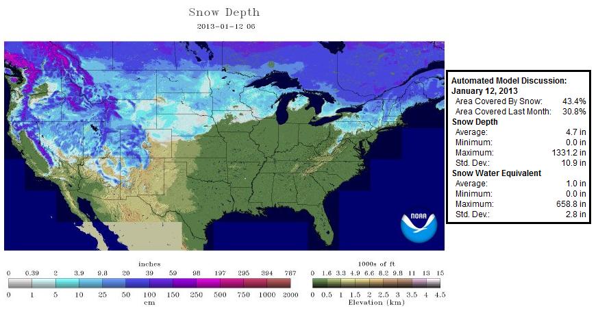
U.S. Snow Depth
Take a look at how 'brown' the Sierra Nevada region is this year compared to last year at this time. According to NOAA's NOHRSC, nearly 31% of the nation was covered in snow on January 12th, while last year at this time nearly 43% of the nation was covered in snow. Note how much more snow there was in the Sierra Nevada region last year vs. this year.
Snow Dogs
Say hello to Dweezel and Stinkfoot. These are two of my good friends dog sled puppies. Monica Zappa is actually going to run the 2014 Iditarod race this March!

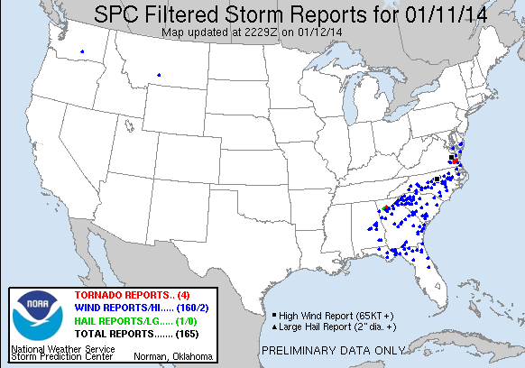
Saturday's Severe Storms
According to the National Weather Service, there was an EF0 tornado that touched down north of Atlanta, GA in Cherokee county.
Source: nws storm survey
Remark: a brief ef-0 tornado touched down in cherokee county georgia just after 730 am in the morning. although the total path was 3 miles...the tornado skipped along the ground as the damage was sporadic. several trees were downed along a path that stretched 1.75 miles ne of waleska to 4.5 miles ne of waleska. in addition to the downed trees...a fence near the starting point of the tornado was damaged when a large tree fell on it.
Thanks for checking in and have a great week ahead! Don't forger to follow me on Twitter @TNelsonWNTV

No comments:
Post a Comment