By Todd Nelson
As we climb out of the depths of this latest Arctic blast, I am reminded by a scene in one of my favorite movies filmed in Minnesota; Grumpy Old Men. As the late and great Walter Matthau steps outside to get the mail, he starts singing "Heat Wave", which was performed by the one and only Marilyn Monroe. If you do enough searching, you can find a pretty good rendition by Miss Piggy too.
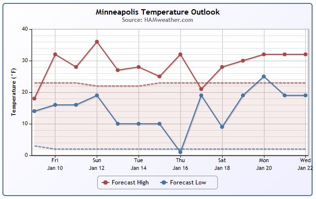
If you're keeping track, the official low at the MSP Airport on Tuesday morning was -23F. The high Friday could be near the freezing mark (+32F). That's nearly a +50F temperature swing in nearly 4 days!
Ahh yes, freezing is going to feel amazing today... enjoy it!
I had a chance to talk to a good friend of mine on Thursday, who now lives in Bullhead City, AZ and is a transplant from Duluth, MN. He mentioned that their overnight low was expected to dip into the 30s, which he now considers 'cold'. Snowbirds.
A quick moving system slides up from Kansas City, MO today with snow chances. It looks like nothing more than a light nuisance. Several weak clippers glide through the region into next week. Each one will spit at us and kick up some cool winds as they clip by. Hey, it's winter!
_____________________________________________________________________
THURSDAY NIGHT: More clouds. Not sub-zero! Low: 13. Winds: SE 10
FRIDAY: More clouds, light snow develops in far SE MN. High: 32. Winds: S 10
FRIDAY NIGHT: Light/nuisance snow continues. Low: 20
SATURDAY: Dripping icicles. Much better. High: 30
SUNDAY: Clouds thicken, light wintry mix possible. Wake-up: 16. High: 35.
MONDAY: Another clipper. breezy and cooler. Wake-up: 14. High: 22.
TUESDAY: More clouds, light snow possible. Wake-up: 18. High: 24.
WEDNESDAY: Partly sunny. Breezy again. Wake-up: 8. High: 23.
THURSDAY: Light snow, turning colder. Wake-up: 13. High: 18
___________________________________________________________________
This Day in Weather History
January 10th
1990: January heat wave. Twin Cities warms to 49 degrees.
1975: "Blizzard of the Century" begins also called the "Superbowl Blizzard" One of the worst Blizzards ever. Stranded people watched the Vikings lose the Superbowl on the 12th. The pressure hit a low of 28.62. This was the record until 1998.
___________________________________________________________________
Minnesota Heat Wave
Wow, it sure is nice to see 30s on forecast maps again isn't it? Looking out into next week, low temps don't appear to be too Arcitc. Stay tuned for more...
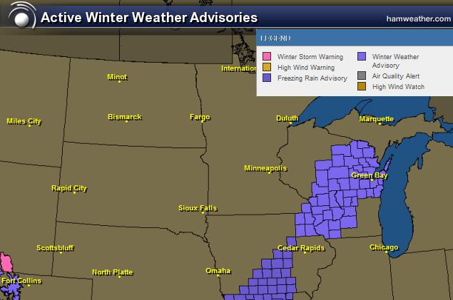
Winter Weather Advisory
The National Weather Service has issued a Winter Weather Advisory for the extreme southeastern MN and for most of central Wisconsin until 6am Saturday.
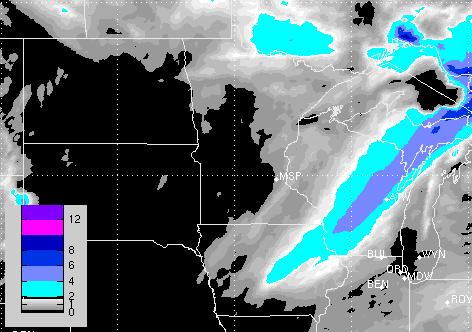
Snow Potential
There appears to be a fairly narrow swath of some shovelable snow across parts of extreme SE Minnesota and central Wisconsin through AM Saturday.
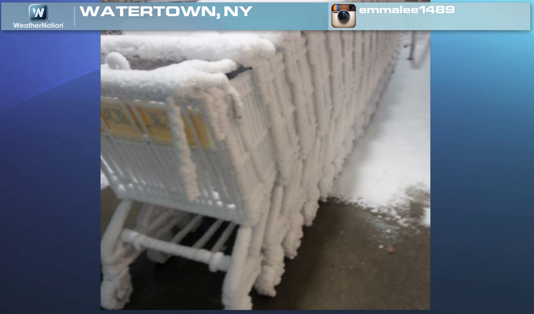
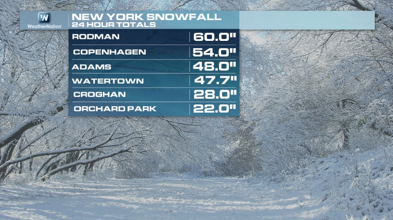
Feet of Lake Effect Snow?
Unreal! This is a picture from Rodman, NY where the snow tally from the latest lake effect snow event came in at 60"!!
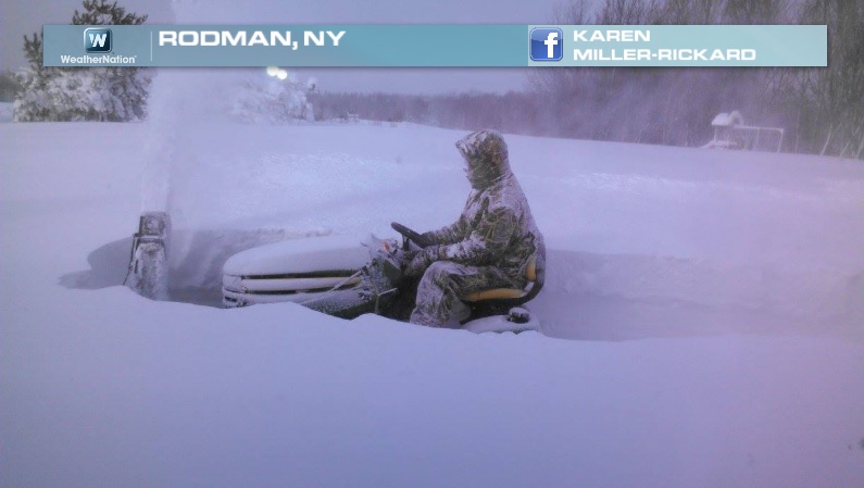
Watertown, NY even got walloped with nearly 2ft.!
Impressive Snowfall Tallies
Thanks to the National Weather Service for the map below, which shows the snow accumulations over a 72 hour period from earlier this week. The numbers below suggests the highest tallies I could find from within the general area.
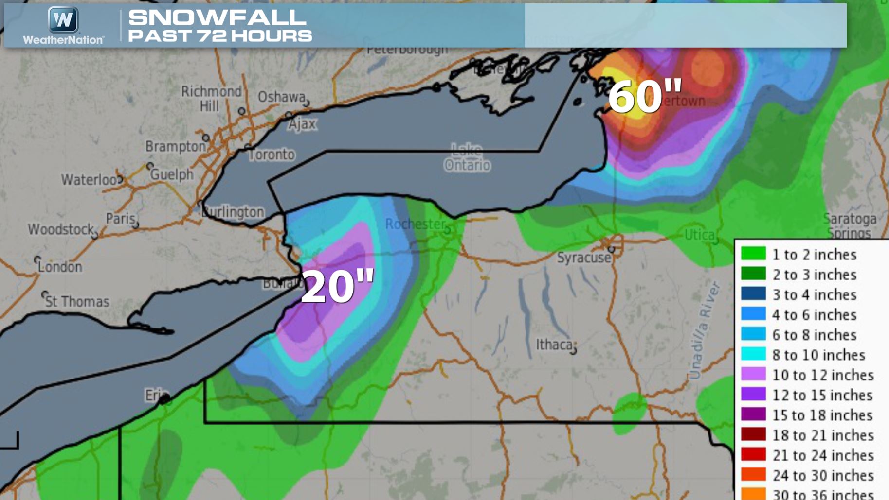
Snowfall Tallies
Lake Effect Snow From Space
A NOAA satellite captured the latest event from space. You can actually see the intense lake effect snow bands across the entire lake. Typically, the longer the fetch or stretch across the lake, the more intense the lake effect snow band(s) can be. There were even reports of thundersnow with this latest event!

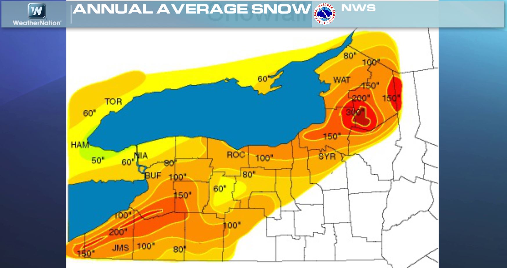
Average Annual Snowfall
Here are some of the highest average annual snowfall tallies that I could find. According to NWS climate data, Marquette sees more than 200" of snow per year, while Watertown, NY sees nearly 80".
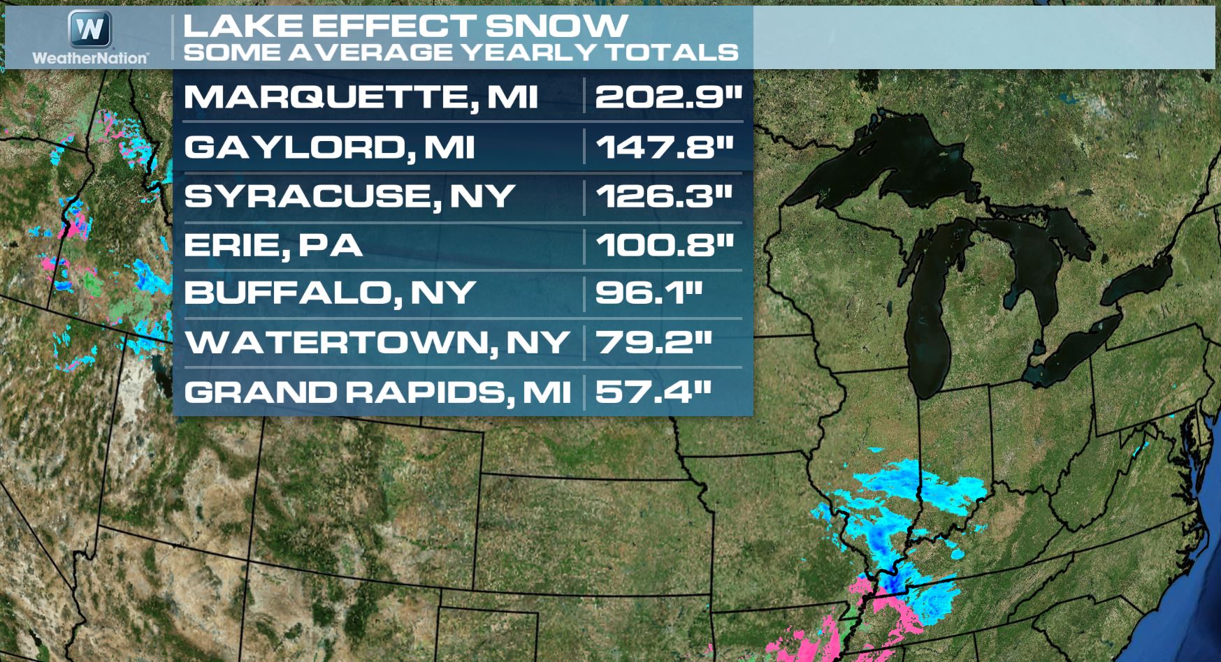
Average Annual Snowfall Tallies
The numbers above are based on individual sites over a 30 year period ending in 2010. The map below from the National Weather Service actually shows that some areas in the Eastern Great Lakes Region see nearly 300"!
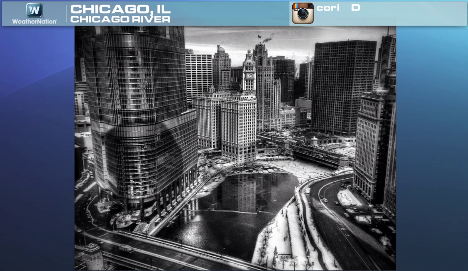
An Icy Chicago River
If you look close enough, you can actually see ice chunks on the Chicago River from the picture below. Interestingly, Chicago is going from sub-zero weather to rain by Friday! Chicago, officially spent 37 hours below 0F earlier this week too!
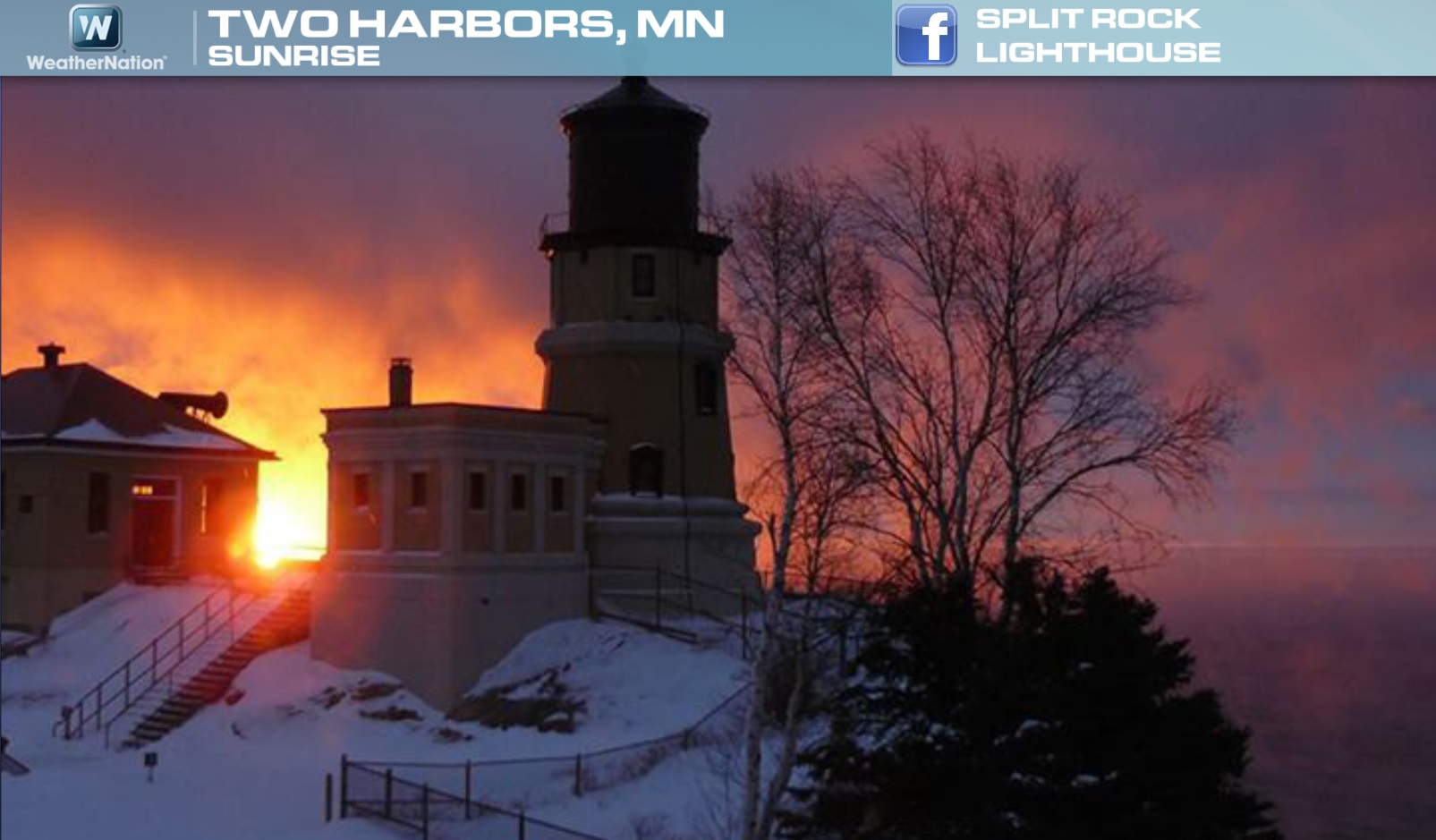
Two Harbors, MN
Nice shot here from the Split Rock Lighthouse Facebook page, where temperatures earlier this week were dangerously cold. Lake Superior was a constant fountain of steam over the past few days, which can be seen a little bit in the picture below.
Major Burns in the Cold Weather
With the recent blast of Arctic air, many tried to 'enjoy' the cold by trying different cold weather experiments. One of the more popular ones was throwing boiling water into the air, but it caused some issues as several folks got some major burns.
"Over Monday and Tuesday, the Los Angeles Times counted at least 50 people on social media who reported burning themselves or their friends after trying to turn boiling water into snow. There were also several reports of people going to the hospital to receive treatment for burns."
Read more from the LATimes HERE:
Warming Trend Continues...
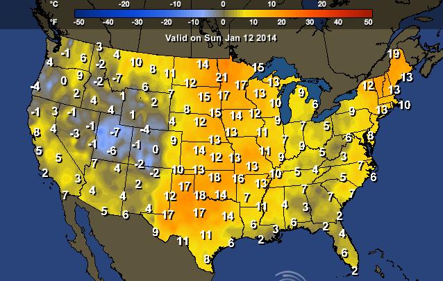
From AM Tuesday temps to high temperatures on Friday, some across parts of the nation could see a 50F+ temperature swing.
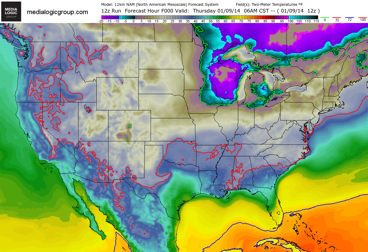
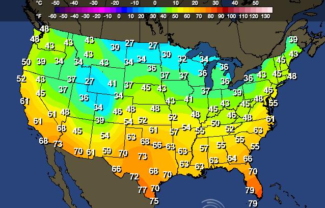
High Temps Friday
Highs From Normal Friday
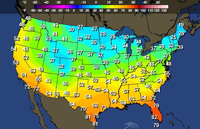
Sunday Highs
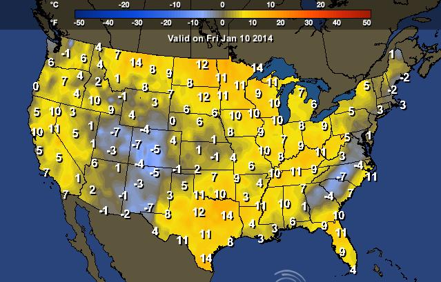
Sunday Highs From Normal
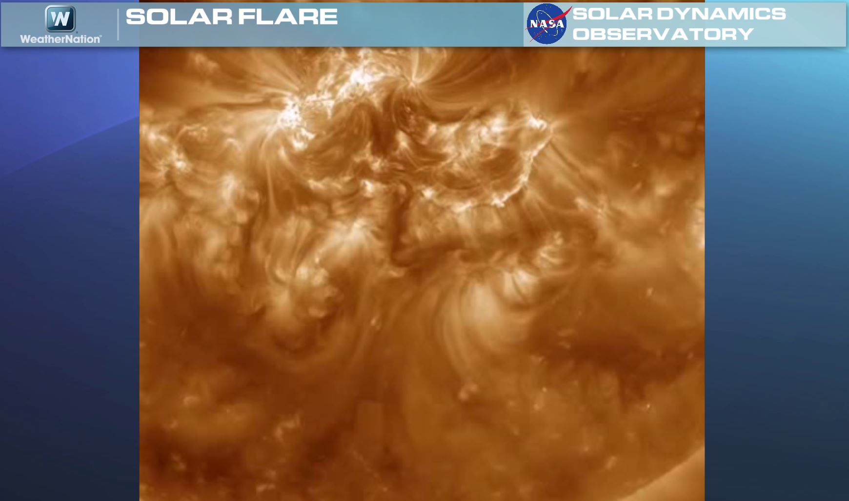
Northern Lights Potential
Earlier this week, a solar storm erupted and sent an X1-Flare towards Earth, meaning northern lights may be visible for some in the higher latitudes.
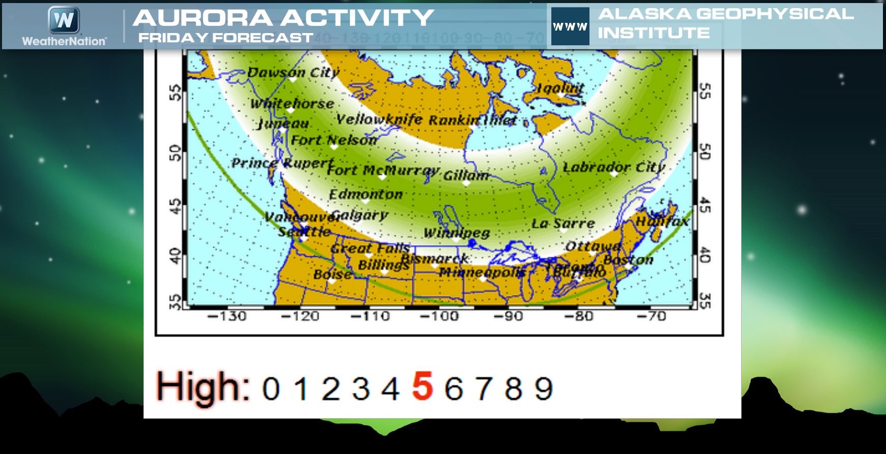
Northern Lights Forecast
According to the Geophysical Institute at the University of Alaska Fairbanks, the northern lights forecast still remains HIGH into Friday.
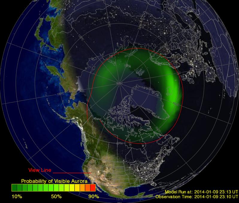
Aurora OVATION
Here's a cool test product from NOAA, which shows the potential viewing area.
Click HERE to see the current view
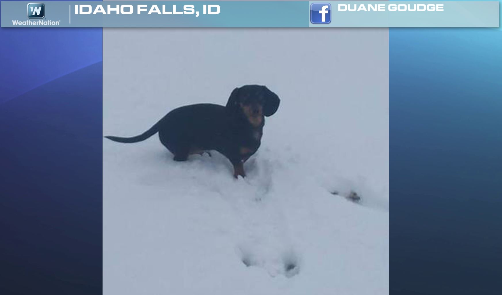
Idaho Snow Dog
Thanks to Duane Goudge for this picture out of Idaho Falls. Enjoy!
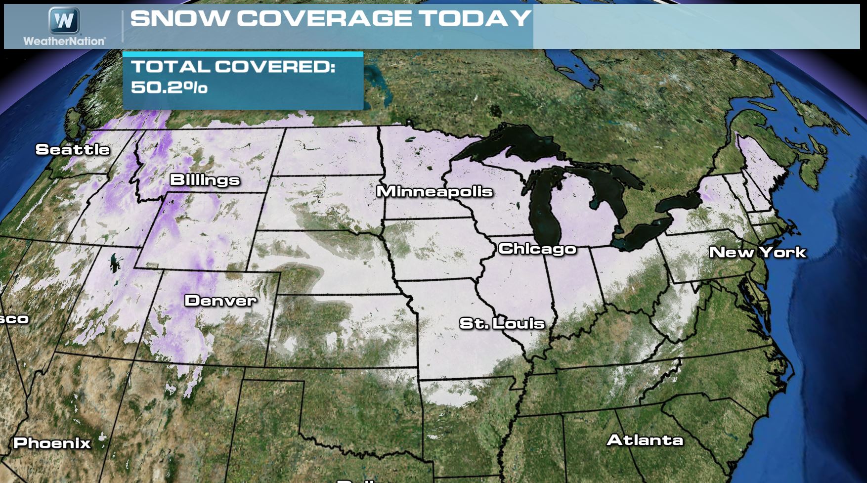
U.S. Snow Depth
According to NOAA, the U.S. snow cover as of Thursday, January 9th showed that nearly 50% of the nation was covered in snow.
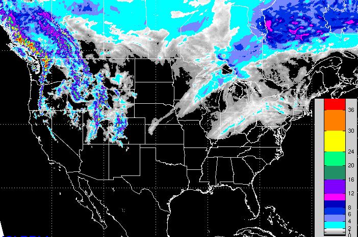
More Snow on the Way
Here's a look at the snow potential over the next few days. Note the heavy snow potential across the western mountains, while a heavier band of snow can't be ruled out over parts of central Wisconsin.
Wetter & Warmer Into the Weekend
Several rounds of heavy precipitation will whip the Pacific Northwest over the coming days. Heavy rain and snow will be possible through early next week. One of these pieces of energy will slide through the middle part of the country on Friday with heavy rain, some icing and snow. By Saturday, that system will kick out a strong to severe thunderstorm threat in the Southeastern part of the country.
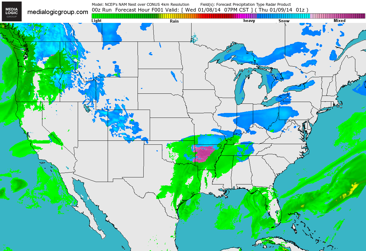
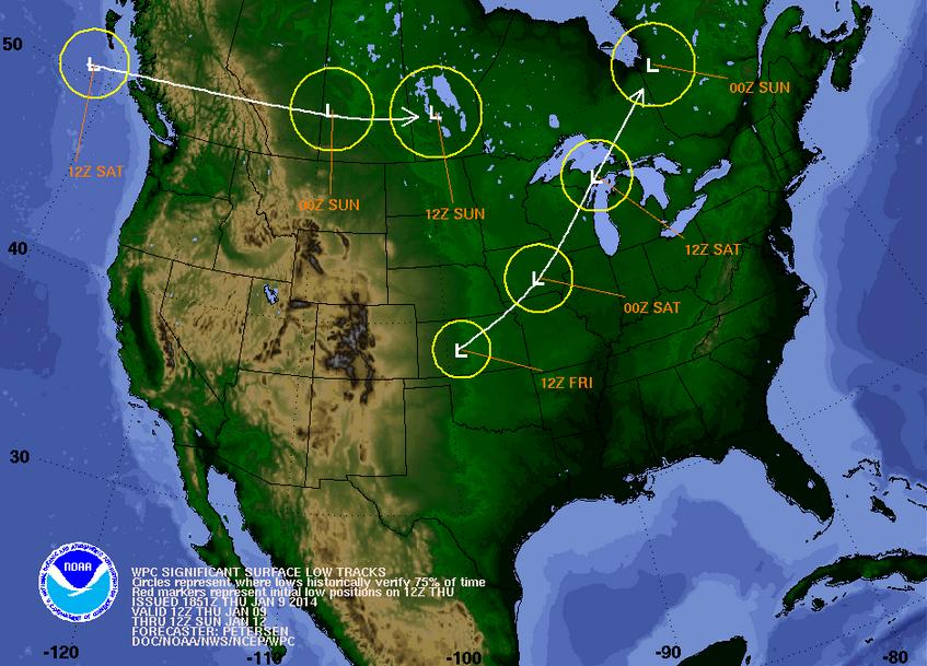
Tracking the Low
After Friday's system blows through the middle part of the country, the storm will move into Canada on Saturday. After that, we'll see a pretty constant flow from the Pacific with clipper systems and several chances of precipitation across the international border, the first of which can be see in southern Canada thru AM Sunday.
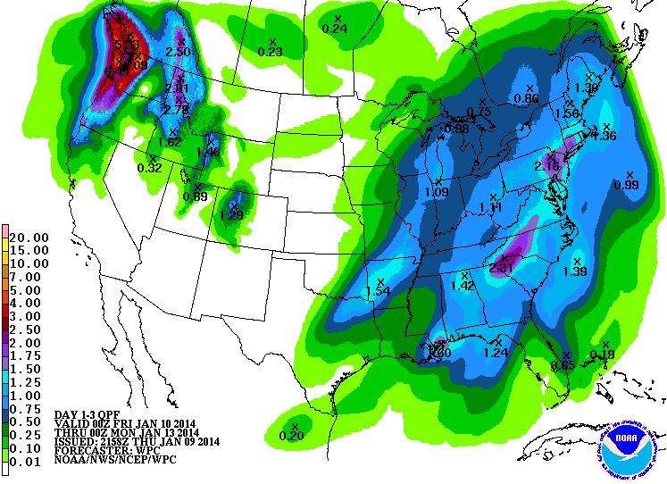
Precipitation Next 3 Days
According to NOAA HPC 3 day precipitation forecast, there appears to be widespread heavy moisture in the Pacific Northwest. There will also be decent amounts of moisture across the middle and eastern part of the country through the end of the weekend as a cold front sweeps across the country.
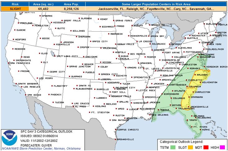
Saturday Severe Threat
As the said storm cross through the eastern part of the country on Saturday, strong to severe thunderstorms can't be ruled out. The Storm Prediction Center has already issued a SLIGHT RISK of severe weather from areas across eastern North Carolina to extreme northeastern Florida.
Thanks for checking in, have a great weekend ahead. Don't forget to follow me on Twitter @TNelsonWNTV

Thanks for giving such an interesting tips for MSP Airport Parking. Online Reservation for Airport parking is big issue, nowadays. Can you tell me how we get online MSP Airport Parking Reservations easily?
ReplyDeleteThat is a bit too cold for my taste but still winters are fun and have their own charm. meet & greet gatwick
ReplyDelete