By Todd Nelson
"I'm mad at you Dad!" said my 4 year old last Thursday during the big snow event. I asked why and his response was, "Because you didn't bring spring!" He apparently thinks I can control the weather... When I broke the news to him that my super powers were less than impressive, he turned his disapproval to the clouds and yelled at them. Not sure I've ever met a kid that wasn't excited to see snow, but strangely it takes some creative negotiating to get him back inside from playing in the snow now.
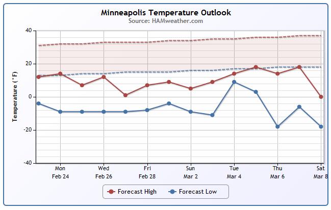
I've noticed 'some' improvement on the roads, but not much. The sun is as strong now as it was in October, so the higher sun angle is helping with the melting process. Get this, the last day of Meteorological Winter is this Friday, which means that the coldest three months (on average) will be behind us.
Even though it'll feel more like the depths of winter through early March, we're now less than one month away from the Vernal Equinox, which occurs on March 20th! There are some long range indications that the 2nd week of March will be warmer. If not, I'm sure there will be several folks looking for a warmer Spring Break vacation if you're not going already.
__________________________________________________________________
SUNDAY NIGHT: Mostly clear and cold. Low: -4. Wind: NW 10-15. Wind Chill: -20F
MONDAY: Cold. Sunny start with increasing PM clouds. High: 14. Winds: WNW 10. Wind Chill: -15F
MONDAY NIGHT: A little light snow, nothing major. Low: -3. Wind: WNW 5-10. Wind Chill: -15F
TUESDAY: More Arctic sun. High: 3
WEDNESDAY: Frigid start. Harsh PM Winds. Wake-up: -10. High: 12
THURSDAY: Sunny, unreasonably cold. Wake-up: -9. High: 3
FRIDAY: Light snow possible. Wake-up: -8. High: 8.
SATURDAY: Meteorological Spring Begins! Wake-up: -8. High: 5.
SUNDAY: Feels more like winter. Wake-up: -3. High: 12.
______________________________________________________________________
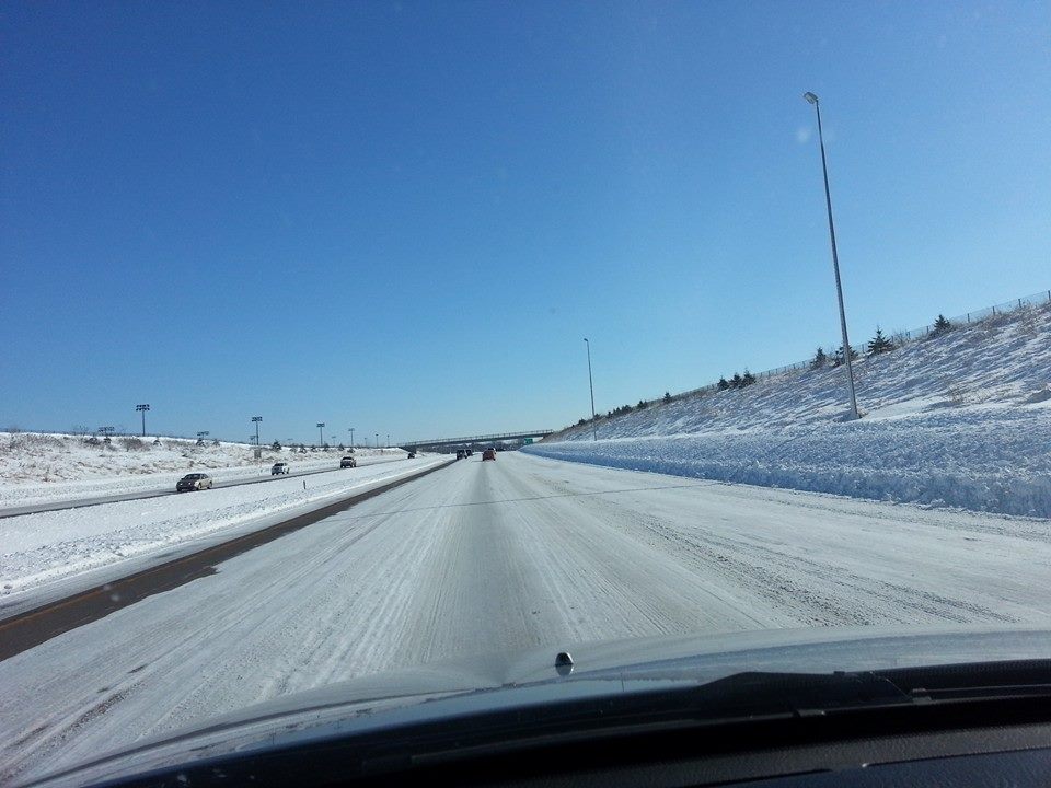
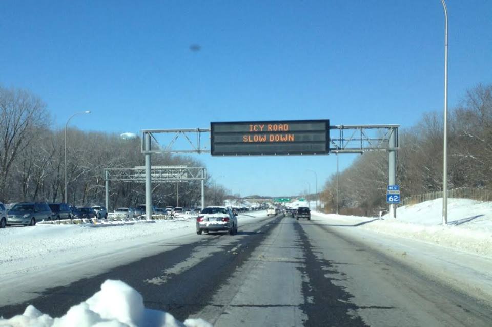
Road Conditions
Thanks to my good friend Mike Haung and Susan Marmot for the pictures who braved the Minnesota roads this weekend. Look at the icy washboard that greeted drivers after that late February storm late last week.
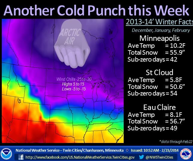
One of the Coldest Meteorological Winters
According to data compiled by the National Weather Service, the Meteorological Winter (which ends February 28th) of 2013-14 could be the 11th coldest in recorded history.
See the data from the NWS Twin Cities HERE:
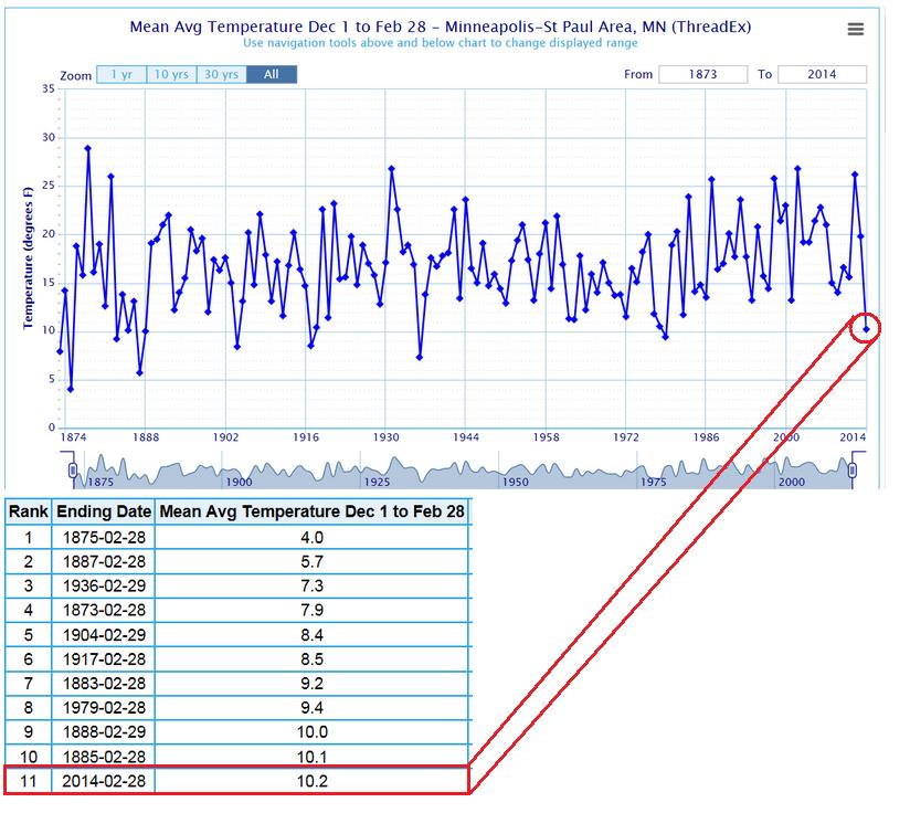
Minneapolis Temperature Trend
Ummm... YUCK! That's all I have to say about that.
Another Cold Punch... Literally
LOL National Weather Service Twin Cities... LOL! I think this social media post by the National Weather Service says it all.
"Strap in for another round of sub-zero temperatures as arctic air settles across the Upper Midwest. Although the meteorological winter (Dec, Jan, Feb) ends in a few days, the cold weather will linger through the weekend."
See more from the NWS Twin Cities HERE:
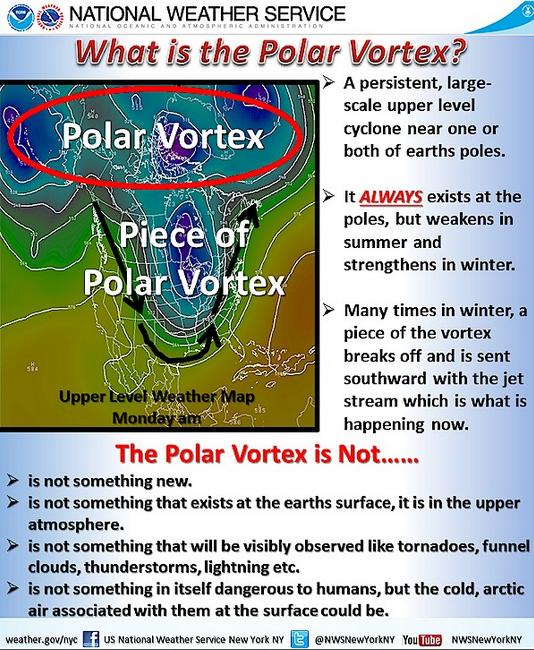
Polar Vortex Part Deux?
No not really... Yes, it's cold, but It's actually a piece of the Polar Vortex as explained by the National Weather Service out of New York, NY in a post from January 6th.
"***Please share this information to become more educated on what exactly the polar vortex is and is not*** You may have heard about a "polar vortex" in the news with regards to the cold air currently affecting the United States and soon to hit the Tri-State area. This is NOT a new atmospheric phenomena as a polar vortex ALWAYS exists at the polar regions of earth, but a piece of the main vortex has broken off and is being sent southward by the jet stream. What exactly is the polar vortex, what is it not? Check out this graphic for more information"
See more from the NWS New York HERE:
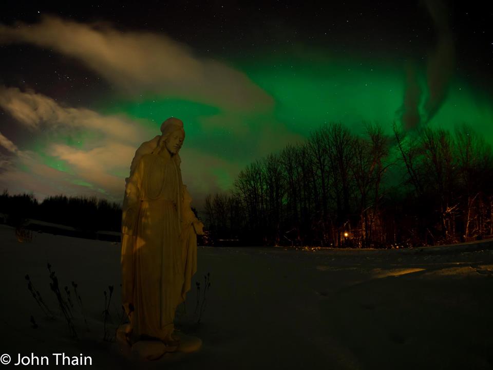
Alaskan Night Light
Thanks to my very talented and good friend John Thain for this picture out of Palmer, AK. It's a haunting picture of the northern lights at a cemetery, but pretty amazing! Good work, John!
Daytona 500
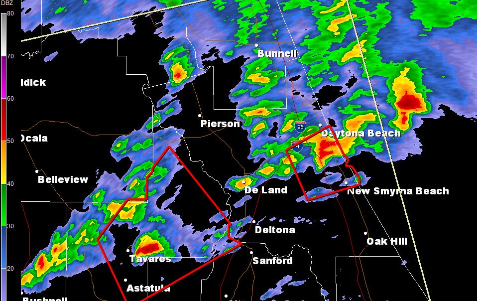
If you were watching the the Daytona 500 yesterday, you may have noticed the inclement looking skies and the delay due to storms in the area. Take a look at this video from @ChelseaGatesUF from the Dayona 500 yesterday when it was really coming down!
See the video HERE:
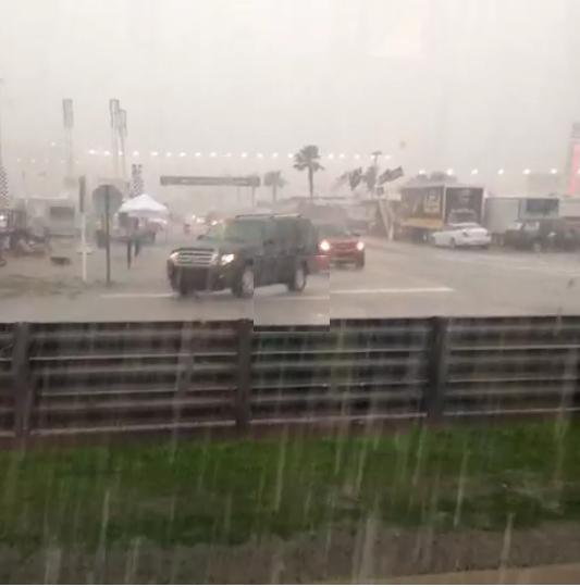
Here was the radar just prior to 4pm EST Sunday with a several storms surrounding the Daytona Beach, FL area.
Weather Outlook
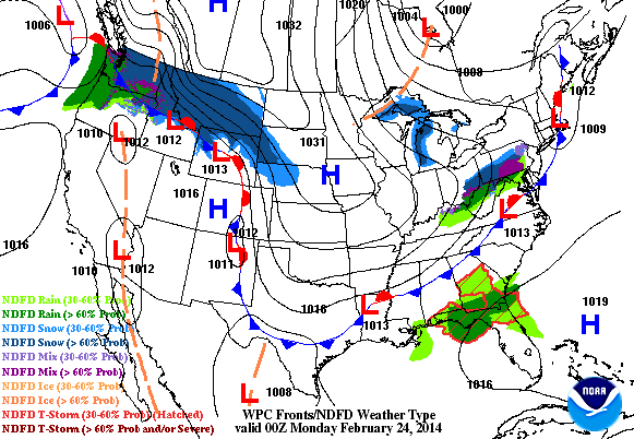
No big storm are in sight, but there will be some precipitation. A quick glancing blow of snow will filter into the Midwest from the Northwest, while rain spreads throughout the southeastern U.S.
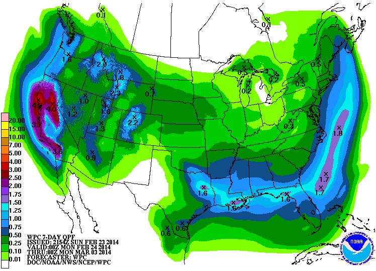
Precipitation Outlook
Here's NOAA's HPC 7 day precipitation outlook. Note the significant increase in precipitation potential across California. This is great news!
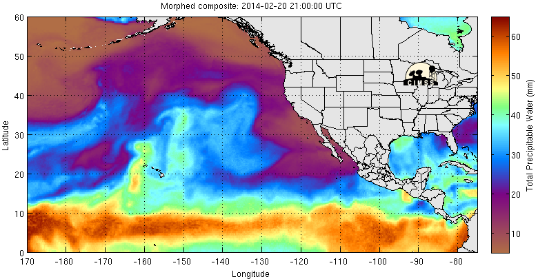
Atmospheric River Acting Up
Keep an eye on that "Atmospheric River" you heard about recently, it's acting up again. Note the plume of brighter colors nearing the West Coast. An increase in moisture is heading your way!
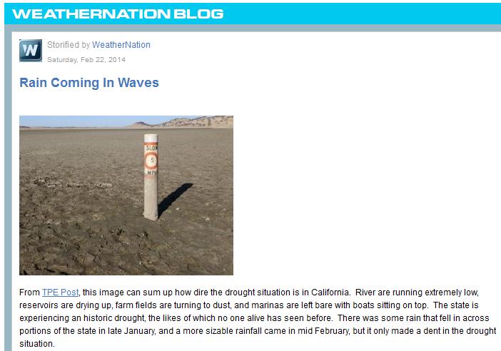
WeatherNation Blog
Read my good friend and colleague (Addison Green)'s blog about the western drough HERE:
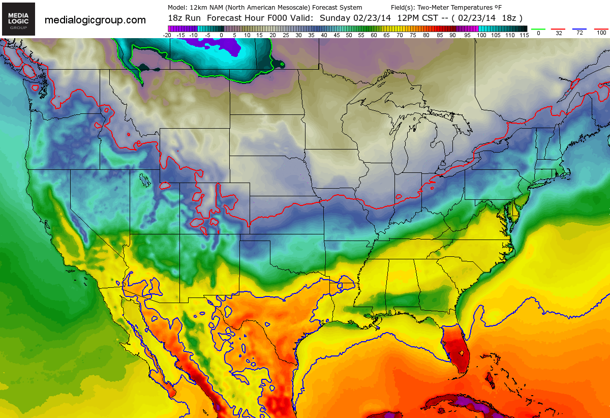
Cold Cometh
Take a look at the temperature loop through early next week... it shows a big Arctic surge through the Upper Midwest, which will ripple through the eastern two-thirds of the nation.
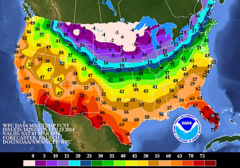
Cold Temps Ahead
Here's a look a look at temperatures into early next weekend. Note that highs across the Upper Mississippi Valley look quite cold for the start of Meteorological Spring.
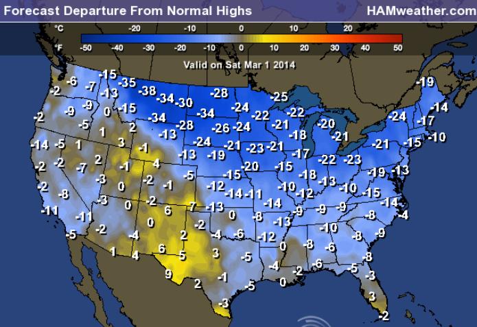
Highs From Normal Saturday
Not only does much of the work week ahead look colder than average, but it looks much colder than average through early next weekend too.
Thanks for checking in and have a great week ahead!
Don't forget to check me out on Twitter @TNelsonWNTV
No comments:
Post a Comment