By Todd Nelson
"I thought you said it was supposed to be warmer, Todd!" Yes, I did... be patient!
Yes, I know it's a bit on the chilly today, but it was expected. We're seeing cold exhaust on the back side of that fast moving clipper system that kicked out a few wind whipped snow flakes yesterday. There is yet again another clipper system that will blow through our neck of the woods tomorrow. Don't be surprised if you find yourself doing a little light shoveling on Saturday, but let it melt. The onset of the warming will take place into early next week. Our first +30F day is on deck for Monday with another +30F in the hole for Tuesday!
Old Man winter is tired and we should get a few more cracks at +30F next week before his relief arrives. There is a slight indication of additional cooling late next weekend, so don't get too excited.
This is normal... It's still February and we'll likely see a few more wintry spats before this extra inning game is over. Don't forget, we saw 30s and 0.5" of snow into May of last year; It was enough to make my parents move to Phoenix! I might still have to book a flight this year to take the edge off this wintry sting.
_______________________________________________________________________
THURSDAY NIGHT: Breezy and colder. Low: 0. Winds: NW 15-25.
FRIDAY: Minor setback in the temperature department. More sun. High: 14. Winds: NW 5-15.
FRIDAY NIGHT: Another cold night. Low: -1.
SATURDAY: Another clipper arrives. Snow likely. Dusting up to 2" possible. High: 22.
SUNDAY: Bright start. Increasing clouds with a light wintry mix developing late/overnight. Wake-up: 7. High: 23.
MONDAY: Wintry mix possible early, then gradual clearing and warmer! Wake-up: 21. High: 35.
TUESDAY: Partly sunny, continued thaw. Wake-up: 20. High: 36.
WEDNESDAY: Puddles continue to grow. Wake-up: 22. High: 34.
THURSDAY: More clouds, light mix possible. Wake-up: 21. High: 35.
___________________________________________________________________________
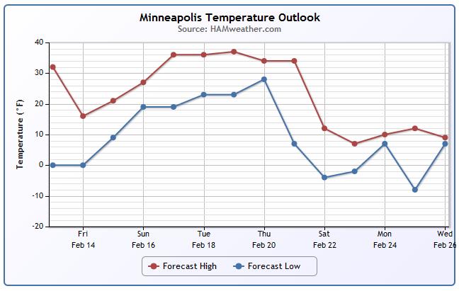
MSP Temp Trend
After a brief cool down on Friday, temperatures warm into the 30s for an extended period next week. There are some indications that it chill down a bit by the end of the month... stay tuned!
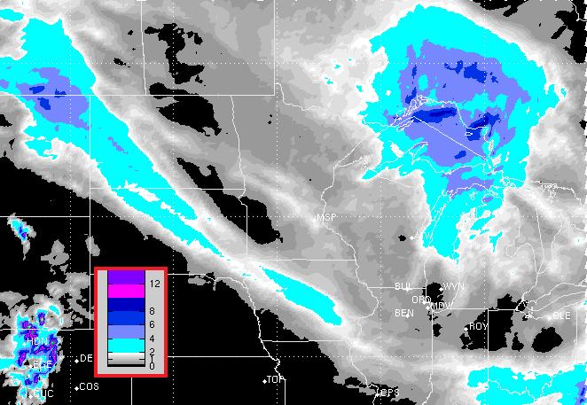
FutureRadar
Watch the blue streaks moving southeast through the Upper Midwest. We had one AM Thursday, another one snakes through on Friday morning and yet another one (not picture shown here) will slide through on Saturday.
Snow Potential
Here's the snow potential through midday Sunday, which shows 2 snow streaks. The one over much of Minnesota is the Saturday snow chance, which could bring a dusting up to 2" to parts of the state.
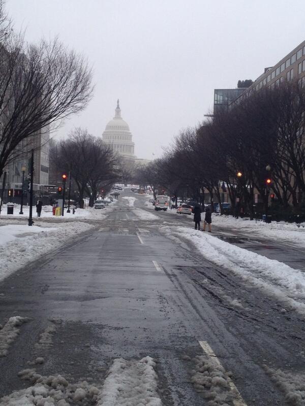
Snowy DC
Thanks to @uplandcounty for this picture out of Washington D.C. where they tallied over a foot of snow!
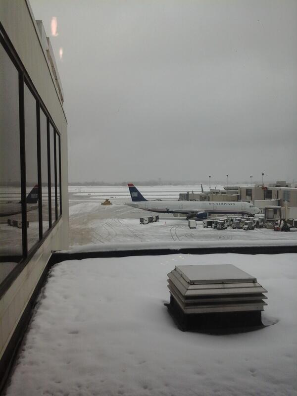
Philadelphia
Thanks to @BearsJState for this image from the Philadelphia Airport
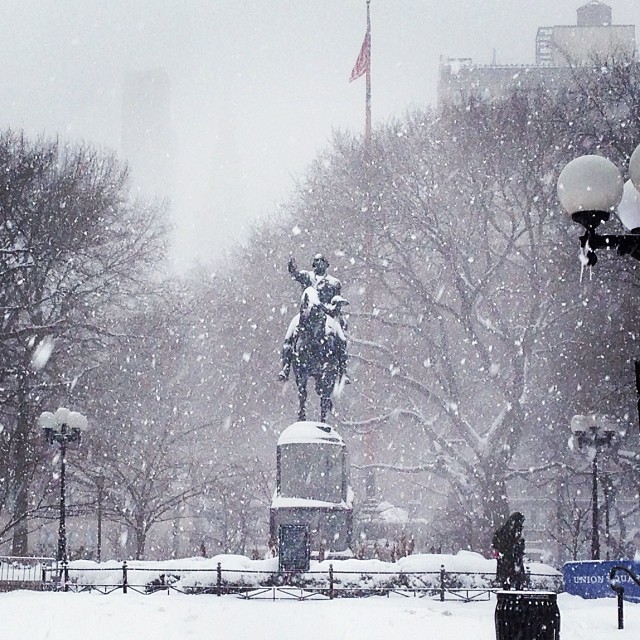
New York
Thanks to @jhowardpr for this picture out of New York. It's a very snowy Union Square!
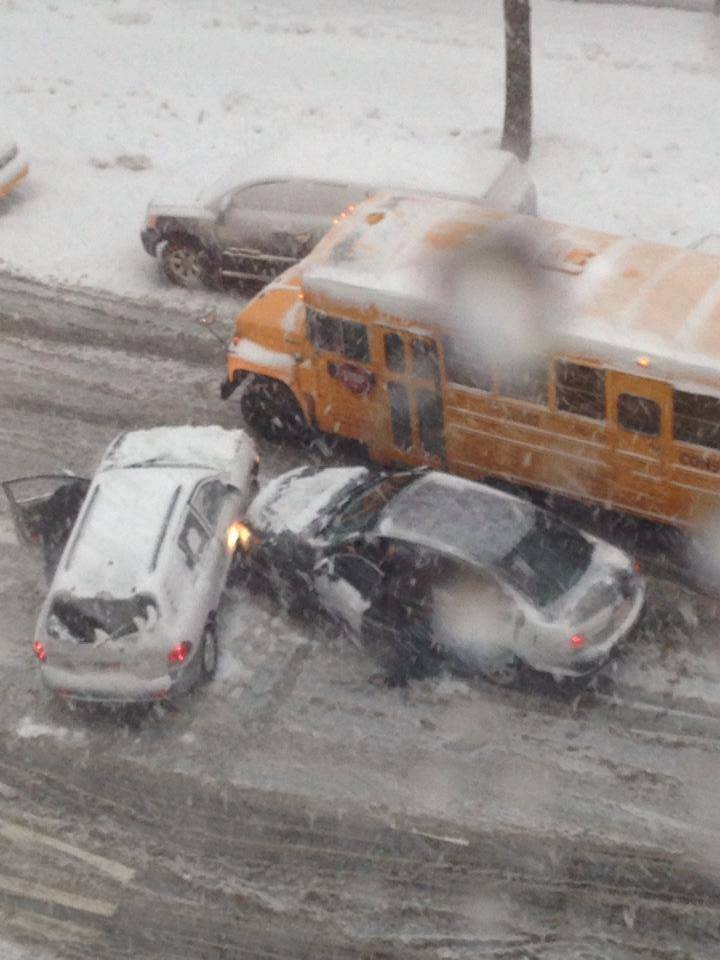
Bronx Accident
Thanks to Tri-State Weather for this image out of the Bronx from yesterday. Interestingly, schools were NOT closed on Thursday in New York. By the way, New York City public schools have only been closed 11 times since 1978!
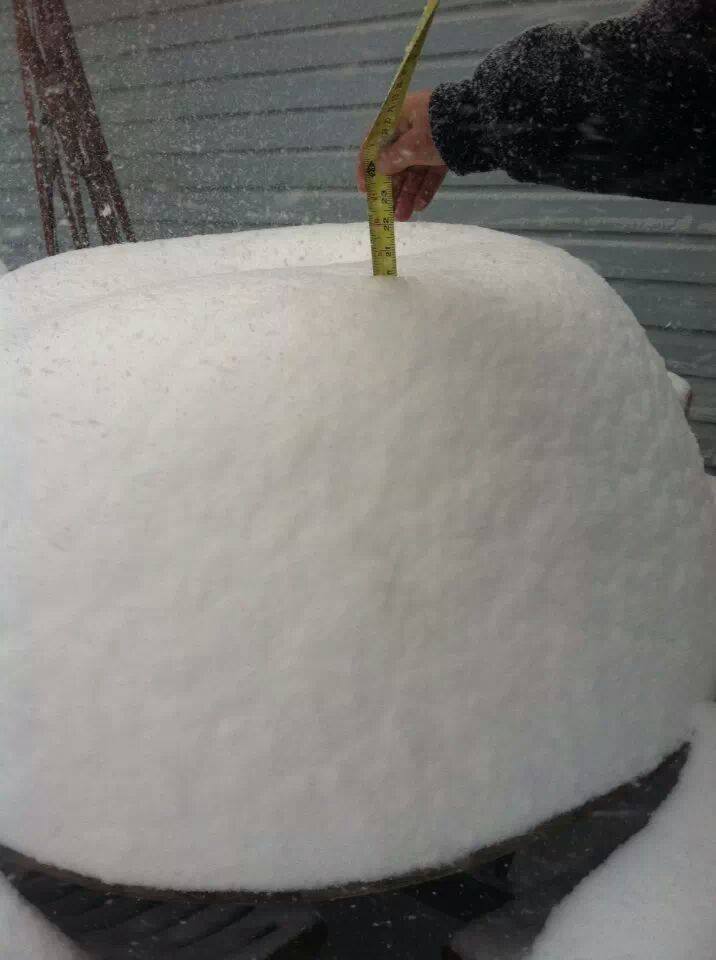
Pilot, VA
WOW! Thanks to Earl Shortridge for this image out of Pilot, VA where he measured 20" !!
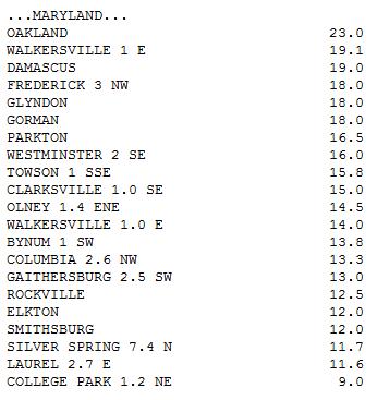
Snow Tallies
NOAA's Weather Prediction Center has a huge list of snow tallies from the latest storm system. As of 4pm EST, there were several reports exceeding 18" and a few nearing 2ft.! Maryland, Virgina and West Virginia seemed to be the two states where some of the heaviest tallies were found.
See the full list HERE:
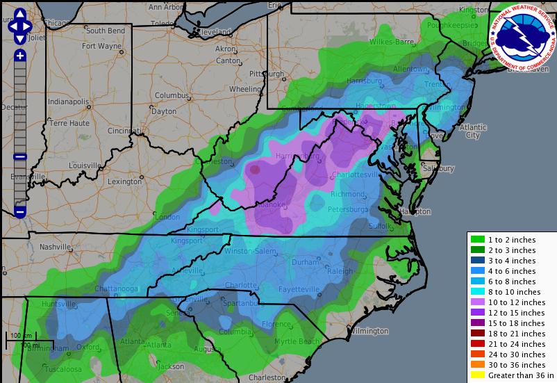
Snow Map
Here's a map of snowfall amounts from Midday Tuesday into Midday Wednesday. Note the extreme snowfall amounts from the northern portions of the Gulf Coast States to near New York.
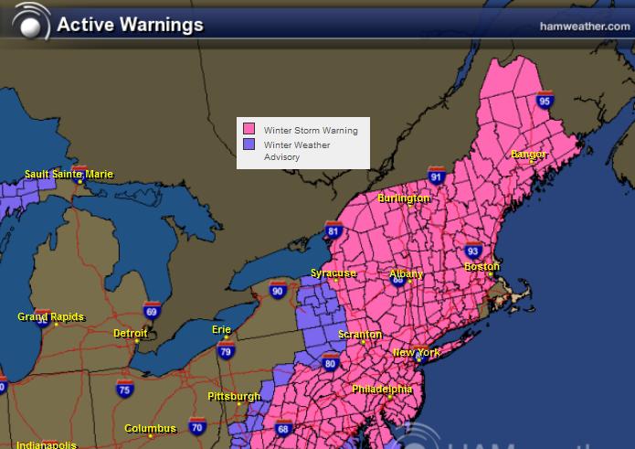
Winter Storm Warning Continues
The Winter Storm Warning in the Northeast will begin to fade on Friday as the storm system pulls away from the coastline. Total snowfall tallies on the high end could be 12" to 18" or more in isolated spots. Blowing snow will be an issue through Friday as strong winds surround the low pressure system.
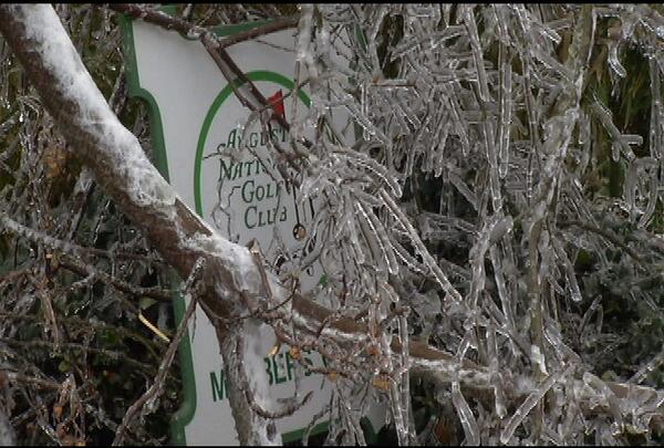
August, GA Ice Damage
Thanks to Jason Nappi from WJBF TV showing more ice damage from Augusta, GA
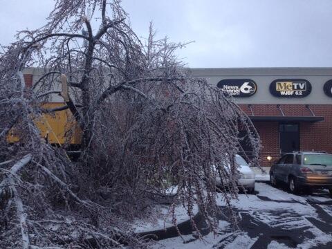
August, GA
Thanks to @Weatherman319 for this image out of August, GA where a tree fell on this Augusta National Golf Club sign.
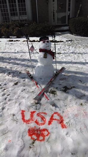
Supportive Snowman
Thanks to Madison Tank out of Woodstock, GA for this image who is showing her support during the Winter Olympics in Sochi Russia. GO USA!!
Active Pattern Continues
The forecast looks quite active into the upcoming weekend. A near continuous fountain on moisture continues to wring itself out over the Pacific Northwest. Pieces of these storms will move through the nation quite frequently, each will bring some rain and snow to parts of the eastern U.S.
Wet in the Pacific Northwest
Heavy precipitation continues to fall in the Pacific Northwest. The image below shows NOAA's 5 day precipitation forecast, where 5" to 10" or more can't be ruled out by early next week!
Atmospheric River
The plume of tropical moisture in the Eastern Pacific continues. The Atmospheric River has been responsible for copious amount of moisture lately. Hopefull we can see this wobble a little farther south into California as well.
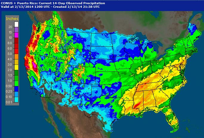
February Precipitation So Far
This is an interesting map, it shows the radar estimated precipitation over the last 7 days. Note how much precipitation we've seen in the western U.S. since the start of the month. This certainly is nice to see, but we still need a lot more, especially in California.
Thanks for checking in and have a great weekend ahead!
Don't forget to follow me on Twitter @TNelsonWNTV

Choose Aceech Software Development Company today for the best results. Visit our site today for more inforation on choosing the right Software Development Company.
ReplyDelete