By Todd Nelson
I guess I'm not surprised by the recent outcome of our March so far. Meteorological Winter (December-February) was considered the 6th coldest on record for Minnesota and the 5th coldest on record for Wisconsin. Why would March be any different?
When the atmosphere gets into a funk, it's not easily snapped out of. It can take time for the atmosphere to shake it's ways and we certainly haven't been able to do so as of late.
According to NOAA's Storm Prediction Center, there have only been 49 tornado reports this year, which well below the 2005-2013 average of 208. Interestingly, this March has only seen 4 tornado reports across the nation, which is typically around 80. That number quickly rises to 155 in the Month of April.
It's safe to say that the severe weather season has started off on a very quiet note, partly due to our much colder than average start to the year. The good news is that our weather pattern looks to warm over the weeks ahead, but this will also likely mean a jump in our storminess across the country.
It's quiet for us today, but a storm blows in on Thursday with a rain changing to snow. Some accumulations may be possible.
=====================
MONDAY NIGHT: A few lingering flurries possible. Cold and breezy Low: 8. Winds: NW 10-15.
TUESDAY: Brisk winds with more PM sun. High: 21. Winds: NW 10-15.
TUESDAY NIGHT: Mostly clear and still chilly. Low: 11. Winds: WNW 5
WEDNESDAY: Clouds thicken, wintry mix possible overnight. High: 38.
THURSDAY: Rain changes to snow. Light accumulations possible. Wake-up: 34. High: 38.
FRIDAY: Some clearing, still chilly. Wake-up: 20. High: 35.
SATURDAY: Back to the 40s! Now we're talking. Wake-up: 21. High: 43.
SUNDAY: Warm start. Dim afternoon start. Wake-up: 32. High: 50.
MONDAY: Rain/snow mix potential. Wake-up: 30. High: 41.
=====================
This Day in Weather History
2007: Record warmth with 72 degrees at Owatonna, MN, 77 at Menomonie, WI and 80 at Eau Claire, WI.
1981: An F2 tornado hits Morrison county and does 25 thousand dollars worth of damage.
====================
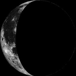
Moon Phase for March 25
========================
Future Radar
Our Monday snow event that kicked out a little more than 1" officially at the MSP Airport moves east by Tuesday. Another shot of colder air moves in for Tuesday, but our next storm system begins to take shape PM Wednesday into Thursday.

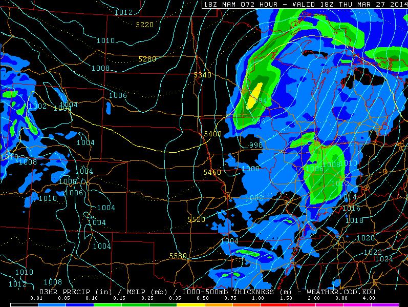
Thursday Storm System
Here's a look at the storm system expected to push through the Midwest on Thursday. At this point, rain appears to be changing to snow across parts of the Upper Midwest. Stay tuned for more.
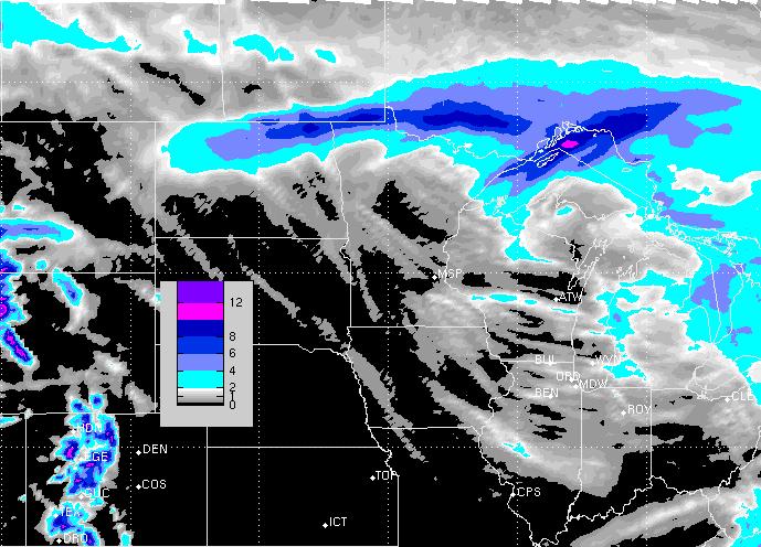
Snow Potential
Here's an early look at snow potential across the Upper Midwest through midday Thursday. This will likely change/evolve over time... stay tuned!
========================
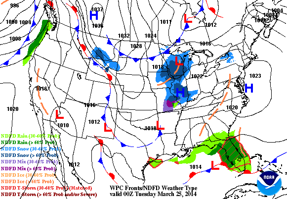
Weather Outlook
Our weather outlook across the nation looks quite active through the week. Our first storm wraps up over the Northeastern part of the country with significant winds and some snow along the coast. The second storm begins to take shape in the western part of the country with heavy rain along the coast and heavy snow for the higher elevations. The storm system will eventually move into the into the middle part of the country with rain and snow.
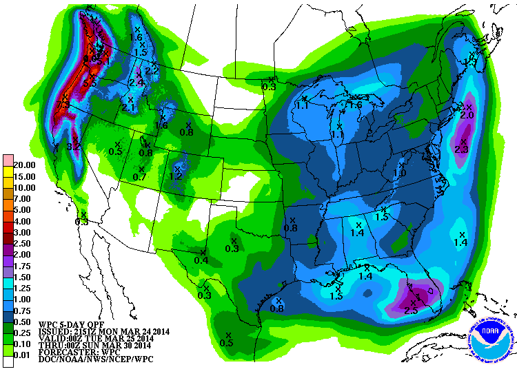
Precipitation Forecast
According to NOAA's HPC 5 day precipitation forecast, the heaviest precipitation is expected to be across the western part of the country, especially in the higher elevations. Some spots through the early weekend could see as much 5" to 7".
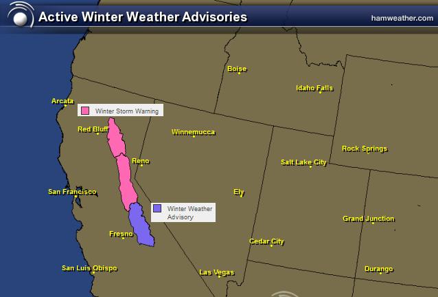
Western Snowfall
The National Weather Service has issued winter weather headlines for places in the Sierra Nevada through Thursday:
...WINTER STORM WARNING IN EFFECT FROM 3 PM TUESDAY TO 11 AM PDT THURSDAY ABOVE 5500 FEET... THE NATIONAL WEATHER SERVICE IN SACRAMENTO HAS ISSUED A WINTER STORM WARNING ABOVE 5500 FEET FOR HEAVY SNOW...WHICH IS IN EFFECT FROM 3 PM TUESDAY TO 11 AM PDT THURSDAY. THE WINTER STORM WATCH IS NO LONGER IN EFFECT. * IMPACTS: GUSTY WIND AND HEAVY SNOW COULD BRING PERIODS OF SIGNIFICANTLY REDUCED VISIBILITY AND DIFFICULT TRAVEL CONDITIONS. CHAIN RESTRICTIONS AND TRAVEL DELAYS ARE LIKELY. * CONFIDENCE: HIGH CONFIDENCE IN PERIODS OF HEAVY SNOW AND STRONG WIND OVER HIGHER TERRAIN. * TIMING: SNOW BEGINS BY TUESDAY AFTERNOON WITH PERIODS OF SNOW INTO EARLY THURSDAY. HEAVIEST SNOW IS EXPECTED WEDNESDAY INTO WEDNESDAY EVENING. * LOCATIONS INCLUDE: LASSEN NATIONAL PARK...DONNER PASS...ECHO SUMMIT...CARSON PASS. * SNOW ACCUMULATIONS: 4 TO 8 INCHES ABOVE 4500 FEET...1 TO 2 FEET ABOVE 5500 FEET BETWEEN TUESDAY AND EARLY THURSDAY. * WIND: SOUTHWEST WIND GUSTS UP TO 45 MPH...LOCALLY HIGHER OVER REMOTE PEAKS.
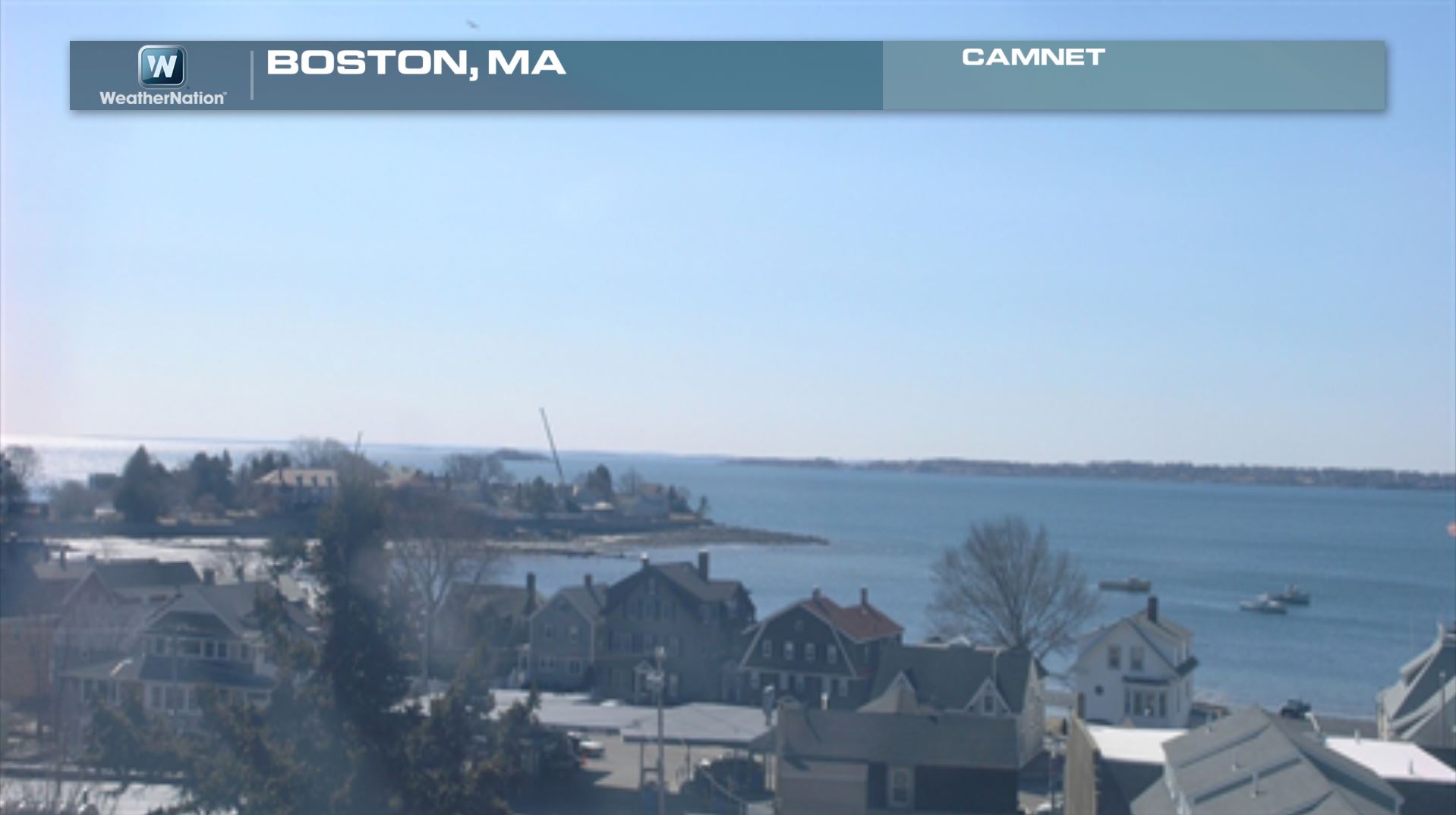
Boston
The webcam from Boston, MA earlier Monday looked quite serene. This is all going to change heading into Tuesday and Wednesday as our big storm takes shape.
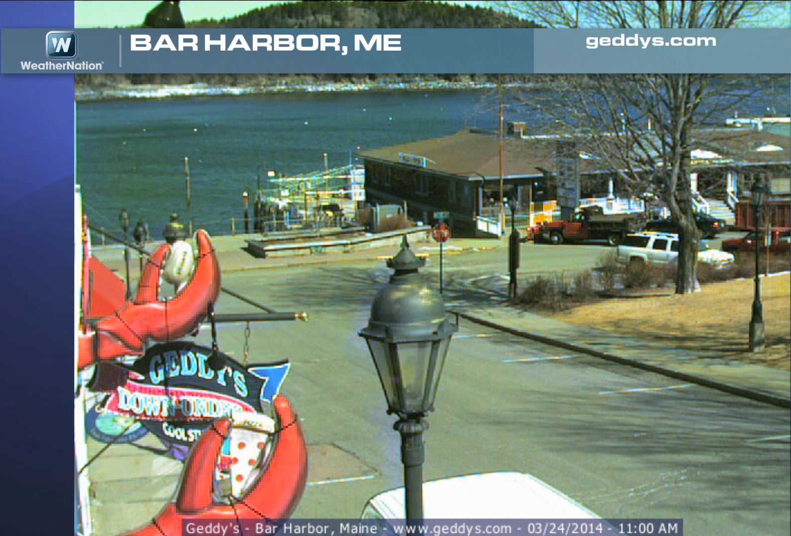
Bar Harbor
Here's another spot that will look quite different by the middle part of the week. Back to that in a moment.
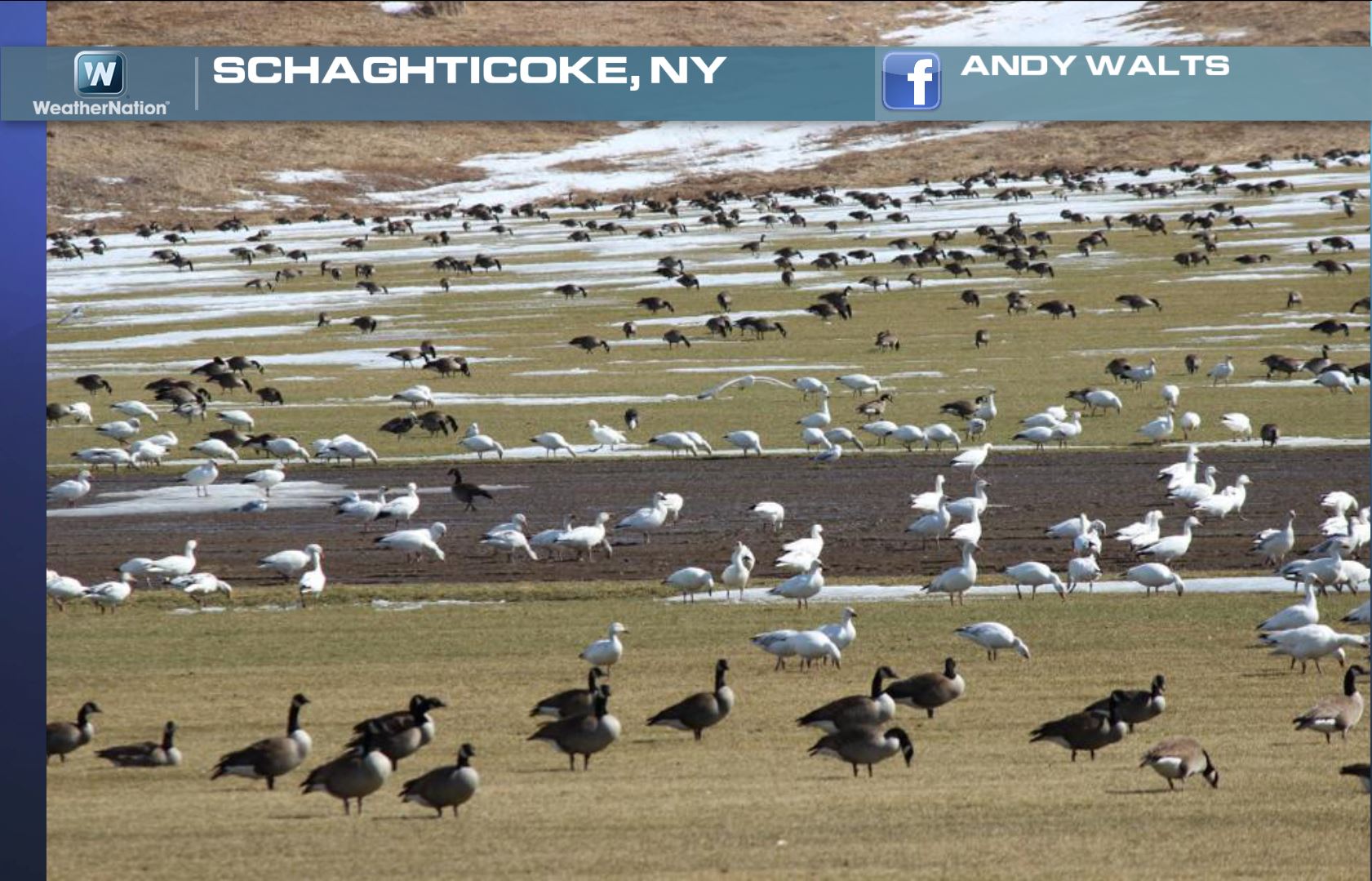
Signs of Spring in New York
How about this... Nice to see the birds migrating again! Thanks to Andy Walts for this picture, which shows a bunch of Canadian and Snow Geese snacking.
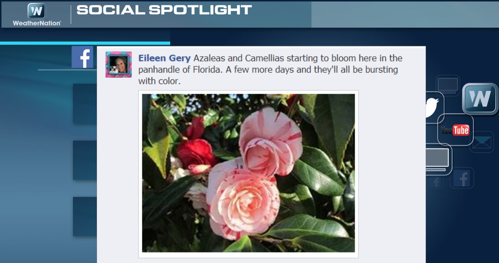
Florida Flowers
Here's another spring view of roses in bloom in Florida.

Florida Flowers
This is what Eileen had to say about her flowers in Florida!
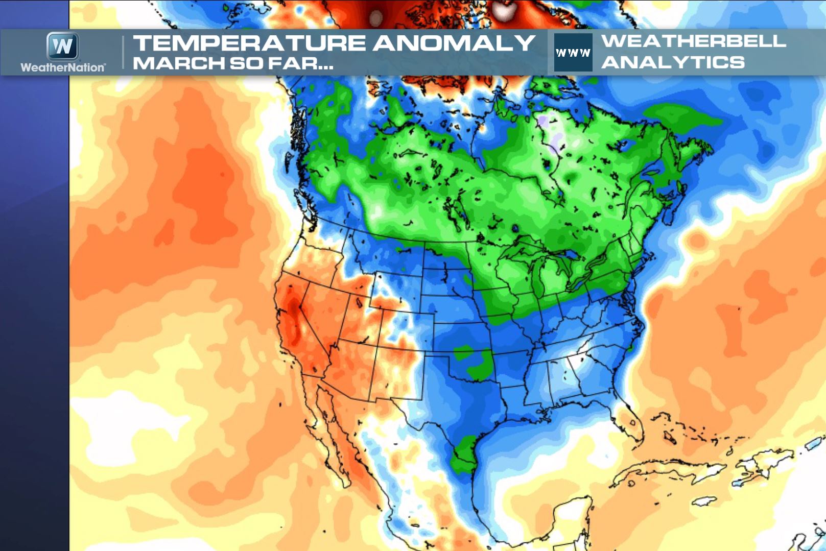
March Temp Anom
March certainly has been a cold month so far. Note the blues and greens across much of Canada and the eastern two-thirds of the nation. This is where temperatures have been much colder than average.
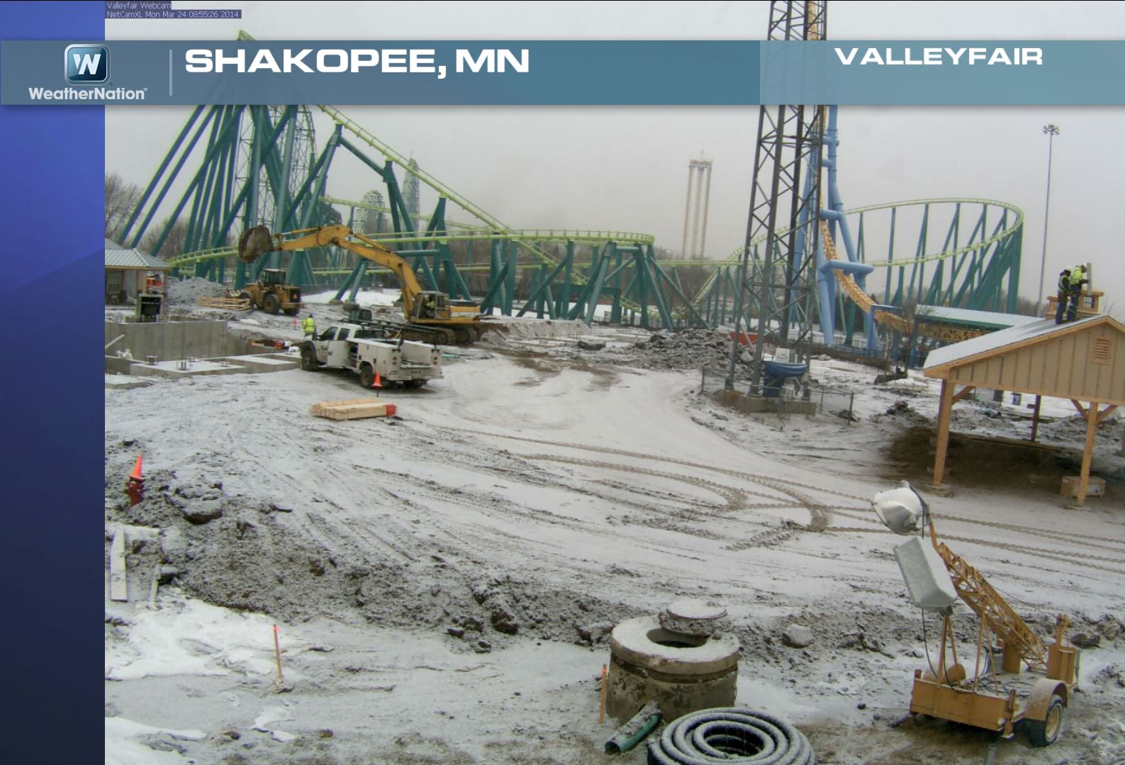
Monday Morning Snow in Minnesota
A quick moving clipper system moving through the Midwest on Monday was responsible for light snow accumulations in many areas. This was the view from Shakopee, MN, which is home to Valley Fair the amusement park.
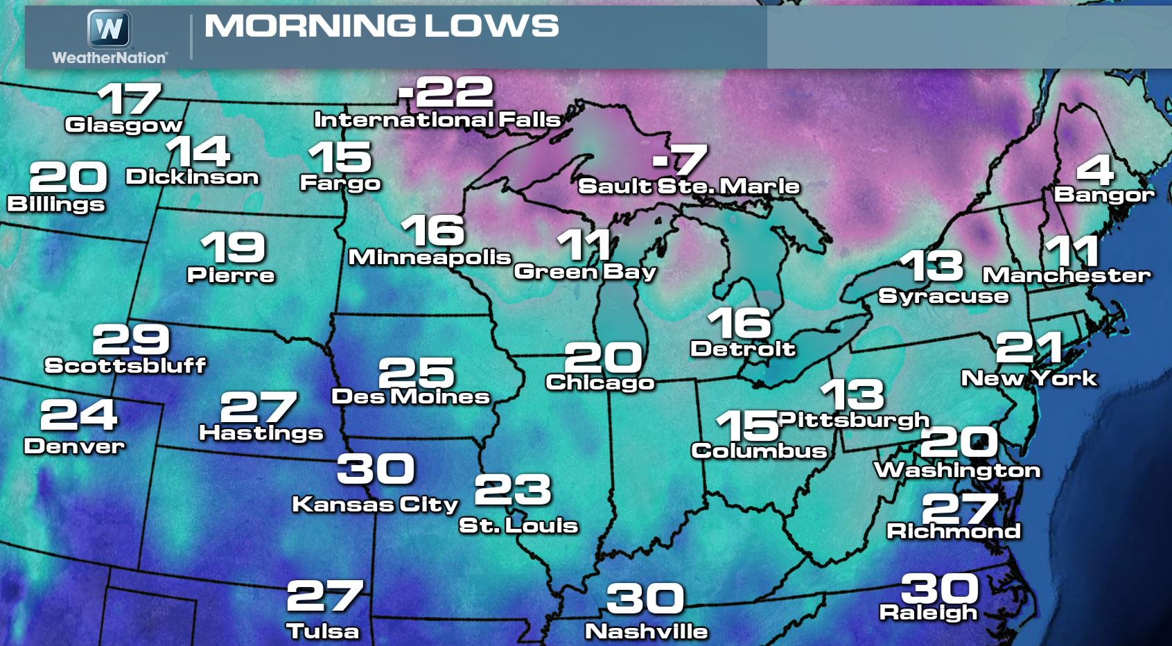
Monday Morning Lows
Take a look at how cold it was on Monday morning. These numbers look more like something we'd see in January, not late March! Good grief!
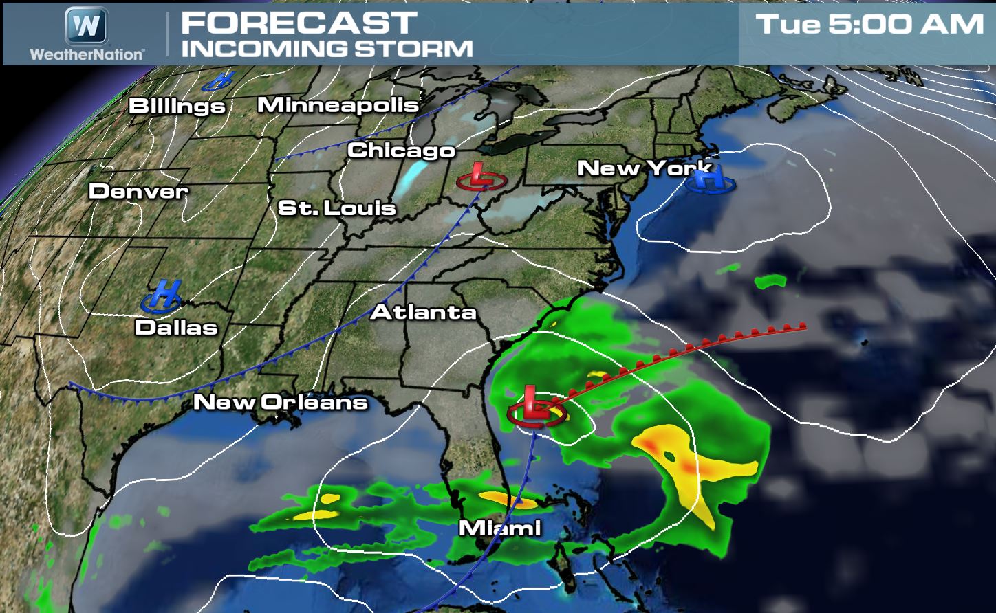
Rapid Storm Intensification
The same clipper system that was responsible for light snow accumulations across the Midwest will aid in the rapid intensification of a low pressure system off the East Coast Tuesday into Wednesday. The rapid intensification will go through a process known as "Bombogenesis" or at least a 24mb drop in 24 hours.
The image below shows the storm systems by AM Tuesday
Here's the storm system by midnight Wednesday as the two storms have merged east of Virginia.
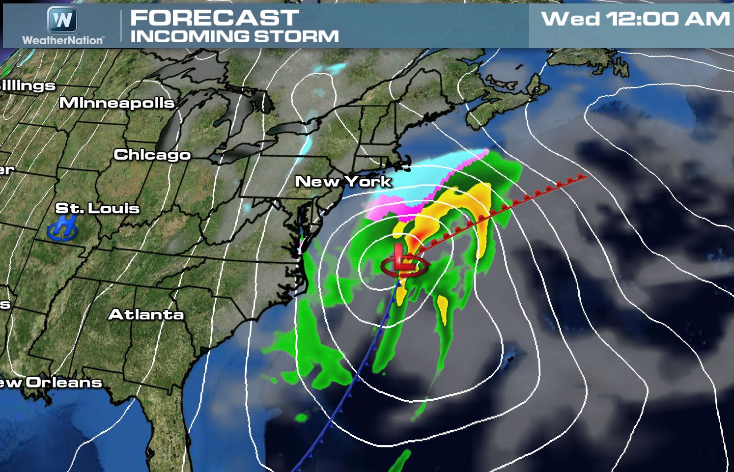
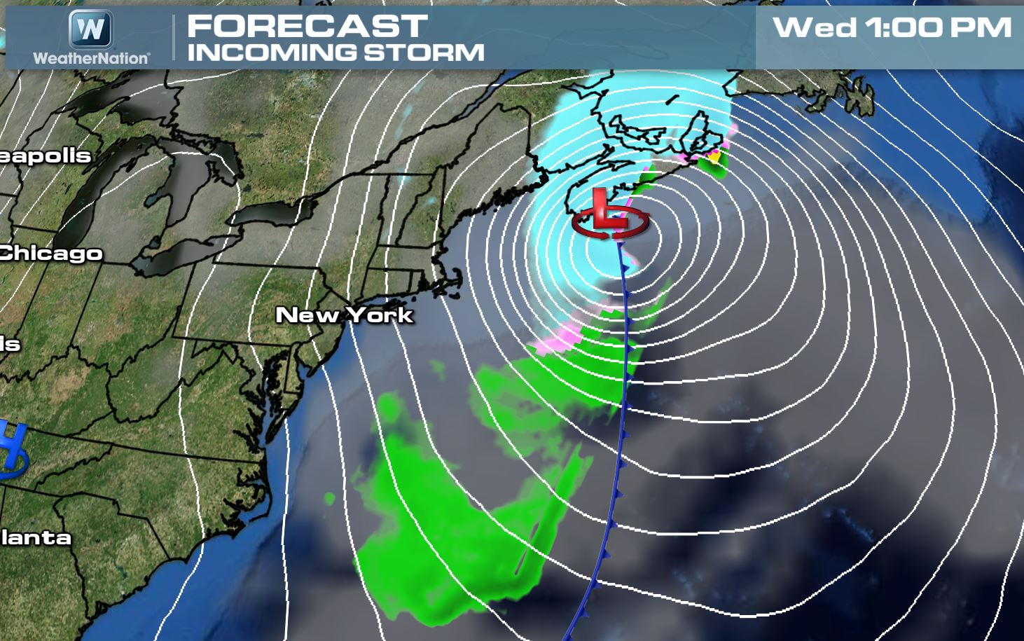
Note how much more intense the storm looks by Wednesday afternoon. The good news is that the storm will be moving quickly, so yes we expect lots of wind and some snow, but it will move quickly out of the region by Thursday.
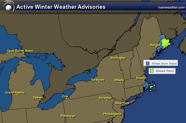
Winter Weather Headlines
...BLIZZARD WATCH NOW IN EFFECT FROM LATE TUESDAY NIGHT THROUGH WEDNESDAY AFTERNOON... * LOCATIONS...CAPE COD...NANTUCKET AND MARTHA/S VINEYARD. * HAZARD TYPES...HEAVY SNOW...STRONG DAMAGING WINDS AND BLIZZARD CONDITIONS. * ACCUMULATIONS...SNOW ACCUMULATION OF 5 TO 10 INCHES WITH A LOW PROBABILITY FOR UP TO A FOOT OF SNOW ACROSS THE OUTER-CAPE AND NANTUCKET. * TIMING...VERY LATE TUESDAY NIGHT THROUGH WEDNESDAY MORNING. * IMPACTS...NEAR ZERO VISIBILITY IN HEAVY SNOW AND STRONG WINDS ARE POSSIBLE. BLOWING AND DRIFTING SNOW MAY MAKE TRAVEL ALMOST IMPOSSIBLE...ESPECIALLY FOR THE WEDNESDAY MORNING RUSH HOUR. IN ADDITION...STRONG WINDS MAY RESULT IN DOWNED TREES AND POWER OUTAGES. * WINDS...NORTH 25 TO 35 MPH WITH GUSTS UP TO 65 MPH. LOW PROBABILITY FOR A FEW GUSTS UP TO HURRICANE FORCE ACROSS THE OUTER-CAPE AND NANTUCKET. * TEMPERATURES...IN THE UPPER 20S AND LOWER 30S. * VISIBILITIES...ONE QUARTER MILE OR LESS AT TIMES.
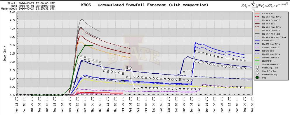
Boston Snow Potential
The Boston snow meteogram doesn't show quite as much snow for the cities as what it was showing in previous runs. The average between the models is around 2" to 3". The maximum is around 4.5", but the minimum is nearly 0.
No comments:
Post a Comment