By Todd Nelson
Your likely displeasure for our early Spring weather is shared by many, no doubt. I am one of them! Unfortunately, an astronomical event isn't the key turn solution for more Spring-like weather you were probably hoping for.
Ron Reimann from Arden Hills wrote to me recently and noted his displeasure for my seemingly perpetual cynicism towards our recent winter. Yes, I agree that our 4 seasons in Minnesota are wonderful and demand new changes in our lives to keep us from getting in a rut, but when one of those particular seasons wears out it's welcome, that rut becomes an issue.
I actually looked up synonyms for the word displeasure and "Winter 2013-2014" was one of them! Keep in mind that Minnesota just endured the 6th coldest meteorological winter on record and our seasonal snowfall is running nearly 12" above normal.
When asked how the weather was for the first day of Spring, Patricia Richardson from Minnesota mentioned that her comments wouldn't be appropriate for a viewing audience. LOL!
We're limping into Spring this year folks. Weather maps continue to indicate more February like temps through the end of March, this weekend especially!
====================
THURSDAY NIGHT: Clouds thicken, light freezing rain/snow mix possible late. Low: 30. Winds: SSE 5-10.
FRIDAY: Chance of rain/snow. Best chance of snow accumulations across far northern MN. Turning breezy and cooler later. High: 42 and falling. Winds: Becoming WNW 10-25.
FRIDAY NIGHT: Lingering light snow. Low: 16. Winds: NW10-20
SATURDAY: Brisk winds! Where's Spring? High: 23.
SUNDAY: Feels February. Wake-up: 8. High: 23.
MONDAY: Chance of light snow. Wake-up: 13. High: 32.
TUESDAY: Gradual clearing, still chilly. Wake-up: 13. High: 28.
WEDNESDAY: Clouds thicken, light mix late? Wake-up: 12. High: 36.
THURSDAY: Light mix early? Partly sunny. Wake-up: 27. High: 38.
====================
This Day in Weather History
March 21
1953: Tornado hits the northern St. Cloud area with high winds from martin to Stearns County.
====================
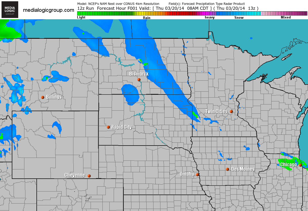
Snow Potential
We have a fast moving clipper system that will be scooting across the international border through Friday. This will be responsible for shovelable snow amounts mainly across the international border. There will be a period of mixing on the southern side of the system, some of which could include freezing rain into early Friday morning.
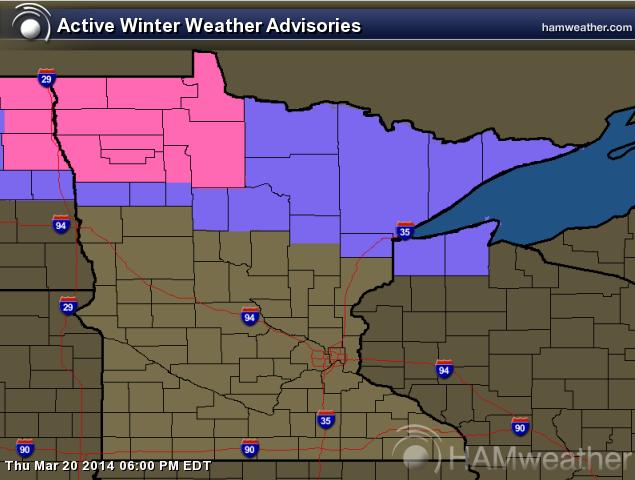
Winter Weather Headlines
...WINTRY MESS ACROSS THE NORTH TONIGHT AND FRIDAY...
AN AREA OF LOW PRESSURE WILL CROSS THE REGION TONIGHT CAUSING A MIX OF WINTRY PRECIPITATION. IN ITS WAKE A STRONG COLD FRONT WILL SWEEP THROUGH THE REGION. PRECIPITATION WILL BEGIN AS RAIN THIS EVENING AND SWITCH OVER TO ALL SNOW LATER TONIGHT AND INTO FRIDAY. SNOW ACCUMULATIONS ARE A BIT UNCERTAIN AS TIMING OF THE SWITCH OVER FROM RAIN TO SNOW WILL IMPACT SNOW AMOUNTS. A STORM TOTAL OF 3 TO 6 INCHES WITH THE POTENTIAL FOR A LOCALIZED THIN BAND OF 6 TO 12 INCHES IN THE WARNED AREA IS POSSIBLE BY MID DAY FRIDAY. STRONG NORTH WINDS GUSTING UP TO 45 MPH WILL ALSO DEVELOP FRIDAY MORNING CREATING AREAS OF BLOWING SNOW...REDUCING VISIBILITY ESPECIALLY IN OPEN COUNTRY. CONDITIONS WILL IMPROVE FRIDAY EVENING BUT VERY COLD TEMPERATURES WILL FOLLOW CONTINUING THROUGH THE WEEKEND.
AS TEMPERATURES COOL TONIGHT ROADWAYS WILL BECOME SNOW COVERED AND VERY SLIPPERY. HAZARDOUS TRAVEL CONDITIONS WILL CONTINUE INTO FRIDAY.
THE WINTER STORM WARNING IS NOW IN EFFECT FROM 1 AM TO 7 PM CDT FRIDAY.
* TIMING...RAIN TURNING TO ALL SNOW AFTER MIDNIGHT. THE SNOW MAY BE HEAVY AT TIMES. A COLD FRONT WILL SWEEP THROUGH THE REGION FRIDAY MORNING...BRINGING ADDITIONAL SNOW SHOWERS AND STRONG NORTHERLY WINDS.
* WINDS...RELATIVELY LIGHT TONIGHT. ON FRIDAY...BECOMING NORTH 30 TO 40 MPH WITH GUSTS TO 45MPH.
* VISIBILITIES...TONIGHT...HEAVY SNOW IS POSSIBLE...AND COULD REDUCE THE VISIBILITY TO ONE QUARTER MILE AT TIMES. ON FRIDAY... BLOWING SNOW WILL REDUCE VISIBILITY TO ONE QUARTER MILE OR LESS.
* SNOW ACCUMULATIONS...3 TO 6 INCHES WITH A THIN BAND OF 6 TO 12 INCHES POSSIBLE.
Snow Potential
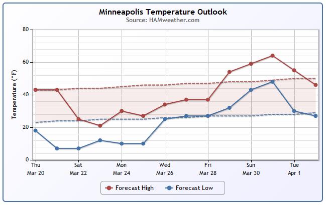
MSP TEMP TREND
Here's a peek at the Minneapolis temperature trend over the next 15 days. Note the significant dip in temperatures by the weekend/next week. Readings at that point will be well below normal, but it appears that long range guidance is suggesting a warmup around the first of April! Hopefully it's not a joke.
====================
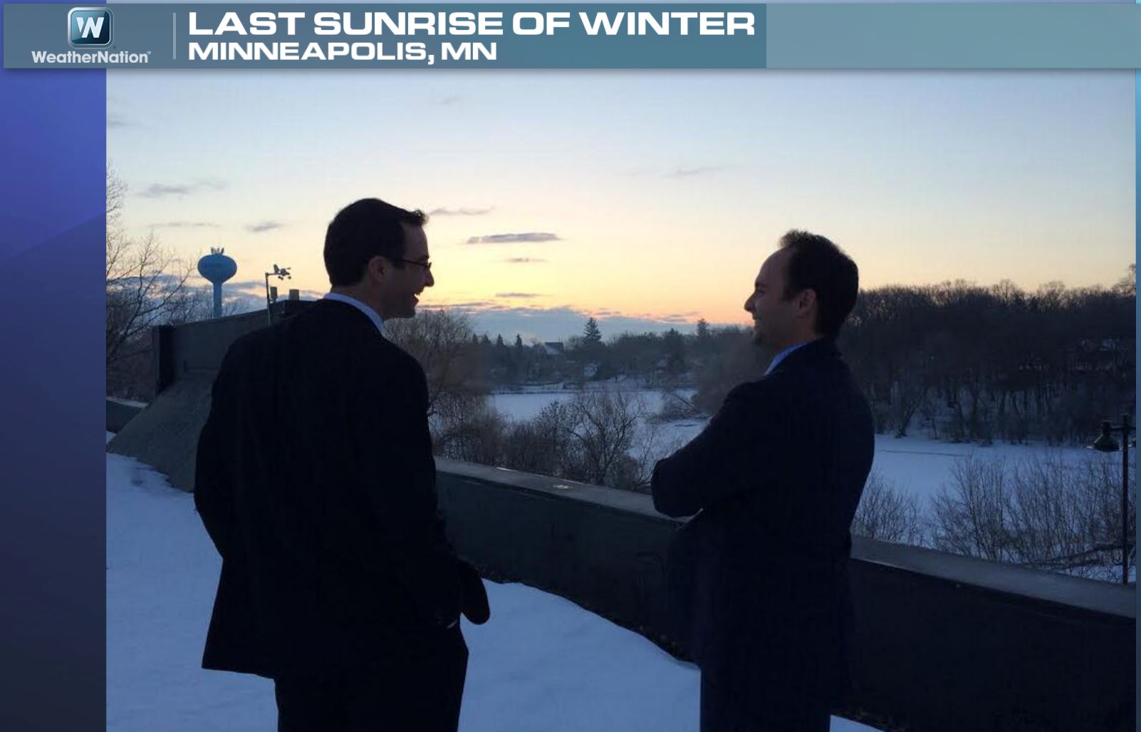
Last Sunrise of Winter
Here's a picture of me and my good friend and colleague at WeatherNation, Aaron Shaffer from Thursday morning. We got to enjoy that last sunrise of Winter... good riddance!
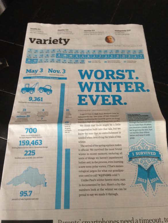
StarTribune Thursday
If you didn't see, this was front page of the Variety section in the StarTribune newspaper on Thursday. Pretty much sums it up in a tongue and cheek sort of way, doesn't it?
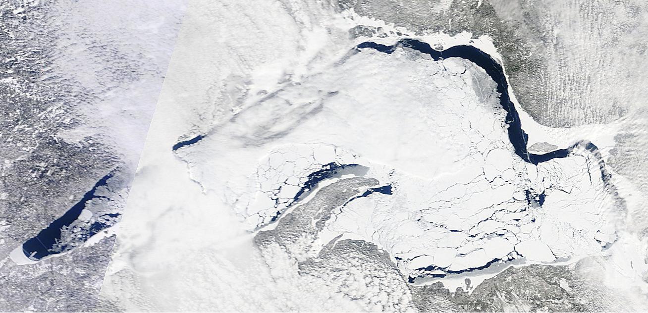
Lake Superior
MODIS satellite captured a pretty amazing image of Lake Superior on Thursday. Take a look at all that ice! As of Thursday (first day of Spring), Lake Superior was still 95.2% covered in ice!
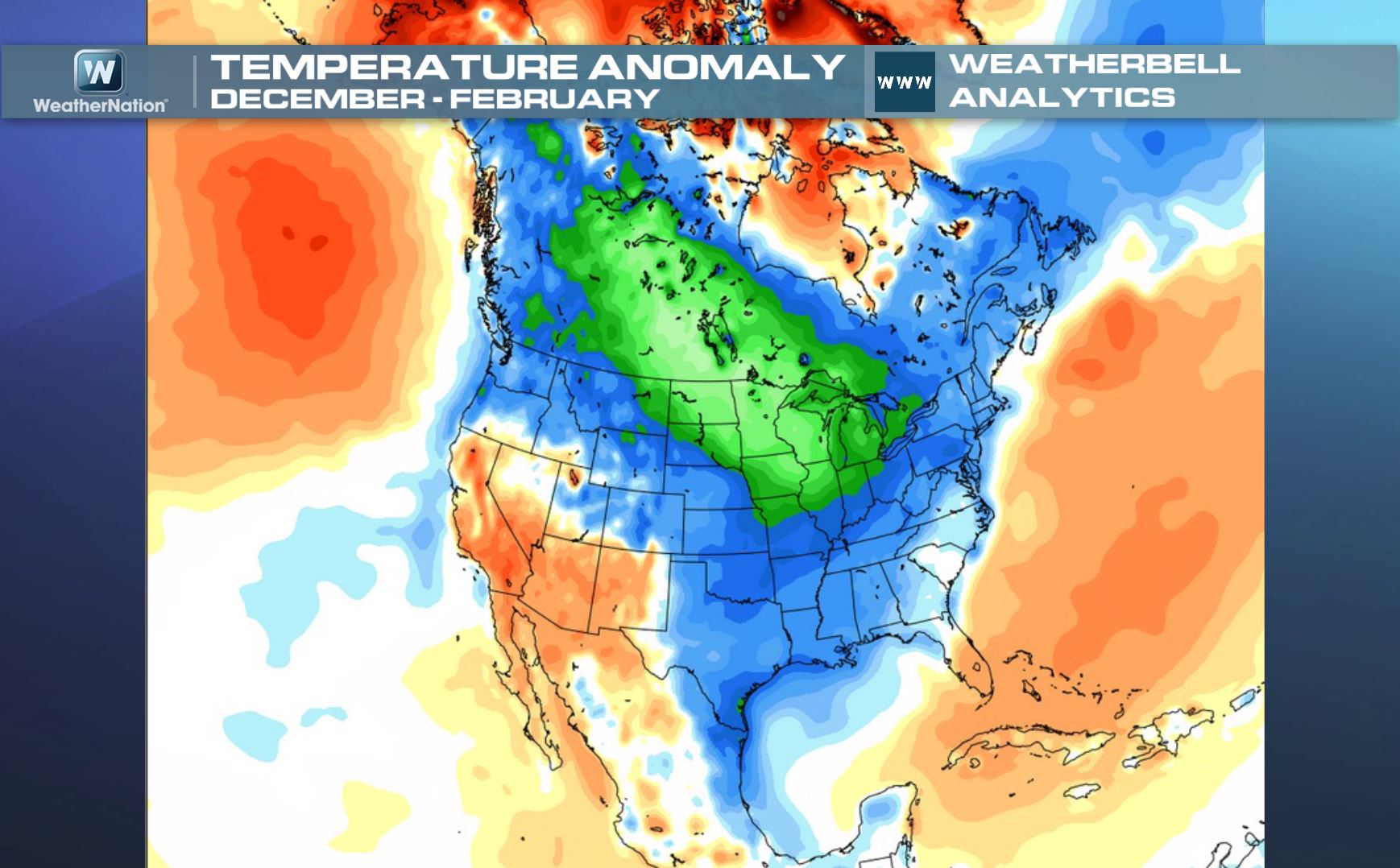
A Look Back at Winter
This was the temperature anomaly or departure from normal for the months of December, January and February, which is also known as meteorological winter. Note the significant levels of colder than normal temperatures from Canada to the eastern two-thirds of the U.S.. The only spot that was warmer than average during this period was Alaska and the Southwestern part of the country.
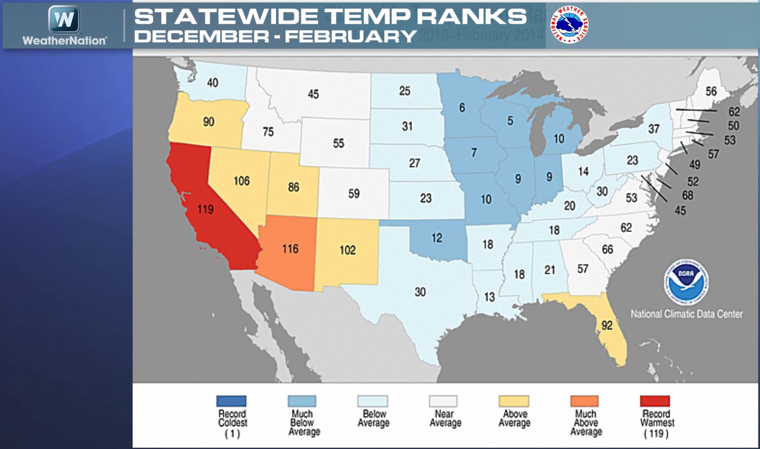
Statewide Temp Ranks for Meteorological Winter
This is the breakdown of the statewide temperature ranks for the same period as above. Note that where it was cooler than average for meteorological winter, several states in the central part of the country saw some states actually had one of their top 10 coldest meteorological winters on record. On the other side of the coin, California had its warmest meteorological winter on record!
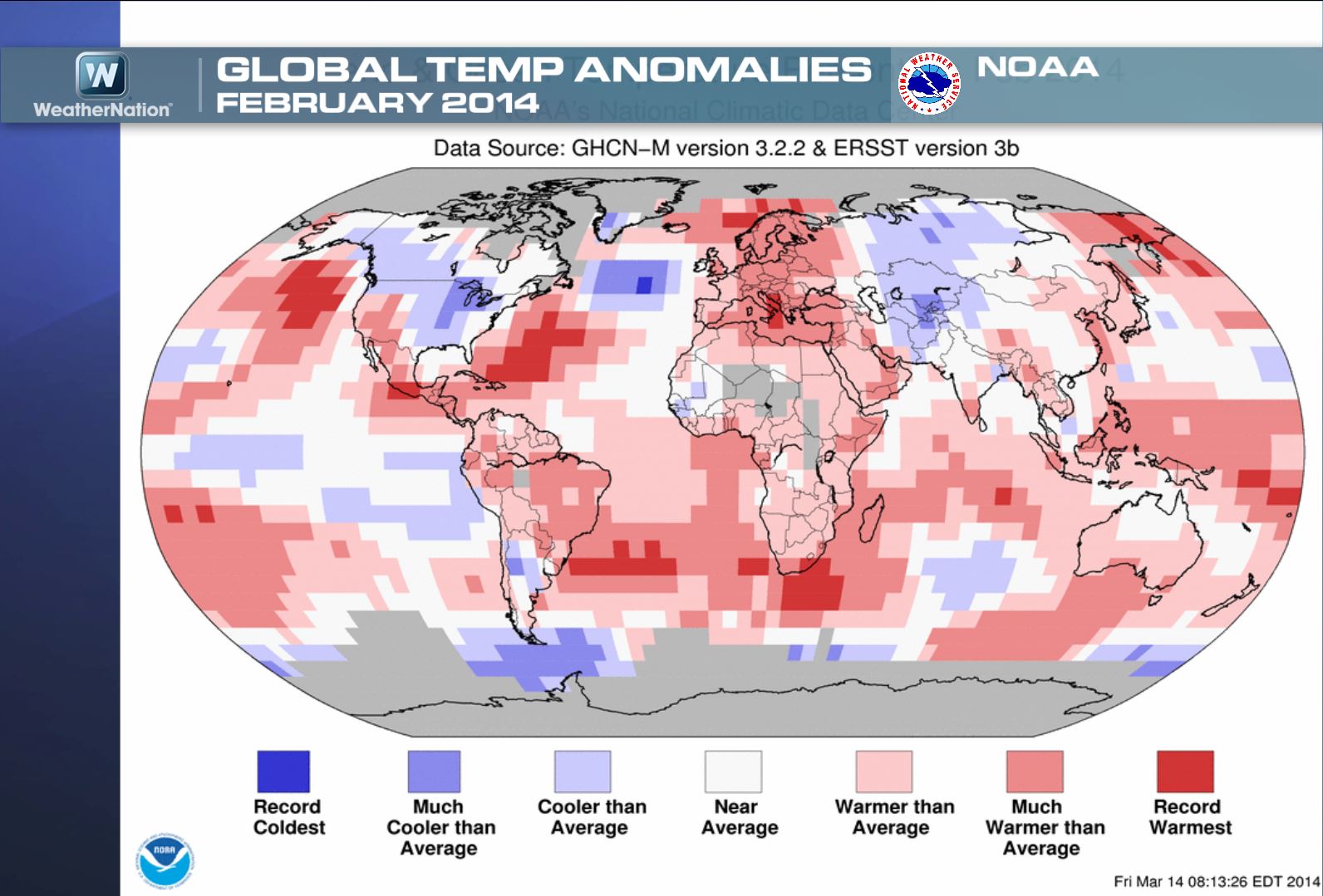
February Global Temps
I thought this was interesting... even though the winter was cold for the U.S., globally February 2014 tied for its 21st warmest February on record. There are several other stats that can be picked out from the NOAA article linked below.
Read more from the NOAA's NCDC HERE:
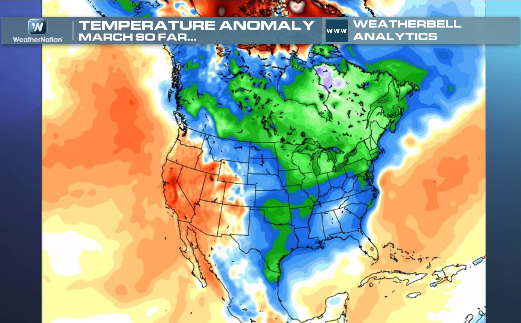
March Temp Anomaly
We still have 10 days left in March and so far, the temperature anomaly for the month has been running well below average in many of the same areas as they did during the 3 month period of meteorological winter. It also shows that the Southwest has been warmer than average during this period as well.
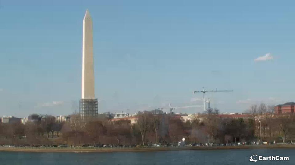
A Sure Sign of Spring - Cherry Blossom Festival Cam
Another sign of Spring is the annual Cherry Blossom Festival in Washington D.C. - The festival kicked off Thursday and will run through April 13th. The National Park Service expects peak bloom from April 8th to April 12th.
See the LIVE CAM HERE:
HERE is the official Cherry Blossom Festival website:
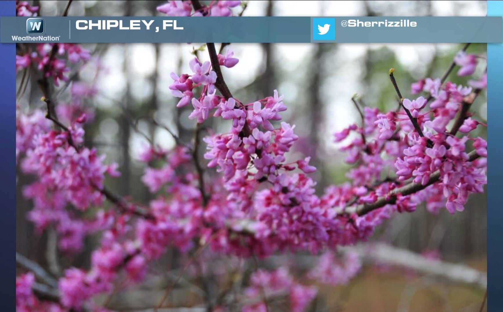
Signs of Spring in Florida
Ah yes... Here's what I like to see! A little color after a long winter. Over the coming weeks we will (hopefully) see quite a few more signs like these below.
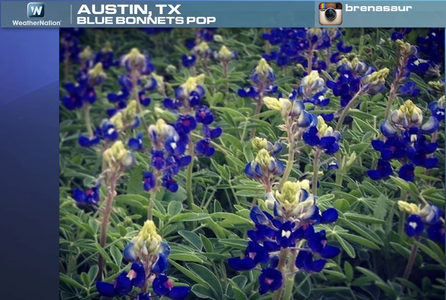
Signs of Spring in Texas
Blue Bonnets in Austin, TX... gotta love this one!
Signs of Spring in Alabama
Magnolia trees bloom in Alabama!

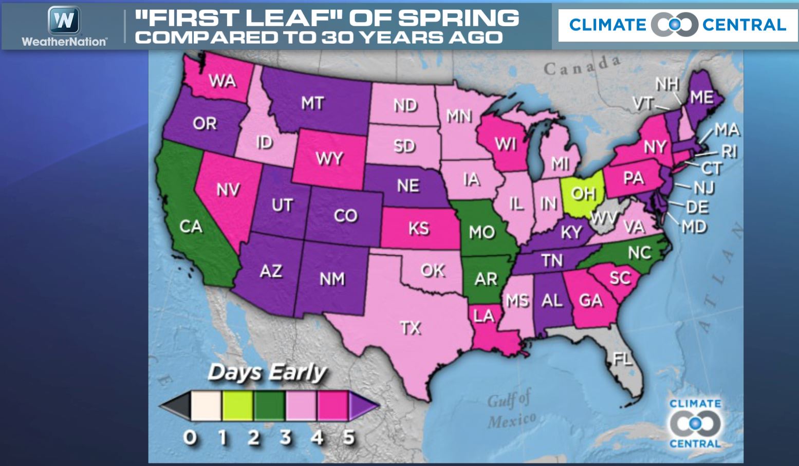
"First Leaf" of Spring
This is interesting. According to Climate Central, this is how many days earlier the "First Leaf" of spring appears compared to 30 years ago. The purple and pink colors indicate nearly 3 to 5 days earlier than it did 30 years ago, while the green colors indicate around 1 to 3 days earlier than before.
See more HERE:
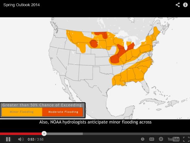
NOAA's Spring Outlook
"On March 20, 2014, NOAA's National Weather Service issued its Spring Outlook, covering flooding, drought, temperature, and precipitation through June. A cold and snowy winter in the northern plains and Midwest has raised the potential for moderate flooding, but fortunately no areas are in major flood risk this year."
See NOAA's Spring Outlook video HERE:
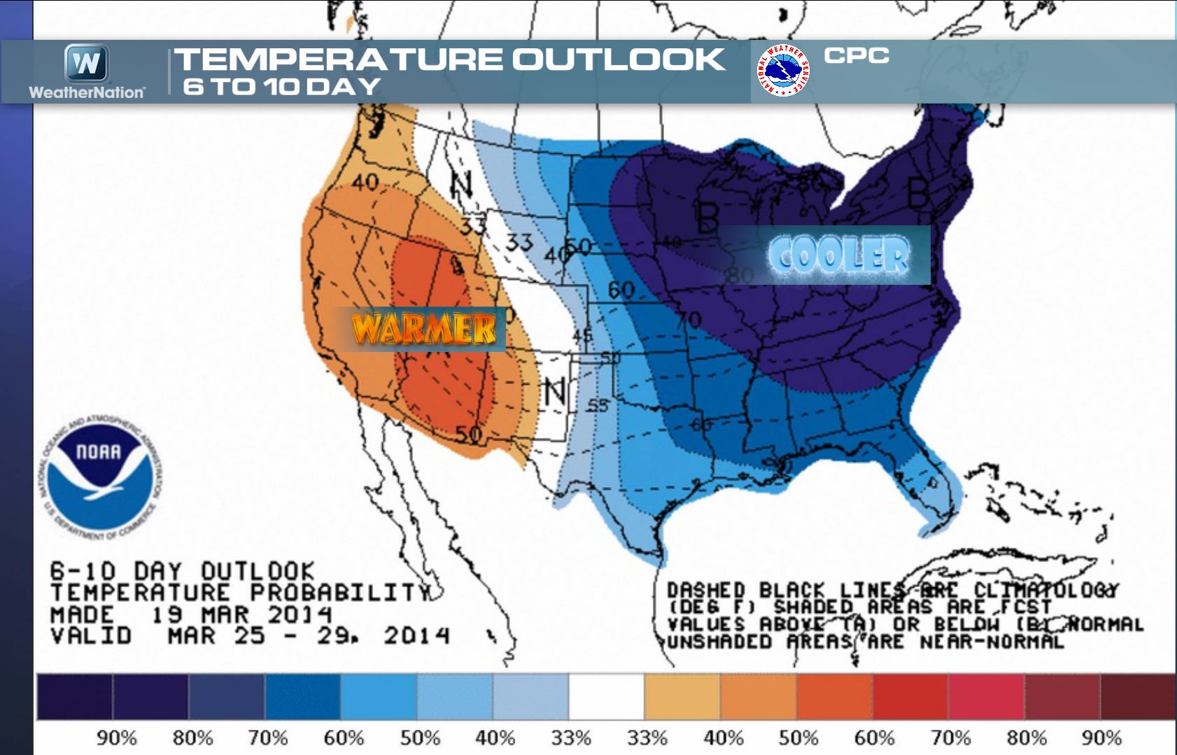
6 to 10 Day Temperature Outlook
According to NOAA's Climate Prediction Center, the eastern two-thirds of the nation look to stay cooler than average until nearly the end of the month. However, the western third of the nation looks to stay warmer than average.
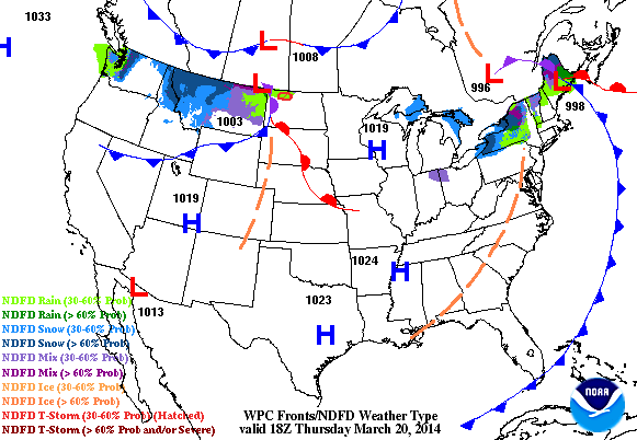
Weather Ahead
A fast moving clipper system will dive through the Upper Mississippi Valley through the end of the week and end up in the Northeast by Saturday. The best chance of snowfall accumulations will land across the international border.
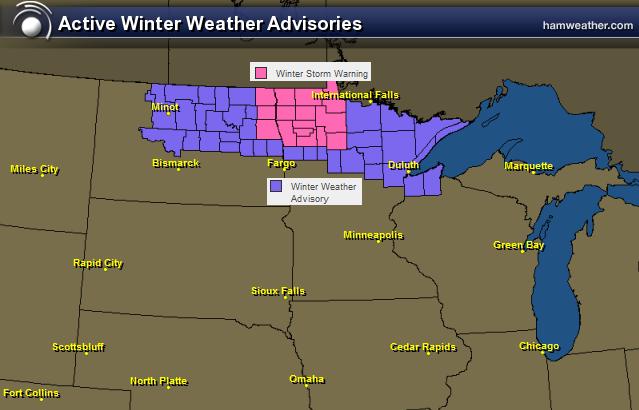
Winter Weather Headlines
The National Weather Service has issued winter weather headlines for a few places across the international border through PM Friday.
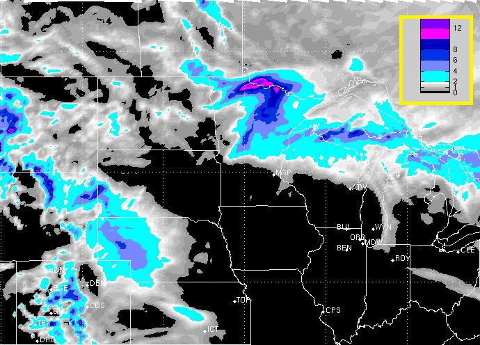
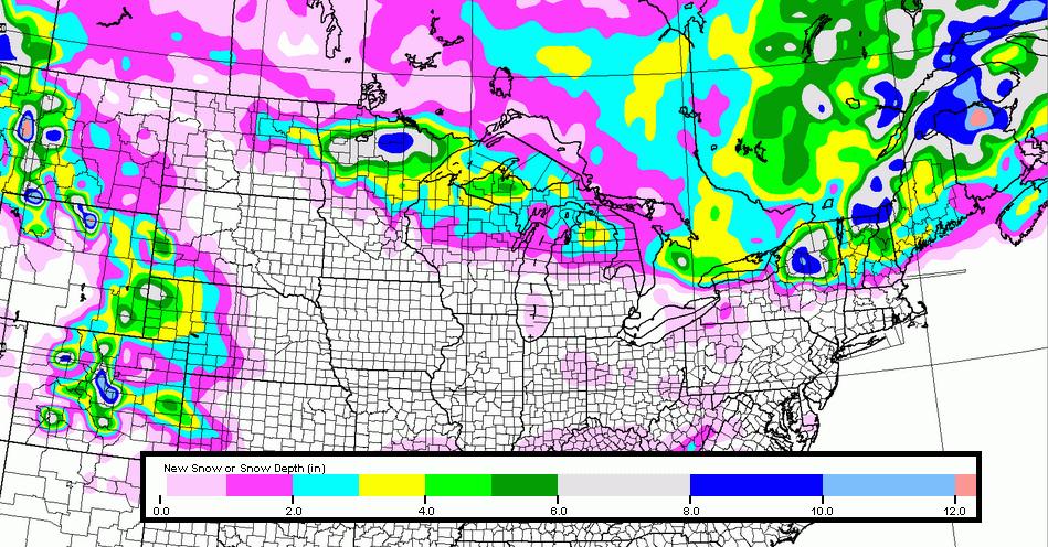
Snow Potential
Here's the snow potential through PM Sunday. Note that the heaviest appear to be along the international border, while light accumulations across the Front Range of the Rockies also appear to be likely.
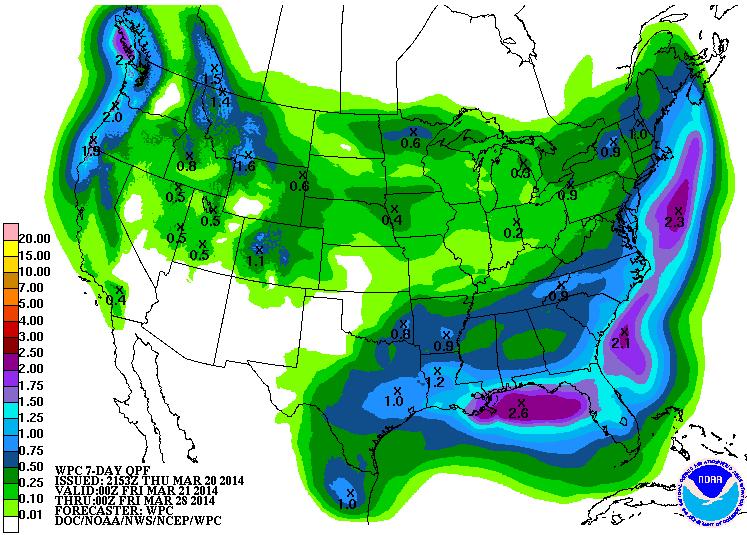
Precipitation Outlook
According to NOAA's HPC 7 day precipitation outlook, the best chance of moisture looks to fall across the southern half of the nation as we head through the weekend and into early next week. However, note the heavier stripe of moisture lifting north along the East Coast. It'll be interesting to see whether or not some of this moisture turns into snow... some models suggest a bigger storm system developing early next week and riding along the East Coast.
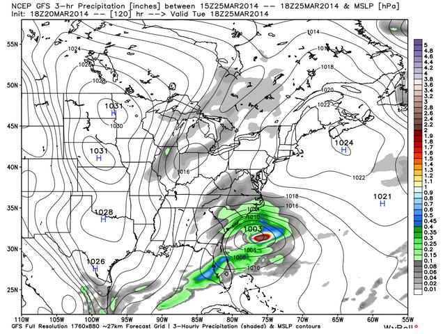
Developing Storm?
This system will be one to watch as we head into next week. It's way too early to tell specifics, but there is certainly a growing snow potential early next week. The image below suggests the (potential) developing storm by early next week. Will this develop and if so, will it head north along the coast? Stay tuned!
Thanks for checking in and have a great weekend ahead! Don't forget to follow me on Twitter @TNelsonWNTV
No comments:
Post a Comment