By Todd Nelson
At 11:57am CDT, the sun's most direct rays will pass over the equator, signifying the start to Spring in the northern hemisphere. Even though the calendar will say Spring, we're certainly not going to have late March weather anytime soon.
Keep in mind that the average high for today is in the low to mid 40s. The average March temperature has been running nearly 8F below average! Interestingly, even with our latest snow, the Twin Cities has only had about 3.5" of snow this March, which is running below the total March average of 10.8". With that said, we've seen 61.5" of snow this season, which is nearly a foot above normal! However, in order to reach the 3rd snowiest season on record, we'd have to see another 2ft. to even come close to the 88.9" recorded in 1950-51.
Last year was an impressive year for Duluth. Not only did they see the 3rd snowiest season on record with 129.6", but they had the snowiest month on record! April 2013 saw 50.8"!! Yes, you read that right! Let's hope that doesn't happen this year.
Another clipper arrives Thursday night/Friday with some light rain/snow. Temperatures behind the clipper will be nearly 20F below average this weekend.
______________
WEDNESDAY NIGHT: Partly cloudy and chilly. Low: 22. Winds: NW 10.
THURSDAY: Happy Spring! Less wind. Sun early, then fading late. High: 42. Winds: Turning SSE 5-10.
THURSDAY NIGHT: Clouds thicken, light rain/snow mix possible late. Low: 28. Winds: SSE 5-15.
FRIDAY: Chance of rain/snow. Best chance of light accumulations across northern MN. Turning breezy and cooler later. High: 40 and falling.
SATURDAY: Another brisk March day. Stray flurry? Wake-up: 16. High: 23.
SUNDAY: Feels more like February. Wake-up: 7. High: 25.
MONDAY: Chance of snow. Wake-up: 13. High: 31.
TUESDAY: Chance of light snow. Wake-up: 14. High: 28.
WEDNESDAY: More sun. Still below average temps. Wake-up: 18. High: 37.
______________
This Day in Weather History
March 20th
1991: Early tornado hits Faribault county from Bricelyn to Wells.
__________________________________________________
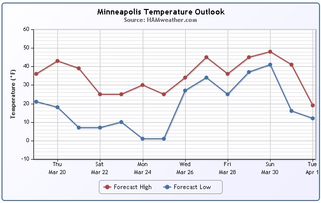
MSP Temp Trend
Thursday marks the first day of Spring 2014; the Vernal Equinox approaches at 11:57am CDT. Even though the calendar will say Spring, the atmosphere certainly won't be responding. Take a look at the temperature trend over the next several days. Note the dip to well below average levels by the weekend/early next week.
More on Tuesday's Snow
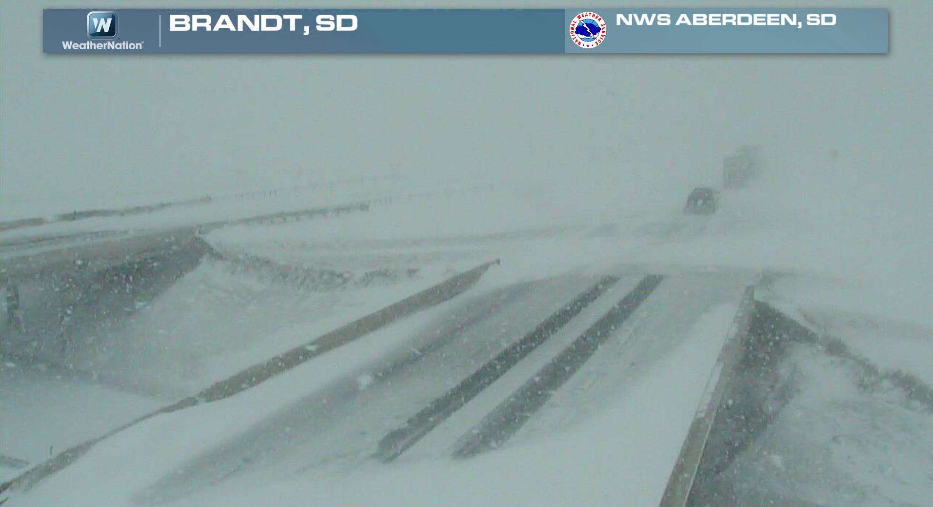
Tuesday's snow was certainly not an unprecedented March event. In fact, March snow in Minneapolis typically averages nearly 11" and is considered to be the 3rd snowiest month (on average) out of the entire year. Thanks to the National Weather Service out of Aberdeen, SD for the image below out of Brandt, SD. At one point yesterday, roads were being closed due to the heavy snow and visibility in some areas through eastern SD.
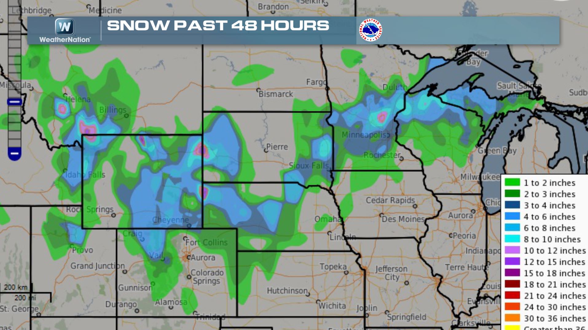
Snowfall From Earlier This Week
Here was the snowfall map from earlier this week. Note the small pink blobs across the snow path. These are areas that had close to 10" or more.
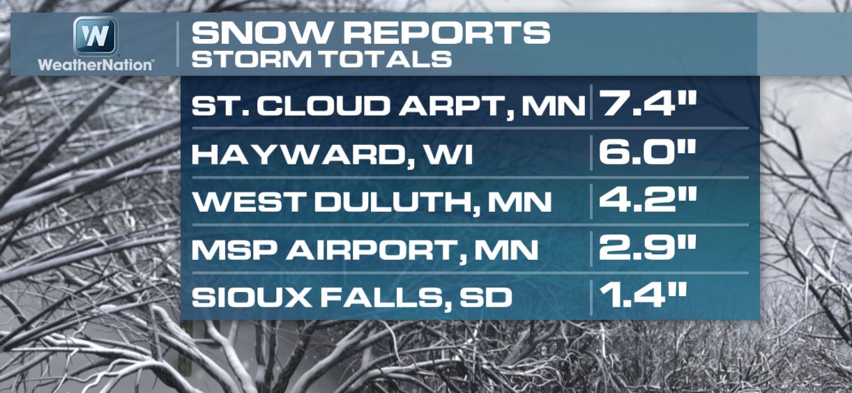
Selected Snow Tallies
These are just a few of the selected tallies from closer to home. The storm total at the MSP Airport was just shy of 3".
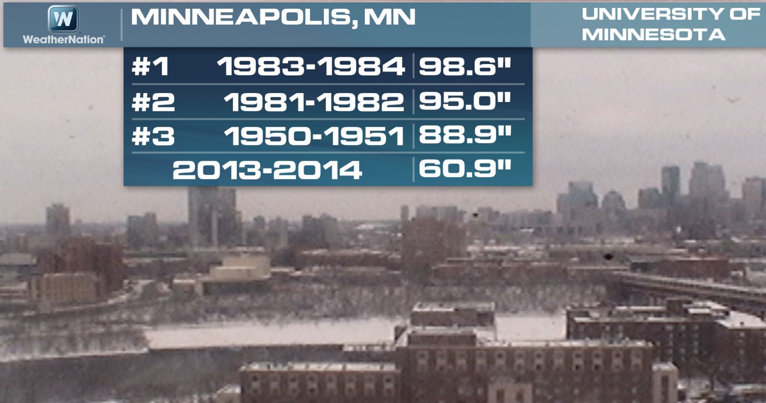
Minneapolis Snow Stats
Interestingly, the Twin Cities is currently nearly 12" above normal on the season. However, even with the recent snow, the 2013-2014 snowfall season is still well below the 3rd snowiest winter on record of 88.9" set in 1950-1951.
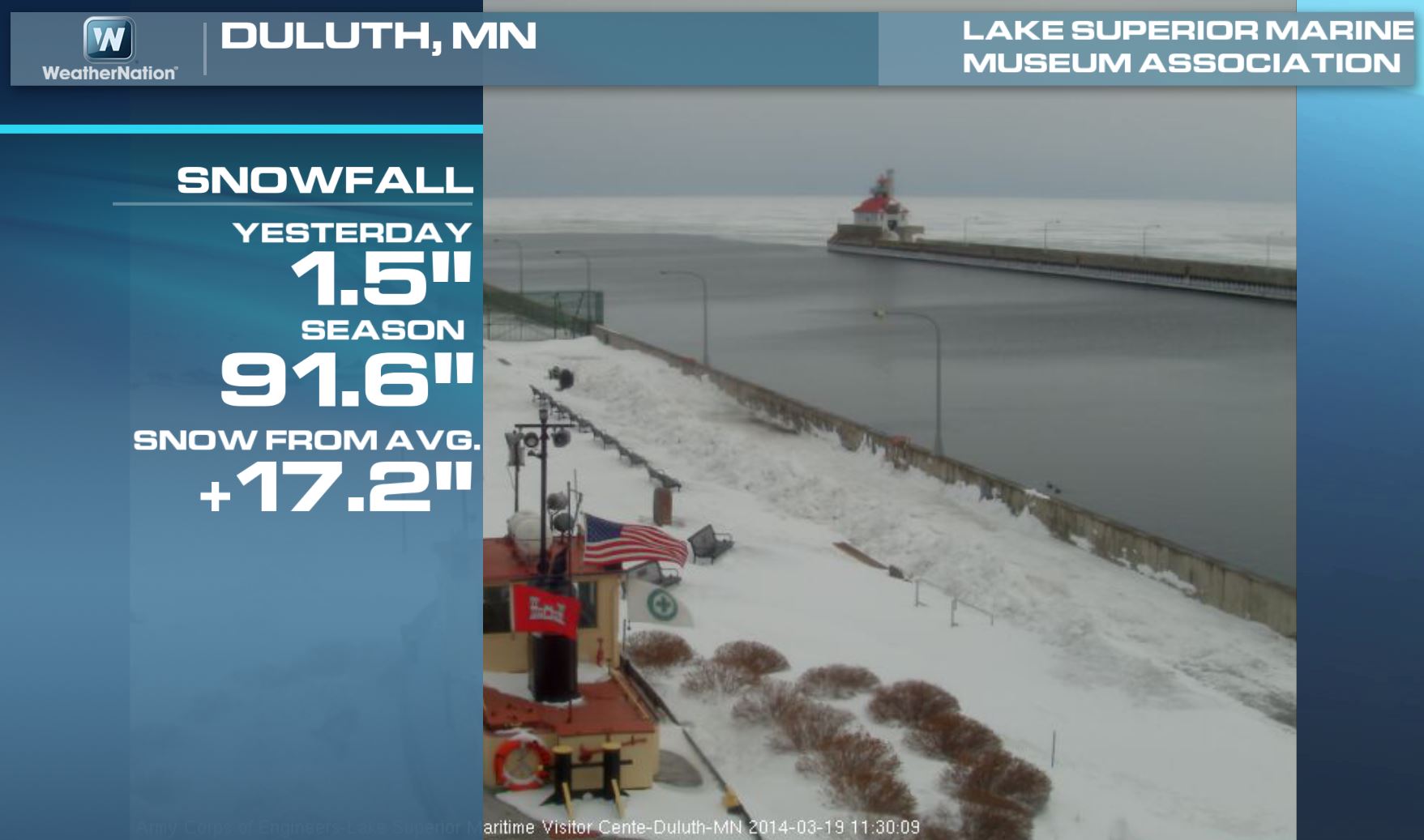
Duluth Snow Stats
Duluth got missed by the heaviest snowfall with this particular system, but the snowfall stats still got padded. The snowfall this season is up to 91.6", which is nearly 17" above normal.
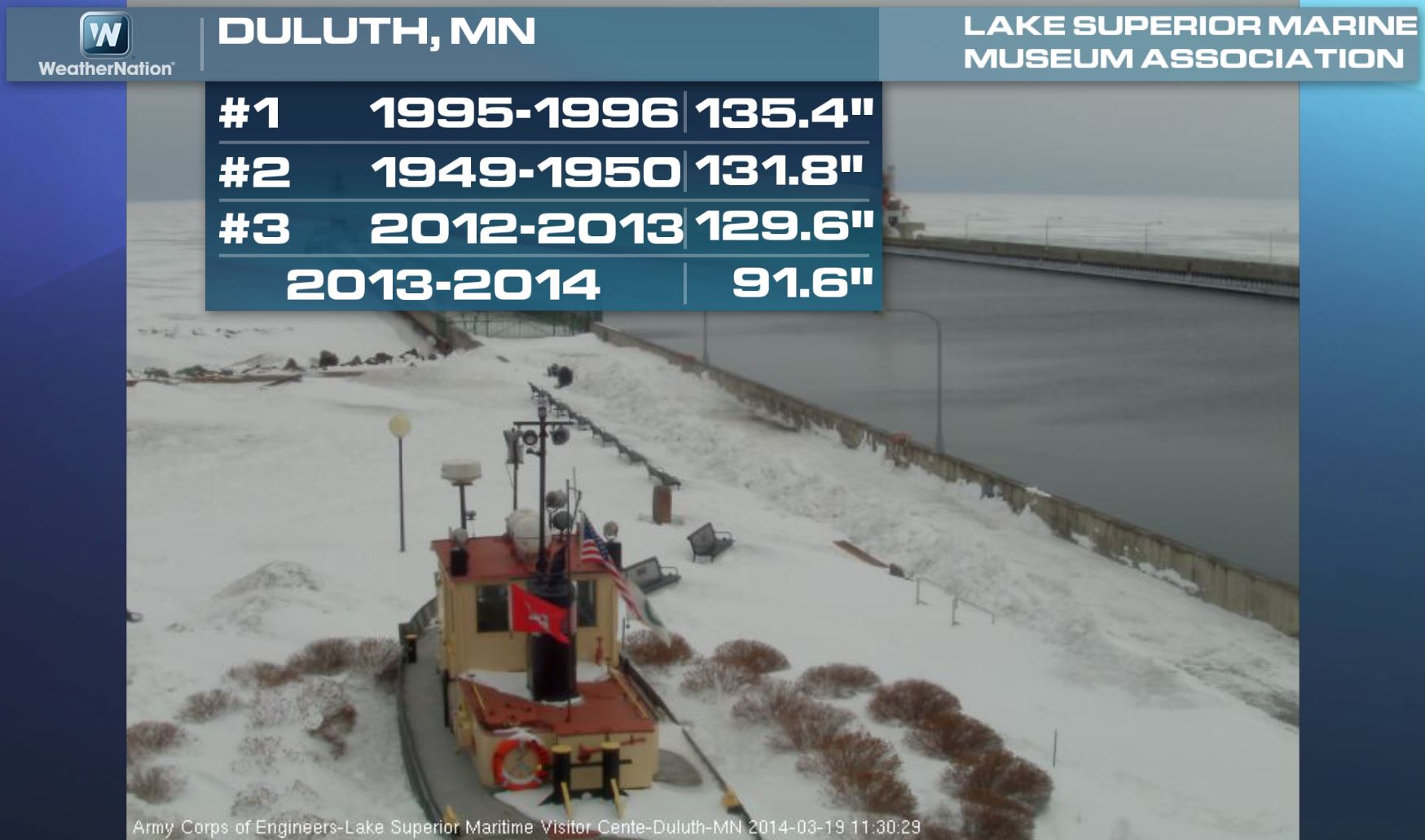
Duluth Snow Stats Continued
Keep in mind that we'd have to get to nearly 130" to see the 3rd snowiest season on record. Note that last year (2012-2013) was the 3rd snowiest on record for Duluth!
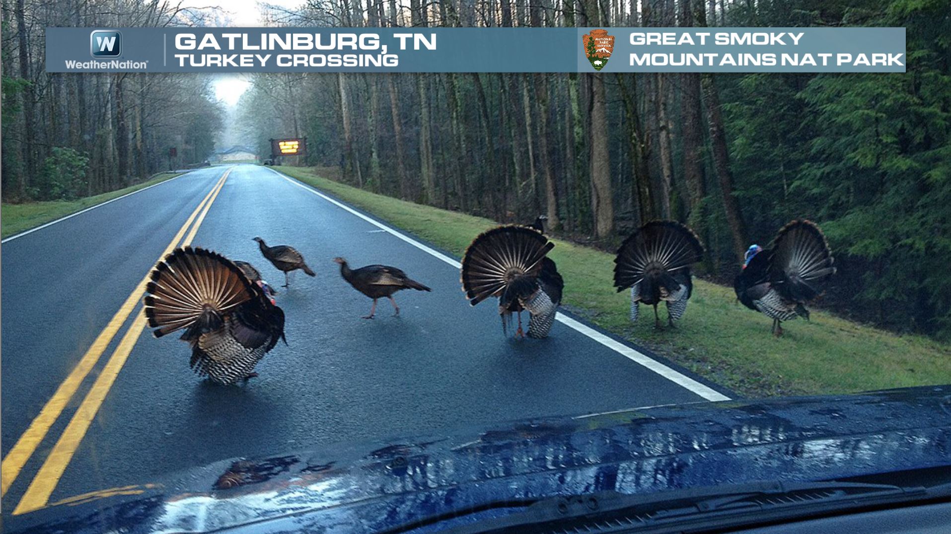
Signs of Spring
The picture below almost looks fake, but it's not! It comes from the Great Smoky Mountains National Park of four BIG tom turkeys strutting their stuff in front of the ladies. I guess they'll be trying to attract the ladies now through about April or May for mating!
Signs of Spring Continued
Here's another sign of Spring from Atlanta, GA. Thanks to @intownexpert on Instagram for the image below of a tree in bloom! By the way, the annual Cherry Blossom Festival in Washington D.C. starts Thursday (first day of Spring) and goes through April 13th:
Here's the link to the National Cherry Blossom Festival

Signs of Spring Continued
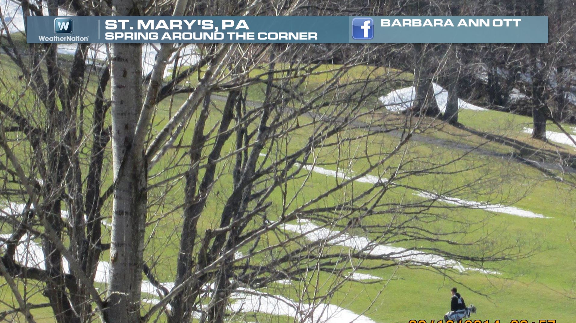
Thanks to Barbara Ann Ott for the image below out of St. Mary's PA. It appears that the picture below was taken from a Golf Course; note the golfer on the bottom right carrying a golf bag. Also note the fairway snowbanks. I've heard of fairway sand traps and other golfing hazards, but the fairway snowbank is new to me... How many extra strokes to you have to take if you land in one?
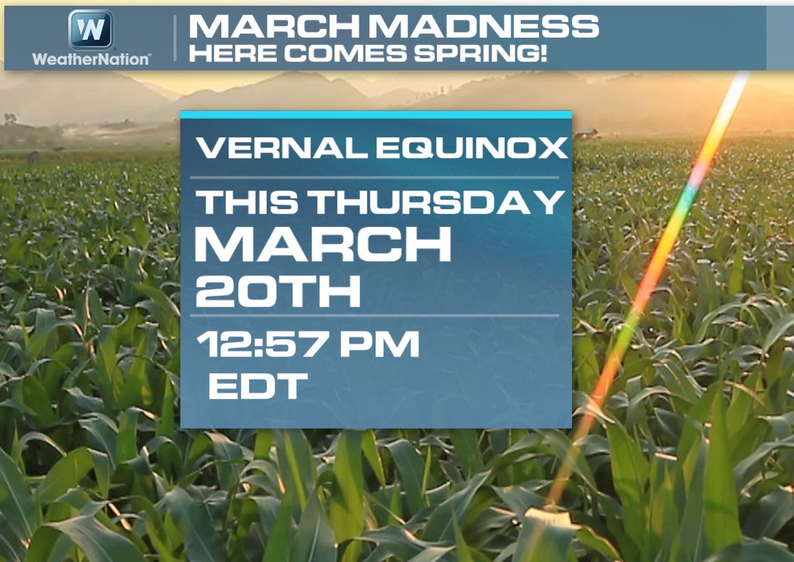
Vernal Equinox
Spring officially arrives at 12:57pm. That's when the sun's most direct ray actually shine over the equator. At this point of the year, there is equal day and equal night across the globe! The word "Equinox" is actually derived from Latin meaning equal night.
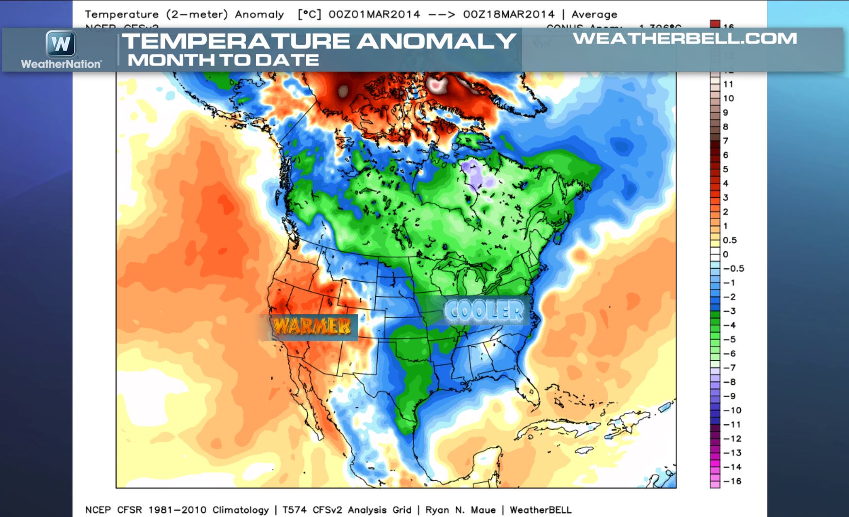
March Temperature Anomalies So Far...
March certainly has been a cold month for Canada and the eastern two-thirds of the nation. Note that the western third of the nation has actually been above average!
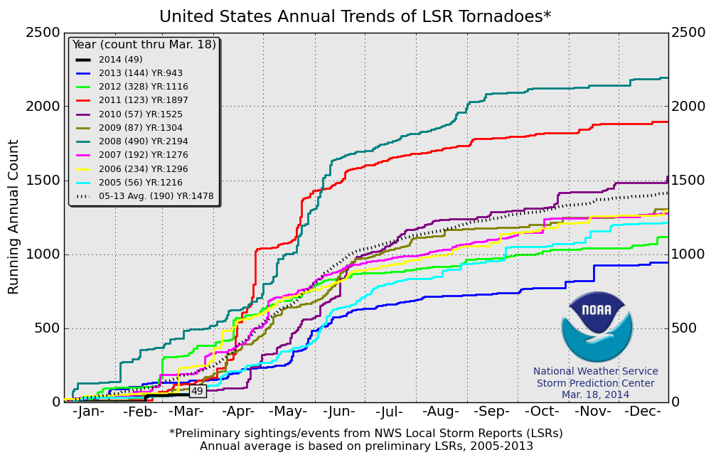
2014 Tornado Count So Far...
Due to the cold air this March and for the beginning of the year for that matter, the 2014 tornado count has been running below average. According to NOAA's SPC, the 2014 count through March 18th is only 49! This is much lower than the past couple of years and lower than the 2005-2013 average of 190.
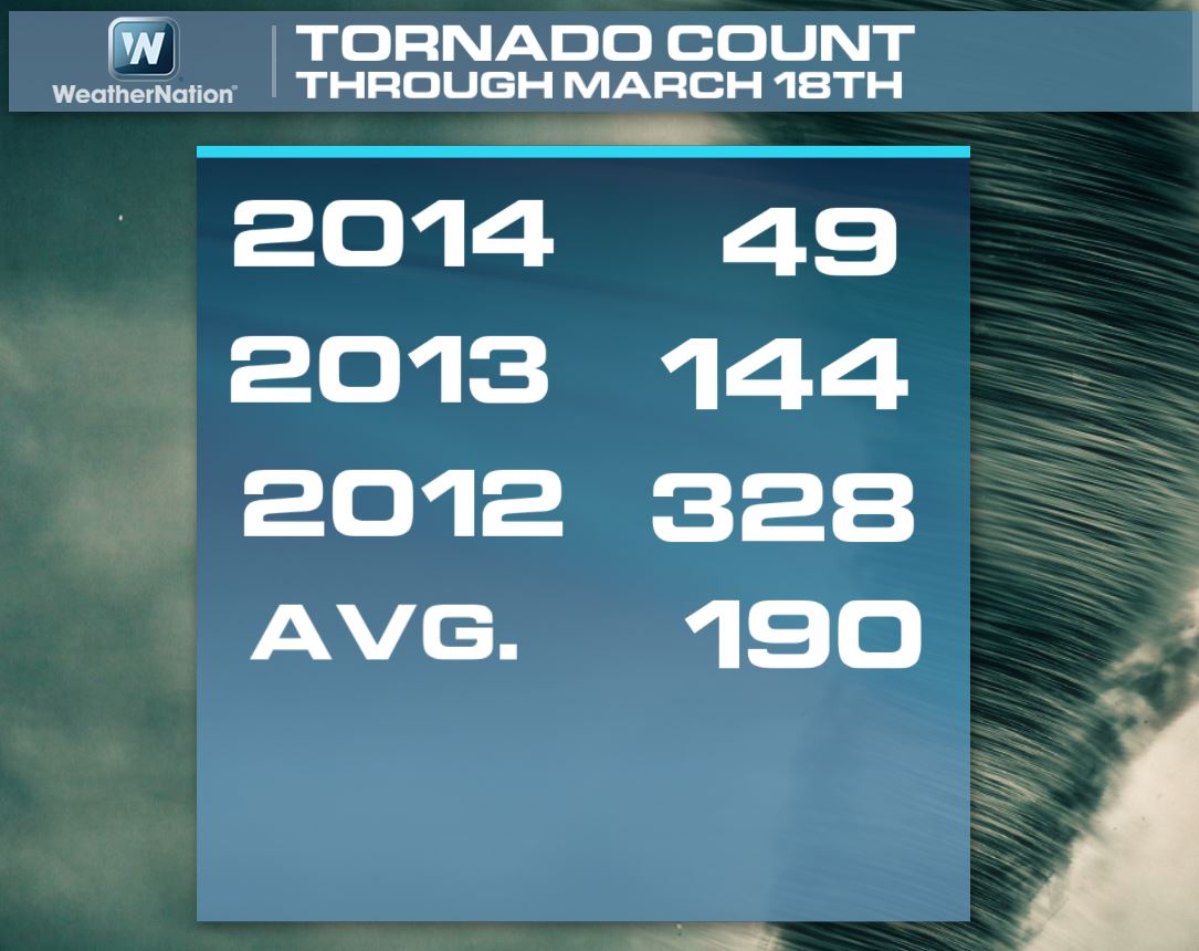
2014 Tornado Count So Far...
Here's a look at the tornado count comparison since 2005. Note that in 2008 we were off to a quick start. By this time in 2008, there had already been nearly 500 tornado reports!
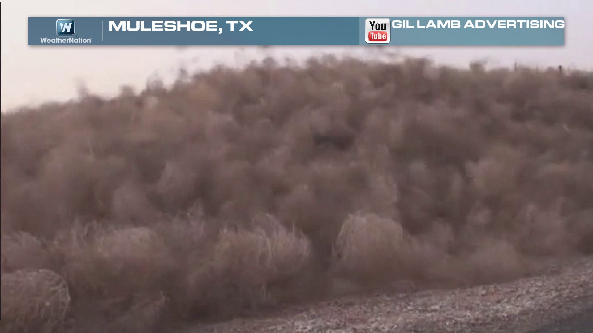
Tumbleweed Stampede...
Now this is something like I've never seen before! I think it looks like a tumbleweed stampede! Thanks to Gil Lamb Advertising on Youtube for the image below. The video actually showed this massive tumbleweed clump in motion!
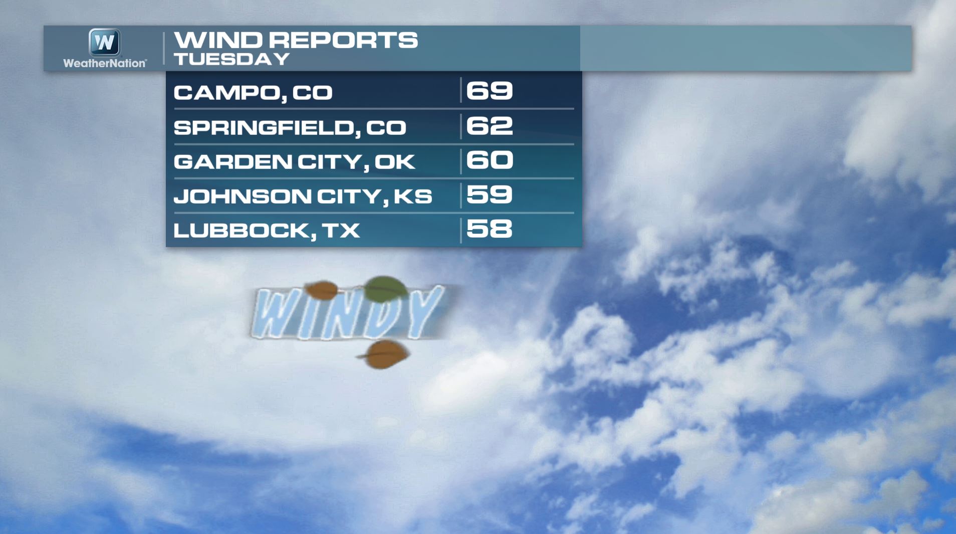
Texas Wind Gusts Tuesday
Here are some of the significant wind gusts from Tuesday.
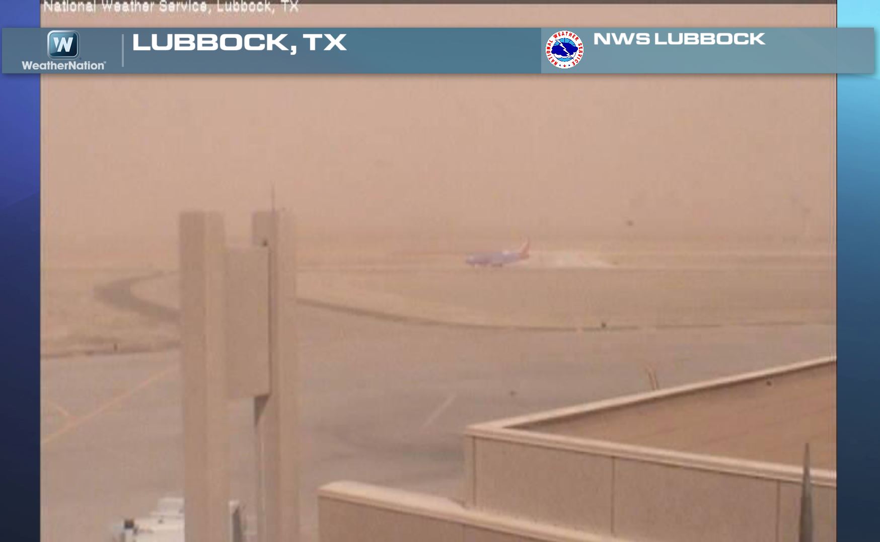
Lubbock, TX Dust Storm Tuesday
The strong winds earlier this week were also responsible for a big dust storm across parts of the Southern Plains. This was the view from Lubbock, TX airport on Tuesday. You can actually see an airplane there!
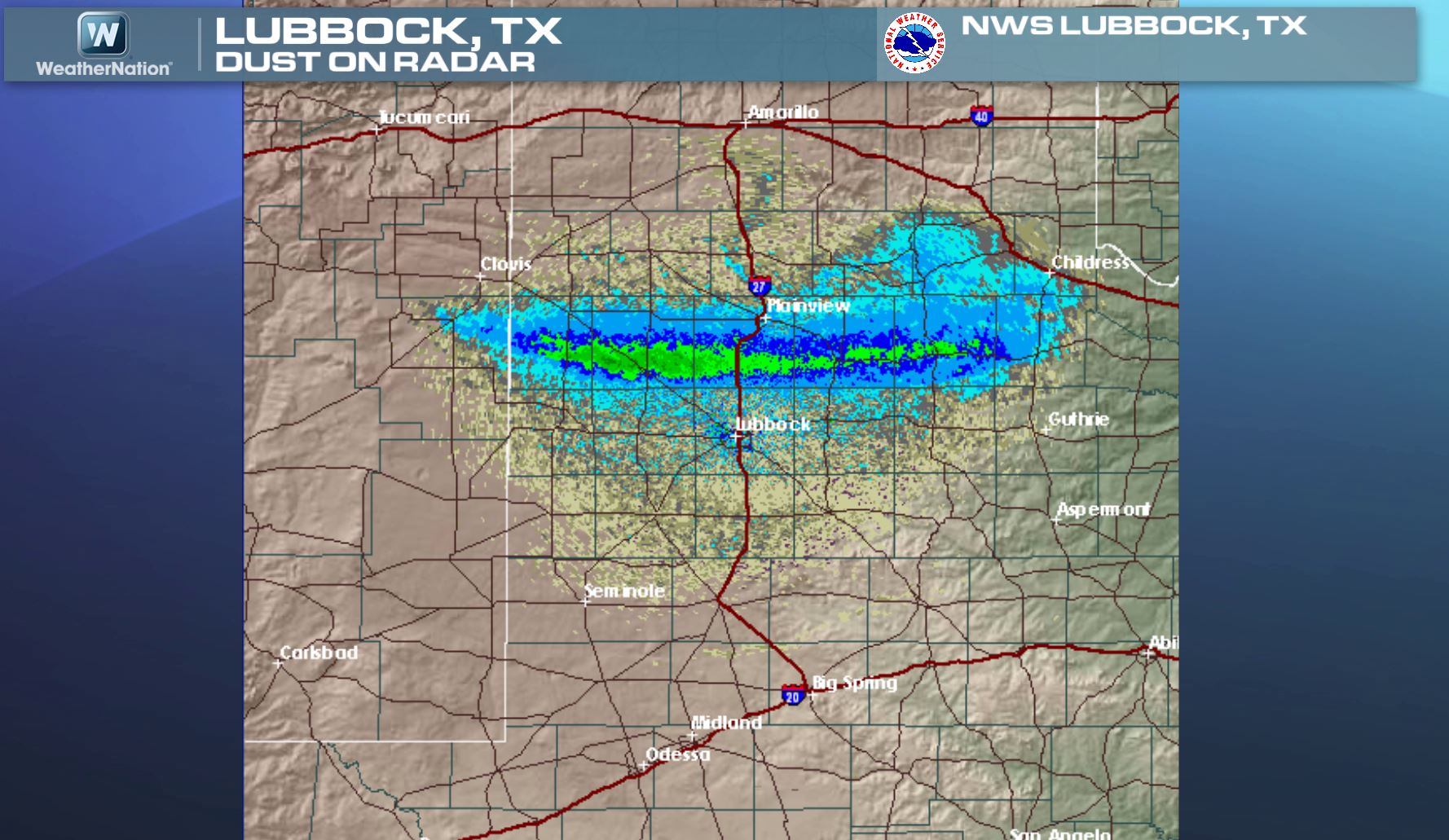
Dust Storm on Radar
This is interesting. Not only does radar detect moisture in the atmosphere, but it can also detect birds, bugs, debris and even dust! The image below actually showed the dust storm as it neared Lubbock, TX on Tuesday.
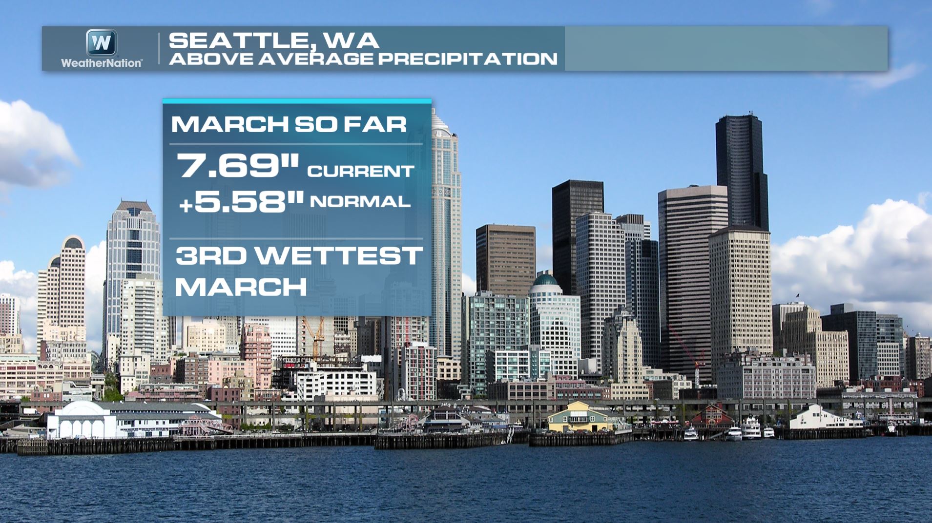
3rd Wettest March for March so Far...
As a side note, did you know that Seattle is at it's 3rd wettest March on record? Seattle has seen nearly 7.7" of precipitation so this month, which is nearly 5.6" above normal!
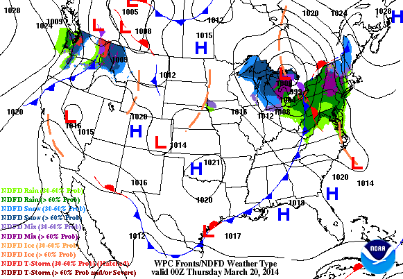
Weather Outlook
Here's the weather outlook through Friday evening. Note that one storm exits the northeastern part of the county and another enters the Upper Mississippi Valley by later this week.
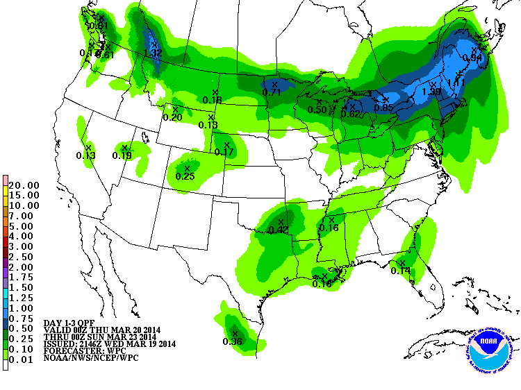
Precipitation Outlook
According to NOAA HPC 3 day precipitation outlook. The best chance for moisture through PM Saturday looks to be across the northern tier of the nation. However, there is a little moisture showing up across the Lower Mississippi Valley.
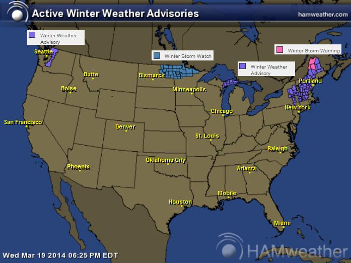
Winter Weather Headlines
The National Weather Service has issued a few winter weather headlines for areas along the international border.
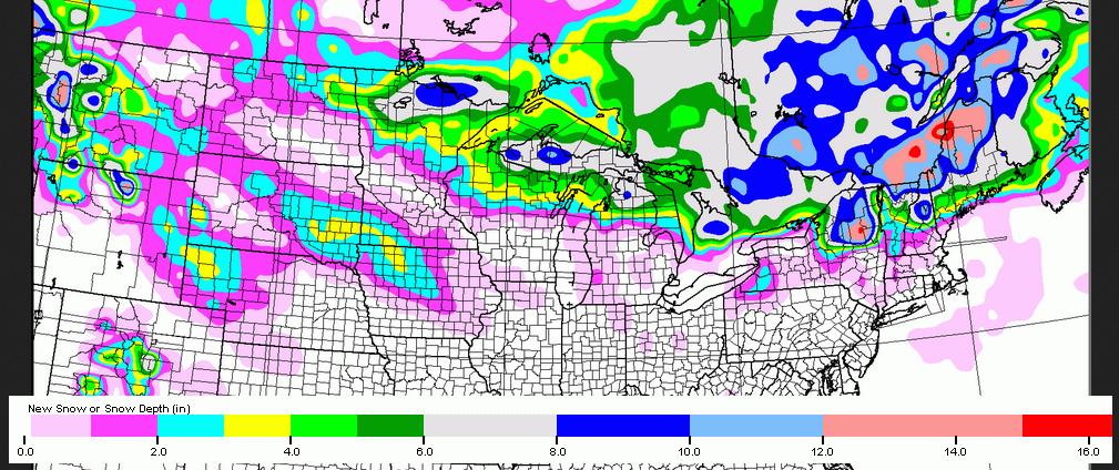
Snow Potential
Here's the snow potential AM Monday. There will be several spots along the international border that could potentially see shovelable snow by early next week.
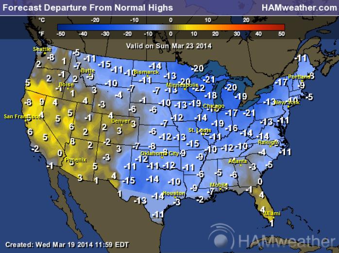
Chilly Outlook
I wish I could say that temperatures will be warming as we head into our first weekend of Spring, but unfortunately, we look to have more of the same. Temperatures by Sunday look to be significantly colder than average for the eastern two-thirds of the nation.
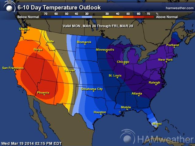
Temperature Outlook Through the End of March
The 6 to 10 day temperature outlook still looks less than ideal through the end of the month for the eastern two-thirds of the nation. The western third of the country looks to stay warmer than average.
Thanks for checking in and have a great rest of your week! Don't forget to follow me on Twitter @TNelsonWNTV

No comments:
Post a Comment