By Todd Nelson
Today marks the last full day of Winter 2013-14... good riddance! I'm not much for slow and slippery commutes. Not sure there is a majority that would disagree with me either.
As of yesterday, we have seen 42 days with measureable snowfall (0.1" or more) this winter season. The largest daily snowfall occurred on February 20th at 8.4". This also coincided with the largest snowfall event of the season; a combined total of 9.9" fell on February 20th and 21st.
Some of us will have a little shoveling ahead of us today, but the sun is going to help make your work a little lighter as it's as strong now as it was back in mid to late September! An event like this in January is much different than what it is in late March. The potential for snow covered and icy washboard roads is not an issue weeks after an event like it can be during the dead of winter.
Keep in mind that even with temperatures feeling more like February now, a sunny day around the Vernal Equinox (which falls tomorrow at 11:57am CDT) can pose a threat for a sunburn in nearly 45mins! Unfortunately, the temperature outlook keeps us below average through the end of the month. Think Spring!
____________________________________________________
TUESDAY NIGHT: Snow continues. Total 2" to 5" by AM Wednesday. Snowfall amounts quickly rise as you head into western/central/northeastern Minnesota Low: 25. Winds: N 10-25.
WEDNESDAY: Storm slides east. Breezy and cooler with lingering light snow showers and flurries early. High: 37. Winds: WNW 10-25.
WEDNESDAY NIGHT: Partly cloudy and chilly. Low: 21.
THURSDAY: Happy Spring! Less wind. Sun early, then fading late. High: 39
FRIDAY: Clouds thicken, chance of rain/snow? Wake-up: 29. High: 39.
SATURDAY: Partly sunny, another brisk March day. Wake-up: 17. High: 24.
SUNDAY: More sun, still quite chilly. Wake-up: 8. High: 26.
MONDAY: Chance of snow. Wake-up: 15. High: 28.
TUESDAY: Spring snow showers possible. Wake-up: 15. High: 28.
_______________________________________________________
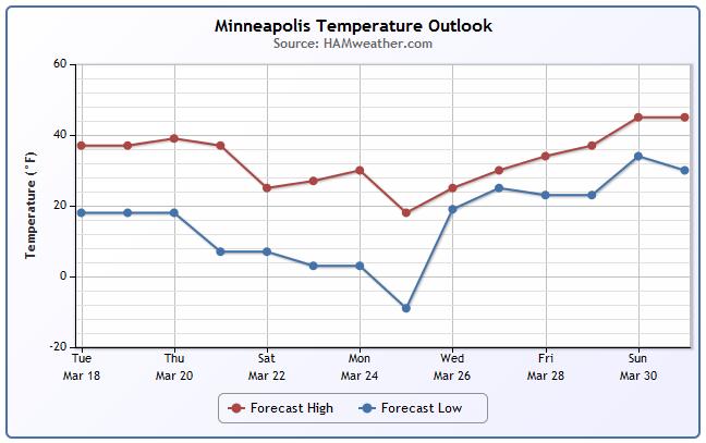
Minneapolis Temp Trend
The temperature through the end of the month still suggests below average temperature for a majority of the time. Temperatures look to take a bigger hit by the weekend/early next.
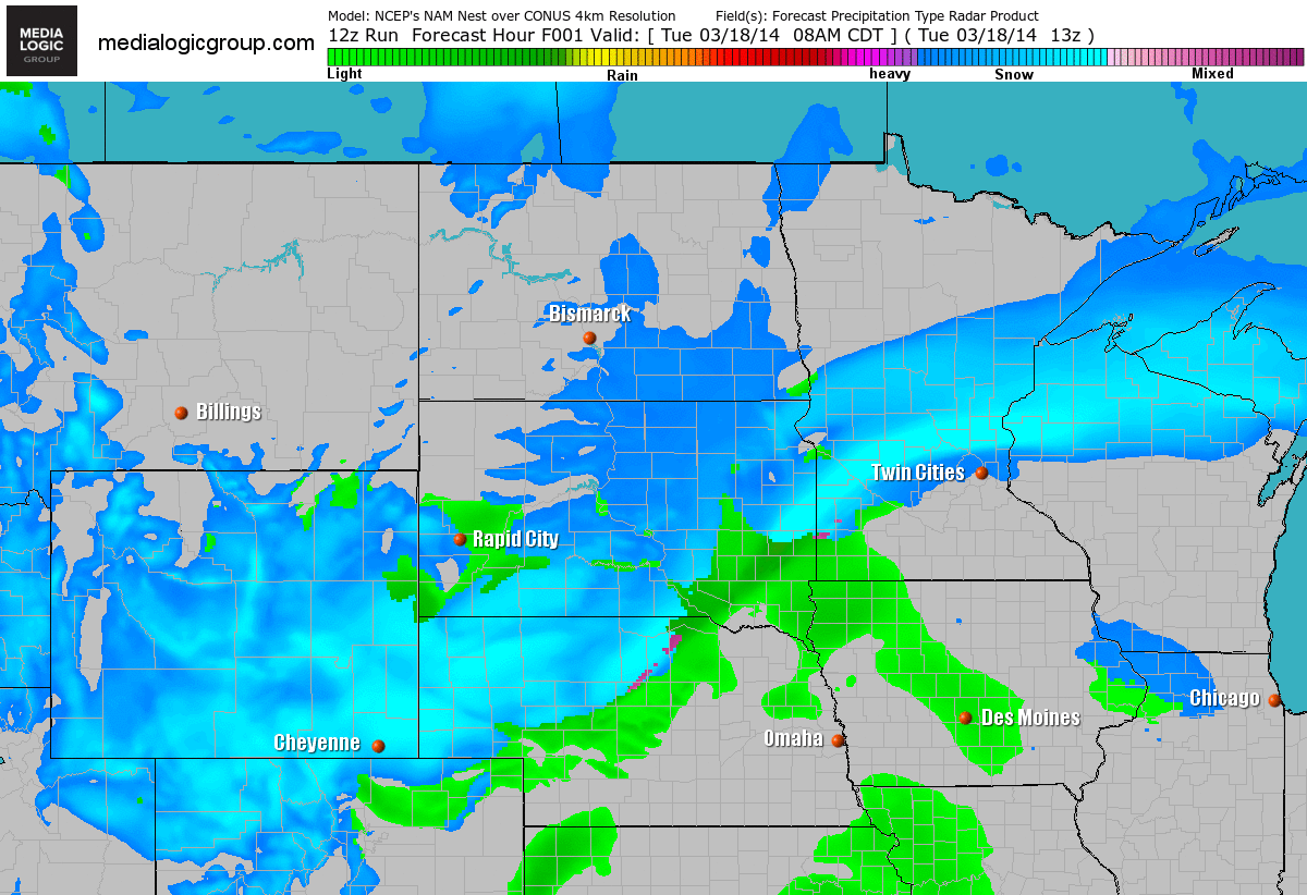
FutureRadar
As we slide into Wednesday, the storm system will begin to shift east of the region. However, Wednesday is expected to be quite breezy with some lingering light snow showers/flurries early in the day. Most of the snow accumulations will be done by late Tuesday night/early Wednesday morning.
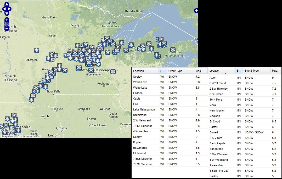
Tuesday Snowfall
Here are some of the preliminary totals through 4:30pm Tuesday (NOT the final storm totals) from around Minnesota and Wisconsin. Note that the greatest tally through that time frame was 9.0" out of Avon, MN.
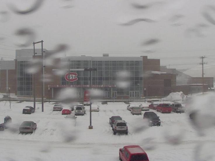
St. Cloud State University
Take a look at this snowy view from St. Cloud State University. This was around 5pm Monday from the Herb Brooks National Hockey Center.
Thanks to my good friend and colleague D.J. Kayser for the image below out of St. Cloud. Prior to Tuesday, St. Cloud had seen nearly 61" of snow on the season, which was nearly 21" above normal!
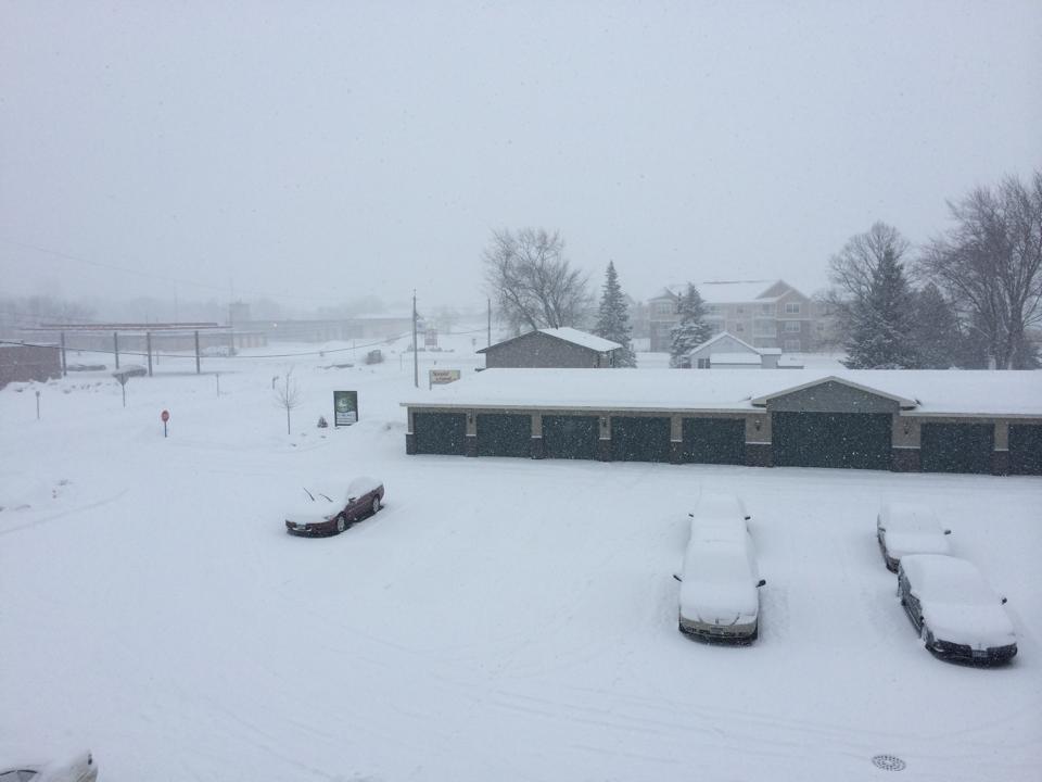
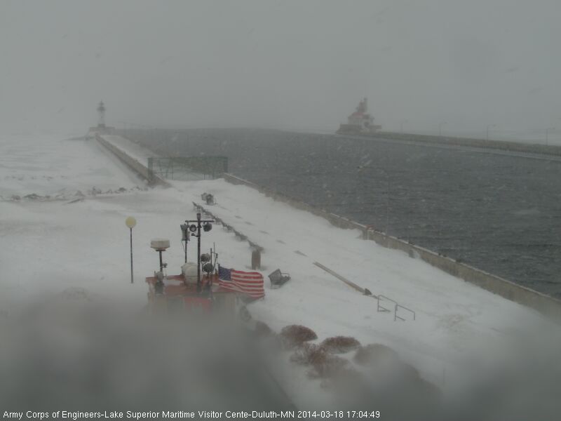
Duluth Webcam
Here was the view from a snowy Duluth early Tuesday evening. Prior to Tuesday, the Duluth seasonal snowfall was 90.1" (+16.1 above normal) Interestingly, in order to get to the top 3 snowiest seasons on record, they would need to see nearly 130". The other interesting stat is that last April, Duluth saw nearly 51" of snow! Let's hope that doesn't happen again.
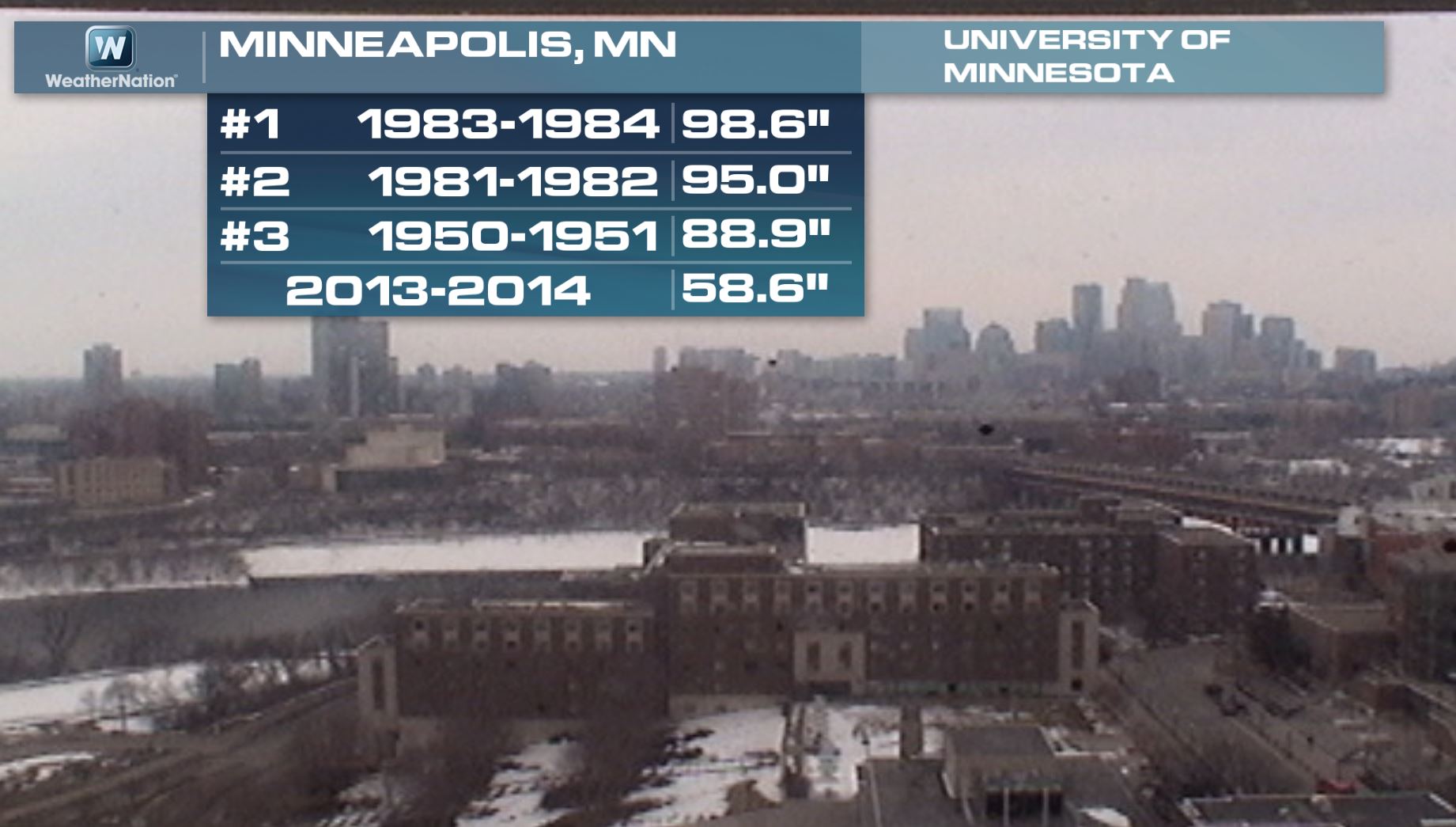
Minneapolis Snow Stat
Prior to Tuesday's snow, Minneapolis had seen nearly 59" of snow, which was still nearly 30" below the 3rd snowiest season on record set in 1950-1951. With that being said, Minneapolis was nearly 10" above normal on the season prior to the snow on Tuesday.
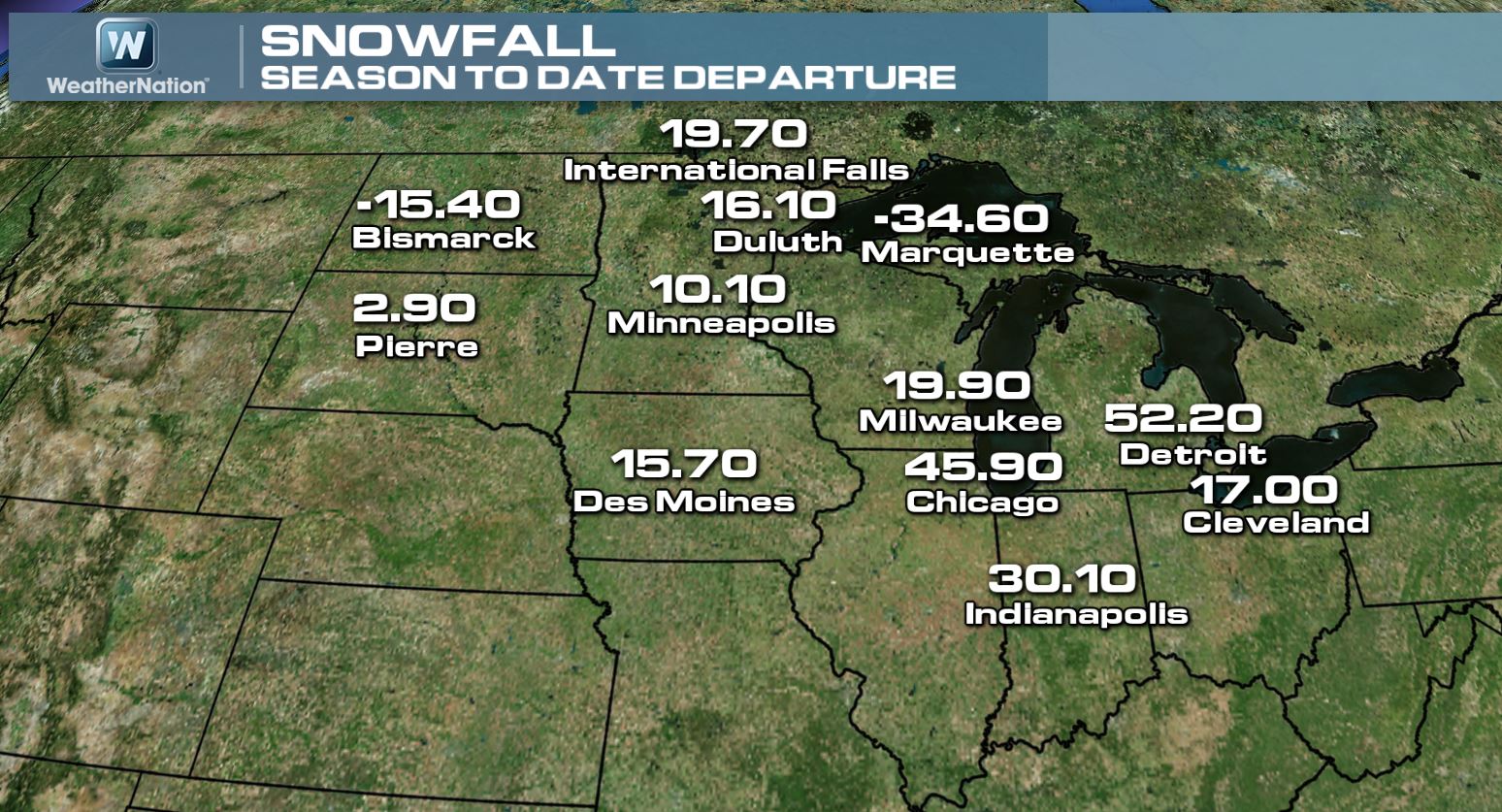
Seasonal Snow Departure From Normal
As of Monday, the seasonal snowfall departures from normal were quite impressive across the Midwest. Look at how much additional snow there is being reported this winter season. Note the significant surpluses near Chicago and Detroit.
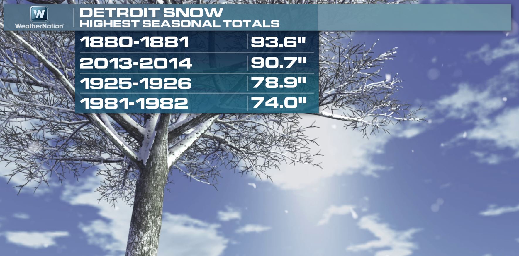
Detroit Snow Stat
According to National Weather Service stats, the near 91" of snow this season in Detroit is good enough for the second snowiest season on record so far. Interestingly, Detroit only needs about 3" of snow to get to the snowiest spot on record! Think we can do it?
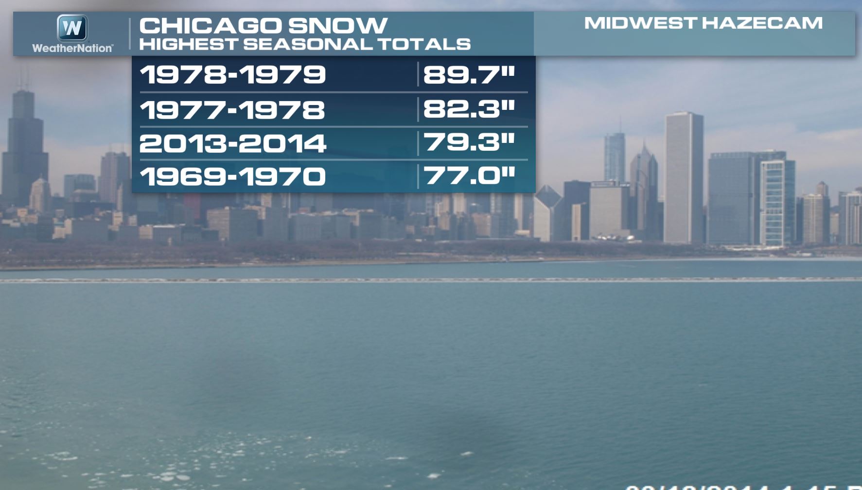
Chicago Snow Stat
As of Monday, Chicago was also in the top 5. In fact, the seasonal tally of 79.3" is good enough for 3rd place so far. A little more than 10" doesn't seem like much after this winter so far, but that's about all we'd need to move into the snowiest season on record spot!
More Snow Stats
Don't forget that we had record snow earlier this week in parts of the Northeast/Mid-Atlantic. Here are a few stats for Philadelphia. With the 4.7" of snow on Monday, Philadelphia has now seen nearly 68" of snow on the season, which is good enough for 2nd place! We still need about 11" to get closer to the snowiest season on record.

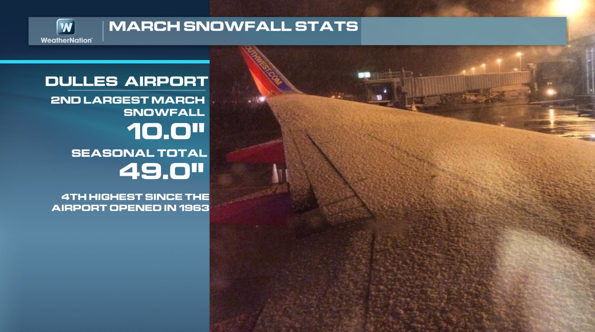
Dulles Airport Stat
10" of storm total snow was recorded at the Dulles Airport, which is good enough for the 2nd largest snow event in March! The seasonal total is now 49", which is the 4th greatest seasonal tally since the airport opened there in 1963!
Not So Spring Like
Tuesday morning was a bit icy across parts of the mid-Atlantic region. Here's a picture from Salisbury, NC, which tells the tale on this frozen semi-spring weather so far. Thanks to Gigi Hall for the image below... Hope you're cherry blossoms make it.

Here's another icy cherry blossom tree from early Tuesday out of Rockwell, NC thanks to @ProdigyNews

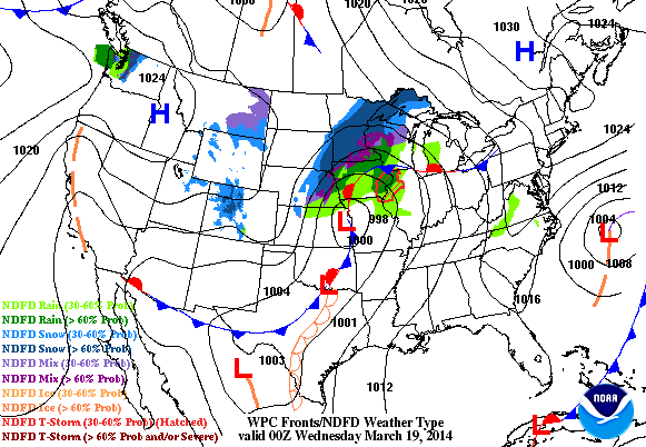
Weather Outlook
As we get rid of one storm system, yet again, another system looks to push into the Upper Midwest by the end of the week. It'll be another round of wintry precipitation with some light accumulations across the international boarder.
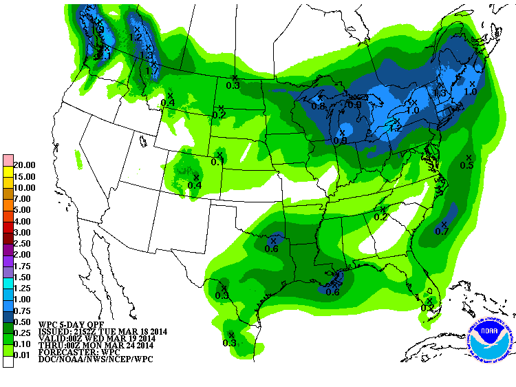
Precipitation Outlook
According to NOAA's HPC 5 day precipitation forecast, the northern tier of the nation shows the best chance of moisture, while a little bit will also be possible across the Lower Mississippi Valley.
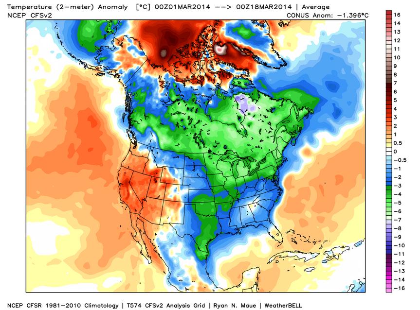
March Temperature Anomaly
Would it surprise you to learn that March has been much cooler than average for a large chunk of North America? All the blues and greens indicate cooler than average conditions for the month thus far. However, the western and southwestern part of the state have been warmer than average.
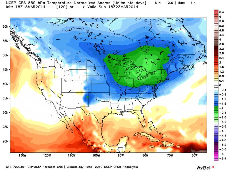
Continued Cold
The 850mb temperature anomaly for this Sunday shows a significantly colder than normal blob of colder air over the northeastern quadrant of the nation. The chilly air will have impacts for much of the eastern two-thirds of the nation for the first weekend of Spring.
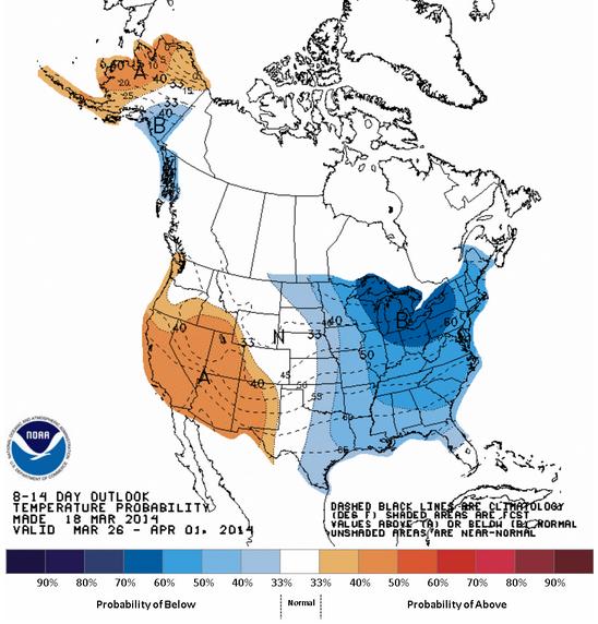
Temperature Outlook
According to NOAA's Climate Prediction Center, the 8 to 14 day temperature outlook shows the eastern half of the country staying colder than average through April 1st, while the western part of the country will be warmer than average.
300 Million Year Old Gear Part Found?
Did you hear about this yet? I just caught wind of it a couple of days ago, but I'm not sure of it's legitimacy... Do you think it's real? Seems strange to me...
"The Earth was so young 300 million years ago, the first land animals had yet to evolve into dinosaurs, most scientists believe. If that's the case, how do you explain the discovery in Russia of a piece of a gear shift -- a common machine part -- embedded into a hunk of 300-million-year-old coal. Has this artifact been correctly identified? And if so, who could have made this thing? And for what purpose?"
Read more from the HuffingtonPost.com HERE:
Thanks for checking in and have a great rest of your week! Don't forget to follow me on Twitter @TNelsonWNTV

No comments:
Post a Comment