By Todd Nelson
Mother Nature is rebooting her computer, hold on ... ... ...
Between temperature running nearly 8.5F below average and the weather stuck between seasons, it appears that we have run into some sort of unforeseen glitch in the Spring matrix.
March, to me, always seems to be one of those blah months as the atmosphere wrestles with itself. Sloppy snow storms generally melt quickly, but the end result leads to monster size pothole lakes, which don't look too threatening until; WHACK! You throw out the alignment in your car.
As we continue playing pothole Frogger over the next several weeks, the active weather pattern looks to continue. The good news is that temperatures will feel a little more 'Springy' on Sunday as we jump into the 40s and 50s across the southern half of the state. Enjoy it because it looks to be short-lived. Another similar rain/snow mix storm looks to take us out of March with cooler than average temperatures returning by April 1st... it's no joke!
I'm hoping the reboot process doesn't take too long, my golf game is really starting to suffer. Besides, who likes looking at dirty snowbanks anyway? Collectively, let's think Spring!
===========
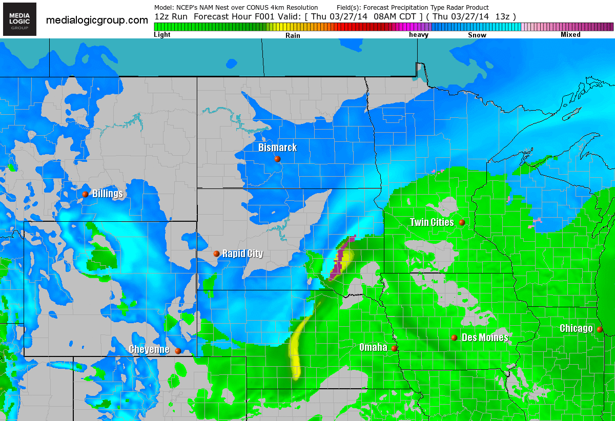
THURSDAY NIGHT: Rain/snow ending early. Up to 1" slop possible. Low: 22. Winds: NW 10-15.
FRIDAY: Quiet with less wind and more sun. High: 35. Winds: NNW5-15.
FRIDAY NIGHT: More clouds, mostly quiet. Low: 18. Winds: Light N.
SATURDAY: A bit breezy with bright sun. High: 42. Winds: SSE 10-20.
SUNDAY: Above average temperatures... that's weird! Fading sunshine by the afternoon with rain developing late. Wake-up: 35. High: 54.
MONDAY: Breezy. Rain changes to snow. Wake-up: 37. High: 41.
TUESDAY: April Fools' Day. Sunny start... we hope! Wake-up: 20. High: 35.
WEDNESDAY: Watching storm to the south. Wake-up: 22. High: 37.
THURSDAY: Still below average temperatures. Wake-up: 25. High: 42
=============
This Day in Weather History
March 28th
1924: A drought was broken in Southern Minnesota with style as 25 inches of snow fell.
=============
Sunrise/Sunset Times
March 28th
SUNRISE 701 AM
SUNSET 736 PM
==============
Moon Phase for March 28th at Midnight
1.5 Days Before New Moon

===============
Weather Outlook
Warmer Weekend?
Considering that we haven't had a weekend (both Saturday and Sunday with highs in the 40s or greater) since mid November, this weekend is going to feel exceptionally warm! The numbers below are the last time we've had highs in the 40s or warmer both weekend days!
Saturday, November 16th: 50F
Sunday, November 17th: 46F
Weekend Outlook
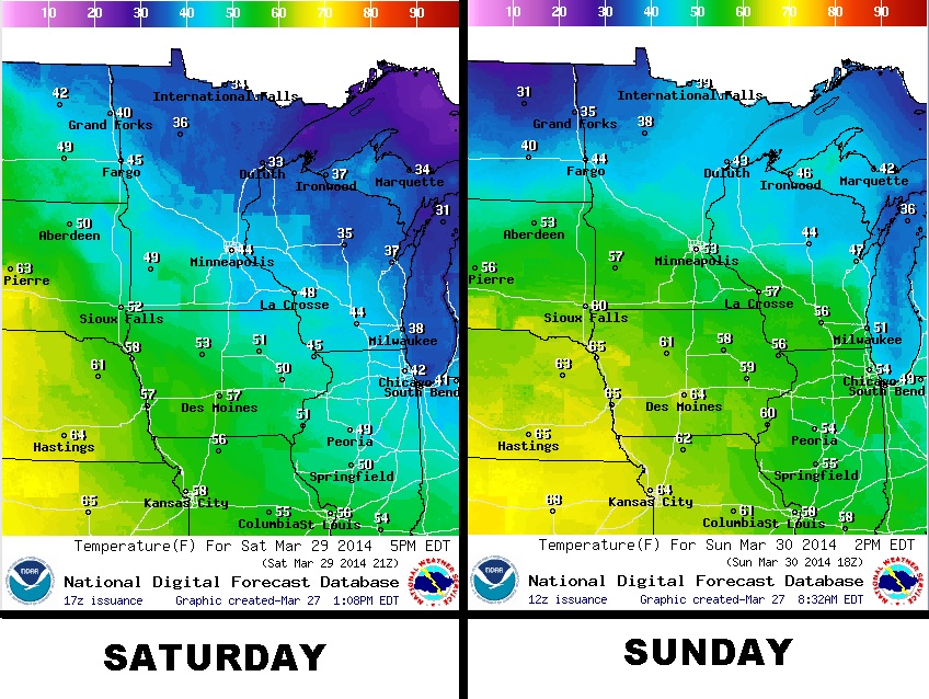
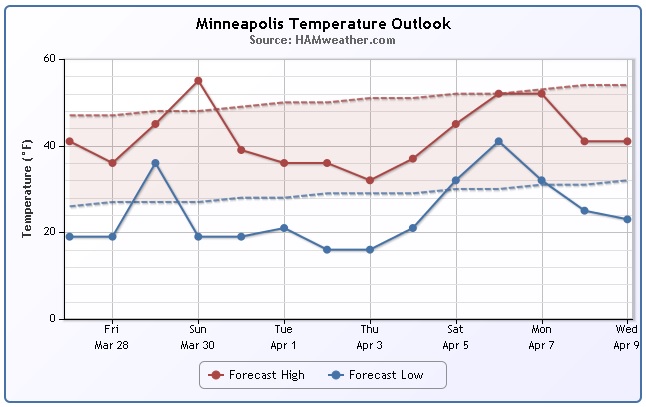
Minneapolis Temperature Trend
The item that peaks my interest is the data point for Sunday, March 30th! High temperatures are still expected to top out in the 50s for Minneapolis prior to another dip into next week. Note that the dip into next week doesn't appear to be as severe as it was in early March and it appears that we pull out of it rather quickly by the first weekend of April 2014.
========================
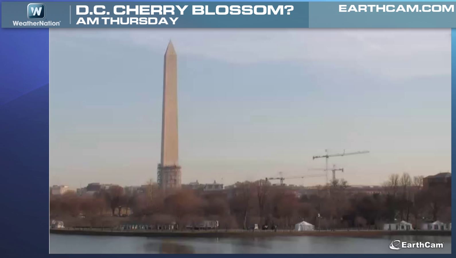
Cherry Blossom Festival Continues
The Cherry Blossom Festival continues in Washington D.C., but we're lacking blossoms here at the end of March. Organizers still suggests that the peak will arrive around mid April, which gives us another couple of weeks. The snow and colder than average temperatures have been delaying the blooms so far.
See more from the National Cherry Blossom Festival HERE:
2nd Snowiest Winter For Washington D.C.
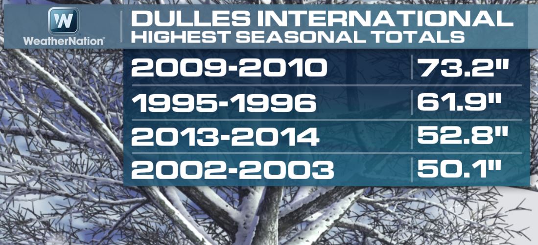
Thanks to the snowfall earlier this week, Washington Dulles International Airport is now considered to be at their 3rd snowiest winter in recorded history with a total of 52.8" (+31.3" above normal) !!
2nd Snowiest Winter For Philadelphia
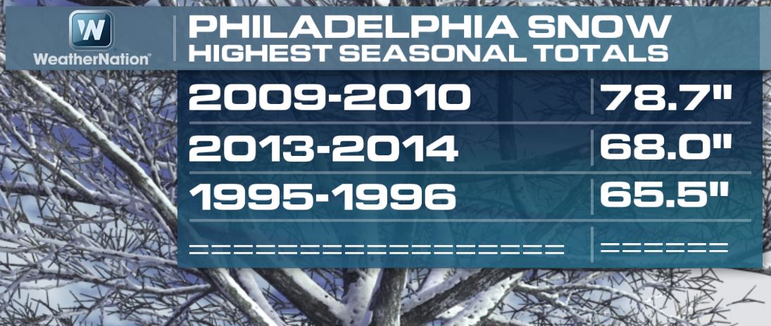
Snow in Philadelphia, PA has been quite impressive this winter season too. In fact, we are now sitting at the 2nd snowiest winter in recorded history with 68" (+46.3" above normal) !!
Snow From Normal
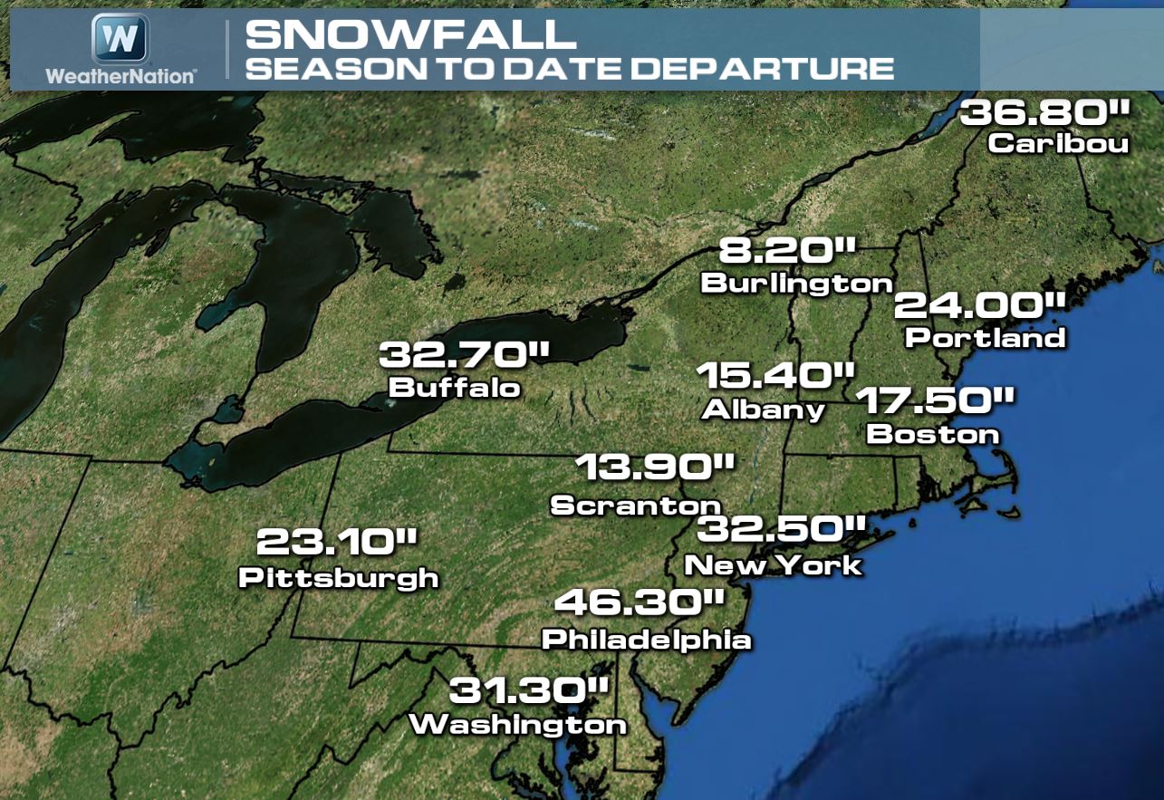
Here is the wider view of seasonal snow departures from normal. Look at how many locations are dealing with double digit surpluses!
Brutal Winds
Take a look at this picture from Nova Scotia on Wednesday. The strong storm that clipped the the coastal communities in the Northeast also blew into Nova Scotia where eagletallion had a hard time bringing back a piece of paneling that blew down the street.
the video is pretty good from Instagram HERE:

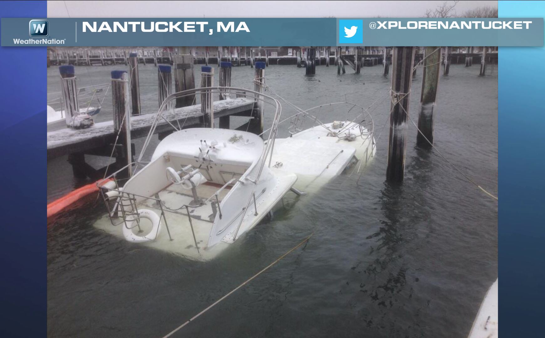
Storm Damage
The storm was responsible for an 82mph wind gust at Nantucket, MA. The end result caused some damage and this unfortunate sight.
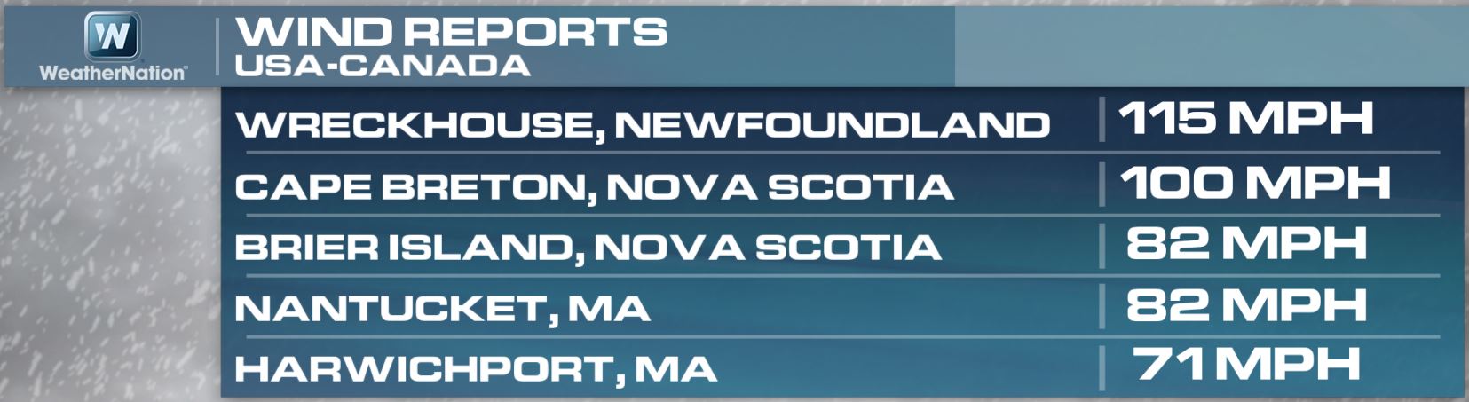
Strongest Winds Recorded
These wind gusts are insane and comparable to that of a category 1 or category 2 hurricane!
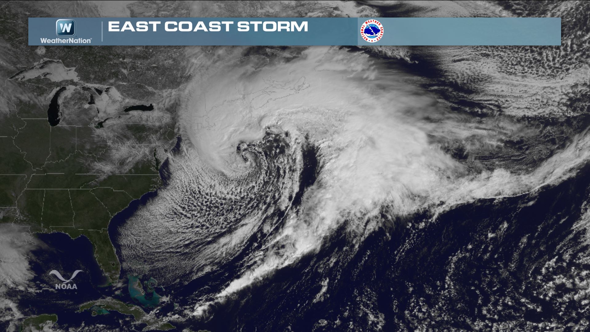
Visible Satellite from Midday Wednesday
It really was a beautiful storm... You don't see ones like this very often, but the visible satellite from Wednesday showed an impressive fully mature storm system.
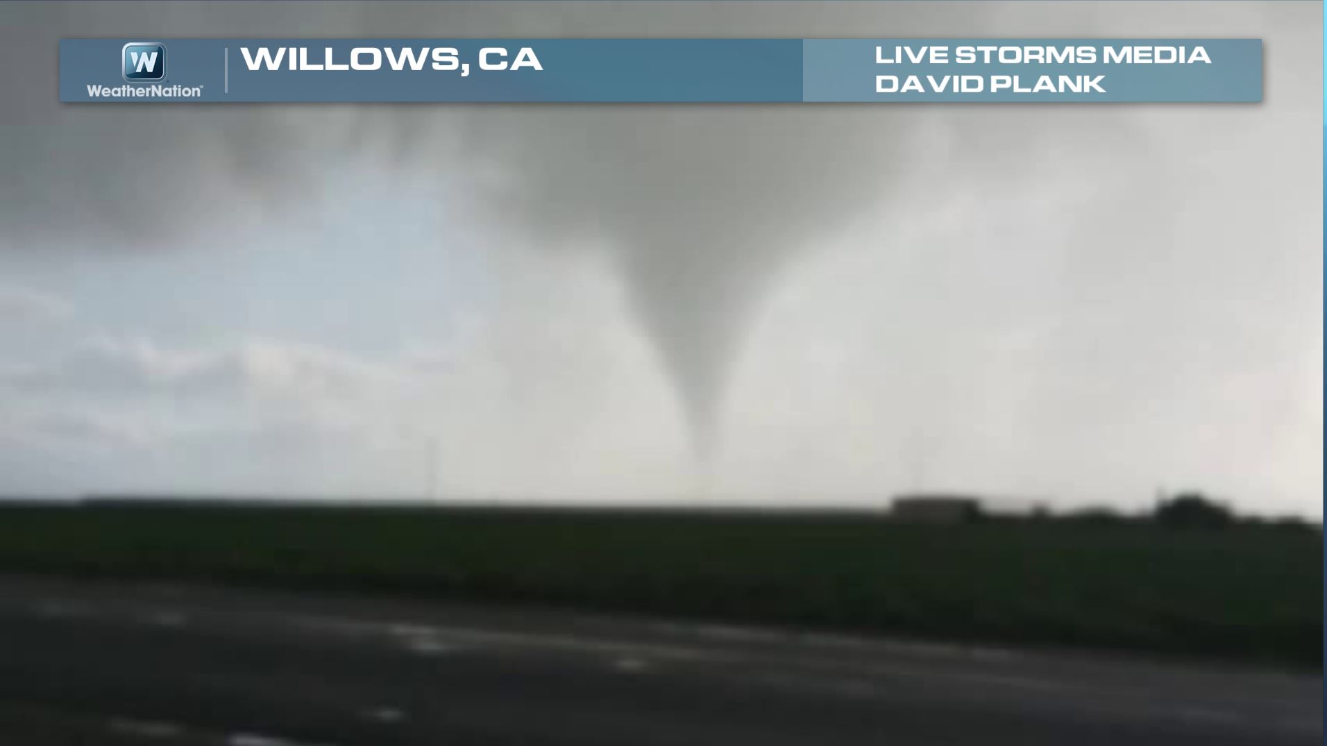
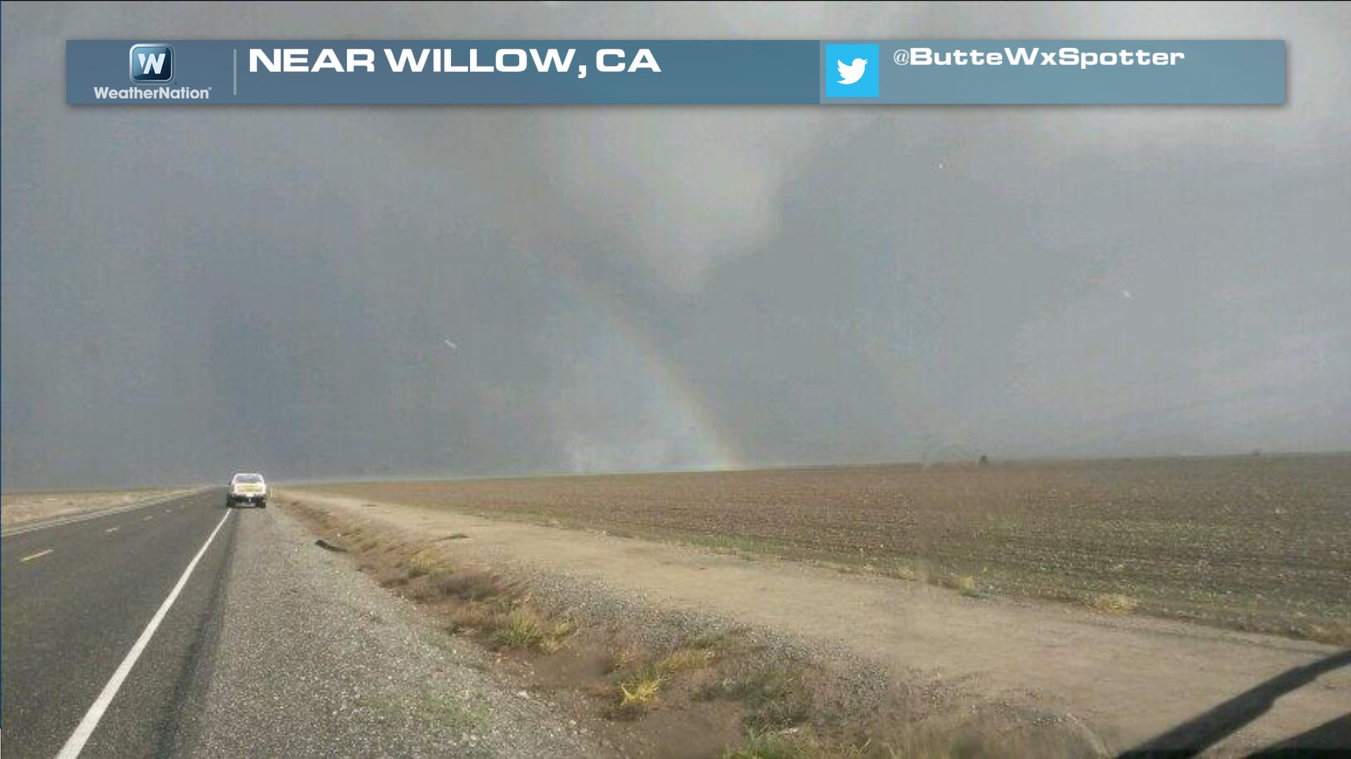
California Tornado??
WOW! Take a look at this rare sight out of Willows, CA. The National Weather Service confirmed an EF0 tornado north of Sacramento, CA on Wednesday. Thanks to David Plank via Live Storms Media!
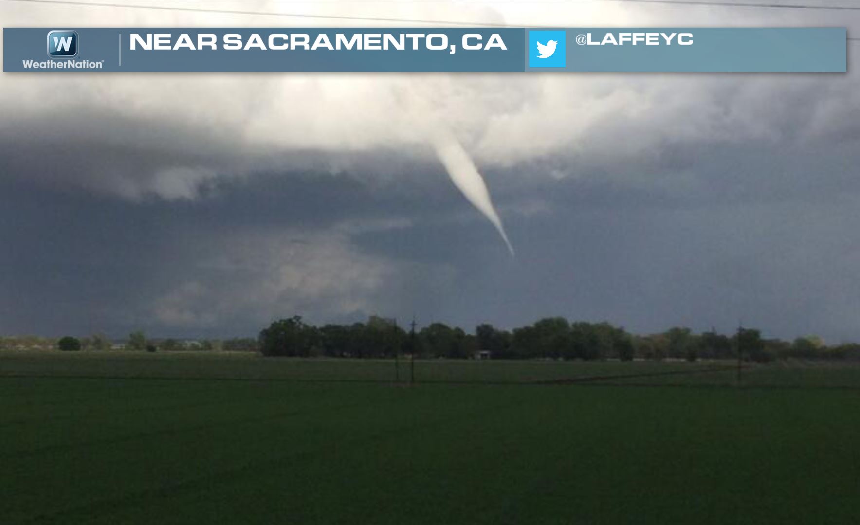
Here was another view of a funnel cloud near Sacramento, CA thanks to @LAFFEYC
@ButteWxSpotter snapped this pretty incredible picture with a funnel cloud and a rainbow! Wow!
California Tornado Reports
Here are some of the storm reports that were sent in on Wednesday:
Willows, CA:
EF1 TORNADO. TIME 530 PM TO 600 PM PDT. MULTIPLE TOUCHDOWNS ALONG COUNTY ROAD 39 BETWEEN ROADS P AND TT. DAMAGE PATH 24 FEET WIDE BY 1500 FEET LONG. WINDS UP TO 100 MPH
TORNADO ON GROUND BETWEEN WILLOWS AND GLENN. SPOTTER EL34.
Bluegum, CA:
CONFIRMED TORNADO ON THE GROUND, ABOUT 3-5 MILES EAST OF I-5, SPOTTER WAS LOCATED 2 MILES EAST OF I-5 AT COUNTY ROAD 39 AND ROAD P.
Roseville, CA:
EF0 TORNADO IN MARKET ST-FILLINGHAM LN-KIRIKTON LN-SYKE CT AREA OF WEST ROSEVILLE BETWEEN 615 PM-620 PM 03/26/2014 ESTIMATED 75-85 MPH WINDS, TORNADO WIDTH 10-20 YARDS,
Ordbend, CA:
ROW OF ALMOND TREES DOWN, CAR WINDOWS BLOWN IN, AND WALNUT TREES DOWN AROUND 2 MILES E OF I-5 AND CR 39 AROUND 543PM - 6PM 3/26/14.
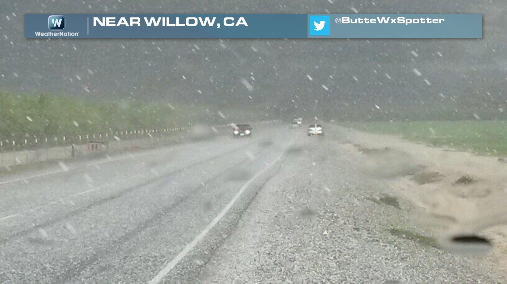
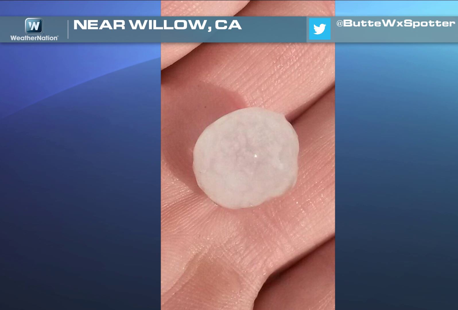
California Hail
Hail can often be a precursor to a tornado as you tend to be closer to the updraft of a thunderstorm, which is where a tornado would be located. Here was a picture of hail falling near Willow, CA, which is where one of the tornadoes was found.
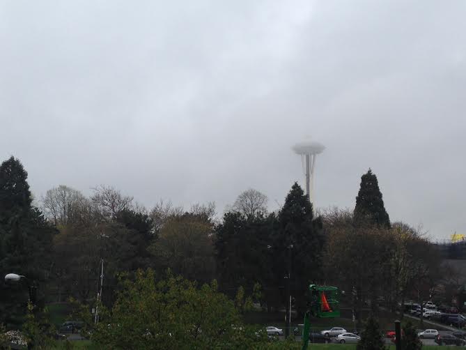
A Wet March in Seattle, WA
To say that this month has been wet is an understatement. It seems as if the spicket won't shut off. Thanks to my good friend Nicholas Shipes for the picture below from Thursday.
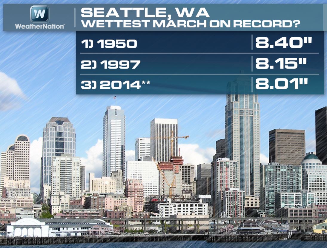
3rd Wettest March in Seattle, WA
As of Wednesday, the monthly precipitation tally was up to 8.01" and nearly 5" above normal. As of Wednesday, Seattle was at the 3rd wettest March on record.
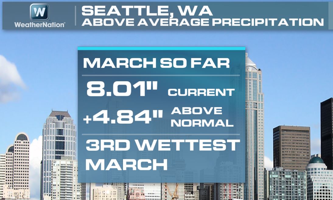
To be honest, we don't need to much additional moisture to make it to the 2nd or even wettest March on record... Stay tuned!
Weather Outlook
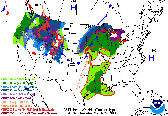
Here's the weather outlook through AM Saturday. Note the fairly active setup that unfolds through that time frame. The biggest threat over the next couple of days is going to be the severe threat from the Lower Mississippi Valley to the Southeastern coast. Hail and high winds look to be the primary threat, but isolated tornadoes can't be ruled, especially on Friday.
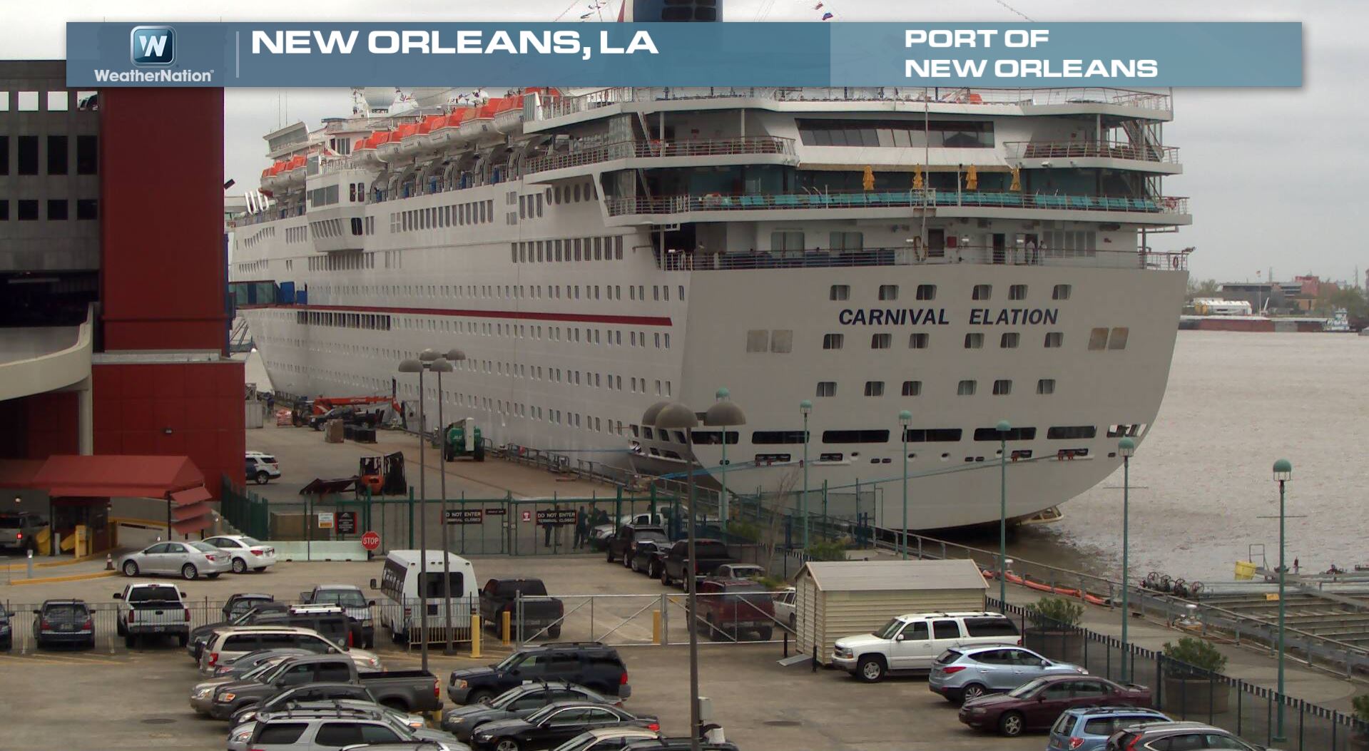
Severe Threat Increases
This was the view out at Port of New Orleans in New Orleans, LA on Thursday. New Orleans is set to get some strong to severe thunderstorms later Friday...
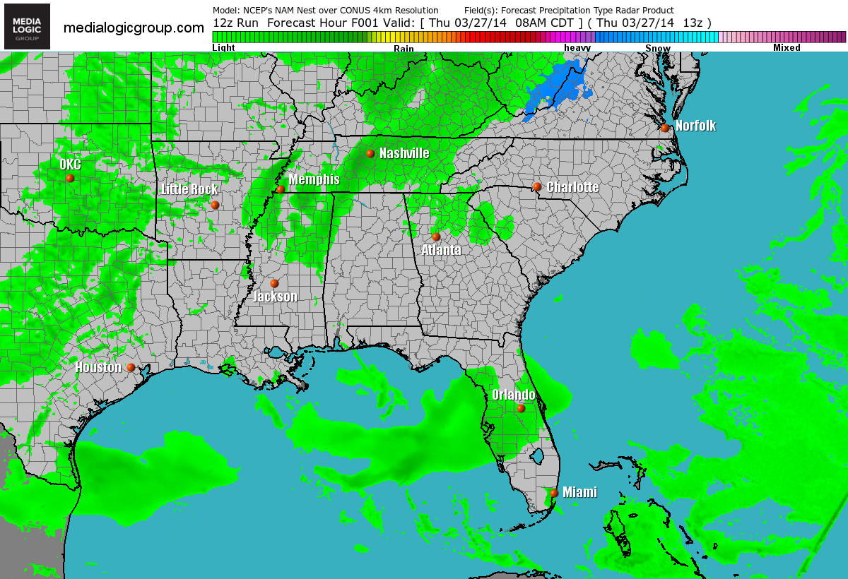
Future Radar
It's a stormy outlook for folks in the southeastern part of the country over the next couple of days. An area of low pressure will develop on the southwestern flank of the cold front and help to continue our unsettled ways through Saturday. Here's the weather outlook across the southeastern part of the country through AM Saturday.
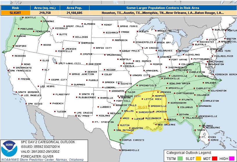
Severe Threat Friday
Here's the latest thinking from NOAA's Storm Prediction Center:
SFC LI'S ARE FORECAST TO BE FROM -4 TO -6 AND THE CRAVEN/BROOKS PARAMETER IS FORECAST TO BE 40,000 M3/S3 OR GREATER DURING THE AFTERNOON HOURS. WITH AT LEAST A MODERATELY UNSTABLE BOUNDARY LAYER /2000-2500 J PER KG MLCAPE AND PERHAPS LOCALLY HIGHER/ IS EXPECTED BY AFTERNOON ACROSS EAST TX/ARKLATEX TO THE LOWER MS VALLEY. AIDED BY STRENGTHENING MID-LEVEL WESTERLIES...RELATIVELY LONG/SOMEWHAT STRAIGHT HODOGRAPHS WITH 40+ KT EFFECTIVE SHEAR WILL SUPPORT THE DEVELOPMENT OF SPLITTING STORMS/SUPERCELLS DURING THE AFTERNOON. IT IS BELIEVED THAT LARGE HAIL WILL BE THE PRIMARY HAZARD THROUGH THE AFTERNOON...WITH SOME DAMAGING WIND/ISOLATED TORNADO RISK AS WELL. WITH TIME...STORMS SHOULD CONSOLIDATE/GROW UPSCALE INTO ONE OR MORE QUASI-LINEAR BANDS/POSSIBLE MCS AS EARLY AS LATE AFTERNOON OR EARLY EVENING AS STORMS SHIFT EASTWARD TOWARD/ACROSS THE LOWER MS VALLEY. THIS COULD LEAD TO AN INCREASED DAMAGING WIND RISK BY EVENING ASIDE FROM SOME TORNADO POTENTIAL...ALTHOUGH VEERED/ONLY MODESTLY STRONG LOW-LEVEL FLOW WILL TEND TO TEMPER THE OVERALL TORNADO POTENTIAL.
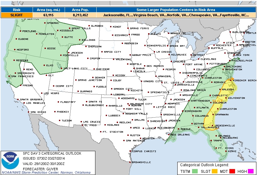
Severe Threat Saturday
SCATTERED/POTENTIALLY NUMEROUS CORRIDORS OF SHOWERS/EMBEDDED TSTMS ARE EXPECTED TO BE ONGOING SATURDAY MORNING ACROSS A BROAD PART OF THE REGION. ALTHOUGH LOW-LEVEL MOISTURE WILL BE INCREASING AHEAD OF THE COLD FRONT...THE PREVALENCE OF EARLY DAY SHOWERS/TSTMS ARE LIKELY TO HINDER APPRECIABLE DESTABILIZATION...FURTHER COMPOUNDED BY THE EXPECTED WEAKNESS OF MID-LEVEL LAPSE RATES ATOP THE WARM SECTOR. REGARDLESS...THE OVERALL SCENARIO/SOME HEATING MAY HELP SUSTAIN EARLY DAY STORMS ACROSS PARTS OF NORTH FL/GA...WHILE A MODEST AFTERNOON UPSWING IN TSTM DEVELOPMENT/INTENSITY COULD OCCUR ACROSS PARTS OF THE CAROLINAS/FAR SOUTHEAST VA. LINE SEGMENTS CAPABLE OF ISOLATED WIND DAMAGE WOULD BE THE PRIMARY HAZARD THROUGH THE EARLY EVENING HOURS.
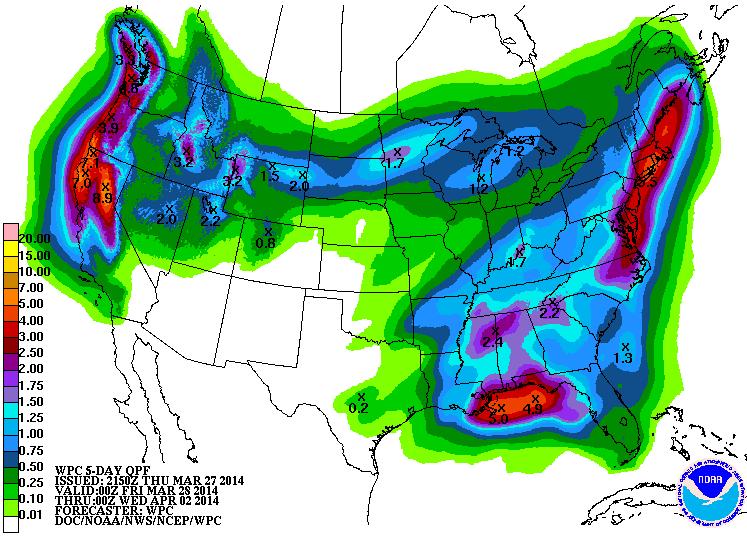
Precipitation Outlook
According to NOAA's HPC, the 5 day precipitation outlook looks quite soggy for nearly every region across the country except for the Southwest and into parts of the Southern Plains.
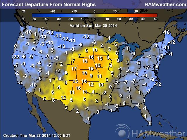
Signs of Spring?
It appears that we will have a brief level of more spring like temperatures moving into the middle part of the country, but it will be brief. The forecast for departure from normal temperatures shows readings nearly 10F to 20F above normal across the middle part of the country on Sunday.
Sunday, March 30th
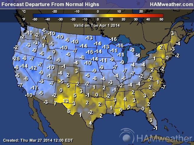
Tuesday, April 1st
Here's the temperature outlook for Tuesday, April 1st, which looks chilly once again for much of the nation.
Thanks for checking in and have a great weekend ahead! Don't forget to follow me on Twitter @TNelsonWNTV

No comments:
Post a Comment