By Paul Douglas
Stare at the weather maps long enough and you begin to hallucinate. I don't recommend it. Weather has always been unpredictable and erratic, but are the patterns shifting in new and odd ways? One trend I've noticed in recent years is a general slowing of weather systems; greater amplitude of the jet stream sparking periods where weather stalls for days, even weeks. At first I thought it was my imagination, but new research from Rutgers and other universities seem to bolster the theory that rapid warming of the Arctic MAY be impacting the speed and configuration of steering winds over the Northern Hemisphere. When weather stalls bad things can result: record floods, deeper, drier droughts, record heatwaves and wildfires.
Early next week a storm will temporarily stall over Indiana. pulling waves of moisture into Minnesota from Sunday into Wednesday.
The atmosphere should be just warm enough for rain. Hopefully no rerun of April 2013, when 18 inches of snow fell. 7 inches has piled up this month.
The sun peeks out Friday, afternoon highs brushing 60F. Plan your yard work for Saturday; showers return Sunday with a cold rain Monday. Next week looks cool, ragged and showery.
====================
THURSDAY NIGHT: Lingering showers early. Otherwise mostly cloudy Low: 39. Wind: WNW 5-10.
FRIDAY: Some sun, hints of spring later. High: 63. Winds: WNW 5-15
FRIDAY NIGHT: Partly cloudy and cool. Low: 37. Winds: NNE 5-10
SATURDAY: Dry start. Clouds thicken with rain developing late. High: 58. Winds: E 10-15
SUNDAY: Unsettled with a few showers. Wake-up: 42. High: 52
MONDAY: Steadier, heavier rain. Wake-up: 44 High: 49
TUESDAY: Rain tapers. Wake-up: 42. High: 53.
WEDNESDAY: Another round of showers? Wake-up: 38. High: 51
THURSDAY: More clouds than sun. Wake-up: 37. High: 56.
=====================
This Day in Weather History
April 25th
1996: Heavy snow over northern Minnesota. 10 inches of snow at Baudette. The International Falls airport closed for only the second time in history.
=====================
Sunrise/Sunset Times
April 25th
SUNRISE 612 AM
SUNSET 811 PM
======================
MSP Average for April 25th
High: 63F
Low: 42F
=====================
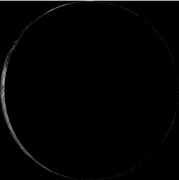
Moon Phase for April 24th at Midnight
3 Days Before New Moon
==========================
Severe Weather Awareness Week Continues
Friday's Topic: EXTREME HEAT
Extreme Heat
Minnesota's Third Deadliest Weather Factor Since 1990...
The third greatest number of weather fatalities in Minnesota since 1990 has been due to excessive heat. Eighteen people have died from high heat and humidity. Only tornadoes and flooding have killed more people in the last 24 years.
Wisconsin's Deadliest Weather Factor Since 1982...
The greatest number of weather fatalities in Wisconsin since 1982 has been due to excessive heat. 134 people have died from high heat and humidity. This total is more than tornadoes, flooding, blizzards or anything else. The 1995 summer heat waves hold the record as the number one weather-related killer in Wisconsin since it became a state in 1848. Most deaths occurred in the major urban areas in southeast Wisconsin, but there have been a number of fatalities in the rest of the state as well.
Read more from the National Weather Service HERE:
============================
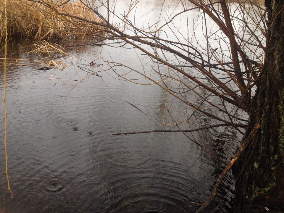
Soggy Thursday
Ahh... well, we haven't had a day like Thursday's steady rain in quite some time. Too bad I wasn't able to take advantage of it on the couch or in bed napping. Thanks to Emily Schmidt for the picture below out of Waite Park, MN.
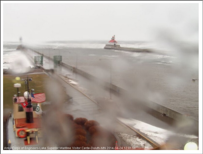
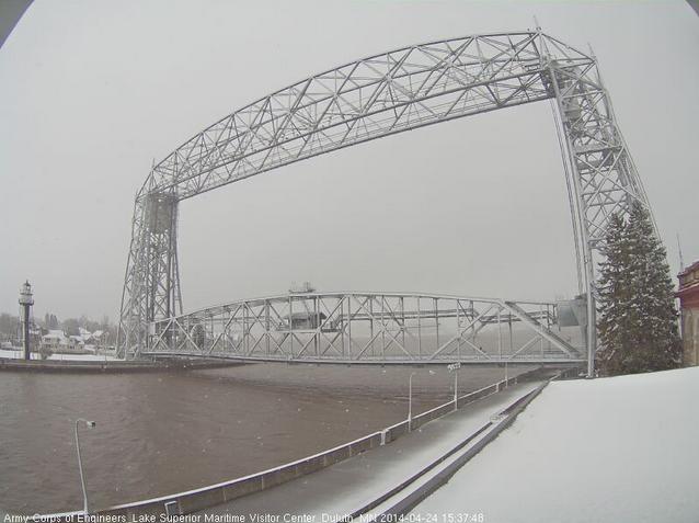
Snow Up North
While most of the state was getting rain on Thursday, snow was falling across the northern part of the state. This was the view from Park Point in downtown Duluth, MN around midday Thursday while snow was reported falling over the hill. As of Wednesday, April 23rd, Duluth had seen 125.3" of snow this season (+40.5" above normal), which is the 5th snowiest season on record!
Last season 2012-2013 saw 129.4" and was the 3rd snowiest season on record. The snowiest season on record is 135.4" set in 1995-1996.
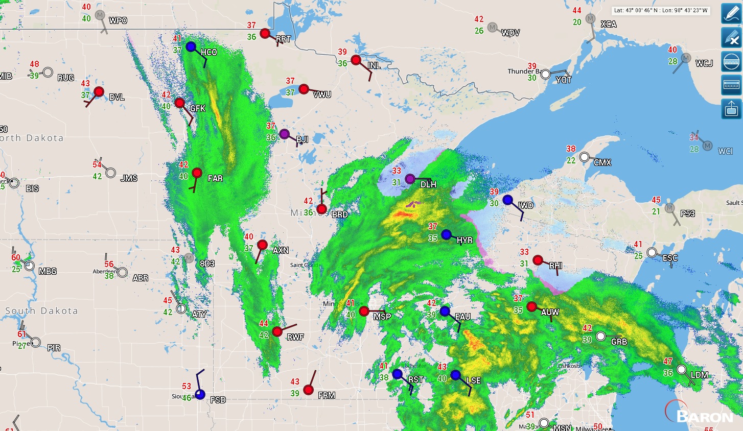
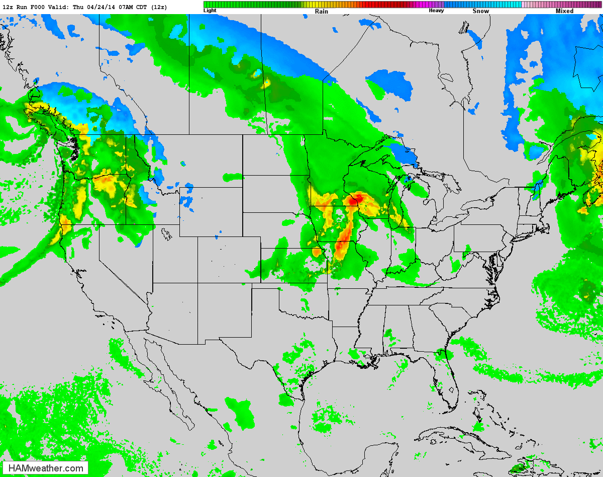
Midday Thursday Weather
This is what the radar looked like midday Thursday as the northern flank of the storm system was sloshing through the Midwest. Note that most areas were seeing rain, while just a few areas on the northern tip of the precipitation field were seeing snow near Lake Superior.
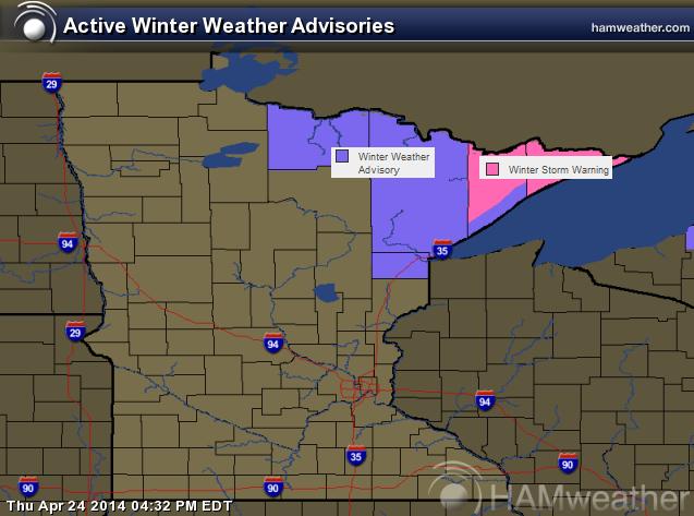
Winter Weather Headlines
...A SNOWY NIGHT ACROSS MUCH OF THE NORTHLAND... .A LOW PRESSURE SYSTEM WILL BRING ACCUMULATING SNOWFALL TO MUCH OF THE NORTHLAND TONIGHT AND INTO FRIDAY MORNING. SNOWFALL IS EXPECTED TO RANGE FROM AN INCH OR LESS FROM EAST CENTRAL MINNESOTA INTO HAYWARD AND PHILLIPS...TO AS MUCH AS A FOOT IN THE TIP OF THE MINNESOTA ARROWHEAD. TWO TO FIVE INCHES OF TOTAL SNOW IS EXPECTED IN THE DULUTH AREA...ESPECIALLY IN THE HIGHER TERRAIN NEAR LAKE SUPERIOR. ROAD CONDITIONS WILL BE VERY SLIPPERY OVERNIGHT AS THE SLUSHY SNOW ACCUMULATES. IF YOU WILL BE DRIVING ACROSS THE REGION OVERNIGHT...BE SURE TO ALLOW PLENTY OF TIME TO REACH YOUR DESTINATION SAFELY.
...WINTER STORM WARNING REMAINS IN EFFECT UNTIL NOON CDT FRIDAY...
* LOCATION...THE ARROWHEAD OF MINNESOTA...INCLUDING ISABELLA... LUTSEN...GRAND MARAIS...GRAND PORTAGE AND THE GUNFLINT TRAIL. * TIMING...TONIGHT THROUGH NOON FRIDAY. * SNOW...8 TO 13 INCHES OF SNOW IS EXPECTED...WITH THE HIGHEST AMOUNTS IN THE EXTREME NORTHEASTERN TIP OF THE ARROWHEAD. * IMPACTS...ROADS WILL BE SNOW COVERED AND SLIPPERY.
...WINTER WEATHER ADVISORY IN EFFECT UNTIL MIDNIGHT CDT TONIGHT...
THE NATIONAL WEATHER SERVICE IN DULUTH HAS ISSUED A WINTER WEATHER ADVISORY FOR SNOW...WHICH IS IN EFFECT UNTIL MIDNIGHT CDT TONIGHT. * LOCATION...DULUTH...CLOQUET...FLOODWOOD...CARLTON AND MOOSE LAKE. * TIMING...TONIGHT THROUGH MIDNIGHT. * SNOW ACCUMULATIONS...3 TO 5 INCHES IS EXPECTED. * IMPACTS...ROADS WILL BE SNOW COVERED AND SLIPPERY.
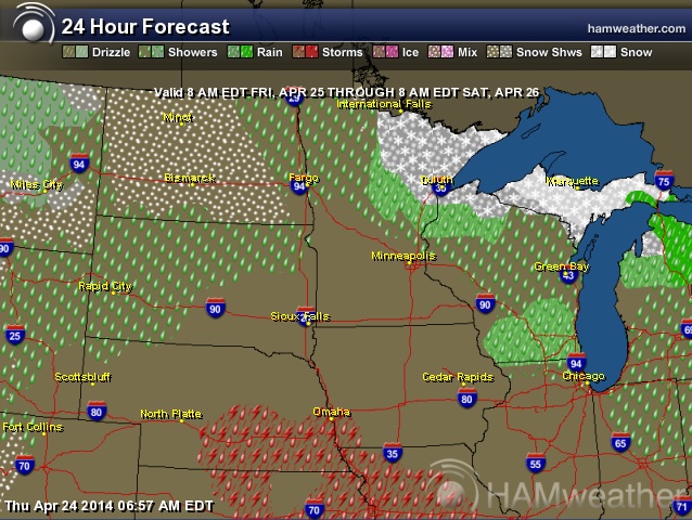
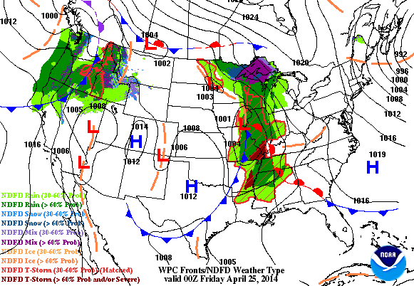
Friday Weather
Weather conditions will be improving a bit on Friday as the storm system begins to shift east. Any lingering rain/snow on Friday will continue to taper prior to our next system moving in over the weekend. The image below suggests weather conditions from 8AM Friday through 8AM Saturday.
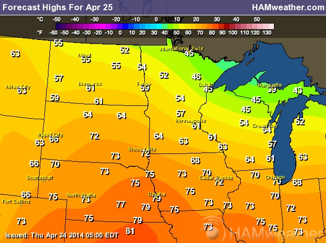
Friday Temps
Enjoy the weather on Friday as another waterlogged storm system will push into the region over the weekend. Hints of Spring return on Friday as temperatures warm into the 60s and 70s in spots across the Midwest.
Weather Outlook
The loop below from AM Thursday through PM Sunday shows one storm exiting the on Friday, while another fairly potent storm system takes its place over the weekend. Not only will heavy rain be an issue, but severe weather will also be a concern. The severe threat looks to be an ongoing issue into early next week.
Severe Threat Friday
The severe threat for Friday will be confined to the extreme eastern part of the country. Portions of North Carolina and Virginia could see some stronger storm later Friday with hail and high wind the primary threat.
...SERN VA SWD ACROSS THE ERN NC VICINITY... AFTERNOON HEATING OF A RELATIVELY MOIST BOUNDARY LAYER WILL CONTRIBUTE TO INCREASING CAPE DEVELOPMENT ACROSS ERN NC AND VICINITY...AHEAD OF THE ADVANCING COLD FRONT AND ASSOCIATED UPPER VORT MAX. AS THIS OCCURS...A DIURNAL INCREASE IN AFTERNOON CONVECTIVE COVERAGE/INTENSITY IS EXPECTED...WITH UPDRAFT ORGANIZATION AIDED BY AMPLE SHEAR ON ACCOUNT OF 40 TO 50 KT WLYS AT MID-LEVELS SPREADING ACROSS THIS REGION ON THE SRN FRINGE OF THE UPPER SYSTEM. ALONG WITH RISK FOR HAIL WITH STRONGER CELLS...LOCALLY DAMAGING WINDS WILL ALSO BE POSSIBLE -- PARTICULARLY IF SOME UPSCALE GROWTH INTO SMALL LINES/CLUSTERS CAN OCCUR -- AS APPEARS POSSIBLE ATTM. THE SEVERE RISK WILL DIMINISH THROUGH THE EVENING...AS THE AIRMASS GRADUALLY STABILIZES AND CONVECTION MOVES OFFSHORE.
Next Pacific Storm
Take a look at the big storm system moving into the western part of the country. This potent storm looks to bring quite a bit of moisture to the western part of the country over the next few days, some of which will be in the form of high elevation snow prior to moving into the middle part of the country with severe weather chances.
Snow For Yosemite National Park
This was the view from Yosemite National Park on Thursday afternoon. Note the dark clouds gathering as the storm system was moving in.
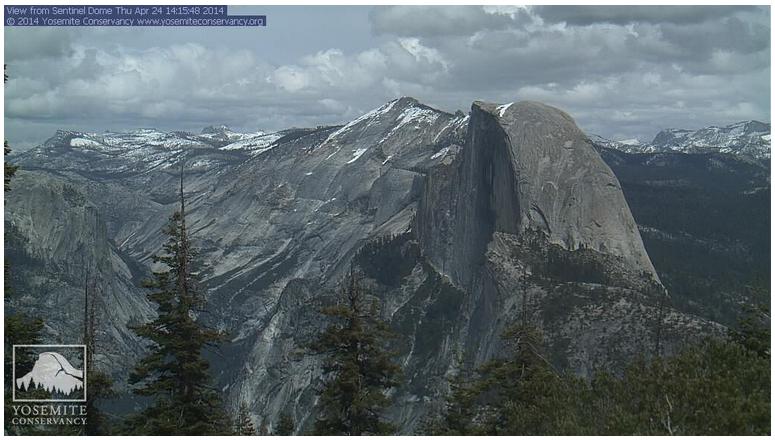
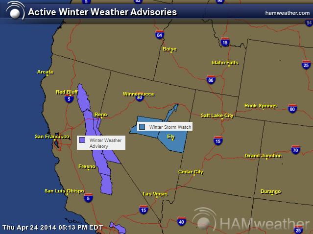
Winter Returns to the West
The Pacific storm system moving into the western part of the country will bring wind, rain and heavy snow. Yosemite National Park in the Sierra Nevada Range could see 6" to 12" of snow by AM Saturday.
...WINTER WEATHER ADVISORY REMAINS IN EFFECT FROM 5 AM FRIDAY TO 5 AM PDT SATURDAY ABOVE 6000 FEET...
A WINTER WEATHER ADVISORY ABOVE 6000 FEET REMAINS IN EFFECT FROM 5 AM FRIDAY TO 5 AM PDT SATURDAY FOR THE HIGHER ELEVATIONS OF THE SOUTHERN SIERRA NEVADA. THE NEXT IN A SERIES OF FAST MOVING PACIFIC STORMS WILL AFFECT THE SIERRA BEGINNING EARLY FRIDAY MORNING.
* SNOW ACCUMULATIONS: UP TO 12 INCHES AROUND AND IN YOSEMITE PARK. 6 TO 9 INCHES IN AND NEAR SEQUOIA AND KINGS CANYON PARKS.
* ELEVATION: ABOVE 6000 FEET.
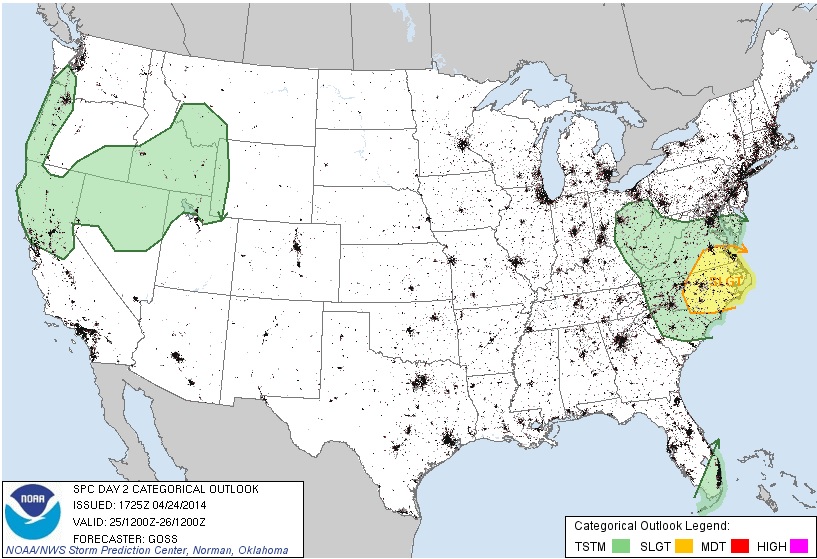
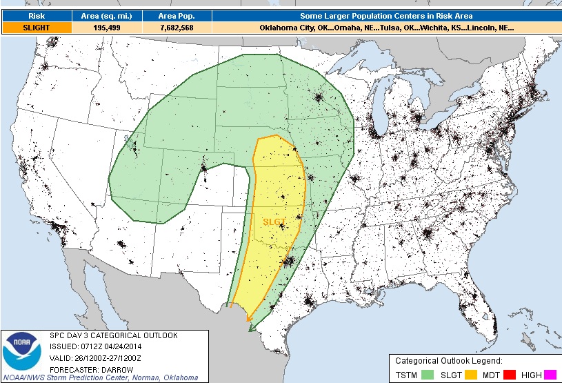
Severe Threat Saturday
Our next big event unfolds this weekend. The first day of the potential multi-day severe weather threat moves in on Saturday ahead of a deepening low pressure system. The Storm Prediction Center has issued an highlighted risk area across the Plains, where hail, high winds and tornadoes may be possible by PM Saturday.
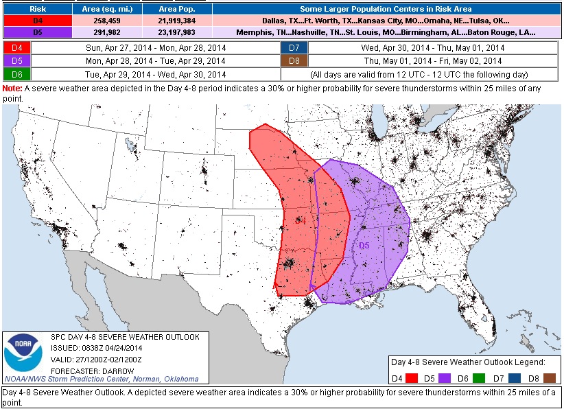
Extended Severe Threat
The potential multi-day severe weather threat looks to continue into Sunday and Monday as the storm system slowly wobbles eastward. Note that from Saturday through Monday, the threat shifts east only slightly as the storm looks to deepen enough to nearly cut itself off from the upper level winds.
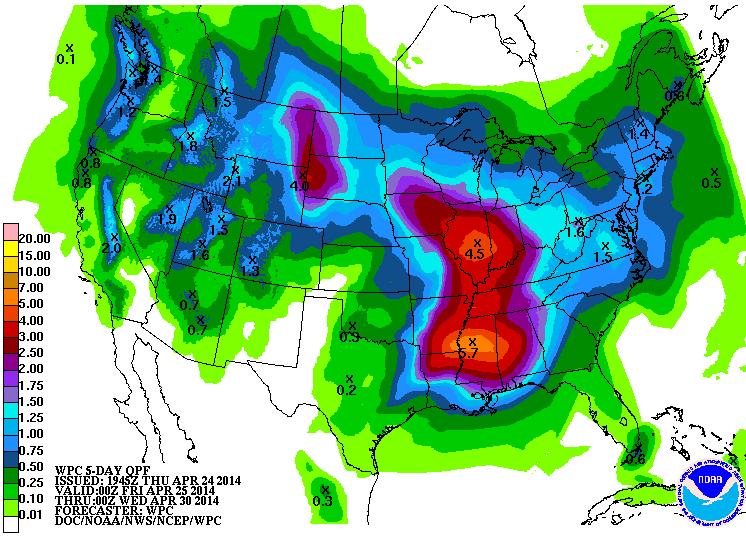
Precipitation Outlook
According to NOAA's 5 day precipitation outlook, there appears to be some widespread heavy moisture on the way over the weekend/next week. Flooding could certainly be an issue as thunderstorm development could bring several round of heavy rain to places in the midsection of the nation over the days ahead.
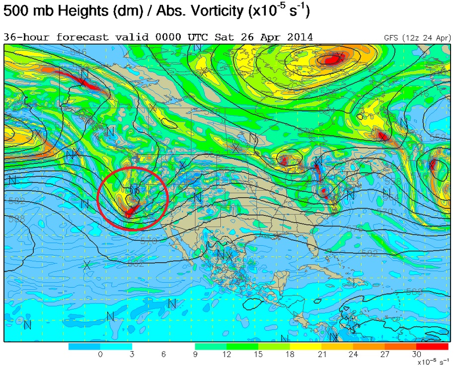
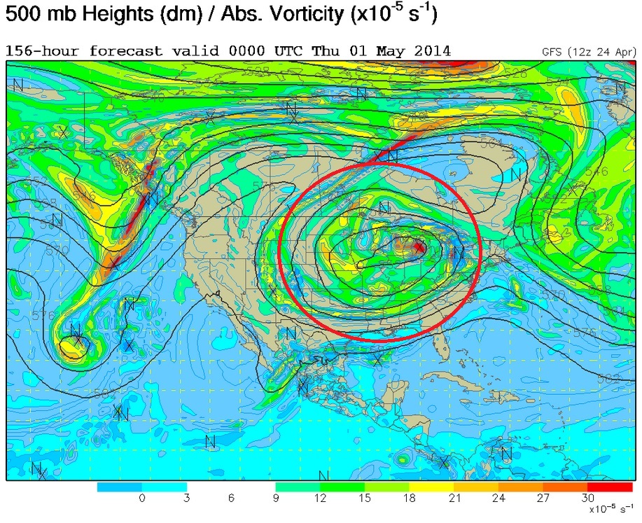
Developing a Cut-Off Low
Take a look at the series of images below. The 500mb vorticity (spin) map from PM Friday through PM Wednesday shows the progression of this potent Pacific disturbance as it moves into the central part of the country and becomes "Cut-Off" or detached from the upper level winds. This particular weather feature will be the cause for stagnant weather next week.
Friday
Saturday
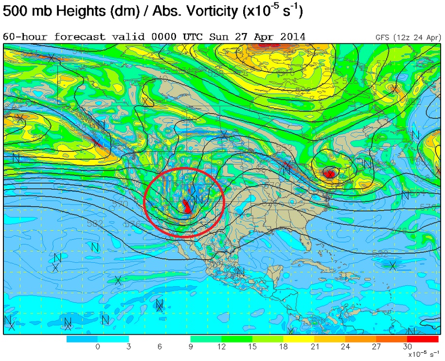
Sunday
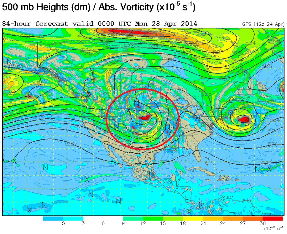
Monday
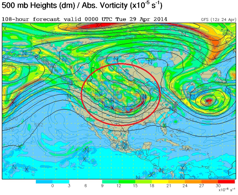
Tuesday
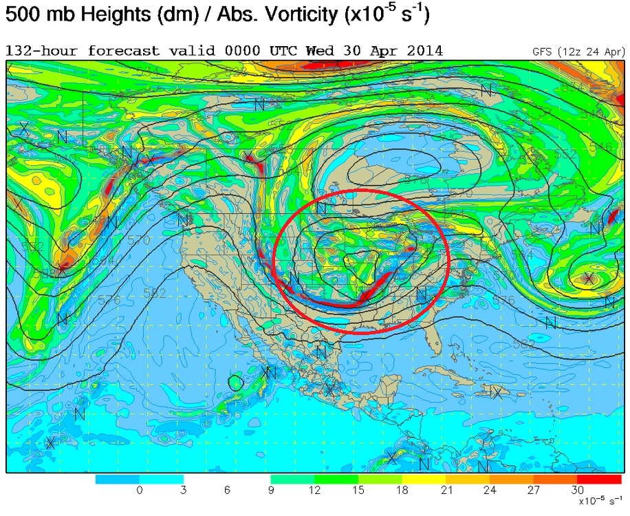
Wednesday
Memories of March
Look at the big cold blob below. This is what the forecast is saying into the middle part of next week as the low pressure system gets cut-off from the upper level winds. If the forecast holds, temperatures could certainly be well below average for much of next week in the eastern two-thirds of the nation.
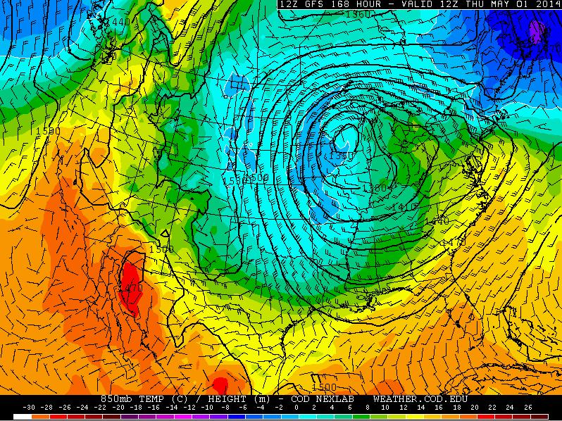
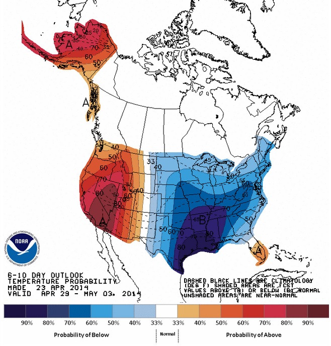
Temperature Outlook
According to NOAA's Climate Prediction Center, the temperature outlook into next week looks quite chilly in the eastern two-thirds of the nation due to the cut-off low developing in the central part of the country. Unfortunately, it looks like this colder than normal weather will stick around for a bit due to the stubbornly slow movement of this weather feature.
Thanks for checking in and have a great rest of your week and weekend ahead! Don't forget to follow me on twitter @TNelsonWNTV

No comments:
Post a Comment