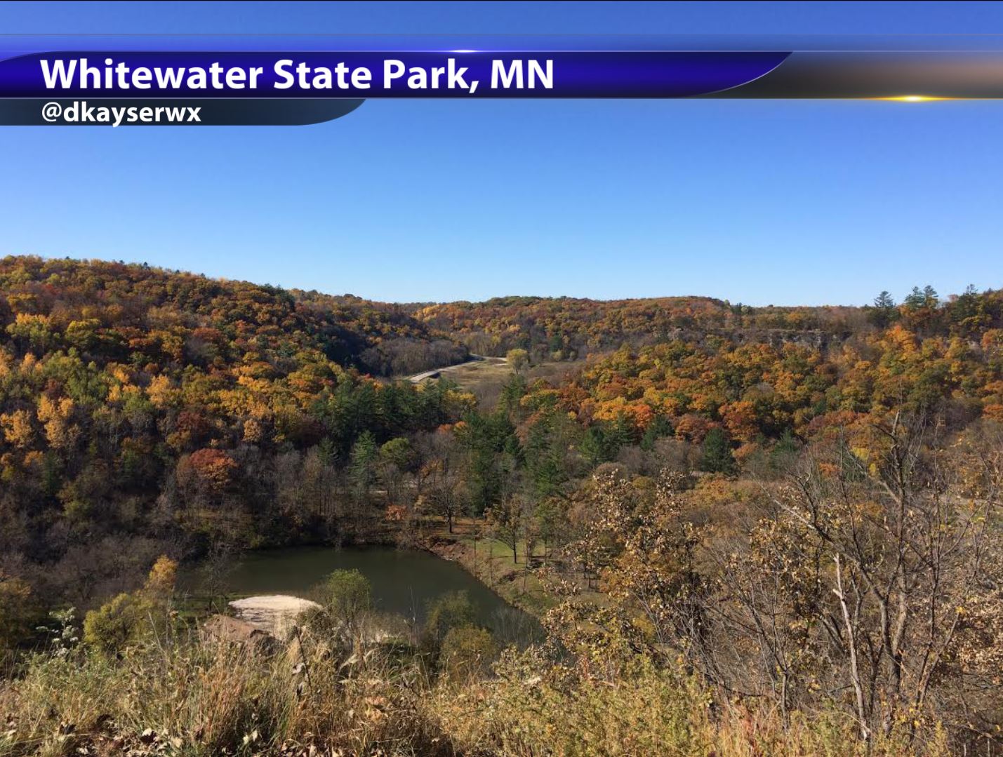
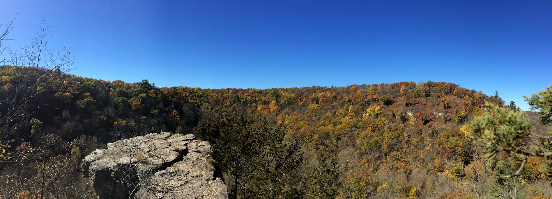
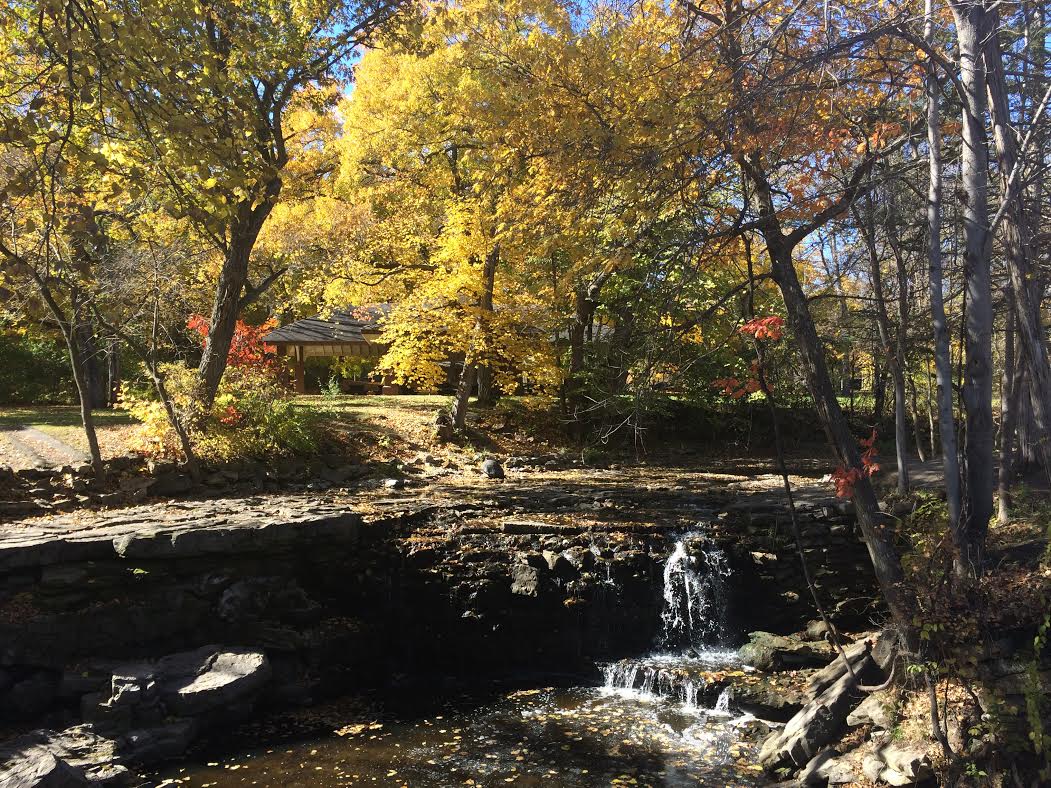
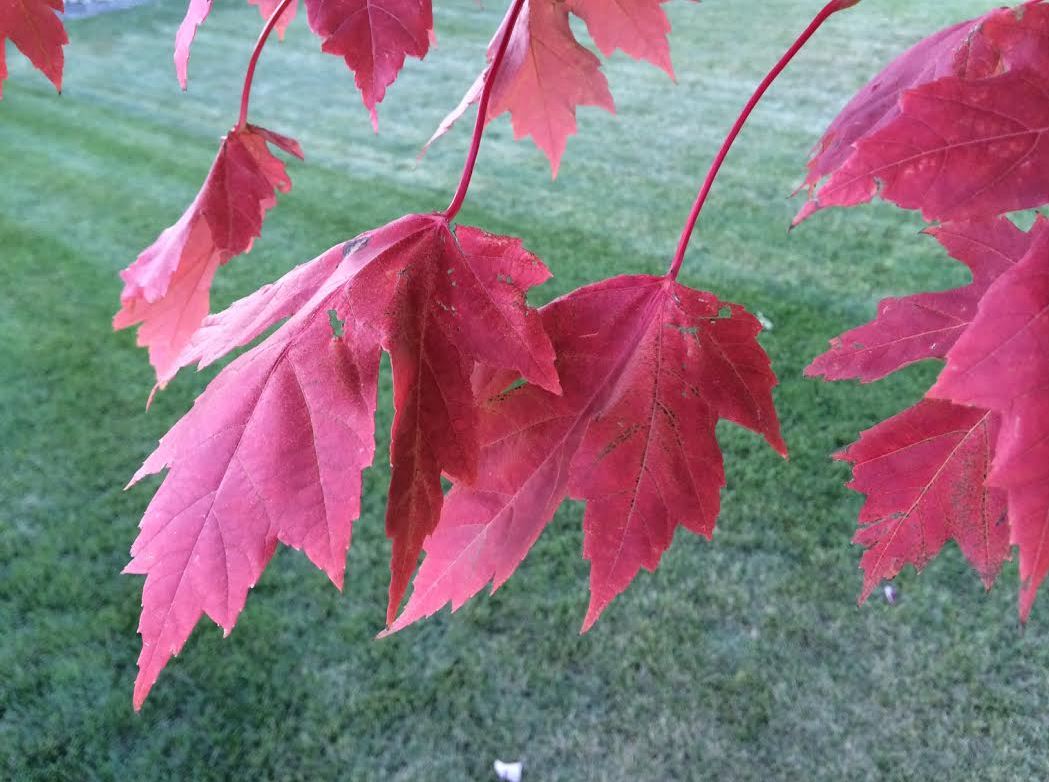
What a stunning picture from my good friend and colleague, D.J. Kayser for the picture below. Whitewater State Park is located near the Mississippi River Valley in southeast Minnesota between Rochester and Winona. Looks like the colors are coming along just great! Thanks for the picture D.J.!!
MN Fall Color Update
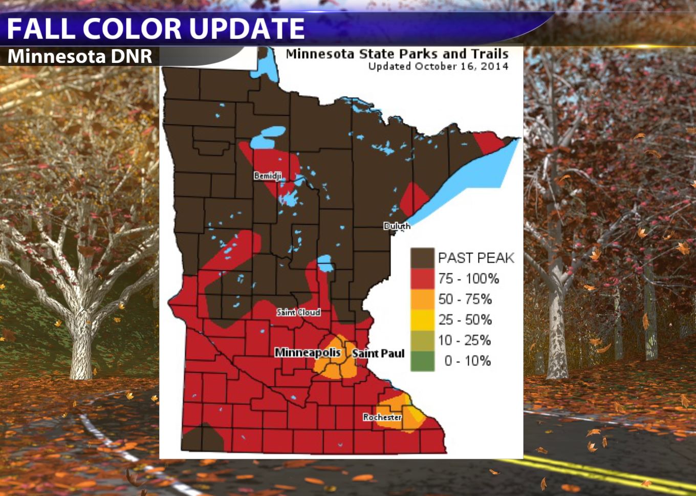
According to the MN DNR, most of northern MN is past peak, but the southern part of the state is peaking now! Get out there and enjoy it while you can... it won't be long before we're in for bare trees for a several month period. Unfortunately, the gusty winds on Friday will be stripping a lot of the beautiful color off those trees.
Facts About Fabulous Fall Foliage
NOAA has a good write up about why leaves change color...
"A favorite American pastime in fall is to pack a picnic basket and set off with loved ones on a Sunday drive along one of the nation’s many scenic byways. It’s a time of year when people enjoy crisp cool weather and marvel at the transforming landscape as tree leaves turn from lush green to gorgeous shades of yellow, orange, red, purple and brown.
While we relish the opportunity to frolic in a big pile of freshly raked leaves, we don’t often think about the science behind why leaves change color and eventually fall from their branches. The answer may surprise you!"
Read more from NOAA HERE:
Future Tense
By Paul Douglas
I should have become an historian. Because documenting the past has to be easier than predicting the future.
I often remind local news legend Don Shelby that you could dress a monkey in a sport coat, smiling at a Teleprompter, to tell you what already happened.
I want to see Randy Shaver over at KARE-11 predict tomorrow's news headlines, based on current events and trends across Minnesota. My friend Mark Rosen's "Sports 7-Day" at WCCO should include daily score forecasts for upcoming Wild, Gophers & Timberwolves games. Wait, there's a phrase for that. Las Vegas.
Meteorologists choose from hundreds of weather models. What to believe, when? A consensus of models, an "ensemble", show warm ridging from the Rockies into the Midwest for the next 1-2 weeks. That means a continued mild bias for the western 2/3rd's of America; chilly intrusions of Canadian air limited to New England.
We cool off Friday but winds ease Saturday; a fleeting shower Sunday. The pattern isn't ripe for big storms of any flavor anytime soon. ECMWF data shows more 60s in a week; no Siberian Spankings shaping up into early November.
Beyond that the crystal ball gets a bit murky. Hey Shelby, help me out!
==============
THURSDAY NIGHT: Increasing clouds. A little warmer. Low: 48.
FRIDAY: Mostly cloudy, windy & cooler. PM shower (mainly up north). High: 55. Winds: WNW 15-25mph
FRIDAY NIGHT: Decreasing clouds late. Still breezy. Low: 39
SATURDAY: More sun, less wind. Brisk. High: 54
SUNDAY: More clouds. Isolated PM Shower. Wake-up: 41. High: 60
MONDAY: Mix of clouds and sun. Wake-up: 45. High: 58.
TUESDAY: Indian Summer. The Sequel. Wake-up: 41. High: 60
WEDNESDAY: Partly sunny, still very nice! Wake-up: 45. High: 63
THURSDAY: Sunny start, late shower? Wake-up: 47. High: 59
==============
This Day in Weather History
October 17th
1971: Heavy rains in NW Minnesota. 4.02" at Georgetown (20 miles N of Moorhead).
1952: Record lows were reported across central Minnesota with lows from 10 to 15 degrees, including a low of 10 degrees at St. Cloud, 12 degrees at Glenwood, and 14 degrees at Alexandria, Litchfield, and Mora.
==============
Average High/Low for Minneapolis
October 17th
Average High: 58F (Record: 84 set in 1910)
Average Low: 39F (Record: 22 set in 1952,1948)
==============
Sunrise/Sunset Times for Minneapolis
October 17th
Sunrise: 7:31am
Sunset: 6:25pm
==============
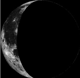
Moon Phase for October 17th at Midnight
2.5 Days After Last Quarter
==============
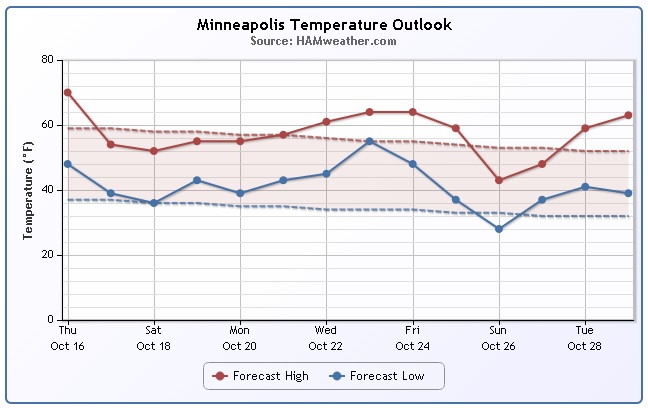
Minneapolis Temperature Trend
I hope you enjoyed your Thursday! Another fairly strong cold front moving through the Upper Midwest late this week will help to tug down additional cold air for Friday/weekend ahead with temperatures struggling to get to 60F even into the early part of next week. However, upper level winds will begin to bubble north by the middle and end of next week, which should allow for some 60s and perhaps even 70s to return for several days late next week... Stay tuned!
===================
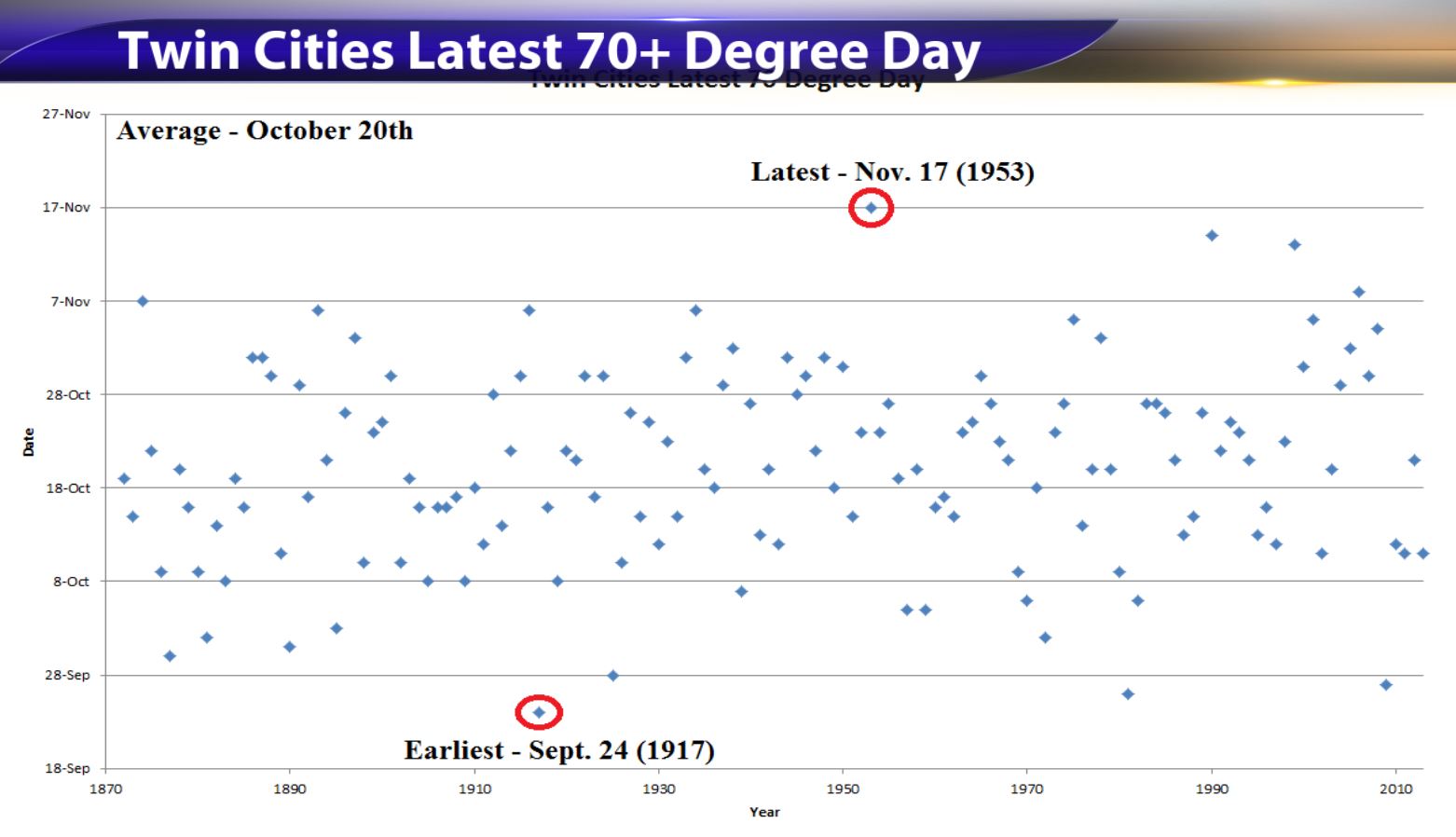
Last 70+ Degree Day for Minneapolis
Thanks to my good friend and colleague D.J.
Weather Outlook Friday
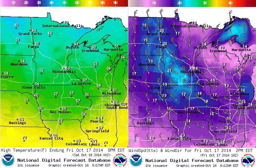
A fairly stout cold front will blast through the Upper Midwest late this week with a shot of cooler weather behind it. The images below show weather conditions on Friday, which look MUCH cooler than Thursday. Note high temperatures on Friday across northern Minnesota may only make it into the 40s! Keep in mind that winds behind the front look quite breezy/gusty, so it'll feel even cooler. You might want to bring an extra layer along with you as you head out the door Friday!
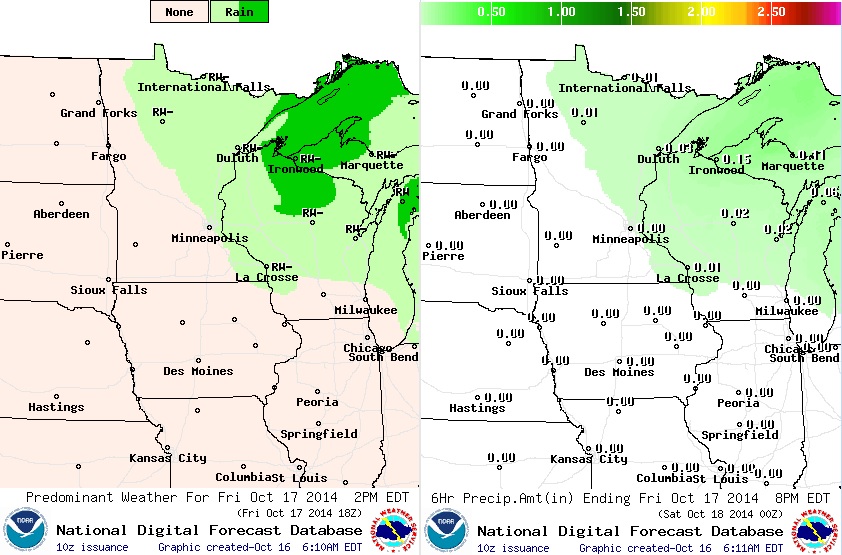
Precipitation Potential
Precipitation doesn't look all that impressive, but more clouds and spits of rain will be possible through the day Friday with very light accumulations expected mainly across the northeastern part of the state. Cool, breezy and somewhat damp skies will be a rude, fall awakening after such a beautiful day Thursday.
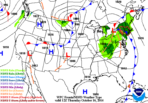
Weather Outlook
This fast moving clipper-like system expected to blast through the Upper Midwest late week will quickly move out by the weekend, but colder temperatures will linger. Note the wintry mix potential at the end of the loop below in the Arrowhead of MN and the U.P. of Michigan late Friday night/early Saturday morning. Nationally, weather conditions on the West Coast and East Coast will be a little more unsettled, while folks in the Rockies and Plains States will be enjoying warm and dry weather.
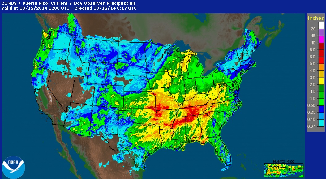
Precipitation Past 7 Days
Severe weather was a big talker earlier this week with several hail, high wind and tornado reports. However, rainfall was another big story with some spots in the central U.S. seeing nearly 5" or more over the last 7 days. Interestingly, it appears that most locations across the country saw at least a little moisture except the Desert Southwest; a place that REALLY needs moisture!
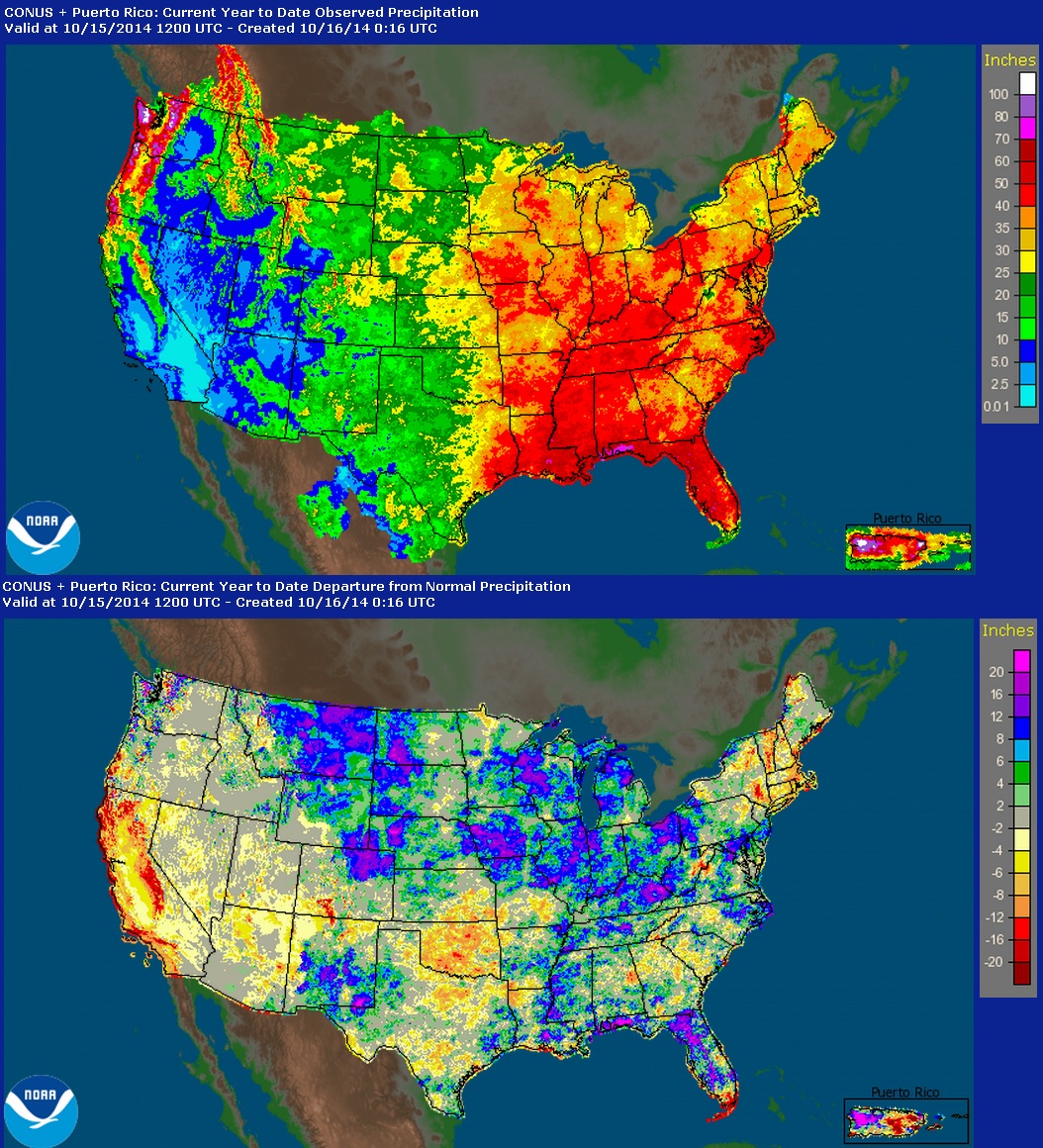
National Precipitation
Here's another look at the national precipitation, however, this shows the precipitation so far this year (top) and the departure from normal (bottom). Note that some of the heaviest precipitation shows up in the eastern half the U.S. and also in parts (mountains/coast) of the western U.S.. As you would expect some of the least precipitation is found in the Desert Southwest, but according to the departure from average, some areas are nearly 15" to 20" below average!
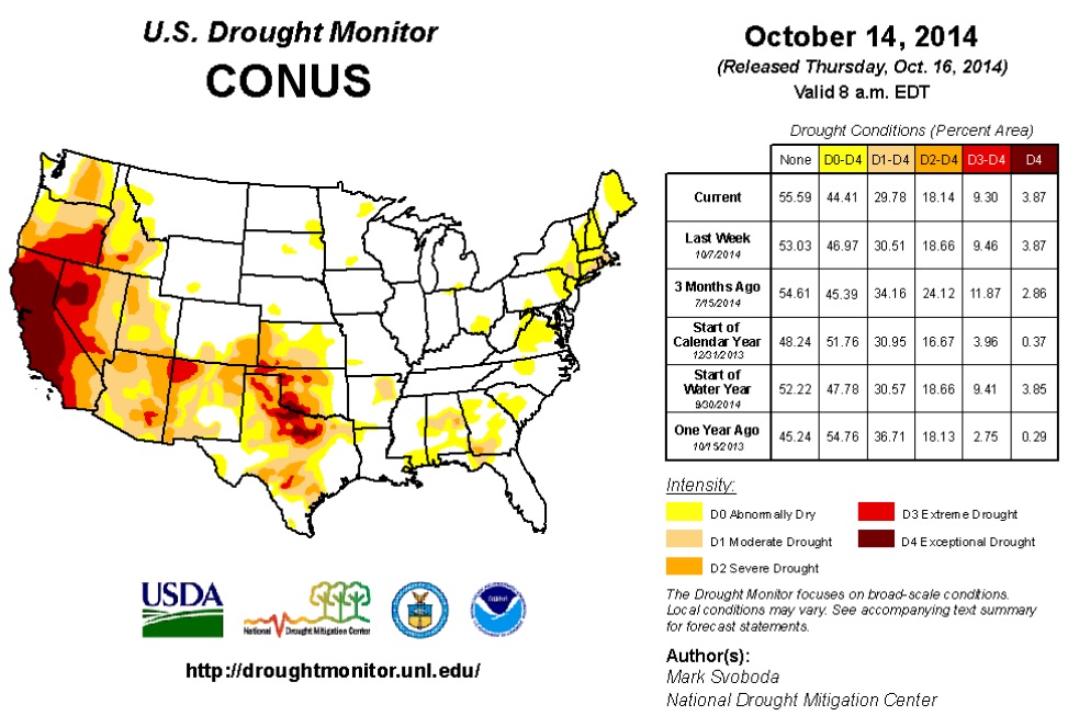
U.S. Drought Monitor
The recent update from the U.S. Drought Monitor shows the worst drought still affecting the Western U.S./California.
"In a repeat of last week, yet another large weather system moved across the country’s midsection, bringing copious rains to the central Plains, middle Mississippi Valley and the Tennessee Valley, with 3-6 inches being a regular occurrence. Parts of the Pacific Northwest also enjoyed some nice moisture during the week. As for temperatures, most of the West and South saw well above normal temperatures, with readings 6 to 12 degrees above the norm. Unseasonably cooler weather was confined mostly to the northern and central Plains along with the Upper Midwest and Great Lakes regions."
Looking Ahead
For the period October 15-20, after seeing a very wet pattern the past few weeks across the country’s mid-section, there should finally be some time to dry out and let the harvesting resume. The only areas showing good chances for heavier precipitation are in the coastal ranges and mountains in the Pacific Northwest, primarily from northern Oregon up into Canada. The other area expecting good rains is from the Mid-Atlantic up into New England, where 1-3 inches should bring some relief to the region. As for temperatures, most of the West, Pacific Northwest and the Great Plains states are expecting to see unseasonably warm temperatures, with readings likely running 3-6 degrees above-normal.
Looking at the 6- to 10-day time frame (October 21-25), the warm temperature trend continues into this period, and the entire western two-thirds of the country and most of Alaska are expected to see above-normal temperatures, with the strongest likelihood falling in the High Plains and along the Rocky Front Range from Colorado and Wyoming up into Montana. The bulls-eye for cooler than normal weather is found in the Tennessee and Ohio Valleys and within the Mid-Atlantic from Georgia northward into New Jersey. A greater likelihood of above-normal precipitation over this period is confined to the Pacific Northwest, Four Corners, southern Florida and the New England coastline. However, a large area of the country from the Great Plains eastward into the Mississippi Valley, the Midwest, Ohio Valley, Tennessee Valley and the western fringes of the Mid-Atlantic can expect it to be dry, with the highest probability falling from the Great Lakes down to the Gulf Coast along the Mississippi Valley."
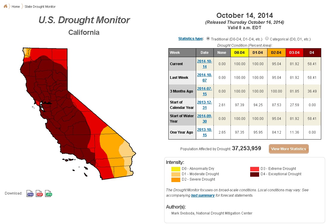
EXCEPTIONAL Drought in California Continues
There was no change to the drought conditions across California from last week as nearly 60% of the state is in an Exceptional Drought.
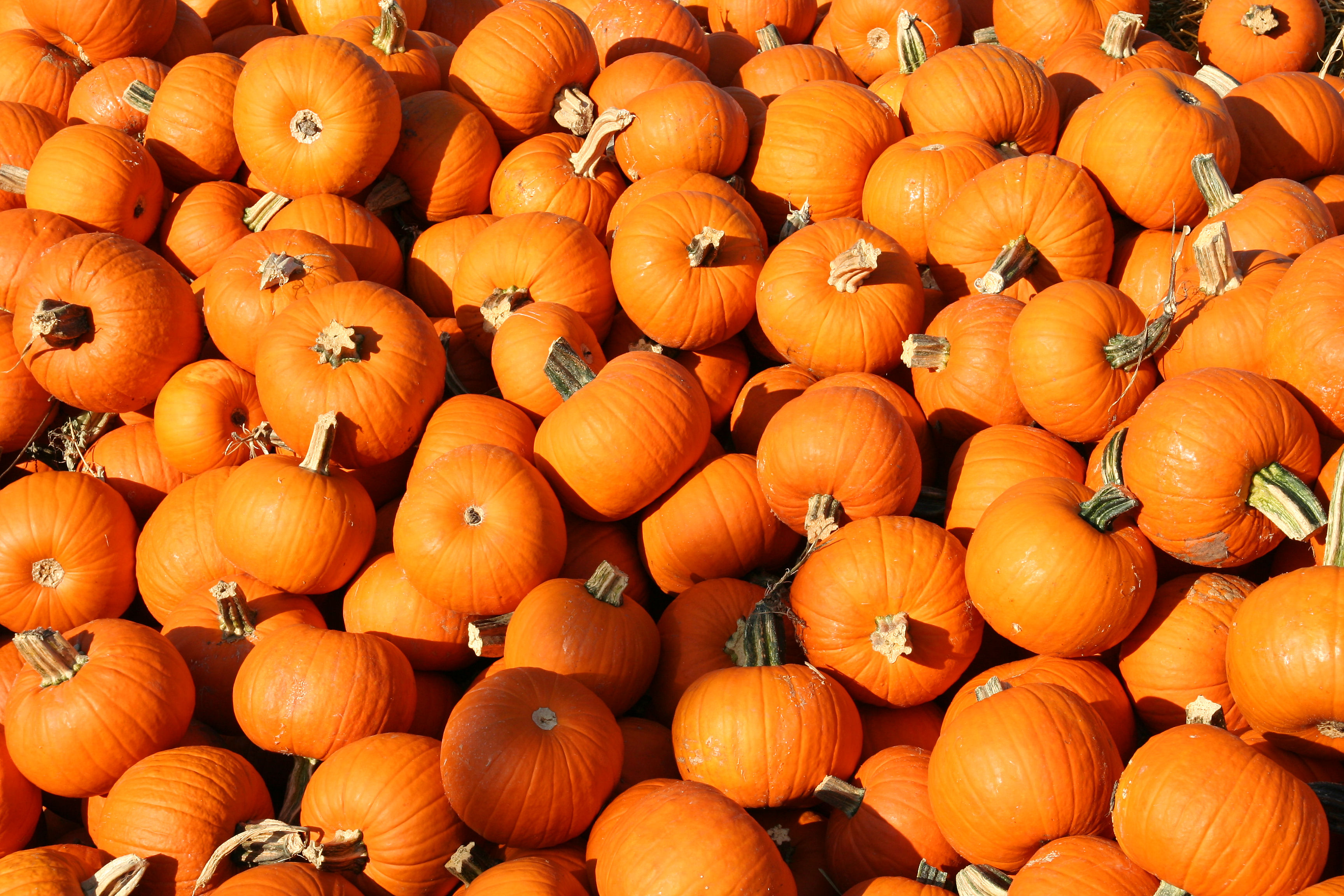
California Drought Continues
A lack of moisture is effecting the current/future of pumpkins in California...
"California's pumpkin crop
Most pumpkins are grown on smaller farms. And they don't go far from the fields. Despite their tough exterior, pumpkins bruise easily and are rarely shipped across state lines. Most are sold locally.
In fact—Halloween jack-o'-lanterns aside—the bulk of the pumpkin crop is used for canned pie filling.
But it is time consuming to grow pumpkins. The season lasts from April to October and planting requires feeding, worries that the crop can grow too fast before harvest and constant spraying for insects.
"The irrigation system helped keep the soil moist but it led to a lot more bugs," Perry said.
"When you sprinkle water normally you get less bugs but then you get more weeds," he added. "It's a constant battle."
Other crops feeling the heat from the California drought include, hay, wheat, olives and corn. Livestock deaths have increased due to lack of water in the state."
Read more from NBCNews HERE:
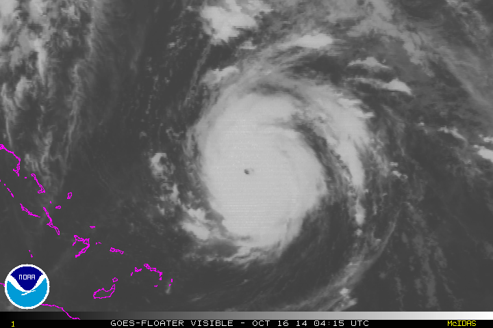
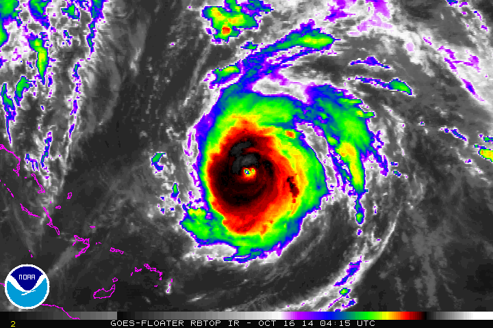
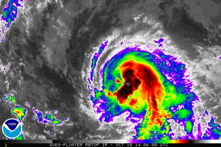
Tracking Gonzalo
The first major hurricane of the 2014 Atlantic Hurricane season blew up to a category 4 storm early Thursday with sustained winds up to 140mph! The loop below shows the Thursday sunrise over Gonzalo when it was located about 525 miles SSW of Bermuda.
Tracking Gonzalo Cont.
According to NOAA's NHC, Gonzalo is expected to track nearly directly over the small island of Bermuda as a potential major hurricane on Friday...
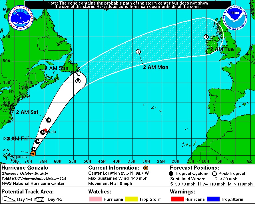
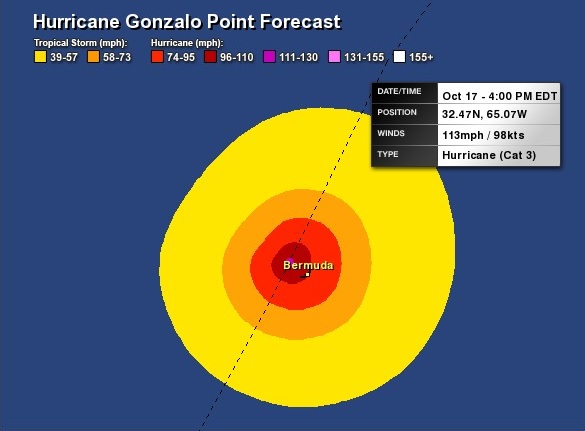
Bracing in Bermuda...
Here's a little closer look at the forecast path of Gonzalo as it tracks towards Bermuda on Friday. Note the path is just west of the Island on Friday afternoon/evening. Unfortunately, the worst part of the storm is typically on the front right, which is where the island sits and could potentially be in the worst part of the storm then.
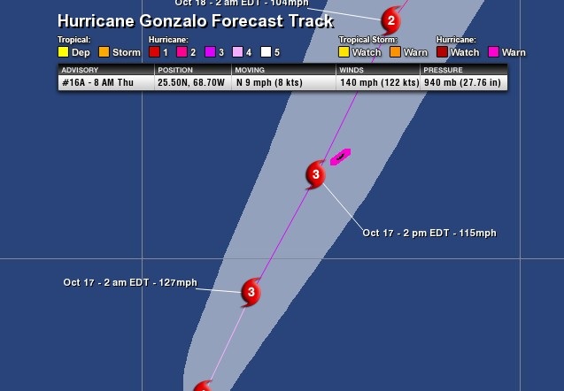
The forecast winds by PM Friday suggest nearly +100mph winds buffeting island, which could cause major/widespread damage...
"Watch out Bermuda, here comes Hurricane Gonzalo.
The powerful system strengthened to a Category 4 storm early Thursday as it churned through the North Atlantic with wind speeds of 140 miles per hour, the National Hurricane Center in Miami reported.
The storm is expected to brush Bermuda on Friday, but Gonzalo's path could still vary enough that officials aren't ruling out a direct hit on the island.
Bermuda is now under a hurricane warning. Gonzalo is expected to cause powerful, gusty winds, heavy rains of up to 6 inches and flooding as it closes in."
Read more from CNN.com HERE:
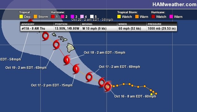
Tracking Ana
As of early AM Thursday, Ana in the Central Pacific was still a Tropical Storm with sustained winds of 60mph. The forecast has Ana moving into the Hawaiian Islands as a potential category 1 hurricane by the weekend.
Tracking Ana Cont.
Here's the forecast track for Ana, which shows the center of the storm south of the Big Island by Saturday. Heavy rains, gusty winds, large surf and high elevation snow will all be possible this weekend as Ana moves in.
"HONOLULU —State, city and county officials are urging Hawaii residents be prepared for strong winds, heavy rain and potential power outages this weekend as Ana moves closer to the islands.
"While it's a beautiful day today, I think by Saturday we're not going to be seeing this kind of weather, unless we are really lucky," said Honolulu Mayor Kirk Caldwell.
"The potential with Ana is that the system will have a lot more impact further down the island chain than what we saw with Iselle," said Chris Brenchley with the National Weather Service.
Downed trees, flash flooding and large waves are also what officials are asking residents to prepare for as Ana makes it way across the state."
Read more from KITV.com HERE:
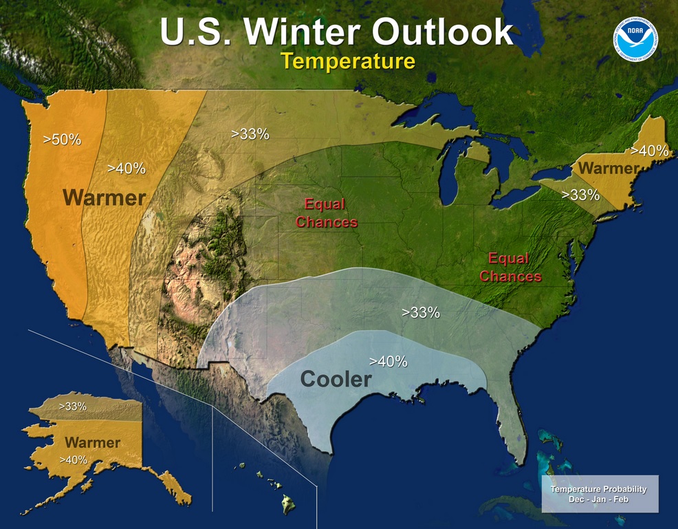
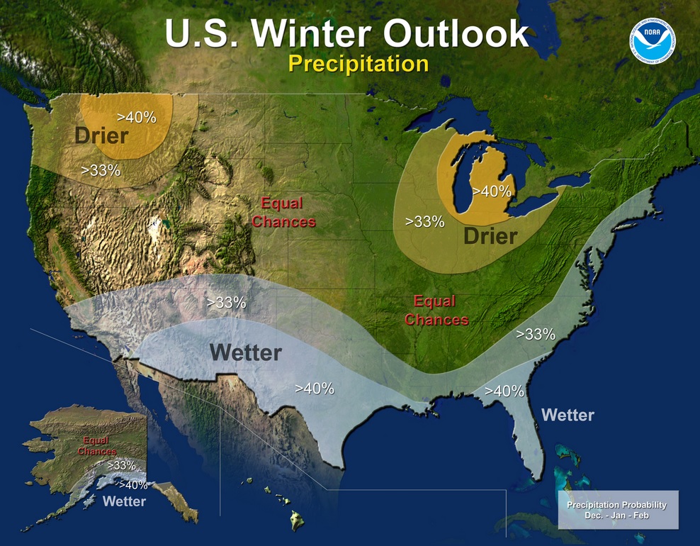
Winter Weather Outlook
Say it ain't snow... Yes, it getting to be that time of the year again. We're starting to think about the cold, dark and snowy days of Winter. NOAA released it's winter outlook on Thursday and this is what they had to say:
"Below average temperatures are favored in parts of the south-central and southeastern United States, while above-average temperatures are most likely in the western U.S., Alaska, Hawaii and New England, according to the U.S. Winter Outlook, issued today by NOAA’s Climate Prediction Center.
While drought may improve in some portions of the U.S. this winter, California's record-setting drought will likely persist or intensify in large parts of the state. Nearly 60 percent of California is suffering from exceptional drought – the worst category – with 2013 being the driest year on record. Also, 2012 and 2013 rank in the top 10 of California’s warmest years on record, and 2014 is shaping up to be California’s warmest year on record. Winter is the wet season in California, so mountainous snowfall will prove crucial for drought recovery. Drought is expected to improve in California’s southern and northwestern regions, but improvement is not expected until December or January."
See the full report from NOAA HERE:
Here's a video from NOAA winter outlook...
Thanks for checking in and have a great rest of your week/weekend ahead. Don't forget to follow me on Twitter @TNelsonWX

No comments:
Post a Comment