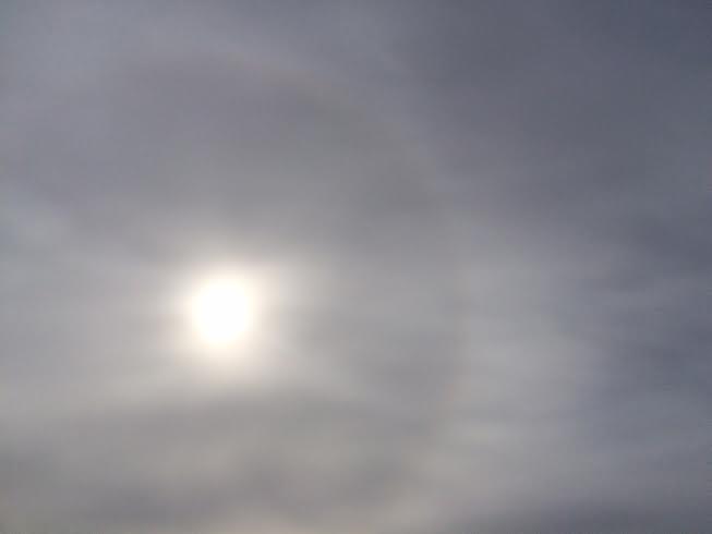
Ring Around the Moon or Sun, Then Rain or Snow Will Surely Come...
That's the old adage as high clouds precede a storm system. These high cirrus clouds are made up of plate-like ice crystals and bend/reflect sunlight into a circular shape around the sun. You'll tend to see this 12 to 24 hours in advance of any precipitation... this was the view of the sky midday Thursday prior to the light snow event expected PM Thursday/AM Friday.
E-mail Escalation
By Paul Douglas
This is the time of year my friend on Marco Island, Florida sends me e-mails with photo attachments of the beach, his fishing boat, a bank thermometer flashing 80 degrees. What a dear, dear friend. I guess it almost compensates for the satellite and radar images of hurricanes I text him in August, when he's glued to The Weather Channel.
A steady supply of fresh, dry Canadian air inoculates us from storms with names but yes, the cold can get old after a time.
The next 2 weeks will trend colder than average as Canada springs a leak; one wave of numbing air after another. Not polar cold, nothing like last winter, but cold enough to get your attention. After poking into the 20s Friday, the mercury tumbles Friday night; a wind chill of 20 below Saturday morning. I may sleep in 'til the crack of March at this rate. A cold weekend gives way to a few milder blips of 20s next Monday and Thursday. Otherwise look for highs in the teens with 2 or 3 nights dipping below zero. Not unusual for mid February.
It could be worse. You could be living in Boston. The city has been submerged under 6 to 8 feet of snow in the last 3 weeks and another blizzard is brewing for Sunday. Almost surreal.
==============
THURSDAY NIGHT: Another clipper, snow likely overnight. Light coating of snow possible by daybreak Friday. Low: 7. Wind: S 5.
FRIDAY: Lingering flakes early. Partly sunny, closer to average. High: 28. Winds: Turning NNW 5-15
FRIDAY NIGHT: Arctic front arrive late. Few flakes, blustery and colder. Low: -3. Winds: NW 15-25. Wind Chill: -5F to -15F.
SATURDAY: Blue sky, bitter wind! Wind chill: -10F to -20F. High: 7
SUNDAY:Clouds, few flurries. Wake-up: -5. High: 11
MONDAY: Cloudy, slight moderation. Wake-up: 6. High: 27.
TUESDAY: Peeks of sun, Canadian breeze. Wake-up: 3. High: 9.
WEDNESDAY: Sunny, still colder than average. Wake-up: -2. High: 10.
THURSDAY: Feeble clipper, more flurries. Wake-up: 2. High: 25.
=================
This Day in Weather History
February13th
1872: Snowstorm buries Sibley County with 12 foot drifts, many people perished in the storm.
1866: What may be Minnesota's' "Greatest Blizzard." It lasted for three days and buried barns in drifts. Luckily, it began at night when many people were at home.
1838: In the days before Tower... At 2:00 am the mercury thermometer at Ft. Snelling froze at 40 below. The actual temperature is unknown.
==================
Average High/Low for Minneapolis
February 13th
Average High: 28F (Record: 51F set in 1890)
Average Low: 12F (Record: -23F set in 1905)
===================
Sunrise/Sunset Times for Minneapolis
February 13th
Sunrise: 7:16am
Sunset: 5:38pm
===================
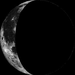
Moon Phase for February 12th at Midnight
2.1 Day After Last Quarter
======================
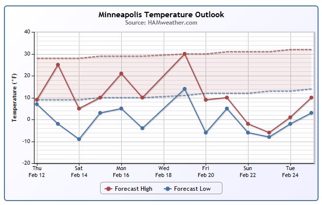
Minneapolis Temperature Trend
Cold weather continues over the next several days with temperatures running well below average by Valentine's Day Saturday! According to extended model runs, we may get back to near average by the end of next week, but cold weather may just stick around through the end of the month!
========================
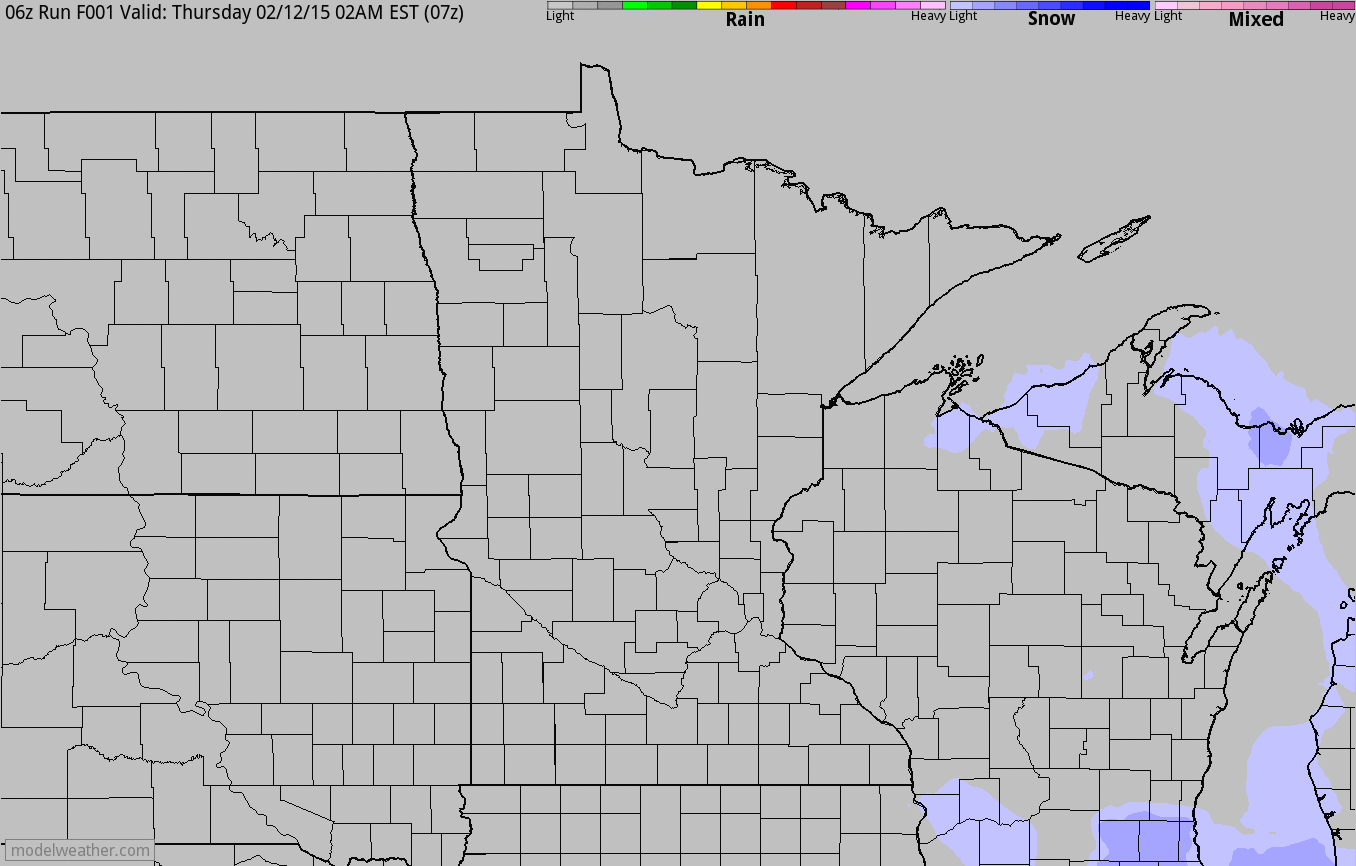
Thursday Night/AM Friday Clipper
A fast moving clipper will quickly burst through the region late Thursday through AM Friday with a light, fluffy coating of snow. Roads AM Friday could be a little slick, but weather conditions quickly improve through the day Friday.
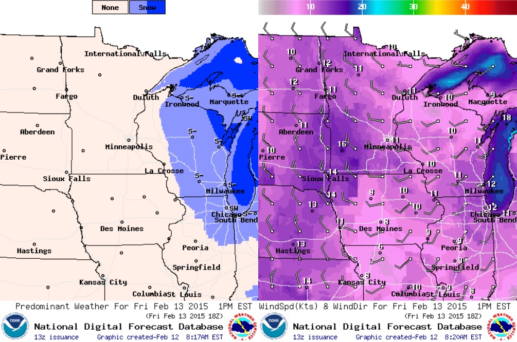
Quick Coating of Snow
Here's a look at the light snow accumulation potential across the Upper Midwest from PM Thursday/AM Friday. I could see a up to 1" of light, fluffy snow across parts of of the state, but most will stay under the 0.5" mark.
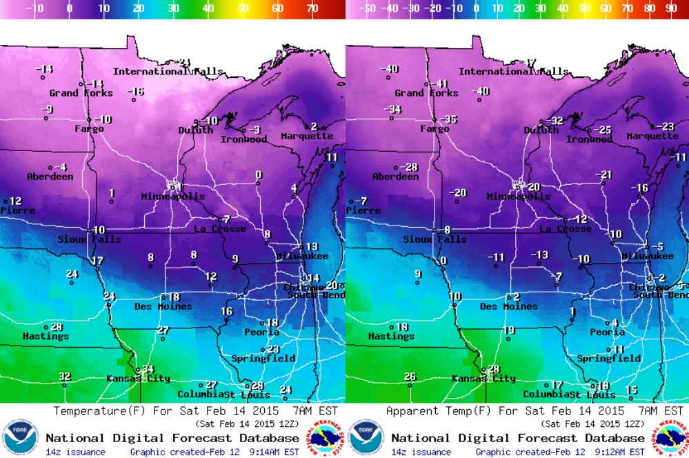
Friday Weather Outlook
Post clipper, temperatures will warm into the 20s and 30s across the southern part of the state, but it'll still feel a bit chilly! Feels like temperatures around midday/early afternoon (image on right) will feel more like the teens across southern MN, while feels like temperatures across the northern part of the state will likely stay in the sub-zero range.
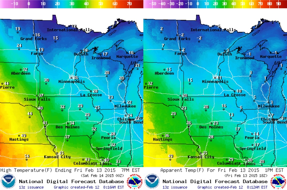
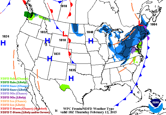
Friday Weather Outlook Continued
The images below show our latest clipper moving quickly into the Great Lakes Region by midday/early afternoon with winds picking up out of the northwest a little more by late afternoon/evening.
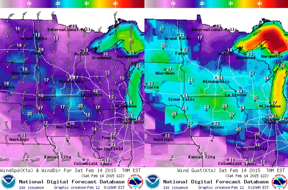
Saturday Weather Outlook
Another fast moving impulse of energy will blast through the region PM Friday/AM Saturday with another surge of Arctic air. It will be denoted by VERY strong winds, which will rattle windows early Saturday morning. Take a look at the wind speeds/gusts by 7AM Saturday.
Saturday Temperature Outlook
Arctic weather conditions will be widespread on Saturday morning with actually air temperatures for most in the single digits and teen below zero, while strong winds will whip up nasty wind chills of -20F to -40F (nearly -50F across far northern MN)!
National Weather Outlook
Continued clippers will result in more snow across parts of the Midwest, Great Lakes and eventually into the Northeast. Take a look at the end of the loop as a developing storm system looks to intensify quickly over the weekend as Arctic air get injected into it... Extended model runs are suggesting another storm on the way for folks in the Northeast!
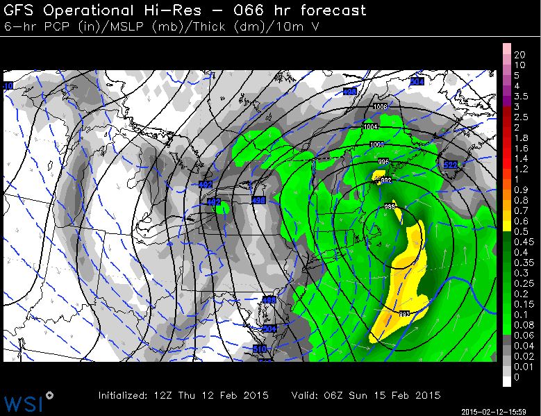
Weekend Storm in the Northeast
Again, extended model runs continue to suggests a fairly potent storm system wrapping up over the Northeast this weekend with lots of wind and heavy snowfall potential. Keep an eye on this one if you're planning any travel in this area through early next week!
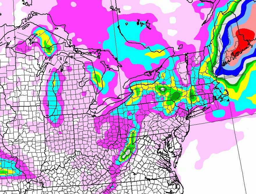
Northeast Snowfall Potential
This is a peak at the snowfall potential through 6pm Sunday for folks in the Northeast. Keep in mind that this will likely change, but there certainly is the potential for additional shovelable/plowable snow for folks that don't really need anymore on top of what they've already seen over the past 2 to 3 weeks.
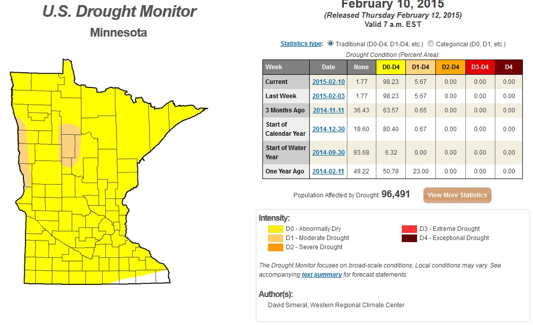
Drought Update
Did you know that most of Minnesota is considered to be abnormally dry? Yes, in fact, some areas across northwestern Minnesota are in the MODERATE DROUGHT category! At this rate, with the lack of snow this winter, spring flooding may not be a big issue this year!
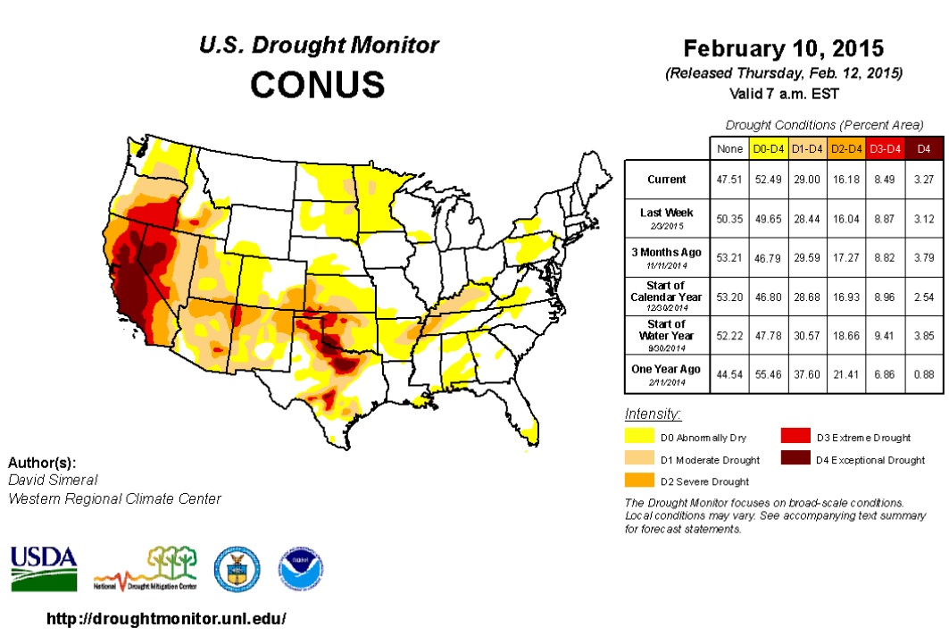
U.S. Drought Monitor
According to the U.S. Drought Monitor, nearly 52% of the country is considered to be abnormally dry, with 29% considered to be in a MODERATE DROUGHT. Interestingly, nearly 3% of the nation is considered to be in an EXCEPTIONAL DROUGHT, much of which is still located in California. Nearly 40% of the state of California is considered to be in an EXCEPTIONAL DROUGHT.
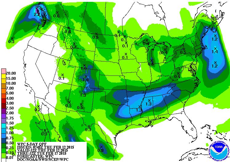
Precipitation Outlook
According to NOAA, the 5 day precipitation outlook looks still fairly active in the Northeast through early next week. The only spot that looks completely dry is California!
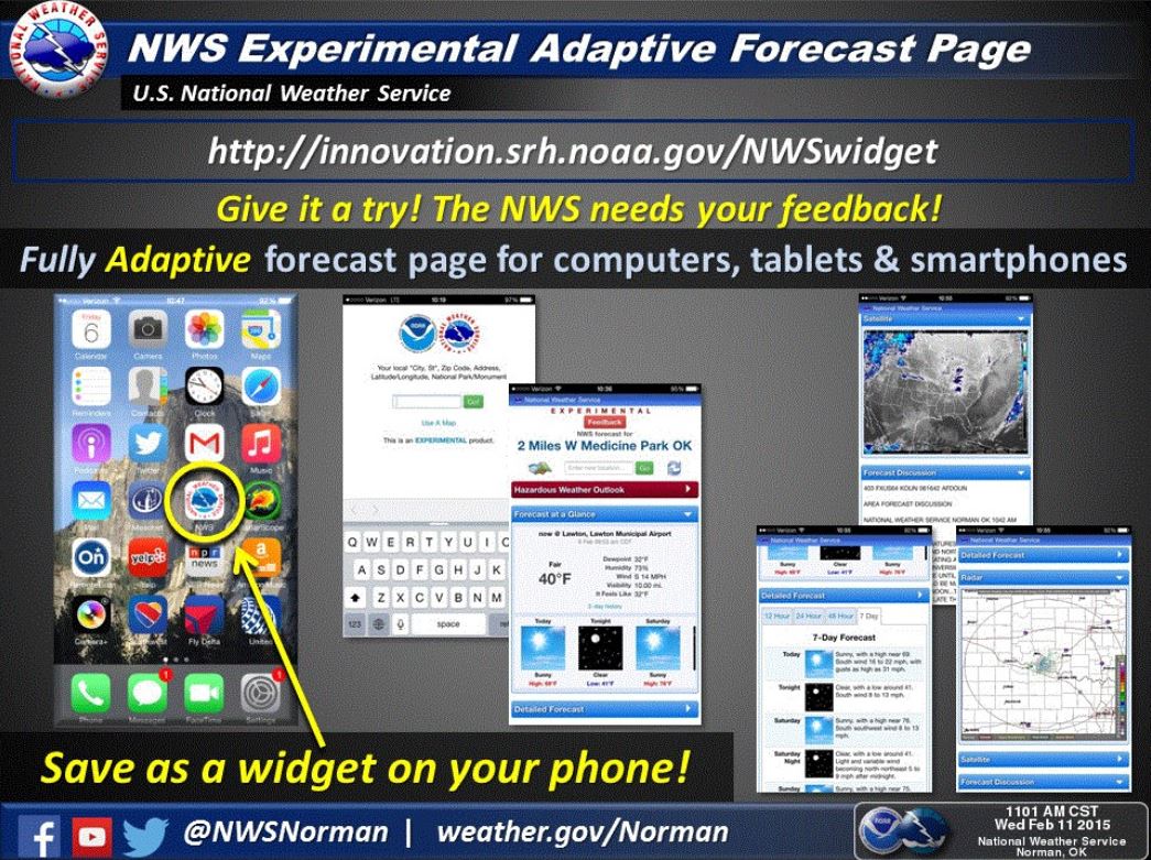
NWS Experimental Adaptive Forecast Page
I am always looking for good weather apps to put on my phone... Here's one from the National Weather Service. It's really not an App, but more of a widget that you can put on your phone to keep up to date with your local weather. Check it out!
Load it on your smart phone HERE: http://innovation.srh.noaa.gov/NWSwidget
Thanks for checking in and have a great rest of your week and weekend ahead! Don't forget to follow me on Twitter @TNelsonWX

No comments:
Post a Comment