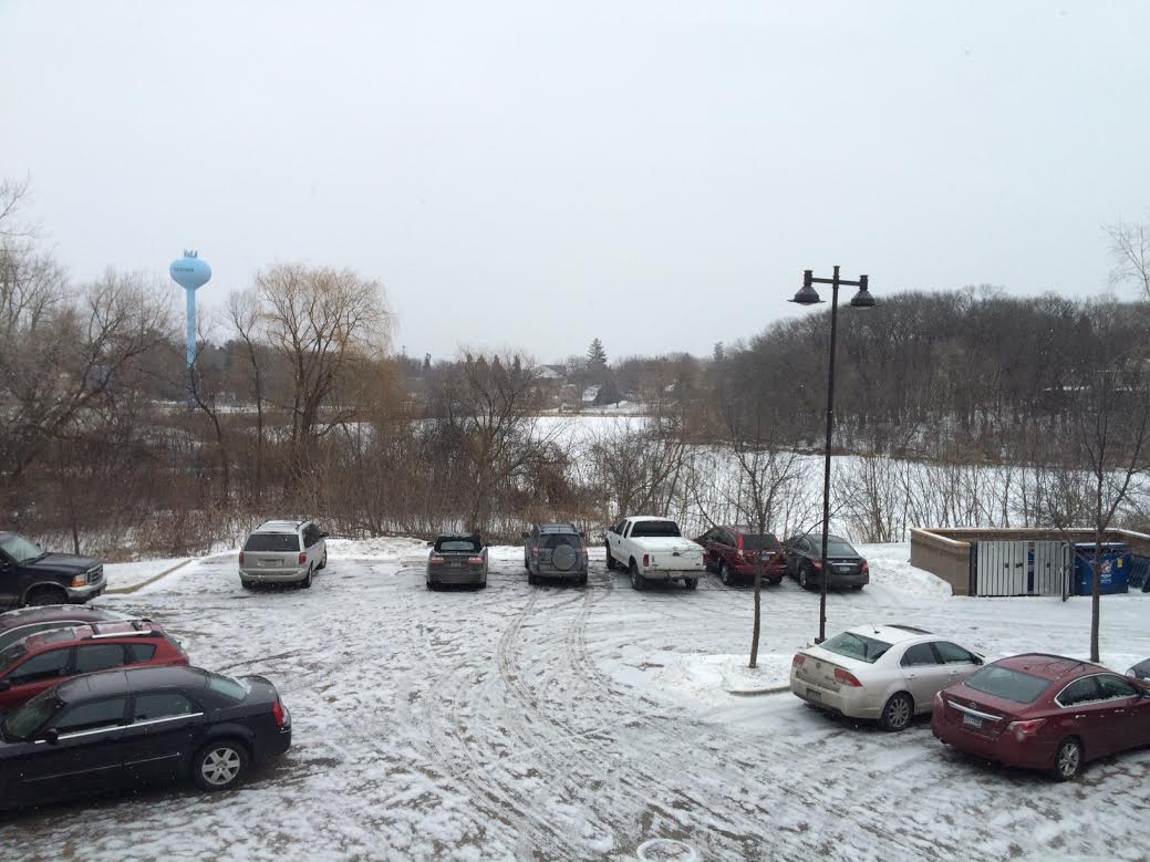
Cold winds return
By Todd Nelson
I have to be honest, the meteorologist in me has been a little depressed about our winter so far. Deep down, I am a little jealous of the feet of snow that has fallen in Boston over the past few weeks. No doubt, the lack of snow has made for several more easy commutes this winter, but talk to most weather nerds and you'll find that they live for extremes!
Minneapolis is nearly 14" below average snowfall this season with no big snow storms in sight. Boston on the other hand could see additional snow accumulations through midweek. The continued cold weather that is plaguing our neck of the woods is also helping to drive major winter storm systems to our south and east.
Looking ahead, I still don't see any blockbuster events unfolding close to home. However, our persistent northwest flow continues over the next several days. Spats of cold, Canadian air look to keep us below average in the temperature department into next week. The coldest weather arrives midweek with temperatures struggling to get above zero for highs across much of the state.
Am I too young to be a snowbird yet? I could get used to having daily tee-times/soaks at the pool. You?
============
MONDAY NIGHT: Mostly cloudy and colder. Low: 1. Winds: NW 10. Wind Chill: -10F to -15F
TUESDAY: Few flakes. Another shot of cold air. High: 8. Winds: NW 10-15. Wind Chill: -10F to -15F
TUESDAY NIGHT: Mostly cloudy, breezy and cold. Low: -6. Winds: NW 10-15. Wind Chill: -10F to -20F
WEDNESDAY: Icy wind, decreasing clouds. AM wind chill: -20F. High: 1.
THURSDAY: Blue sky, still raw. Wake-up: -9. High: 7.
FRIDAY: Clipper arrives, light snow chance. Wake-up: -2. High: 17.
SATURDAY: Cold winds return. Wake-up: 8. High: 15.
SUNDAY: Quiet. Still below average. Wake-up: 1. High: 16.
MONDAY: A little warmer, nothing rough. Wake-up: 5. High: 20.
===============
This Day in Weather History
February 17th
1981: Warm weather continues across Minnesota with a record high of 55 in the Twin Cities. Crocuses were blooming.
1894: The Minneapolis Weather Bureau journal notes: Sleighing very poor, about half of the vehicles are on wheels.
===============
Average High/Low for Minneapolis
February 17th
Average High: 30F (Record: 55F set in 1981)
Average Low: 14 (Record: -20F set in 1936)
===============
Sunrise/Sunset Times for Minneapolis
February 17th
Sunrise: 7:10am
Sunset: 5:44pm
===============
Moon Phase for February 17th at Midnight
0.7 Days Before New Moon

=================
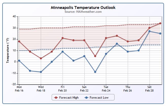
Minneapolis Temperature Trend
Take a look at our average high temperature track (dashed red line) and note that our average high at this time of the year in right around 30F. Thanks to a persistent NW flow, our high temperatures through much of the rest of the month will stay well below average! In fact, daytime highs on Wednesday may not even get out of the sub-zero range for a number of folks across the state. It'll even be a close call for us in Minneapolis! Temperatures look to gradually warm back to near average levels by the start of March.
=================
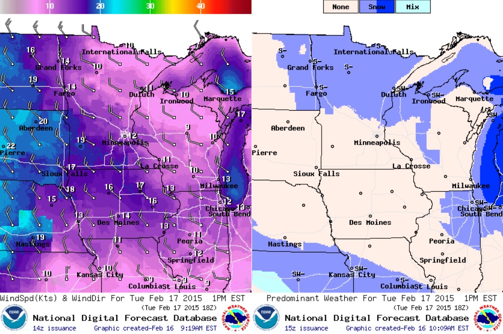
Tuesday Weather Outlook
Temperatures on Tuesday will be cooler than that of Monday. Actual air temperatures will be stuck in the single digits and teen across the state with -10s and -20s for wind chill values even through the afternoon hours.
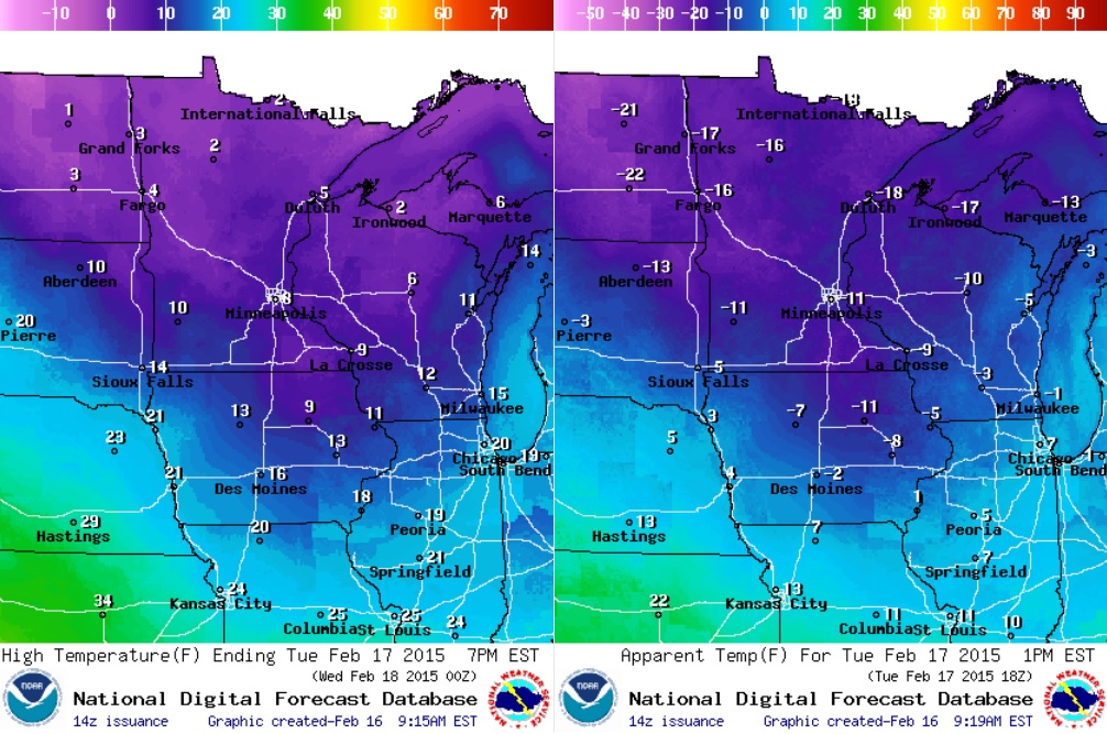
Tuesday Weather Outlook
Lingering light snow will still be possible across the far northern reaches of the state during the day. However, breezy winds will be a bigger issue as colder air continues to settle into the region. Wind gusts on Tuesday could approach 15mph to 25mph late in the day, especially across far western MN.
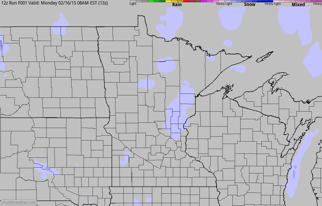
Weather Outlook
After nearly a full day of flurries and light snow on Monday that didn't add up to much, another light snow chance will scoot through the region
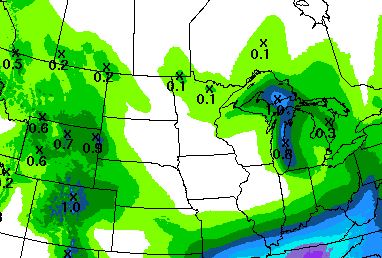
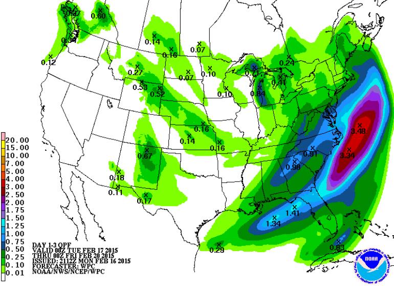
5 Day Precipitation Outlook
According to NOAA's HPC, the 5 day precipitation outlook shows minimal precipitation potential for folks in the Upper Midwest.
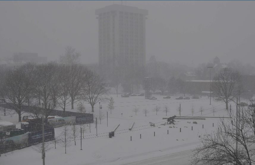
Snowy Presidents Day
This was the view from the @UniversityofKY in Lexington, KY. Heavy snow of up to a foot or more pushed through parts of the Commonwealth on Monday and set several daily snowfall records.
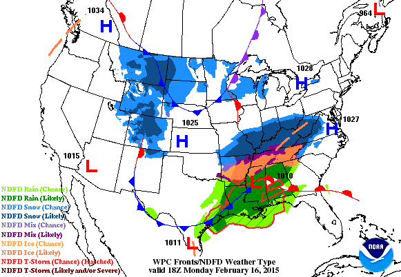
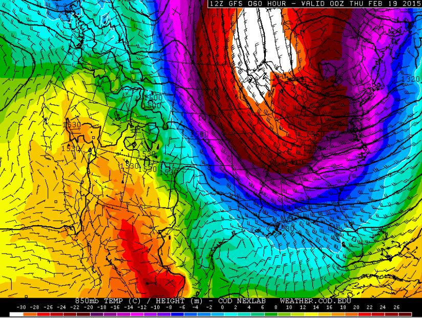
National Weather Outlook
The latest winter storm that dumped heavy snow and ice across the Middle Mississippi Valley to the Ohio/Tennessee Valley will continue on it's eastward track through the Mid-Atlantic Region through midweek. Note how the storm looks to graze parts of the Northeast (including Boston) through midweek!
Precipitation Outlook
According to NOAA's HPC, the 3 day precipitation forecast keeps most of the heavy precipitation off the East Coast. Meanwhile, the West Coast continues to stay dry.
 Cold Weather Continues
Look at the significant blob of colder air that looks to surge south of the border by midweek. The cold air will have wide-reaching effects. The eastern two-thirds of the country will be colder than average, while the western third of the nation looks to stay above average.
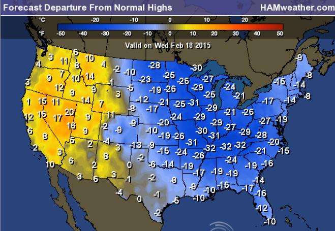
Highs From Average Wednesday
Highs on Wednesday will be significantly colder than average across the eastern two-thirds of the nation. Temps will be running nearly 20F to 30F below average!
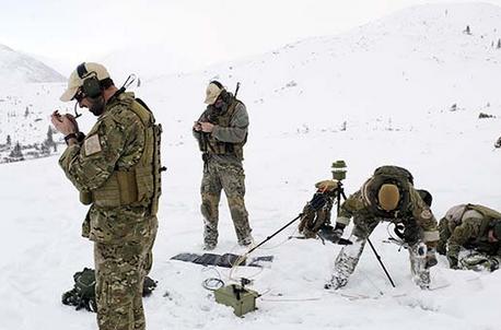
"Send in the Weathermen"
Great story here from NBCNews.com meteorologists in the line of duty...
"In New York and Washington, D.C., the funerals continued. Families gave up hope of a miracle rescue in the rubble of the World Trade Center and Pentagon. But if this soldier succeeded he would never shoot his gun and no one outside the military would know his work.
He was a weatherman.
More precisely, he was a special operations weather technician, known as a SOWT (pronounced sow-tee). As the Department of Defense’s only commando forecasters, SOWTs gather mission-impossible environmental data from some of the most hostile places on Earth."
Read more from NBCNews.com HERE:
Thanks for checking in and have a great rest of your week! Don't forget to follow me on Twitter @TNelsonWN

No comments:
Post a Comment