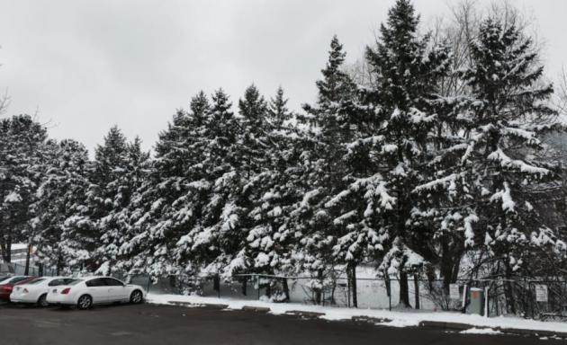
32 F. high in the Twin Cities Monday.
45 F. average high on March 23.
26 F. high on March 23, 2014.
2" snow on the ground at MSP International Airport.
March 24, 1851: Heat wave across Minnesota with 60's and 70's common.
“...
With
that kind of an increase, there is about 2 percent increase in the
moisture in the atmosphere, which feeds into all the weather systems
that occur, and it gets concentrated and magnified by all of the storms,
so you can get double or quadruple the effects,” Trenberth says. - from a PRI article focused on El Nino.
Perspective.
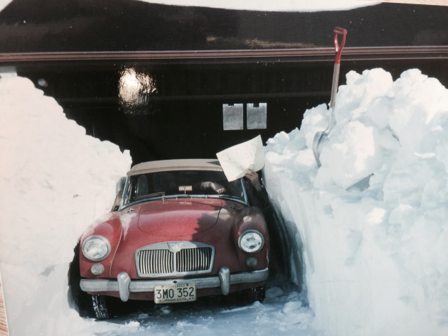
It can always be worse, right? Rodney and Esther Turnquist sent me this
photo taken on St. Patty's Day, 1965. I'm happy to see the red MG
wasn't impacted by the 4-6 foot drifts that buried greater Minnesota on
March 17, 1965. The sign says "St. Patty's Day 1965". It puts the meager
snow piles in my yard into perspective.
One Step Back
Considering
most of Minnesota is in a moderate drought I'm happy to see any water,
in any state - liquid or frozen - falling from the sky. If you've lived
here more than 10 minutes you know that spring is more theory than
reality; often two steps forward, one step back.
This week is a
poignant, downright blunt reminder that March is Minnesota's third
snowiest month of the year, just behind January and December.
Considering the sun is as high in the sky as it was in mid-September
snow can't stay on the ground for long.
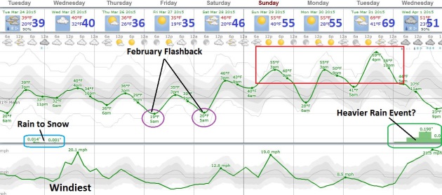
Keep telling yourself that
Wednesday morning, when we could wake up to a light slushy coating (of
sweet frozen custard!) In spite of a pleading sun temperatures may not
climb out of the 30s Thursday and Friday. No worries. Hints of spring
return this weekend; ECMWF guidance shows a few days in the 60s next
week - maybe a heavier rain event the middle of next week. Bring it on.
Tuesday
night's clipper may spark a light coating, but winter snowfall to date
(30.8 inches) is 20 inches below average here in the Twin Cities.
Perspective: New York City has picked up 23 more inches than the metro
area. Boston is up to 110.3 inches and counting.
Make it stop!
*
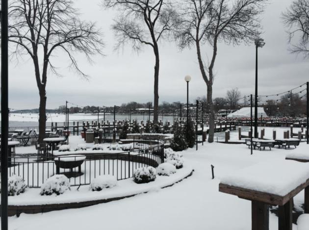
I snapped the photo above at Maynards in Excelsior Monday afternoon.
Yes, that's open water in Excelsior Bay. Note to self, and to anyone
else intent on testing Darwin's Law: stay off the ice.
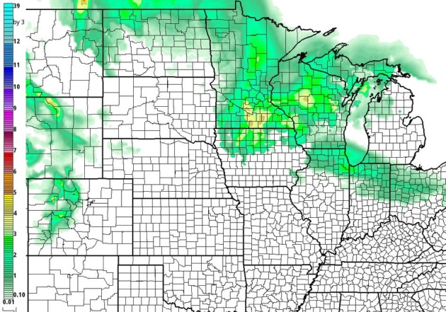
Tuesday Night Slush?
Right now I don't see a rerun of Sunday night's snow blitz, maybe a
coating to an inch of additional slush for portions of Minnesota as rain
ends as a few hours of wet snow tonight. 60-hour NAM snowfall
prediction: NOAA and HAM WEATHER.
Spring On Temporary Hold.
Thursday and Friday will be chilly with temperatures struggling to
climb out of the 30s, but a high sun angle will make mid to upper 30s
feel considerably better than in January. We warm up over the weekend,
European guidance hinting at 60s by Tuesday with a potential for a more
significant rain event the middle of next week.
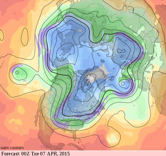
High Amplitude Pattern.
Northern and southern branches of the jet stream are forecast to merge
and amplify by April 6, with a possible rain/snow mix pushing across the
Plains into the Ohio Valley and Northeast, short-circuiting any warming
during the first week of April. Map: GrADS:COLA/IGES.
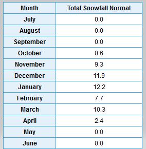
March: Third Snowiest Month of the Year, On Average.
I stand corrected. The other day I mentioned that March was the second
snowiest month (behind January) but in reality the latest 30-year NOAA
averages show March as third snowiest, with an average of 10.3", behiind
January and December. Graph above: Twin Cities National Weather
Service.
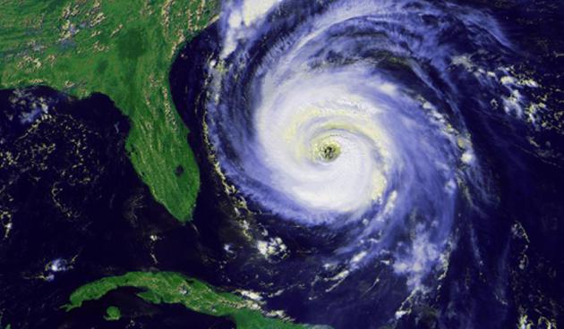
Welcome To The "Double El Nino" - And More Extreme Weather.
Although El Nino tends to often tamp down tornadoes and hurricanes for
the USA it can spike extreme weather (and temperatures) worldwide.
Here's the intro to a story at PRI,
Public Radio International: "
We’re about to experience a “double El Niño” — a rare weather phenomenon that climatologists had warned about several months ago.
That means two consecutive years of the concentration of warm water in
the Pacific Ocean that brings West Coast storms, quiet hurricane seasons
in the Atlantic and busy ones in the Pacific. The danger is that this
could mean more than a few months of odd weather, but instead usher in a
new phase of climate change. Last year was the warmest year on record;
2015 looks set to be even warmer..."
Image credit: "
El Niño Makes Atlantic hurricanes less likely." Credit: NOAA/ National Climatic Data Center.
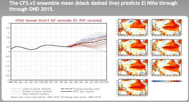
A More Significant (Longer Duration) El Nino Event in 2015?
The Pacific continues to warm and factors may be converging to prolong
some of this warmth into the end of 2015. Expect more warm weather
records to be broken. Chart above: NOAA.
Step Into a 3-D Tornado And See An Epic Storm Up Close.
Here's a quick story and video focused on recreating the May, 2013 EF-5
tornado that hit Moore, Oklahoma, killing 23 people. Scientists are
modeling the storm in high-resolution and then visualizing the supercell
to try to learn more about what makes some supercells spin up monster
tornadoes. Here's a clip from
New Scientist: "...
Using radar data collected as the event unfolded, Bill Carstensen
from Virginia Tech and colleagues built a 3D model of the developing
storm, stacked on top of a digital version of the Oklahoma landscape.
The tornado is displayed in a unique, four-story-high virtual theatre at the university
where it can be viewed with an Oculus Rift headset. The set-up allows a
person to walk into the tornado as though they were a towering giant,
viewing it from the perspective of someone 2.1 metres tall..."
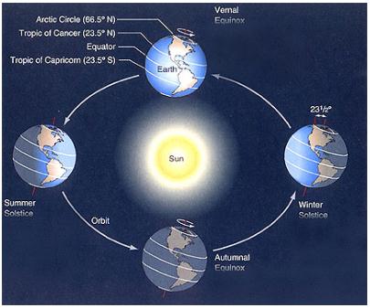 Why Spring Gets About 30 Seconds Shorter Every Year
. Minnesota springs are already short enough, some might add. Here's an excerpt from
Live Science: "...
The
Earth's seasons are caused by the tilt of the Earth on its axis (not by
how close the planet is to the sun). This tilt of 23.5-degrees from the
straight-up-and-down position means that for six months of the year,
the Earth's Northern Hemisphere is leaning slightly toward the sun,
whereas during the other six months, the Southern Hemisphere leans
toward the sun. The main reason spring is getting shorter is that the
Earth's axis itself moves, much like a wobbling top, in a type of motion
called precession..." (Image credit above: NASA).
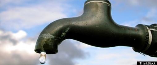
U.N. Report Warns of Serious Water Shortages Within 15 Years. TIME has the story; here's the introduction: "
If
we continue on our current trajectory, warns the report, we'll only
have 60% of the water we need in 2030 The world will only have 60% of
the water it needs by 2030 without significant global policy change,
according to a new report from the U.N.
While countries like India are rapidly depleting their groundwater,
rainfall patterns around the world are becoming more unpredictable due
to global warming, meaning there will be less water in reserves..."
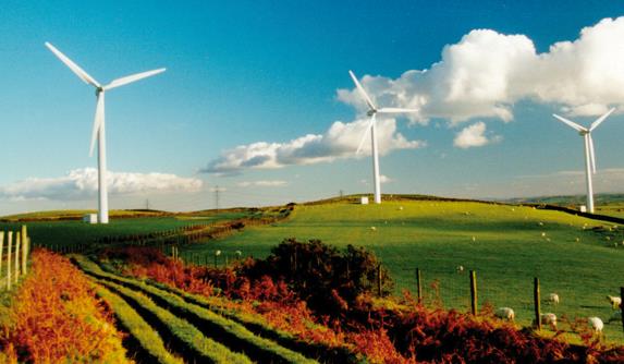
Costa Rica Has Powered Itself Using Only Renewable Energy for 75 Days Straight. Granted, the country is a fraction of the size of the USA, but this is still an impressive feat. Here's an excerpt from
Metro: "
Thanks
to heavy rainfall powering four hydroelectric plants, no fossil fuels
have been burnt to generate electricity since December 2014. According
to the state-run Costa Rican Electricity Institute, 80 percent of the
country’s energy came from hydropower and 10 percent came from
geothermal energy in 2014..."
Tesla's Elon Musk: "A Future Time When Human Driving is Illegal?" A bold statement, and it seems ludicrous today, but 20 years from now? Who knows - but check out
gizmag.com for the story; here's a clip: "...
He's
also bullish on self-driving cars, and this week Musk went so far as to
declare that they may completely replace the cars we drive today."In
the distant future, [legislators] may outlaw driven cars because they’re
too dangerous," Musk said on stage at Nvidia's GPU Technology
Conference, following the introduction of Nvidia’s Drive PX self-driving
car computer. "We’ll take autonomous cars for granted in quite a short
time..."
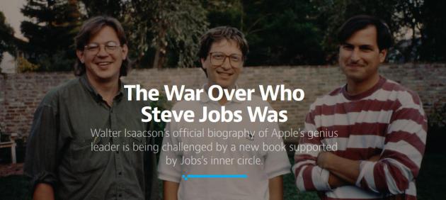
The War Over Who Steve Jobs Was. Backchannel at
medium.com
has an interesting look at the movement to clean up the iGenius's image
and ongoing legacy. Frankly I don't even care if he was an a-hole. He
pushed people to do things they didn't even know they could accomplish
and put a sizable dent in the (digital) universe. That's quite enough
for one life. Here's an excerpt from the article: "...
Isaacson’s
eponymous biography of Jobs became a publishing phenomenon, selling over
a million copies and making Isaacson himself somewhat of a celebrity.
But privately, those closest to Jobs complained that Isaacson’s portrait
focused too heavily on the Apple CEO’s worst behavior, and failed to
present a 360-degree view of the person they knew. Though the book Steve Jobs
gave copious evidence of its subject’s talent and achievements,
millions of readers finished the book believing that he could be
described with a word that rhymes with “gas hole...”
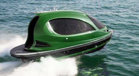
What Comes After Wave Runners? Well, if you have a need for serious speed on the water consider a Jet Capsule Reptile; details via
Gizmag: "
Following the success of the Lazzarini-designed Jet Capsule
mini yacht, a lighter and faster version called the Reptile has been
launched. It's 500 kg (1,102 lb) lighter than its predecessor and is
equipped with a 570 hp Ilmor MV8 high performance marine engine that
powers the compact vessel to maximum speeds of 50 knots – that's over 90
km/h (57.5 mph)..."
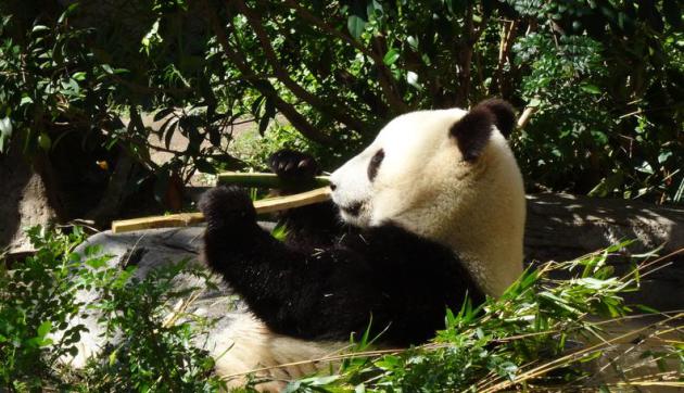
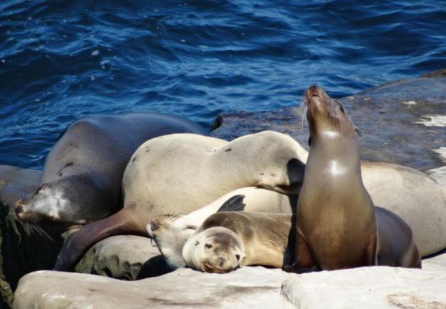
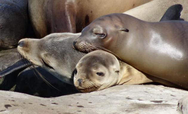
Hungry Pandas and Smiling Sea Lions.
I just got back from San Diego, where I had a chance to check out the
zoo and a couple of very cute panda bears from China. Lounging on the
rocks in La Jolla were sea lions and I swear I saw a few of them
grinning under a lukewarm sun. Hey, I'd be grinning too...
TODAY: Clouds increase. PM showers develop. Winds: SE 15. High: 39
TUESDAY NIGHT: Rain ends as a little wet snow. A light coating of slush is possible. Low: 32
WEDNESDAY: Mostly cloudy, drying out. High: 42
THURSDAY: Peeks of sun, cold breeze. Wake-up: 28. High: 37
FRIDAY: Cold start with a bright blue sky, light winds. Nippy. Wake-up: 19. High: 35
SATURDAY: Intervals of sun, milder breeze. Wake-up: 23. High: 49
SUNDAY: Mild start, then cooling off. Dry. Wake-up: 41. High: 53
MONDAY: Plenty of sun. Springy again! Wake-up: 31. High: 57
Climate Stories...
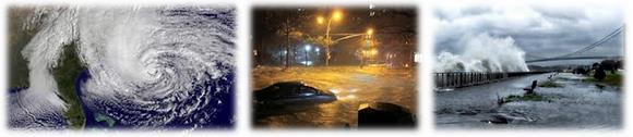
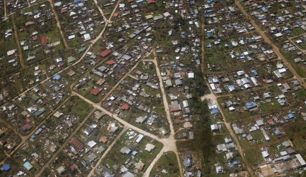
Cyclone Pam Is Just The Start.
Newsweek puts the super-cyclone (same thing as a typhoon and hurricane) into perspective; here's an excerpt: "
In
the wake of island nation Vanuatu’s devastation by Cyclone Pam, in
which 320 mile-per-hour winds killed dozens of people and destroyed 90
percent of the buildings in the capital city of Port Vila, public health
experts fear that the country's ruined infrastructure will result in
mass starvation and epidemics of disease. As the rate of global climate
change continues to increase, such tragedies will become more and more
common around the world. Vanuatu is not alone..."
Image credit above: "
An
aerial view of the destruction after Cyclone Pam hit Port Vila, capital
city of the Pacific island nation of Vanuatu, on March 17, 2015." Edgar Su/Reuters.
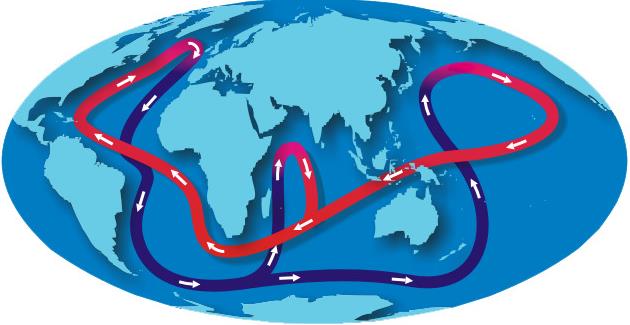
A Slow-Down In The North Atlantic Conveyer Belt?
There was always concern among scientists that melting of (fresh)
water, mainly from a rapidly melting Greenland, might impact the broad
Atlantic Ocean circulation pattern. Chris Mooney has details of new
research at
The Washington Post; here's an excerpt: "...
According to a new study just
out in Nature Climate Change by Stefan Rahmstorf of the Potsdam
Institute for Climate Impact Research and a group of co-authors, we’re
now seeing a slowdown of the great ocean circulation that, among other
planetary roles, helps to partly drive the Gulf Stream off
the U.S. east coast. The consequences could be dire – including
significant extra sea level rise for coastal cities like New York and
Boston..."
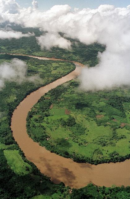
Amazon Forest Becoming Less of a Climate Change Safety Net. Justin Gillis has the story for
The New York Times; here's an excerpt: "
The ability of the Amazon forest to soak up excess carbon dioxide is weakening over time, researchers reported last week.
That finding suggests that limiting climate change could be more
difficult than expected. For decades, Earth’s forests and seas have been
soaking up roughly half of the carbon pollution that people are pumping
into the atmosphere. That has limited the planetary warming that would
otherwise result from those emissions..."
File photo credit: "
Rivers
meander like brown snakes through the world's largest tropical rain
forest, the Amazon basin, home to an estimated 50,000 Asheninka Indians." (Photo by Tyrone Turner).
Journalists Have To Decide What To Do About Candidates Who Are Climate Change Denialists. Jay Rosen has an interesting post at
PressThink; here's an excerpt: "...
Persistence:
Call what it is — a rejection of the science — and keep calling it
that. “The Senator doubts that climate change is real, a position at
stark odds with an overwhelming scientific consensus.” Here, you take
responsibility for pointing out to voters that, while the candidate has
his views, the evidence does not support them. And you do this not once,
but every time the issue comes up. This is the fact-checking solution.
Advantage: puts the campaign press back on the side of truthtelling. A
major plus! Problem: likely to result in charges of bias from the
candidates so described, likely to trigger the backfire effect among some voters (“in which corrections actually increase misperceptions among the group in question.”)..."


No comments:
Post a Comment