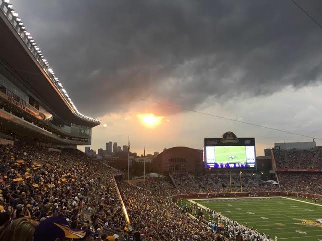
A well advertised thunderstorm event seemed to be a little underwhelming (severe-wise). However, strong thunderstorm developed in a few areas with heavy rain and a few hail reports. It also disrupted the Vikings' 3rd preseason game at TCF Bank Stadium a couple of times. If you were watching/listening, you overheard play being suspended during the 2nd quarter due to thunderstorms moving through the area. Thanks to Kristin Ladwig Eggebraaten for the series of pictures below, who was at the game and experienced the situation first hand.
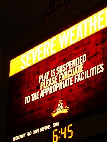
Kristin also snapped this picture from Williams Arean where Vikings fans were evacuated to get out of the inclement weather.

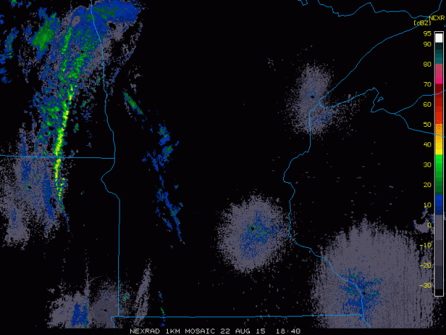
Storms on Radar
Take a look at the line of thunderstorms that developed during the PM hours on Saturday. Note the two distinct lines that developed, but the second line really seemed to 'pop' as it went through the twin Cities. Interestingly, there wasn't a lot of severe weather reports with this particular event, but the rain was quite impressive where some of the heaviest thunderstorms developed.
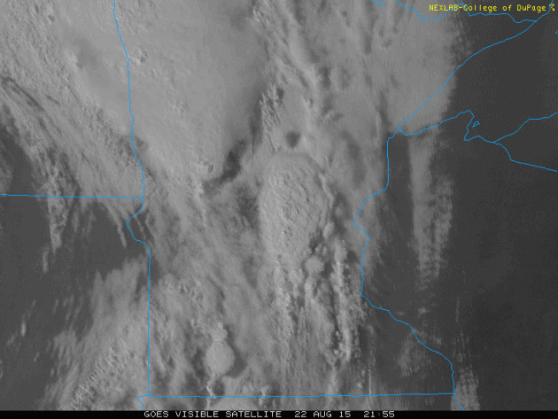
Storms via Visible Satellite
The visible satellite loop below shows thunderstorms exploding across parts of the Upper Mississippi Valley as the sun was going down late Saturday.
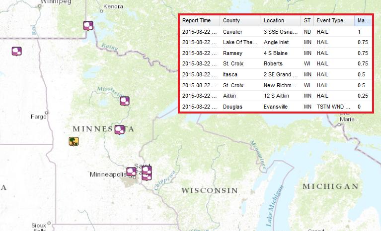
Not So Many Storm Reports...
Thankfully, there were only a few hail reports across the region... It really could have been much worse.
_______________________________
Respect
By Paul Douglas
Traditions ground us; they're the glue that hold families (and societies) together. I can't imagine Minnesota without the State Fair, the Fishing Opener and the St. Paul Winter Carnival.
I'm at OBX, the Outer Banks of North Carolina, where our east coast family likes to gather when they're not invading our cabin up north. At least there's nothing in the water up at Pelican Lake that can take my arm off; no underwater beasts that will leave me pointing to the weather map with a hook. Could be a good gimmick though..? Hmmm.
Here in Corolla, North Carolina we're tracking sharks, riptides, undertows and jellyfish. Other than that the water is great! Suddenly Minnesota's lakes look even more inviting.
Yesterday's barrage of severe T-storms is gone; northwest winds whipping up behind another supernaturally vigorous cool front. I know it's back-to-school time and the first Christmas sale is imminent, but let's wait until after October 1 to chat about cold fronts. Not going there.
Peeks of (refreshing!) sun today give way to a streak of comfortable blue sky this week; the next chance of a lonely thundershower Friday. I'd wager a stale bagel we'll see 90s again by Labor Day.
________________________________
SUNDAY: Showers north, windy and cooler. High: 70. Winds: NW 20-30
SUNDAY NIGHT: Mostly clear, still breezy and cooler. Low: 50. Winds: WNW 10-25.
MONDAY: Partly sunny, brisk for August. High: 71. Winds: WNW 10-25
TUESDAY: Blue sky, just about perfect. Wake-up: 54. High: 73
WEDNESDAY: Blue sky, light wind. DP: 48. Wake-up: 56. High: 75.
THURSDAY: MN State Fair Starts! More sun, seasonal temps. Wake-up: 58. High: 79
FRIDAY: Less sun, a few stray t-storms. Wake-up: 61. High: 78
SATURDAY: Nothing rought. Wake-up: 62. High: 81.
__________________________________
This Day in Weather History
August 23rd
1955: Hail in Houston County, with piles to a foot deep at Rushmore.
___________________________________
Average High/Low for Minneapolis
August 23rd
Average High: 80F (Record: 97F set in 1948)
Average Low: 61F (Record: 42F set in 1891)
____________________________________
Sunrise/Sunset Times for Minneapolis
August 23rd
Sunrise: 6:24am
Sunset: 8:06pm
____________________________________
Moon Phase for August 23rd at Midnight
1.5 Days Since First Quarter
____________________________________
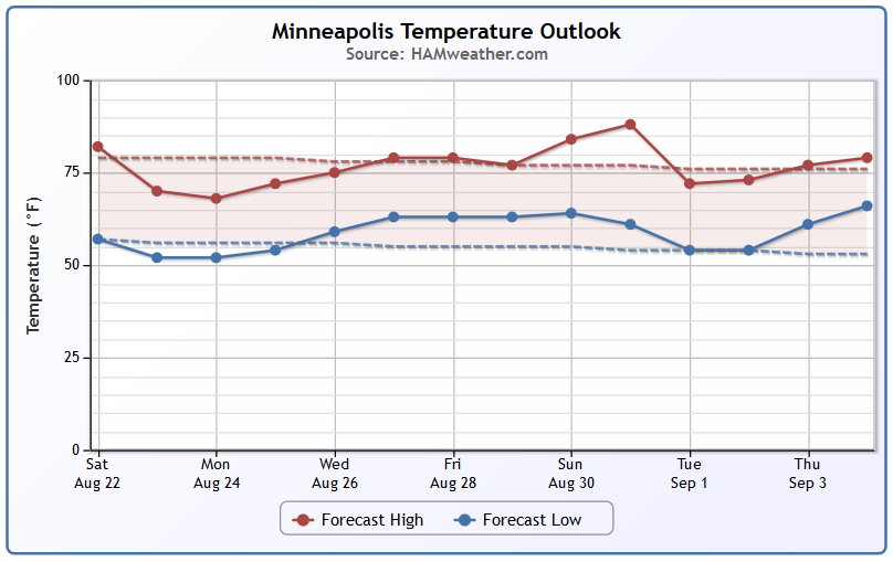
Minneapolis Temperature Trend
Fall-like temperatures return on Sunday and Monday with highs in the 60s across much of the state. We gradually warm to near average temps again by late week/weekend. We're still getting indications of a brief hot spell at the end of the month.
_________________________________
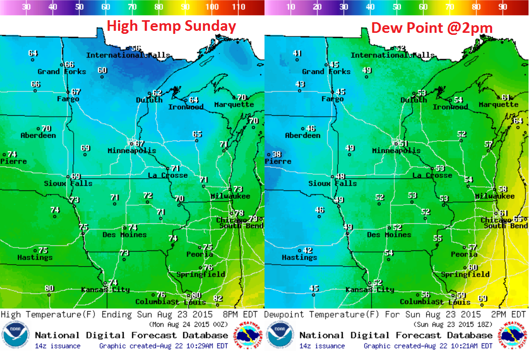
Sunday Weather Outlook
Welcome back to fall! Highs on Sunday will be in the 50s and 60s across the state with falling dewpoints and humidity values. It will feel more like September/October... grab your favorite sweatshirt!
Sunday Weather Outlook
Wrap around moisture will continue across parts of northern MN and WI through Sunday. Locations farther southwest will actually see a little sunshine. We'll see a gradual clearing late Sunday into early next week.
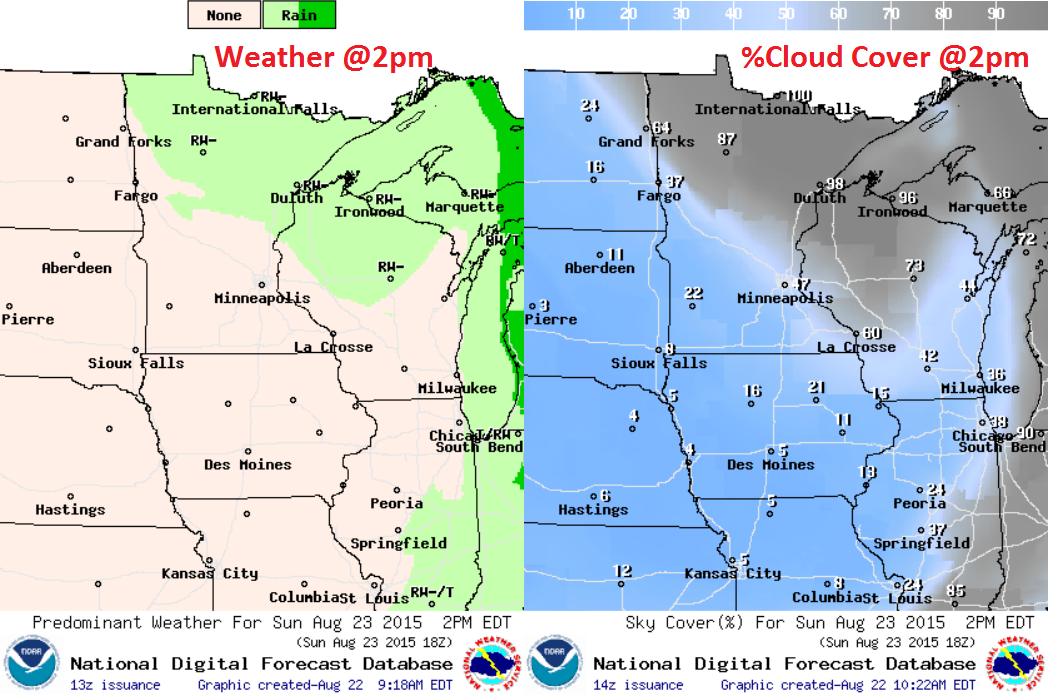
Sunday Weather Outlook
The vigorous area of low pressure will help to whip up strong winds on Sunday. Note that wind gusts could be around 30mph+ during the afternoon hours!
__________________________________
Morning Cup of Sunshine
Thanks to my good friend Beret Grong Brost for the picture below. Sure is a peaceful view from the shores of Lake Superior! Note the sun looks a little smoky. This is actually from all the wildfires in the Western U.S.. Thanks Beret, enjoy the rest of you weekend! Though, it'll feel like September/October up there on Sunday...

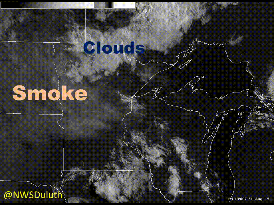
Smoke on Satellite
Here's a neat animation from the National Weather Service in Duluth. They put together a visible satellite loop of what it looked like as smoke was drifting across the Upper Midwest on Friday.
"Smoke from wildfires out west is moving across the country today, with smoke now over the northern plains into the Upper Midwest. This animation of the visible satellite shows the smoke as it spread into the Northland this morning. This smoke aloft will result in hazy orange-hued look to the sky today."
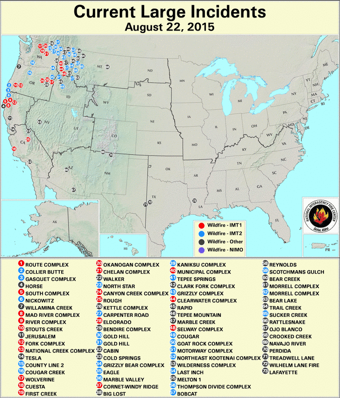
Large Wildfires
Take a look at all the active wildfires in the Western U.S.! The largest concentration is across the Northern Rockies, espeically in Washington, Oregon, Idaho and Montana!
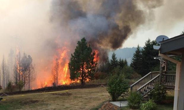
Clearwater Complex
Here's a humbling image... Note the large flames near this home! Unfortunately, several structures have been burned this year due to the large amount of wildfires in the Western U.S.. Interestingly, a number of these have started from lightning! Extremely dry, hot and windy conditions have allowed for explosive wildfire growth in many areas. Thousands of personnel have been working around the clock to help fight these fires... Kudos to the many many men and women on the front lines and behind the scenes!
Clearwater Complex: Facts at a Glance (Updated 8/22)
Size: 41,313 total acres· Date Started: 08/10/2015 Percent Containment: 40%
Personnel Assigned: 845 Equipment: 56 engines, 12 dozers, 25 water tenders
Cause: Lightning
Aircraft Assigned: 5 helicopters
(Image Credit: InciWeb via Steve Creech)
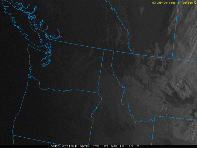
Widespread Smoke
Take a look at the visible satellite from AM Saturday across the Pacific Northwest. The the smoky haze that seems to be drifting throughout the region there. That is the dense smoke from all the wildfires burning there!
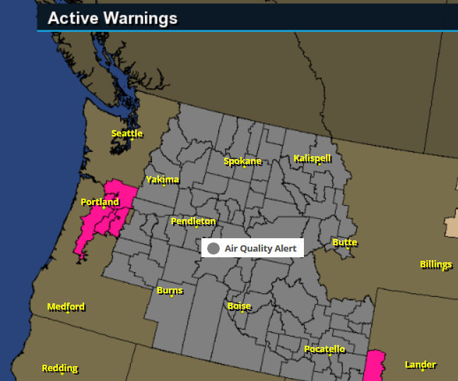
Widespread Smoke - Poor Air Quality
A SMOKE AIR QUALITY ALERT HAS BEEN ISSUED. WILDFIRES BURNING IN THE REGION COMBINED WITH FORECASTED CONDITIONS WILL CAUSE AIR QUALITY TO DETERIORATE AND COULD REACH UNHEALTHY LEVELS. POLLUTANTS IN SMOKE CAN CAUSE BURNING EYES...RUNNY NOSE...AGGRAVATE HEART AND LUNG DISEASES...AND AGGRAVATE OTHER SERIOUS HEALTH PROBLEMS. LIMIT OUTDOOR ACTIVITIES AND KEEP CHILDREN INDOORS IF IT IS SMOKY. PLEASE FOLLOW MEDICAL ADVICE IF YOU HAVE A HEART OR LUNG CONDITION.
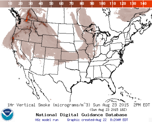
Smoke Analysis
Thick smoke from the western wildfires continues to drift east. Smoky sunsets can be seen on Sunday where brown/red colors show up below.
________________________________
National Weather Outlook
Widespread thunderstorms PM Saturday will give way to much nicer conditions across the Upper Midwest as we head into early next week. However, the strong cold front will make it feel more like fall in many locations through the middle part of the country.
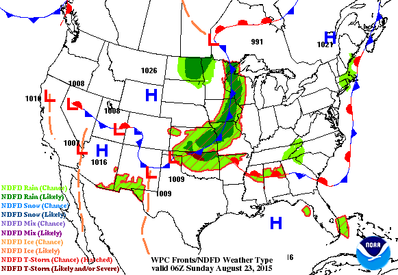
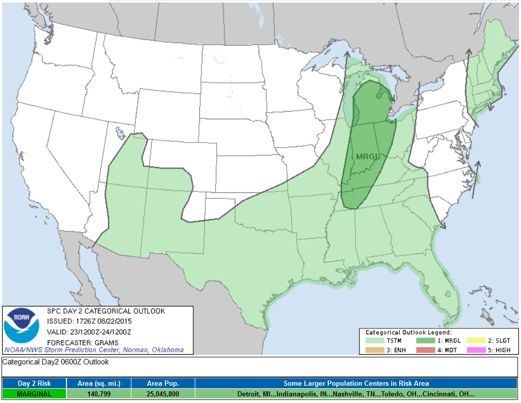
Severe Threat Sunday
...SUMMARY... ISOLATED STRONG TO SEVERE STORMS WILL BE POSSIBLE FROM LOWER MICHIGAN TO THE MID-SOUTH...MAINLY MIDDAY TO EARLY EVENING ON SUNDAY. DAMAGING WINDS SHOULD BE THE PRIMARY HAZARD. ...SYNOPSIS... LEAD SHORTWAVE IMPULSE CENTERED ALONG THE MN/ONTARIO BORDER AT 12Z/SUN SHOULD SHIFT N ACROSS NWRN ONTARIO AS AN UPSTREAM IMPULSE TRACKS ACROSS THE UPPER MS VALLEY TO UPPER GREAT LAKES. INITIALLY DEEP SURFACE LOW WILL UNDERGO CYCLOLYSIS AS IT DRIFTS E OVER NWRN ONTARIO. ATTENDANT OCCLUDED/COLD FRONT WILL PUSH E ACROSS THE GREAT LAKES/MIDWEST AND SE OVER THE LOWER MS VALLEY/SRN PLAINS.
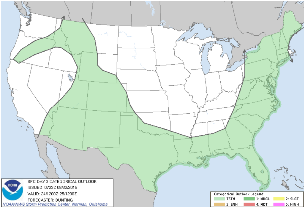
Severe Threat Monday
...SUMMARY... SCATTERED THUNDERSTORMS WILL BE POSSIBLE MONDAY ALONG A COLD FRONT FROM THE NORTHEAST U.S. INTO THE MID-ATLANTIC AND GULF COAST STATES. SCATTERED STORMS ARE ALSO POSSIBLE ACROSS THE SOUTHWEST U.S. ...SYNOPSIS... A SLOW-MOVING UPPER LOW WILL PERSIST OVER THE GREAT LAKES/SOUTHERN ONTARIO MONDAY WHILE CONTINUING TO GRADUALLY WEAKEN. UPPER LEVEL HIGH PRESSURE WILL REMAIN CENTERED NEAR THE FOUR-CORNERS REGION. A FRONTAL BOUNDARY WILL EXTEND FROM THE NORTHEAST U.S. SOUTHWARD THROUGH THE MID-ATLANTIC AND SOUTHEAST STATES...THEN WESTWARD INTO THE SOUTHERN PLAINS LATE MONDAY AFTERNOON.
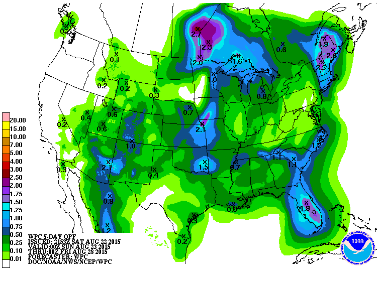
5 Day Precipitation Outlook
______________________________________
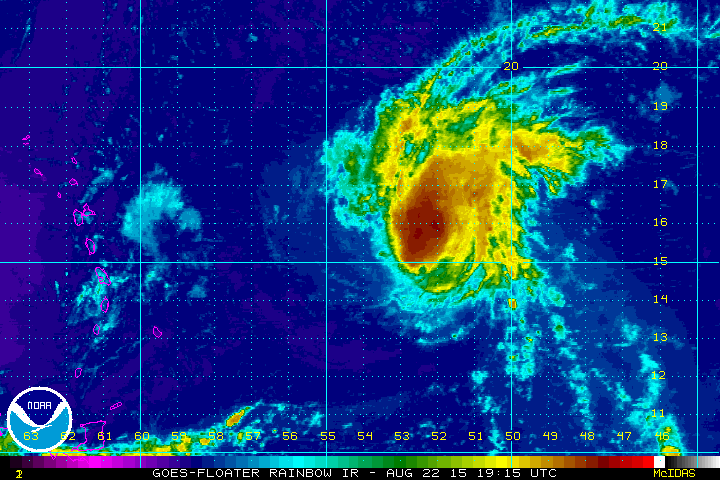
Tropical Update - Danny Drifts West
This was the view of Danny in the Atlantic PM Saturday. Danny had been downgraded from category 3 strength on Friday to a tropical storm. Danny is entering an area with stronger upper level winds (wind shear), which is less favorable for hurricanes. Stronger upper level winds tend to rip apart the storm, so as Danny moves west, look for additional weaken over the coming days.
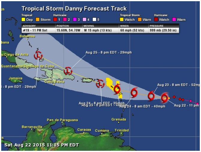
Tracking Danny
According to NOAA's NHC, Danny will continue to track WNW into a less favorable environment, where upper level winds are stronger. This will help to an expected weakening process as it drifts over some the Caribbean Islands. The forecast has Danny weakening into a tropical depression north of Cuba late next week.
_________________________________
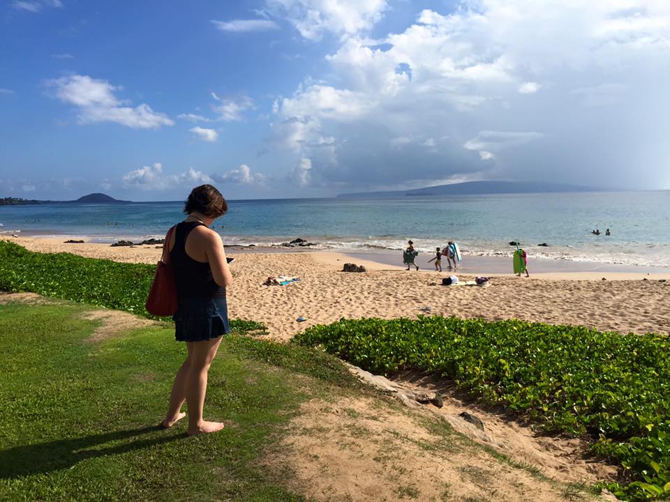
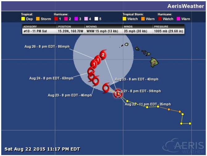
A Hurricane in Hawaii?
Thanks to my family members Jessica Gust and Aaron McEachran for this beautiful picture from Maui. Jessica texted me earlier this month wanting to know if there was any risk of a tropical system moving across the islands, I said the threat remains low, but latest forecasts suggests a more interesting outlook later this week.
Kilo in the Central Pacific
According to the Central Pacific Hurricane Center, Kilo was only a tropical depression on Saturday morning. However, Kilo is expected to intensify over the coming days as it tracks north toward the Hawaiian Islands.
Tracking Kilo
The forecast for Kilo isn't quite as impressive as it was before (which is good news). However, Kilo may still strengthen to hurricane status by next week as it nears the small islands of Hawaii. Stay tuned!
_____________________________________
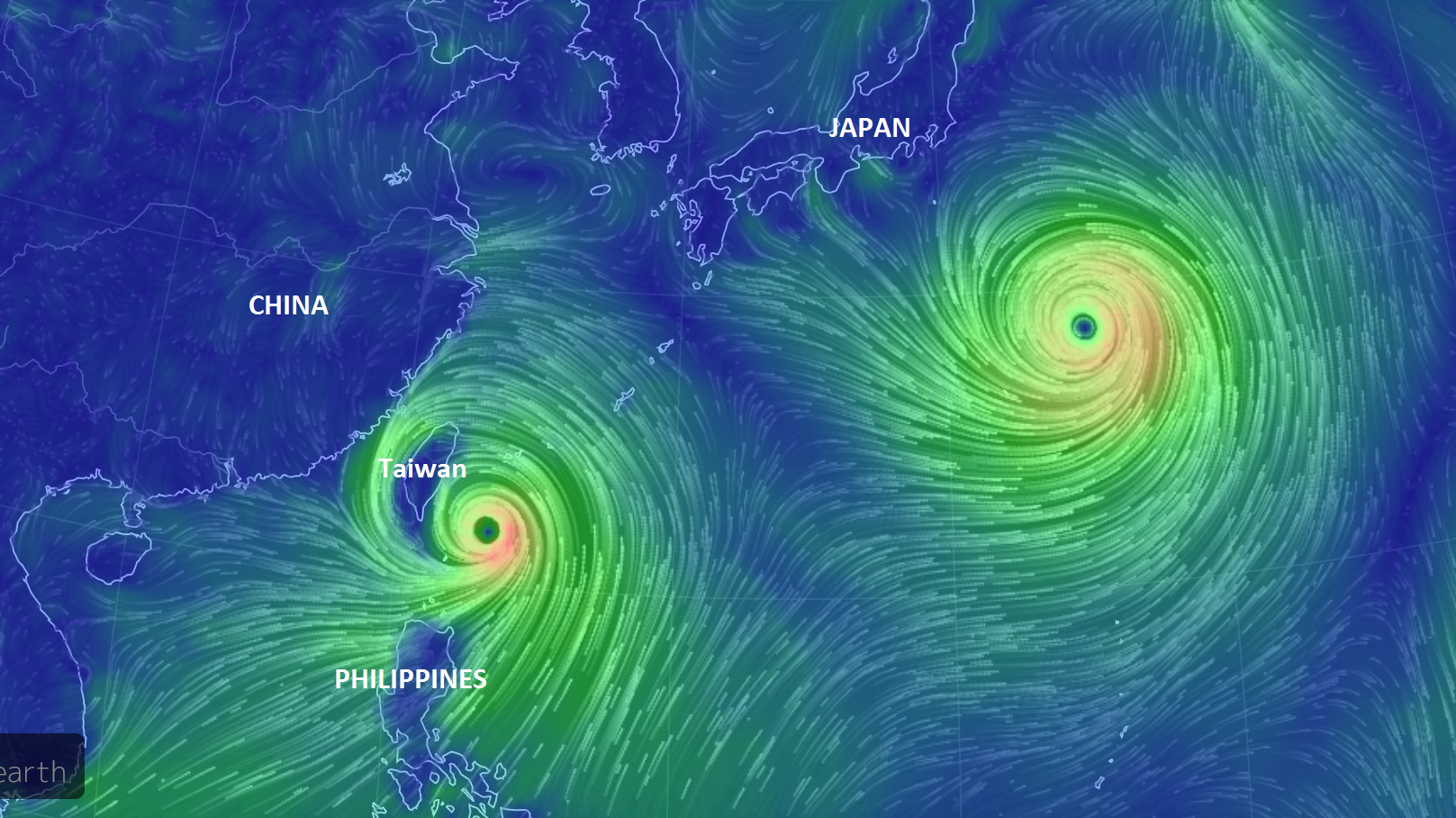
Dualing Typhoons
Weather maps in the West Pacific have been pretty interesting to look at over the past several days. The image below showed the extensive wind field associated with two typhoon (GONI & ATSANI). Note the western-most system (GONI) impacting places like the Philippines and Taiwan. Keep in mind that Taiwan saw a direct hit with a very strong Typhoon Soudelor a couple of weekends ago. Another strong typhoon is not something they would like to see now. Meanwhile, Atsani continues to be more of a fish storm (mainly over water), but note how much large it is compared to Goni.
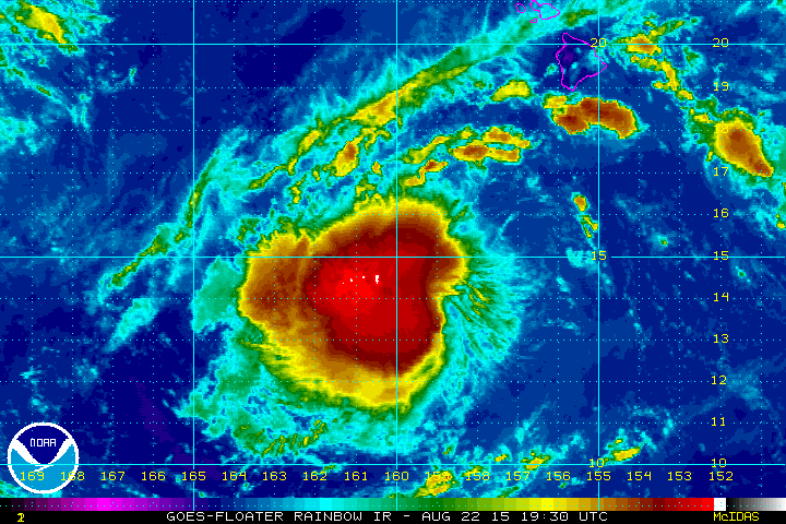
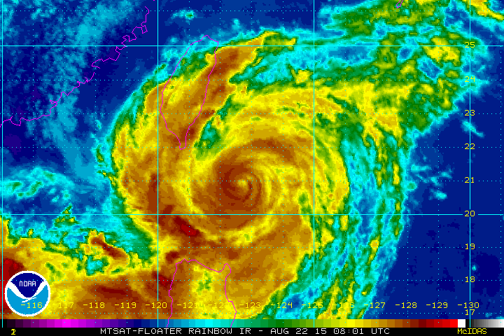
Goni Satellite
While the center of GONI appears to be off-shore, heavy (flooding) rains and gusty winds are still impacting the northern Philippines and Taiwan.
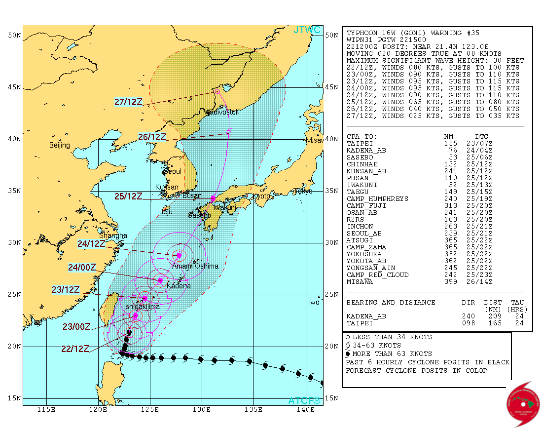
Tracking GONI
According to the Joint Typhoon Warning Center, GONI will continue to drift NNE over the coming days, impacting southern Japan early next week.
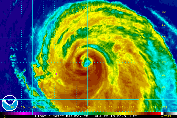
ATSANI Satellite
The satellite loop of ATSANI from Saturday showed the eye starting to deteriorate a bit as it began a more NNE track into the open waters of the Pacific.
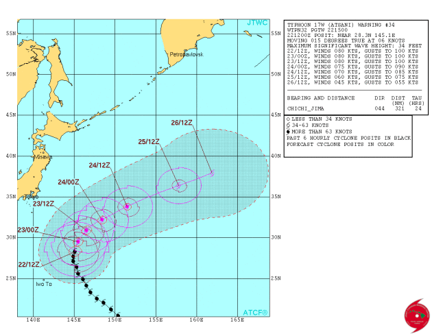
Tracking ATSANI
This is what you call a fish storm. While ATSANI has been impressive at different stages in it's life cycle, it has stayed mainly over open water. The forecast track from the JTWC has ATSANI drifting NE (away from Japan) through next week.
Thanks for checking in and have a great rest of your weekend. Don't forget to follow me on Twitter @TNelsonWX

No comments:
Post a Comment