Spits of wind-whipped rain showers continued on the western flank of a fairly vigorous area of low pressure for mid August. I actually had a brief bout of anxiety thinking about the upcoming cold season, thinking it's going to be here before we know it. Enjoy the upcoming weather while you can, Tuesday and Wednesday's weather was a little taste of what's right around the corner...

Fall-Like Storm
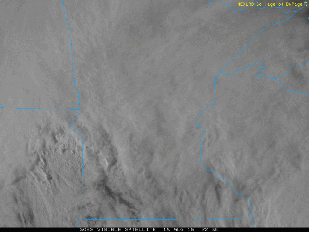
Here's a neat animation of the fall-like storm system that was with us on Tuesday and Wednesday. Note the tight counter-clockwise circulation as it slid northeast toward Lake Superior. This was responsible for late Septemberish/early Octoberish temperatures and heavy rainfall tallies. The good news is that the storm system will loosen it's grip on the region Thursday. Friday will feel like August again with sunshine and temps near 80 degrees.
Tuesday Rainfall
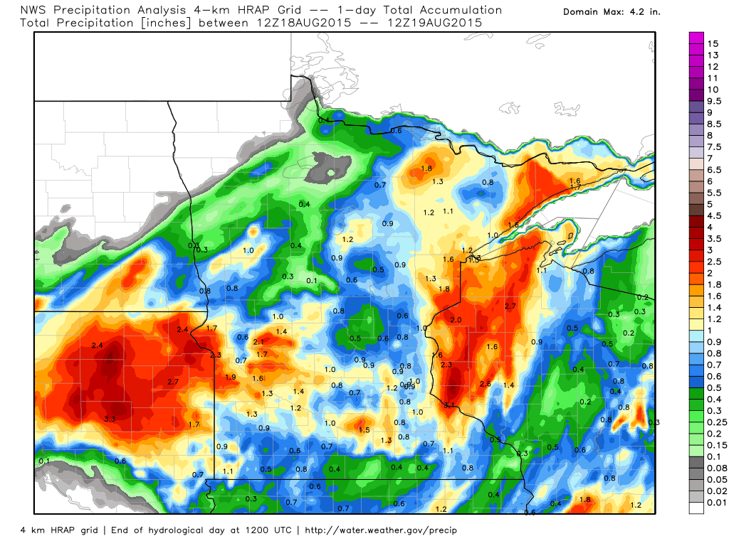
Radar estimated rainfall tallies from AM Tuesday to AM Wednesday showed pockets of heavy rain across parts of the Upper Mississippi Valley. Note the several 1" to 2" amounts during that time frame.
_________________________________
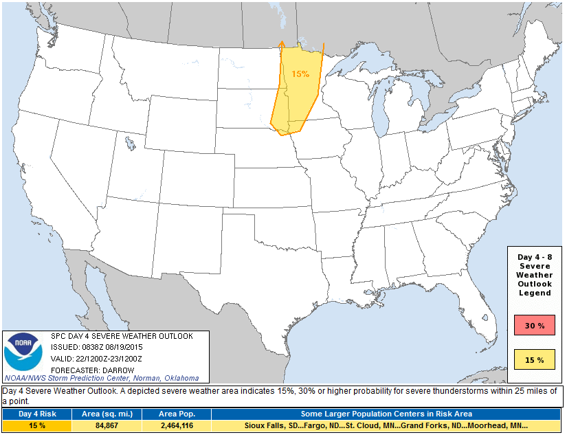
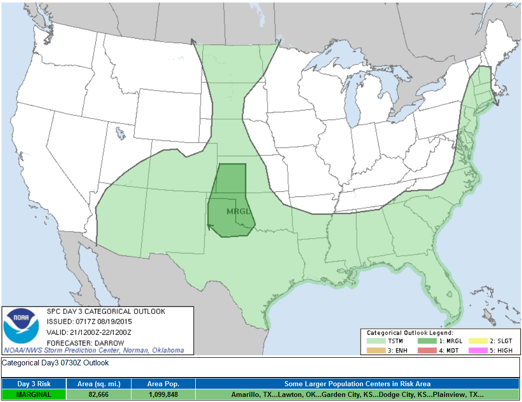
Severe Threat Saturday?
...DISCUSSION... LATEST MEDIUM RANGE MODEL GUIDANCE CONTINUES TO SUGGEST A STRONG UPPER TROUGH WILL TRANSLATE ACROSS THE NRN ROCKIES INTO THE NRN PLAINS DURING THE DAY4 PERIOD. FOCUSED HEIGHT FALLS ALONG A PRONOUNCED PROGRESSIVE COLD FRONT SHOULD ENHANCE UVV SUCH THAT TSTMS SHOULD DEVELOP ACROSS THE UPPER RED RIVER VALLEY INTO MN BY LATE AFTERNOON. AMPLE MOISTURE IS EXPECTED TO RETURN ACROSS THE PLAINS INTO THE UPPER MS VALLEY ENHANCING A NARROW CORRIDOR OF INSTABILITY WHERE SHEAR PROFILES ARE EXPECTED TO SUPPORT ORGANIZED CONVECTION. WHILE THUNDERSTORMS APPEAR POSSIBLE DOWNSTREAM AHEAD OF THIS FEATURE DURING THE DAY5 PERIOD...MOISTURE/INSTABILITY ARE EXPECTED TO BE CONSIDERABLY WEAKER OVER THE GREAT LAKES AND THE PROSPECT FOR ORGANIZED SEVERE CONVECTION IS TOO LOW TO WARRANT A RISK ATTM.
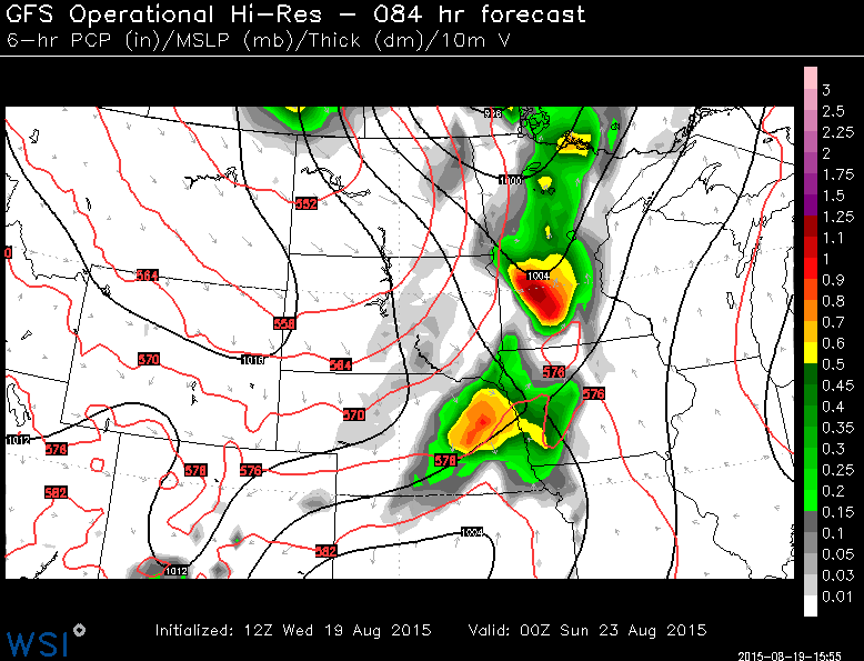
Saturday Severe Threat
Warmer and somewhat muggy conditions will help to set the stage for a what looks like a fairly thundery Saturday evening/night across parts of the Upper Midwest. The image below is the 6 hourly precipitation forecast through 7pm Saturday. Stay tuned for more updates as we get closer to the weekend.
_________________________________________
Bucket List
By Paul Douglas
Zermatt. Bavaria. Maui. Watercolor. Coronado Island. Pelican Lake. Excelsior. A few of my favorite spots on the planet and I'm determined to find more. I'm up to 47 countries, and there's much more to explore.
My wife and I have made a conscious decision not to wait until we're in our 80s. Too many unknowns. So we're setting out now, seeing as much of the planet as we can, always relieved to return home to Minnesota.
Recent research suggests that experiences, not things, provide the most lasting satisfaction. We buy stuff, it makes us happy for a little while, then the thrill wears off. But trips - time with friends and family - those memories seem to endure. What's on your bucket list?
The sun makes a cameo appearance today; temperatures warming into Saturday, when a few late-day T-storms herald the arrival of another autumnal push of fresh air. Sunday looks windy & showery; then we dry out and warm up again next week.
The maps sure don't look like mid-August. A ridiculously resilient ridge of high pressure out west keeps a parade of cool fronts sailing south into Minnesota.
But summer isn't over. The GFS model still brings 90s into town late August and early September.
______________________
WEDNESDAY NIGHT: Breezy with lingering showers. Low: 53. Winds: WNW 10-20
THURSDAY: Hints of September. Fresh sun. High: 73. Winds: WNW 10-15
THURSDAY NIGHT: Mostly clear and quiet. Low: 61. Winds: Turning SSE 5mph.
FRIDAY:Warm sun, feels like August again. High: 83.
SATURDAY: Sunny start, late PM t-storms. Wake-up: 65. High: 82
SUNDAY: Showers north, windy and cooler. Wake-up: 59. High: 73.
MONDAY: Sunny with a cool breeze. Wake-up: 55. High: 74.
TUESDAY: Warm sun, less sun. Wake-up: 59. High: 80
WEDNESDAY: Parly sunny, parly sweaty. Wake-up: 63. High: 82.
________________________
This Day in Weather History
August 20th
1904: Both downtown Minneapolis and St. Paul were hit by tornadoes. This was the highest official wind ever recorded in Minnesota over one minute (110 mph in St. Paul).
_________________________
Average High/Low for Minneapolis
August 20th
Average High: 80F (Record: 97F set in 1972)
Average Low: 62F (Record: 40F set in 1950)
__________________________
Sunrise/Sunset Times for Minneapolis
August 20th
Sunrise: 6:21am
Sunset: 8:11pm
___________________________
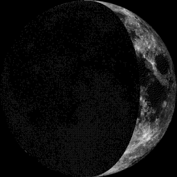
Moon Phase for August 20th at Midnight
1.5 Days Before First Quarter
_____________________________
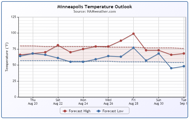
Minneapolis Temperature Trend
After a brief fall-like weather stint, temperatures will gradually warm through the rest of the week to near average temps late this week/weekend ahead. It appears that Saturday will be another fairly warm and muggy day with a chance of a few strong to severe storms late in the day. Post-front Sunday, we cool back down to slightly below average levels. However, note the (potential) big warm up as we approach the start of the MN State Fair late next week! Extended models suggests highs near 100°?? Stay tuned!
Last 100°+ Days in Minneapolis?
According to NOAA's NCDC the average (1981-2010) number of 100°+ days in Minneapolis is only 0.3 days per year! 0.1 days in June and 0.2 days in July.
Last Time Minneapolis hit 100°+: 102° on July 6th, 2012. However, 2 days earlier we hit 101° on July 4th, 2012.
Interestingly, we have only hit 100°+ 4 times since 2006: 103° on June 7th 2011 & 101° on July 31, 2006
____________________________________
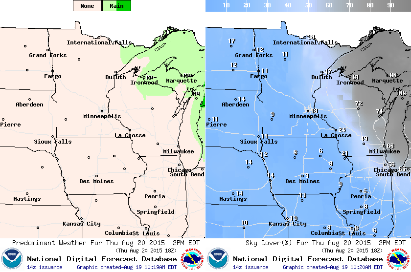
Thursday Weather Outlook
Refreshing sunshine. Thursday's forecast calls for highs in the 70s with less wind. The good news is that our fall-like storm system will loosen its grip across the region, so it won't feel quite as Octoberish as it did on Wednesday.
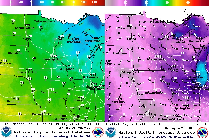
Thursday Weather Outlook
Any lingering showers will be confined to the extreme NE part of MN. Much of the rest of the region will enjoy comfortable sunshine. More sunshine and back to near average temps return Friday.
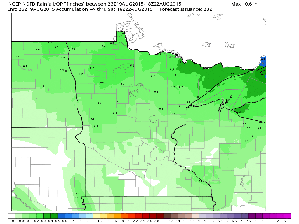
Rainfall Potential
Any additional precipitation from the departing fall-like storm system will be light. Our next best chance of additional rainfall looks to move in late Saturday with the potential of strong storms.
_______________________________
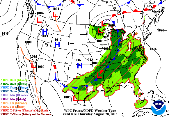
National Weather Outlook
So long fall-like storm. The trailing cold front will continue to push east with scattered showers and storms through Friday. An area of high pressure moves in behind it with drier, cooler weather. Note our next developing impulse of energy across the High Plains late Friday. This will help to trigger additional strong storms over the weekend. Stay tuned.
Severe Threat Thursday
...SUMMARY... LOCALIZED DAMAGING WIND GUSTS WILL BE POSSIBLE WITH THUNDERSTORM ACTIVITY EXPECTED ACROSS PARTS OF THE LOWER GREAT LAKES REGION...THE UPPER OHIO VALLEY...AND THE MID ATLANTIC COAST ON THURSDAY. ...SYNOPSIS... DEAMPLIFICATION OF LARGE-SCALE MID/UPPER TROUGHING NOW PRESENT OVER THE INTERIOR U.S. APPEARS LIKELY THROUGH THIS PERIOD...AS AN EMBEDDED CYCLONE REDEVELOPS NORTHEAST OF THE UPPER GREAT LAKES INTO THE SOUTHERN HUDSON/JAMES BAY REGION. AN ASSOCIATED SURFACE COLD FRONT IS EXPECTED TO ADVANCE FROM THE LOWER GREAT LAKES REGION AND OHIO VALLEY INTO NORTHERN AND MID ATLANTIC COASTAL AREAS...WHILE STALLING AND WEAKENING ACROSS THE GULF STATES AND SOUTHERN PLAINS. SEASONABLY HIGH MOISTURE CONTENT AIR WILL PERSIST TO THE SOUTH AND EAST OF THIS FEATURE...ACROSS THE GULF AND SOUTH ATLANTIC COAST STATES. GUIDANCE IS SUGGESTIVE THAT A PLUME OF THIS AIR ADVECTING NORTHWARD AHEAD OF THE FRONT WILL BECOME INCREASINGLY PINCHED OFF ACROSS THE CHAMPLAIN/HUDSON VALLEY INTO THE NORTHERN MID ATLANTIC COAST BY LATE THURSDAY NIGHT...WHILE A RETURN FLOW BEGINS TO DEVELOP ACROSS THE SOUTHERN INTO CENTRAL HIGH PLAINS.
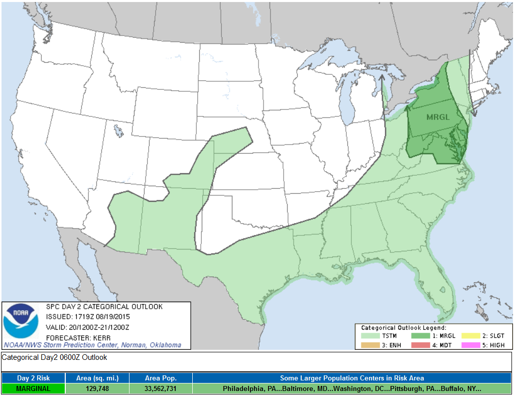
Severe Threat Friday
...SRN/CNTRL HIGH PLAINS... STRONG SHORT-WAVE TROUGH WILL DIG SEWD ACROSS THE NRN ROCKIES DURING THE DAY3 PERIOD. A SECONDARY MUCH WEAKER DISTURBANCE WILL LIKELY FLATTEN SWRN U.S. RIDGE AND APPROACH THE CNTRL/SRN HIGH PLAINS DURING THE AFTERNOON HOURS. THIS LOW-LATITUDE FEATURE SHOULD ENCOURAGE RICHER TROPICAL AIR MASS TO RETURN NWD AND LATEST MODELS SUGGEST A WARM FRONT WILL ADVANCE INTO THE RED RIVER REGION...ARCING NWWD INTO THE HIGH PLAINS OF THE TX PANHANDLE. WARM ADVECTION ALONG WRN FRINGE OF THIS RETURNING BOUNDARY...COUPLED WITH HIGH PLAINS HEATING SHOULD CONTRIBUTE TO AT LEAST ISOLATED ROBUST THUNDERSTORM DEVELOPMENT...AIDED IN PART BY THE WEAK DISTURBANCE. GUSTY WINDS AND PERHAPS SOME HAIL APPEAR TO BE THE MAIN THREATS. FARTHER NORTH...WHILE A FEW THUNDERSTORMS MAY DEVELOP ACROSS THE NRN HIGH PLAINS LATE IN THE PERIOD AHEAD OF AFOREMENTIONED STRONG TROUGH...MOISTURE/INSTABILITY APPEAR TOO WEAK TO WARRANT SEVERE PROBS.
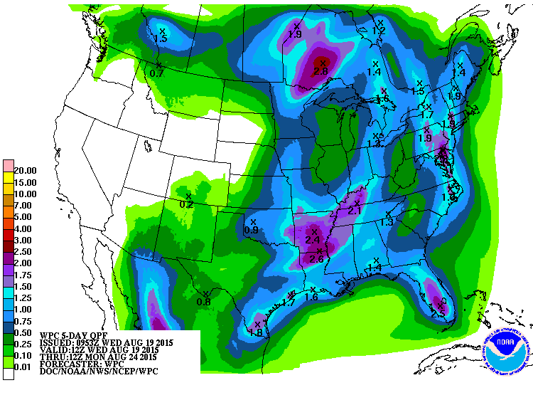
5 Day Precipitation Outlook
Heavy pockets of rain will continue to fall across the eastern half of the country, but the heaviest appears to be along and east of the Appalachians as the front slides east Thursday and Friday. Unfortunately, dry weather continues in the Western U.S., where large wildfires continue to burn.
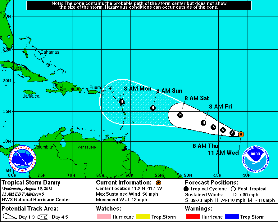
Update on Danny
According to NOAA's NHC, Danny was still a tropical storm on Tuesday, but is forecast to strengthen into a hurricane as early as Thursday. Danny is the 4th named storm of the 2015 Atlantic Hurricane Season, which has a 90% chance of being below average according to the latest NHC forecast.
Tracking Danny
Here's the official NHC forecast track for Danny. Note that Danny is expected to strengthen to hurricane status later this week as it tracks toward the Eastern Caribbean.
__________________________________________
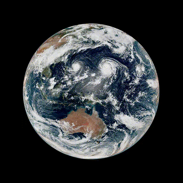
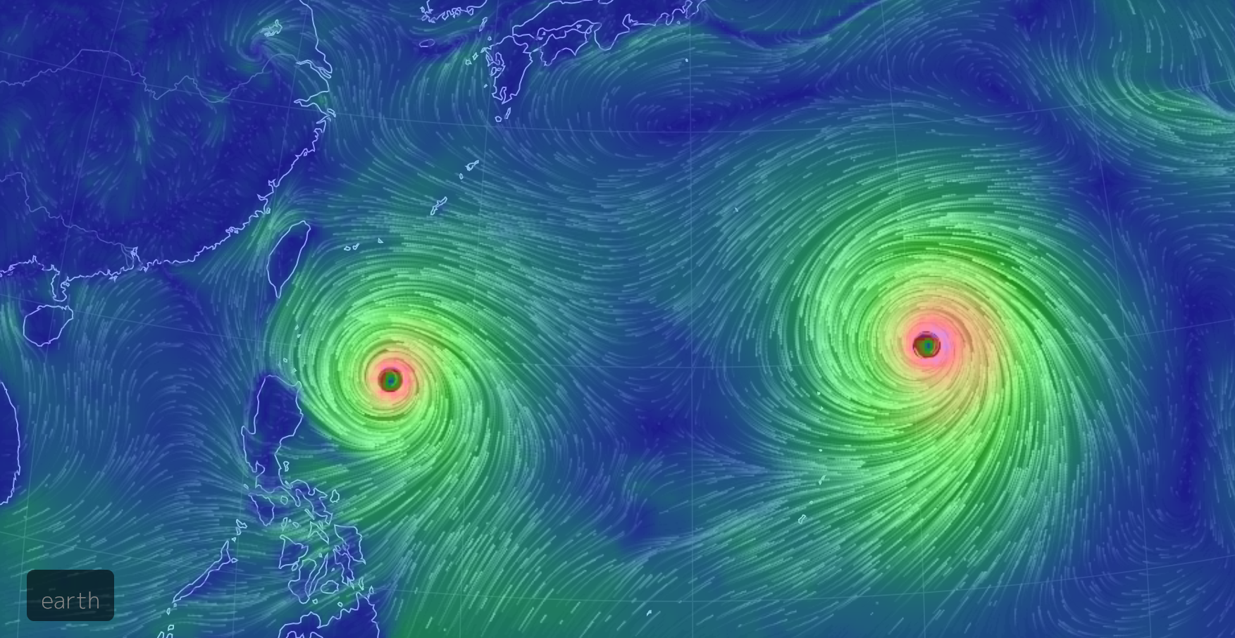
Problems in the Pacific
Menacing typhoons in the West Pacific continue at incredible strength. Both GONI and ATSANI were equivalent to major hurricanes on Wednesday evening (CDT), running at category 4 strength
(Image via: JMA/NOAA - himawari-8 Satellite)
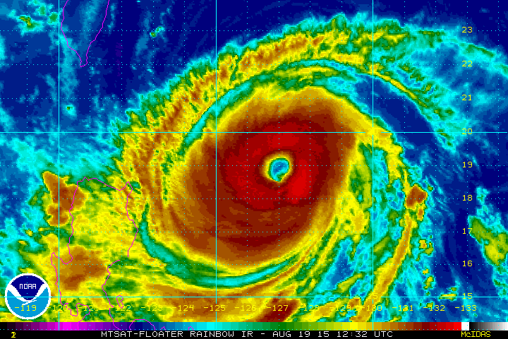
Typhoon GONI
Typhoon GONI is another impressive species in the Western Pacific. The satellite loop from Wednesday evening (CDT) showed a very large, clean eye with intense thunderstorm activity (bright reds) surrounding the eyewall
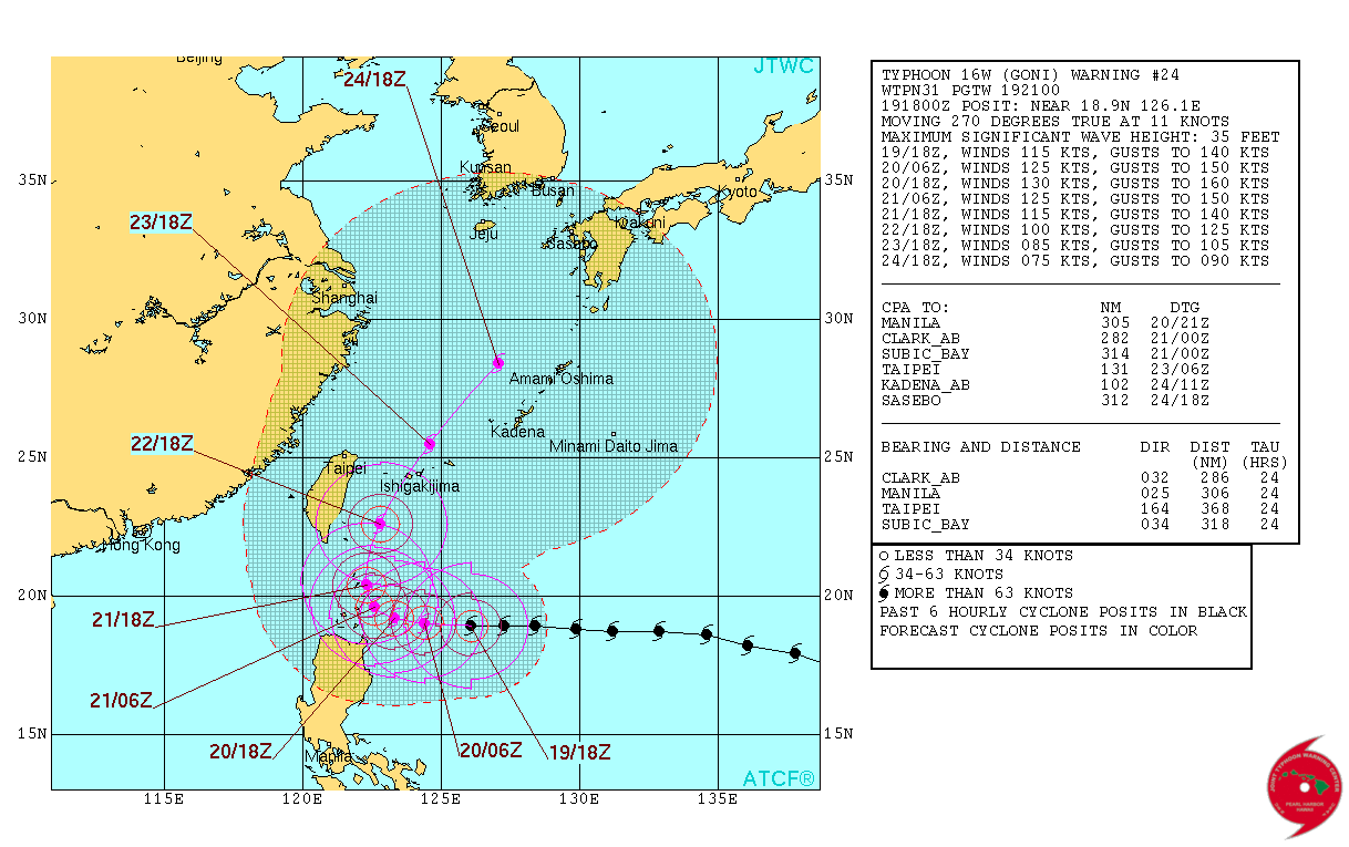
Tracking GONI
According to the Joint Typhoon Warning Center, GONI will take a hard right, steering east of Taiwan. The good news is that it won't be a direct hit like Typhoon SOUDELOR did 2 weekends ago, but heavy rain, strong winds and high surf will still impact the island.
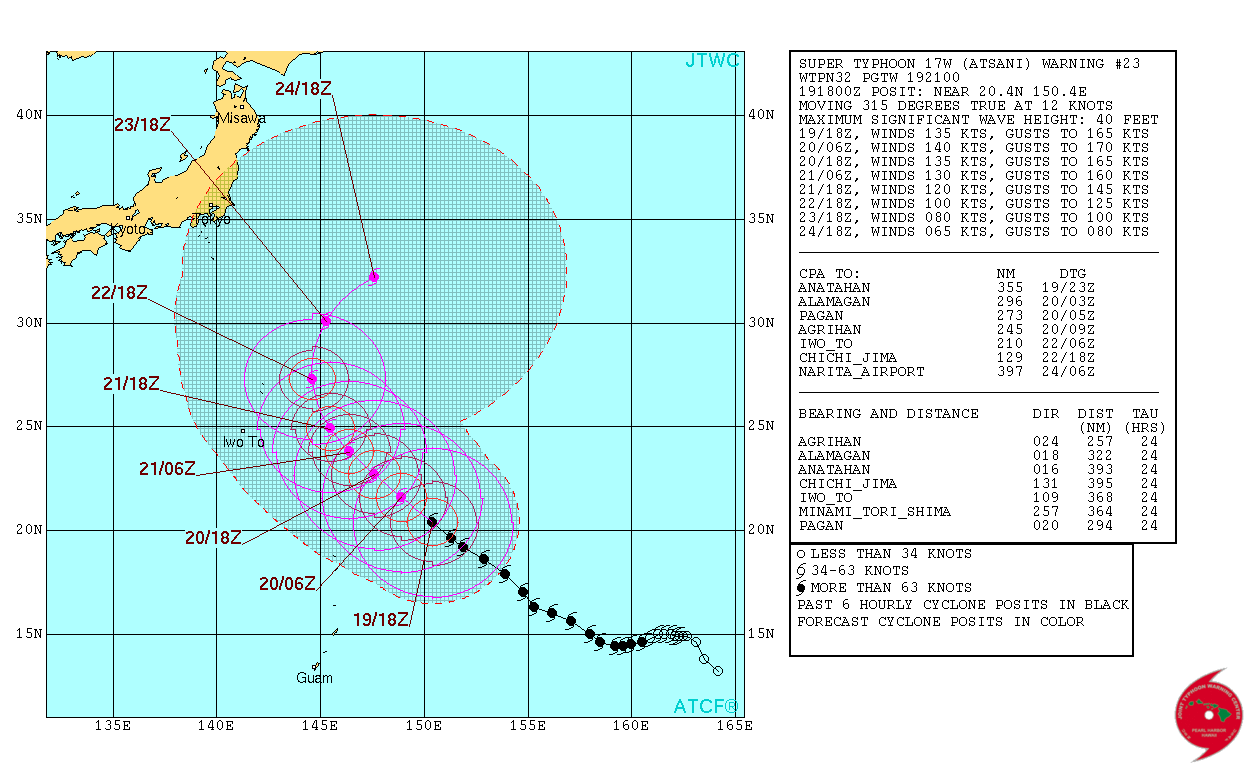
Typhoon ATSANI
Typhoon ATSANI was the stronger of the 2 typhoons on Wednesday. It was just below the category 5 classification with sustained just below 156mph. It really is incredible to think that Mother Nature can produce something so beautiful, yet so violent. Note the near perfectly symmetrical eye!
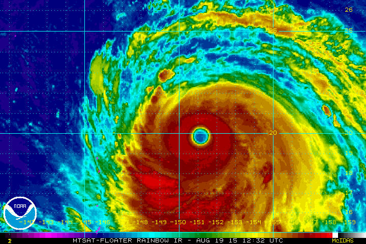
Tracking ATSANI
The good news is that Typhoon ATSANI looks to stay 'mostly' over open water. A problem for ships and slow moving whales, ATSANI could briefly clip up to Super Typhoon status with sustained winds possibly exceeding 160mph...
Thanks for checking in and have a great rest of your week. Don't forget to follow me on Twitter @TNelsonWX

No comments:
Post a Comment