
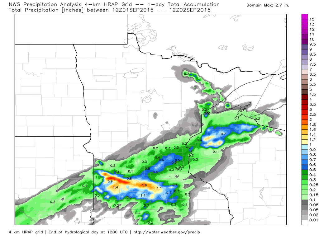
Rainfall Monday through AM Tuesday
Scattered thunderstorms moved through the southern Minnesota Tuesday through AM Wednesday with some heavy pockets of rain, especially across the southwest of the Minnesota River Valley. There were also a few heavy pockets in Northwestern Wisconsin.
Wednesday's Stubborn Sunshine
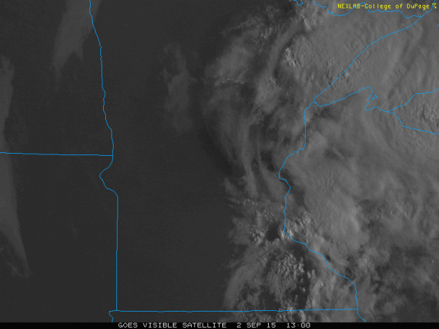
Thanks to lingering thunderstorms in Wisconsin much of the Day Wednesday, low clouds were fairly persistent across central Minnesota, including in the Twin Cities. However, much of the rest of the state was sunny much of the day.
Clouds and Temps
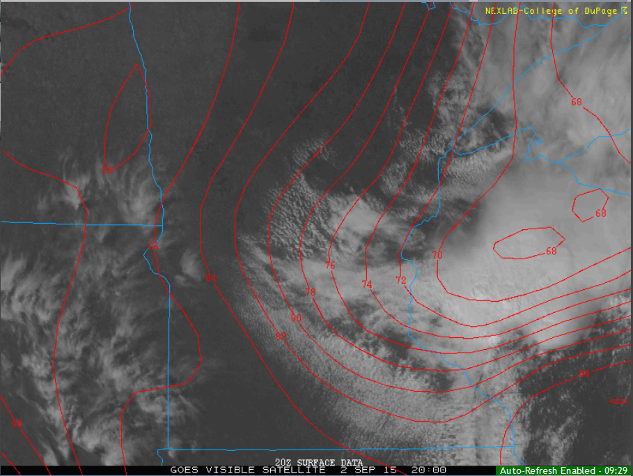
Take a look at how the clouds impacted temperatures across the state on Wednesday. Temperatures in parts of Minnesota and Wisconsin were still in the 60s and 70s by mid-afternoon, while areas that had sunny skies were already in the mid/upper 80s. It's amazing what cloud cover can do to the temperature profile, isn't it?
____________________________________
Dog Days of September
By Todd Nelson
Welcome to the hazy, lazy days of September! Did you miss it? If it wasn't for all the school sales and supplies in local stores, I probably would have forgotten what time of the year it is!
It seems inevitable that we somehow always sneak in a warm spell around the Minnesota State Fair, doesn't it? The great Minnesota sweat together is notorious for a few hot days, people watching and eating too much. BURP!
Weather conditions over the next few days will be reminiscent of the dog days of summer. With high temperatures approaching 90 degrees and dewpoints near 70 degrees, it'll feel more like the mid 90s. The hot, sticky sun will no doubt have you in search of the nearest A/C unit through the weekend.
A large storm system begins slowly sliding our way toward the weekend with several rounds of showers and storms on it's eastern flank. The northern half of the state looks soggier than the rest. However, strong storms could rumble through the rest of the state late Sunday as the main cold front blows through.
I have a nagging suspicion that this could be one of summer's last gasps. Try to enjoy it! We all what's right around the corner.
_______________________________
WEDNESDAY NIGHT: Partly cloudy, warm and sticky. Low: 70. Winds: ESE 5mph
THURSDAY: Hot sun, very sticky. DP: 70F Feels Like: 95F High: 91. Winds: SE 12mph
THURSDAY NIGHT: Mostly clear, warm and sticky. Low: 71. Winds: SSE 10mph
FRIDAY:Sweaty. Crank the A/C. High: 90. Winds: S 10-15 mph
SATURDAY:Sultry. Stray PM t-storm. Wake-up: 72. High: 89
SUNDAY: Last hot day. Strong storms possible late. Wake-up: 71. High: 87
LABOR DAY: Soggy AM, fresh PM breeze. Wake-up: 70. High: 79
TUESDAY: Back to school. Cooler. Rain south. Wake-up: 59. High: 75.
WEDNESDAY: Hello Fall! Rain southeast. Wake-up: 56. High: 70.
________________________________
This Day in Weather History
September 3rd
1989: An early afternoon thunderstorm dropped 1 3/4 inch hail in Stearns and Morrison Counties.
1980: An F2 tornado resulted in $2.5 million in property damage later an F3 touched down causing $25 million in damages in Stearns County.
1970: The record-setting hailstone fell that made Coffeyville, KS famous. It had a circumference of 17.5 inches and weighed 1.67 pounds.
1917: Earthquake felt from Staples to Brainerd.
_________________________________
Average High/Low for Minneapolis
September 3rd
Average High: 77F (Record: 97F set in 1925)
Average Low: 58F (Record: 32F set in 1974)
__________________________________
Sunrise/Sunset Times for Minneapolis
September 3rd
Sunrise: 6:37am
Sunset: 7:47pm
*Daylight lost since yesterday: ~3 minutes and 1 second
*Daylight lost since the summer solstice (June 21st): ~2 hours and 25 minutes
__________________________________
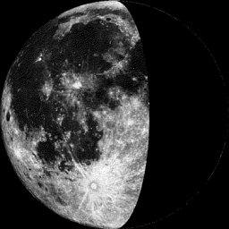
Moon Phase for September 3rd at Midnight
1.1 Day Before First Quarter
_____________________________________
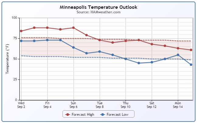
Minneapolis Temperature Trend
Our sweaty September continues over the next several days with temperatures running well above average. There a chance that some of us could hit 90F by the end of the week. Note that temperatures look to take a bit of a tumble back to near normal levels next week.
Here's a little excerpt from a recent Twin Cities National Weather Service Forecast Discussion on how rare this particular warm spell is:
THE EXTENDED PERIOD CONTINUES TO LOOK WARM AND MOSTLY DRY THROUGH THE WEEK...WITH SHOWERS AND THUNDERSTORMS ALONG A PASSING COLD FRONT FOR THE WEEKEND. THE WARMTH IS RATHER IMPRESSIVE FOR THIS TIME OF YEAR...ESPECIALLY WHEN LOOKING AT THE LOW TEMPERATURES AT MSP. ONLY TWICE HAS THERE BEEN A 4-DAY STREAK IN SEPTEMBER OF LOW TEMPS 70DEG OR WARMER...AND CURRENTLY THAT IS FORECAST TO OCCUR THE 2ND THROUGH THE 5TH. THE PREVIOUS SEPTEMBER WARM SPELLS WERE IN 1931 (6 DAYS) AND 1960 (5 DAYS).
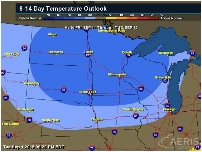
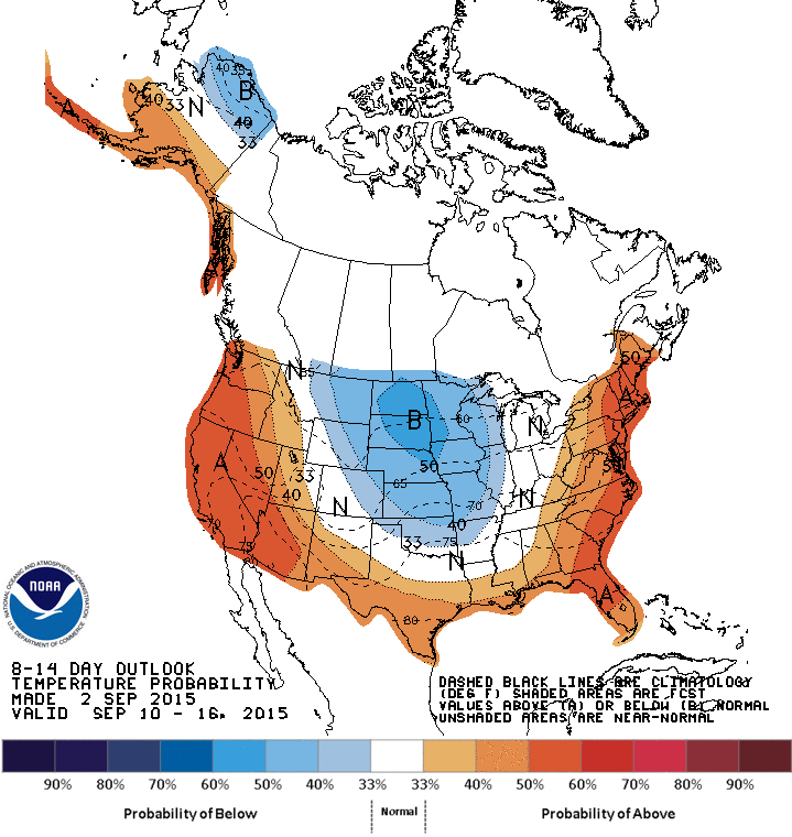
8 to 14 Day Temperature Outlook
According to NOAA's CPC, the 8 to 14 day temperature outlook suggests a good chance of below average temperatures across much of the Upper Midwest by mid month. Stay tuned...
___________________________
Thursday Weather Outlook
Memories of summer will be with us once again on Thursday with highs approaching 90F in many spots. Note the near 100F reading in Pierre, SD!! Keep in mind that dewpoints will be very sticky in the 60s and 70s. Regardless if the actually temperature slides into the 90s or not, it will feel very much like the 90s with dewpoints as highs as they will be... Stay cool.
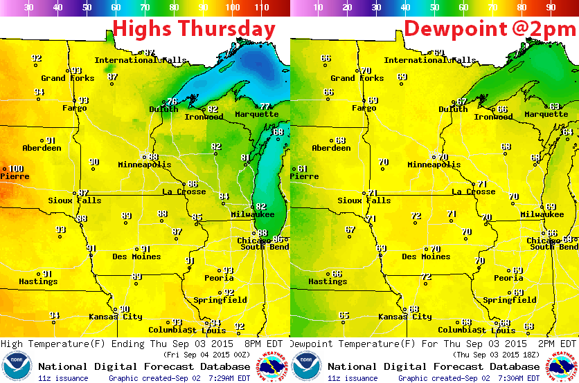
Thursday Weather Outlook
Wednesday's rainfall will continue to slowly push east into the Great Lakes on Thursday. Note that there will be more sun across the region, which will temp to push temperatures into the upper 80s to lower 90s by Thursday afternoon.
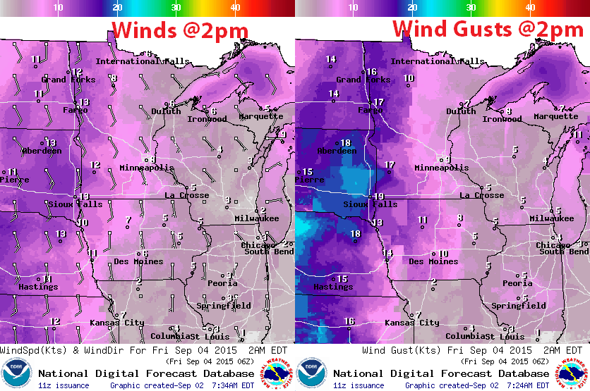
Thursday Weather Outlook
Winds on Thursday will be fairly light across the Upper Mississippi Valley with the exception of far western Minnesota and through the Dakotas where winds will be gusting to near 20mph.
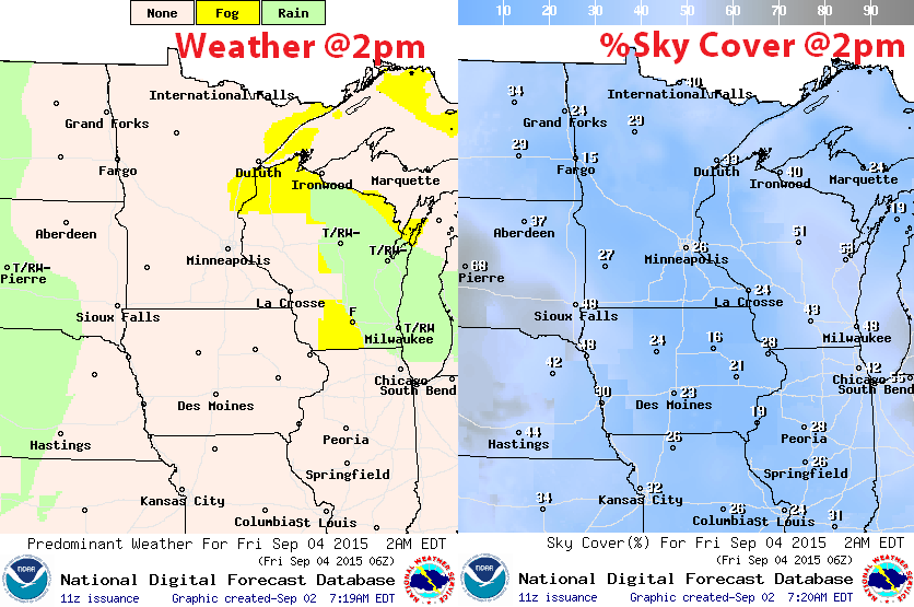
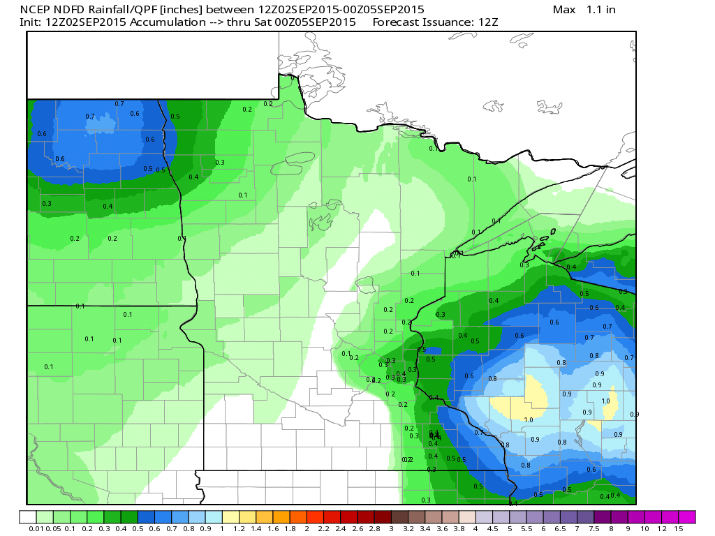
Rainfall Potential
The rainfall potential through Friday starting to push into far northwestern Minnesota as our next system approaches from the west. It'll be a slow mover, so rainfall tallies could add up through the rest of the weekend/into early next week with daily rounds of showers and storms possible.
_______________________________
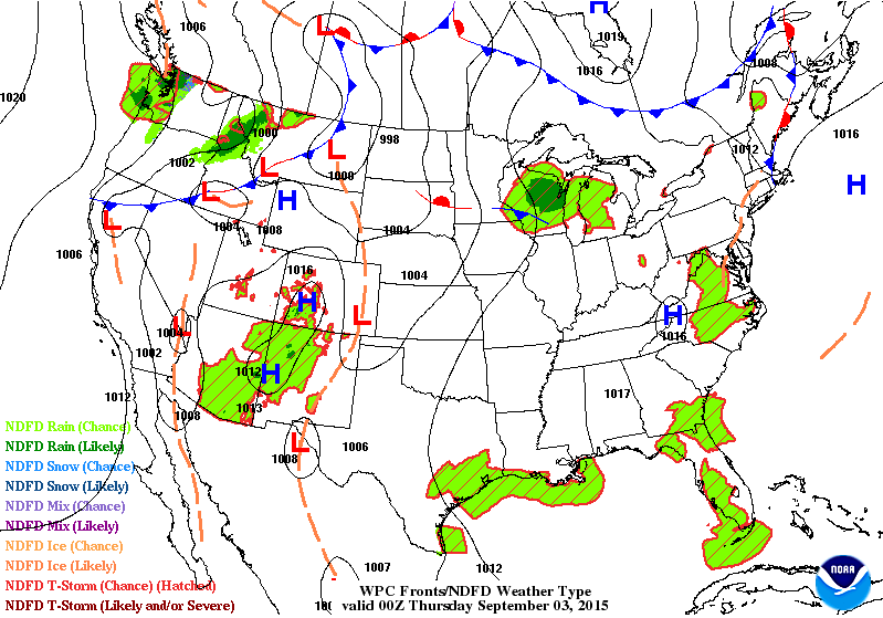
National Weather Outlook
The national weather outlook through PM Thursday shows appreciative moisture moving into the western half of the country, especially along the international border. This slow moving front will have the capability of heavy rainfall potential and a few strong to severe storms over the next several days.
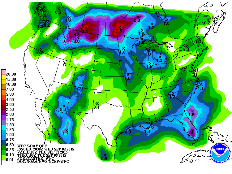
5 Day Precipitation Outlook
According to NOAA's WPC, the 5 day rainfall forecast suggests nearly 1" to 3"+ rainfall potential from parts of Montana through the Upper Midwest and into Canada. Meanwhile, monsoonal moisture will continue to lift north out of the Four Corners Region and tropical moisture will continue over Florida.
National Weather Outlook
Here's a neat looking picture from the National Weather Service's Facebook page, which shows a fairly intense trough of low pressure over the western third of the country by Saturday. Keep in mind that this particular low pressure system has had a hand in pushing the large hot dome across much of the eastern two-thirds of the country over the last several days.
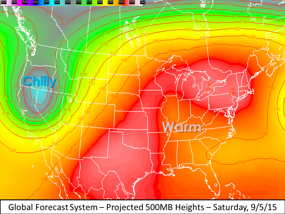
_________________________________________
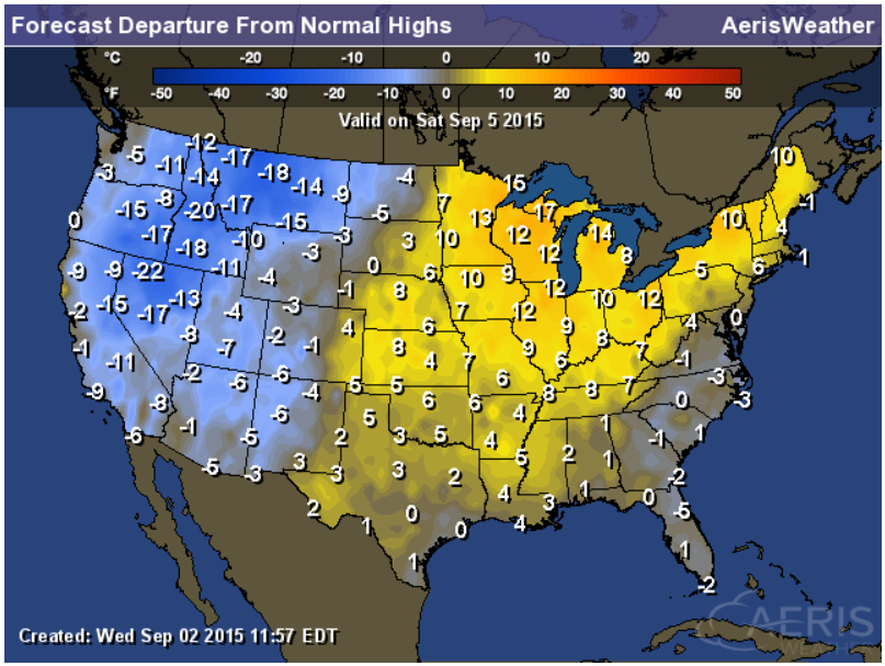
Highs From Average Saturday
In association with the the map above, surface temperatures on Saturday will be quite a bit below average in the western half of the country as the trough of low pressure swings through, while surface temperatures in the eastern half of the country will be warmer than average underneath the ridge.
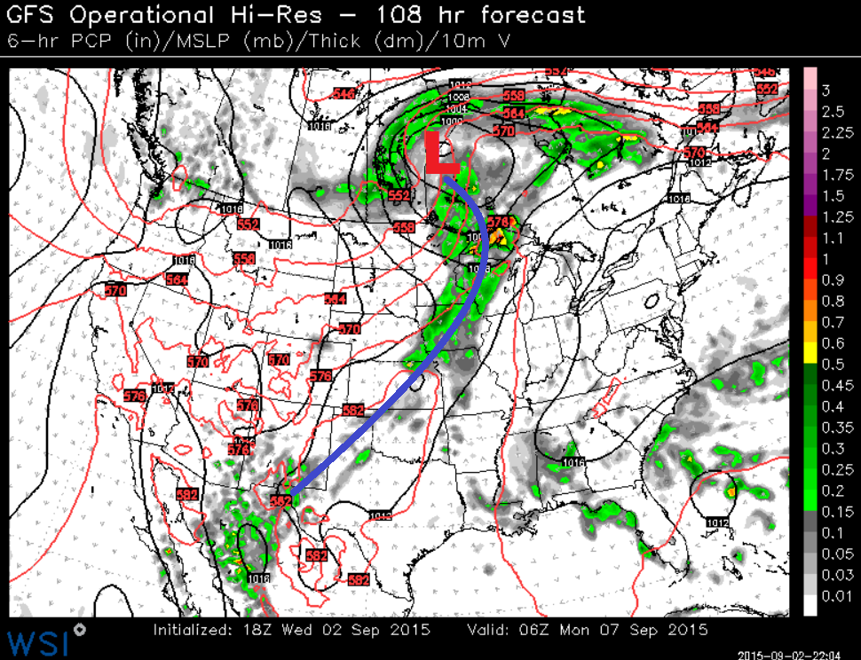
A Cold Front Nears...
Here's the forecast heading into Sunday night/early Monday morning. Note the strong cold front moving through the Upper Midwest with widespread scattered showers and storms. This send temperatures into more fall-like levels as the front passes.
8 to 14 Day Temperature Outlook
According to NOAA's CPC, the 8 to 14 day temperature outlook, which takes us into mid September, suggests that cooler than average temperatures will be possible in the middle part of the country. However, coastal locations may still be dealing with above average temperatures.
_____________________________________
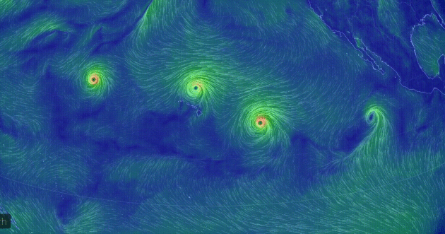
Active in the Pacific
The circulation may below from Earth.Nullschool shows a pretty impressive set of tropical system in the pacific. From left to right, Kilo, Ignacio, Jimena and TD-14 (likely to become Kevin) are in play here. Thanks to extremely warm water temperatures due to an El Nino year, tropical systems seem to be whipping up without any issue.
_________________________________________
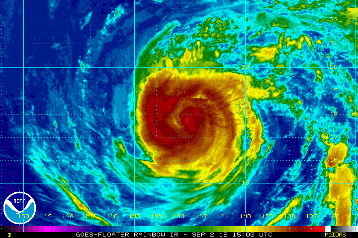
Hurricane Jimena
Hurricane
Jimena was still a category 2 hurricane on Wednesday evening (CDT)
tracking north away from the Hawaiian Islands. The satellite loop below
shows a solid center of circulation, but no defined eye wall.
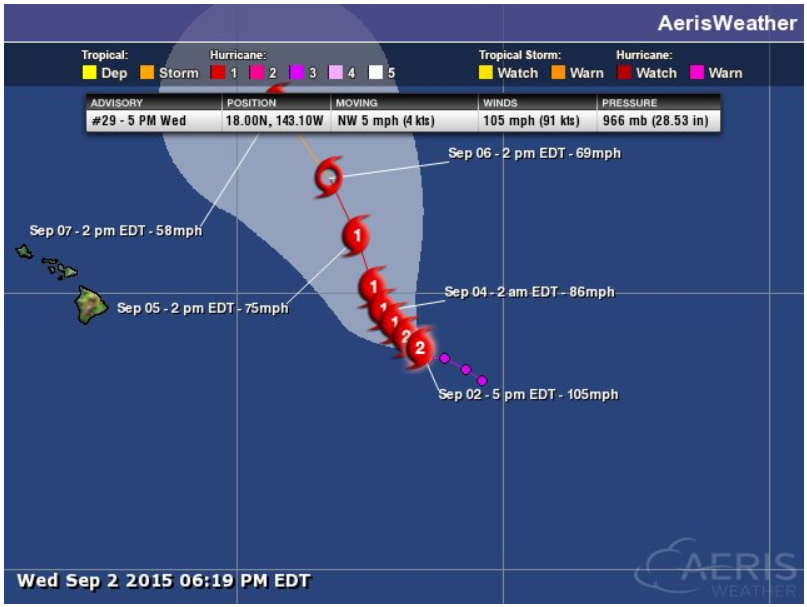
Tracking Jimena
There's
a big sigh of relief for those on the Hawaiian Islands again as this
perviously strong hurricane continues to weaken and slide north into
less favorable weather conditions.
______________________________________________
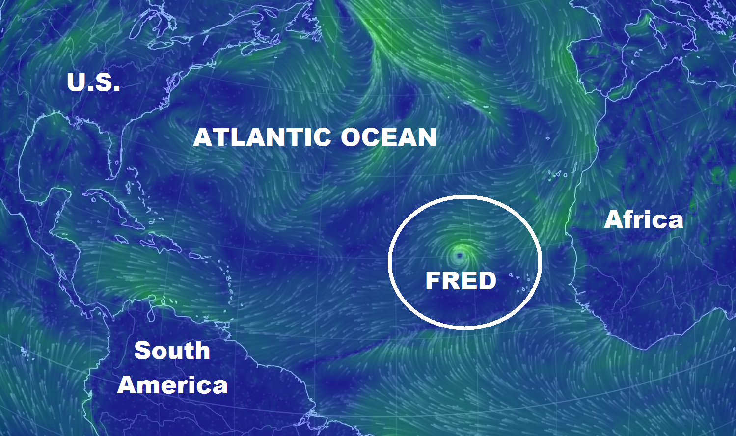
Not too Active in the Atlantic Basin
The
image below from Earth.Nullschool.net shows the only active storm in
the Atlantic Basin being Fred just west of Africa. Fred did become our
2nd hurricane of the 2015 Atlantic Hurricane Season, but quickely
weakened as it moved north.
______________________________________________
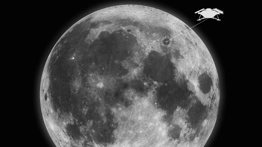
"Rest in Peace on the Moon for $12,000" ??
"Many people dream of travelling to the moon, but if all else fails, they can now be laid to rest there. Celestial funeral firm Elysium Space is now offering a "Lunar Memorial," in which your cremated remains are privately dispatched to the moon. But it'll cost you—the early bird rate starts at $9,950 for the first 50 participants, but costs $11,950 thereafter."
Read more from CNBC.com HERE:
(Image courtesty: Elysium Space)
______________________________________
Thanks for checking in and have a great rest of your week! Don't forget to follow me on Twitter @TNelsonWX

No comments:
Post a Comment