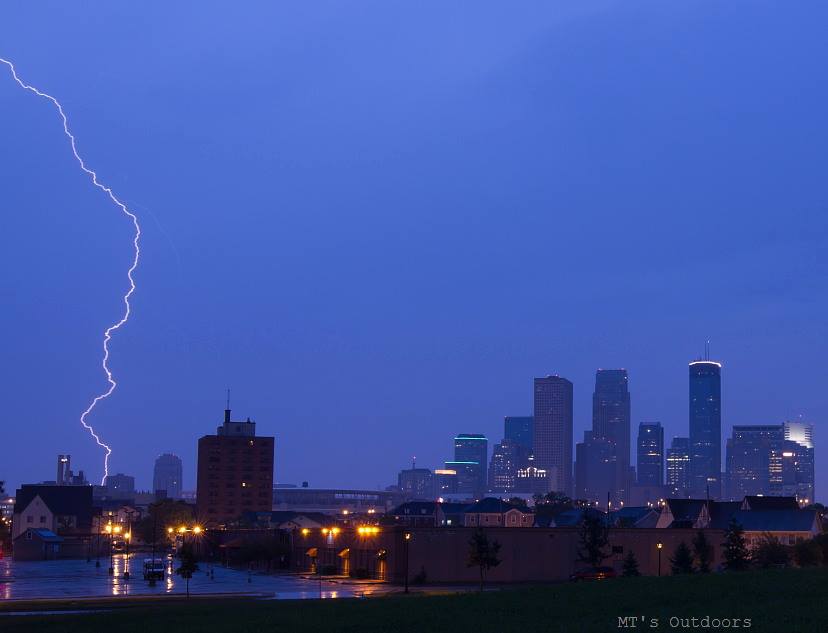
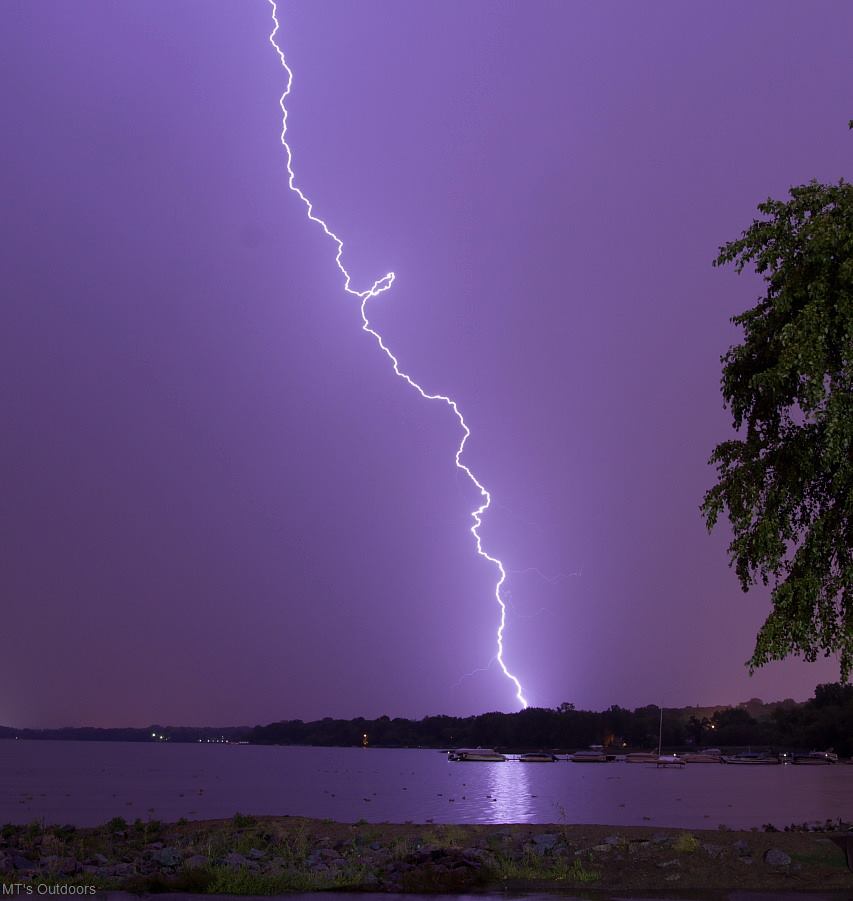
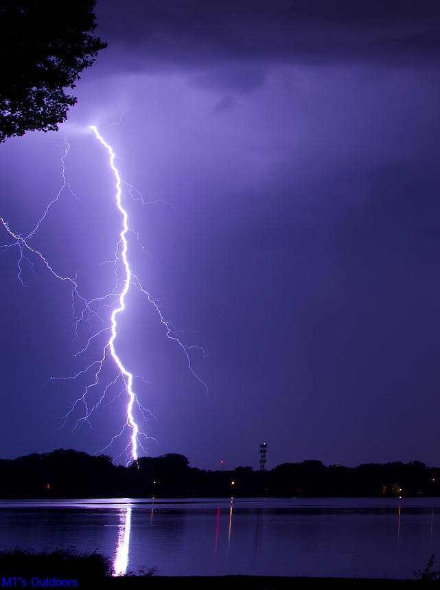
WOW! Take a look at these amazing pictures that Michael Thompson snapped from Minneapolis early Sunday morning! Quite impressive!!
You can see more of Michael's work here: http://www.mtsoutdoorsimages.com/
Great shots Michael! Thanks again!!
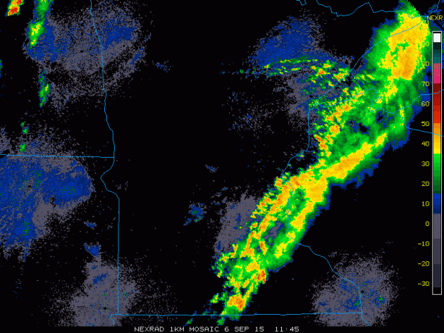
Storms on Radar: PM Saturday - AM Sunday
This is what round #1 of storms looked like on Saturday morning as they were moving through parts of Minnesota and Wisconsin.
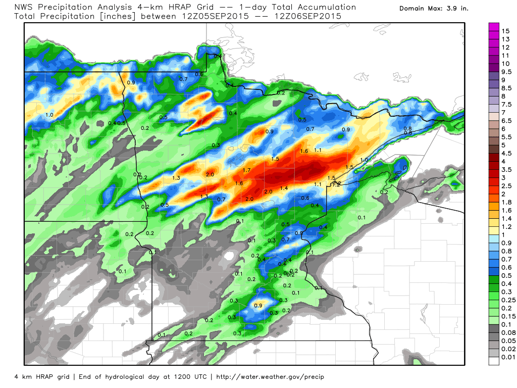
Rainfall AM Saturday - AM Sunday
Rainfall
on Saturday was quite impressive across parts of central and northern
Minnesota. Radar estimated rainfall suggests nearly 1" to 2"+ in some
areas.
___________________________________________
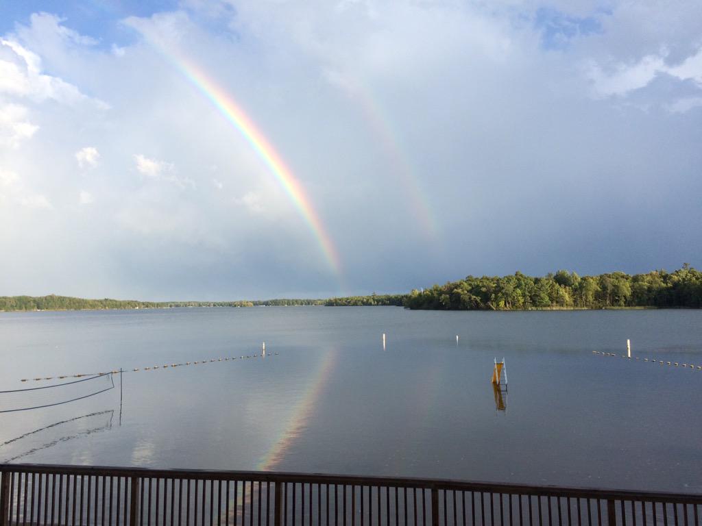
Double Rainbow From Ruttger's Bay Lake Lodge
Thanks
to @aweidner22 for the picture below from Ruttger's Bay Lake Lodge.
Aaron caught a double rainbow on the tail end of a line of storms that
was stronger just north of them.
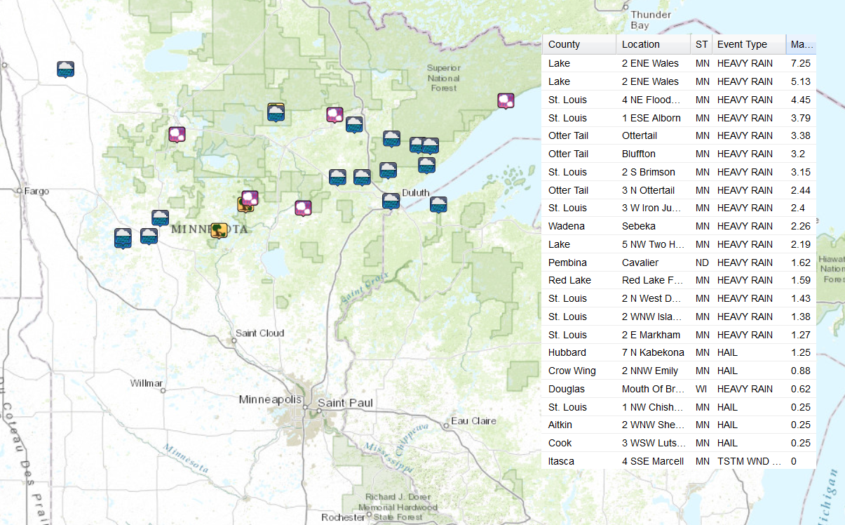
Sunday Storm Reports
Here are some of the storm reports that came in from Sunday's storms.
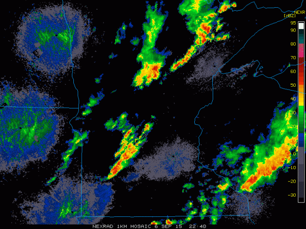
PM Sunday Storms
This is what the line of storms looked like on Sunday evening as they developed across the region.
__________________________________
Labor Day Special
By Todd Nelson
An unexpected trip up north this weekend turned into a very fun and memorable way to end summer. I realized that I am going to miss this particular summer more so than any other in the recent past. We've been treated to a plethora of pretty amazing days. Not too overly hot and humid for an extended period of time and adequate rain at just the right time to keep lawns and gardens looking mostly lush. Hope you enjoyed it!
Scattered showers and storms on Sunday ended the hot and muggy streak for us. Monday we'll be post-front with a much more noticeable dip in humidity levels. With plenty of sun and temperatures not as hot as they've been over the past several days, this will be a Labor Day to remember. Get out and enjoy it!
Extended model runs keep us somewhat active through the week ahead, but temperatures will continue to cool to more fall-like levels by the end of the week. According to NOAA's Climate Prediction Center, much of the middle part of the country will have below average temperatures by mid month.
Interestingly, the MN DNR is already showing 10 to 25 percent fall color in the Arrowhead, which typically peaks in a few weeks.
________________________
SUNDAY NIGHT: Scattered showers and storms early, then turning partly cloudy. Low: 63. Winds: SW turning WNW 5-15mph
LABOR DAY: Not as hot, sun fades late. High: 80. Winds: NW 5-10mph
MONDAY NIGHT: Spotty shower or storm possible. Low: 62. Winds: NW 5.
TUESDAY: Back to school. Cooler with a spotty shower possible. Wake-up: 62. High: 78.
WEDNESDAY: Comfy. Storms possible overnight. Wake-up: 55. High: 76.
THURSDAY:Slight chance of thunder. Wake-up: 56. High: 73.
FRIDAY: Hello Fall! Quiet and cool. Wake-up: 51. High: 68.
SATURDAY: Cool. Bright sun. Wake-up: 50. High: 70.
SUNDAY: More clouds. A tad warmer. Wake-up: 54. High: 76.
__________________________
This Day in Weather History
September 7th
1990: Strong winds and Hail up to 2 inches was reported in Swift, Douglas, Stevens, Kandiyohi, Meeker, Stearns, and Waseca Counties.
1986: A touch of winter over the north, with 20 degrees at Embarrass and 30 at Duluth.
1922: The fifth consecutive day of 90 degrees or above in the Minneapolis area.
___________________________
Average High/Low for Minneapolis
September 7th
Average High: 75F (Record: 98F set in 1976)
Average Low: 56F (Record: 40F set in 1956)
____________________________
Sunrise/Sunset Times for Minneapolis
September 7th
Sunrise: 6:42am
Sunset: 7:39pm
_____________________________
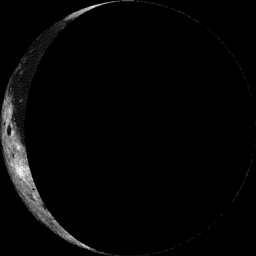
Moon Phase for September 7th at Midnight
2.9 Days After Last Quarter
______________________________
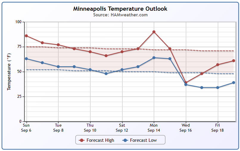
Minneapolis Temperature Trend
Temps will slowly decrease to near/slightly below average levels through the week. The extended models suggests a quick warm day, but potentially much cooler than average readings by the middle part of the month.
____________________________________
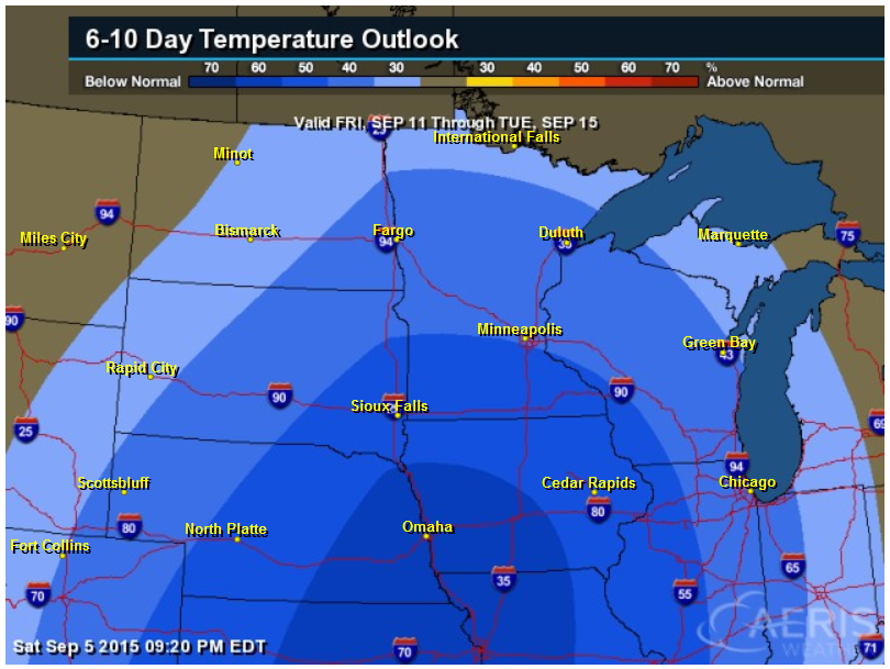
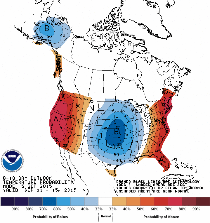
6 to 10 Day Temperature Outlook
According to NOAA's CPC, the 6 to 10 day temperature outlook is still suggesting some pretty decent cooler than average readings in the middle part of the country through the middle part of the month.
___________________________________________
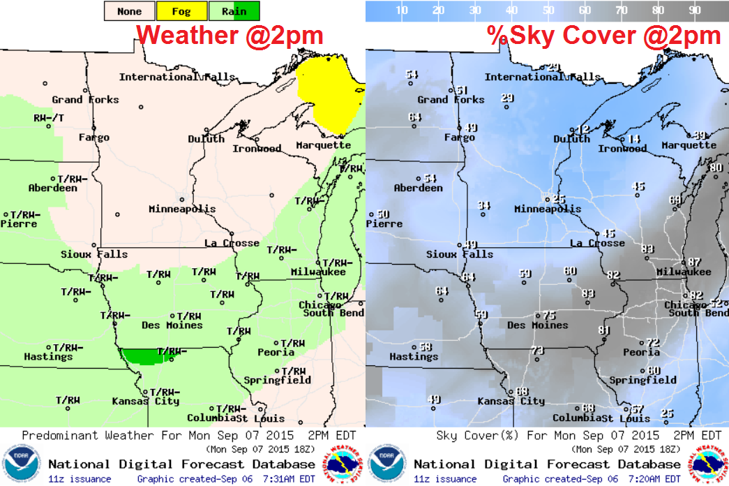
Monday Weather Outlook
We had several warm days earlier this month with feels like temperatures in the low to mid 90s. Thanks to the passage of a cool front, temperatures and dewpoints will fall to more comfortable levels through the rest of the week.
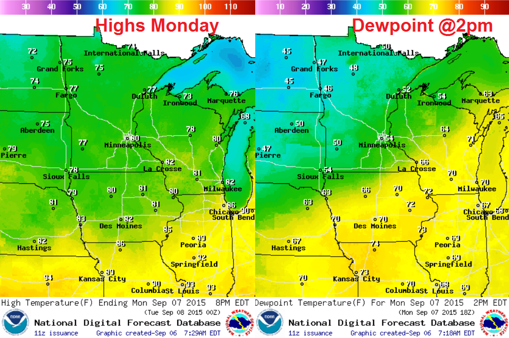
Monday Weather Outlook
Winds on Monday won't be much of a problem, but will be more northwesterly, helping to draw down some cooler and less humid weather from Canada.
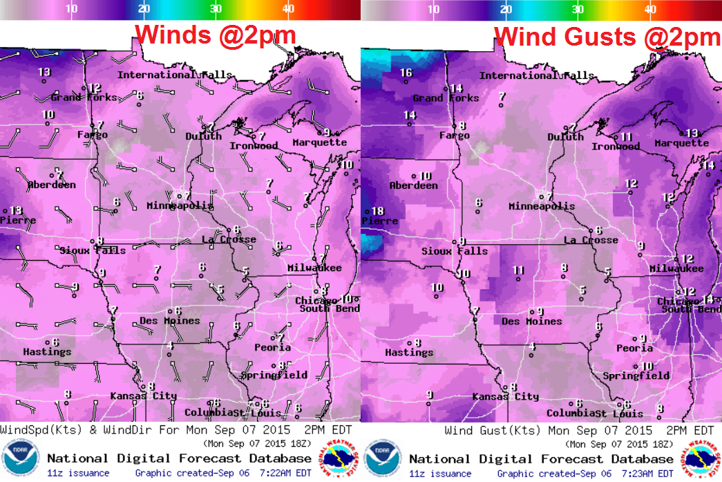
Monday Weather Outlook
As the front pushes southeast, it'll take the showers and storms along with it. Monday will be a brighter, drier day. It'll be an enjoyable Labor Day, take advantage of it!
__________________________________________
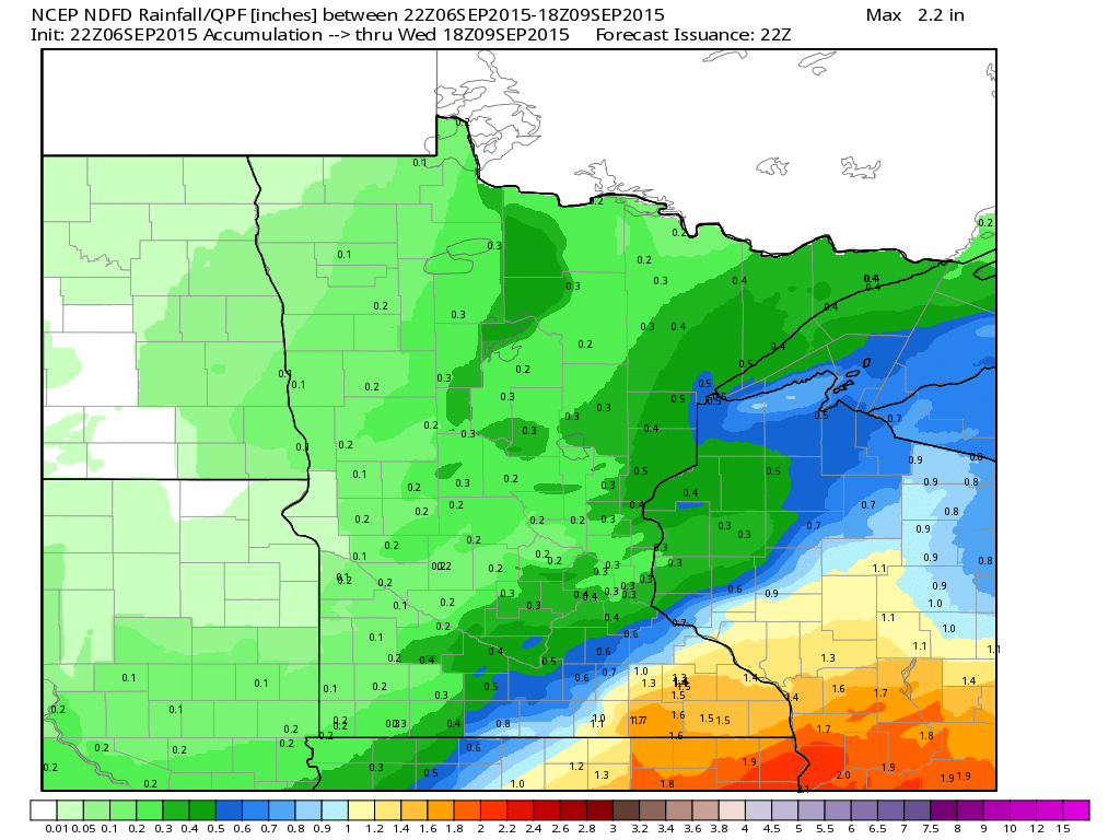
Rainfall Potential
The storm system that brought us all the heavy rain over the weekend will continue sliding southeast and drag the heavy rainfall potential along with it. This is the rainfall potential through midday Wednesday.
______________________________________
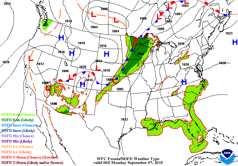
National Weather Outlook
The cold front responsible for scattered showers and storms over the weekend will continue pushing southeast through the early week time frame. This will allow cooler, drier weather to filter in behind it. Weather conditions through the week ahead will feel more like it should at this time of the year.
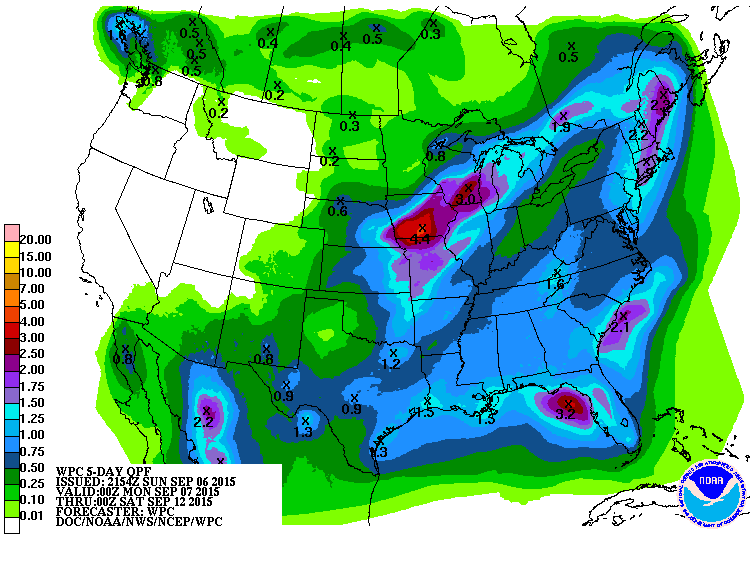
5 Day Precipitation Outlook
According to NOAA's WPC, the 5 day rainfall forecast suggests heavy rainfall across parts of the Midwest/Central U.S. as our current cold front sags south through the early week time frame. Meanwhile, heavy pockets of rain will be possible in the Southeast and southern tier of the nation. The Western U.S. looks to remain mostly dry.
____________________________________
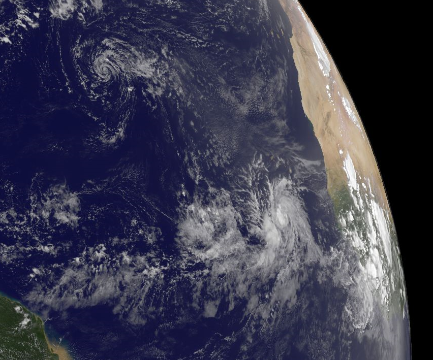
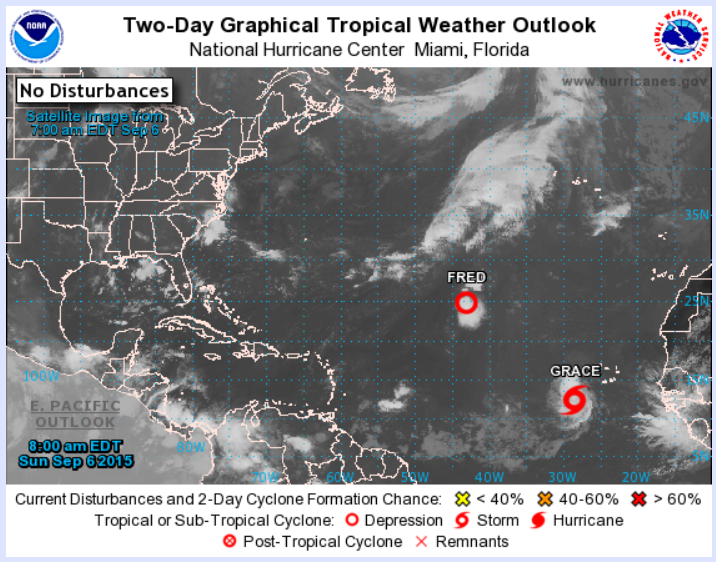
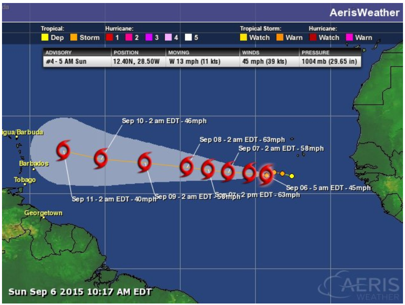
Atlantic Update
As of Sunday, the National Hurricane Center was tracking two systems in the Atlantic Basin. Fred and newly formed Tropical Storm Grace (7th named storm of the 2015 Atlantic Hurricane Season).
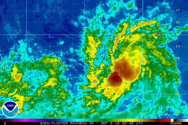
Grace
This was Tropical Storm Grace on Sunday morning, which became our 7th named storm of the 2015 Atlantic Hurricane Season on Saturday.
Tracking Grace
According to the National Hurricane Center, Grace will continue tracking west as a tropical storm through the week ahead. Stay tuned!
_____________________________________
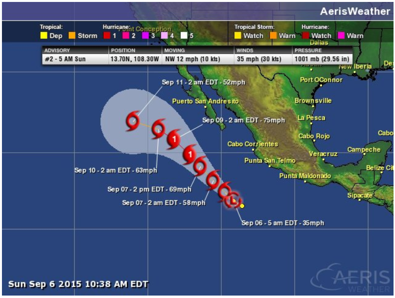
Update on the Pacific
Thanks to El Nino and warmer than average water temperatures, the Pacific Ocean has been pretty active this season. There were 4 systems ongoing in the Pacific, including newly formed Tropical Depression Fifteen.
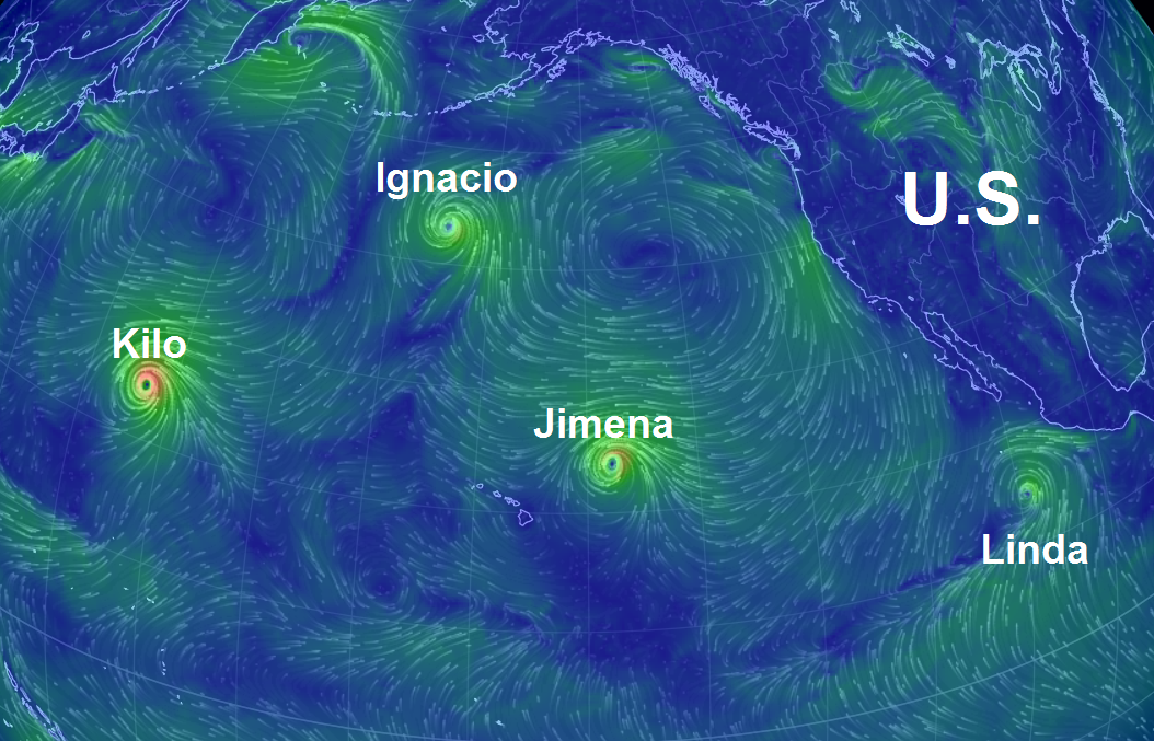
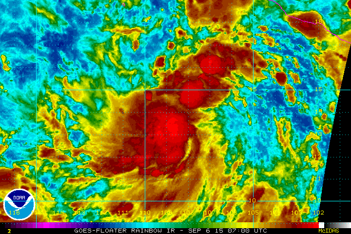
Tropical Storm Linda
This was Tropical Storm Linda as of early Sunday.
Tracking Linda
Linda became the fifteenth named storm in the Eastern Pacific this season and is forecast to become a Hurricane by the early week time frame.
_____________________________________
6 to 10 Day Temperature Outlook
According to NOAA's CPC, the 6 to 10 day temperature outlook keeps much of the middle part of the country and Alaska under cooler than average temperature readings, while those along the East and West Coast will be warmer than average.
Fall in Alaska
Thanks to my good friend, Monica Zappa, for the picture below. Monica is one of my fellow meteorology classmates from St. Cloud State University and now resides in Alaska. She is dog sled racer and is planning on running the Iditarod again this year for the third straight year in a row!! Monica was out for a recent run with her dogs and was enjoying the fall colors. Thanks Monica!

________________________________________
Thanks for checking in and have a great week ahead! Don't forget to follow me on Twitter @TNelsonWX

No comments:
Post a Comment