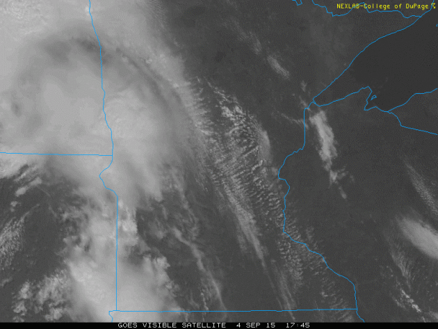
Friday's Visible Satellite Loop
Scattered showers and storms that developed across western MN pushed through the rest of the state through the evening. This is wast the visible satellite loop, which showed thunderstorms developing across the state.
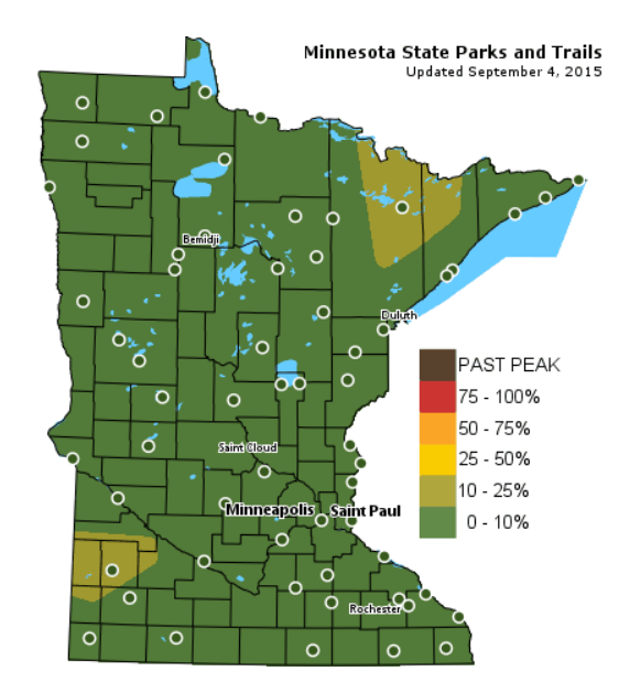
Fall Color Map...
Yes, it's that time of the year again! Thanks to the MN DNR for there wonderful fall color update map. As you can see, there isn't much happening yet, but there are a couple of areas starting to show some fall signs... stay tuned.
See the Fall Color Update Map from the MN DNR HERE:
Warm and unsettled
By Todd Nelson
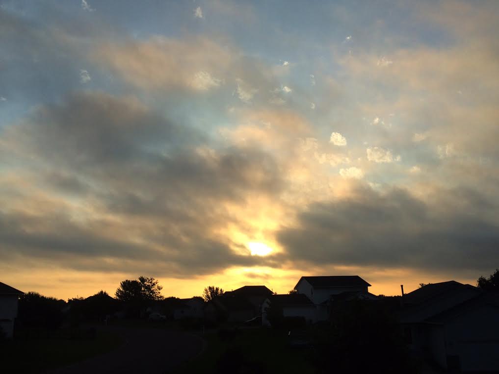
Happy September? Is it really Labor Day Weekend, already? WOW! That summer went fast, didn't it? Weather maps certainly don't look like meteorological fall, but I am not complaining. I'll take the warmth while I can get it.
According to NOAA's NCDC, Minneapolis typically averages 0.4 days at or above 90 degrees during the month of September. Last time we hit that mark was in 2013 when we had 3 days in the 90s! In fact, we hit 94 degrees twice! September 2013 ended up being nearly 5 degrees above average. This September, we're nearly running nearly 10 degrees above average and we will still be nearly 10 to 15 degrees above average (76 degrees) through the weekend!
Our sticky weather is compliments of a large ride of high pressure that has set up in the eastern two-thirds of the country over the past few days. An approaching storm system will help to enhance that heat and humidity through the weekend with rounds of showers and storms firing up through PM Sunday. The heaviest rain will stay across the northern half of the state, but a few strong storms PM Sunday could bring heavier rainfall to your backyard rain gauge. Next week, fall weather arrives.
_______________________________
FRIDAY NIGHT: Mostly cloudy, spotty thunder possible. Low: 73. Winds: SSE 10-15mph
SATURDAY: Find some A/C. PM storms, mainly northern MN. Feels Like: 95F. High: 90. Winds: S 10-15mph.
SATURDAY NIGHT: Scattered showers and storms. Low: 75. Winds: S 10-15mph
SUNDAY: Last hot day. Strong storm possible late. High: 87. Winds: S 15-25mph
LABOR DAY: Not as hot, sun fades late. Wake-up: 63. High: 80
TUESDAY: Back to school. PM rumble? Wake-up: 60. High: 78.
WEDNESDAY: Late day thunder possible. Wake-up: 58. High: 75.
THURSDAY: Breezy. Gradual clearing. Wake-up: 56. High: 72.
FRIDAY: Brisk sun. Wake-up: 52. High: 70.
__________________________________
This Day in Weather History
September 5th
1990: Nine inches of rain fell over the next two days in Duluth, washing out a million dollars worth in roads.
1982: 77 mph winds were reported in Anoka County.
__________________________________
Average High/Low for Minneapolis
September 5th
Average High: 76F (Record: 98F set in 1922)
Average Low: 57F (Record: 36F set in 1962)
____________________________________
Sunrise/Sunset Times for Minneapolis
September 5th
Sunrise: 6:39am
Sunset: 7:43pm
_____________________________________
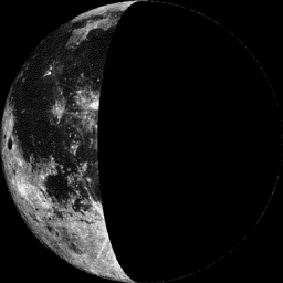
Moon Phase for September 5th at Midnight
0.9 Days After Last Quarter
_______________________________________
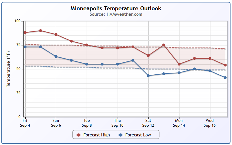
Minneapolis Temperature Trend
The end is near... the end of the heat that is. Note that we will still be nearly 10 to 15 degrees above average through the weekend, but we gradually cool to near normal levels by next week. The extended forecast is suggesting a potentially even bigger cool down as we get closer to the middle part of the month.
_______________________________________
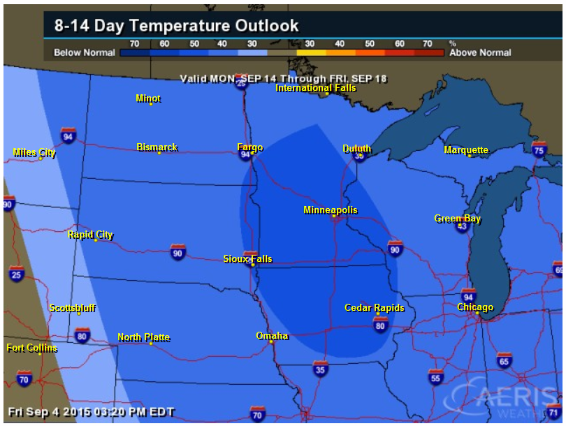
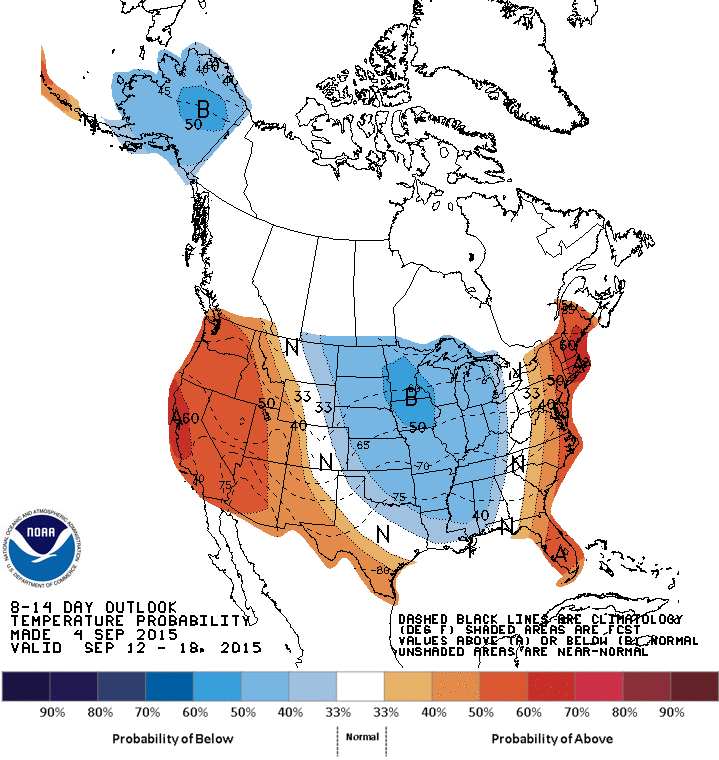
8 to 14 Day Temperature Outlook
According to NOAA's CPC, the 8 to 14 day temperature outlook suggests a pretty good chance of below average temperatures by the middle part of the month
_____________________________________
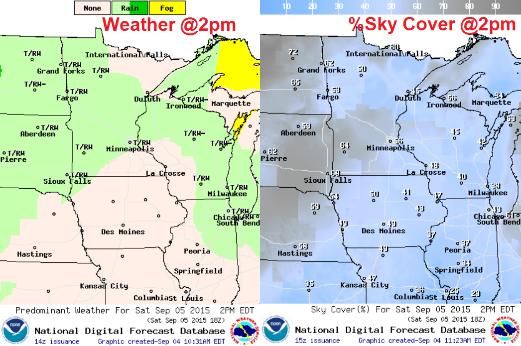
Saturday Weather Outlook
It'll be another warm day Saturday with highs approaching the 90F mark across the southern half of the state. Near 70F dewpoints will be widespread making it feel more like the low/mid 90s
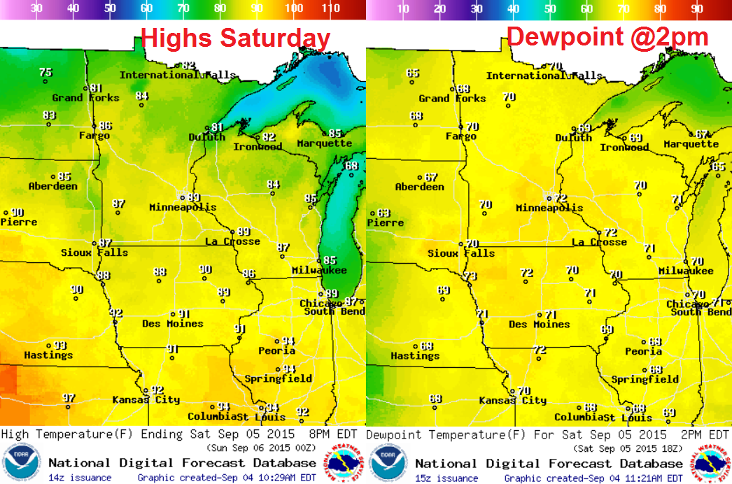
Saturday Weather Outlook
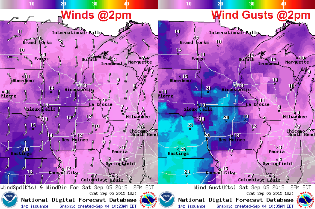
Breezy south winds on Saturday will help push heat and humidity north through the Upper Midwest. Wind gusts could be near 20mph+ across the southern half of the state.
Saturday Weather Outlook
Saturday will be a little unsettled across the region with spotty showers and storms developing, mainly later in the day. The maps below suggest weather conditions possible by 2pm Saturday.
________________________________________
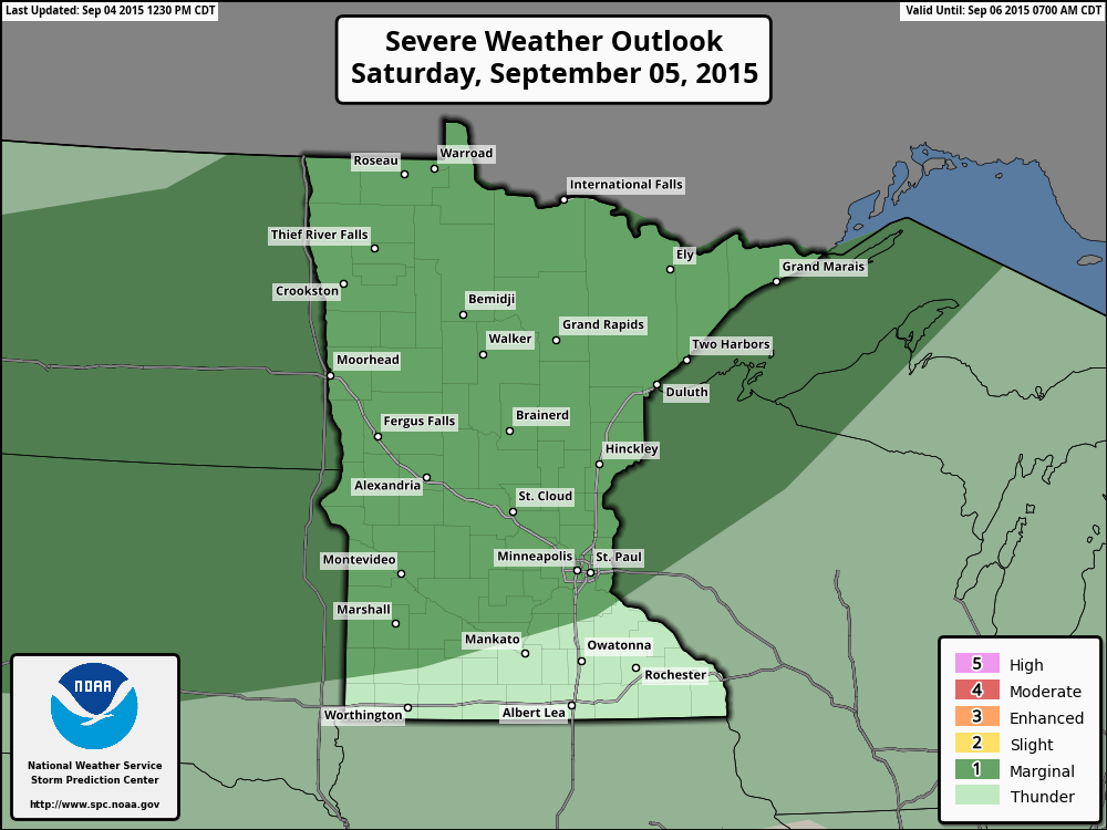
Severe Threat Saturday
...SUMMARY... A FEW STRONG TO SEVERE STORMS WILL BE POSSIBLE OVER A PORTION OF THE NORTHERN PLAINS INTO THE UPPER MISSISSIPPI VALLEY SATURDAY AFTERNOON AND EVENING. ...SYNOPSIS... UPPER TROUGH OVER THE PACIFIC NW WILL BEGIN TO ADVANCE THROUGH THE NRN ROCKIES SATURDAY AND APPROACH THE NRN HIGH PLAINS BY THE END OF THE PERIOD. A LOW-AMPLITUDE SHORTWAVE TROUGH WILL LIFT NEWD THROUGH THE NRN HIGH PLAINS AND UPPER MS VALLEY AREA DURING DAY. AT THE SFC A QUASI-STATIONARY FRONT WILL EXTEND FROM NWRN MN SWWD TO A SFC LOW OVER NWRN SD THEN WWD TO A WEAK SFC LOW OVER SRN MT EARLY SATURDAY. A COLD FRONT WILL STRETCH SSWWD FROM THIS LOW THROUGH ERN ID INTO NEV. THIS FRONT WILL MOVE EWD THROUGH THE PERIOD...REACHING THE NRN HIGH PLAINS LATER SATURDAY NIGHT.
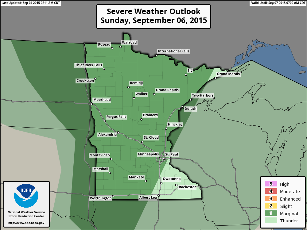
Severe Sunday
...SUMMARY... SCATTERED THUNDERSTORMS...A FEW SEVERE...ARE EXPECTED TO DEVELOP ACROSS PARTS OF THE NORTHERN PLAINS AND UPPER MISSISSIPPI VALLEY.
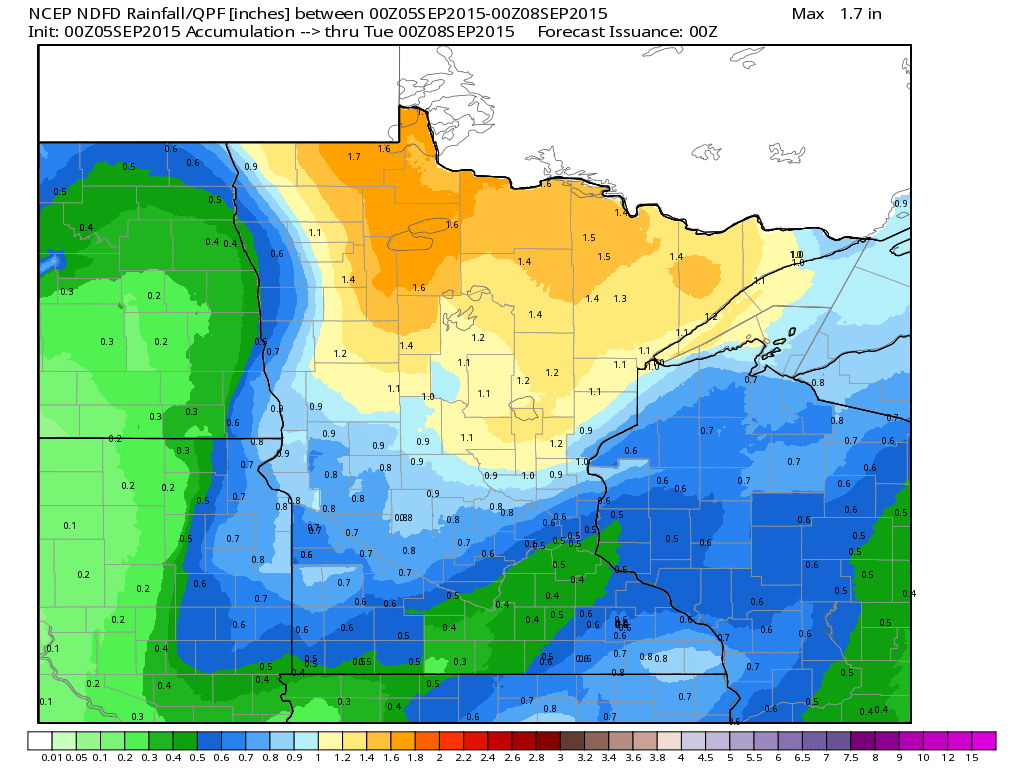
Rainfall Potential
This slow moving, water logged storm will have potential rainfall amounts rather high across the northern half of the state. This particular model (NCEP NDFD) suggests nearly 1" to 3" through PM Monday.
___________________________________
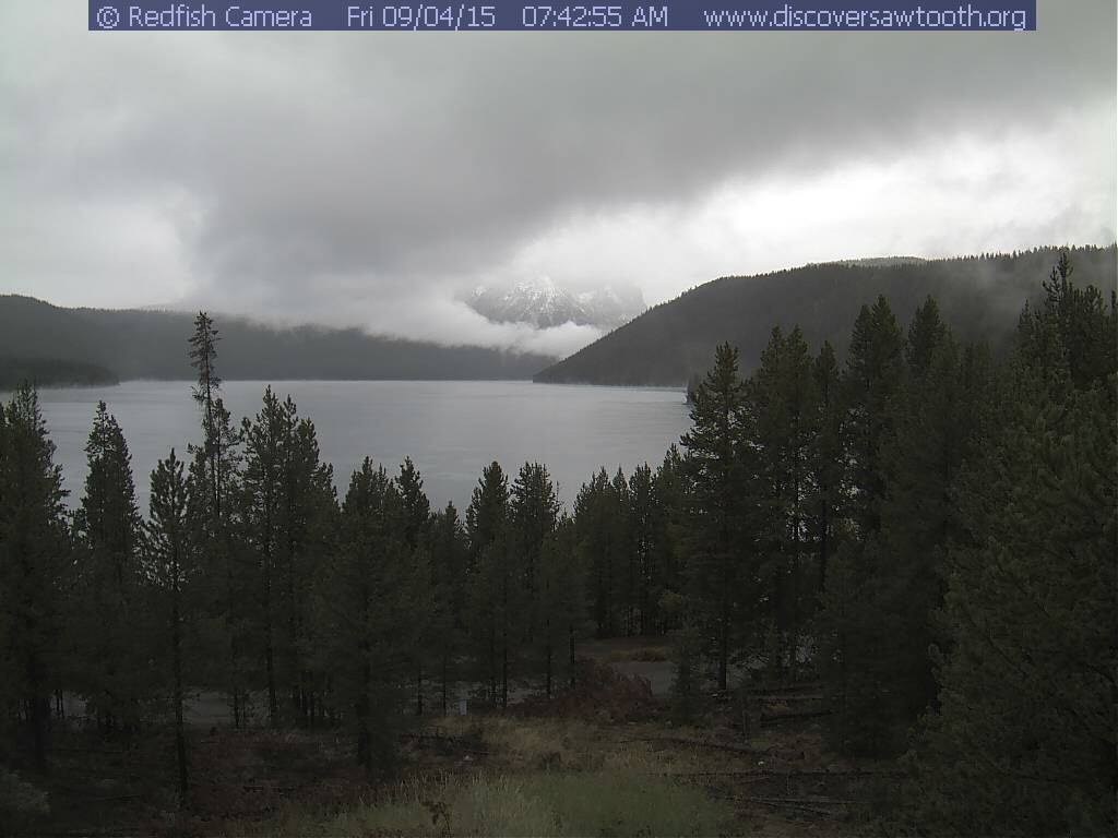
Fresh Mountain Snow... ??
Tuesday, September 1st was the start of Meteorological Fall and it's already starting to look a little wintry in the higher elevations of the Northern Rockies. Thanks to a fairly large trough of low pressure swinging through the western third of the country, temperatures are running nearly 10F to 20F+ below average.
"Fresh snow on the mountains around Stanley this morning. Webcam: Sawtooth Interpretive and Historical Association (SIHA)"
See more from the National Weather Service out of Boise Idaho HERE:
______________________________
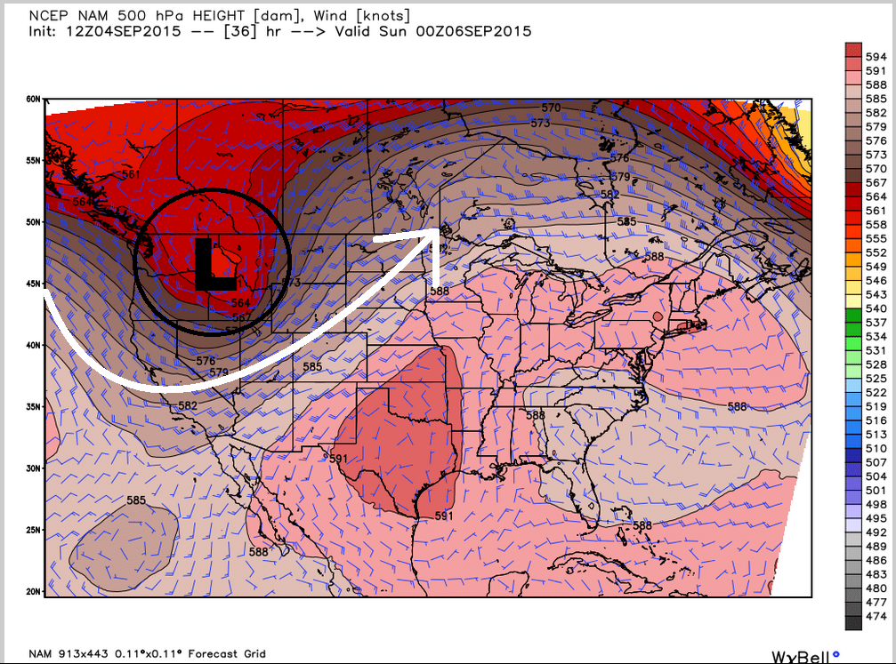
Upper Level Storm Saturday
Here's an interesting map, which shows a fairly robust are of low pressure in the Pacific Northwest. This storm is part of the driving force behind all the warmth in the eastern two-thirds of the country, while also dropping temperatures in the western third of the country to below average levels.
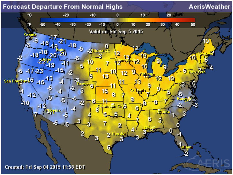
Highs From Average Saturday
The map below would suggest a tale of two different seasons, really. Note that locations in the western third of the nation will be nearly 10F to 20F below average, while areas in the eastern two-thirds of the nation will be nearly 10F to 15F above average.
8 to 14 Day Temperature Outlook
According to NOAA's CPC, the 8 to 14 day temperature outlook shows a fairly significant chunk of cooler than average temperatures in the middle part of the country by the middle part of the month. Meanwhile, areas on either coast may still be dealing with warmer than average readings.
__________________________________
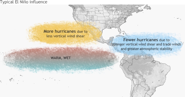
Update on the What's Happening in the Tropics?
Did you know that we've only had 2 hurricanes in the Atlantic Basin so far this year? NOAA released a recent article talking about our 2nd hurricane of the season (Fred) and how El Nino is impacting this year's season.
"El Niños tend to increase the amount of the storms in the Pacific Ocean, while acting to suppress their numbers in the Atlantic Ocean. As of the end of August, the Atlantic Ocean has seen six generally weak storms, only two of them hurricanes. Hurricane Fred may have been a hurricane for only a brief amount of time, but it still managed to set a record."
Read the full article from NOAA HERE:
______________________________________
Thanks for checking in and have a great weekend ahead! Don't forget to follow me on Twitter @TNelsonWX

No comments:
Post a Comment