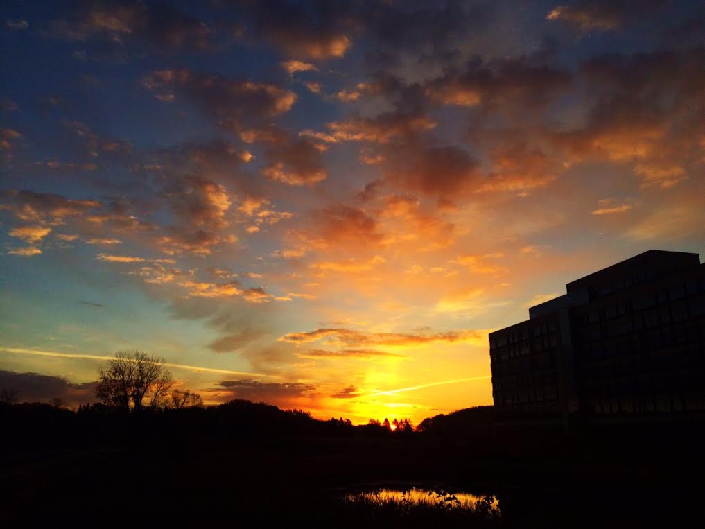
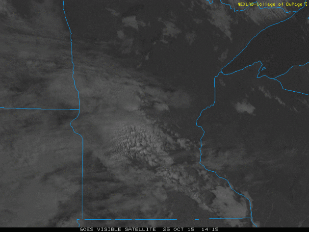
Somewhat Cloudy Sunday
Take a look at the visible satellite loop from Sunday below. Note the band of clouds that sat over central Minnesota for much of the day. There were also a few spits of rain associated with some of these clouds. Note that if you were in extreme northern or southern MN, skies were crystal clear!
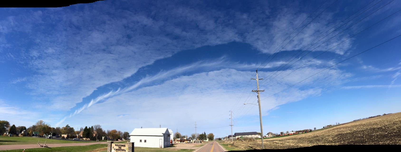
Fallstreak / Hole Punch Cloud
Thanks to my good friend Jerrid Sebesta for this picture from Southwestern MN on Sunday. A fairly rare fallstreak / hole punch cloud seen here from a descending airplane through a cloud layer! Very neat! Thanks Jerrid!
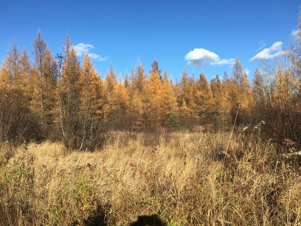
Fall Color Fading Fast
Thanks to several chilly and breezy days as of late, you've probably noticed the the lack of leaves and fall colors on the trees. Thanks to my good friend and colleague @DKayserWX for the picture below. He found a patch of yellow tamarack trees near Hill City this weekend!
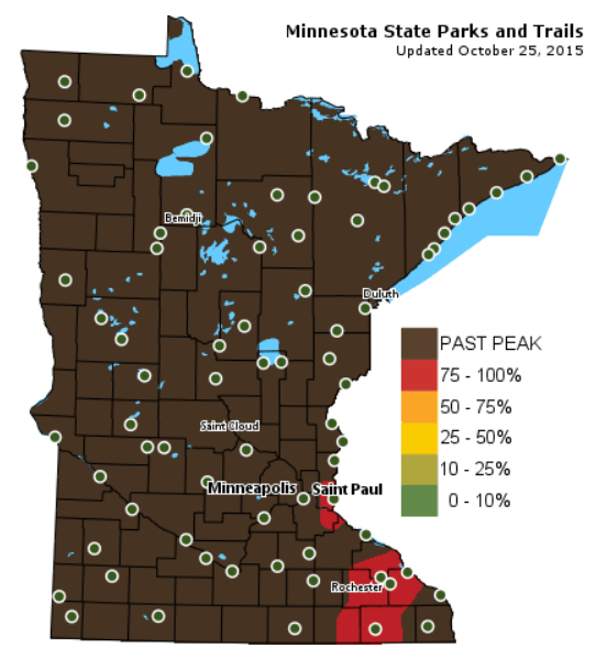
Fall Color Update
According to the MN DNR, much of the state is already past peak in the fall color department. However, foliage is peaking right now in the extreme southeastern part of the state. Hard to see the leaves go, isn't it? Seems so bare for so long before the leaves return again.
____________________________
Some sun Monday - A wintry mix by midweek?
By Todd Nelson, filling in for Douglas
It's getting bare out there, isn't it? Think about it. We typically get about five solid months with leaves on the trees and they're gone. More than half of the year, we stare at stale trees. Sobering moment.
Yes, those crisp autumn days and nights are starting to catch up with us. I'm starting to dress in layers and the furnace is starting to kick in. I'm noticing more happening on weather maps. The sublime summer and favored fall weather looks to be fading.
Cold air intrusions from Canada look to be playing a role in more intense storm systems developing over the coming days and weeks. The first of which will mix with remnant moisture from Hurricane Patricia midweek. Cold, wind-whipped rain showers will be found across the Upper Midwest on Wednesday. It may even be cold enough for some of the first wet snowflake reports across the state by Wednesday night! The ground is still too warm for any accumulation, but don't be surprised if you see a few snow splats on the windshield.
This may be the deep breath before the plunge?
____________________________
SUNDAY NIGHT: More clouds, a few showers possible. Winds: SSE 5mph. Low: 42
MONDAY: Stray AM shower, more PM sun. Winds: ESE 5mph. High: 58
MONDAY NIGHT: Partly cloudy and quiet. Winds: E 5mph. Low: 44.
TUESDAY: More PM clouds, rain develops late. Winds: SE 15mph. High: 60
WEDNESDAY: Windy. Cold rain with a mix possible north. Winds: W 25mph. Wake-up: 42. High: 48
THURSDAY: Breezy. Cold spits of rain. Winds: NW 20mph. Wake-up: 37. High: 50.
FRIDAY: Brisk sun. Less wind. Wind: ESE 5mph. Wake-up: 33. High: 48.
SATURDAY: Witch watch. PM Showers? Wake-up: 34. High: 50.
SUNDAY: Chance of rain. Chilly. Wake-up: 34. High: 49.
_____________________________
This Day in Weather History
October 26th
1996: An unusual outbreak of severe occurred across north central Minnesota. Intense low pressure tracking into Minnesota produced blizzard conditions over portions of South Dakota, while further east in Minnesota, unseasonably mild temperatures developed. Temperatures climbed near 70 with dew points in the 50s. 1 to 1 3/4 inch hail and strong winds were reported in Lac Qui Parle, Yellow Medicine, Chippewa, and Swift Counties. These storms produced 12 tornadoes, the largest reported were F2s. Southwest of Alexandria in Douglas County, an F2 tornado with a 9 mile track destroyed several homes. One women sustained broken bones and internal injuries when a portion of her house, with her inside, was flung 200 feet onto the interstate. This tornado also pushed over a 500 pound fuel tank. Tornadoes also touched down in Swift, Kandiyohi, Pope, Stearns, and Isanti Counties.
1985: Indian Summer across Minnesota. Twin Cities hits 70.
______________________________
Average High/Low for Minneapolis
October 26th
Average High: 53F (Record: 83F set in 1955)
Average Low: 36F (Record: 16F set in 1962)
______________________________
Sunrise/Sunset Times for Minneapolis
October 26th
Sunrise: 7:43am
Sunset: 6:10pm
*Daylight lost since yesterday: ~2 minutes and 54 seconds
*Daylight lost since summer solstice (June 21st): ~ 5 hours and 9 minutes
__________________________
Moon Phase for October 26th at Midnight
0.2 Days Before Full Hunter's Moon
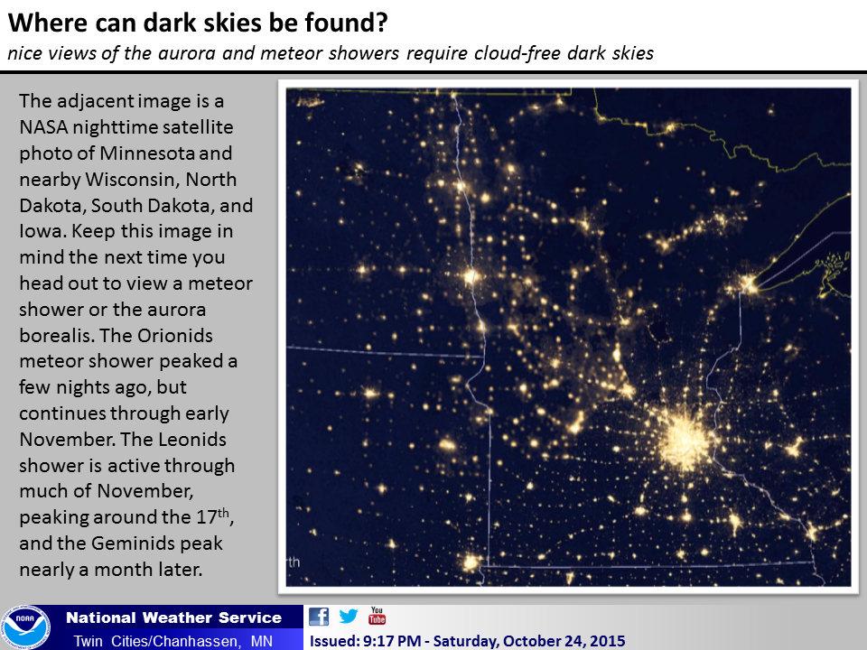
Minnesota Light Pollution
If you've been checking the evening skies lately, you may have noticed a few meteors. The Orionids (leftovers from Halley's Comet) peaked earlier this week, but you still maybe able to see some over the next couple of nights if the weather cooperates. Here's an interesting post from the NWS Twin Cities regarding light pollution across the state and where your best odds may be at seeing meteors and northern lights when the time comes.
See more from the National Weather Service out of the Twin Cities HERE:
Bakken Oil Field
Here's another post by the NWS Twin Cities, which shows a wider view and includes the very evident Bakken Oil Field in the upper left hand part of the picture.

_______________________________________
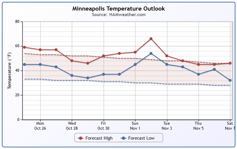
Minneapolis Temperature Trend
The last week of October will feature fall-like temperatures. An approaching storm system will drag temperatures to below average reading by the second half of the week. It may even be cold enough for some of the first flakes of the season to fly across parts of Minnesota! A brief warm up may be in store for us during the early part of November, but it doesn't appear to last long as temps dip quickly back to near normal levels.
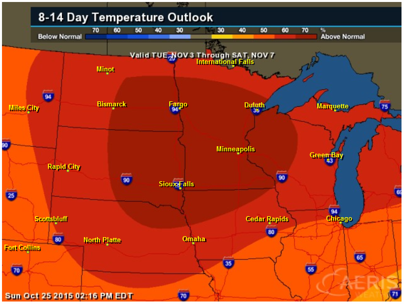
8 to 14 Day Temperature Outlook
According to NOAA's CPC, the 8 to 14 day temperature outlook suggests warmer than average temperatures across much of the Upper Midwest into early November. Keep in mind that the warmer than average weather looks to be fairly brief!
___________________________________
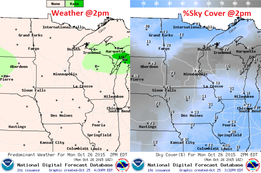
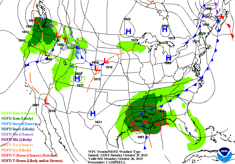
Monday Weather Outlook
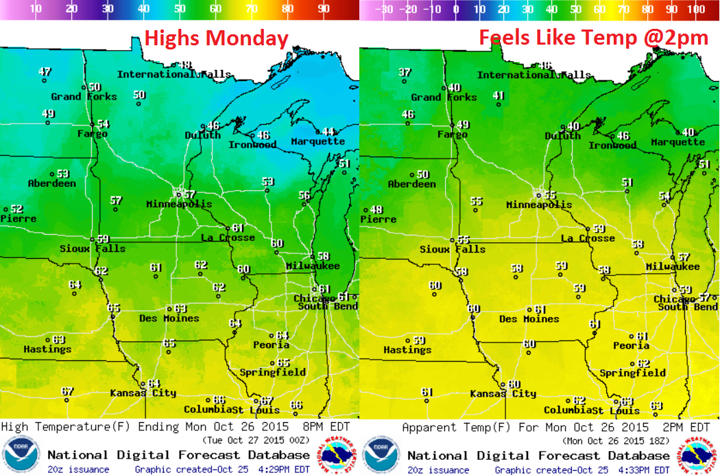
Monday Weather Outlook
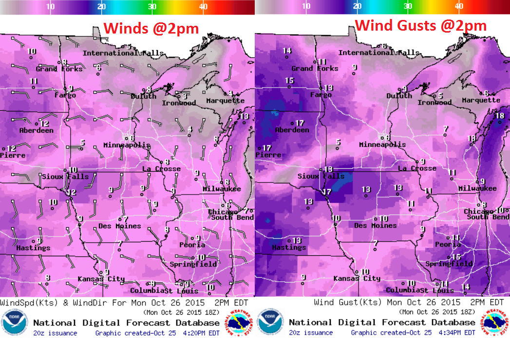
Monday Weather Outlook
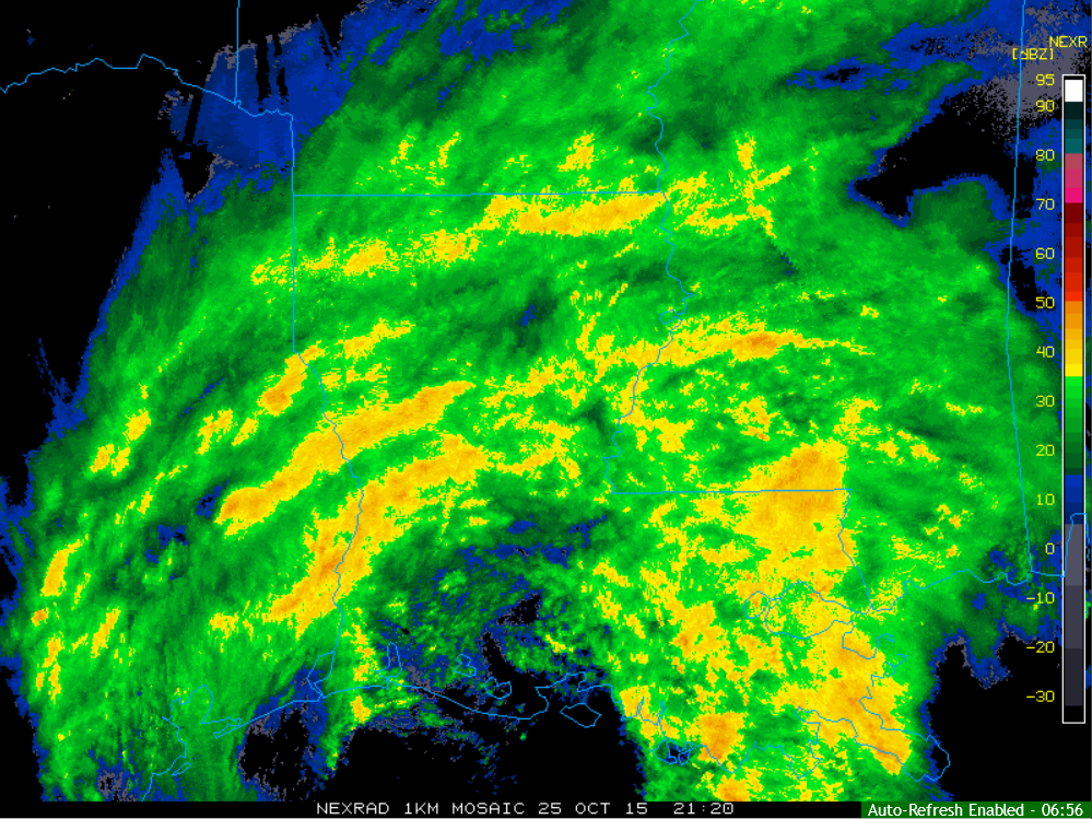
Southern Rainfall
Here was the radar from late Sunday centered over Louisiana, which showed multiple bands of heavy rainfall continuing to pound the Deep South. Heavy rain has led to several areas of flooding across the deep south over the last several days.
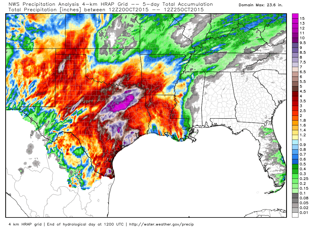
Rainfall Past 5 Days
Here's the 5 day radar estimated rainfall over the southern U.S., which shows significant rainfall tallies over the eastern part of the state. Some locations have seen nearly 10"+, but a majority of the region has seen 2"+
National Weather Outlook
The image below shows two different areas of disturbed weather that will meet near the Great Lakes by midweek and intensify to bring gusty winds, heavier rainfall and the potential of wet snow to the area.
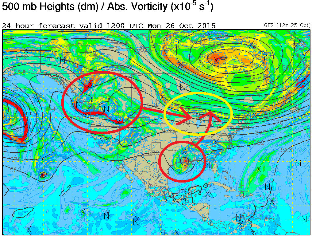
National Weather Outlook
Watch the two system come together through the early week time frame. Keep in mind that the moisture from the south is associated with the remnants of Hurricane Patricia! The storm system moving in from the west will bring in colder Canadian air and be responsible for mixed precipitation and snowfall potential across the high elevation in the western mountains and also across the international border
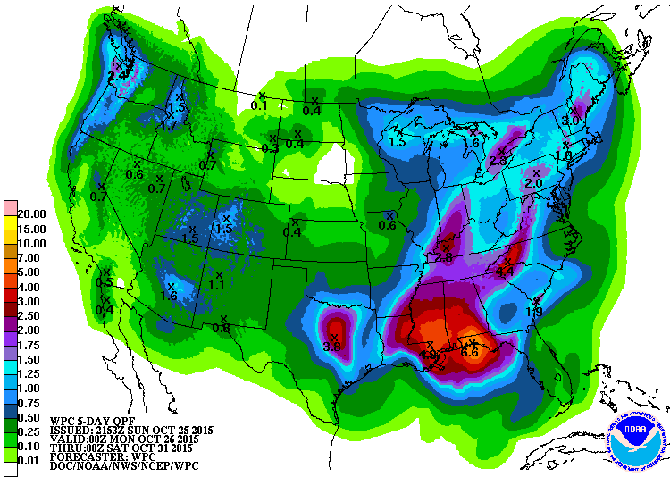
5 Day Precipitation Outlook
According to NOAA's WPC, the 5 day precipitation forecast suggests a fairly decent swath of moisture from the Gulf Coast to the Great Lakes/Northeast and the remnants of Hurricane Patricia move through. Stormy Pacific weather will also spread much needed moisture through the western U.S. over the next several days.
_______________________________________
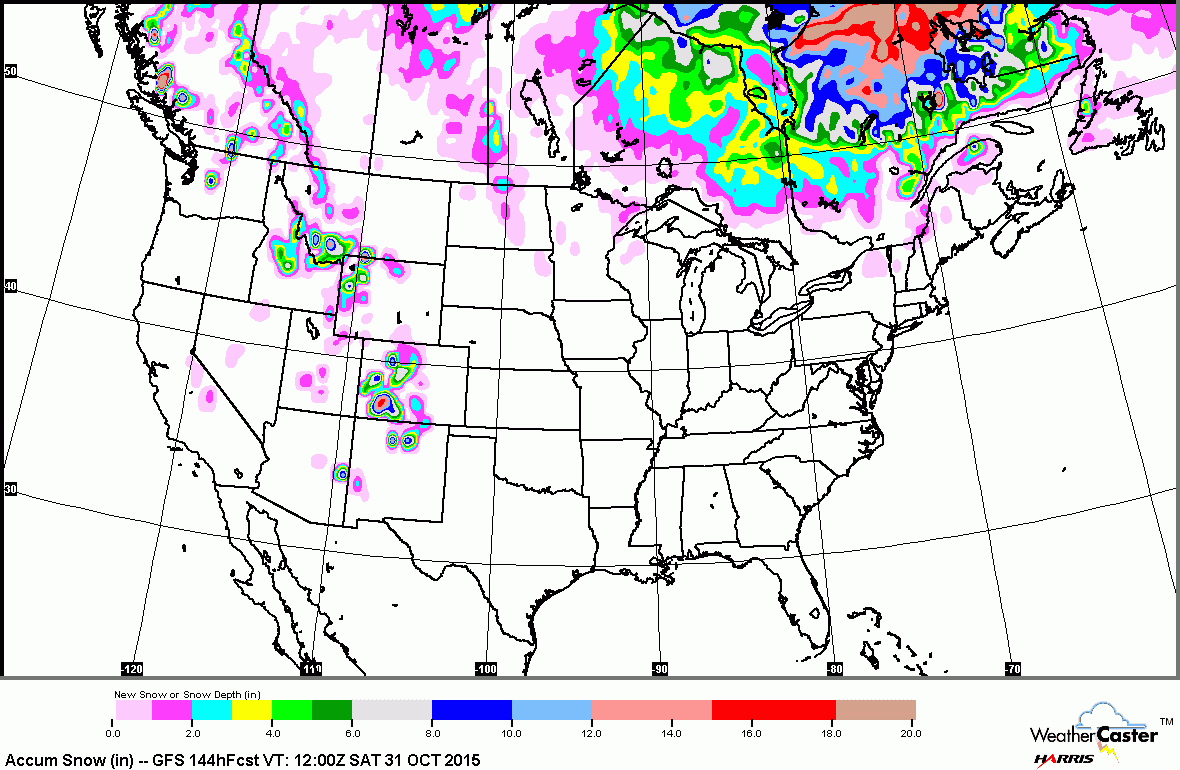
Snowfall Potential
The latest snowfall forecast from the GFS model shows accumulating snow potential across the high elevations in the Rocky Mountains, but also a little across the northern tier of the nation in the Upper Midwest.
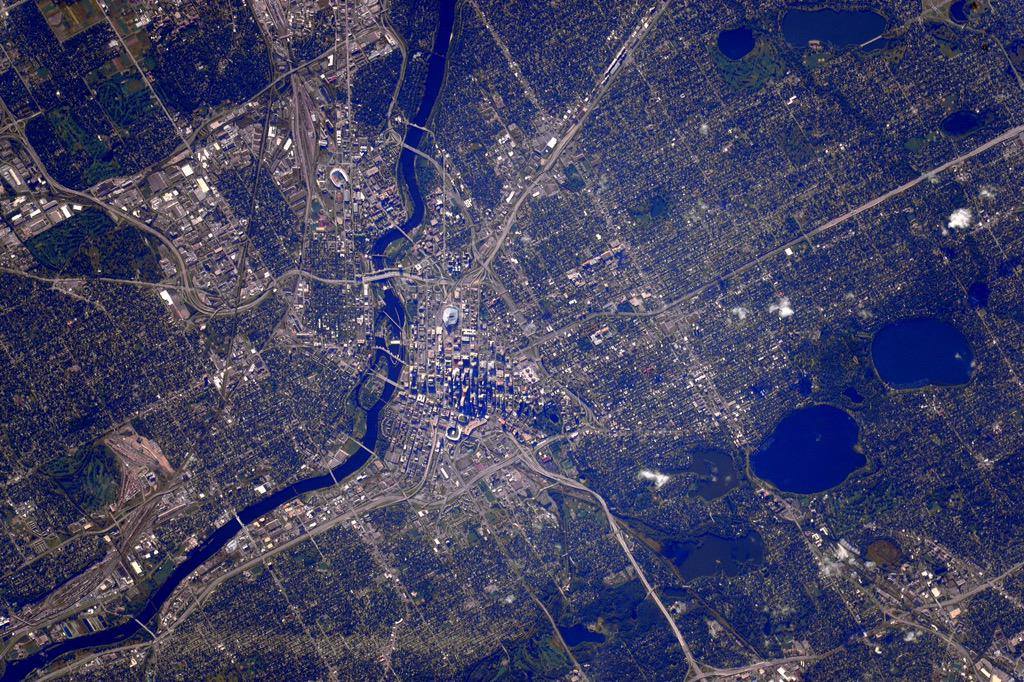
Interesting Image From Space
Here's a neat post from the Minnesota State Climatology Office. This is a picture of the Twin Cities on from September 22, 2015 by astronaut Kjell Lindgren aboard the ISS. Interestingly, if you look at the bottom of the picture, you can see a tornado scar from May 11, 2011.
Read more about the May 11, 2011 tornado HERE:
Thanks for checking in and have a great week ahead! Don't forget to follow me on Twitter @TNelsonWX

No comments:
Post a Comment