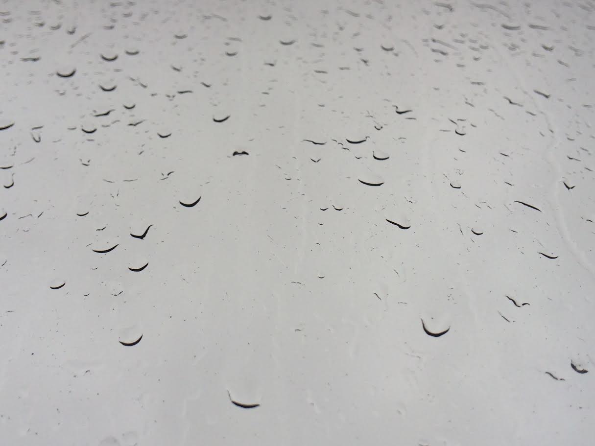
Wet & Windy Monday Morning
Does
anyone else think it's a little odd to be staring out the wind and
looking at puddles in December? Good grief! Thanks to above average
temperatures across the region, Monday's storm system brought more rain
than wintry precipitation to the area. Keep in mind that through
December 13th, the Twin Cities was running 10" below average snowfall so
far this season.
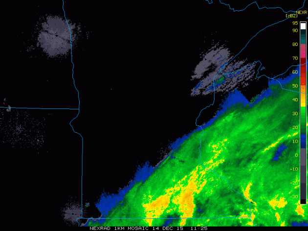
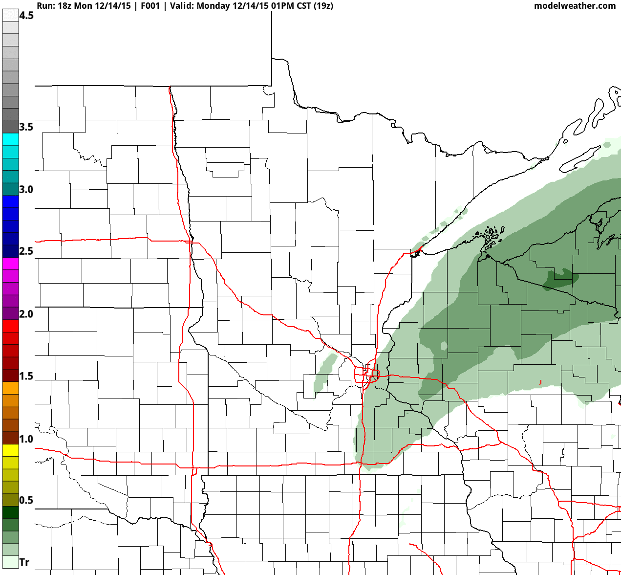
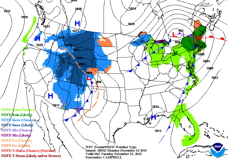
Monday Morning Radar
Here
was the radar from early Monday. Note how sharp the line of rain/wintry
precip was across southeastern Minnesota and Wisconsin.
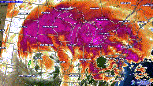
Satellite of Storm System
This
is what the storm system looked like on IR satellite on Monday morning.
Note the tight counterclockwise circulation over the Midwest as the
storm system was lifting northeast toward the Great Lakes.
Interestingly, temperatures in association with this storm were quite warm, so much of the precipitation fell in the form of rain.
_____________________
Dreaming of a White Christmas? Move North
By Paul Douglas
By Paul Douglas
On
average 3 out of 4 December 25ths in the Twin Cities are "white", with
an inch or more of snow on the ground. There can be wild swings from
year to year. Christmas 2014 was brown, but 2013 saw 9 inches. Snow
lovers of all ages got their Big Gift.
This year may take a minor meteorological miracle to get a whopping inch on the ground at KMSP next Friday
morning. I now have serious doubts. The same El Nino signal
overwhelming all other signals, circulations and oscillations will
dominate weather over North America through the remaining winter. This
near-record warming of Pacific Ocean water isn't forecast to fade until
spring of 2016.
The next feeble storm arrives Wednesday;
the atmosphere warm enough for a sloppy mix at MSP. A plowable
accumulation is possible from Detroit Lakes to the Brainerd Lakes area,
but amounts in the metro will probably be negligible.
There's little doubt a cold front will trigger a rash of coats and hats within 48-72 hours. Friday's wind chill may dip into single digits. Temperatures rebound, staying above 32F from Sunday thru next week. Sorry Santa.
______________________
MONDAY NIGHT: Cloudy, still gusty. Winds: N 5-15. Low: 32
TUESDAY: Overcast, slushy mix arrives at night. Winds: E 10-15. High: 36
TUESDAY NIGHT: Rain/snow mix likely. 1" - 2" snow possible. Winds: ESE 10-15. Low: 34.
WEDNESDAY: Rain/snow mix. 1" to 2" snow possible. Winds: SW 10-15. High: 40
THURSDAY: Mostly cloud, few flakes. Winds: NW 10-20. Wake-up: 26. High: near 30
FRIDAY: Coldest day of the week; windchill dips to 5F. Winds: NW 10-15. Wake-up: 16. High: 22
SATURDAY: Some sun, late day thaw.. Winds: S 10-15. Wake-up: 12. High: 33
SUNDAY: More clouds than sun. Winds: S 10-15. Wake-up: 23. High: 36
MONDAY: A little rain or drizzle possible. Winds: E 10-15. Wake-up: 29. High: 37.
________________________
________________________
This Day in Weather History
December 15th
December 15th
1971: A snowstorm hits Duluth with 10 inches.
_______________________
_______________________
Average High/Low for Minneapolis
December 15th
December 15th
Average High: 27F (Record: 49F set in 1923)
Average Low: 12F (Record: -21F set in 1901)
_______________________
Average Low: 12F (Record: -21F set in 1901)
_______________________
Sunrise/Sunset Times for Minneapolis
December 15th
December 15th
Sunrise: 7:44am
Sunset: 4:32pm
_______________________
Sunset: 4:32pm
_______________________
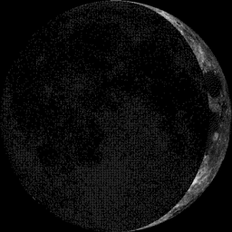
Moon Phase
2.3 Days Before First Quarter
2.3 Days Before First Quarter
___________________________
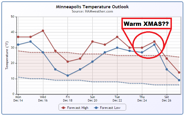
Minneapolis Temperature Trend
Through
December 13th, temperatures in the Twin Cities were running nearly 14F
above average and was the 3rd warmest (December 1st-13th) on record! It
appears that we'll still have much warmer than average temperatures
through midweek before we finally cool down to at or below normal levels
through the end of the week/ early weekend. However, note that extended
model runs are suggesting another surge of above average temperatures
through much of next week, just in time for the Christmas holiday.
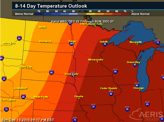
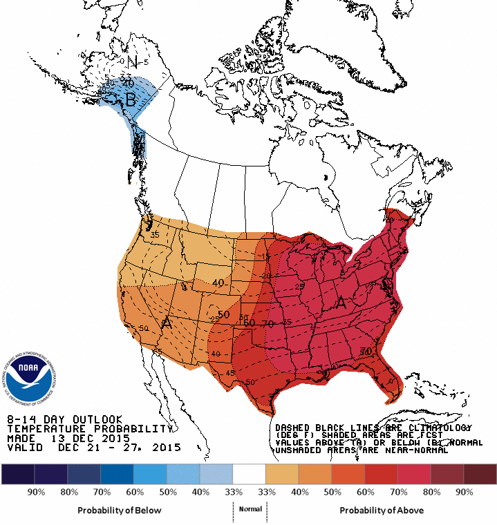
8 to 14 Day Temperature Outlook
According
to NOAA's CPC, the 8 to 14 day temperature outlook suggests warmer than
average temperatures for the Midwest from December 23rd - December
27th. This mimics the warmer than average temperature trend through much
of next week shown in the graphic above.
_______________________
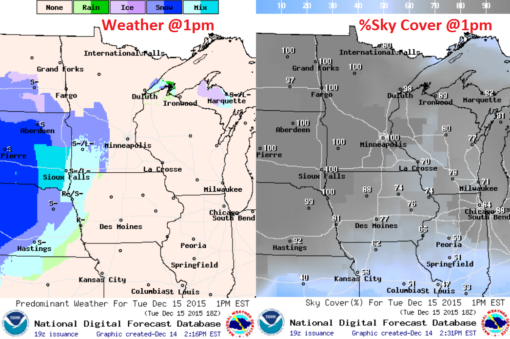
Tuesday Weather Outlook
Although
temperatures won't be as warm as it has been over the past several
days, much of the Upper Midwest will be dealing with above average
temperatures again on Tuesday. Feels like temperatures will be a little
cooler due to stronger winds.
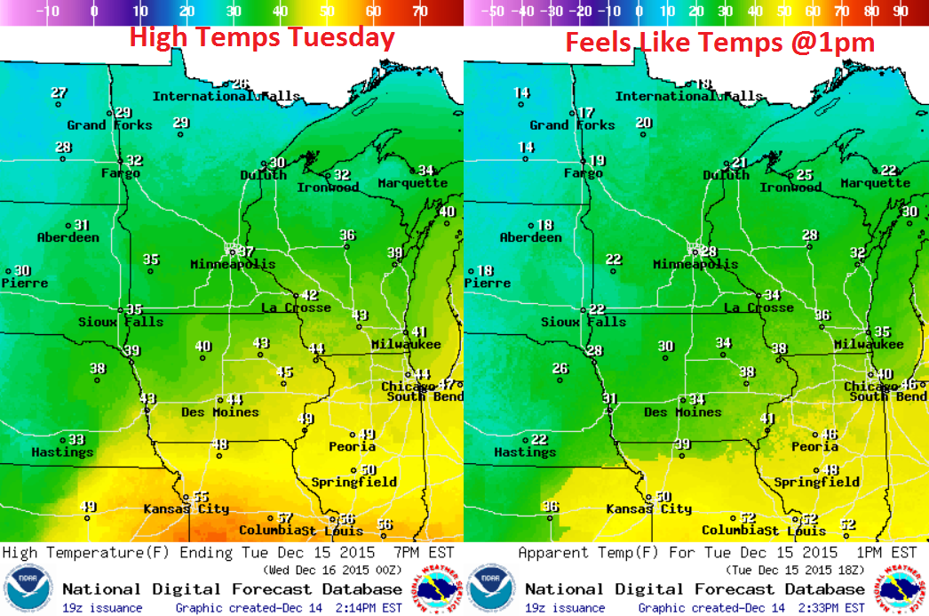
Tuesday Weather Outlook
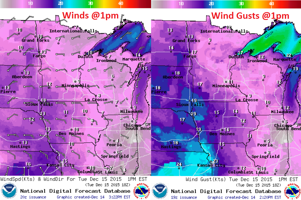
Wind
speeds will be picking up across the region through the day Tuesday as
our next storm system approaches from the southwest. The good news is
that this winds won't be as strong as they were with the system that
moved through earlier this week.
Tuesday Weather Outlook
A
rain/snow mix will begin to develop later Tuesday as our next storm
system approaches from the southwest. It appears that snow will be the
predominate precipitation type from the Dakotas into northwestern
Minnesota as colder temperatures will be present there.
More Precipitation on the Way
Here's
the precipitation outlook from midday Monday to Wednesday night. Note
the next surge of heavier moisture moving through the region PM
Tuesday/Wednesday. Some of this moisture will be in the form of
shovelable/plowable snow, mainly across the Dakotas and northern
Minnesota.
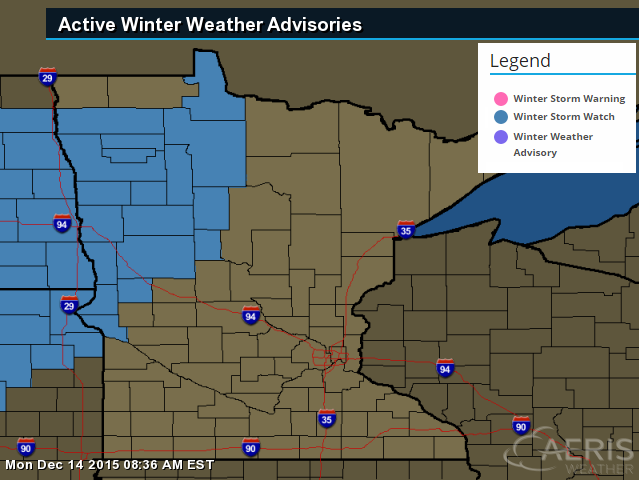
Winter Weather Headlines
...WINTER STORM WATCH REMAINS IN EFFECT FROM TUESDAY EVENING THROUGH WEDNESDAY AFTERNOON...
*
LOCATIONS...MOST OF EASTERN NORTH DAKOTA INTO NORTHWESTERN AND WEST
CENTRAL MINNESOTA...ALONG AND SOUTH OF A DEVILS LAKE TO GRAFTON TO
BAUDETTE LINE.
* TIMING...6 PM TUESDAY TO 6 PM WEDNESDAY
* SNOW ACCUMULATIONS...4 TO 8 INCHES.
* WINDS...NORTH 15 TO 25 MPH WITH GUSTS UP TO 30 MPH.
PRECAUTIONARY/PREPAREDNESS
ACTIONS... A WINTER STORM WATCH MEANS THERE IS A POTENTIAL FOR
SIGNIFICANT SNOW...SLEET...OR ICE ACCUMULATIONS THAT MAY IMPACT TRAVEL.
CONTINUE TO MONITOR THE LATEST FORECASTS.
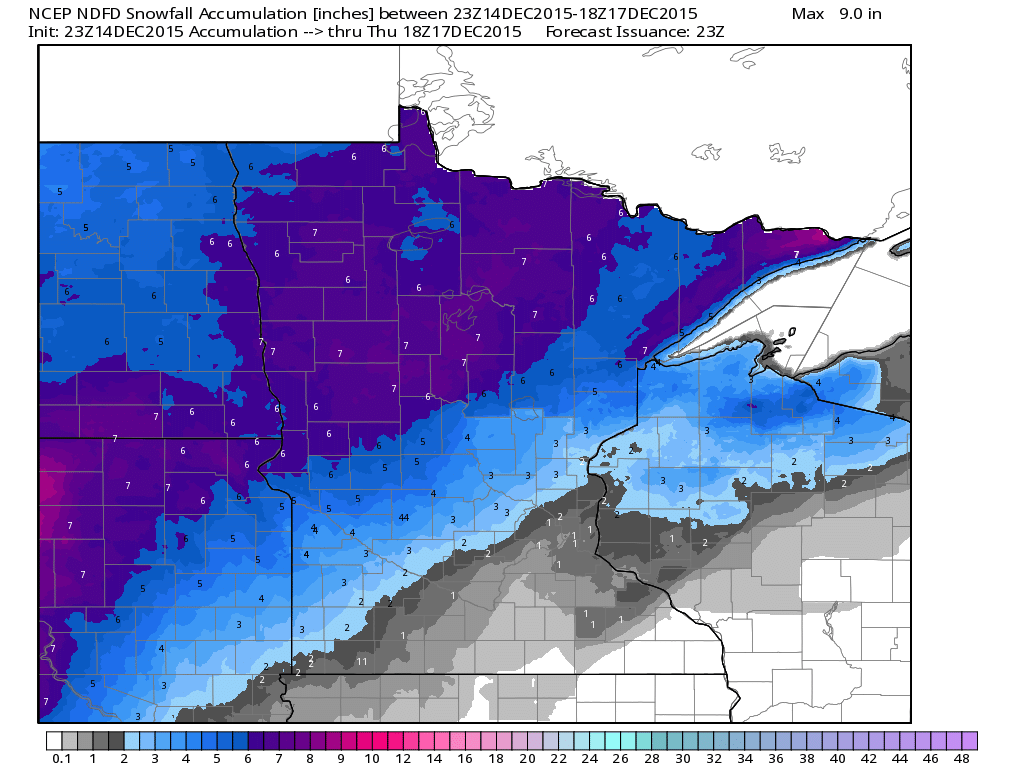
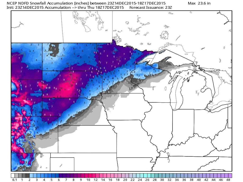
Minnesota Snowfall Potential
Here's
the snowfall potential through midday Thursday, which suggests nearly
4" to 8" of snow in the purple colors from parts of the Dakotas to
northwestern Minnesota and parts of the North Shore. Note that the Twin
Cities looks to get missed by much of the appreciative snow once again.
Midwest Snowfall Potential
Here's
the Midwest snowfall potential through midday Thursday. Note that some
some of the heaviest looks to stay in the higher elevations and into
parts of South Dakota
__________________________________
National Weather Outlook
Here's
the latest storm system as it wraps up over the Central U.S. through
midweek. Note that some of the heaviest snow will be found from the
Rockies to the Upper Midwest through early Wednesday, while rain looks
fall across the Mississippi Valley to the Gulf Coast States.
_____________________________
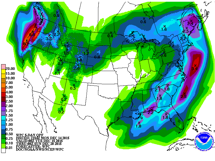
5 Day Precipitation Outlook
According
to NOAA's WPC, the 5 day precipitation outlook suggests heavier rain in
the Eastern U.S. with some spots seeing nearly 1" to 2"+, while the
heaviest still appears to be in the Pacific Northwest with as much as 4"
to 8" of liquid in spots.
____________________________________
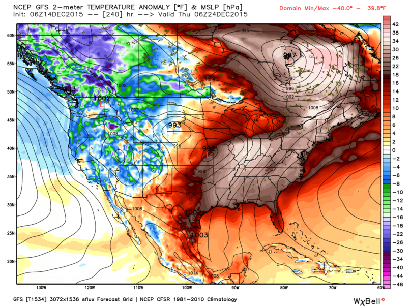
Warmer Outlook For Xmas
Here's
an interesting map that shows the temperature anomaly for XMAS eve.
Note that the eastern half of the country appears to be MUCH warmer than
average, while the western half of the country looks to be cooler than
average.
8 to 14 Day Temperature Outlook
According
to NOAA's CPC, the 8 to 14 day temperature outlook suggests another
bubble of warmer than average temperatures taking over the Eastern U.S.
as we head into next week and around the Christmas holiday.
________________________
Paris Climate Deal: 5 Big Issues
Here are the 5 big issues that were brought up and the Paris Climate Summit:
Issue: Keeping the warming of the planet within a “safe” range.
Issue: Ratcheting down greenhouse-gas emissions
Issue:
Getting more aggressive action (because current pledges don’t put the
world on a path to limiting warming to 2 degrees C, much less 1.5
degrees).
Issue: Adapting to damage that will inevitably occur, even with the pact.
Issue: Who pays?
Thanks for checking in and have a great rest of your week! Don't forget to follow me on Twitter @TNelsonWX

No comments:
Post a Comment