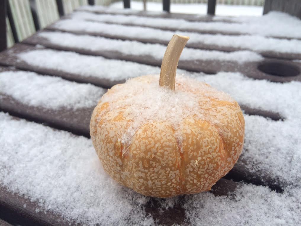
Somewhat Snowy Sunday
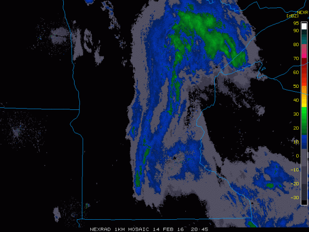
This was the radar from late Sunday afternoon as a snowy burst drifted through the central part of the state. It was enough snow to coat most roadways with a quick dusting to 1"
Presidents and the Weather - 40F by Late Week?
By Paul Douglas
On America's first Independence Day: July 4, 1776, the high in Philadelphia was 76F. Coincidence? The reason we know this is one of our Founding Fathers, Thomas Jefferson, bought a new thermometer.
Jefferson made regular observations at Monticello from 1772-78. George Washington was also an amateur weather nerd, recording the weather in his diary right up until the day he died. In 1870, relying on telegraphed weather updates for military and commerce, President Ulysses Grant signed into law a new agency that would become the U.S. Weather Bureau. In 1890 President McKinley ordered this Bureau to begin tracking hurricanes. A tip of hat to all the U.S. Presidents who helped to advance the science of meteorology.
And no, spring is NOT right around the corner, but 30s will feel like a sweet revelation this week; 40s possible Thursday into Saturday. We cool off slightly next week (nothing subzero) before a more sustained push of Pacific warmth arrives in early March. Is the very worst of winter behind us? Yes.
A few more Tournament Storms next month? Maybe. But don't hold your breath.
__________________________
Extended Forecast
SUNDAY NIGHT: Snow tapers early. Cloudy. Winds: SE 5-10. Low: 18.
MONDAY: Mostly cloudy and milder. Wind: SSW 5-10. High: 33
MONDAY NIGHT: Mostly cloudy with more light snow late. Winds: SSW 5. Low: 25.
TUESDAY: Flurries early, still gray. Winds: NNW 5-10. High: 32
WEDNESDAY: Intervals of sun, cooler. Winds: NNE 5. Wake-up: 15. High: 25
THURSDAY: Overcast, windy and milder. Winds: SE 10-15. Wake-up: 21. High: 39
FRIDAY: Vague hints of spring. Rain shower? Winds: SSE 10-15. Wake-up: 31. High: 42.
SATURDAY: Drier day, a few sunny peeks. Winds: W 5-10. Wake-up: 32. High: 41SUNDAY: Mostly cloudy and cooler. Winds: NE 10-20. Wake-up: 30. High: 34.
__________________________
This Day in Weather History
February 15th
1921: An early blast of spring weather invades Minnesota. Thunderstorms were reported across the southern portion of the state. Winona had a high of 67.
__________________________
Average High/Low for Minneapolis
February 15th
Average High: 29F (Record: 63F set in 1921)
Average Low: 13F (Record: -25F set in 1875)
__________________________
Sunrise/Sunset Times for Minneapolis
February 15th
Sunrise: 7:14am
Sunset: 5:40pm
*Daylight gained since yesterday: ~2mins & 55secs
*Daylight gained since winter solstice: ~1hr & 39mins
_____________________________
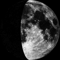
Moon Phase for February 15th at Midnight
1 Day Since First Quarter
__________________________________
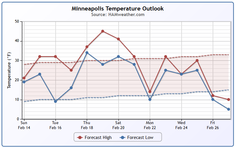
Minneapolis Temperature Trend
Warmer temperatures are on the way for the upcoming week with highs well above average and consistently in the 30s and perhaps even the 40s by the end of the week. Note that by the 4th week of the month it appears that we will get back to near average.
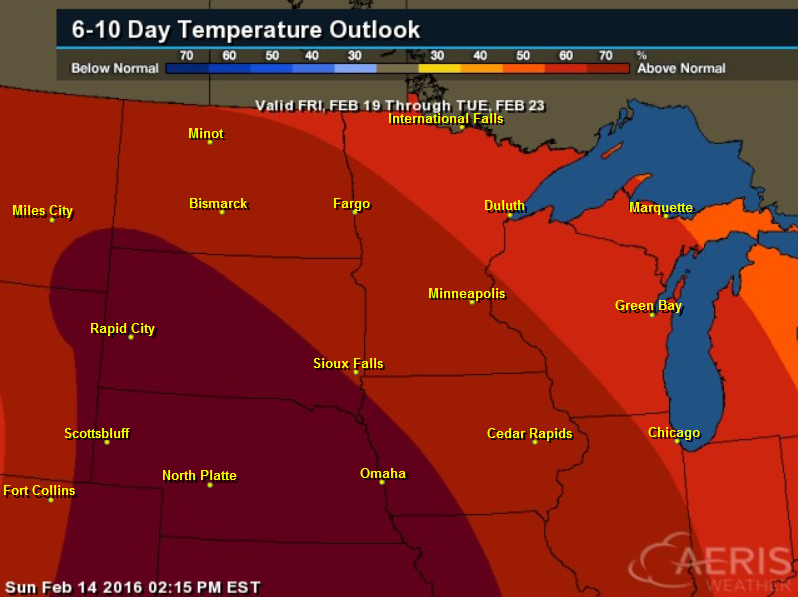
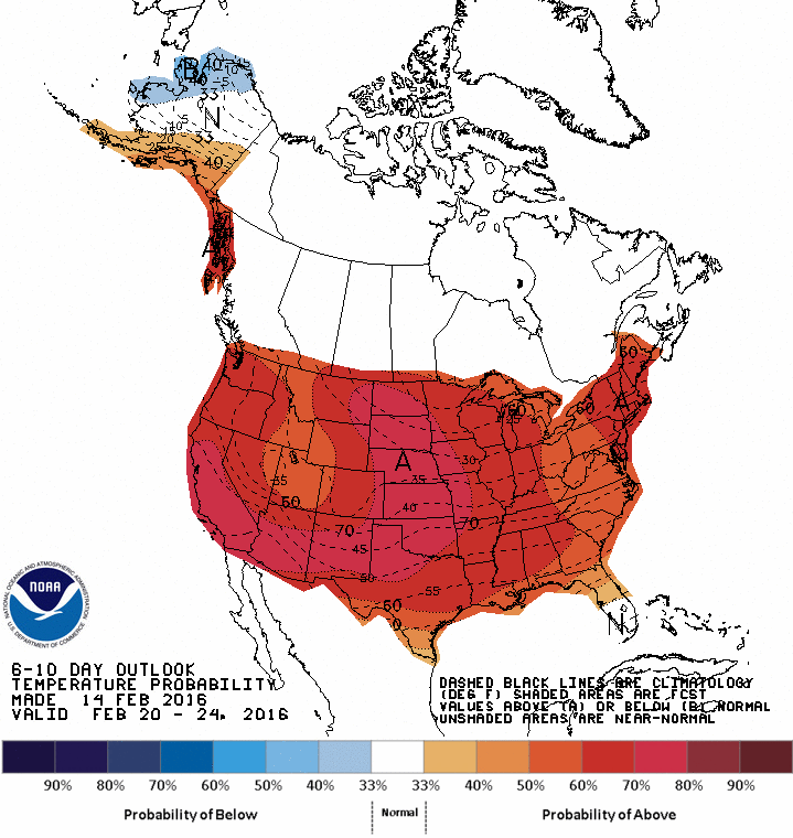
6 to 10 Day Temperature Outlook
According to NOAA's CPC, the 6 to 10 day temperature outlook suggests warmer than average temperatures from the 19th-23rd. It appears that warmer than average temperatures will be fairly widespread across much of the nation too!
______________________________
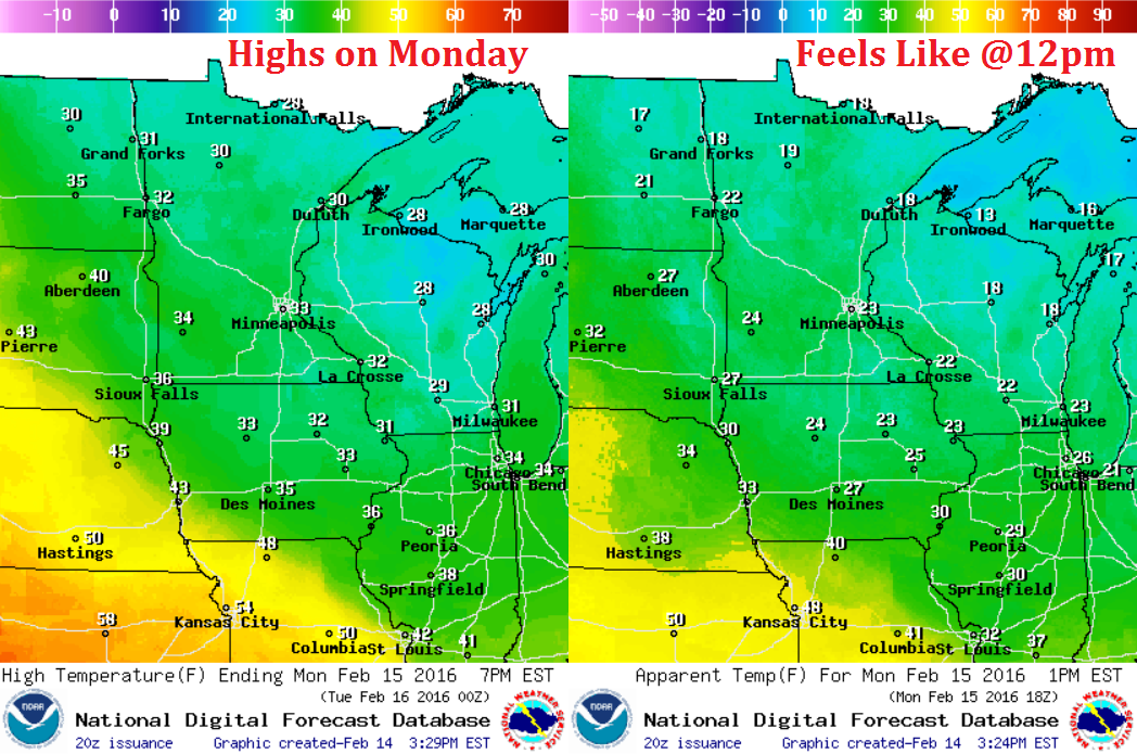
Monday Weather Outlook
High temperatures on Monday will once again return to above average levels across much of the region. 30s and 40s will be found across much of the Upper Midwest with feels like temps in the 10s, 20s and 30s.
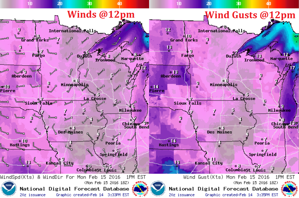
Monday Weather Outlook
Winds won't be much of an issue on Monday, but a south to southwesterly breeze will help to keep temperatures warmer than we've had over the past several days.
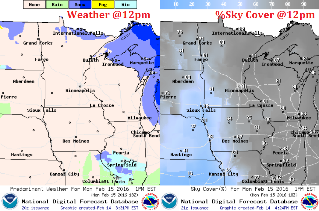
Monday Weather Outlook
Light snow will continue across the international border and near the Great Lakes Region. Mostly to partly sunny skies will be found across much of Minnesota.
____________________________
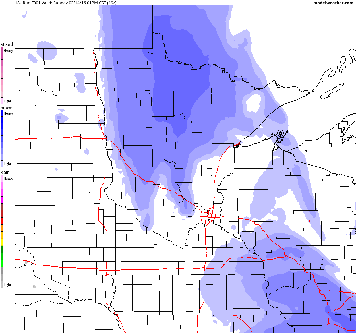
Simulated Radar
The fast moving clipper rolls into town PM Monday - Tuesday with minor snow accumulations across parts of the state. Note that precipitation type could be in the form of a wintry mix across the southwestern part of the state.
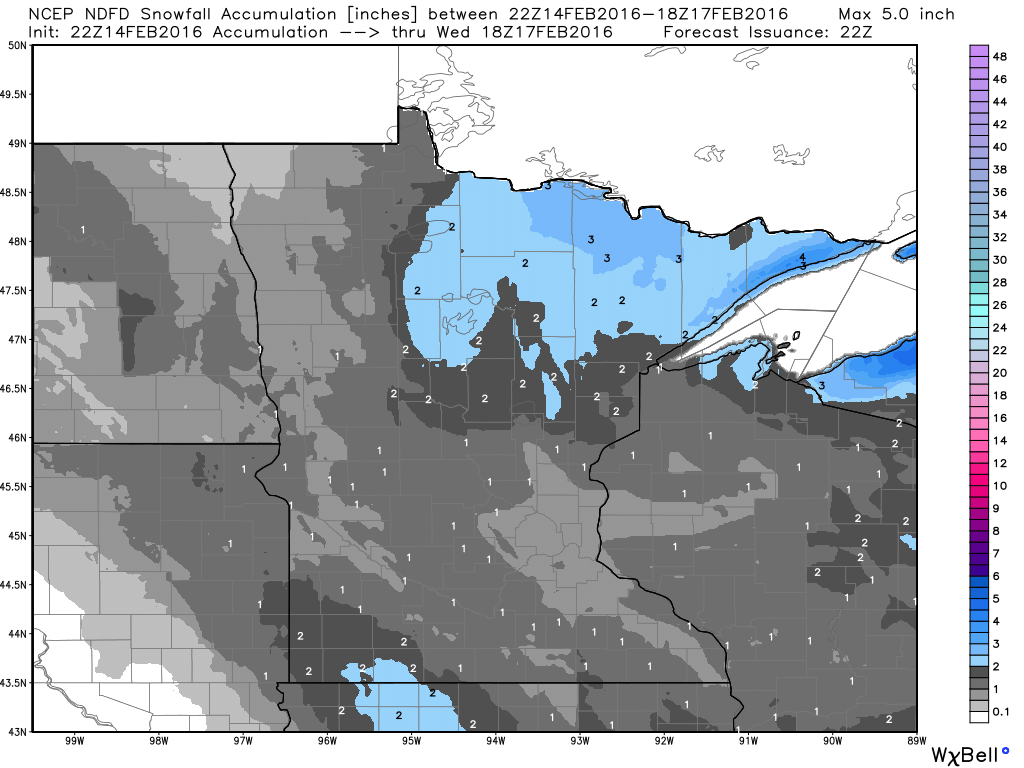
Snowfall Potential
As our next clipper rolls through the region, light snowfall accumulations will once again be possible across the Upper Midwest. Here's the additional snowfall potential through midday Wednesday. Note that most areas will generally see 1" or 2", there could be a few isolated 3" amounts across northeastern MN.
_______________________________
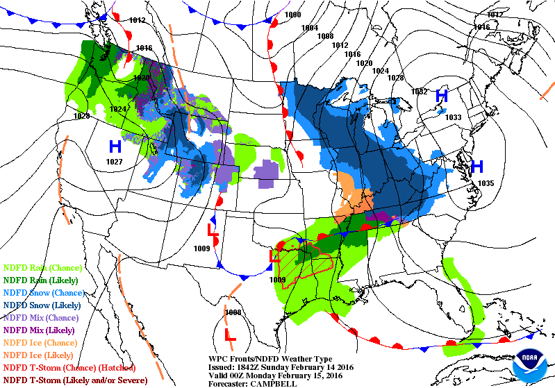
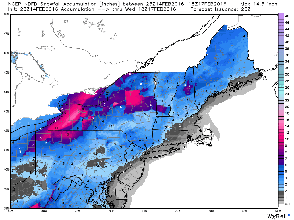
National Weather Outlook
The eastern half of the country will remain fairly active through the early/middle part of the week as clippers and storm systems continue to slide through. Note the heavier blob of moisture that looks to work into the northeastern part of the country through PM Tuesday.
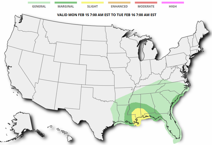
Severe Threat Monday
...SUMMARY...
   THUNDERSTORMS MAY IMPACT PORTIONS OF THE CENTRAL INTO EASTERN GULF
   COAST MONDAY...AND COASTAL SOUTH CAROLINA LATE MONDAY NIGHT...WITH
   SOME RISK FOR SEVERE WEATHER.

   ...SYNOPSIS...
   LARGE-SCALE UPPER RIDGING STILL BUILDING OVER THE EASTERN
   PACIFIC...AND GRADUALLY DEVELOPING INLAND OF THE PACIFIC
   COAST...APPEARS LIKELY TO REMAIN PROMINENT THROUGH THIS FORECAST
   PERIOD.  THE EVOLUTION OF DOWNSTREAM TROUGHING ACROSS THE CENTRAL
   INTO EASTERN U.S. IS MORE UNCERTAIN...HOWEVER.  SIZABLE SPREAD IS
   EVIDENT AMONG THE MODELS...AND WITHIN THE MODEL ENSEMBLE OUTPUT
   /PARTICULARLY THE NCEP SREF/...CONCERNING AT LEAST A COUPLE OF SHORT
   WAVE PERTURBATIONS EMERGING FROM A STRONG JET STREAK ROUNDING THE
   CREST OF THE RIDGE...BEFORE DIGGING TO THE LEE OF THE ROCKIES.

   ONE IMPULSE...ALREADY IN THE PROCESS OF DIGGING TO THE LEE OF THE
   NORTHERN ROCKIES...APPEARS LIKELY TO REACH THE CENTRAL PLAINS BY 12Z
   MONDAY.  THEREAFTER...THE DEGREE TO WHICH IT CONTINUES DIGGING
   TOWARD THE CENTRAL/EASTERN GULF COAST REGION BEFORE TURNING
   EASTWARD...VERSUS DIGGING INTO THE OZARK PLATEAU BEFORE TURNING INTO
   THE OHIO/TENNESSEE VALLEYS...REMAINS UNCLEAR.

   IN LOWER LEVELS THIS MAY HAVE CONSIDERABLE IMPACT ON POTENTIAL
   SURFACE CYCLOGENESIS ACROSS THE SOUTHEAST...AND THE EXTENT OF
   LOW-LEVEL MOISTURE RETURN OFF THE GULF OF MEXICO...AS WELL AS THE
   WESTERN ATLANTIC.  REGARDLESS...EVEN OVER PORTIONS OF THE WESTERN
   AND CENTRAL GULF OF MEXICO THAT HAVE NOT BEEN IMPACTED BY THE BRUNT
   OF THE MOST RECENT COLD INTRUSION...CONSIDERABLE BOUNDARY LAYER
   MODIFICATION NEEDS TO OCCUR TO SUPPORT A SUBSTANTIVE RETURN FLOW
   MOISTURE.  FURTHERMORE...EVEN THE NAM...WHICH MAY BE AMONG THE MOST
   AGGRESSIVE WITH THE UPPER IMPULSE DIGGING INTO THE GULF COAST
   REGION...INDICATES ONLY MODEST SURFACE FRONTAL WAVE DEVELOPMENT
   ACROSS NORTHERN PORTIONS OF THE GULF STATES INTO THE LEE OF THE
   SOUTHERN APPALACHIANS DURING THIS PERIOD.
Winter Weather Headlines
Winter weather headlines continue from parts of the Ohio/Tennessee Valley to parts of the Northeast.
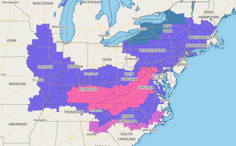
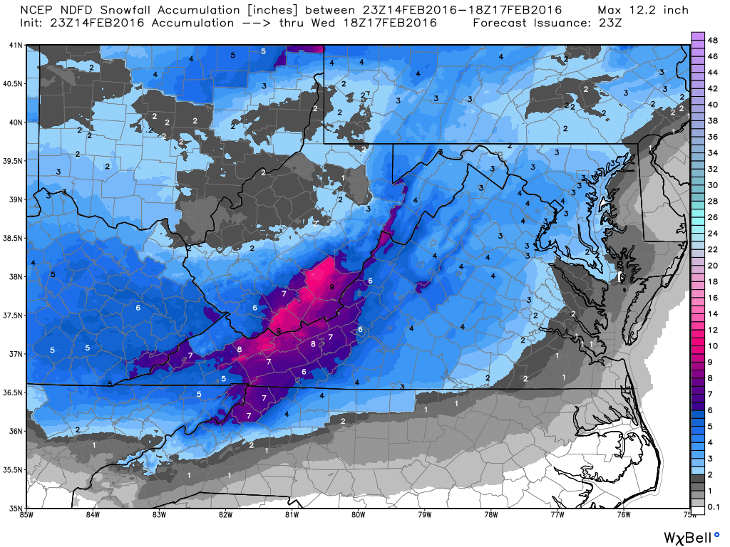
Snowfall Potential
The snowfall potential across parts of the Appalachians suggests nearly 6"+ as the storm system slides northeast through the early week time frame.
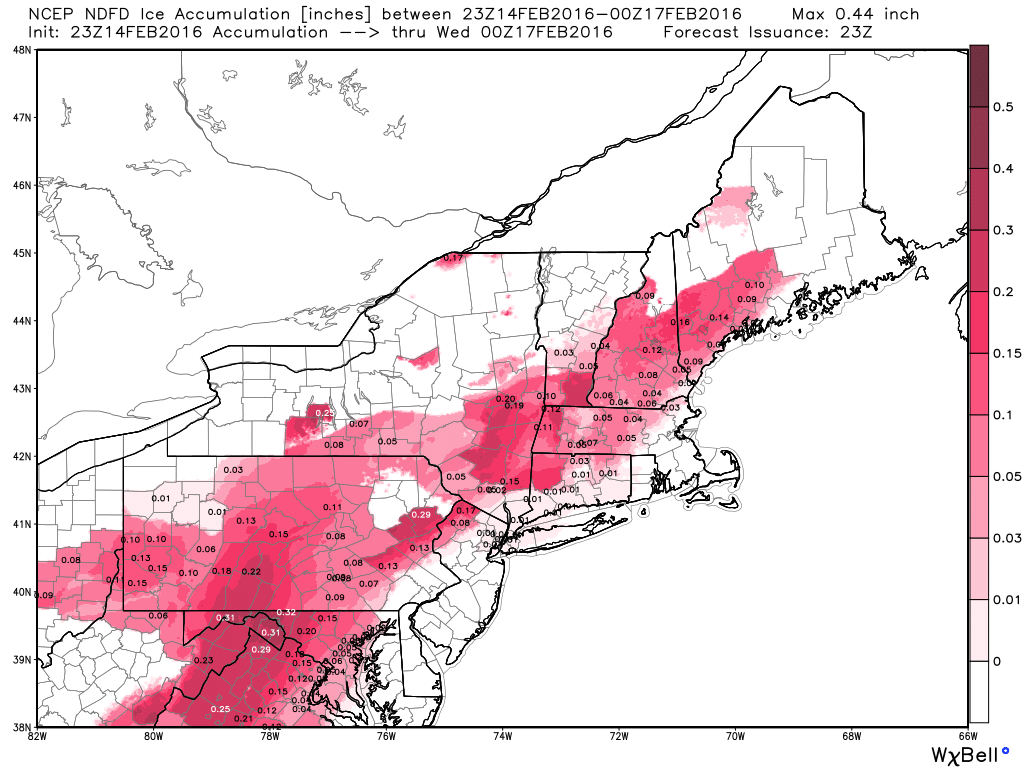
Icing Potential?
Along with snowfall potential, icing potential will also be possible across parts of the region. Here's a look at the area that could see some of the potential problems.
Temperature Outlook
Recent slaps of cold air will slowly fade out of the northeast through the week ahead. Milder temperatures will begin settling in through the week ahead.
6 to 10 Day Temperature Outlook
According to NOAA's CPC, the 6 to 10 day temperature outlook suggests that most of the nation will be above average
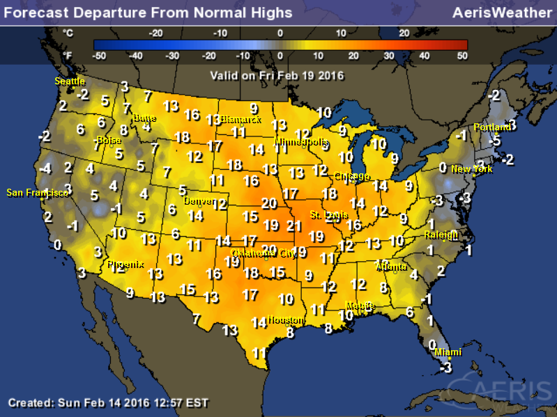
Highs From Average fror Friday, February 19th
Note that much of the nation will be well above average by this Friday!
Thanks for checking in and have a great week ahead! Don't forget to follow me on Twitter @TNelsonWX

No comments:
Post a Comment