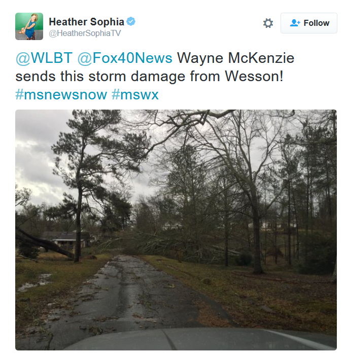
This was the view from Wesson, MS midday Monday after an apparent tornado went through the area. There were also reports of damage at the Wesson High School.
President's Day Tornadoes in the Southern U.S.
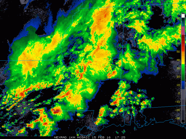
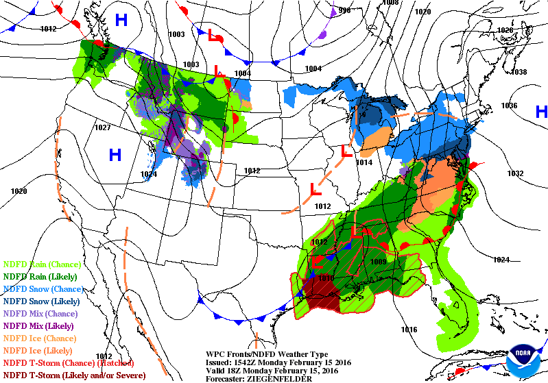
This was the radar loop from midday Monday as strong to severe thunderstorms rumbled across the Lower Mississippi Valley and Gulf Coast States. At this time, there were a number of tornado warnings on going across parts of Mississippi and Alabama.
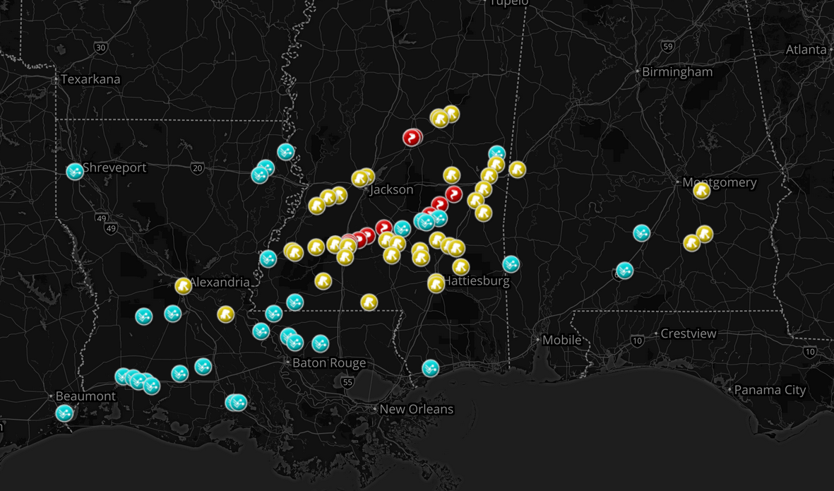
Storm Reports Monday
The storm reports from Monday suggests that a number of damaging wind, large hail and even tornado reports came in from parts of the Lower Mississippi Valley/Gulf Coast States on Monday.
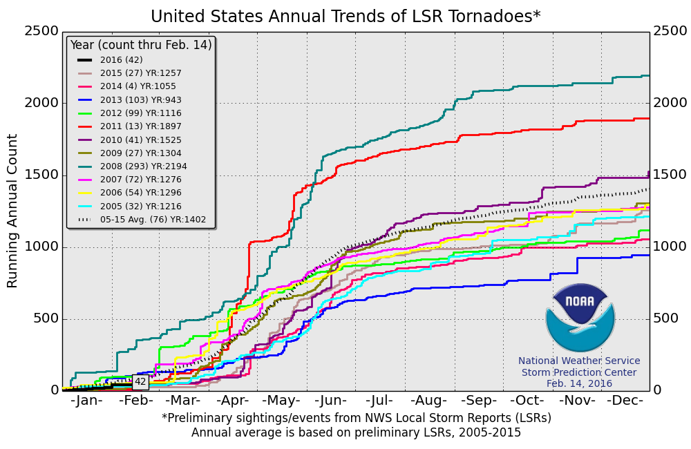
2016 Tornado Reports
According to NOAA's SPC, there have been 42 tornado reports so far this year (through February 14th). Interestingly, this is a little less than the short-term average (2005-2014) of 76 through that date. However, this year is off to a more active start than 2015 & 2014. Note that in 2008, there had been nearly 300 tornado reports through February 14th!
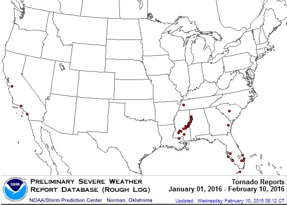
2016 Tornado Report Map
Here's the 2016 tornado report map through February 10th. Note that most of the tornadoes are located in the Southeastern part of the country, however 3 have occurred in California!
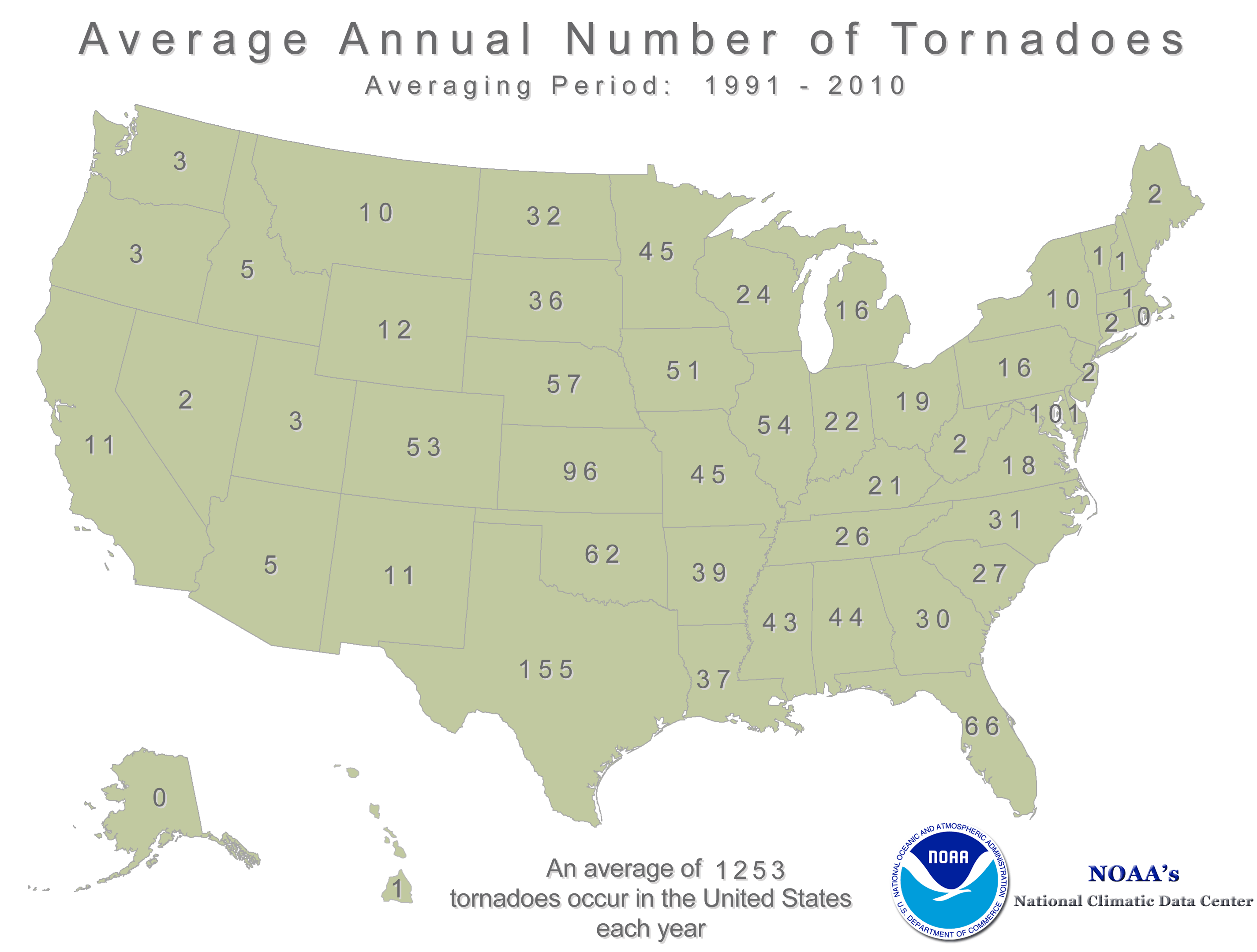
Annual Average Tornado Map
According to NOAA's NCDC, there are typical only 11 tornadoes that occur each year in the state of California, but 3 of those typical happen during the months of January and February. So, in all reality, 3 tornadoes this early in the year is average for them!
_________________________________
Paul's Theory of Weather Relativity. 40s Coming
By Paul Douglas
"When all is said and done, the weather and love are the two elements about which one can never be sure” wrote Alice Hoffman. I am sure of this: our reaction to the weather varies with the seasons.
Why does 40F feel like punishment in October, but in mid-February 40F is a source of sweet relief? It all depends on what you've just enjoyed (or endured). We are hard-wired to respond to weather, not climate. Our reaction to the vagaries of the weather depends on what we just muddled through, where we've been.
But where are we going Oh Clueless Sage? The sun is as high in the sky Tuesday as it was on October 26, when the high at MSP was 59F. Lingering snow and a steady IV-drip of Canadian air will tap the brakes on upcoming warm fronts, but a few 40s are likely by late week. There may be a little spring in your step by Friday.
The pattern isn't ripe for storms with names close to home anytime soon. A few rain showers may sprout Friday; clippers dropping nuisance snowfalls late Sunday and next Wednesday.Saturday was the 10th day of subzero this winter. Average is 23 subzero days
__________________________
Extended Forecast
MONDAY NIGHT: Mostly cloudy with more light snow late. Winds: S 5. Low: 26.
TUESDAY: Flurries early, still gray. Light coating possible. Winds: NNW 5-15. High: 33
TUESDAY NIGHT: Mostly cloudy. Winds: NW 5-10. Low: 15.
WEDNESDAY: Partly sunny and cooler. Winds: NNE 5. High: 25
THURSDAY: Overcast, windy and milder. Winds: SE 10-15. Wake-up: 13. High: 40
FRIDAY: Wind-whipped rain showers. Winds: SSW 10-15. Wake-up: 33. High: 42.
SATURDAY: More clouds than sun, mild. Winds: W 10-15. Wake-up: 32. High: 44
SUNDAY: Clouds increase, PM wet snow? Winds: WNW 10. Wake-up: 31. High: 38
MONDAY: Mostly cloudy, turning milder. Winds: N 10. Wake-up: 22. High: 27.
___________________________
This Day in Weather History
February 16th
1981: A significant warmup occurs across Minnesota. Highs in the 50s and 60s are common. 5 daily high records are broken in a row in the Twin Cities, with many others also broken statewide.
1903: A temperature of -59 is recorded at Pokegama Dam, tying the state record low at that time. It would not be broken for another 93 years.
___________________________
Average High/Low for Minneapolis
February 16th
Average High: 29F (Record: 60F set in 1981)
Average Low: 13F (Record: -26F set in 1936)
___________________________
Sunrise/Sunset Times for Minneapolis
February 16th
Sunrise: 7:13am
Sunset: 5:42pm
____________________________
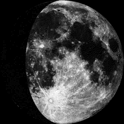
Moon Phase for February 16th at Midnight
2.0 Days Since First Quarter
________________________________
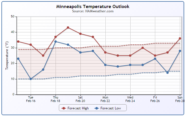
Minneapolis Temperature Trend
The extended forecast for Minneapolis suggests a very mild stretch of weather moving in through the 3 week of February. Note that temperatures look to be consistently in the 30s with readings Friday and Saturday possibly bumping up into the 40s!
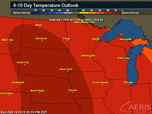
6 to 10 Day Temperature Outlook
According to NOAA's CPC, the 6 to 10 day temperature outlook for the Midwest suggests warmer than average temperatures from February 20th - 24th.
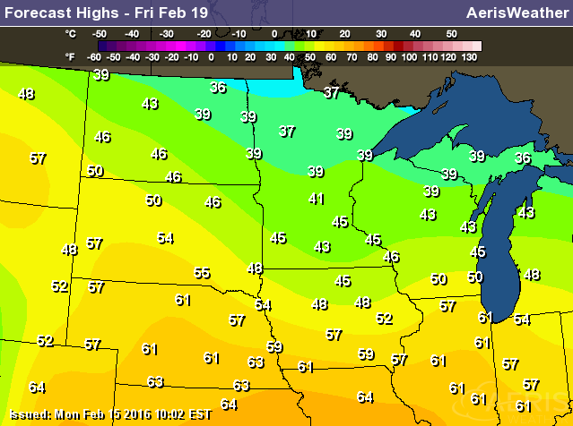
High Temperatures Saturday, February 20th
Here's a look high temperatures on Friday, February 19th. Note that much of the state could be dealing readings in the 30s and 40s with some 50s and 60s showing up across the Central U.S.! These temperatures are a little more reminiscent of mid March.
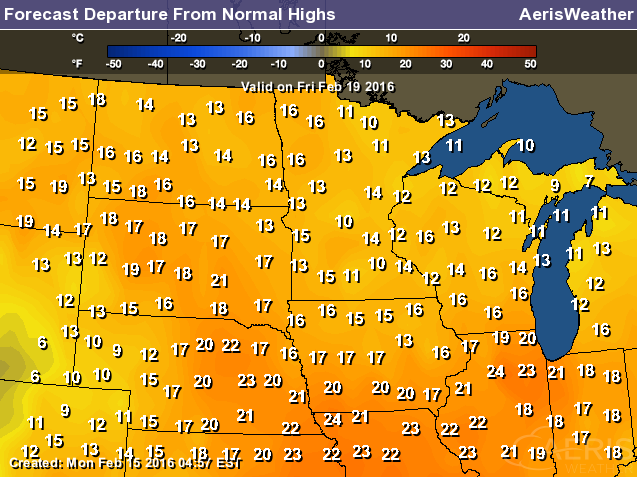
Highs From Average for Friday, February 19th
High temperatures on Friday will be running nearly 10° to 20° above average across the Midwest with some spots in the Central U.S. running nearly 25° above average!
_____________________________________
Tuesday Weather Outlook
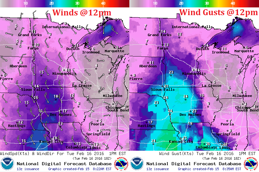
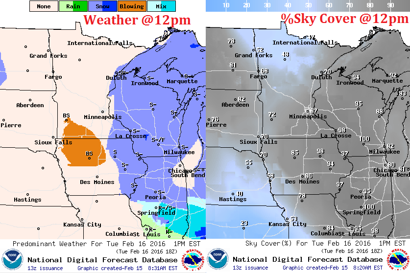
While we have to wait a few more days for the real warmth to arrive, temperatures on Tuesday will still be milder than it was on Saturday. High temperatures across Minnesota will range from the 10s across the far north to the 30s across the far south. However, feels like temperature midday Tuesday will hold in the single digits across the far north due to a stronger breeze developing
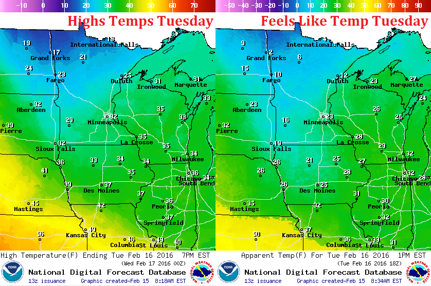
Tuesday Weather Outlook
A clipper moving through the Midwest on Tuesday will help to stir up the winds. By midday Tuesday winds will be a little stronger across rural areas of western and southern MN. A few gusts of 20mph+ can't be ruled out there.
Tuesday Weather Outlook
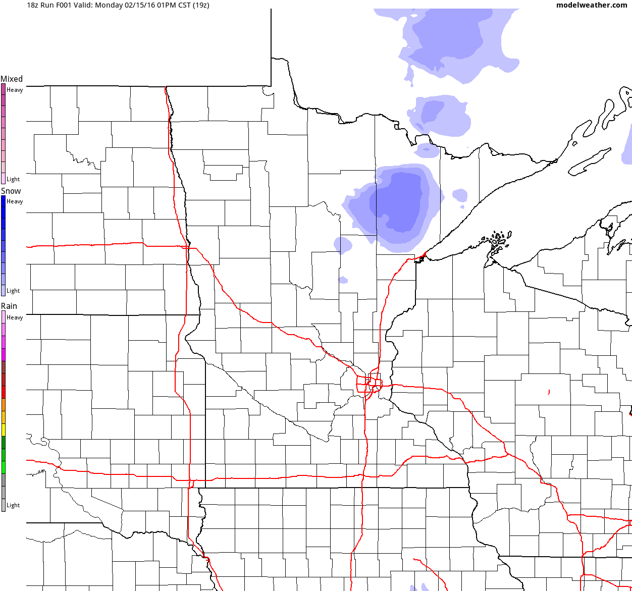
The snowfall expected with our clipper system will quickly move southeast out of the region by the second half of the day, so any accumulations that we see would generally be found from PM Monday - midday Tuesday.
Simulated Radar
Here's a look at our next clipper as it dives southeast through the region PM Monday - midday Tuesday. Note that the heaviest, steadiest snow appears to be found from the Eastern Dakotas into Southwestern MN and into Iowa. Interestingly, anoter quick clipper could impact some of those same areas from PM Tuesday - AM Wednesday.
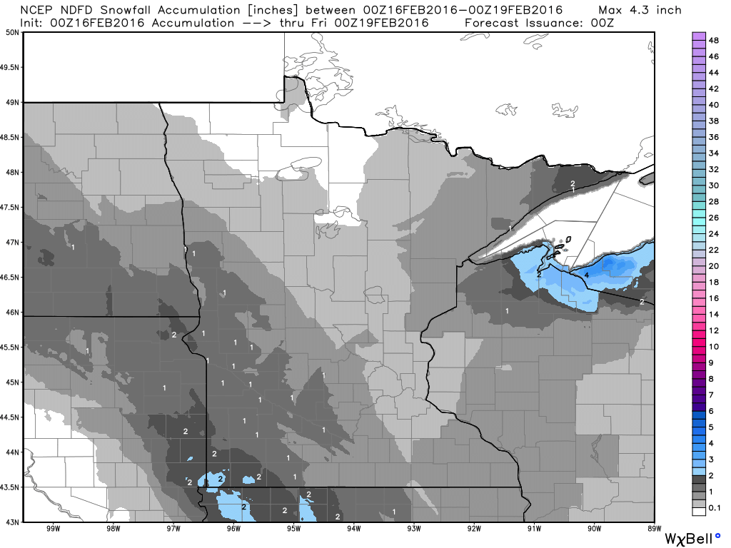
Minnesota Snowfall Potential
Here's the latest snowfall potential through 6pm Wednesday. Note the heaviest appears to be from the eastern portions of the Dakotas into southwestern Minnesota. There is a potential of some light 1" to 2"+ amounts, with a light coating in the Twin Cities.
__________________________
National Weather Outlook
The storm system causing all the commotion in the Eastern U.S. will continue moving up the coast through PM Tuesday/AM Wednesday with additional heavy rainfall and wintry precipitation.
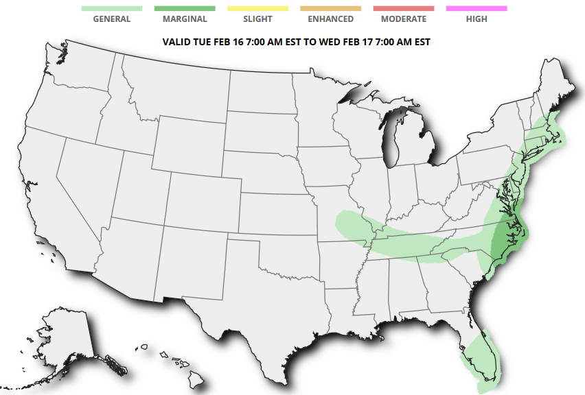
Severe Threat AM Tuesday
...SUMMARY...
   ISOLATED SEVERE STORMS MAY OCCUR THROUGH ABOUT MIDDAY TUESDAY ACROSS
   EASTERN NORTH CAROLINA AND SOUTHEAST VIRGINIA.

   ...SYNOPSIS...
   A LEAD SHORTWAVE TROUGH SHOULD PROGRESS ALONG THE
   APPALACHIANS/PIEDMONT...AS AN UPSTREAM WAVE QUICKLY MOVES FROM THE
   LOWER MO VALLEY TO THE LOWER MID-ATLANTIC COAST THROUGH EARLY WED. A
   DEEPENING SURFACE CYCLONE SHOULD TRACK FROM VA TO ST LAWRENCE
   VALLEY...WITH AN ATTENDANT COLD FRONT PUSHING EAST OFF MUCH OF THE
   MID/SOUTH-ATLANTIC COAST. TRAILING PORTION OF THIS FRONT WILL DECAY
   OVER THE FL PENINSULA.
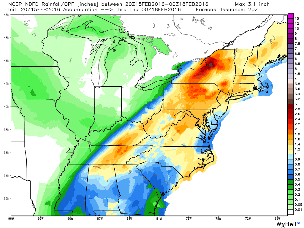
Heavy Eastern Precipitation
Take a look at this strip of heavy precipitation across the Eastern U.S. through 6pm Wednesday. It appears that a large swath of 1" to 2"+ liquid tallies may be possible, which could lead to areas of flooding.
Flood Concerns
A number of flood watches have been issues from parts of the Ohio/Tennessee Valley to the Eastern Great Lakes through PM Tuesday. 1" to 2"+ rainfall and snow melt could lead to excess runoff, which may lead to areas of flooding in some areas.

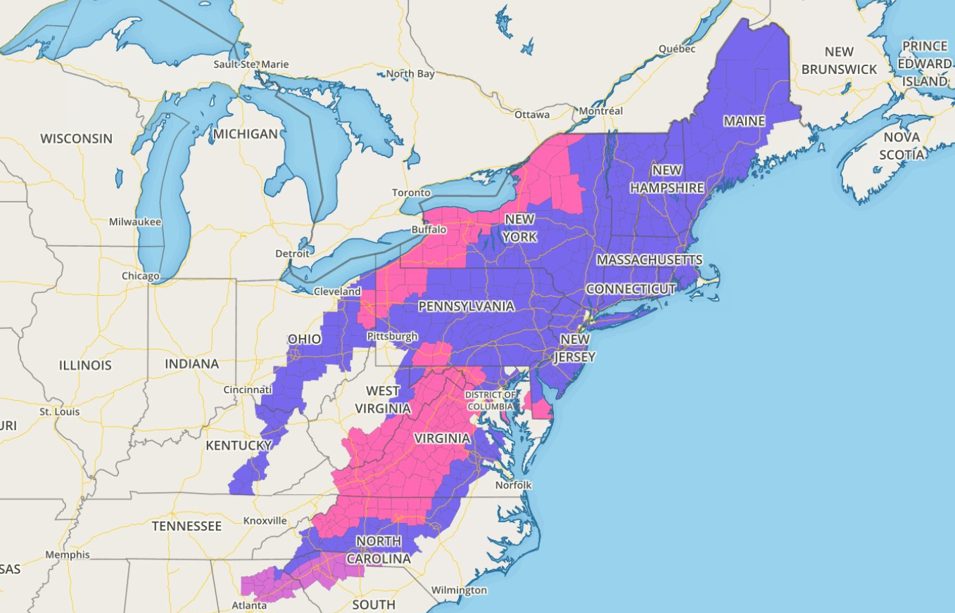
Winter Weather Headlines
A number of winter weather headlines have been posted from parts of the Mid-Atlantic States to the Northern New England States for the potential of heavy snow and icing.
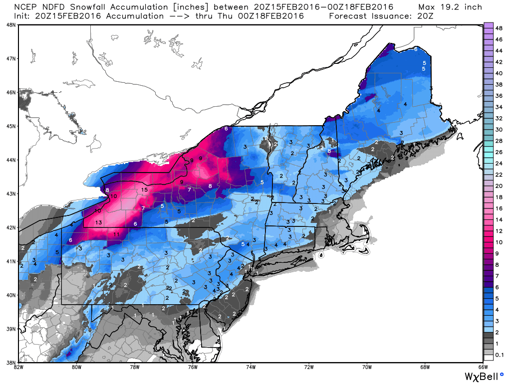
Northeast Snowfall Potential
As the system lifts northeast, heavy snowfall will be found across parts of the Eastern Great Lakes!

Northeast Snowfall Potential
Here's a closer look at snowfall potential in the Northeast. Note that some of the heaviest looks to fall across parts of western New York with as much as 12"+ possible!
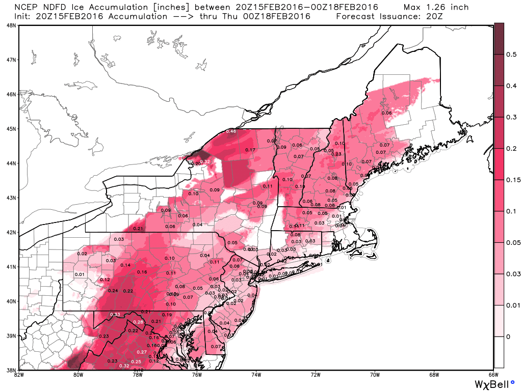
Ice Potential
Wintry weather continues in the Northeast through Tuesday with areas of snow and ice. Here's a look at how much ice may be possible across the area.
__________________________________
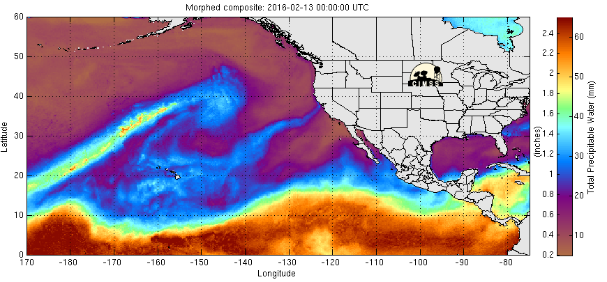
Eastern Pacific Water Loop
The precipitable water loop in the Eastern Pacific show a plume of heavier moisture moving into the West Coast once again. This will help to produce heavy rain and snow across parts of the West Coast over the next several days.
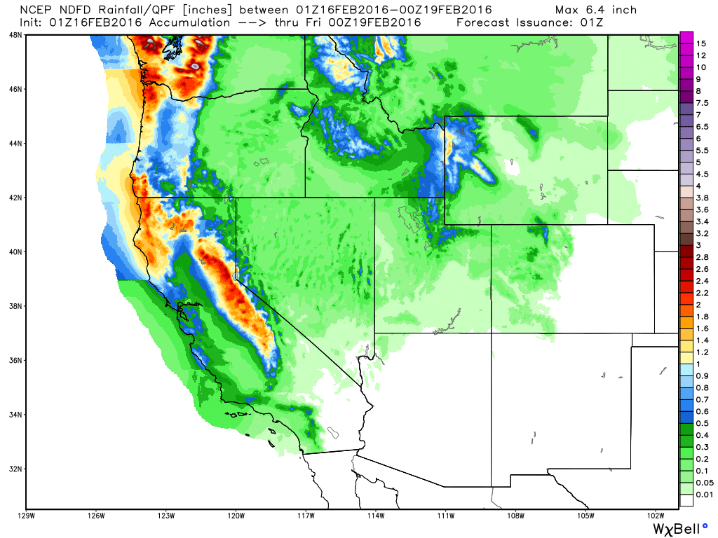
Precipitation Outlook
Take a look at the precipitation across the West Coast, note the heavy precipitation amounts across the higher elevations. Some of this heavy moisture could lead to flood concerns
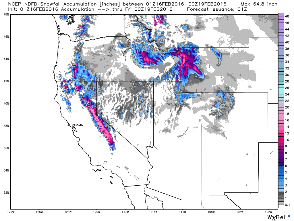
Western Snowfall Potential
As moisture builds into the the Western U.S., some of it will turn to snow across the high elevations. Note the heavy snowfall potential that looks to return to the Sierra Nevada Range in California.
__________________________________
Thanks for checking in and have a great rest of your week. Don't forget to follow me on Twitter @TNelsonWX

No comments:
Post a Comment