49 F. high temperature in the Twin Cities Tuesday.
63 F. average high on April 26.
64 F. high on April 26, 2015.
April 27, 1996: Embarrass records a low of 9 degrees. Some central, and most northern, Minnesota lakes are still ice-covered.
April 27, 1921: A late season blizzard hits Hibbing. The temperature was 75 degrees three days earlier.
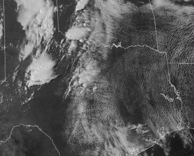
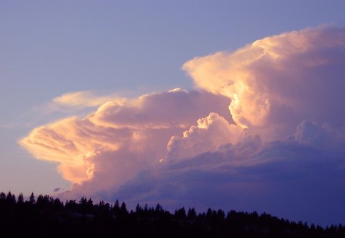
Tornado Lotto: When To Pay Extra-Close Attention
Xenia. Greensburg. Joplin. Tuscaloosa. Fridley. All towns leveled by large, violent tornadoes. Every spring an unholy meteorological lotto plays out on the Plains. Most of us are spared, but a few cities are decimated.
The next 4-8 weeks are, historically, most violent. Why? The ground is warming rapidly, yet the upper atmosphere is suffering from a wintry hangover. Extreme instability, along with Gulf moisture and wind shear create a ripe environment for "supercell" storms.
Things to watch for: large hail is often a precursor. A PDS (particularly dangerous situation) tornado watch is a clue you're not dealing with garden-variety storms. A "Tornado Emergency" is one step above a tornado warning, implying a confirmed tornado on the ground. In spite of high tech there's still no substitute for common sense.
Don't complain about a chilly week. The storm that spawned big tornadoes yesterday tracks to our south, keeping us on the stable (safe) northern edge of the system. Up to 1 inch of rain falls tonight into Thursday; even more over far southern Minnesota.
Enjoy the cool front; 80F is possible the first weekend of May!
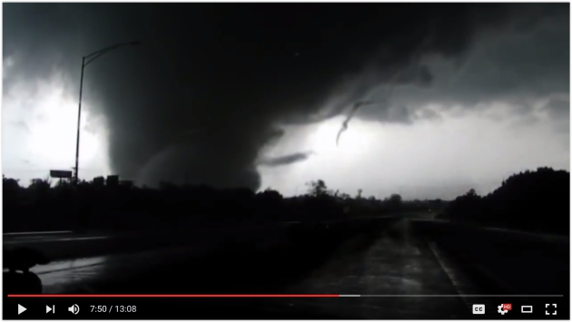
* The raw tornado chaser video is here (rated PG for salty language). No wonder it has 3.5 million views on YouTube - it's amazing.
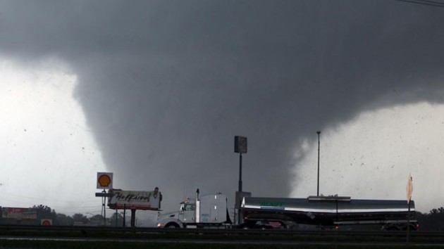
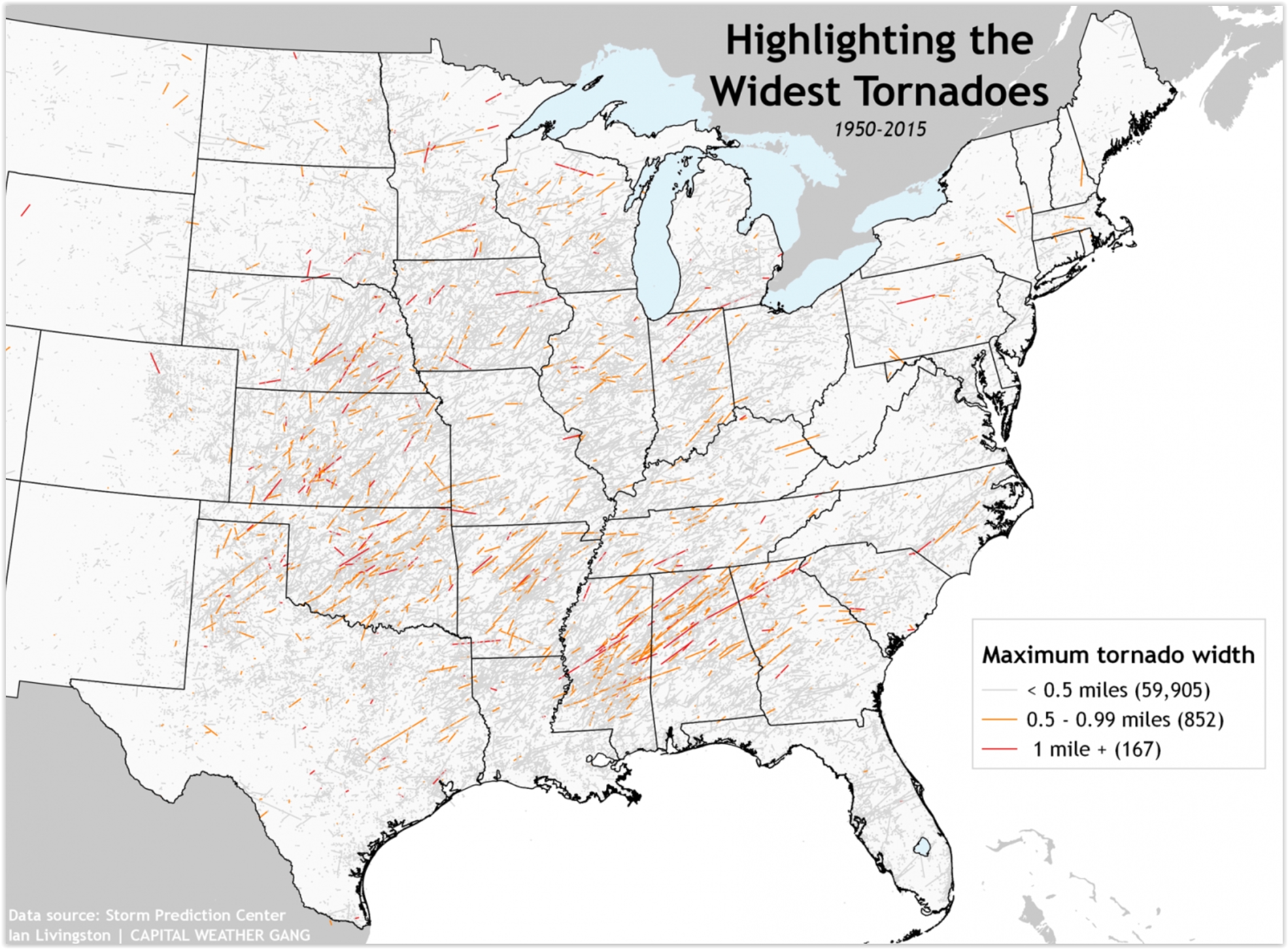
Two Reasons Why We Have To Stop Throwing Around the Phrase "Wedge Tornado". I couldn't agree more. Here's a snippet from Capital Weather Gang: "...While width is not a measure of strength (I’ve seen an EF-1 wedge tornado in Kansas), it is true that the widest tornadoes tend to be strong. From 0.25 miles up to one mile wide, we find 69 percent of 0.25 mile wide tornadoes were rated F/EF-2 (strong) or greater and 87 percent made that classification at 1 mile wide. Given their scare appeal, it is understandable that wedge tornadoes are feared and widely reported. Additionally, many of the great tornado disasters of our time — think Joplin (2011) or Greensburg (2007) — have been caused by wedge tornadoes..."
Map credit: SPC, Ian Livingston, Capital Weather Gang.
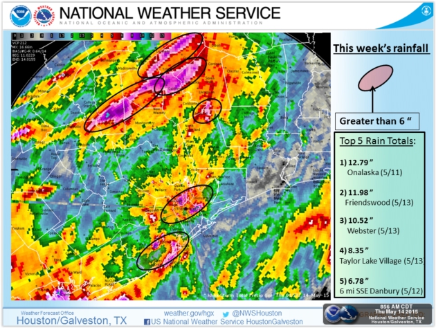
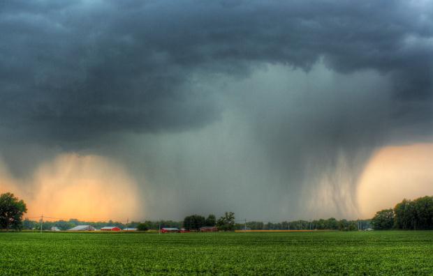
Houston Flood Control Efforts Fall Behind Urban Sprawl.
Not only is the rain falling harder (as a general rule) but
urbanization and sprawl has limited the ability of rainwater to soak
into the soil - now it often has no choice but to run off into streets
and storm sewers. Here's an excerpt from Yahoo News: "Flood
control has long been a challenging issue in Houston, dating back to
the city's infancy on the banks of the Buffalo Bayou when its first
flood was recorded more than 170 years ago. Major reservoirs built in
the 1940s helped alleviate some of problems, but a population explosion
and urban sprawl since then enveloped the reservoirs. Experts said the
city's efforts since then have fallen woefully short of the massive
needs. And there is climate change, which has increased the frequency of
large rainfalls, climatologists said. The result this week was that
sudden downpours overwhelmed infrastructure and inundated whole sections
of the city, leaving at least seven people dead..."
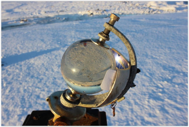
Photo credit above: "A Campbell-Stokes sunshine recorder in Antarctica". (Photo: Akulovz/CC BY-SA 4.0).
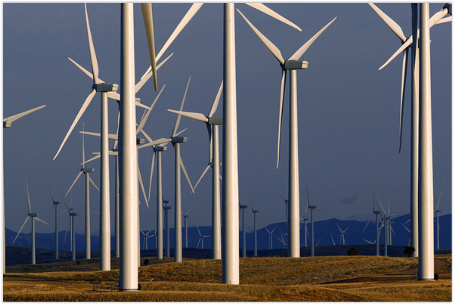
U.S. Wind Power Jobs Hit Record High, Up 20% in 2016. Clean Technica has an update - here's the intro to a recent story: "The US wind power industry reached a record job high of 88,000 jobs at the start of 2016, up 20% in the space of a year. According to a new report from the American Wind Energy Association (AWEA), the American wind power industry supported a record 88,000 jobs at the start of 2016, an increase of 20% over 2015. The report, US Wind Industry Annual Market Report, Year Ending 2015, heralded the strong job growth in the sector with the recent news that wind topped new energy capacity in the US in 2015..."

Forget Too Much TV. It's Too Big TV We Should Worry About.
Wave goodbye to the traditional 30 and 60 minute TV "show". Streaming
TV changes everything, including expectations. Here's a clip at The New York Times: "...Today’s great fattening, like so many trends in TV now, is in part the influence of streaming TV.
The only thing limiting the length of a Netflix or Amazon binge show is
your ability to sit without cramping. The menu is bigger, and so are
the portions. Meanwhile, basic cable channels realized that there was no
reason their “hourlong” series needed to end on the hour. If they
pushed a 10 p.m. drama’s end to, say, 11:17, they could give their
creators the kind of narrative real estate available on ad-free HBO and
Showtime..."
The Future of TV Is Happening Faster Than Anyone Thought. Every industry gets disrupted - just about the only thing that is predictable is disruption. The Washington Post reports.

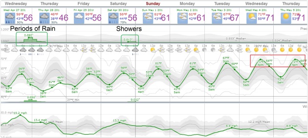
TODAY: Windy with periods of rain. Winds: E 20-30. High: 51
WEDNESDAY NIGHT: More rain, heaviest south of MSP. Low: 41
THURSDAY: Soggy. Rain tapers to showers. Winds: NE 10-20. High: 50
FRIDAY: More clouds than sun, drier. Winds: NE 8-13. Wake-up: 42. High: 58
SATURDAY: Dry start, PM showers possible. Winds: E 15-25. Wake-up: 47. High: near 60
SUNDAY: Damp start, drier day of the weekend. Winds: E 10-15. Wake-up: 46. High: 62
MONDAY: Partly sunny, less wind. Winds: NE 7-12. Wake-up: 45. High: 64
TUESDAY: Plenty of sunshine, pleasant. Winds: SW 8-13. Wake-up: 44. High: 67
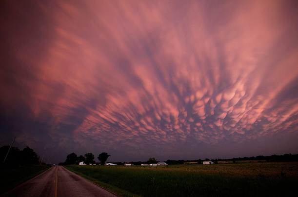
* Photo credit above: Mike Hall.
Climate Stories...
The Math the Planet Relies on Isn't Adding Up Right Now. The warming is taking place faster than those "alarmist climate models" have been predicting. Chris Mooney reports at The Washington Post: "As over 150 nations assemble to sign the Paris climate agreement in New York on Friday, reams of new analysis are pouring out from the planet’s vital number-crunchers, who look at the fundamental relationship between how much carbon we put in the air and how much the planet’s temperature increases as a result. And it’s adding up to a somber verdict: We seem closer to must-avoid climate thresholds than we thought — and crossing them may have bigger consequences than we recognize..."
Image credit: Planetary Visions LTD.
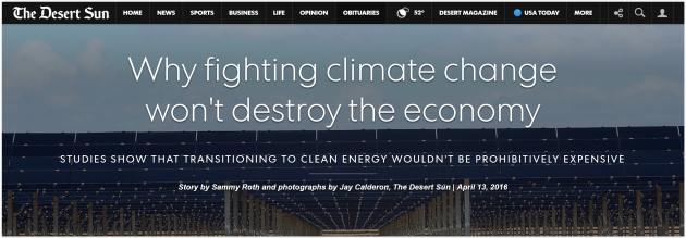
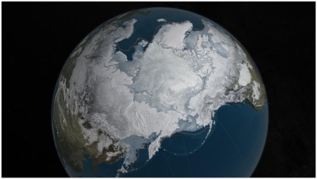
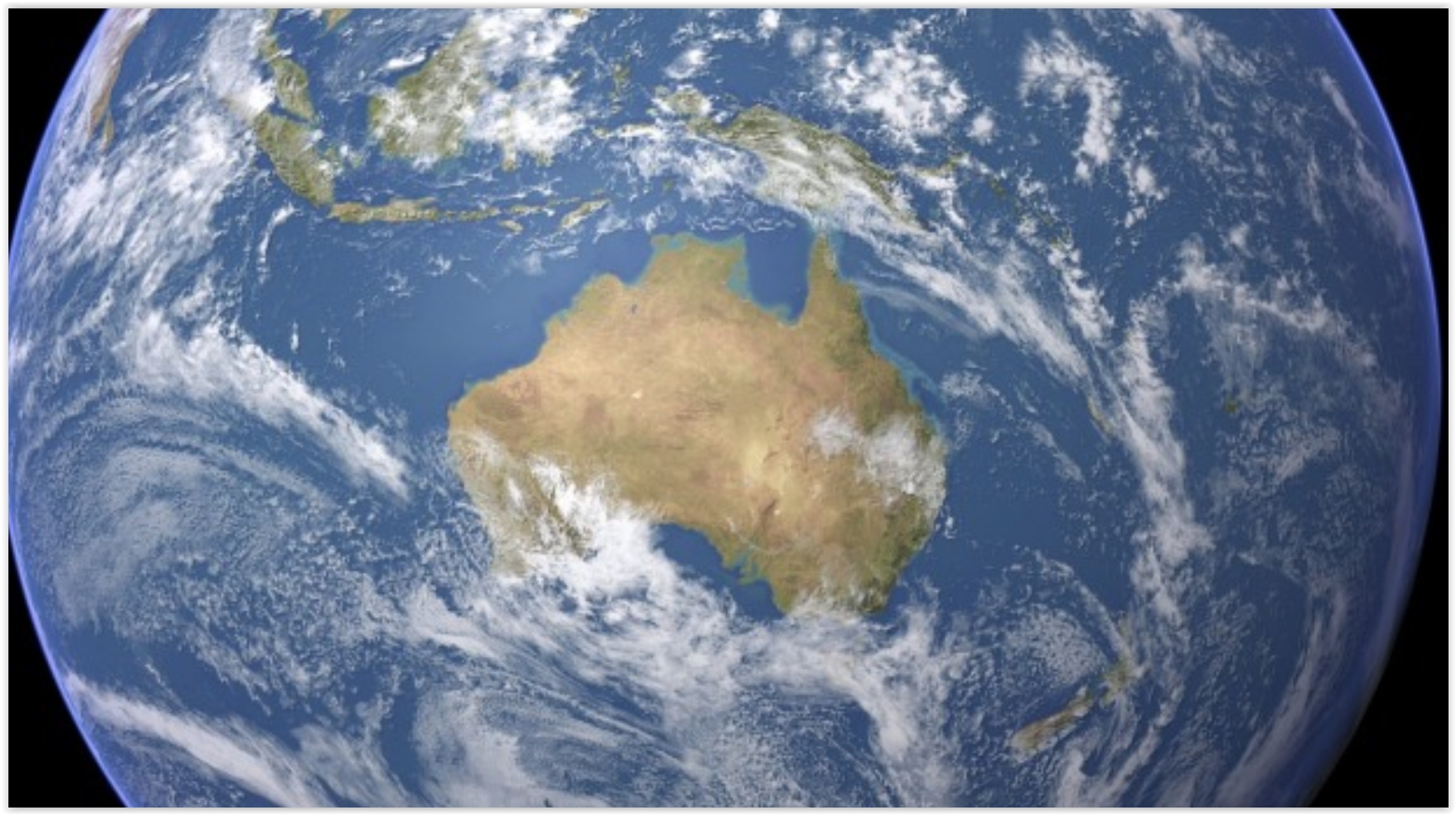
Image credit above: "This image provided by NASA shows Arctic sea ice at it maximum, the lowest on record. The winter maximum level of Arctic sea ice shrank to the smallest on record, thanks to extraordinarily warm temperatures, federal scientists said." (AP)
Saudi Arabia Plans for Life After Oil. Bloomberg has the story.
No comments:
Post a Comment