72 F. high in the Twin Cities Tuesday.
74 F. average high on May 31.
63 F. high temperature on May 31, 2015.
June 1, 1993: St. Cloud records its latest ever freezing temperature, with a record low of 32.
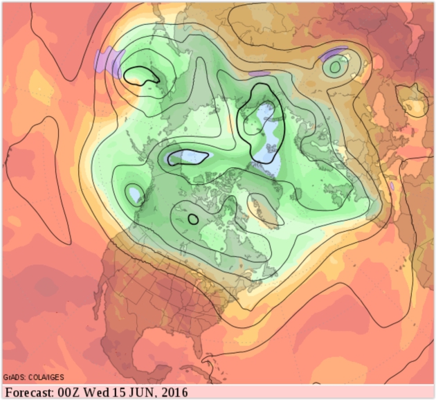
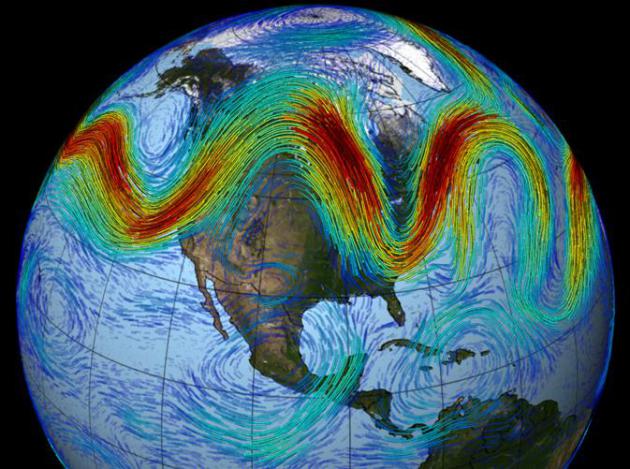
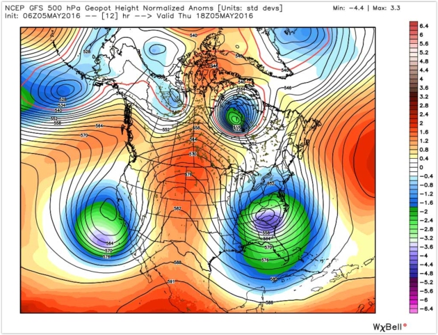
Canada Takes The Edge Off Our Heat and Humidity
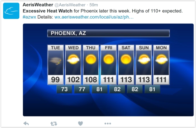
You know that annoyingly-persistent friend or family member who gives you updates from Phoenix during January, gloating about blue sky and "perfect golf weather"? Now might be a good time to touch base.
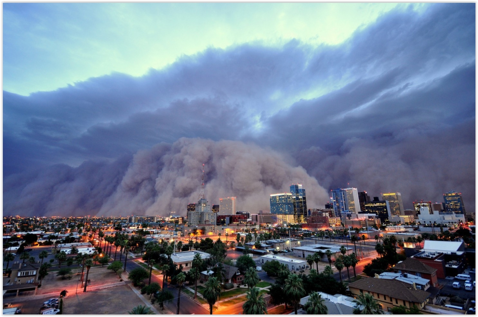
An Excessive Heat Watch is in effect for Phoenix, for highs from 110-115F with a heat index topping 120F. "But it's a dry heat Paul!" Uh, my oven is a dry heat - I still wouldn't stick my head inside.
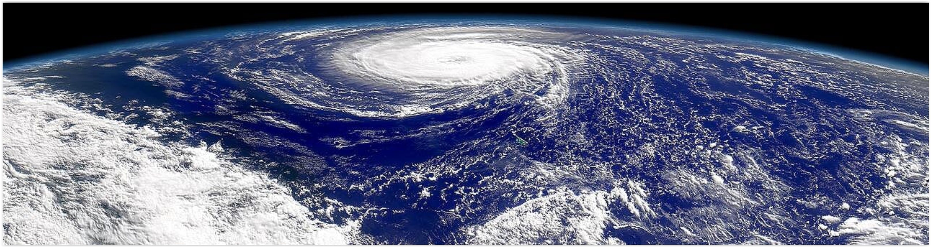
Send a note to your Florida friends, too. It's been 11 years since a major (category 3 or stronger) hurricane has struck the Sunshine State. La Nina cool phases tend to favor more hurricanes in the Atlantic. Remind them Minnesotans don't track "storms with names".
The inevitable cold fronts are looking better. Canada leaks cooler, fresher air south of the border, meaning highs in the 70s into the weekend, with a welcome dip in dew point. A lonely instability T-shower may sprout later this afternoon, but Thursday looks stunning. More widespread T-storms arrive Friday with a cool wind and nagging shower risk on Saturday.
No sizzling heat until mid-June at the earliest. Whew.

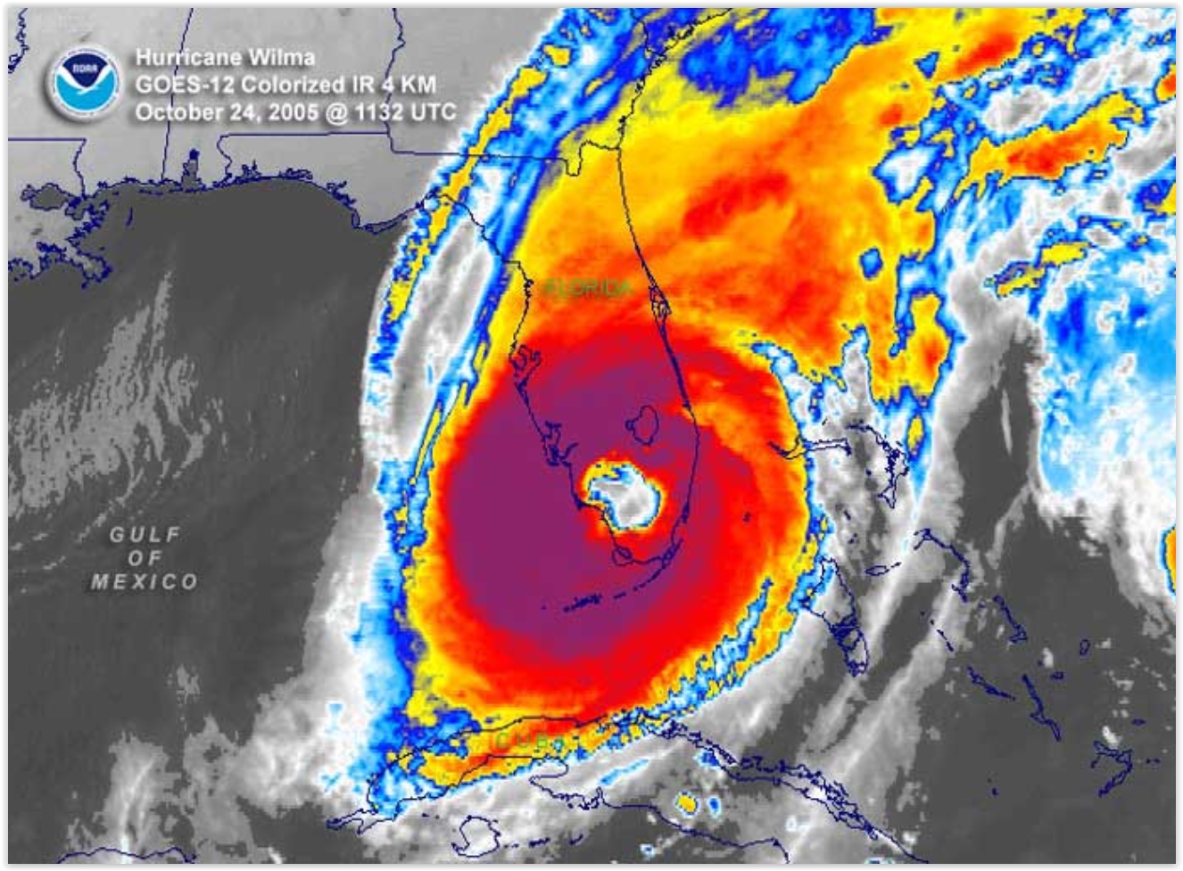
If You Build It They Will Come - Hurricanes, That Is. Meteorologist John Morales from Miami has a timely post at WXshift; here's the intro: "In the classic baseball movie "Field of Dreams," a baseball diamond was built in a cornfield. In what could be a disaster movie-in-production, Florida has built enough housing and infrastructure in the past decade to accommodate 2.5 million new residents. It’s clear that a lot of building has been going on in the Sunshine State lately. But not one has come! Not a single hurricane has reached Florida since major Hurricane Wilma in October 2005. When this year’s Atlantic hurricane season starts on June 1, it’ll mark a record 10 years, seven months and eight days since the last landfall..."
Image credit: "Satellite image of Hurricane Wilma over Florida." Credit: NOAA.
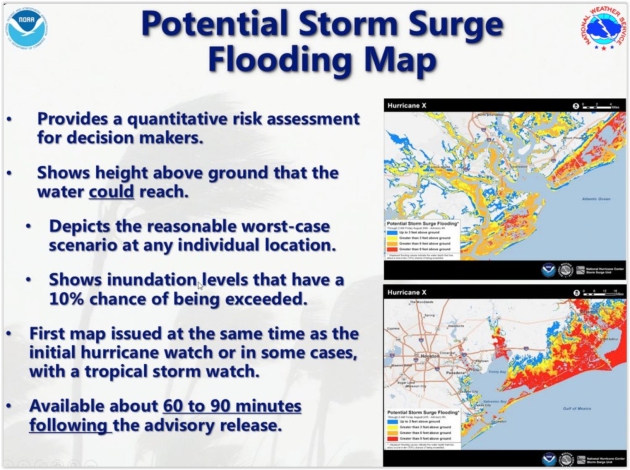
Column: A Big Hurricane Will Hit Us Sometime.
You could make a (statistical) argument that Floridians are living on
borrowed time. Is this the year the hurricane-drought ends? Here's an
excerpt of an Op-Ed at The Tampa Bay Times: "A
storm is coming. We just don't know when. After an unprecedented streak
of 10 years without a hurricane, maybe you're comfortable with
Florida's preparation for the next big hurricane, the flooding and
powerful winds. But it's not wise to become complacent about storms;
Florida remains the most hurricane-prone state in the nation, and a big
one is coming — sometime..."
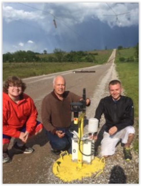
Meet TWIRL, The Storm Chasers Who Planted Sensors In The Heart of a Twister. Yes, but can they purchase life insurance at reasonable rates. Don't try this at home. Here's an excerpt from Yahoo Finance: "May 9 started out just like any other day for scientists and students participating in the Center for Severe Weather Research’s TWIRL project. The group’s fleet of mobile Doppler on Wheels (DOWs)
and observation vehicles had already made their way some 800 miles from
their Colorado home base to south central Oklahoma, looking to
intentionally place themselves in harm’s way. And on this day, boy did
they ever. Why would somebody do such a thing? Science, of course. TWIRL
stands for “Tornadic Winds: In-situ and Radar observations at Low
levels.” In plain English, these researchers want to understand better
how tornadoes form, their strength, and how their winds do damage. The
hope is by getting data at the surface often missed by stationary radars
dozens if not hundreds of miles away, a better understanding of this
killer weather phenomena will save lives later through improved
forecasts..."
Photo credit: "Left to right, Molyneaux, Marshall, and DeFlitch with the damaged Pod O." CSWR.
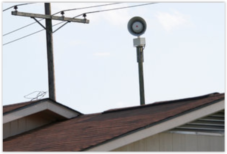
Tornado Sirens, An Old Technology, Still Playing a Vital Role. Remember that sirens were created for outdoor alerting - just don't rely on them when you're in the house, office or shop. Here's a clip from a New York Times article: "...For out-of-the-way places, such as golf courses, lakes and hiking trails, where cellphone service might be spotty or nonexistent, sirens are an “important redundancy” to alert the public, said Bill Bunting, the chief of forecast operations at the Storm Prediction Center in Norman, Okla. Mr. Shelts said social media can be ineffective in delivering warnings because there is no true management or vetting of what gets posted. Incomplete, inaccurate or outdated information could be shared..."
Photo credit: "Most sirens emit sounds between 400 and 600 hertz, which researchers have found is the best range to get people’s attention." Credit Rogelio V. Solis/Associated Press.
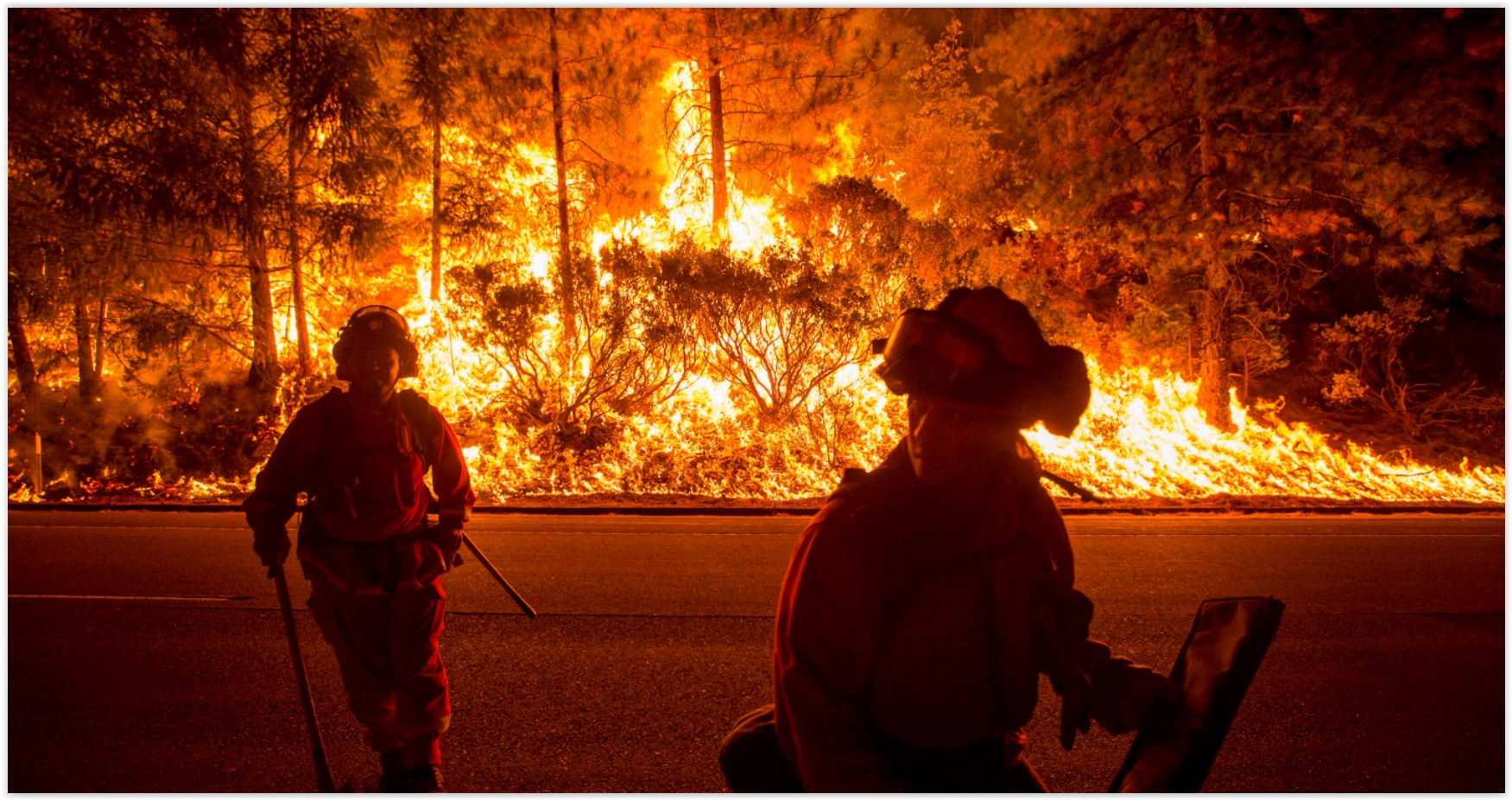
Republicans and Democrats Agree On At Least One Thing: Wildfires Are a Major Threat. Here's the intro to a story at Grist: "A bipartisan group of U.S. senators is teaming up to do away with preordained spending caps on emergency fire recovery efforts as the American West braces for another wildfire season. Drier conditions, likely driven by climate change, have turned vast swaths of the continent into veritable tinderboxes; last summer, for example, five million acres of Alaska and 1.7 million acres across Washington, Oregon, and Idaho burned. “We need to call mega-fires what they are — disasters,” said Sen. Mike Crapo (R-Idaho), in a press release..." (Image credit: REUTERS/Noah Berger).


Image credit: "Slices of cucumber and a tomato slice are pictured in this illustration photo taken in Berlin May 30, 2011." Reuters/Pawel Kopczynski.
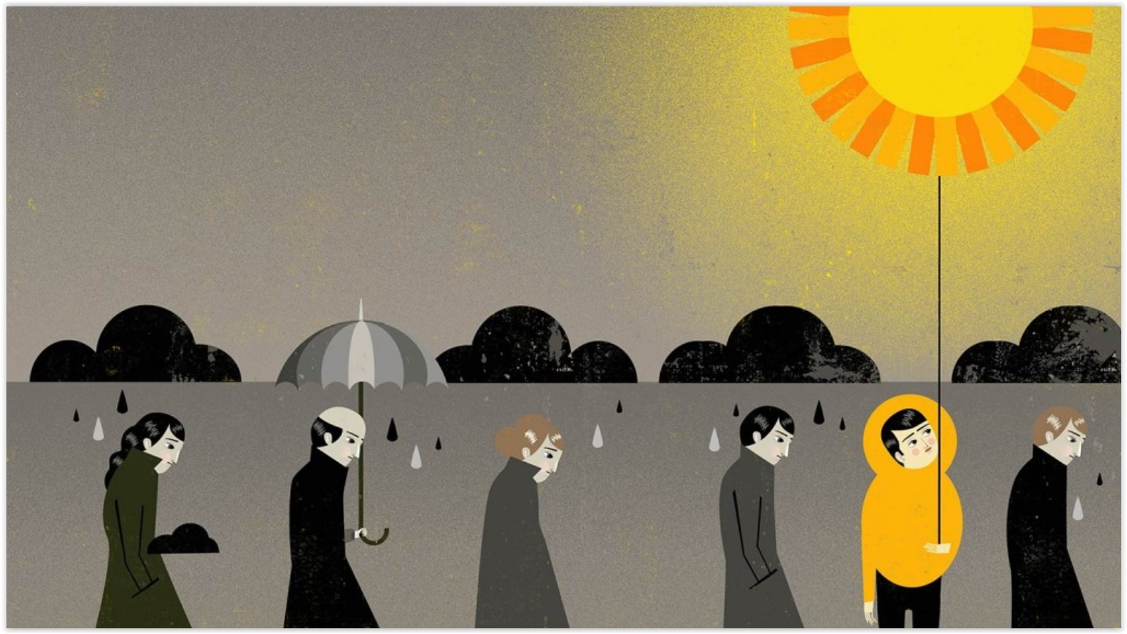
Weather and Mood: Rainy With a Chance of Depression. Are you "weather-sensitive"? It would appear that there's considerable data to suggest that some of us are more prone to ups and downs triggered by changes in the weather. Here's an excerpt from Everyday Health: "...Weather is going to affect you more if you are a highly-sensitive person, as defined by Elaine Aron, PhD, in her best-seller, The Highly Sensitive Person. If you answer yes to these and most of the questions on Aron’s website, you’re probably in the club, which holds 15 to 20 percent of human beings. Are you easily overwhelmed by bright lights and noise? Do you startle easily? Do other people’s moods influence you? Does caffeine have a great effect on you? Research has indicated that hypersensitive people are genetically different from folks who have a normal degree of sensitivity. This might explain why the rain or cold or heat affects some of us much more than others, and why some people would thrive in a humid, hot climate, while others would wilt. Your response to weather would depend on your sensitivity type..."
Arabic Weather Term "Haboob" is Apparently Troubling for Some Texans. You can't make this stuff up; here's an excerpt from Capital Weather Gang: "A wall
of dust raced toward Lubbock, Texas, on Sunday, and the National
Weather Service threw out a word of caution on its Facebook page.
“A haboob is rapidly approaching the Lubbock airport and may affect the
city as well,” the meteorologists wrote. The use of the meteorological
term “haboob,” a word with Arabic roots, didn’t sit well with some
residents..."
Photo credit above: "On
Sunday evening, a haboob — like the one showed here — rolled through
Lubbock, Tex., but some Texans were more upset by the terminology than
the storm itself." (Daniel Bryant).

Much-Needed Laughs. The news is more depressing than ever, so I welcomed a chance to be a guest judget at the House of Comedy
last night at Mall of America. All 8 finalists were amazing - my
congrats to all of them for having the courage to stand up there and
take risks. I laughed so hard I had to change my man-diaper.
TODAY: Partly sunny, breezy. Slight risk of a late-day shower. Winds: W 10-20. High: near 70
WEDNESDAY NIGHT: Gradual clearing, cooling breeze. Low: 51
THURSDAY: Sunny and spectacular. Winds: NW 7-12. High: 74
FRIDAY: Warmer with strong PM T-storms. Winds: S 10-15. Wake-up: 59. High: near 80
SATURDAY: Cool wind, lingering showers. Winds: NW 10-20. Wake-up: 58. High: 68
SUNDAY: Slightly better. Sunny AM, late PM shower? Winds: NW 10-15. Wake-up: 53. High: 73
MONDAY: More sun, less wind. Winds: NW 8-13. Wake-up: 52. High: 74
TUESDAY: Sunny, turning warmer. Winds: S 10-15. Wake-up: 56. High: near 80
Climate Stories...
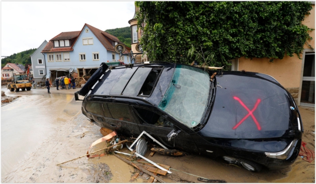
Photo credit: Kai Pfaffenbach/Reuters. "A damaged car is pictured Monday after floods in the town of Braunsbach, Germany."

If Climate Scientists Are In It For The Money, They're Doing It Wrong. Here's an excerpt from Ars Technica: "...It's also worth pointing out what they get that money for, as exemplified by a fairly typical program announcement for NSF grants. It calls for studies of past climate change and its impact on the weather—pretty typical stuff. This sort of research could support the current consensus view. But it just as easily might not. It's impossible to tell before the work's done. And that's true for pretty much every scientific funding opportunity—you can't dictate the results in advance. So, even if the granting process were biased (and there's been no indication that it is), there is no way for it to prevent people from obtaining data that poses problems for the current consensus..."
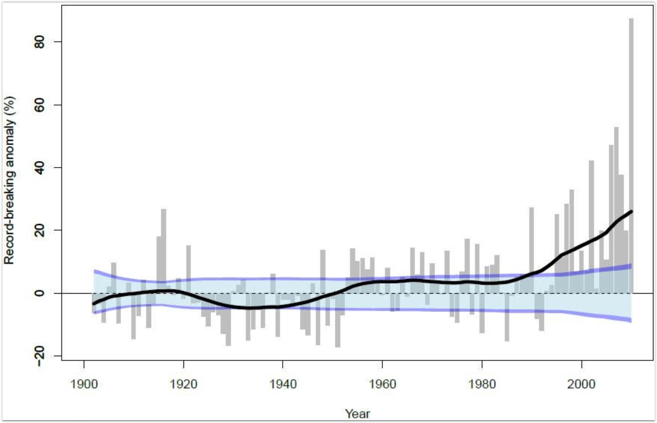
Record-Breaking Heavy Rainfall Events Increased Under Global Warming. Professional climate deniers will tell you otherwise, but the data suggests an increase in extreme rainfall events, worldwide. Here's an excerpt from PIK Research Portal: "Heavy rainfall events setting ever new records have been increasing strikingly in the past thirty years. While before 1980, multi-decadal fluctuations in extreme rainfall events are explained by natural variability, a team of scientists of the Potsdam Institute for Climate Impact Research detected a clear upward trend in the past few decades towards more unprecedented daily rainfall events. They find the worldwide increase to be consistent with rising global temperatures which are caused by greenhouse-gas emissions from burning fossil fuels. Short-term torrential rains can lead to high-impact floodings..."
Graphic credit: Lehmann et all, 2015. Climate Crocks has more on global rainfall trends here.
No comments:
Post a Comment