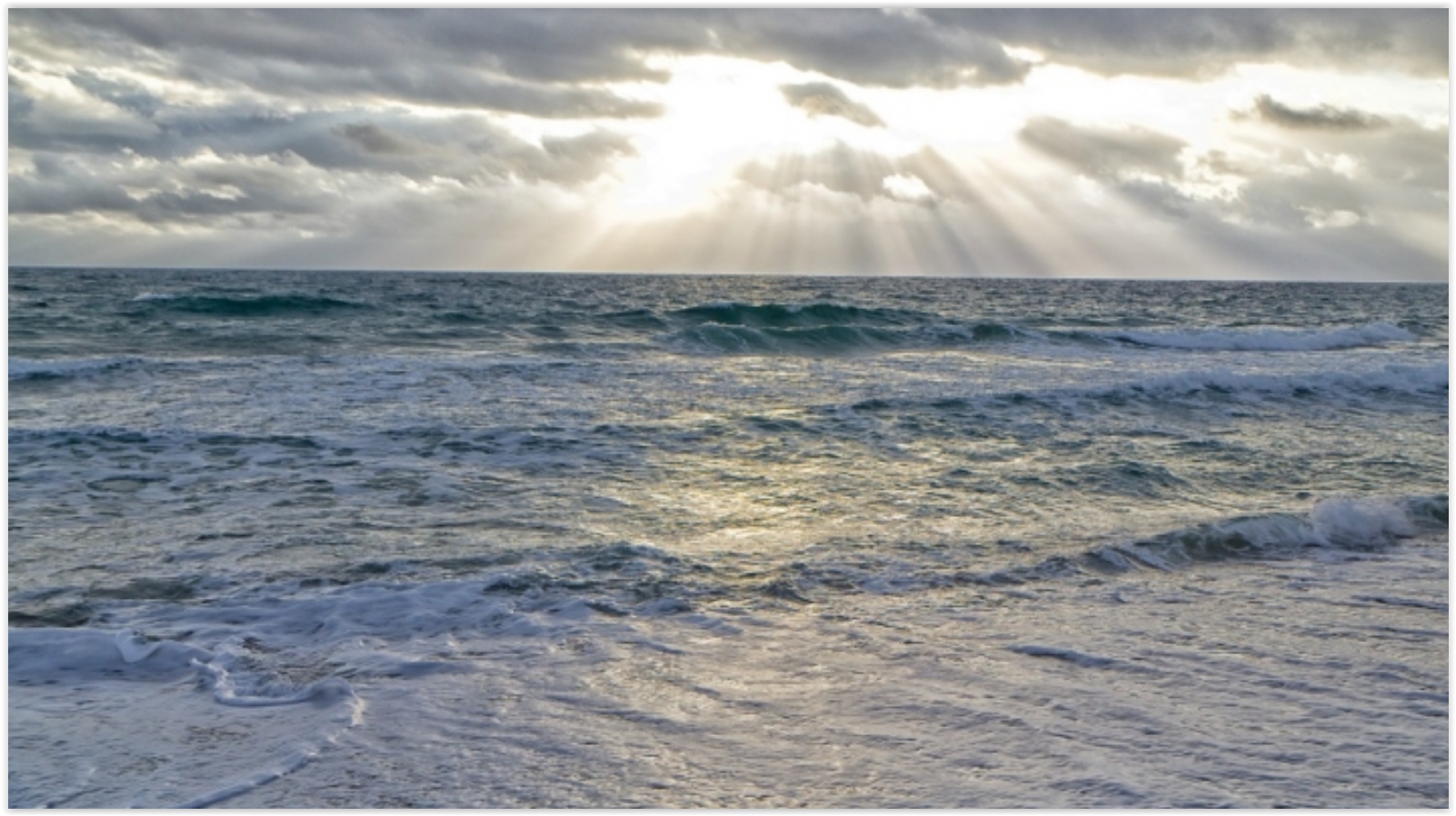
60 F. low temperature Monday morning.
84 F. high reported in the Twin Cities on Memorial Day.
73 F. average high on May 30.
May 31, 1932: A heat wave hits southern Minnesota, with highs of 108 at Campbell, Fairmont, Faribault, and New Ulm.
High Puddle Index Today - Weekend Cooling Trend
I met an old meteorology buddy in Chicago last weekend, now teaching after being laid off from a major airline. "I still love the weather but is it a good business?" he asked.
Great question.
We are drowning in weather. Apps, TV, radio, print, social media, thousands of web sites with weather-on-demand. How can you create enough value to carve out a sustainable business model?
Every business is being disrupted by the Internet, automation, computerization, globalization and even AI - and meteorology is no exception. Computers have outsourced people, in many cases. And nobody wants to be in a commodity business, with hundreds or thousands of competitors, all selling the same product.
We've been hypnotized by technology; the real art is a (consistently) accurate forecast that keeps people safer, and companies more profitable.
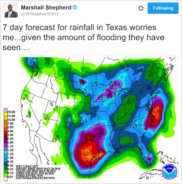
Today is the wettest day of the week as a front pushes east. Skies clear tomorrow, leaving us with a stunning Thursday. T-storms late Friday mark the leading edge of cooler, Canadian air next weekend; 60-degree highs possible early next week.
This free A/C gives way to another surge of summer-like 80s by the latter half of next week.
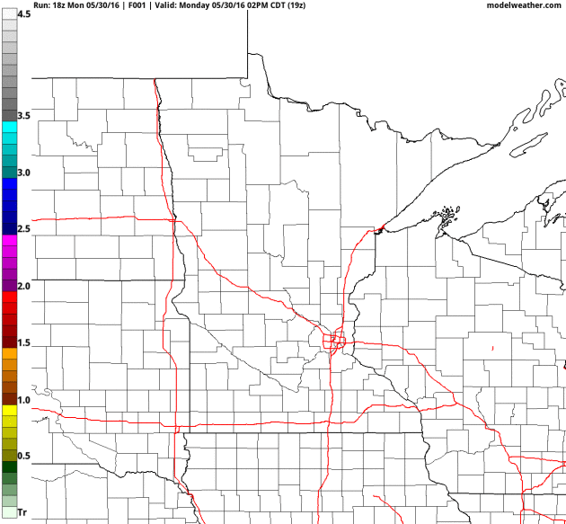
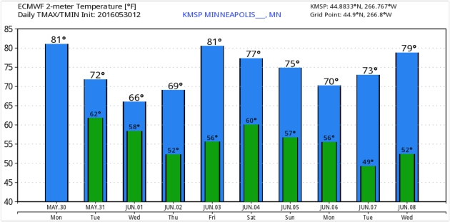
Canadian Aftertaste.
Some are already complaining about the heat and humidity, and if you
don't like the muggies you'll be breathing a lot easier by next weekend
with highs in the 70s and a noticeable dip in dew point. Friday looks
like the warmest day this week with some low 80s nearby. ECMWF guidance:
WeatherBell.
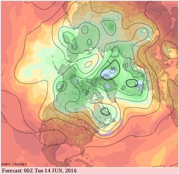
Warming Up By Mid-June.
After a relatively cool and comfortable start to June long-range GFS
guidance shows the core of the jet lifting north, allowing warmer,
stickier air to expand northward. A few 80s by mid-June? Likely, but I
don't see any extended stretches of 90s, not yet.
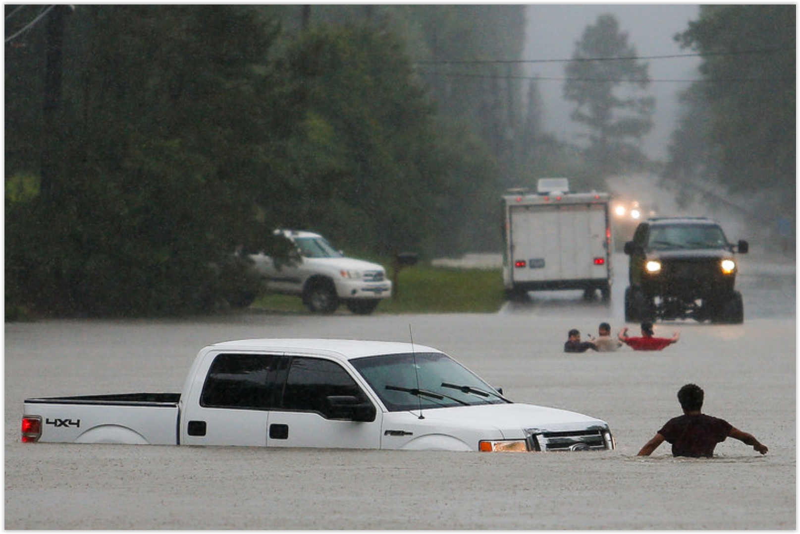
6 Dead in Texas Floods, And More Rain is Coming. Here's an update on the incessant rains afflicting much of Texas from the New York Times: "..Since
Wednesday, the thunderstorms have dropped pockets of intensely heavy
rain, or “rain bombs,” as meteorologists call them. These have
circulated through East Texas, Dallas and Corpus Christi, along with
Austin and San Antonio, hitting some parts harder than others, said Kurt
Van Speybroeck, a National Weather Service
meteorologist. As a result, rainfall has ranged from four inches in
parts of the Dallas-Fort Worth area to 30 inches in Washington County,
the authorities said..."
Photo credit above: "The three men in the foreground had to abandon their truck Friday after getting caught in rising flood waters in Magnolia, Tex." Credit Michael Ciaglo/Houston Chronicle, via Associated Press.
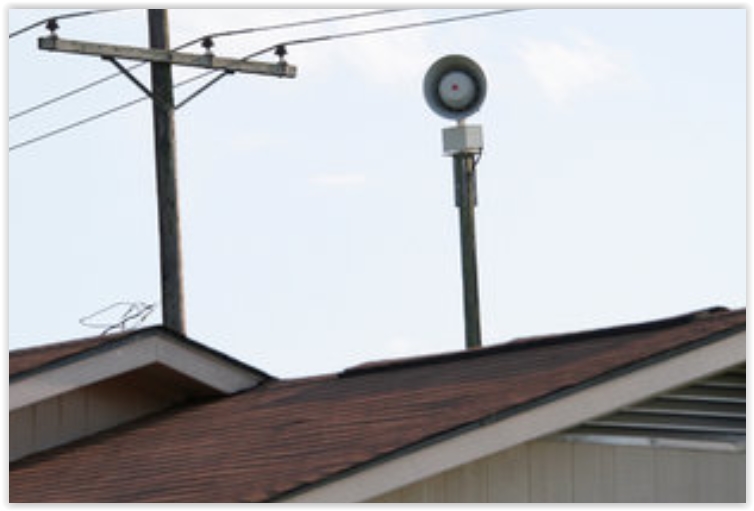
Tornado Sirens, An Old Technology, Still Playing a Vital Role. Remember that sirens were created for outdoor alerting - just don't rely on them when you're in the house, office or shop. Here's a clip from a New York Times article: "...For out-of-the-way places, such as golf courses, lakes and hiking trails, where cellphone service might be spotty or nonexistent, sirens are an “important redundancy” to alert the public, said Bill Bunting, the chief of forecast operations at the Storm Prediction Center in Norman, Okla. Mr. Shelts said social media can be ineffective in delivering warnings because there is no true management or vetting of what gets posted. Incomplete, inaccurate or outdated information could be shared..."
Photo credit: "Most sirens emit sounds between 400 and 600 hertz, which researchers have found is the best range to get people’s attention." Credit Rogelio V. Solis/Associated Press.


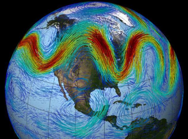
Abrupt Atlantic Ocean Changes May Have Been Natural. Here's an excerpt from Climate Central: "...Climate change may not have been to blame for an abrupt recent slowdown of a sweeping Atlantic Ocean current, a change that delivered an intense pulse of ocean warming and sea level rise through the Gulf of Maine and elsewhere along the East Coast. Modeling-based analysis by British scientists, published Monday in Nature Geoscience, concluded that the decline in the Atlantic meridional overturning circulation (AMOC) from 2004 to 2014 was “part of decadal variability of the North Atlantic,” representing a recovery following a previous strengthening of its currents. Still, leading scientists warn that greenhouse gas pollution appears to be causing the circulation pattern to slow down, and that it will continue to do so with far-reaching implications for weather and for flood-prone cities and farms around the world..."
Photo credit above: "Atlantic Ocean currents influence the weather and sea levels." Credit: John Spade/Flickr


Why You Will Marry The Wrong Person. Here's an excerpt of a little day-brightener from The New York Times: "...Indeed,
marriage tends decisively to move us onto another, very different and
more administrative plane, which perhaps unfolds in a suburban house,
with a long commute and maddening children who kill the passion from
which they emerged. The only ingredient in common is the partner. And
that might have been the wrong ingredient to bottle. The good news is
that it doesn’t matter if we find we have married the wrong person. We
mustn’t abandon him or her, only the founding Romantic idea upon which
the Western understanding of marriage has been based the last 250 years:
that a perfect being exists who can meet all our needs and satisfy our
every yearning..."

TODAY: Showers & T-storms likely. Winds: SW 8-13. High: 74
TUESDAY NIGHT: Evening showers, drying out late. Low: 58
WEDNESDAY: More sun, PM instability shower up north. Winds: W 10-15. High: near 70
THURSDAY: Best day in sight. Bright sun. Winds: W 8-13. Wake-up: 53. High: 73
FRIDAY: Sunny start, watch for late storms. Winds: SE 10-15. Wake-up: 59. High: 81
SATURDAY: Peeks of sun, cooler breeze. Winds: NW 10-20. Wake-up: 60. High: 74
SUNDAY: Partly sunny, PM showers north. Winds: NW 10-15. Wake-up: 57. High: 73
MONDAY: Mix of clouds and sun, cool. Winds: N 10-20. Wake-up: 56. High: 69
Climate Stories...
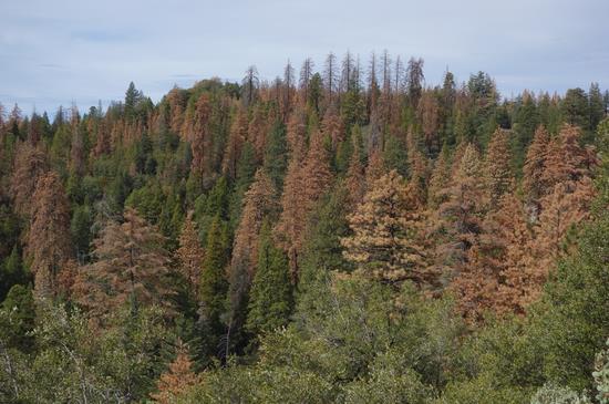
A Walk in the Dead Woods. Here's an excerpt of an Op-Ed at The New York Times: "...The dead woods are a sad symptom of a larger planetary illness. Last year, more than 10 million acres burned in the United States — a record, consuming an area larger than Maryland. Fire seasons are nearly 80 days longer than they were in the 1970s, according to the Forest Service. “We keep setting records that we don’t want to see beat,” said Vilsack. We keep setting horrid heat records as well. In April, for the seventh straight month, global temperatures posted a new average monthly high. Roads have melted in India. A city in the northwest, Phalodi, posted the warmest day in India since records were kept: 123.8 degrees on May 19..."
File photo: USGS.
No comments:
Post a Comment