67 F. high yesterday in the Twin Cities.
74 F. average high on June 1.
June 2, 1945: Snow and sleet pile up to 4.5 inches at Tower.
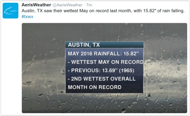
June 2, 1898: Heavy rain falls across Minnesota. Just over 7 inches is reported at Pine River Dam.
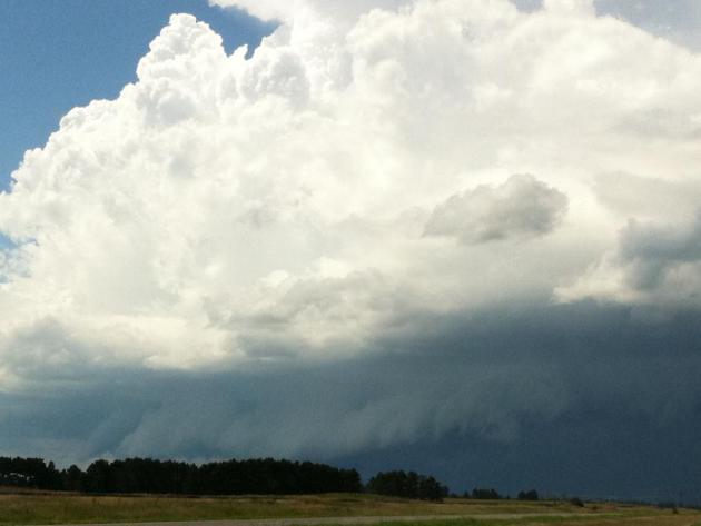
Severe Risk Friday - A "Plan B" Weekend Coming
I would like to publicly apologize for the weekend forecast. I have NOTHING to do with the weather - but I WILL be blamed when the sky turns foul and runny on Saturday. It's inevitable.
Which begs the question: are you 'weather-sensitive'? New research suggests that 15-20 percent of us are genetically hypersensitive to our surroundings. Are you easily overwhelmed by bright lights and noise? Do you startle easily? Extra-sensitive to caffeine? If so a dreary weekend may affect your moods more than most.
I wish I could prescribe an antibiotic of warm weekend sunshine, but another surge of cool air keeps us showery much of Saturday and Sunday with a stiff wind. Temperatures may not climb out of the 60s Saturday afternoon. The approach of this (rude, ill-timed) cool front may spark the first widespread severe T-storm outbreak of 2016 on Friday. The biggest risk is large hail and straight-line winds, but an isolated tornado can't be ruled out.
That said, today will be stunning and summer heat returns next week; 90F by next Thursday. Wild weather swings?
Welcome to Minnesota!
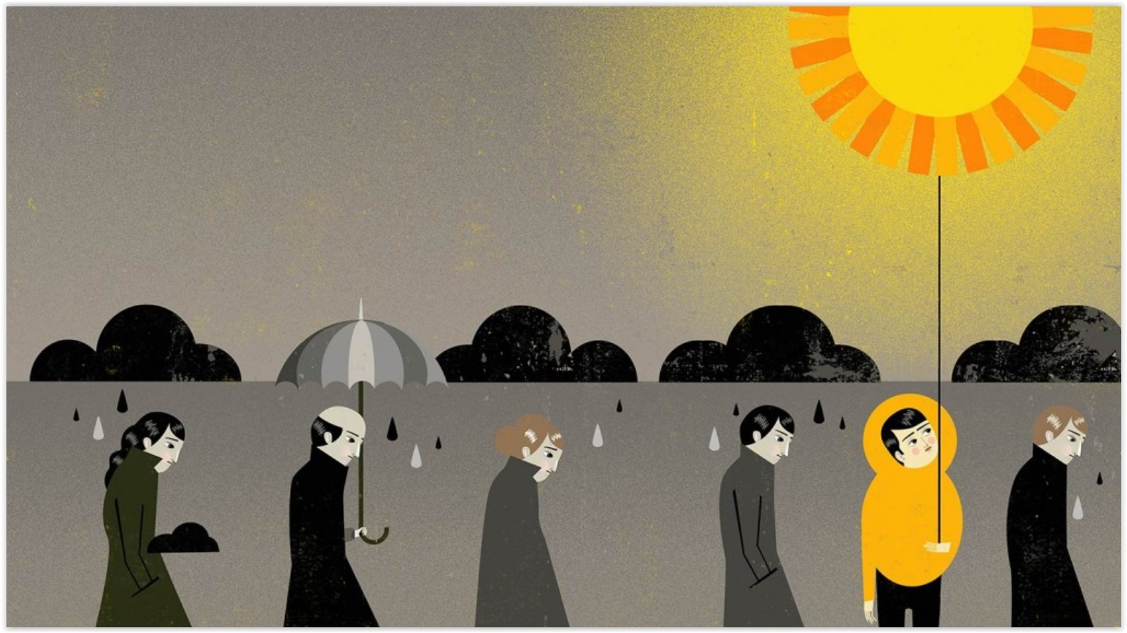
Weather and Mood: Rainy With a Chance of Depression. Are you "weather-sensitive"? It would appear that there's considerable data to suggest that some of us are more prone to ups and downs triggered by changes in the weather. Here's an excerpt from the information referenced in today's column at Everyday Health: "...Weather is going to affect you more if you are a highly-sensitive person, as defined by Elaine Aron, PhD, in her best-seller, The Highly Sensitive Person. If you answer yes to these and most of the questions on Aron’s website, you’re probably in the club, which holds 15 to 20 percent of human beings. Are you easily overwhelmed by bright lights and noise? Do you startle easily? Do other people’s moods influence you? Does caffeine have a great effect on you? Research has indicated that hypersensitive people are genetically different from folks who have a normal degree of sensitivity. This might explain why the rain or cold or heat affects some of us much more than others, and why some people would thrive in a humid, hot climate, while others would wilt. Your response to weather would depend on your sensitivity type..."
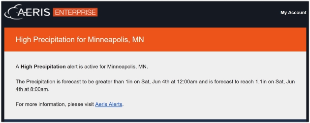
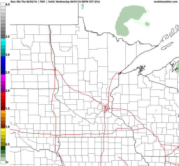
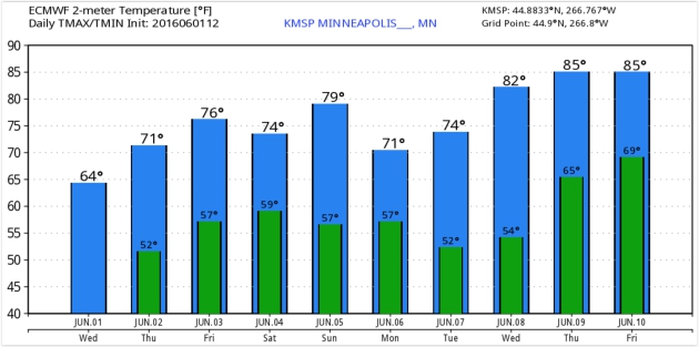
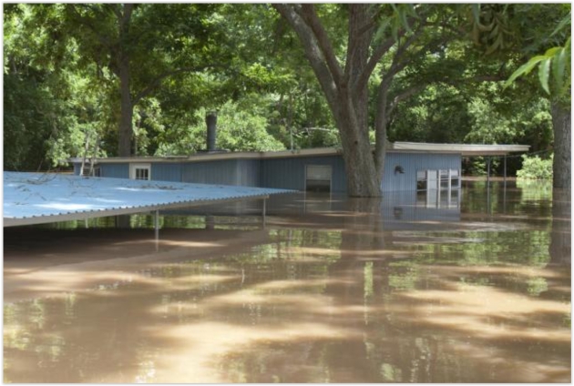
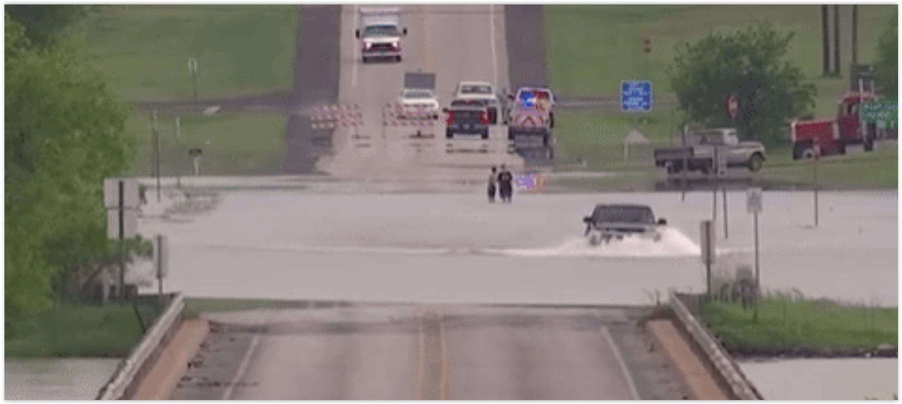
Photo credit: "A house is flooded by water from the rain-swollen Brazos River in Richmond, Texas." Reuters/Daniel Kramer.
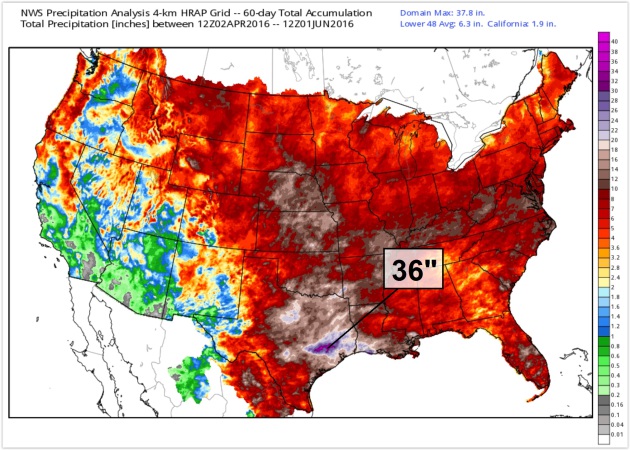
Derived Precipitation from April 2 to June 1: NOAA and WeatherBell.
What To Do If You're Driving And Encounter a Flash Flood. Rule #1 - don't drive through high water - it's impossible to estimate water depth, especially at night. Only 2 feet of moving water can turn your vehicle into a boat, with tragic consequences. NOAA has it right: "Turn around, don't drown." Here's an excerpt from Popular Mechanics: "...Getting swept away while inside your vehicle is extremely dangerous. Although it sounds counterintuitive, if you're stuck inside your car, you'll want to roll down your windows and allow water to enter your vehicle. You can escape from your vehicle through the window or, if that's not possible, wait until the water pressure is equal on both sides of your door so it will open..."

Federal Flood Officials in Texas Use Twitter to Alert. Leveraging social media (from trusted sources) makes a lot of sense; here's the intro to an explanation from USA TODAY: "Faced
with relentless floods, Texas-based federal officials are turning to a
new ally in the war on rising water: Twitter. The U.S. Geological
Survey, the federal agency responsible for monitoring river levels,
recently launched a pair of Twitter feeds -- @USGS_TexasFlood and
@USGS_TexasRain – that give out automated, real-time river levels and
rainfall amounts during heavy rains. The feeds help first-responders and
flood forecasters see river gauges in real time and help with decisions
ranging from when to evauate to weekend forecasts..."
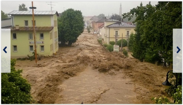
Extreme Flooding Grips Germany.
The photo above is from Bavaria; a similar blocking pattern prolonging
extreme rains day after day with no break in sight looking out the next
5-7 days. Photo: tagesschau.de.
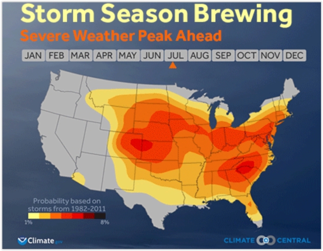
Image credit: "The probability of severe weather forming on a given day in the U.S." Credit: Climate Central.
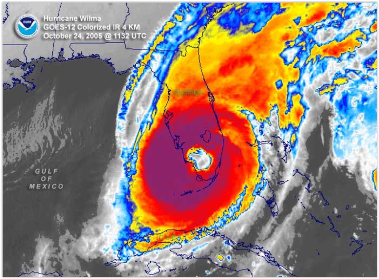
If You Build It They Will Come - Hurricanes, That Is. Meteorologist John Morales from Miami has a timely post at WXshift; here's the intro: "In the classic baseball movie "Field of Dreams," a baseball diamond was built in a cornfield. In what could be a disaster movie-in-production, Florida has built enough housing and infrastructure in the past decade to accommodate 2.5 million new residents. It’s clear that a lot of building has been going on in the Sunshine State lately. But not one has come! Not a single hurricane has reached Florida since major Hurricane Wilma in October 2005. When this year’s Atlantic hurricane season starts on June 1, it’ll mark a record 10 years, seven months and eight days since the last landfall..."
Image credit: "Satellite image of Hurricane Wilma over Florida." Credit: NOAA.
Column: A Big Hurricane Will Hit Us Sometime.
You could make a (statistical) argument that Floridians are living on
borrowed time. Is this the year the hurricane-drought ends? Here's an
excerpt of an Op-Ed at The Tampa Bay Times: "A
storm is coming. We just don't know when. After an unprecedented streak
of 10 years without a hurricane, maybe you're comfortable with
Florida's preparation for the next big hurricane, the flooding and
powerful winds. But it's not wise to become complacent about storms;
Florida remains the most hurricane-prone state in the nation, and a big
one is coming — sometime..."
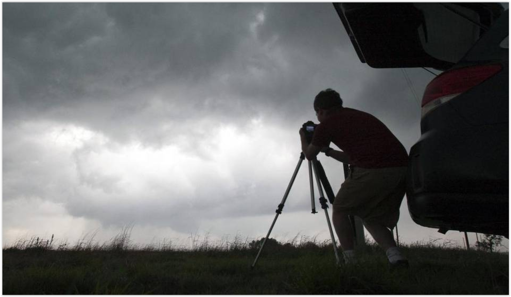
Storm Chasers, Stay Home. Good luck with that admonition, not when fame (and money) are both on the line. Here's an excerpt of an Eric Holthaus post at Slate: "Last
week, the National Weather Service tallied more than 120 tornado
reports across 10 states. All in all, that means it’s been a pretty
average week in late May in the heartland—this is peak tornado season,
after all. What’s less average is the traffic that Kansas and other
tornado-prone states experienced. And not because people were trying to
get out of the way of the tornadoes. It’s because storm chasers were
trying to get to them. Weather fanatics call this traffic phenomenon
“chaser convergence,” and it’s increasingly making rural roads unsafe at
the worst possible moments. Chaser convergence has been around for years but likely never on this scale (each red dot represents a storm chaser reporting his or her location)..."
Leave Tornado Chasing To The Professionals. Here's the intro of an Op-Ed at the Star-Telegraph: "We’re
smack dab in the middle of another tornado season. But one of the
biggest nuisances doesn’t come from the sky. We’re talking about you,
amateur storm chasers. Storm chasing, a vocation and/or passion for
some, has made its way into the national zeitgeist. We blame you, Twister. It’s become so popular that tornado chasers even use the term “chaser convergence” when they spot a gaggle of vehicles huddled together along the side of the road..."
Photo credit: "A storm chaser photographs a rotating thunderstorm just east of Pretty Prairie, Kansas, April 14, 2012." Travis Heying MCT.
Photo credit: "A storm chaser photographs a rotating thunderstorm just east of Pretty Prairie, Kansas, April 14, 2012." Travis Heying MCT.
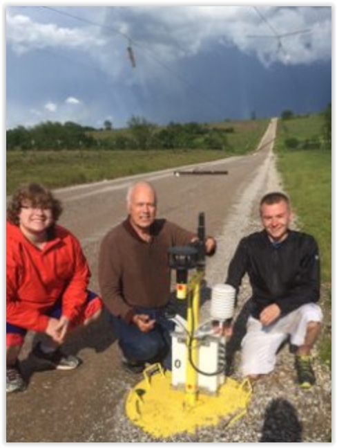
Meet TWIRL, The Storm Chasers Who Planted Sensors In The Heart of a Twister. Yes, but can they purchase life insurance at reasonable rates. Don't try this at home. Here's an excerpt from Yahoo Finance: "May 9 started out just like any other day for scientists and students participating in the Center for Severe Weather Research’s TWIRL project. The group’s fleet of mobile Doppler on Wheels (DOWs)
and observation vehicles had already made their way some 800 miles from
their Colorado home base to south central Oklahoma, looking to
intentionally place themselves in harm’s way. And on this day, boy did
they ever. Why would somebody do such a thing? Science, of course. TWIRL
stands for “Tornadic Winds: In-situ and Radar observations at Low
levels.” In plain English, these researchers want to understand better
how tornadoes form, their strength, and how their winds do damage. The
hope is by getting data at the surface often missed by stationary radars
dozens if not hundreds of miles away, a better understanding of this
killer weather phenomena will save lives later through improved
forecasts..."
Photo credit: "Left to right, Molyneaux, Marshall, and DeFlitch with the damaged Pod O." CSWR.
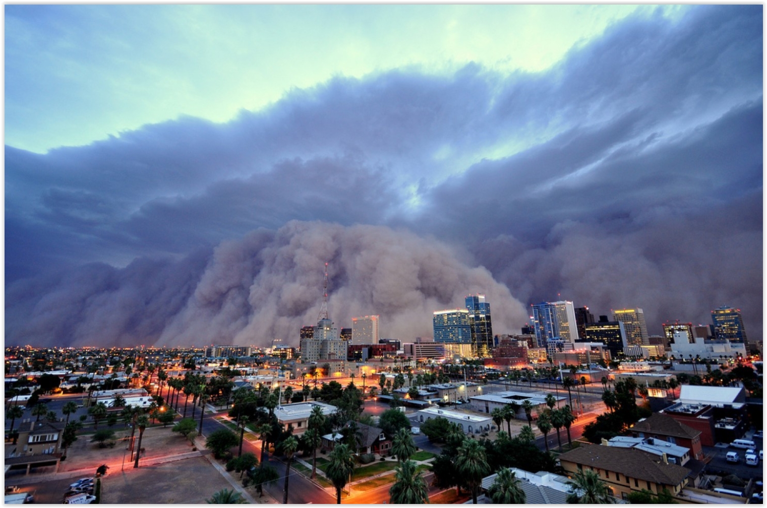
Arabic Weather Term "Haboob" is Apparently Troubling for Some Texans. You can't make this stuff up; here's an excerpt from Capital Weather Gang: "A wall
of dust raced toward Lubbock, Texas, on Sunday, and the National
Weather Service threw out a word of caution on its Facebook page.
“A haboob is rapidly approaching the Lubbock airport and may affect the
city as well,” the meteorologists wrote. The use of the meteorological
term “haboob,” a word with Arabic roots, didn’t sit well with some
residents..."
Photo credit above: "On
Sunday evening, a haboob — like the one showed here — rolled through
Lubbock, Tex., but some Texans were more upset by the terminology than
the storm itself." (Daniel Bryant).
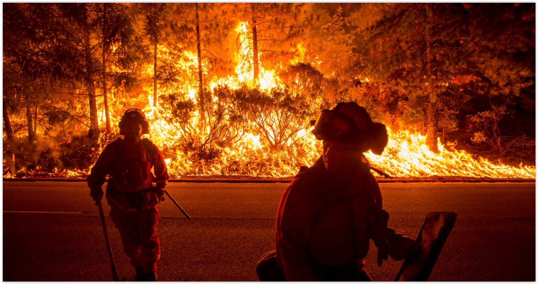
Republicans and Democrats Agree On At Least One Thing: Wildfires Are a Major Threat. Here's the intro to a story at Grist: "A bipartisan group of U.S. senators is teaming up to do away with preordained spending caps on emergency fire recovery efforts as the American West braces for another wildfire season. Drier conditions, likely driven by climate change, have turned vast swaths of the continent into veritable tinderboxes; last summer, for example, five million acres of Alaska and 1.7 million acres across Washington, Oregon, and Idaho burned. “We need to call mega-fires what they are — disasters,” said Sen. Mike Crapo (R-Idaho), in a press release..." (Image credit: REUTERS/Noah Berger).
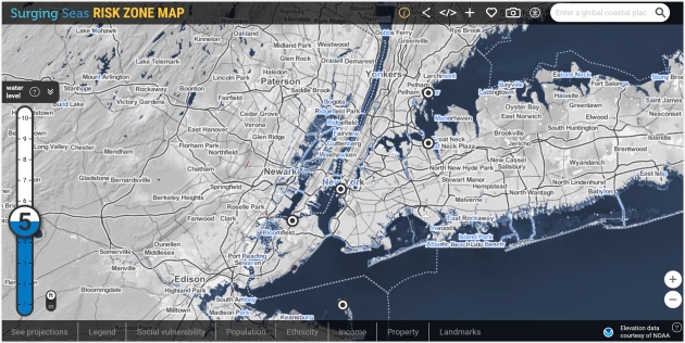
Surging Seas Risk Zone Map above courtesy of Climate Central.
Nuclear Plants, Despite Safety Concerns, Gain Support as Clean Energy Sources. Here's the intro to a New York Times story: "Just a few years ago, the United States seemed poised to say farewell to nuclear energy. No company had completed a new plant in decades, and the disaster in Fukushima, Japan, in 2011 intensified public disenchantment with the technology, both here and abroad. But as the Paris agreement on climate change
has put pressure on the United States to reduce greenhouse gas
emissions, some state and federal officials have deemed nuclear energy
part of the solution. They are now scrambling to save existing plants
that can no longer compete economically in a market flooded with cheap natural gas..."
File photo: CNN.
The World Is About to Install 700 Million Air Conditioners. Here's What That Means For The Climate. Here's a clip from The Washington Post: "As
summer temperatures finally settle in, many in the United States take
it for granted that they can dial down the thermostat: Americans use 5 percent of
all of their electricity cooling homes and buildings. In many other
countries, however — including countries in much hotter climates — air
conditioning is still a relative rarity. But as these countries boom in
wealth and population, and extend electricity to more people even as the
climate warms, the projections are clear: They are going to install
mind-boggling amounts of air conditioning, not just for comfort but as a
health necessity..."

2015: A Record Year for Renewables. Reuters has the facts and figures: "A record amount of renewable power capacity was installed worldwide last year as solar and wind costs fell, becoming more competitive with fossil fuels, research by renewables policy organisation REN21 showed on Tuesday. New installations of renewable power generation capacity (including hydropower) rose to 1,848.5 gigawatts (GW) globally in 2015, an increase of 147.2 GW from the previous year, Paris-based REN21's annual renewables global status report showed. This is the largest ever annual increase in installed capacity and was mainly driven by renewables becoming more cost-competitive with oil, coal and gas in many markets and an increase in government policies to support the growth of clean energy, it added..." (File photo: MN.gov).


Photo credit: "The Licorice Shrine." Anncarolrandall (Atlas Obscura User).
TODAY: Sunny and beautiful. Winds: W 7-12. High: 73
THURSDAY NIGHT: Partly cloudy and dry. Low: 59
FRIDAY: T-storms arrive, a few may be severe. Winds: S 8-13. High: 74
SATURDAY: Mostly cloudy, cool wind, lingering showers. Sorry. Winds: NW 10-20. Wake-up: 57. High: 67
SUNDAY: A bit better. AM sun, late-day shower. Winds: NW 10-20. Wake-up: 54. High: 73
MONDAY: Partly sunny, late-day shower risk. Winds: NW 10-15. Wake-up: 57. High: 75
TUESDAY: Sunny and stunning. Winds: E 5-10. Wake-up: 58. High: 78
WEDNESDAY: Intervals of sun, warming up again. Wake-up: 59. High: 83

The "Temperature Spiral" Has an Update. It's Not Pretty. This is one of the better visualizations I've ever seen about the warming underway - here's an update from Climate Central: "...Like a lot of people, I found Ed Hawkins' temperature animation very compelling because it details observed warming from 1850 to present in a novel way,” U.S. Geological Survey scientist Jay Alder said. “His graphic sets the context for looking at projections from climate models.” So Alder used climate projections and stretched the spiral to its logical conclusion in 2100 when most climate model projections end. Using our current carbon emissions trends, it shows that things could get out of hand pretty quickly..."
Animation credit: "An update to the famous temperature spiral using future climate projections." Credit: Jay Alder/USGS.
Houston Flooding is a Perfect Storm of Climate Change and Bad Urban Planning. Suddenly the "no zoning!" provisions seem like more of a bug than a feature, according to Grist: "...One likely cause,” Texas’ state climatologist John Nielsen-Gammon tells Grist, “is the increase in ocean temperatures from the Gulf of Mexico and tropical Atlantic. That determines how much moisture is in the atmosphere.” As temperatures increase, so does rainfall. But it’s not just the rainfall that is endangering Houston’s citizens — it’s also ecologically irresponsible development. Houston is the only major American city without formal zoning laws. As a result, developers have been free to pave over huge swaths of valuable wetlands that absorb runoff..."
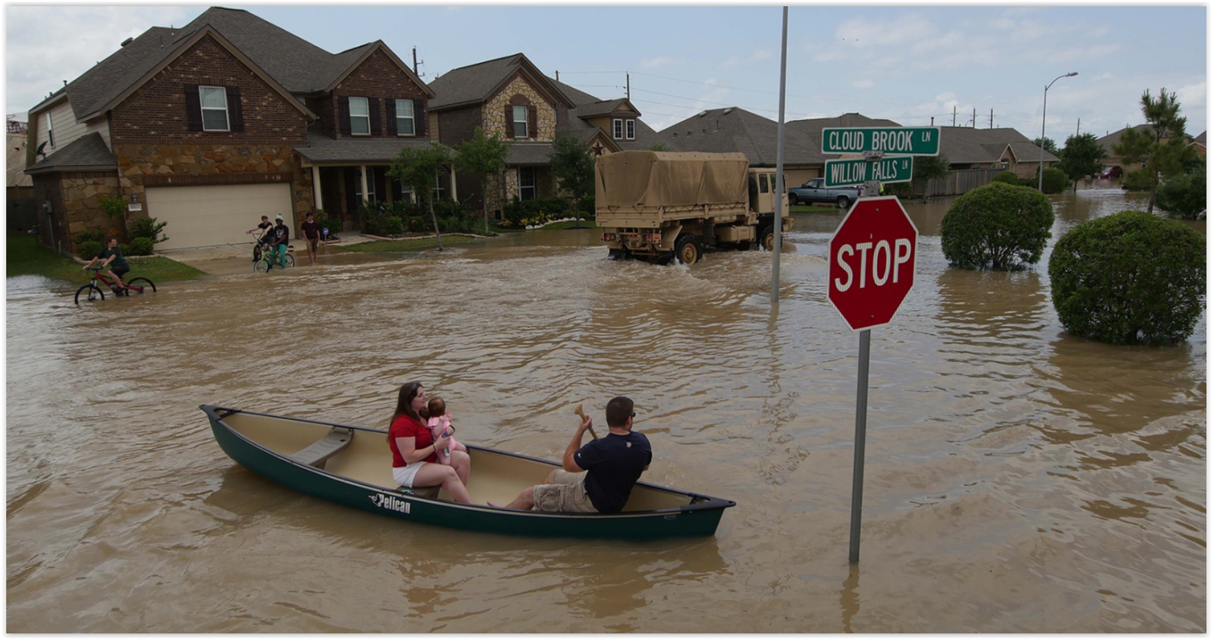
Photo credit: U.S. Army National Guard/1st Lt. Zachary West/Handout via Reuters.
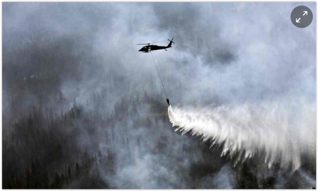
Photo credit: "A “Bambi Bucket” hanging from a helicopter releases hundreds of gallons of water on to the Stetson Creek Fire near Cooper Landing, Alaska, last year." Photograph: Sgt Balinda O'Neal/AP.
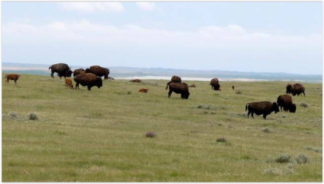
Photo credit: "A herd of bison graze south of Swift Current, Sask. Dr. Sylvain Charlebois, a specialist in food distribution and policy at Dalhousie University, is warning that the Canadian Prairies are extremely vulnerable to climate change." (Bill Graveland CP).
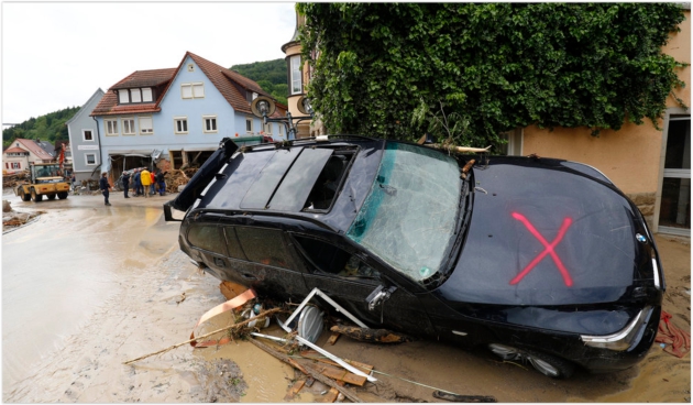
Photo credit: Kai Pfaffenbach/Reuters. "A damaged car is pictured Monday after floods in the town of Braunsbach, Germany."

If Climate Scientists Are In It For The Money, They're Doing It Wrong. Here's an excerpt from Ars Technica: "...It's also worth pointing out what they get that money for, as exemplified by a fairly typical program announcement for NSF grants. It calls for studies of past climate change and its impact on the weather—pretty typical stuff. This sort of research could support the current consensus view. But it just as easily might not. It's impossible to tell before the work's done. And that's true for pretty much every scientific funding opportunity—you can't dictate the results in advance. So, even if the granting process were biased (and there's been no indication that it is), there is no way for it to prevent people from obtaining data that poses problems for the current consensus..."
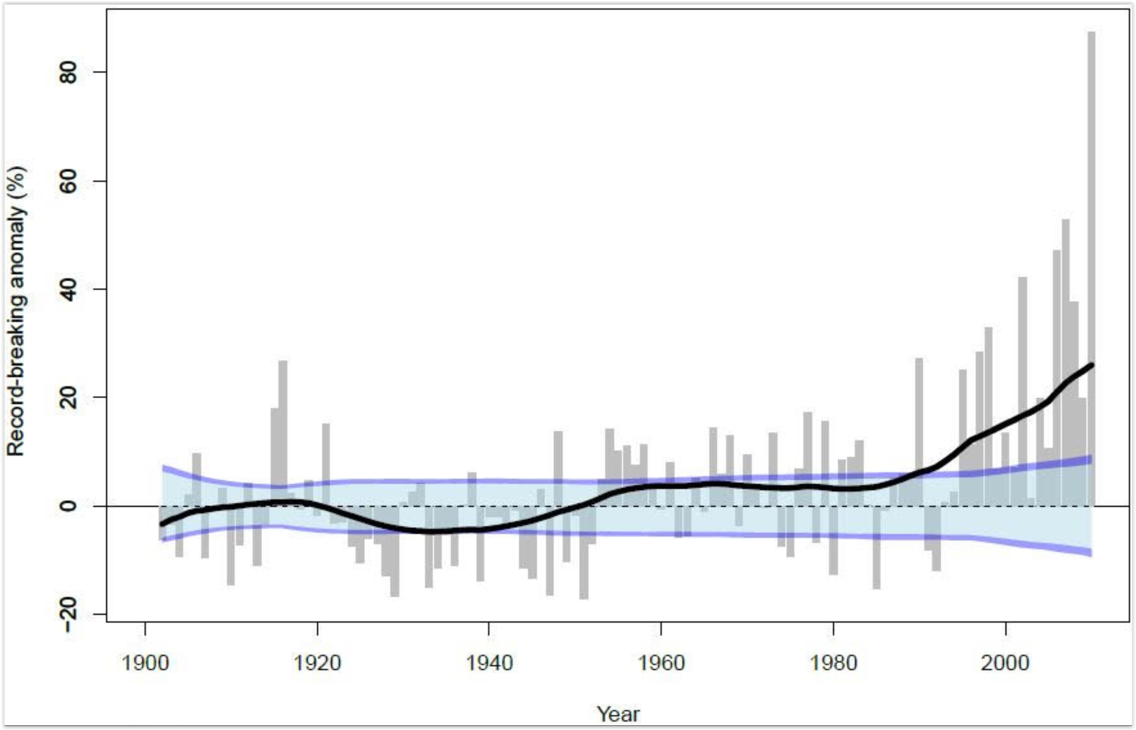
Record-Breaking Heavy Rainfall Events Increased Under Global Warming. Professional climate deniers will tell you otherwise, but the data suggests an increase in extreme rainfall events, worldwide. Here's an excerpt from PIK Research Portal: "Heavy rainfall events setting ever new records have been increasing strikingly in the past thirty years. While before 1980, multi-decadal fluctuations in extreme rainfall events are explained by natural variability, a team of scientists of the Potsdam Institute for Climate Impact Research detected a clear upward trend in the past few decades towards more unprecedented daily rainfall events. They find the worldwide increase to be consistent with rising global temperatures which are caused by greenhouse-gas emissions from burning fossil fuels. Short-term torrential rains can lead to high-impact floodings..."
Graphic credit: Lehmann et all, 2015. Climate Crocks has more on global rainfall trends here.
No comments:
Post a Comment