74 F. average high on June 2.
76 F. high on June 2, 2015.
June 3, 1955: Seven people are killed on Lake Traverse when their boat is overturned by strong winds from a thunderstorm.
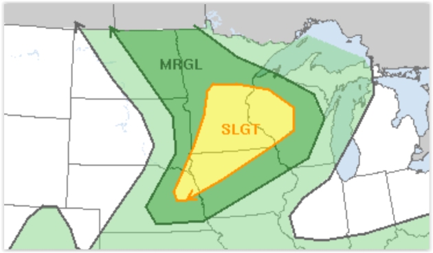
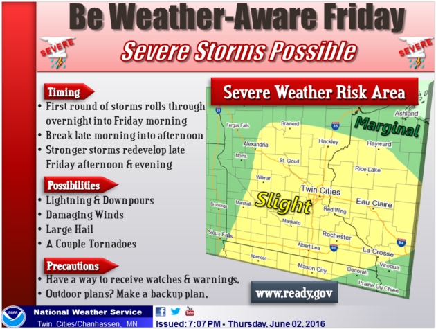
A Rarity So Far in 2016: Severe Risk Later Today
Do you feel like you're being spammed by severe storm messages? Most meteorologists would much rather hear "you're crying wolf!" than "there was no warning!"
We've come a long way since the first emergency sirens started wailing for severe weather back in the 50s. Nationwide the average lead time for tornado warnings is 13 minutes, up from 5 minutes in the 70s. Doppler radar has revolutionized the tracking and forecasting of severe local storms since the mid-90s. Fewer people than ever are being unnecessarily warned. At some point GPS-specific warnings will alert just the homes in the path of tornadoes and damaging wind and hailstorms (via smartphones and Smart TVs).
Stay tuned.
Although wind shear is marginal & low-level moisture minimal there may be just enough instability for a few severe storms later today. The primary risk is hail; a 15 percent chance of severe storms within 25 miles of any point.
Sunday looks like the nicer day of the weekend; a stray PM shower near Duluth and Spooner.
ECMWF guidance still hints at 90F next Thursday as summer returns with a vengeance.
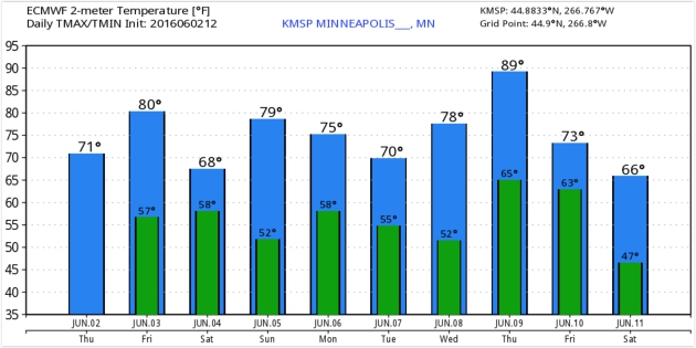
Cool Breeze Saturday - Heating Up Next Week.
ECMWF guidance suggests Sunday will be the milder day of the weekend,
with a brief heat "spike" by Thursday of next week, when metro
temperatures may approach 90 degrees. Graphic: WeatherBell.
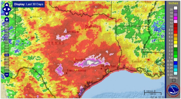
Map credit: "Last 30 days of rain, ending June 1." Credit: NOAA.
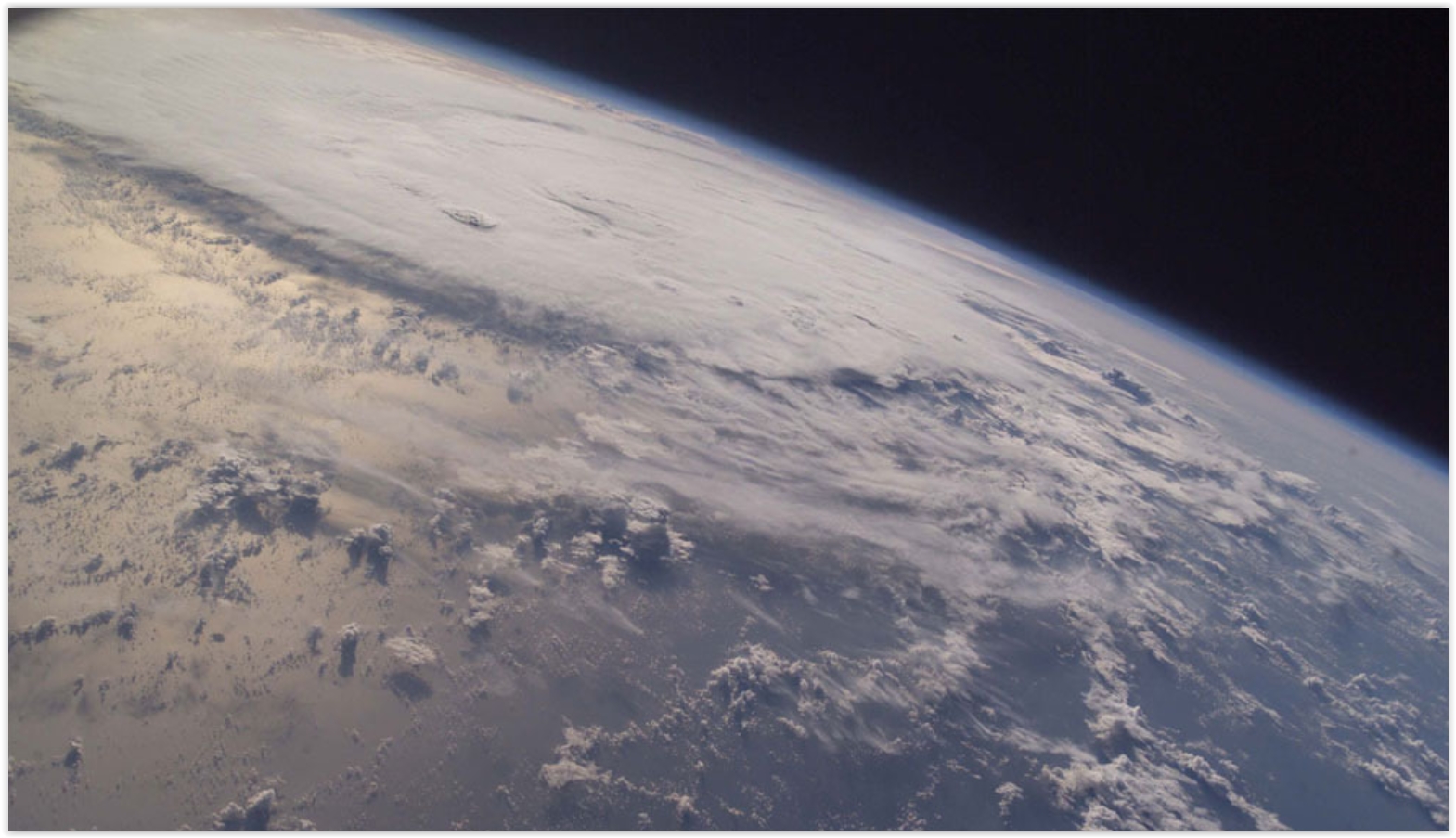
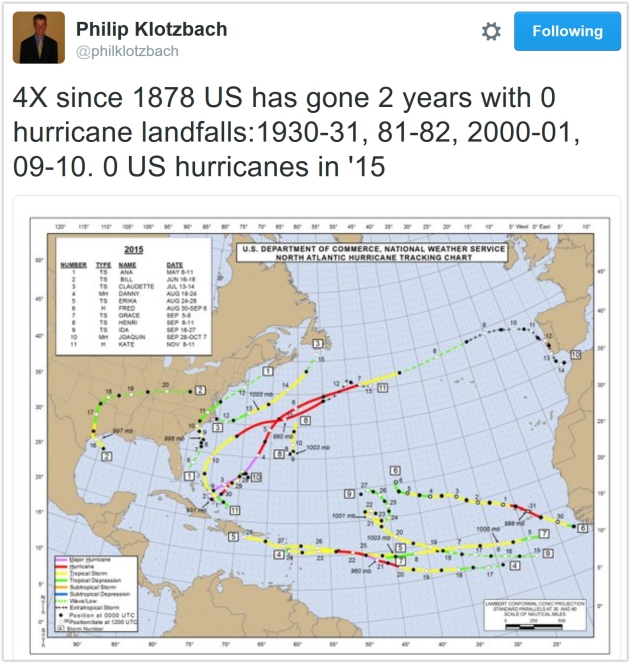
No Major U.S. Hurricane Landfalls in 9 Years: Luck? At some point the law of averages catches up with you, although I pretty sure I said something similar last year. And 2014. And 2013. Here's an excerpt from NASA: "The United States hasn’t experienced the landfall of a Category 3 or larger hurricane in nine years – a string of years that’s likely to come along only once every 177 years, according to a new NASA study. The current nine-year “drought” is the longest period of time that has passed without a major hurricane making landfall in the U.S. since reliable records began in 1850, said Timothy Hall, a research scientist who studies hurricanes at NASA’s Goddard Institute for Space Studies, New York..."
Hurricane Ivan file image: NASA ISS.
What To Do If You're Driving And Encounter a Flash Flood. Rule #1 - don't drive through high water - it's impossible to estimate water depth, especially at night. Only 2 feet of moving water can turn your vehicle into a boat, with tragic consequences. NOAA has it right: "Turn around, don't drown." Here's an excerpt from Popular Mechanics: "...Getting swept away while inside your vehicle is extremely dangerous. Although it sounds counterintuitive, if you're stuck inside your car, you'll want to roll down your windows and allow water to enter your vehicle. You can escape from your vehicle through the window or, if that's not possible, wait until the water pressure is equal on both sides of your door so it will open..."

Federal Flood Officials in Texas Use Twitter to Alert. Leveraging social media (from trusted sources) makes a lot of sense; here's the intro to an explanation from USA TODAY: "Faced
with relentless floods, Texas-based federal officials are turning to a
new ally in the war on rising water: Twitter. The U.S. Geological
Survey, the federal agency responsible for monitoring river levels,
recently launched a pair of Twitter feeds -- @USGS_TexasFlood and
@USGS_TexasRain – that give out automated, real-time river levels and
rainfall amounts during heavy rains. The feeds help first-responders and
flood forecasters see river gauges in real time and help with decisions
ranging from when to evauate to weekend forecasts..."
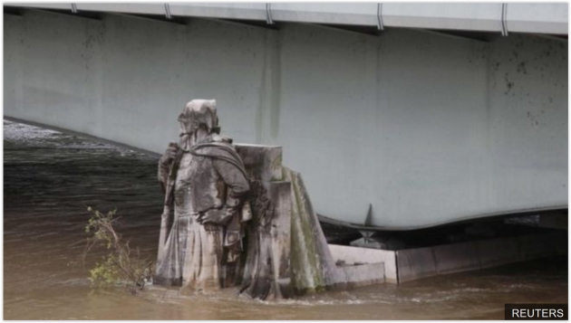
France Floods: Louvre To Close as Seine Rises Further. Here's the intro to an update on the widespread flooding gripping much of France and Germany at BBC: "The
world's most visited museum, the Louvre in Paris, is to close on Friday
amid worsening flooding caused by days of torrential rain. The move
will allow staff to move works at risk of damage to higher parts of the
gallery, a statement said. The Seine, which runs through Paris past the
Louvre, has risen five metres above normal levels. Heavy rains across
Europe have left at least 10 people dead, most of them in Germany..."
Photo credit: Reuters. "Waters are rising up the Zouave statue in Paris. The 1910 floods reached his shoulders."
Thousands Evacuated as France Declares Emergency Over Floods. CNBC has more details.
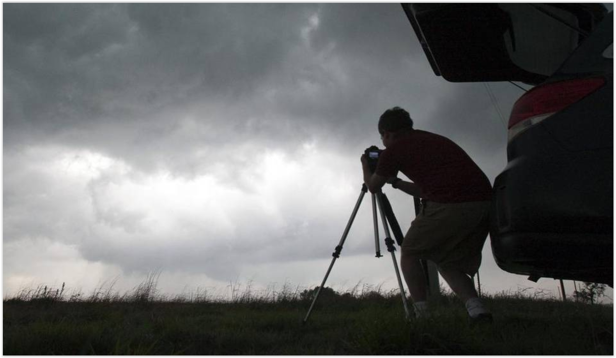
Storm Chasers, Stay Home. Good luck with that admonition, not when fame (and money) are both on the line. Here's an excerpt of an Eric Holthaus post at Slate: "Last
week, the National Weather Service tallied more than 120 tornado
reports across 10 states. All in all, that means it’s been a pretty
average week in late May in the heartland—this is peak tornado season,
after all. What’s less average is the traffic that Kansas and other
tornado-prone states experienced. And not because people were trying to
get out of the way of the tornadoes. It’s because storm chasers were
trying to get to them. Weather fanatics call this traffic phenomenon
“chaser convergence,” and it’s increasingly making rural roads unsafe at
the worst possible moments. Chaser convergence has been around for years but likely never on this scale (each red dot represents a storm chaser reporting his or her location)..."
Leave Tornado Chasing To The Professionals. Here's the intro of an Op-Ed at the Star-Telegraph: "We’re
smack dab in the middle of another tornado season. But one of the
biggest nuisances doesn’t come from the sky. We’re talking about you,
amateur storm chasers. Storm chasing, a vocation and/or passion for
some, has made its way into the national zeitgeist. We blame you, Twister. It’s become so popular that tornado chasers even use the term “chaser convergence” when they spot a gaggle of vehicles huddled together along the side of the road..."
Photo credit: "A storm chaser photographs a rotating thunderstorm just east of Pretty Prairie, Kansas, April 14, 2012." Travis Heying MCT.
Photo credit: "A storm chaser photographs a rotating thunderstorm just east of Pretty Prairie, Kansas, April 14, 2012." Travis Heying MCT.
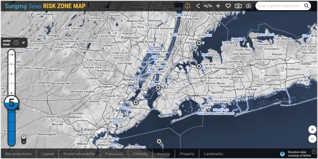
Surging Seas Risk Zone Map above courtesy of Climate Central.
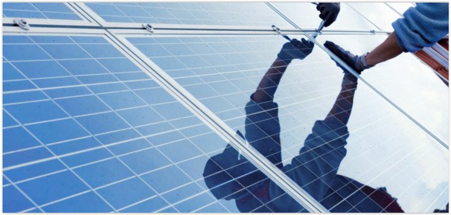
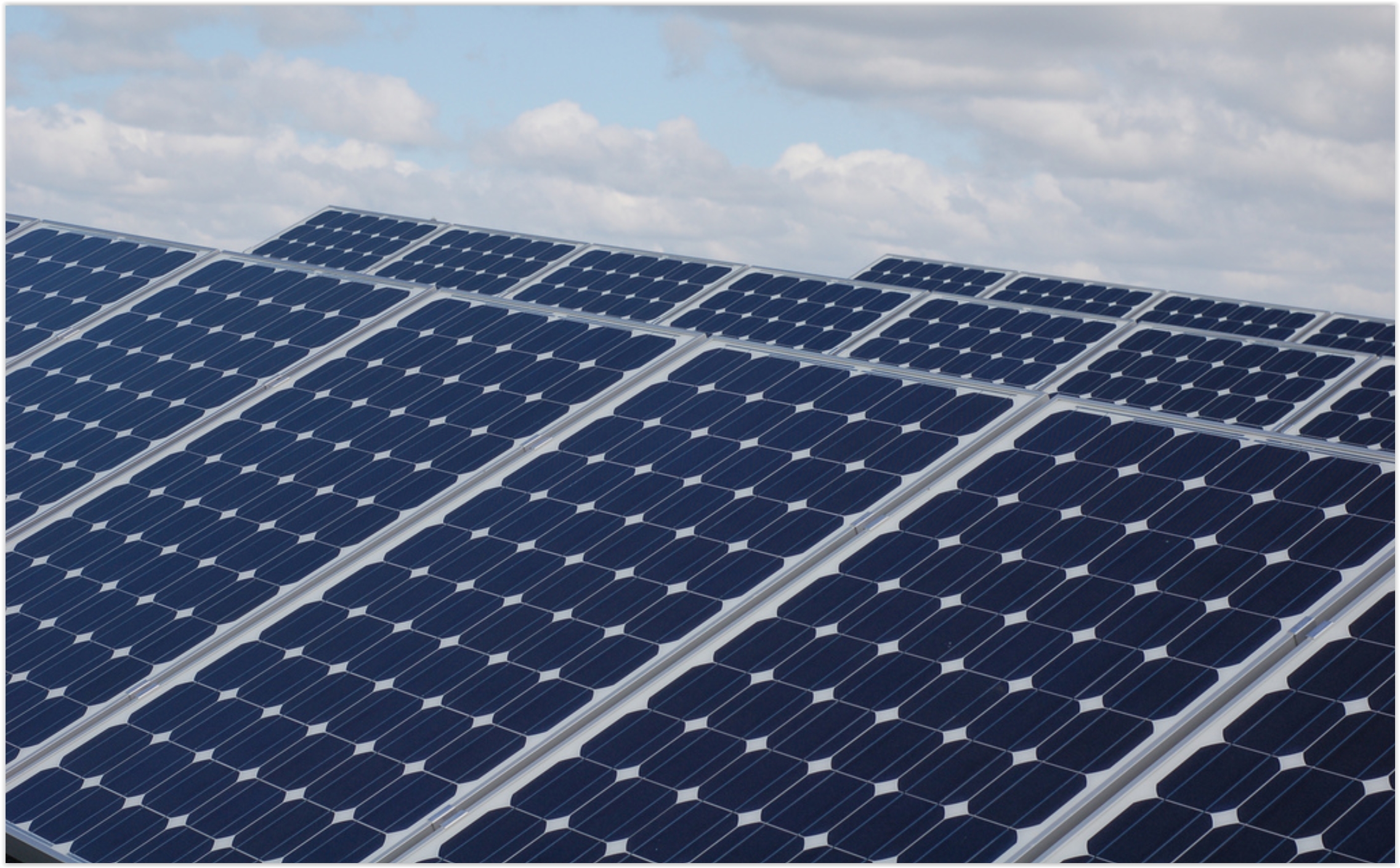
2016 Is A Breakthrough Year for Solar. TheHill has some encouraging statistics and projections: "Over the past few months, we've seen a rush of exciting developments in solar, some giving us insight into how distributed energy may work in the future. Thanks to tax credits (ITC) being renewed, 2016 will be a breakthrough year for U.S. solar, rising a stunning 119 percent. Sixteen gigawatts (GW) are expected to be installed, shattering last year's record 7.3 GW, according to the Solar Energy Industries Association (SEIA) and GTM Research. In February, we passed a wonderful milestone as the millionth home was outfitted with a solar system. About 300,000 Americans will install solar this year..." (Photo: Utility Dive).
Critics: Minnesota Utility's Solar Plan Pushes Out Competitors. Midwest Energy News has the story; here's a clip: "...I think people are really excited about the opportunity to have more solar energy across Minnesota and in northern Minnesota,” she said. “There was a belief that community solar would add to the region’s economy.” However, if the program is owned solely by Minnesota Power, community solar may not have as great a potential as it would have in a more open process allowing other community solar developers into the mix, she argued. The group, calling itself the Northland Community Solar Coalition, includes churches, environmental organizations, clean energy groups and climate change activists such as Will Steger..."


TODAY: Unsettled, few strong to severe T-storms. Winds: S 10-20. High: near 80
FRIDAY NIGHT: Few T-storms, locally heavy rain. Low: 60
SATURDAY: Periods of cool sunshine, stray PM shower. Winds: NW 10-20. High: 72
SUNDAY: Partly sunny, PM showers up north. Winds: NW 10-20. Wake-up: 55. High: 76
MONDAY: Fading sun, few PM showers. Winds: NW 10-15. Wake-up: 56. High: 73
TUESDAY: Brilliant sunshine, less wind. Winds: NW 8-13. Wake-up: 54. High: 72
WEDNESDAY: Partly sunny and warmer. Winds: S 10-15. Wake-up: 53. High: 79
THURSDAY: Hot, steamy sun, few T-storms. Winds: S 10-20. Wake-up: 63. High: near 90
Photo credit: "From left, Secretary of Agriculture Tom Vilsack, and Sen. Jeanne Shaheen, D-N.H., holding a press conference at the Miles Smith Farm in Loudon, N.H., on Tuesday, Aug. 19, 2014." Credit: Photo By Bill Clark/CQ Roll Call.

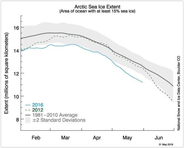
Graphic credit: "Sea ice extent through the end of May, with the blue line showing 2016." Image: NSIDC
How Global Warming Will Destroy Our Global Heritage. Here's a snippet from a New Yorker article: "...In
Venice, the rising water is “eating away at the substance of the
buildings as damp spreads up the brickwork.” Statues are flaking and
blistering, and mosaics in St. Mark’s Basilica are crumbling. Superstorm
Sandy caused a hundred million dollars in damage to the Statue of
Liberty, an experience that only highlighted its vulnerabilities. Higher
and stronger waves could topple statues on Easter Island. Flash floods
are expected to hit Stonehenge. At times, the report reads like a guide
to places that have been lost, then found, and, any minute, will be lost
again..." (Image: NASA).
Climate Central has more perspective on the risk to cultural and natural treasures around the planet.
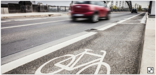
Climate Change: While We're Waiting for Solutions, It Must Start With Us. Here's an excerpt of an Op-Ed at The Star Tribune: "...I
find it disturbing that many of my “progressive” friends, who claim to
be concerned about global climate change, haven’t really changed their
lifestyles all that much. Air traffic is at an all-time high, and with
the recent downturn in gas prices, SUVs and trucks have been selling
like mad. Certainly, not all of these big carbon consumers are
climate-change doubters or libertarians who believe in letting the
“magic of the markets” correct all things in due time. Many are
progressives who haven’t yet adapted their lifestyles. Why aren’t more
of us walking or biking to work, school, church, the post office or the
grocery store?..."

The "Temperature Spiral" Has an Update. It's Not Pretty. This is one of the better visualizations I've ever seen about the warming underway - here's an update from Climate Central: "...Like a lot of people, I found Ed Hawkins' temperature animation very compelling because it details observed warming from 1850 to present in a novel way,” U.S. Geological Survey scientist Jay Alder said. “His graphic sets the context for looking at projections from climate models.” So Alder used climate projections and stretched the spiral to its logical conclusion in 2100 when most climate model projections end. Using our current carbon emissions trends, it shows that things could get out of hand pretty quickly..."
Animation credit: "An update to the famous temperature spiral using future climate projections." Credit: Jay Alder/USGS.
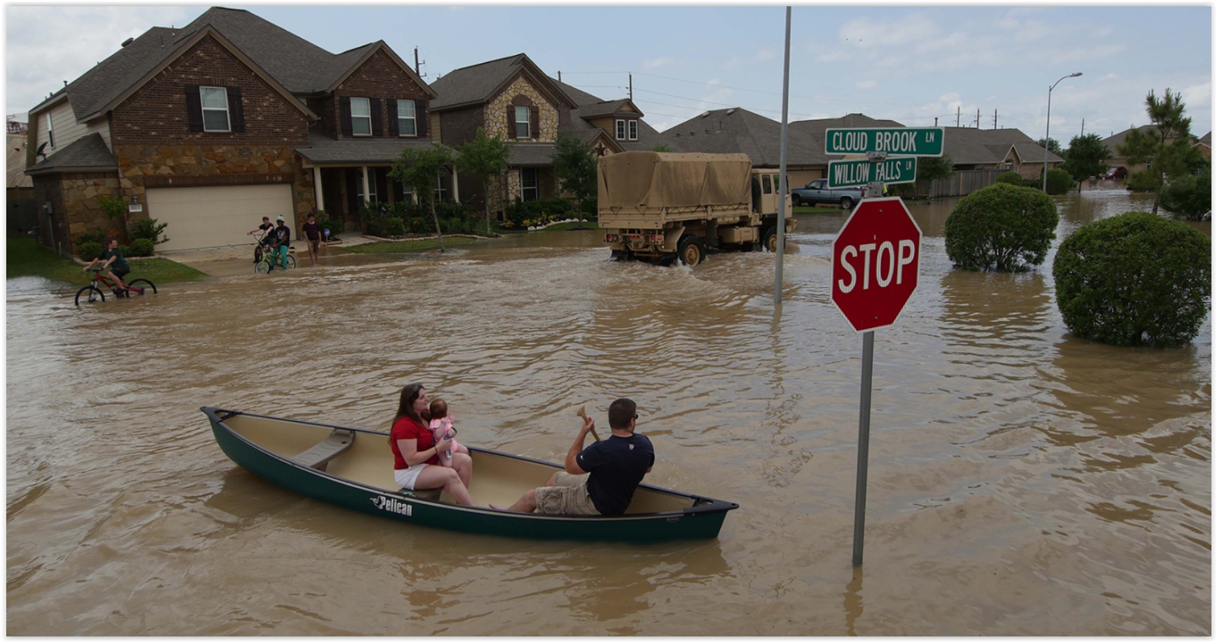
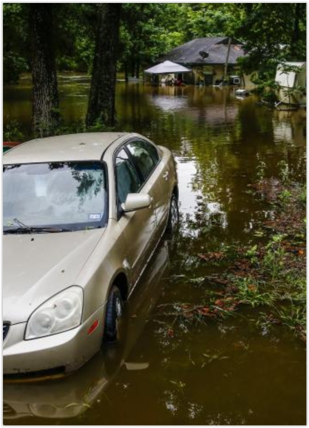
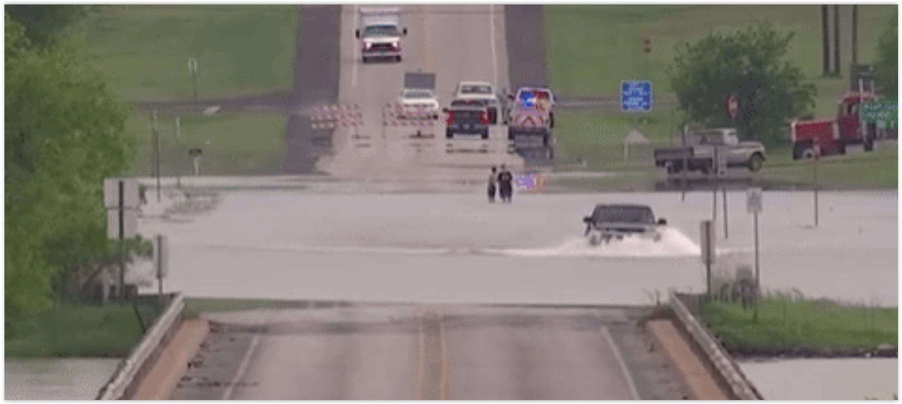
Houston Flooding is a Perfect Storm of Climate Change and Bad Urban Planning. Suddenly the "no zoning!" provisions seem like more of a bug than a feature, according to Grist: "...One likely cause,” Texas’ state climatologist John Nielsen-Gammon tells Grist, “is the increase in ocean temperatures from the Gulf of Mexico and tropical Atlantic. That determines how much moisture is in the atmosphere.” As temperatures increase, so does rainfall. But it’s not just the rainfall that is endangering Houston’s citizens — it’s also ecologically irresponsible development. Houston is the only major American city without formal zoning laws. As a result, developers have been free to pave over huge swaths of valuable wetlands that absorb runoff..."
Photo credit: U.S. Army National Guard/1st Lt. Zachary West/Handout via Reuters.
The World Is About to Install 700 Million Air Conditioners. Here's What That Means For The Climate. Here's a clip from The Washington Post: "As
summer temperatures finally settle in, many in the United States take
it for granted that they can dial down the thermostat: Americans use 5 percent of
all of their electricity cooling homes and buildings. In many other
countries, however — including countries in much hotter climates — air
conditioning is still a relative rarity. But as these countries boom in
wealth and population, and extend electricity to more people even as the
climate warms, the projections are clear: They are going to install
mind-boggling amounts of air conditioning, not just for comfort but as a
health necessity..."
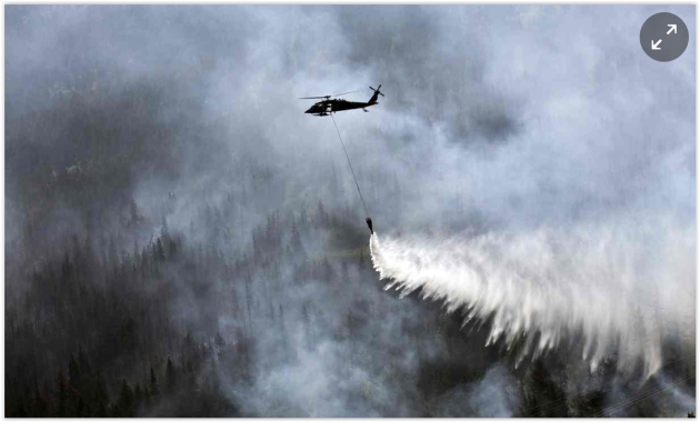
Photo credit: "A “Bambi Bucket” hanging from a helicopter releases hundreds of gallons of water on to the Stetson Creek Fire near Cooper Landing, Alaska, last year." Photograph: Sgt Balinda O'Neal/AP.
No comments:
Post a Comment