75 F. average high on June 3.
67 F. high on June 3, 2015.
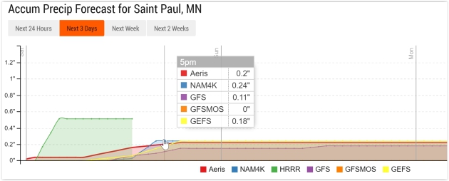
.21" rain fell yesterday at KMSP.
June 4, 1935: The latest official measurable snowfall in Minnesota falls at Mizpah on this date with 1.5 inches.
Foul Saturday Gives Way to a Promising Sunday
“Life isn't about waiting for the storm to pass. It's about learning to dance in the rain” wrote Vivian Greene.
A quote that sounds better on a Tuesday than a Saturday.
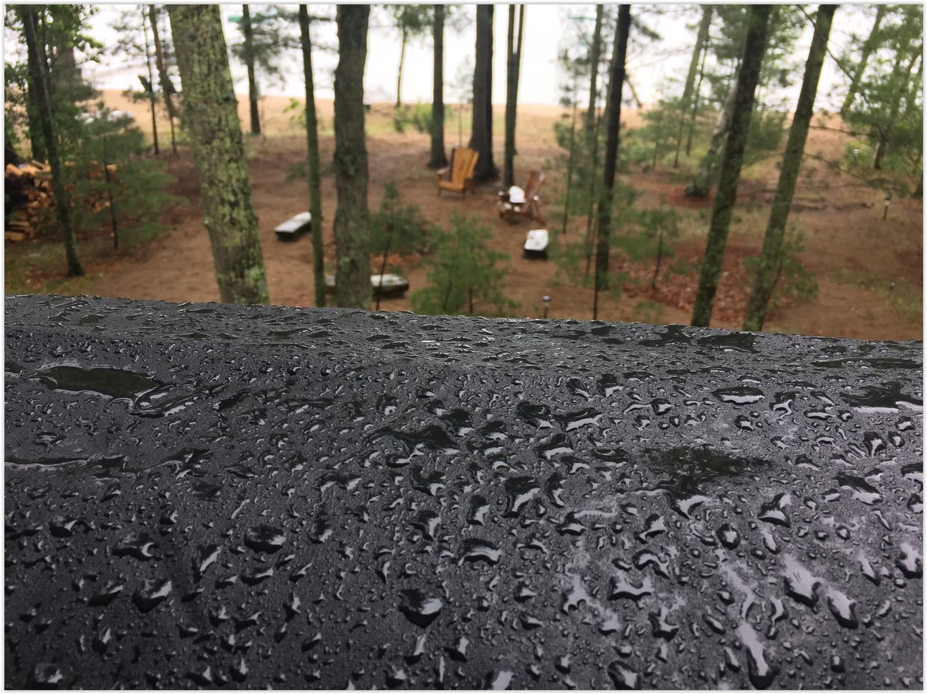
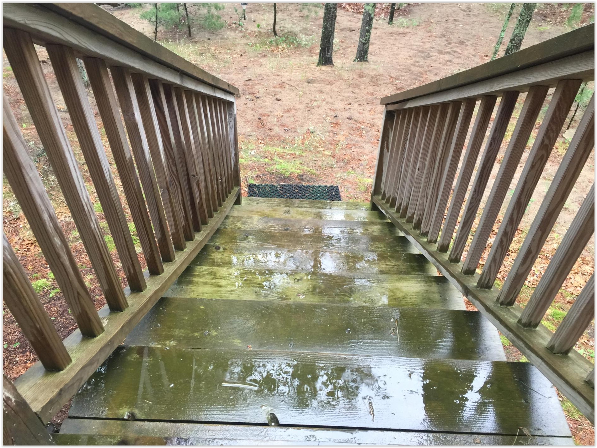
Weather was a washout at our cabin up on Pelican Lake yesterday. The kind of day that makes you want to curl up on the couch in the fetal position and watch C-Span. As I flicked on the furnace I understood some of the ongoing confusion about climate change. "How can the planet be warming if I'm chilly?"
We live in our bubbles.
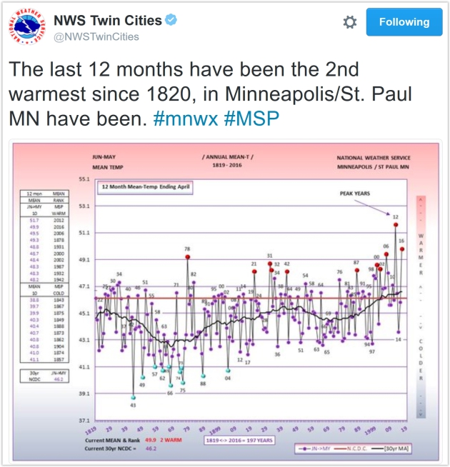
According to the Twin Cities National Weather Service the last 12 months have been the warmest since 1820, in case anyone asks.
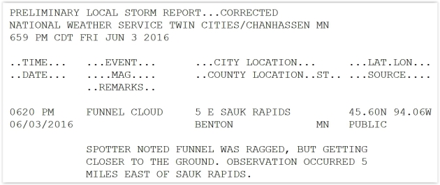
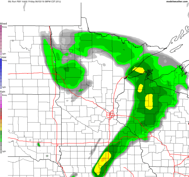
All that rain and thick cloud cover kept the airmass over Minnesota cool and stable, preventing a widespread severe storm outbreak.
You may get a sudden urge to clean out the garage today with leftover clouds and showers; temperatures stuck in the 60s with a stiff breeze. Sunday looks better with puddles of blue sky and 70s.
And if it's any consolation next weekend looks truly lake-worthy: 80s, even a shot at 90 degrees.
We're due for more sweaty weather.
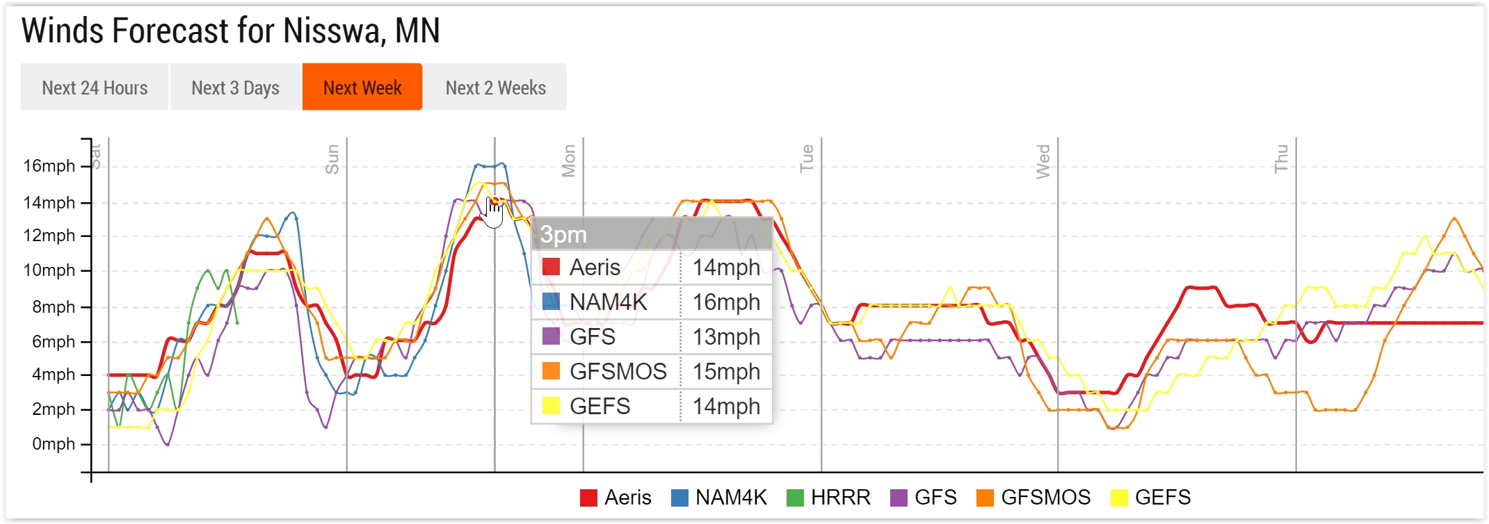
Gusty Winds Into Monday. Sustained winds reach 15-20 mph today with higher gusts. Models show a relaxing pressure gradient by Tuesday and Wednesday with winds dropping under 10 mph.
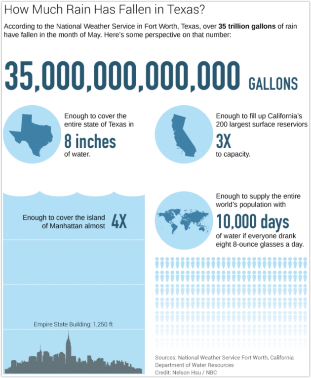
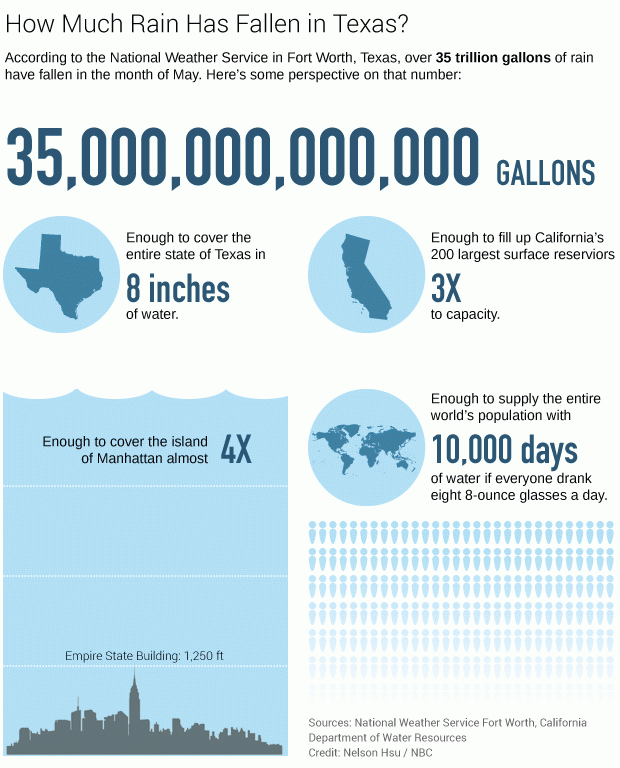
May Closes Wet For Some. Dr. Mark Seeley has a good recap of May and an assortment of other timely, interesting weather nuggets in this week's edition of Minnesota WeatherTalk; here's the intro: "The last week of May brought frequent, and sometimes heavy rains to many parts of the state. for some northern Minnesota climate stations it rained each day over the last week of the month. Sotty thunderstorms brought some new record daily rainfall amounts over the last day of May, including 0.99 inces at Lakefield; 1.67 inches at Hokah; 1.29 inches at La Crescent; 1.27 inches at Austin; 1.19 inches at Hallock; and an incredible 4.45 inches at Crookston. That amount at Crookston ranked as the 4th highest daily rainfall in history there...."

"Exceptional" Floods Continue to Wreak Havoc in France. Here's an excerpt from France 24: "Torrential downpours that have lashed France for several days now have also closed roads, stranded people on rooftops and forced schools to close their doors, with parts of the country being hit by the worst flooding in 100 years. In France’s Loire Valley, a large expanse of water pooled in front of the 16th century Chateau de Chambord, reflecting the much-visited Renaissance castle’s image..."
The Mona Lisa Stays Dry. CNN has the reassuring news here.
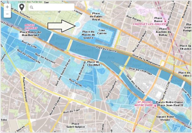
The Wall Street Journal has more perspective on the historic flooding in Paris.
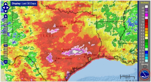
Map credit: "Last 30 days of rain, ending June 1." Credit: NOAA.
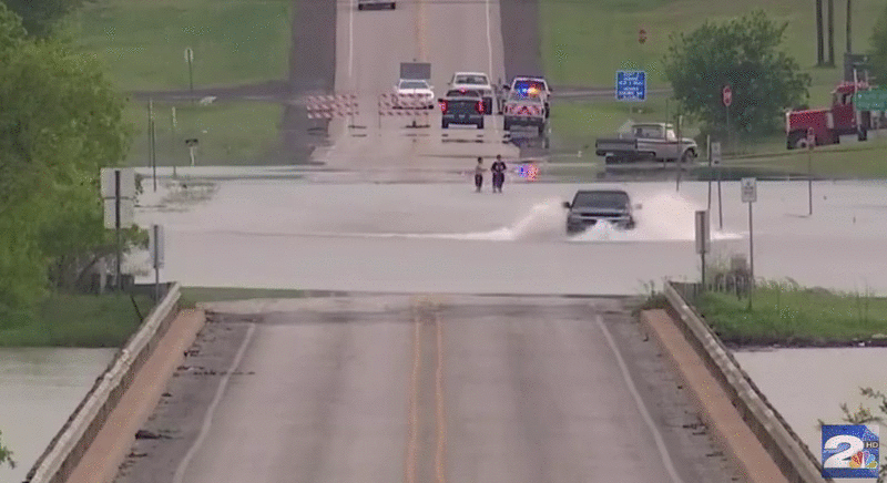
Tough Guy Tries To Drive Across Flood, Fails Miserably. Geekologie reminds all of us what not to do when encountering a flooded highway: "This is a video of a man in Texas who really believes his Chevy Avalanche can get him across a heavily flooded road. So, at least in his mind, Avalanches > Floods. Unfortunately for his pride and dry underwear, he is wrong and has to jump out and swim to safety. This is dangerous and you shouldn't do it, I don't care how big you think your Truck Nuts are..."
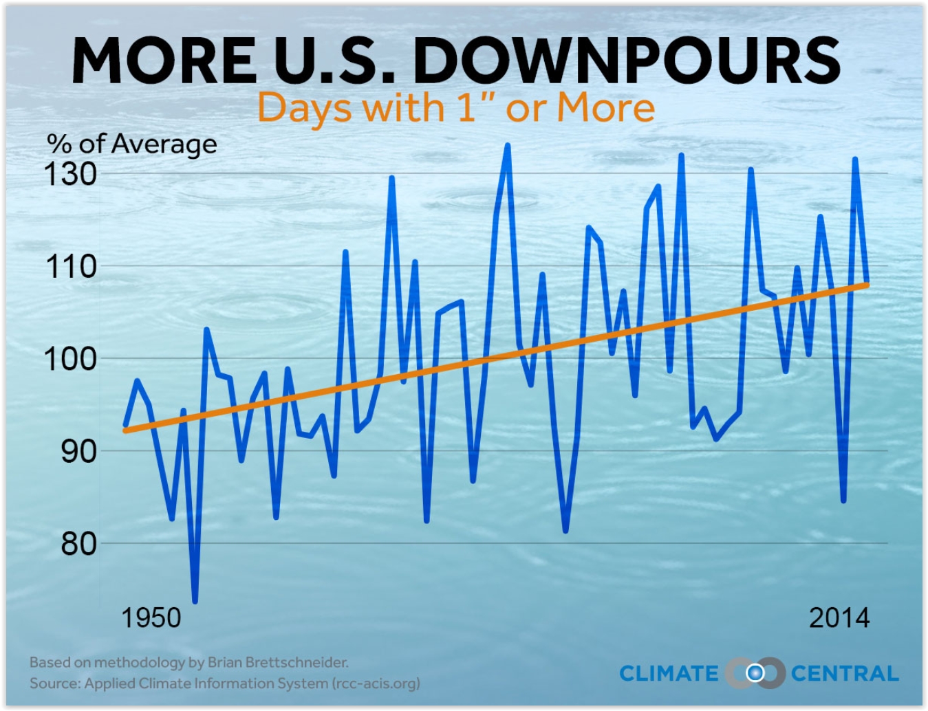
Across U.S., Heaviest Downpours On The Rise. Here's an excerpt of an analysis at Climate Central: "...Across most of the country, the heaviest downpours are happening more frequently, delivering a deluge in place of what would have been routine heavy rain. Climate Central’s new analysis of 65 years of rainfall records at thousands of stations nationwide found that 40 of the lower 48 states have seen an overall increase in heavy downpours since 1950. The biggest increases are in the Northeast and Midwest, which in the past decade, have seen 31 and 16 percent more heavy downpours compared to the 1950s..."
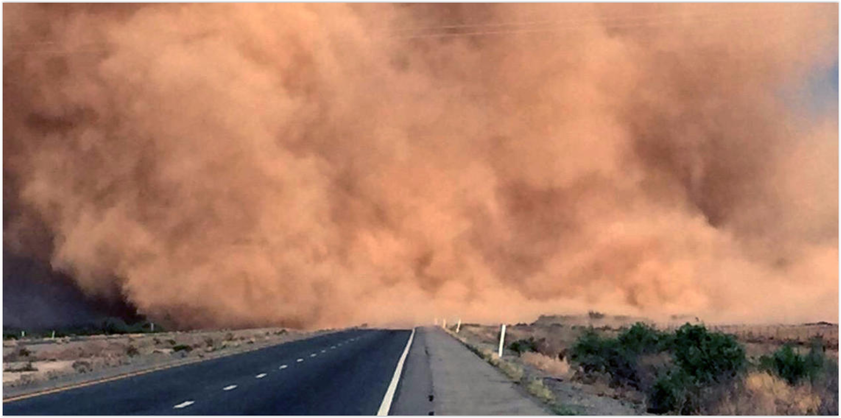
It's Summer in Arizona. Time To Come Inside. The L.A. Times summarizes the challenges of summer-living in Arizona; here's the intro: "In northern climes, dead leaves, gardeners bringing their plants inside and children praying for school closures all signal one thing: Winter is blowing in hard and mean. Here in Arizona, they mark something else. It’s not winter. It’s summer. The leaves are curling up and dying of heat. Gardeners bring in their plants, fearing not frost but the first truly hot day. And when children supplicate a higher power for bad weather, they're praying for school-shuttering monsoons..."
Photo credit: "A desert dust storm known as a haboob engulfs Interstate 10 near San Simon, Ariz., in May." (Arizona Department of Public Safety / Associated Press).
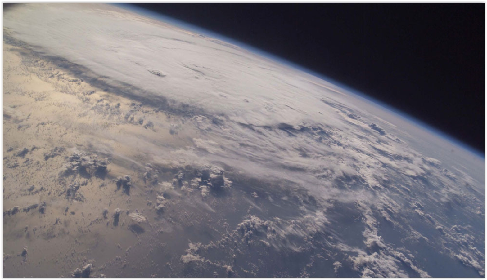
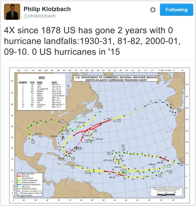
No Major U.S. Hurricane Landfalls in 9 Years: Luck? At some point the law of averages catches up with you, although I pretty sure I said something similar last year. And 2014. And 2013. Here's an excerpt from NASA: "The United States hasn’t experienced the landfall of a Category 3 or larger hurricane in nine years – a string of years that’s likely to come along only once every 177 years, according to a new NASA study. The current nine-year “drought” is the longest period of time that has passed without a major hurricane making landfall in the U.S. since reliable records began in 1850, said Timothy Hall, a research scientist who studies hurricanes at NASA’s Goddard Institute for Space Studies, New York..."
Hurricane Ivan file image: NASA ISS.
More Storms and Flooding: How We'll Need to Adapt to Extreme Weather. We are increasing the probability, loading the meteorological dice, for more extreme events. Here's an excerpt of an interview at Deutsche Welle: "...In general, we are seeing an increase around the world of the risk of a range of types of extremes, including rainfall extremes that may cause flooding events like what we have here. We see more people and assets at risk in places that can get flooded. In addition, people tend to not be aware enough of that risk, and how that risk is changing.... Climate change is changing the climate overall, including the peaks - the extremes - in the weather. When the climate changes overall, that changes the probability of certain events. So we won't say, "This event was caused by climate change," but we may say, "the chances of this event happening are now twice as likely than they were before..."
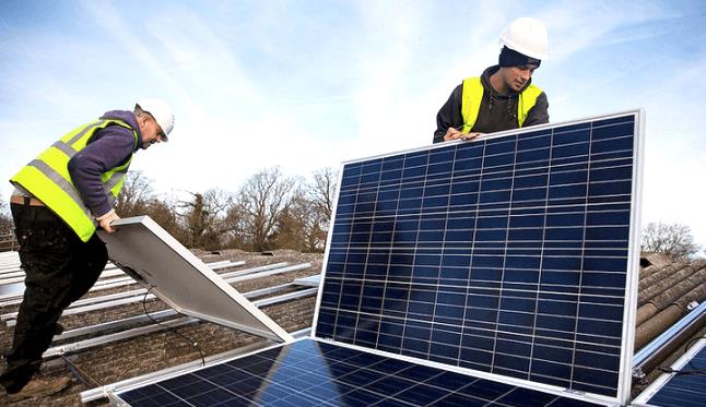
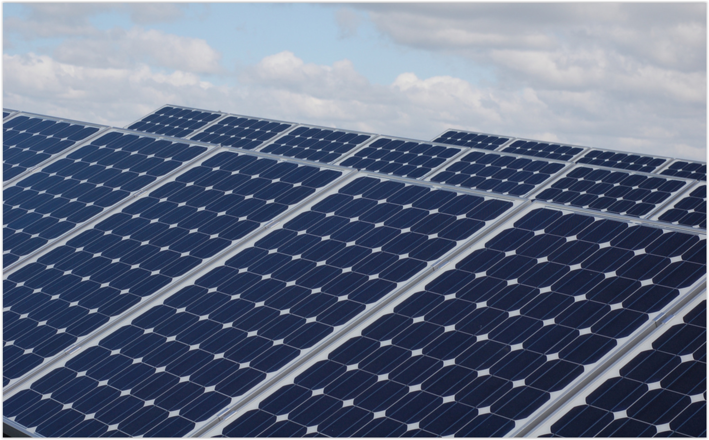
Shifting Economic Winds Spell Trouble for Solar Giants SolarCity and Sunrun. MIT Technology Review has the story; here's an excerpt: "...But price declines, the extension of the federal investment tax credit for solar, and an increase in the number of lenders willing to finance solar purchases are combining to make owning panels a much cheaper option for consumers. That could be bad news for SolarCity and Sunrun, two big solar providers that currently dominate the U.S. residential solar market. Both companies have built their businesses around long-term leases, and third party ownership of rooftop solar stood at 72 percent in 2014... (File image: SolarCity).
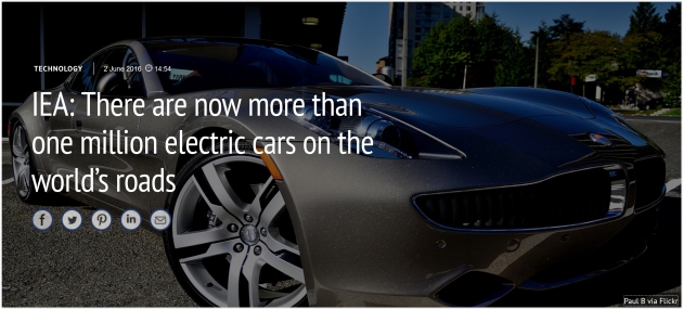
IEA: There Are Over One Million Electric Cars on the World's Roads. Carbon Brief has the details: "In 2015, the number of electric cars on the road globally passed the one million threshold for the first time.
The rapid growth of the industry means that it is now the only
technology sector on track to meet the International Energy Agency’s
(IEA) 2C scenario. This is the conclusion of the IEA’s Energy Technology Perspectives 2016
report, which it released on Wednesday. This is the latest edition of
their annual progress review of the technologies that will determine the
rate of global emissions, including renewables, nuclear, CCS and coal..."
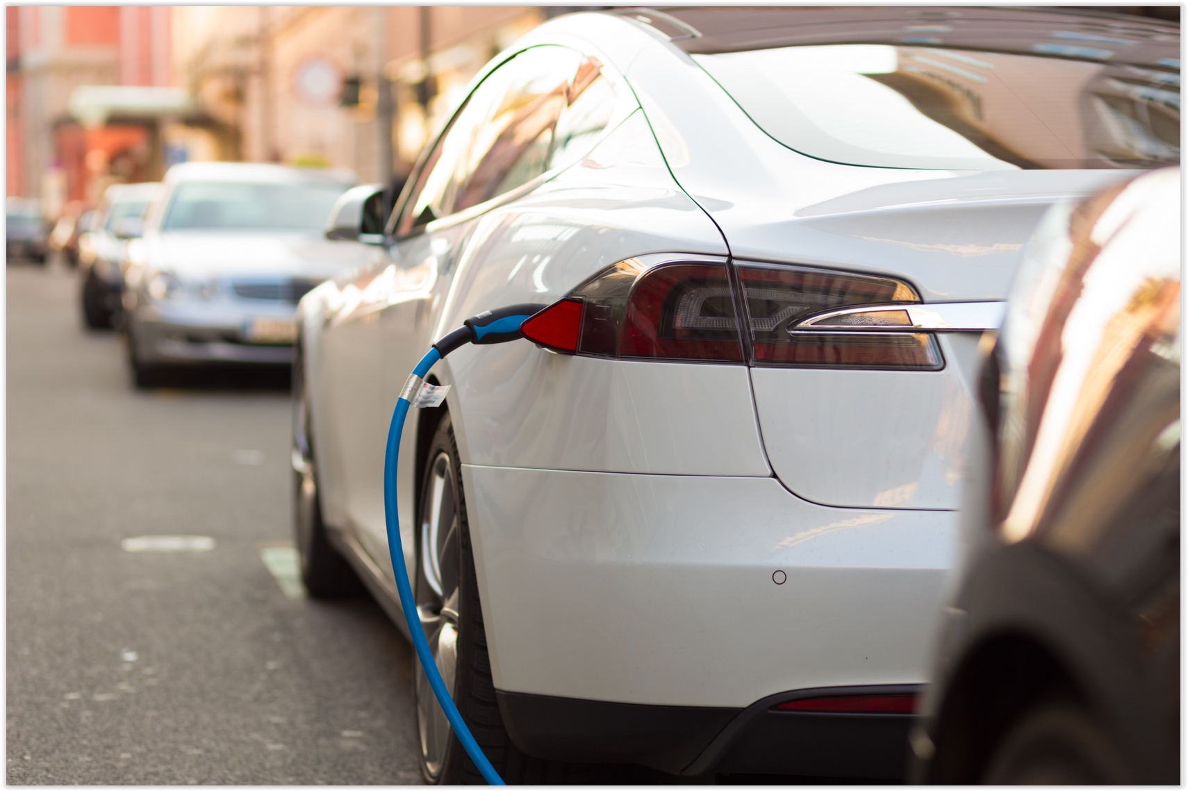
The Trends Driving Electric Vehicle Development. It's a convergence of factors, according to TechCrunch: "...Three
technology trends are converging in automobile transportation — and not
a minute too soon, given the giant emissions and human carnage wrought
by conventional vehicles:
- In my view, Tesla has demonstrated that electric vehicles can result in a superior automotive product in terms of driving performance, safety, comfort and even convenience.
- On-demand and ridesharing services shifted billions of car miles (including more than 1.5 billion miles on Uber alone) to their offering and made the case that ownership is an unnecessary and perhaps even negative part of the car experience..."
That
could be bad news for SolarCity and Sunrun, two big solar providers
that currently dominate the U.S. residential solar market. Both
companies have built their businesses around long-term leases, and
third-party ownership of rooftop solar stood at 72 percent in 2014.
Critics: Minnesota Utility's Solar Plan Pushes Out Competitors. Midwest Energy News has the story; here's a clip: "...I think people are really excited about the opportunity to have more solar energy across Minnesota and in northern Minnesota,” she said. “There was a belief that community solar would add to the region’s economy.” However, if the program is owned solely by Minnesota Power, community solar may not have as great a potential as it would have in a more open process allowing other community solar developers into the mix, she argued. The group, calling itself the Northland Community Solar Coalition, includes churches, environmental organizations, clean energy groups and climate change activists such as Will Steger..."

"Floating Homes" to deal with repeated flooding? The UK's Daily Mail has a curious story.

A Worldwide Health Check Up. The new Vital Signs series at How We Get To Next is worth your time; here's an excerpt: "Active
energy. Basal body temperature. Blood glucose. Body mass index.
Caffeine intake. Calories ingested. Electrodermal activity. Forced vital
capacity. Heart rate. Hydration level. Oxygen saturation. REM cycles.
Respiratory rate. UV index. These days, we can track just about every
vital sign and body movement we make — and mostly with free apps on our
smartphones. Monitoring and understanding our health is, quite
literally, at our fingertips. And
yet, more Americans are dying. Or at least, given an adult mortality
rate that’s been steadily decreasing over the past half century in the
United States and globally, they did last year..."
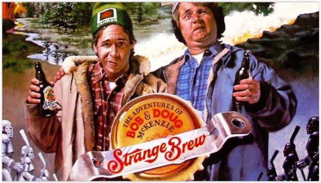
Image credit: "The classic purveyors of Canadian accents in the U.S.—from sketch comedy troupe SCTV." (Photo: YouTube).
TODAY: Cool, windy, showery - pretty foul. Winds: NW 10-20. High: 67
SATURDAY NIGHT: Evening shower, still windy and cool. Low: 56
SUNDAY: Mild sun returns, late-day T-shower? Winds: NW 10-20. High: 76
MONDAY: Still gray and unsettled, few showers around. Winds: NW 10-20. Wake-up: 57. High: 69
TUESDAY: Spectacularly sunny. Winds: NW 7-12. Wake-up: 53. High: 73
WEDNESDAY: Some sun, T-shower up north. Winds: S 7-12. Wake-up: 58. High: near 80
THURSDAY: Partly sunny and less humid. Winds: NE 8-13. Wake-up: 62. High: 78
FRIDAY: Plenty of sun, feels like summer again. Wake-up: 59. High: 83
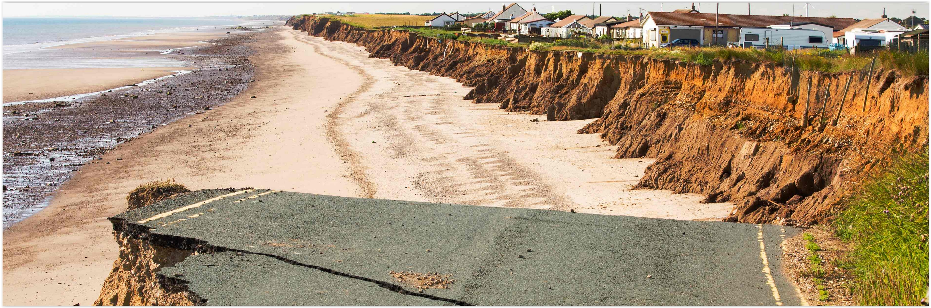
From Floods to Forest Fires: A Warming Planet - In Pictures. The Guardian has the photo essay; here's a link and story excerpt: "Droughts, floods, forest fires and melting poles – climate change is impacting Earth like never before. From the Australia to Greenland, Ashley Cooper’s work spans 13 years and over 30 countries. This selection, taken from his new book, shows a changing landscape, scarred by pollution and natural disasters – but there is hope too, with the steady rise of renewable energy..."


Photo credit: Rex.
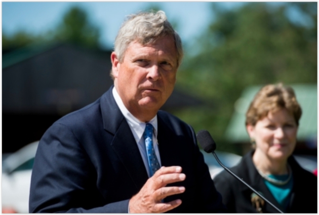
Photo credit: "From left, Secretary of Agriculture Tom Vilsack, and Sen. Jeanne Shaheen, D-N.H., holding a press conference at the Miles Smith Farm in Loudon, N.H., on Tuesday, Aug. 19, 2014." Credit: Photo By Bill Clark/CQ Roll Call.

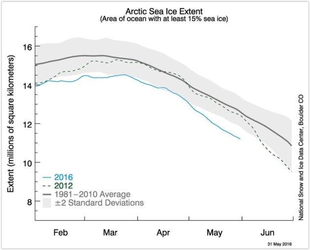
Graphic credit: "Sea ice extent through the end of May, with the blue line showing 2016." Image: NSIDC
How Global Warming Will Destroy Our Global Heritage. Here's a snippet from a New Yorker article: "...In
Venice, the rising water is “eating away at the substance of the
buildings as damp spreads up the brickwork.” Statues are flaking and
blistering, and mosaics in St. Mark’s Basilica are crumbling. Superstorm
Sandy caused a hundred million dollars in damage to the Statue of
Liberty, an experience that only highlighted its vulnerabilities. Higher
and stronger waves could topple statues on Easter Island. Flash floods
are expected to hit Stonehenge. At times, the report reads like a guide
to places that have been lost, then found, and, any minute, will be lost
again..." (Image credit: NASA).
Climate Central has more perspective on the risk to cultural and natural treasures around the planet.
No comments:
Post a Comment