Recounts from the Memorable Blizzard
Here’s a wonderful mix tape from KFAI’s MinneCulture, which includes interviews from staff members that worked during the blizzard as well as other stories from the massive storm.
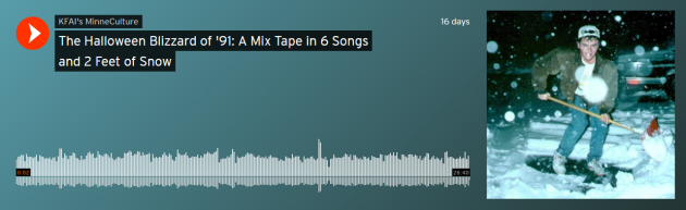
“How can you forget the one Halloween in your life that came with two feet of snow? KFAI’s Britt Aamodt was studying biology at Gustavus Adolphus College when a record snowstorm blasted its way into her life. She wasn’t alone in experiencing the legendary Halloween Blizzard of 1991, a storm that closed schools, shuttered stores and workplaces and left an indelible memory on those that experienced it. (Photo byPeter Boulay)”
 _______________________________________________________________
25th Anniversary of the 1991 Halloween Blizzard
Here’s a wonderful mix tape from KFAI’s MinneCulture, which includes interviews from staff members that worked during the blizzard as well as other stories from the massive storm.
“How can you forget the one Halloween in your life that came with two feet of snow? KFAI’s Britt Aamodt was studying biology at Gustavus Adolphus College when a record snowstorm blasted its way into her life. She wasn’t alone in experiencing the legendary Halloween Blizzard of 1991, a storm that closed schools, shuttered stores and workplaces and left an indelible memory on those that experienced it. (Photo byPeter Boulay)”
25th Anniversary of the 1991 Halloween Blizzard
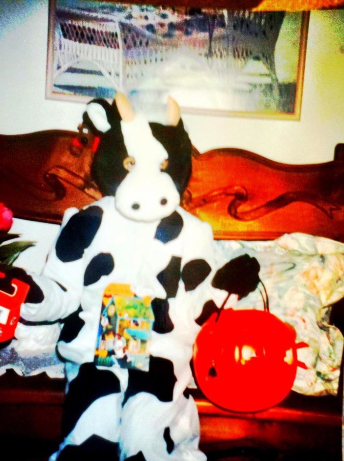
Believe it or not, this is the 25th anniversary of the 1991 Halloween Blizzard. I was 9 that year and dressed up as a cow. It was an incredible storm and vividly remember snow piling up on my snout as I trudged from house to house in search for goodies.
The Minnesota State Climate Office has a wonderful write up regarding the storm, here's an excerpt:
"The Halloween Blizzard of 1991 still stands as a benchmark blizzard in Minnesota that other storms are compared to 25 years later."
"October Blizzards in Minnesota are rare, but they have happened in the past. The most severe early blizzard on record for Minnesota was the devastating October 16, 1880 storm. This storm left behind drifts of snow to 20 feet high in the Canby area and brought train traffic to a standstill over western Minnesota until the spring thaw. This winter is vividly portrayed in Laura Ingalls Wilder's Book: The Long Winter."
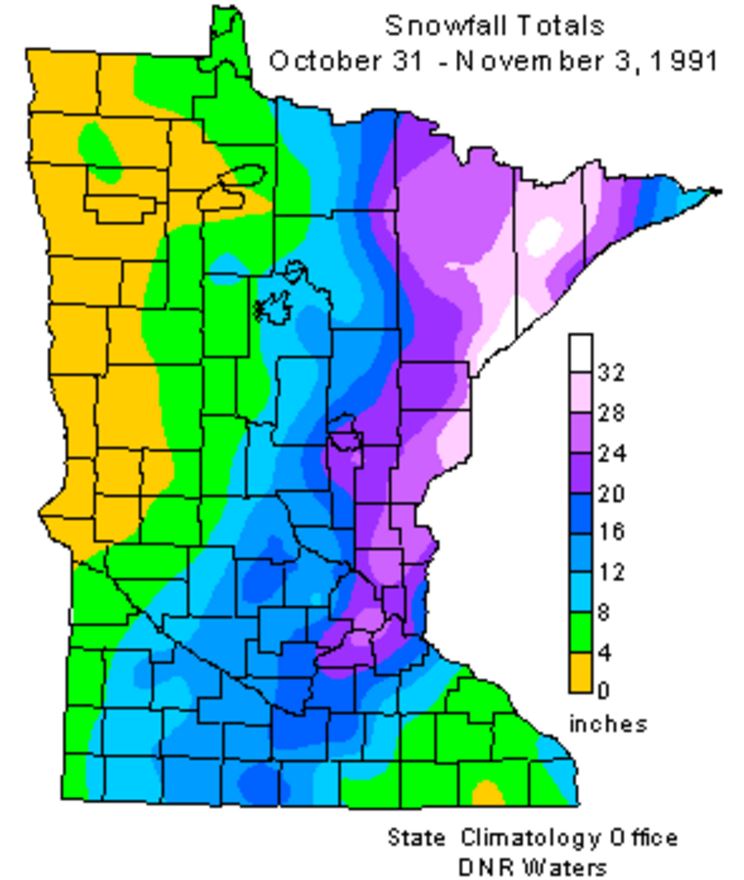
"The Halloween Blizzard in 1991 is one of those weather events that people can recall what they were doing as it unfolded. Folks were still celebrating the Minnesota Twins second World Series win in just four years when a cold front ushered in unseasonably cold air. The high temperature in the Twin Cities was 65 degrees on the 29th, over ten degrees above normal. On October 30th, the high temperature in the Twin Cities only reached 32 degrees. By this time a low pressure area was developing around Galveston Texas. From the seasoned veterans at the National Weather Service to students studying meteorology at St. Cloud State, there was no secret that a large storm was coming. Most forecasts for October 31st for central Minnesota called for a cold rain by the afternoon. Possibly heavy. The primary question at the time was: "How much rain would fall?""
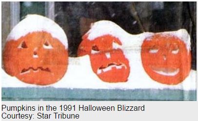
"As Halloween dawned back in 1991, some wintry weather was anticipated but no one was expecting a blizzard. The National Weather Service issued a Winter Storm Watch at 4:00 am on the 31st with a potential of a foot of snow. The first inkling that the forecast under projected snowfall totals came when precipitation started falling as snow at about 11:30am in the Twin Cities, much earlier than anticipated. With the realization that the precipitation would be snow, not rain, a Winter Storm Warning was issued during the day by the National Weather Service in the Twin Cities and forecasters realized there was a potential for a lot of snow. As the afternoon faded into evening a surreal scene unfolded with kids attempting to trick or treat wearing coats and boots and pumpkins becoming covered with a snowy blanket. 8.2 inches of snow fell by midnight on the 31st at the Twin Cities International Airport, the most for the entire month of October on record for the Twin Cities."
See more from the Minnesota State Climatology Office HERE:
"The Halloween Blizzard in 1991 is one of those weather events that people can recall what they were doing as it unfolded. Folks were still celebrating the Minnesota Twins second World Series win in just four years when a cold front ushered in unseasonably cold air. The high temperature in the Twin Cities was 65 degrees on the 29th, over ten degrees above normal. On October 30th, the high temperature in the Twin Cities only reached 32 degrees. By this time a low pressure area was developing around Galveston Texas. From the seasoned veterans at the National Weather Service to students studying meteorology at St. Cloud State, there was no secret that a large storm was coming. Most forecasts for October 31st for central Minnesota called for a cold rain by the afternoon. Possibly heavy. The primary question at the time was: "How much rain would fall?""
"As Halloween dawned back in 1991, some wintry weather was anticipated but no one was expecting a blizzard. The National Weather Service issued a Winter Storm Watch at 4:00 am on the 31st with a potential of a foot of snow. The first inkling that the forecast under projected snowfall totals came when precipitation started falling as snow at about 11:30am in the Twin Cities, much earlier than anticipated. With the realization that the precipitation would be snow, not rain, a Winter Storm Warning was issued during the day by the National Weather Service in the Twin Cities and forecasters realized there was a potential for a lot of snow. As the afternoon faded into evening a surreal scene unfolded with kids attempting to trick or treat wearing coats and boots and pumpkins becoming covered with a snowy blanket. 8.2 inches of snow fell by midnight on the 31st at the Twin Cities International Airport, the most for the entire month of October on record for the Twin Cities."
See more from the Minnesota State Climatology Office HERE:
Halloween Climatology
I know we're still a few days away from Halloween, but the Minnesota State Climatology Office has some good stats regarding Halloween Climatology for the Twin Cities.
"Halloween is typically a time of crunchy leaves on the ground, and a bit of chill in the air. High temperatures in the Twin Cities are generally in the 40's and 50's. It is more common for the daily high on Halloween to be in the 60's than in the 30's. 70's tend to be a bit rare, with only eight Halloween high temperatures being 70 degrees or above. The warmest Halloween on record was 83 degrees in 1950, with the second coldest maximum temperature on record arriving one year later with a high of 30 in 1951. The coldest Halloween maximum temperature was a chilly 26 degrees back in 1873. The last fifteen years have had some balmy Halloween afternoons with a 71 degrees in 2000, and some quite cool ones as well with a 34 in 2002. There hasn't been a Halloween washout since 1997. Measurable precipitation has occurred on Halloween only 26% of the time in the Twin Cities, or 38 times out of 144 years. The most rain recorded was in 1979 with .78 inches. In 1991 .85 inches of precipitation fell, which was snow. In spite of the 1991 Halloween Blizzard, measurable snow on Halloween is about as rare as getting a full sized candy bar in your trick or treat bag. Since 1872 there's been enough snow to measure only six times: .6 in 1884, .2 in 1885, 1.4 in 1932, .4 in 1954, .5 in 1995 and of course 8.2 inches with the Halloween Blizzard of 1991. Thus there has been measurable snow on only 4% of the days."
2016 Halloween Weather Outlook
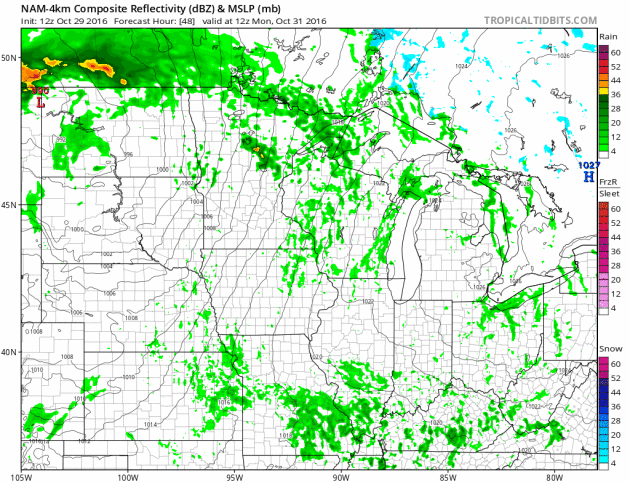
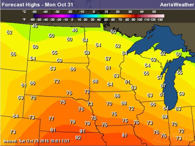
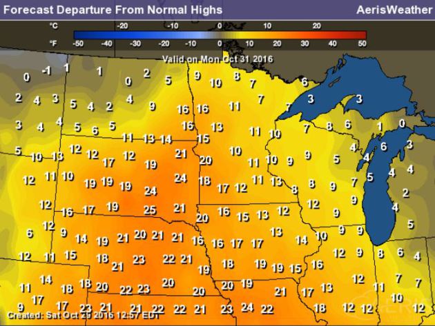
Here's a preview of the 2016 Halloween weather across the Upper Midwest. Note that another storm system will push through the region with light rain shower potential across parts of the state. With that said, we will be on the southern side of the storm, which means temperatures will be quite mild through the day, but it will be breezy.
2016 Halloween Temperature Outlook
High temperatures on Halloween Monday will be very warm across much of the Upper Midwest with readings nearly 10F to 15F above average.
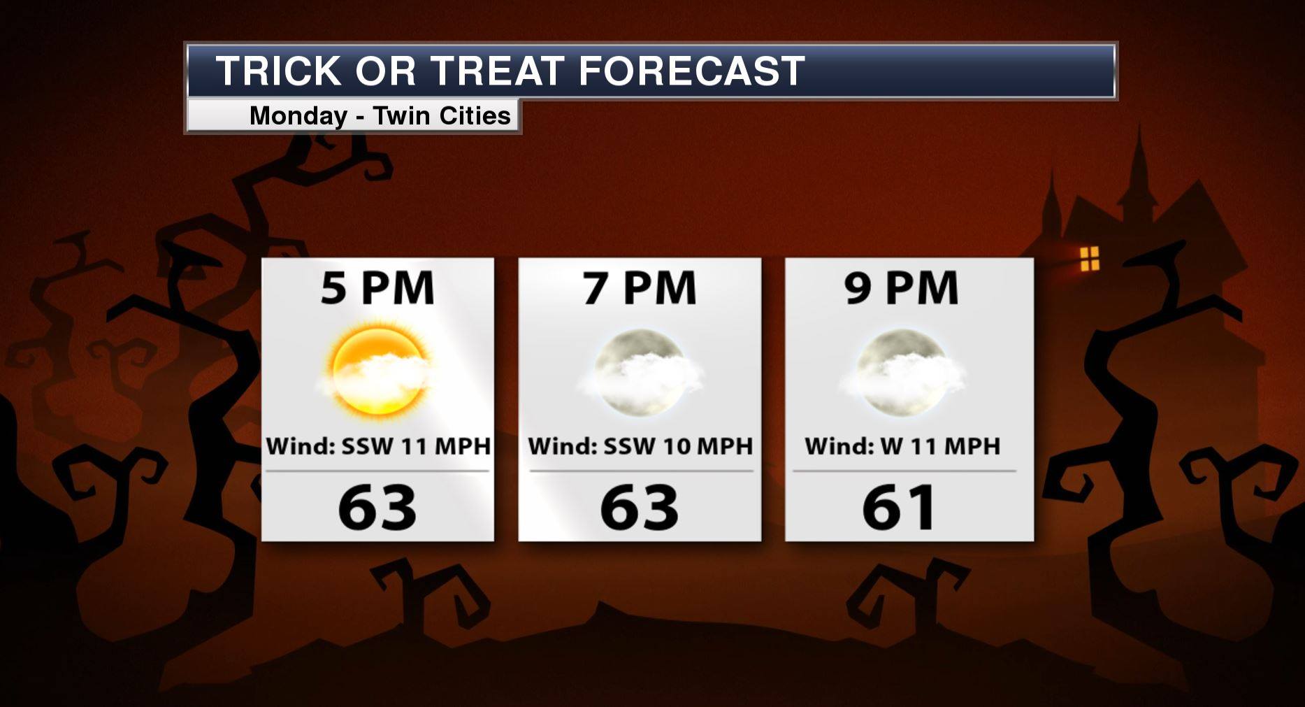
Minneapolis Trick or Treat Forecast
__________________________________________
Fall Color Update
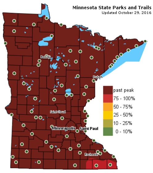
According to the MN DNR, much of the state is now past peak in the fall color department with the exception of a few spots in the extreme southeastern part of the state.

___________________________________________________________________________
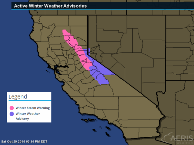
Snow in California! Sierra Nevada Snow...
...WINTER STORM WARNING REMAINS IN EFFECT FROM 8 AM TO 11 PM PDT SUNDAY...
* MAIN IMPACTS: SLICK ROADS AND REDUCED VISIBILITY DUE TO HEAVY SNOW AND STRONG WIND. TRAVEL DELAYS AND CHAIN CONTROLS LIKELY.
* OTHER IMPACTS...WINDS GUSTING TO 60 MPH THROUGH PASSES AND OVER HIGHER TERRAIN REDUCING VISIBILITY SIGNIFICANTLY AND CAUSING DANGEROUS DRIVING CONDITIONS.
* TIMING...SUNDAY INTO SUNDAY NIGHT...HEAVIEST SUNDAY AFTERNOON.
* LOCATIONS...TRANS SIERRA NEVADA PASSES INCLUDING INTERSTATE 80 AND HIGHWAY 50 ABOVE 6500 FEET.
* SNOW ACCUMULATIONS...6 TO 12 INCHES POSSIBLE ABOVE 6500 FEET WITH 1 TO 2 FEET OF SNOW ABOVE 7500 FEET. SNOW ACCUMULATIONS OF UP TO 3 INCHES POSSIBLE DOWN TO 5500 FEET SUNDAY EVENING.
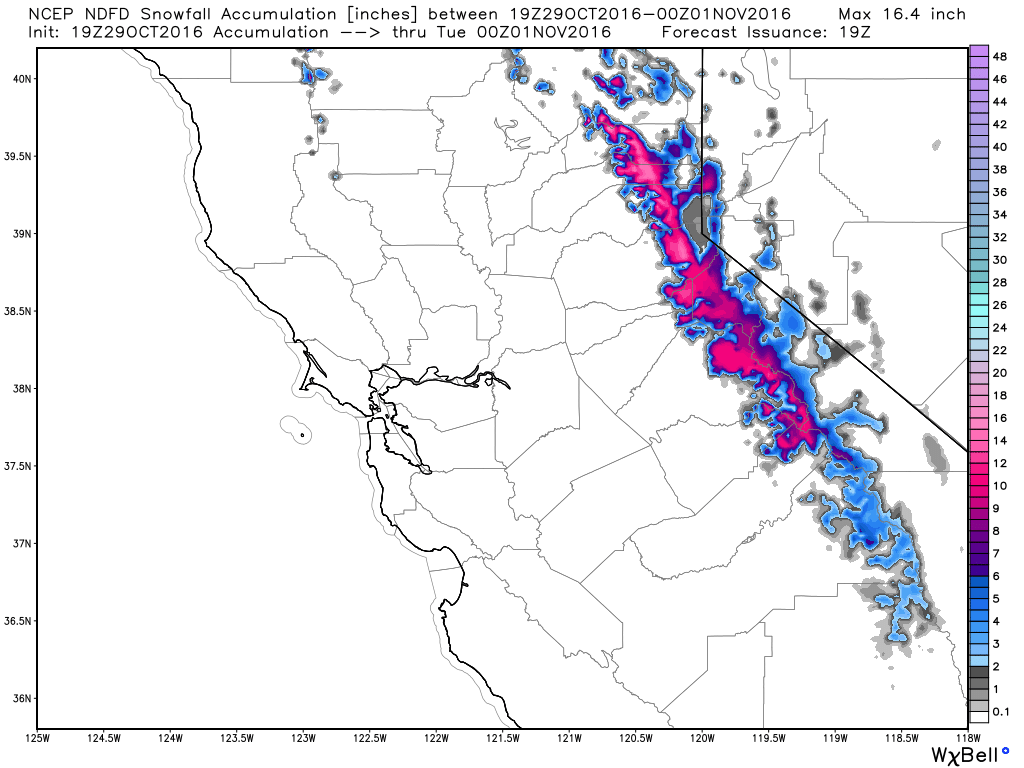
Here's the snowfall potential through PM Monday, which suggests some fairly significant amounts across the higher elevations of the Sierra Nevada Range. Some spots in the highest elevations could see 1 to 2 feet!
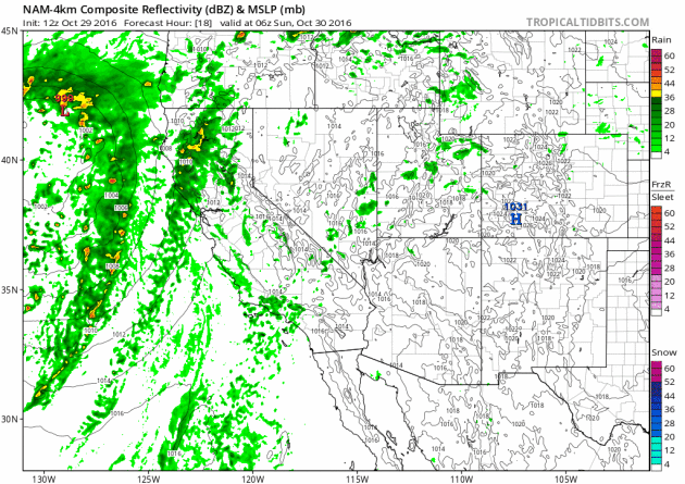
Quick Hitting Storm in the West
Another surge of Pacific moisture is expected to move into the Western U.S. later this weekend with heavy rain and high elevation snow. The heaviest precipitation looks to move in on Sunday and exit quickly by Monday.
Better Sunday. Feels Like Early October This Week
One week from today, we fall back 1 hour to standard time. While that means we'll have more daylight in the morning, it also means that it'll be dark when we get home from work! Note that we've lost nearly 5 and a half hours of daylight since the Summer Solstice on June 20th and we're still slated to lose another hour and a half by the Winter Solstice on December 21st.
We're definitely in a downward spiral toward the colder months of winter, but the atmosphere doesn't seem to be responding. I've seen a few small swarms of waterfowl flying overhead, but the big flocks are still lurking in Canada where above average temperatures have kept lakes and ponds ice-free. November is around the corner, but it has been feeling more like early October with more mild weather on the way for the week ahead.
After damp Saturday, Sunday will feature drier and somewhat sunnier conditions. A Witch Watch has been issued for Monday, but no snow or blizzards are brewing for this year's trick or treat. Mild winds and a few PM showers shouldn't be too spooky.
___________________________________________________
Extended Weather Outlook
SATURDAY NIGHT: Showers early, then mostly cloudy. Winds: NNW 5. Low: 40.
SUNDAY: Damp start. More PM sun. Winds: SSE 5-10. High: 52.
SUNDAY NIGHT: Mostly cloudy. Winds: SSE 5-10. Low: 44.
Halloween Monday: Mild and blustery. Few showers. Winds: SSW 10-20. High: 63.
TUESDAY: Sunnier and still mild. Winds: WSW 5-10. Wake-up: 48. High: 62.
WEDNESDAY: Partly cloudy, rain stays south. Winds: NNW 5-10. Wake-up: 48. High: 62.
THURSDAY: Bright sun. Winds: SSW 5-15. Wake-up: 44. High: 61.
FRIDAY: Mostly sunny. Where's November? Winds: WNW 5. Wake-up: 44. High: 60.
SATURDAY: Sunshine. More like early October. Winds: SSW 5-10. Wake-up: 42. High: 61.
_______________________________
_______________________________
This Day in Weather History
October 29th
1951: An early snow storm drops as much as 8 inches of snowfall in north central Minnesota. Mora had 8 inches, while Long Prairie received 6 inches. Glenwood, Little Falls, Morris, and New London all had 5 inches of new snow. Meanwhile, surrounding areas received a couple of inches.October 29th
1936: An intense dust storm causes damage in Central Minnesota. Heavy wind damage is reported in Stearns County.
________________________________
Average High/Low for Minneapolis
October 29th
Average High: 51F (Record: 83F set in 1950)
Average Low: 35F (Record: 10F set in 1925)
_________________________________
Average Low: 35F (Record: 10F set in 1925)
_________________________________
Sunrise/Sunset Times for Minneapolis
October 29th
October 29th
Sunrise: 7:49am
Sunset: 6:03pm
Sunset: 6:03pm
*Daylight Lost Since Yesterday: ~2mins & 49sec
*Daylight Lost Since Summer Solstice: ~5hours and 24mins
______________________________________________________________________
*Daylight Lost Since Summer Solstice: ~5hours and 24mins
______________________________________________________________________
Moon Phase for October 29th at Midnight
0.6 Days Since New Moon
0.6 Days Since New Moon

Weather Outlook Sunday
High temperatures on Sunday will again be at or slightly below average levels for the end of October, but we'll warm to above average levels into next week.
High Temperatures From Average Saturday
High temps from average on Sunday will once again be a little closer to where we should be at this time of the year, but note the warmer temps building to the west. This is the warmer weather that will be with us as we head into next week.
Weather Outlook Saturday
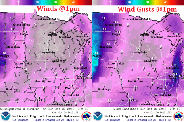
Winds on Monday will be quite light as a bubble of high pressure slides through the region. Enjoy the lighter winds while you can because they pick out significantly on the backside of this feature as we head into Monday.
Weather Outlook Saturday
After a soggy Saturday, Sunday appears to be drier with even a little sunshine by the afternoon.
___________________________________________________________
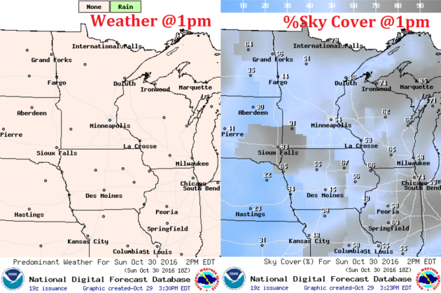
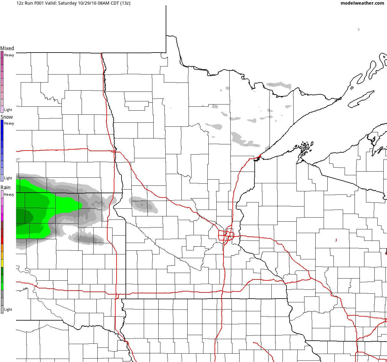
Simulated Radar
The simulated radar from Saturday to PM Monday shows our Saturday showers settling down to a quieter and somewhat sunnier Sunday. Our next chance of light rain looks to move in on Halloween Monday.
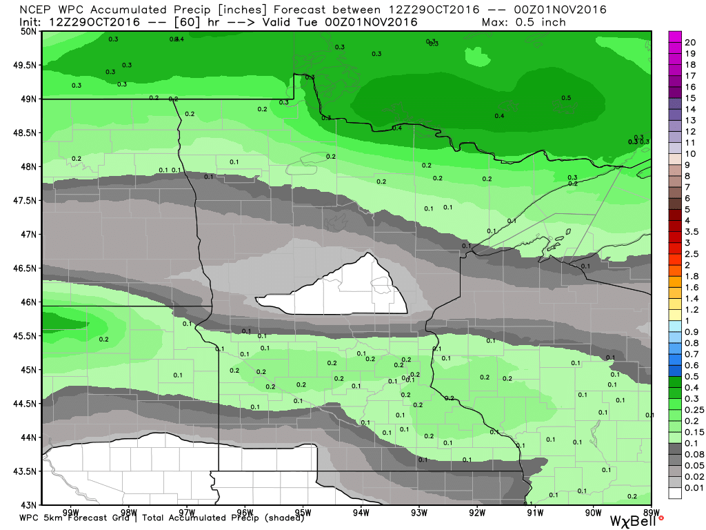
Rainfall Potential
The batch of steadier rain that moved through the central and southern part of the state on Saturday will be gone by Sunday. Our next batch of rain moves through Monday will the heaviest likely across the extreme northern part of the state.
_______________________________________
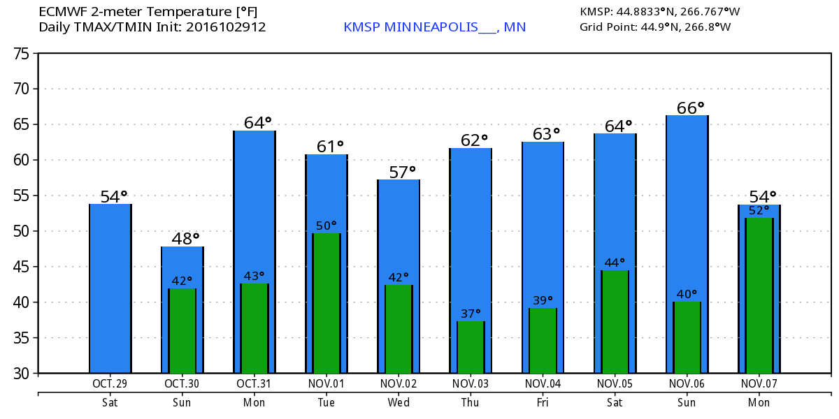
Extended Weather Outlook
Temperatures for the rest of the weekend will remain at or slightly below average, but looking at the extended temperature forecast, much of next week will be warmer than average and more like early October.
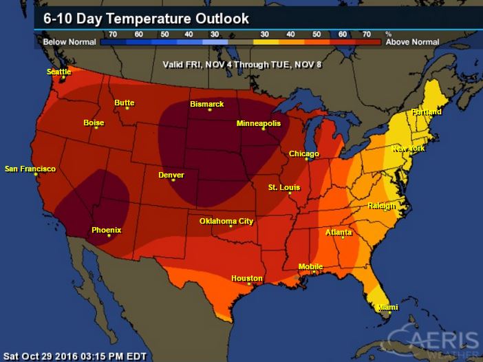
Warm Temperatures Return to Midwest
According to NOAA's CPC, the 6 to 10 day temperature outlook suggests warmer than average temperatures continuing across much of the Upper Midwest as we head through the early part of November.
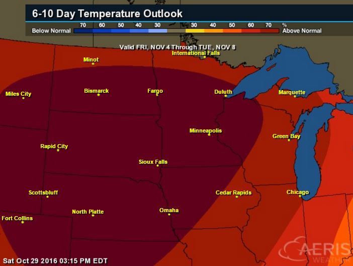
Here's the national temperature outlook from November 4th - 8th, which shows warmer than average conditions across much of the nation.
__________________________________________
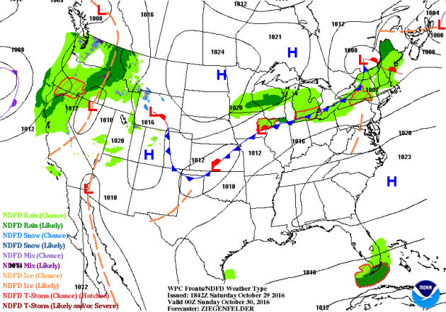
National Weather Outlook
Active weather conditions continue across the Western U.S. with heavy rain along the coast and high elevation snow. Some of the Pacific moisture will make it into the Central US over the coming days.
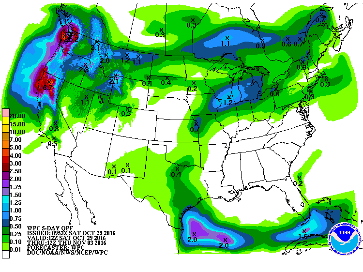
Precipitation Outlook
According to NOAA's WPC, the heaviest precipitation across the nation will be found in the Western U.S., where come 3" to 6"+ amounts can't be ruled out across parts of California. Much of the Central U.S. will remain dry with the exception of those along the northern tier of the nation.
 ____________________________________________________________________
"10 Years on, Climate Economists Reflect on Stern Review"
"Climate change is ultimately a problem of dollars and cents across generations. That’s because the actions society takes today to address climate change — namely cutting carbon pollution — won’t provide immediate benefits. Instead, those benefits will be reaped in the coming years and decades and even centuries in the form of fewer people dying from heat waves, cities not being submerged by rising seas, farmers dealing with reduced risk of megadroughts. Weighing all these costs and benefits in terms that governments can create policies around and businesses can prepare for is no small task. Yet 10 years ago, that’s the Stern Review, a 700-page behemoth of a report, did."See more from Climate Central HERE:

____________________________________________________________________________
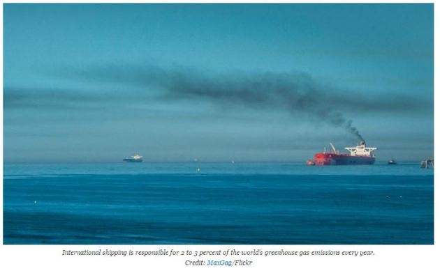
"Shipping Industry Postpones Climate Plan Until 2023"
"A firm plan for potentially easing the shipping industry’s impact on the climate will be delayed for seven years under a roadmap drafted by a United Nations agency on Friday. The lackluster outcome at the end of a week of environmental talks in London deepened the disparity between ship and plane operators and much of the rest of the world when it comes to tackling global warming. The shipping industry participated in the negotiations on behalf of some nations."
See more from Climate Central HERE:
_______________________________________________________________________
Thanks for checking in and don't forget to follow me on Twitter @TNelsonWX

No comments:
Post a Comment